Map of Indianapolis city (balance)

Map of Indianapolis city (balance)

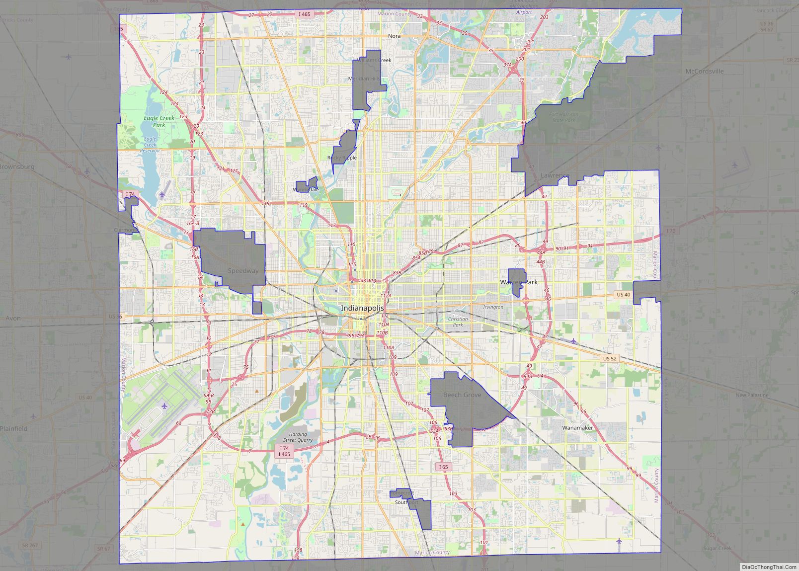
Indianapolis city (balance) overview: Name: Indianapolis city (balance) LSAD Code: 00 LSAD Description: 0 State: Indiana County: Marion County FIPS code: 1836003 Indianapolis is home to the Motor Speedway, the largest city in Indiana. Have an amazing experience in the city with this Indianapolis map collection that includes highways, roads, things to do, and more. … Read more

Map of Fort Wayne city

Map of Fort Wayne city

Fort Wayne is a city in and the county seat of Allen County, Indiana, United States. Located in northeastern Indiana, the city is 18 miles (29 km) west of the Ohio border and 50 miles (80 km) south of the Michigan border. The city’s population was 263,886 as of the 2020 Census, making it the second-most populous … Read more

Map of Evansville city, Indiana

Map of Evansville city, Indiana

Evansville is a city in and the county seat of Vanderburgh County, Indiana, United States. The population was 118,414 at the 2020 census, making it the state’s third-most populous city after Indianapolis and Fort Wayne, the largest city in Southern Indiana, and the 249th-most populous city in the United States. It is the central city … Read more

Map of Carmel city

Map of Carmel city

Carmel /ˈkɑːrməl/ is a suburban city in Indiana, United States, immediately north of Indianapolis. With a population of 100,777, the city spans 49 square miles (130 km) across Clay Township in Hamilton County, Indiana, and is bordered by the White River to the east; the Hamilton-Boone county line to the west; 96th Street to the south … Read more

Map of Advance town

Map of Advance town, Indiana

Advance is a town in Jackson Township, Boone County, Indiana, United States. The population was 477 at the 2010 census. Advance town overview: Name: Advance town LSAD Code: 43 LSAD Description: town (suffix) State: Indiana County: Boone County Elevation: 932 ft (284 m) Total Area: 0.59 sq mi (1.53 km²) Land Area: 0.59 sq mi (1.53 km²) Water Area: 0.00 sq mi (0.00 km²) Total Population: … Read more

Map of Aberdeen CDP, Indiana

Map of Aberdeen CDP, Indiana

Aberdeen is a census-designated place (CDP) in Center Township, Porter County, in the U.S. state of Indiana. The community centers on The Course at Aberdeen, a golf course. The population of the CDP was 1,875 at the 2010 census. Aberdeen CDP overview: Name: Aberdeen CDP LSAD Code: 57 LSAD Description: CDP (suffix) State: Indiana County: … Read more

Map of Akron town, Indiana

Map of Akron town, Indiana

Akron is a town in Henry Township, Fulton County, Indiana, United States. The population was 1,167 at the 2010 census. Akron town overview: Name: Akron town LSAD Code: 43 LSAD Description: town (suffix) State: Indiana County: Fulton County Elevation: 850 ft (259 m) Total Area: 0.46 sq mi (1.19 km²) Land Area: 0.46 sq mi (1.19 km²) Water Area: 0.00 sq mi (0.00 km²) Total Population: … Read more

Map of Albany town, Indiana

Map of Albany town, Indiana

Albany is a town in Delaware and Randolph counties in the U.S. state of Indiana, along the Mississinewa River. The population was 2,295 at the 2020 census. It is part of the Muncie, IN Metropolitan Statistical Area. Albany town overview: Name: Albany town LSAD Code: 43 LSAD Description: town (suffix) State: Indiana County: Delaware County, … Read more

Map of Alamo town, Indiana

Map of Alamo town, Indiana

Alamo is a town in Ripley Township, Montgomery County, in the U.S. state of Indiana. The population was 66 at the 2020 census, unchanged from 2010. Alamo town overview: Name: Alamo town LSAD Code: 43 LSAD Description: town (suffix) State: Indiana County: Montgomery County Elevation: 814 ft (248 m) Total Area: 0.06 sq mi (0.16 km²) Land Area: 0.06 sq mi (0.16 km²) … Read more

Map of Alfordsville town

Map of Alfordsville town

Alfordsville is a town in Reeve Township, Daviess County, Indiana, United States. The population was 101 at the 2010 census. Alfordsville town overview: Name: Alfordsville town LSAD Code: 43 LSAD Description: town (suffix) State: Indiana County: Daviess County Elevation: 512 ft (156 m) Total Area: 0.07 sq mi (0.17 km²) Land Area: 0.07 sq mi (0.17 km²) Water Area: 0.00 sq mi (0.00 km²) Total Population: … Read more

Map of Alexandria city, Indiana

Map of Alexandria city, Indiana

Alexandria is a city in Monroe Township, Madison County, Indiana, United States. It is about 48 miles (77 km) northeast of Indianapolis. According to the 2020 census, its population was 5,149, nearly unchanged from 2010. Alexandria city overview: Name: Alexandria city LSAD Code: 25 LSAD Description: city (suffix) State: Indiana County: Madison County Elevation: 869 ft (265 m) … Read more