Map of Woodburn city, Indiana

Map of Woodburn city, Indiana

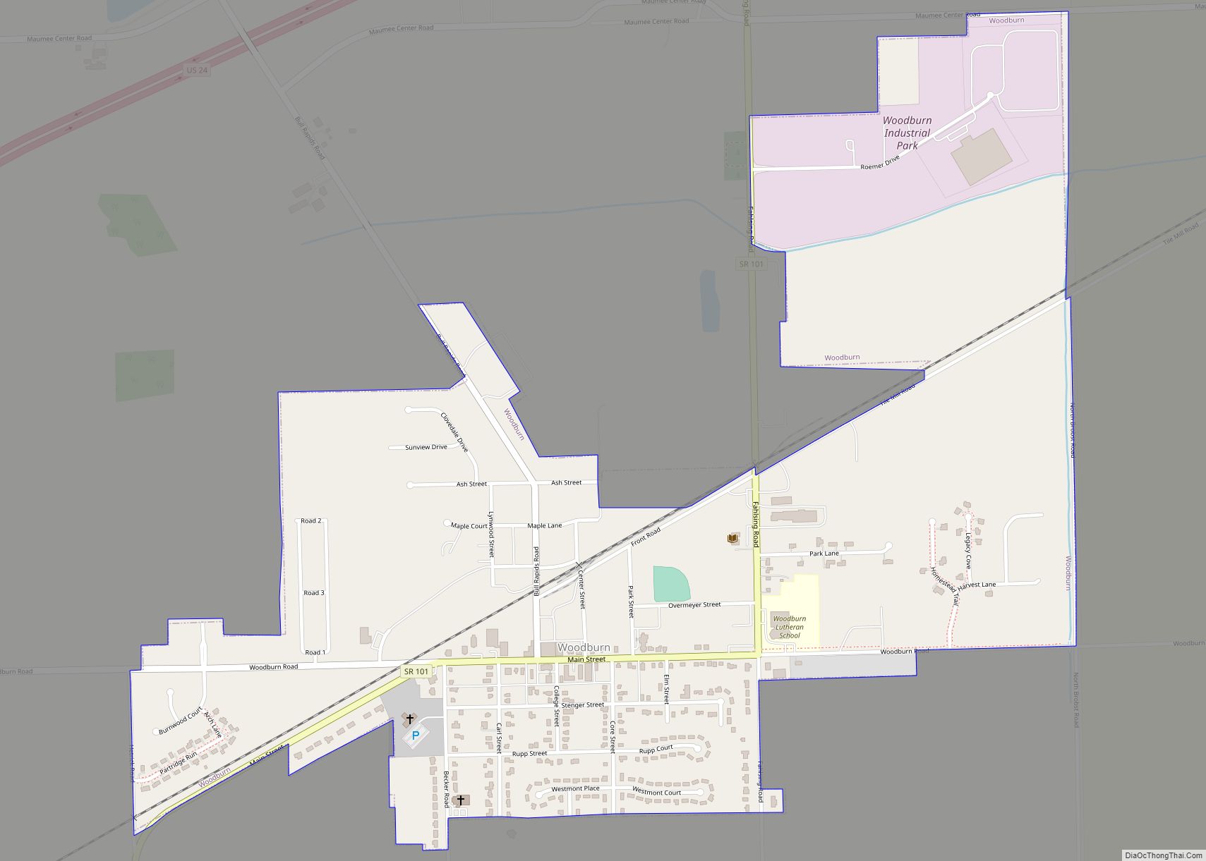
Woodburn is a city in Maumee Township, Allen County, Indiana, United States. The population was 1,520 at the 2010 census, making it the smallest in state as Cannelton had a population of 1,563 in the 2010 Census. Woodburn city overview: Name: Woodburn city LSAD Code: 25 LSAD Description: city (suffix) State: Indiana County: Allen County … Read more

Map of Yorktown town, Indiana

Map of Yorktown town, Indiana

Yorktown is a town in Mount Pleasant Township, Delaware County, Indiana, United States. The population was 11,548 at the 2020 census. It is part of the Muncie, IN Metropolitan Statistical Area. Yorktown town overview: Name: Yorktown town LSAD Code: 43 LSAD Description: town (suffix) State: Indiana County: Delaware County Elevation: 902 ft (275 m) Total Area: 32.17 sq mi … Read more

Map of Yeoman town

Map of Yeoman town

Yeoman is a town in Jefferson Township, Carroll County, Indiana, United States. The population was 139 at the 2010 census. It is part of the Lafayette, Indiana Metropolitan Statistical Area. Yeoman town overview: Name: Yeoman town LSAD Code: 43 LSAD Description: town (suffix) State: Indiana County: Carroll County Elevation: 663 ft (202 m) Total Area: 0.13 sq mi (0.33 km²) … Read more

Map of Wynnedale town

Map of Wynnedale town

Wynnedale is a town in Washington Township, Marion County, Indiana, United States. The population was 215 at the 2020 census. It has existed as an “included town” since 1970, when it was incorporated into Indianapolis as part of Unigov. It is part of Indianapolis, but retains a functioning town government under IC 36-3-1-11. Wynnedale town … Read more

Map of Zionsville town

Map of Zionsville town

Zionsville is a suburban town located in the extreme southeast area of Boone County, Indiana, United States, northwest of Indianapolis. The population was 14,160 at the 2010 census, 30,693 at the 2020 census. Zionsville promotes itself as a tourist attraction, centered on its village-styled downtown area. This area consists primarily of Main Street, paved entirely … Read more

Map of Zanesville town

Map of Zanesville town, Indiana

Zanesville is a town in Allen and Wells counties in the U.S. state of Indiana, southwest of Fort Wayne. The population was 600 at the 2010 census. Zanesville town overview: Name: Zanesville town LSAD Code: 43 LSAD Description: town (suffix) State: Indiana County: Allen County, Wells County Elevation: 810 ft (247 m) Total Area: 0.84 sq mi (2.17 km²) Land … Read more