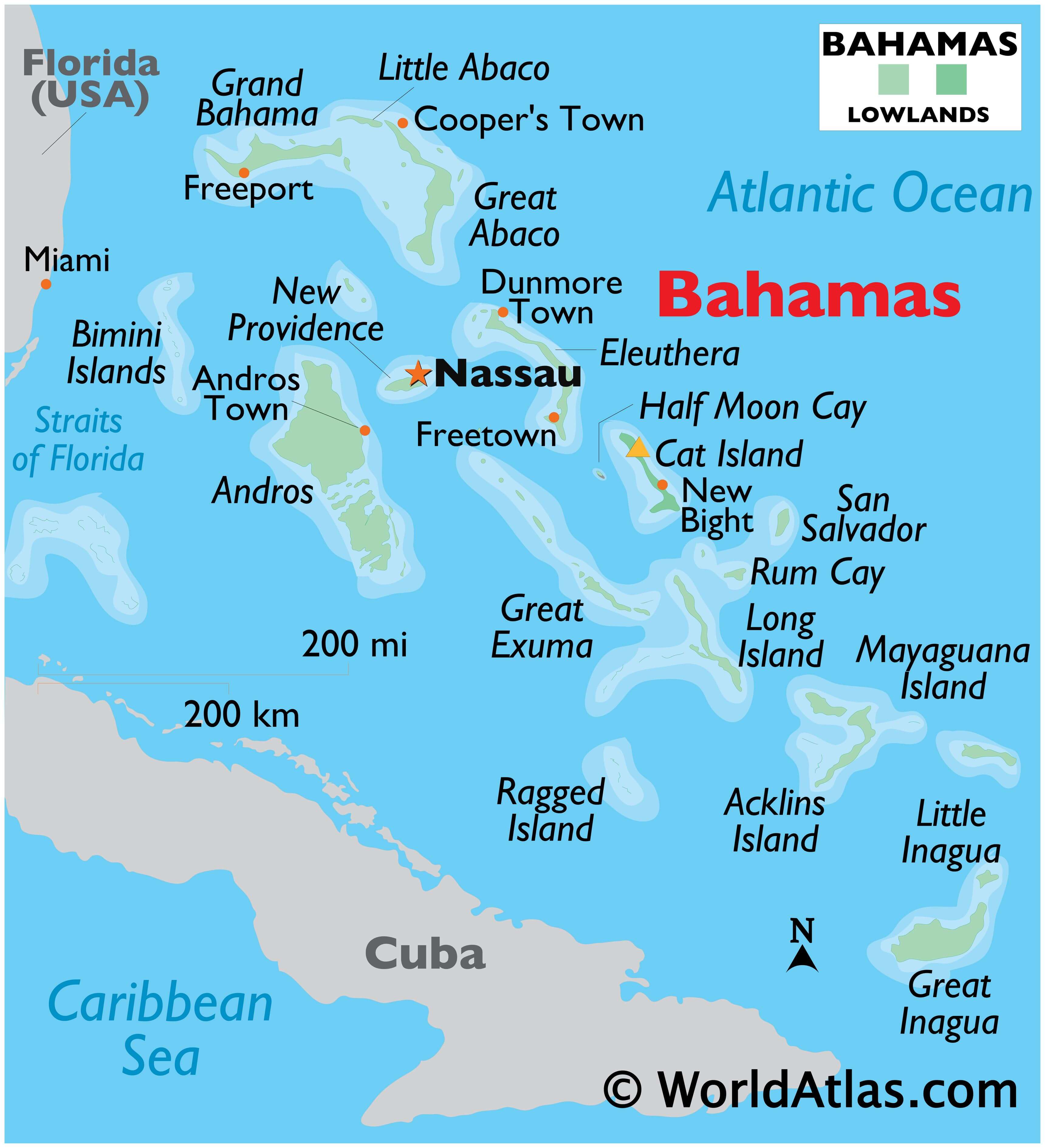
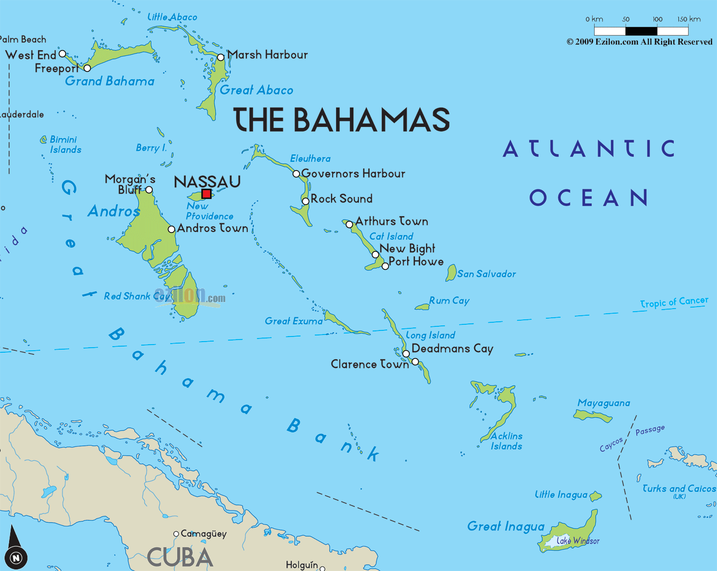
Covering an area of 13,878 sq. km, The Bahamas (all coral in origin) occupies larger part of Lucayan Archipelago and comprises a group of nearly 700 (atolls) ring-like coral islands, and (cays) small, low islands composed largely of coral or sand. The islands were mostly created by the disintegration of coral reefs and seashells, and low scrub covers much of their surfaces. As observed on the map, the highest point is located on Cat Island, where limestone rock rises to 63m (206ft) above sea level. There are a handful of small freshwater lakes and just one small river located on Andros Island.
| Flag: |  |
|---|---|
| Legal Name: | Commonwealth of The Bahamas |
| Capital Value: | Nassau |
| Official languages: | English |
| Demonym(s): | Bahamian |
| Government: | Unitary parliamentary constitutional monarchy |
| Legislature: | Parliament |
| Total Area: | 13,880 km² |
| Land Area: | 10,010 km² |
| Water Area: | 3,870 km² |
| Population: | 389,482 |
| Density: | 25.21/km (65.3/sq mi) (181st) |
| GDP: | $12.83 Billion |
| GDP Per Capita: | $32,933.49 |
| Currency Value: | Bahamian dollars (BSD) |
| Driving side: | left |
| Calling code: | +1 242 |
| Internet TLD: | .bs |
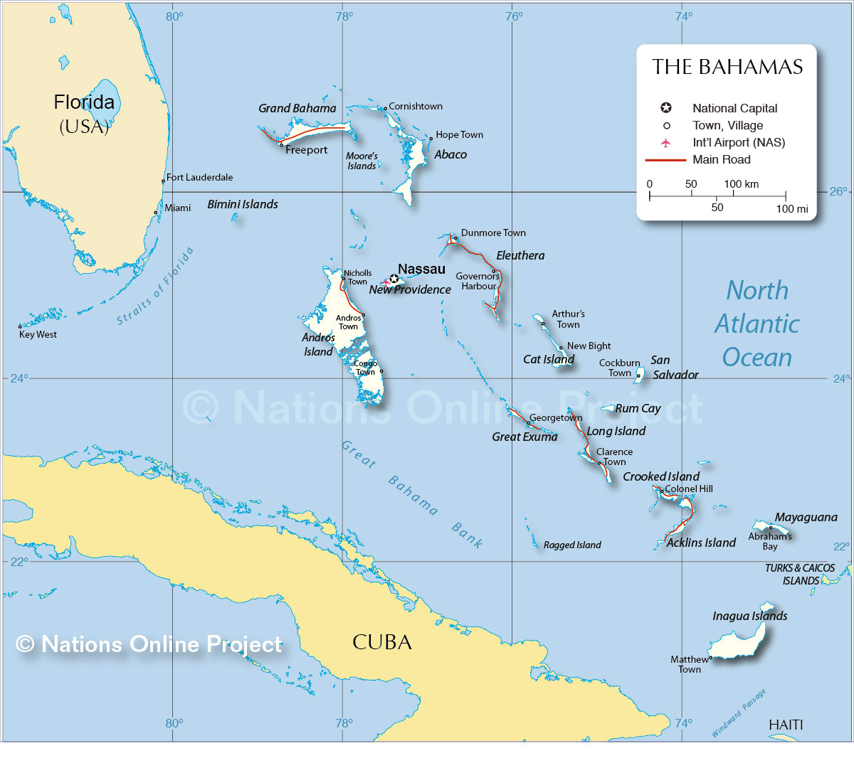
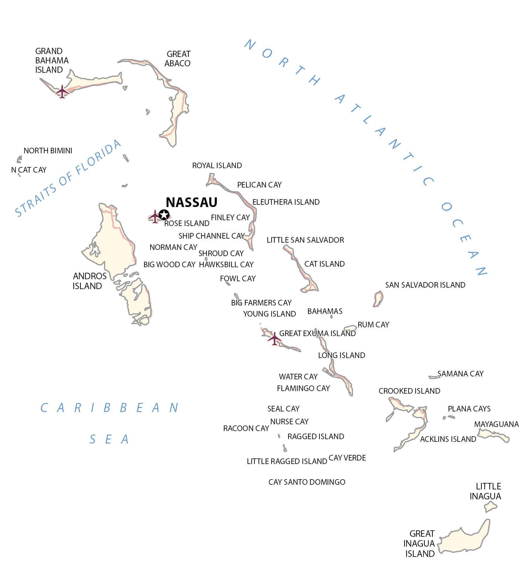
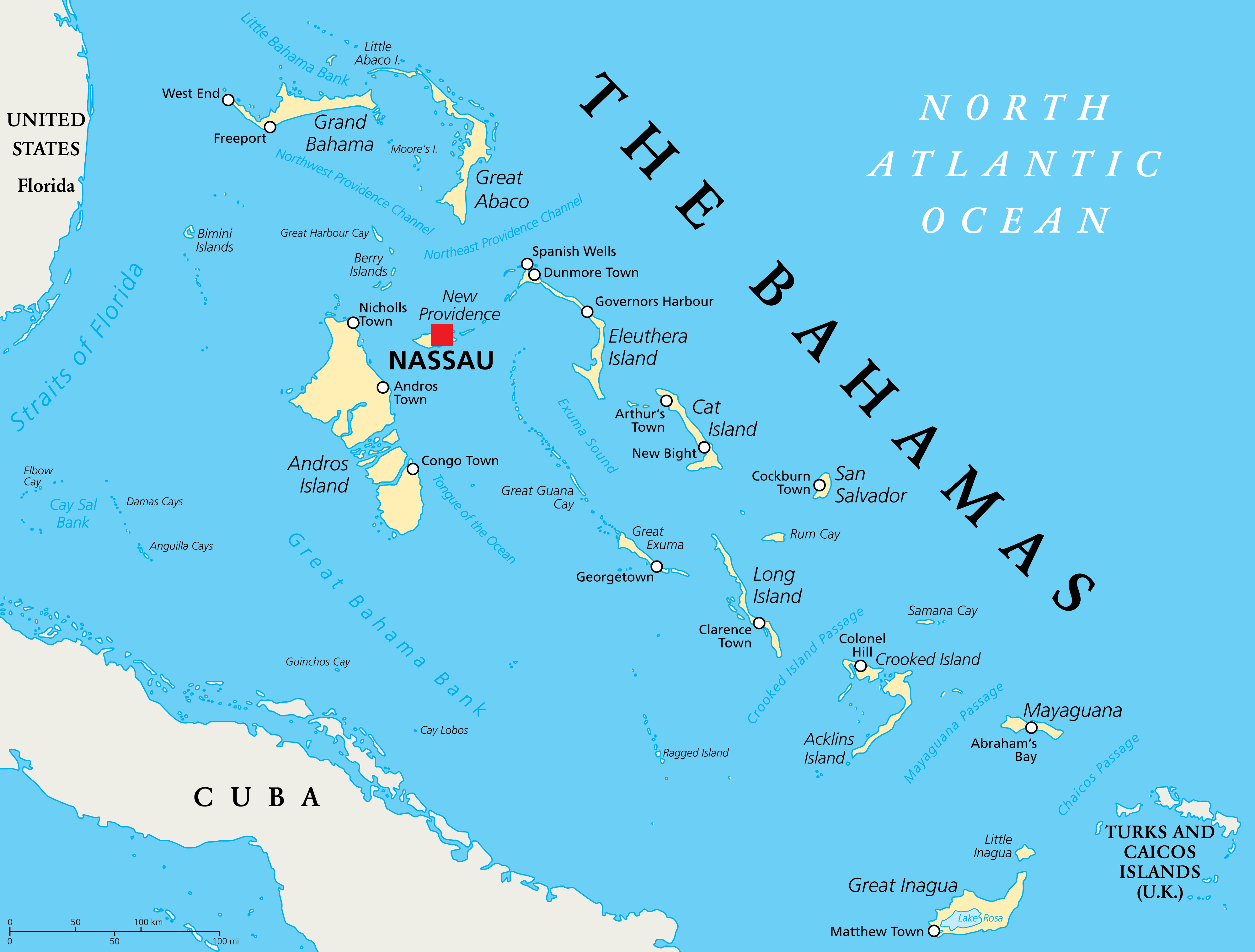
The Bahamas is an archipelago of 700 islands, cays, and islets in the Caribbean Sea. With this Bahamas map, you can explore the beauty of the islands, from the major cities to the airports and seaports. The map also features elevation and satellite imagery, so you can get an even better understanding of the archipelago.
Online Interactive Political Map
Click on ![]() to view map in "full screen" mode.
to view map in "full screen" mode.
The Bahamas (officially, The Commonwealth of The Bahamas) is divided into 31 districts. In alphabetical order, the districts are: Acklins, Berry Islands, Bimini, Black Point (Exuma), Cat Island, Central Abaco, Central Andros, Central Eleuthera, City of Freeport (Grand Bahama), Crooked Island, East Grand Bahama, Exuma, Grand Cay (Abaco), Harbour Island (Eleuthera), Hope Town (Abaco), Inagua, Long Island, Mangrove Cay (Andros), Mayaguana, Moore’s Island (Abaco), North Abaco, North Andros, North Eleuthera, Ragged Island, Rum Cay, San Salvador, South Abaco, South Andros, South Eleuthera, Spanish wells (Eleuthera) and West Grand Bahama.
Covering an area of 13,878 sq. km, The Bahamas occupies larger part of Lucayan Archipelago and comprises a group of 700 ring-like coral islands, islets and cays. Located on the island of New Providence is, Nassau – the capital and the largest city of The Bahamas. Nassau is a primate city, a busy sea port and a major administrative, educational, economic and commercial center of the country. Its spectacular scenery attracts tourists from all over the world.
Location Maps
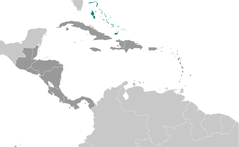
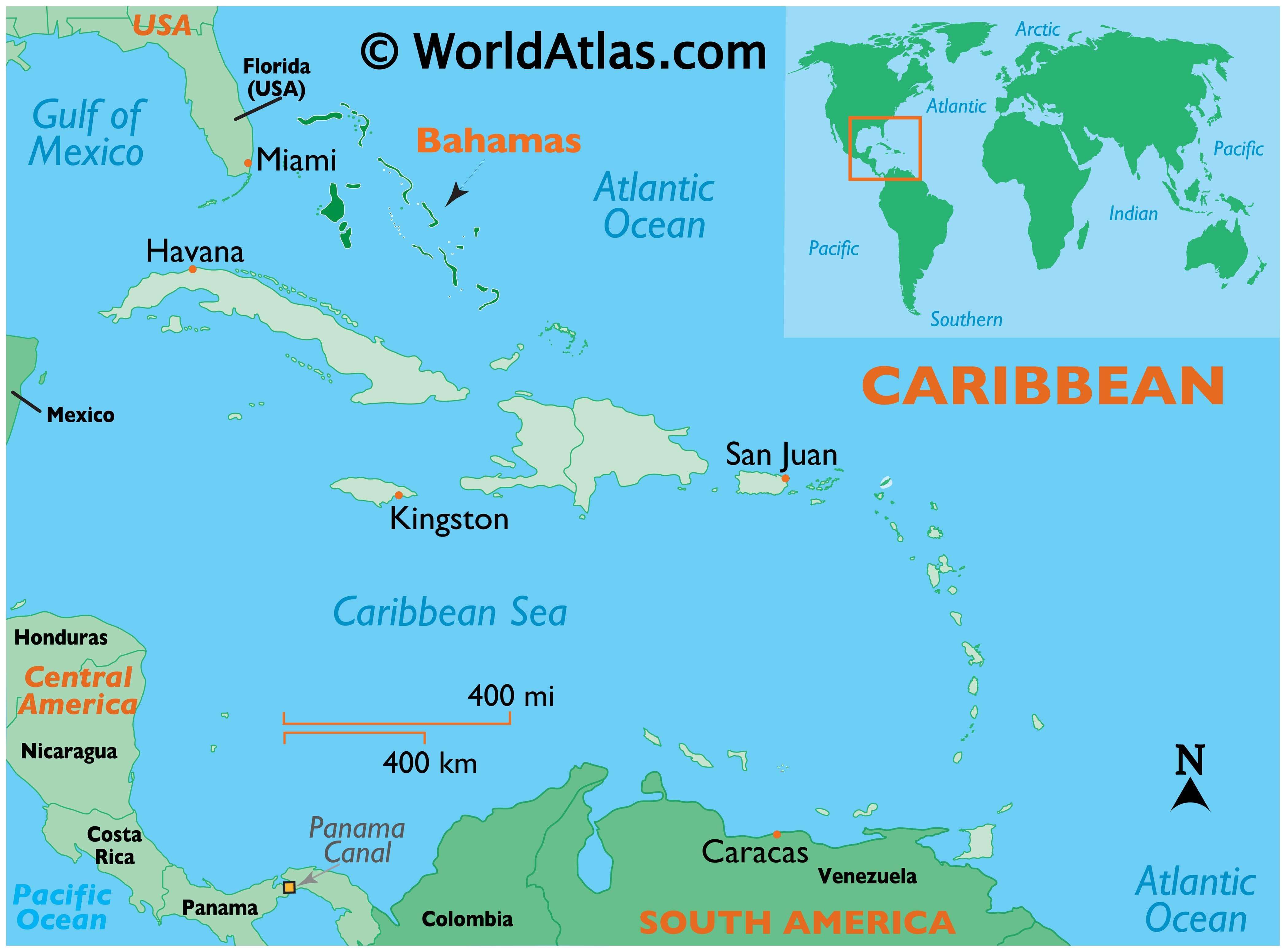
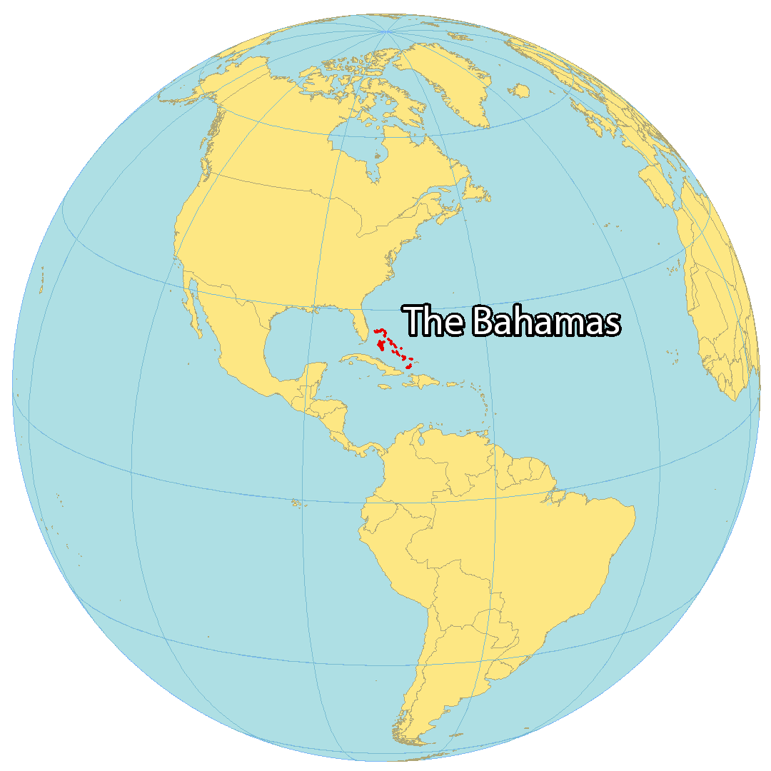
Where is Bahamas?
The Bahamas is a chain of islands situated in the Caribbean Sea close to the Straits of Florida. It contains around 700 islands in the North Atlantic Ocean, however just 31 of them are possessed. The chain of islands is situated around southeast of Florida and northeast of Cuba.
Nassau is the capital and biggest city of The Bahamas and is on the island of New Providence. Its other primary islands incorporate Grand Bahama, Andros (the biggest), and San Salvador Island. It is likewise one of only a handful couple of nations to have the word “The” in its name. The other nation is in Africa known as The Gambia.
High Definition Political Map of Bahamas
History
Pre-colonial era
The first inhabitants of the Bahamas were the Taino people, who moved into the uninhabited southern islands from Hispaniola and Cuba around the 800s–1000s AD, having migrated there from South America; they came to be known as the Lucayan people. An estimated 30,000 Lucayans inhabited the Bahamas at the time of Christopher Columbus’s arrival in 1492.
Arrival of the Spanish
Columbus’s first landfall in what was to Europeans a “New World” was on an island he named San Salvador (known to the Lucayans as Guanahani). Whilst there is a general consensus that this island lay within the Bahamas, precisely which island Columbus landed on is a matter of scholarly debate. Some researchers believe the site to be present-day San Salvador Island (formerly known as Watling’s Island), situated in the southeastern Bahamas, whilst an alternative theory holds that Columbus landed to the southeast on Samana Cay, according to calculations made in 1986 by National Geographic writer and editor Joseph Judge, based on Columbus’s log. On the landfall island, Columbus made first contact with the Lucayans and exchanged goods with them, claiming the islands for the Crown of Castile, before proceeding to explore the larger isles of the Greater Antilles.
The 1494 Treaty of Tordesillas theoretically divided the new territories between the Kingdom of Castile and the Kingdom of Portugal, placing the Bahamas in the Spanish sphere; however they did little to press their claim on the ground. The Spanish did however exploit the native Lucayan peoples, many of whom were enslaved and sent to Hispaniola for use as forced labour. The slaves suffered harsh conditions and most died from contracting diseases to which they had no immunity; half of the Taino died from smallpox alone. As a result of these depredations the population of the Bahamas was severely diminished.
Arrival of the English
The English had expressed an interest in the Bahamas as early as 1629. However, it was not until 1648 that the first English settlers arrived on the islands. Known as the Eleutherian Adventurers and led by William Sayle, they migrated from Bermuda seeking greater religious freedom. These English Puritans established the first permanent European settlement on an island which they named Eleuthera, Greek for free. They later settled New Providence, naming it Sayle’s Island. Life proved harder than envisaged however, and many – including Sayle – chose to return to Bermuda. To survive, the remaining settlers salvaged goods from wrecks.
In 1670, King Charles II granted the islands to the Lords Proprietors of the Carolinas in North America. They rented the islands from the king with rights of trading, tax, appointing governors, and administering the country from their base on New Providence. Piracy and attacks from hostile foreign powers were a constant threat. In 1684, Spanish corsair Juan de Alcon raided the capital Charles Town (later renamed Nassau), and in 1703, a joint Franco-Spanish expedition briefly occupied Nassau during the War of the Spanish Succession.
16th century
During proprietary rule, the Bahamas became a haven for pirates, including Blackbeard (circa 1680–1718). To put an end to the “Pirates’ republic” and restore orderly government, Britain made the Bahamas a crown colony in 1718, which they dubbed “the Bahama islands” under the governorship of Woodes Rogers. After a difficult struggle, he succeeded in suppressing piracy. In 1720, the Spanish attacked Nassau during the War of the Quadruple Alliance. In 1729, a local assembly was established giving a degree of self-governance for British settlers. The reforms had been planned by the previous Governor George Phenney and authorised in July 1728.
During the American War of Independence in the late 18th century, the islands became a target for US naval forces. Under the command of Commodore Esek Hopkins, US Marines, the US Navy occupied Nassau in 1776, before being evacuated a few days later. In 1782 a Spanish fleet appeared off the coast of Nassau, and the city surrendered without a fight. Later, in April 1783, on a visit made by Prince William of the United Kingdom (later to become King William IV) to Luis de Unzaga at his residence in the Captaincy General of Havana, they made prisoner exchange agreements and also dealt with the preliminaries of the Treaty of Paris (1783), in which the recently conquered Bahamas would be exchanged for East Florida, which would still have to conquer the city of St. Augustine, Florida in 1784 by order of Luis de Unzaga; after that, also in 1784, the Bahamas would be declared a British colony.
After US independence, the British resettled some 7,300 Loyalists with their African slaves in the Bahamas, including 2,000 from New York and at least 1,033 European, 2,214 African ancestrals and a few Native American Creeks from East Florida. Most of the refugees resettled from New York had fled from other colonies, including West Florida, which the Spanish captured during the war. The government granted land to the planters to help compensate for losses on the continent. These Loyalists, who included Deveaux and also Lord Dunmore, established plantations on several islands and became a political force in the capital. European Americans were outnumbered by the African-American slaves they brought with them, and ethnic Europeans remained a minority in the territory.
19th century
The Slave Trade Act 1807 abolished slave trading to British possessions, including the Bahamas. The United Kingdom pressured other slave-trading countries to also abolish slave-trading, and gave the Royal Navy the right to intercept ships carrying slaves on the high seas. Thousands of Africans liberated from slave ships by the Royal Navy were resettled in the Bahamas.
In the 1820s during the period of the Seminole Wars in Florida, hundreds of North American slaves and African Seminoles escaped from Cape Florida to the Bahamas. They settled mostly on northwest Andros Island, where they developed the village of Red Bays. From eyewitness accounts, 300 escaped in a mass flight in 1823, aided by Bahamians in 27 sloops, with others using canoes for the journey. This was commemorated in 2004 by a large sign at Bill Baggs Cape Florida State Park. Some of their descendants in Red Bays continue African Seminole traditions in basket making and grave marking.
In 1818, the Home Office in London had ruled that “any slave brought to the Bahamas from outside the British West Indies would be manumitted.” This led to a total of nearly 300 enslaved people owned by US nationals being freed from 1830 to 1835. The American slave ships Comet and Encomium used in the United States domestic coastwise slave trade, were wrecked off Abaco Island in December 1830 and February 1834, respectively. When wreckers took the masters, passengers and slaves into Nassau, customs officers seized the slaves and British colonial officials freed them, over the protests of the Americans. There were 165 slaves on the Comet and 48 on the Encomium. The United Kingdom finally paid an indemnity to the United States in those two cases in 1855, under the Treaty of Claims of 1853, which settled several compensation cases between the two countries.
Slavery was abolished in the British Empire on 1 August 1834. After that British colonial officials freed 78 North American slaves from the Enterprise, which went into Bermuda in 1835; and 38 from the Hermosa, which wrecked off Abaco Island in 1840. The most notable case was that of the Creole in 1841: as a result of a slave revolt on board, the leaders ordered the US brig to Nassau. It was carrying 135 slaves from Virginia destined for sale in New Orleans. The Bahamian officials freed the 128 slaves who chose to stay in the islands. The Creole case has been described as the “most successful slave revolt in U.S. history”.
These incidents, in which a total of 447 enslaved people belonging to US nationals were freed from 1830 to 1842, increased tension between the United States and the United Kingdom. They had been co-operating in patrols to suppress the international slave trade. However, worried about the stability of its large domestic slave trade and its value, the United States argued that the United Kingdom should not treat its domestic ships that came to its colonial ports under duress as part of the international trade. The United States worried that the success of the Creole slaves in gaining freedom would encourage more slave revolts on merchant ships.
During the American Civil War of the 1860s, the islands briefly prospered as a focus for blockade runners aiding the Confederate States.
Early 20th century
The early decades of the 20th century were ones of hardship for many Bahamians, characterised by a stagnant economy and widespread poverty. Many eked out a living via subsistence agriculture or fishing.
In August 1940, the Duke of Windsor (erstwhile King Edward VIII) was appointed Governor of the Bahamas. He arrived in the colony with his wife. Although disheartened at the condition of Government House, they “tried to make the best of a bad situation”. He did not enjoy the position, and referred to the islands as “a third-class British colony”. He opened the small local parliament on 29 October 1940. The couple visited the “Out Islands” that November, on Axel Wenner-Gren’s yacht, which caused controversy; the British Foreign Office strenuously objected because they had been advised by United States intelligence that Wenner-Gren was a close friend of the Luftwaffe commander Hermann Göring of Nazi Germany.
The Duke was praised at the time for his efforts to combat poverty on the islands. A 1991 biography by Philip Ziegler, however, described him as contemptuous of the Bahamians and other non-European peoples of the Empire. He was praised for his resolution of civil unrest over low wages in Nassau in June 1942, when there was a “full-scale riot”. Ziegler said that the Duke blamed the trouble on “mischief makers – communists” and “men of Central European Jewish descent, who had secured jobs as a pretext for obtaining a deferment of draft”. The Duke resigned from the post on 16 March 1945.
Post-Second World War
Modern political development began after the Second World War. The first political parties were formed in the 1950s, split broadly along ethnic lines, with the United Bahamian Party (UBP) representing the English-descended Bahamians (known informally as the “Bay Street Boys”) and the Progressive Liberal Party (PLP) representing the Black-Bahamian majority.
A new constitution granting the Bahamas internal autonomy went into effect on 7 January 1964, with Chief Minister Sir Roland Symonette of the UBP becoming the first Premier. In 1967, Lynden Pindling of the PLP became the first black Premier of the Bahamian colony; in 1968, the title of the position was changed to Prime Minister. In 1968, Pindling announced that the Bahamas would seek full independence. A new constitution giving the Bahamas increased control over its own affairs was adopted in 1968. In 1971, the UBP merged with a disaffected faction of the PLP to form a new party, the Free National Movement (FNM), a centre-right party which aimed to counter the growing power of Pindling’s PLP.
The United Kingdom Government gave the Bahamas its independence by an Order in Council dated 20 June 1973. The Order came into force on 10 July 1973, on which date Prince Charles delivered the official documents to Prime Minister Lynden Pindling. This date is now celebrated as the country’s Independence Day. It joined the Commonwealth of Nations on the same day. Sir Milo Butler was appointed the first governor-general of The Bahamas (the official representative of Queen Elizabeth II) shortly after independence.
Post-independence
Shortly after independence, The Bahamas joined the International Monetary Fund and the World Bank on 22 August 1973, and later the United Nations on 18 September 1973.
Politically, the first two decades were dominated by Pindling’s PLP, who went on to win a string of electoral victories. Allegations of corruption, links with drug cartels and financial malfeasance within the Bahamian government failed to dent Pindling’s popularity. Meanwhile, the economy underwent a dramatic growth period fuelled by the twin pillars of tourism and offshore finance, significantly raising the standard of living on the islands. The Bahamas’ booming economy led to it becoming a beacon for immigrants, most notably from Haiti.
In 1992, Pindling was unseated by Hubert Ingraham of the FNM. Ingraham went on to win the 1997 Bahamian general election, before being defeated in 2002, when the PLP returned to power under Perry Christie. Ingraham returned to power from 2007 to 2012, followed by Christie again from 2012 to 2017. With economic growth faltering, Bahamians re-elected the FNM in 2017, with Hubert Minnis becoming the fourth prime minister.
In September 2019, Hurricane Dorian struck the Abaco Islands and Grand Bahama at Category 5 intensity, devastating the northwestern Bahamas. The storm inflicted at least US$7 billion in damages and killed more than 50 people, with 1,300 people still missing.
In September 2021, the ruling Free National Movement lost to the opposition Progressive Liberal Party in a snap election, as the economy struggled to recover from its deepest crash since at least 1971. Progressive Liberal Party (PLP) won 32 of the 39 seats in the House of Assembly. Free National Movement (FNM), led by Minnis, took the remaining seats. On 17 September 2021, the chairman of the Progressive Liberal Party (PLP) Phillip “Brave” Davis was sworn in as the new Prime Minister of Bahamas to succeed Hubert Minnis.
Physical Map of Bahamas