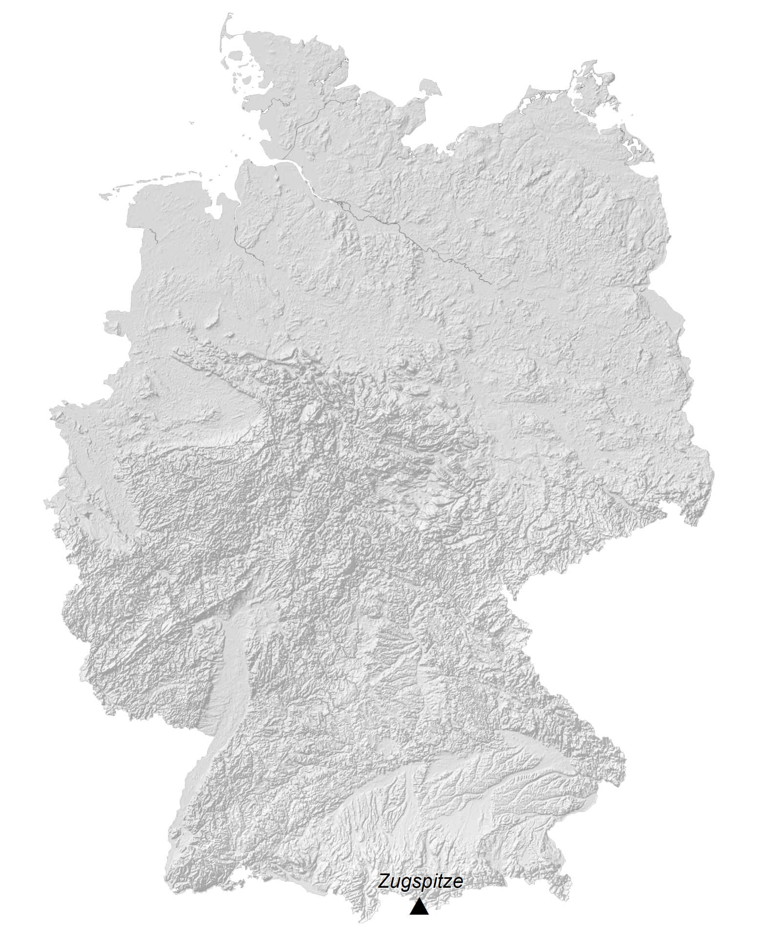
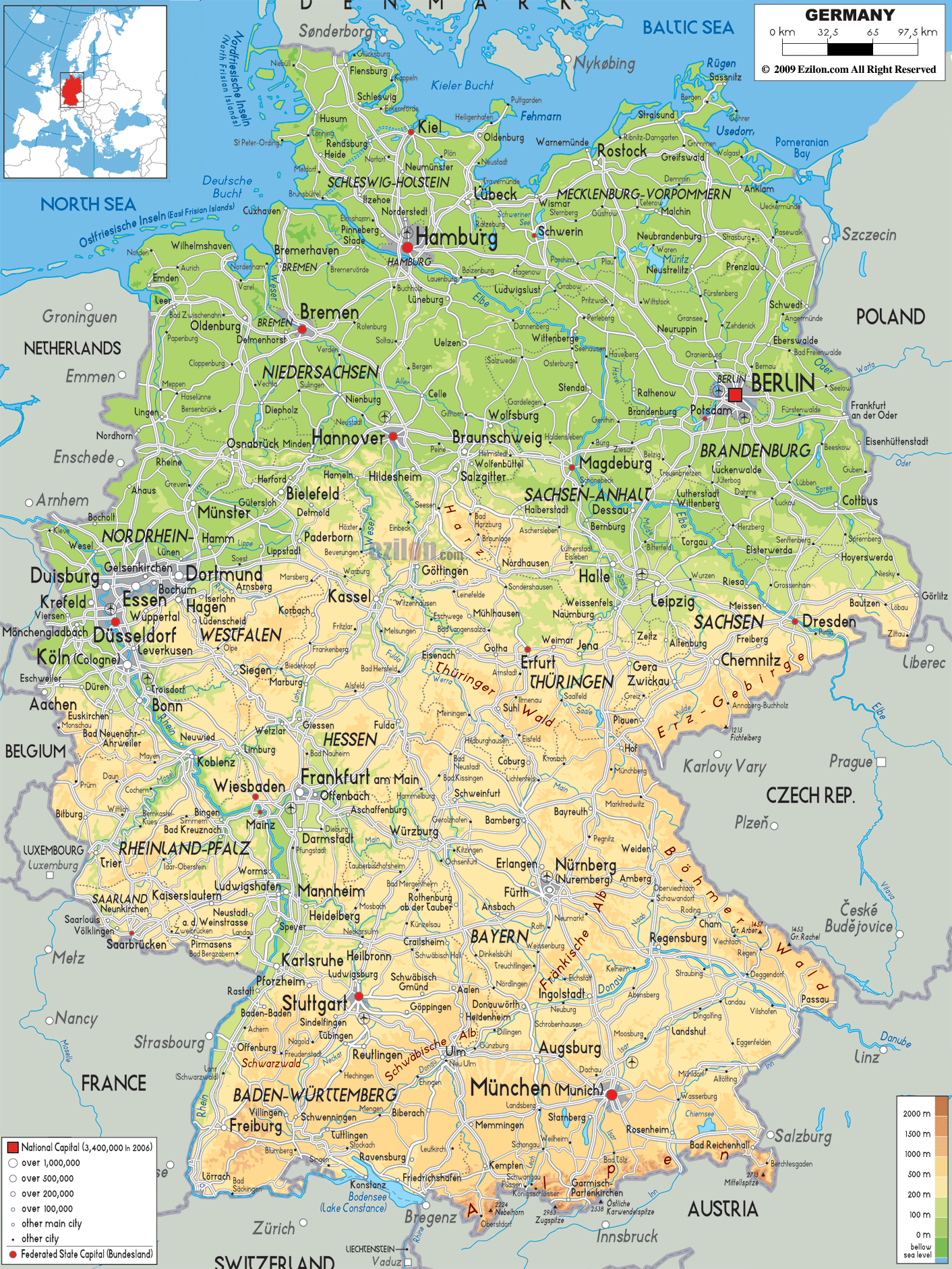
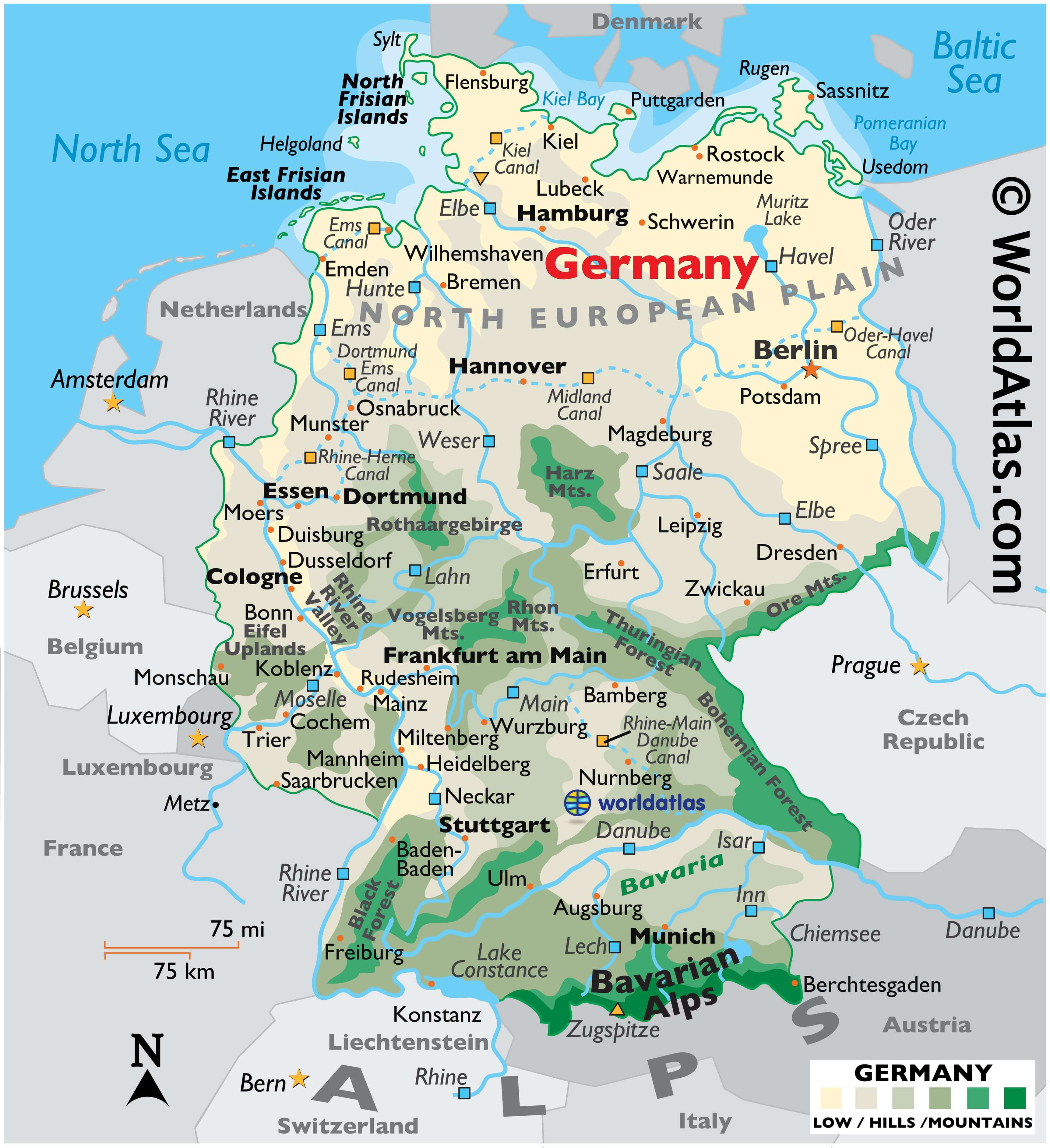
By size, Germany is the seventh-largest European country. It covers an area of 357,022 km2(137,847 sq mi). As observed on Germany’s physical map, the country’s topography varies significantly from north to south.
The North European Plain extends across the country’s northern reaches; this flat, lowland terrain is dissected by numerous bogs, rivers and streams, and is mostly used as farmland.
The North Sea coastline is a low, marshy wetland with dikes, mudflats and scattered islands. The Baltic Sea is hillier with some jagged cliffs. Rugen, Germany’s largest island, is forested and rather hilly with cliffs and sandy beaches.
In the northeast, and then stretching to the south of Berlin, Germany’s land remains sandy and punctuated by dozens of mostly small lakes formed by retreating glaciers during the last Ice Age.
The land then rises into the forested uplands of central Germany. Major landforms here include the volcanic in origin Harz Mountains and the thickly wooded Rothaargebirge Mountains.
Further south, the rounded hills and mountains of the Eifel and Huynsruck uplands front the Rhine River Valley. Moving eastward through Germany, the Vogelsberg Mountains, Rhon Plateau (or Mts.), and Thuringian Forest are the dominant features. The uplands continue eastward, eventually rising into the Ore Mountains on the Czech Republic border.
In the far south, the land remains mostly hilly, with heavily forested mountains. The Bohemian Forest covers a lower mountain range along the Czech Republic border. Along the country’s far-southwestern border with the Rhine River and France stands the thick (story-book famous) Black Forest.
The Bavarian Alps, the highest mountains in Germany, stretch across its southern border with Austria. Snow-covered Zugspitze, Germany’s highest point, is found here. It is 2,962 m (9,718 ft) tall and marked on the map by a yellow upright triangle.
Stretched along the northern coastline, the Frisian Islands, East and North, are separated from the mainland by the Waddenmeer. These barrier islands provide a small level of protection from the North Sea.
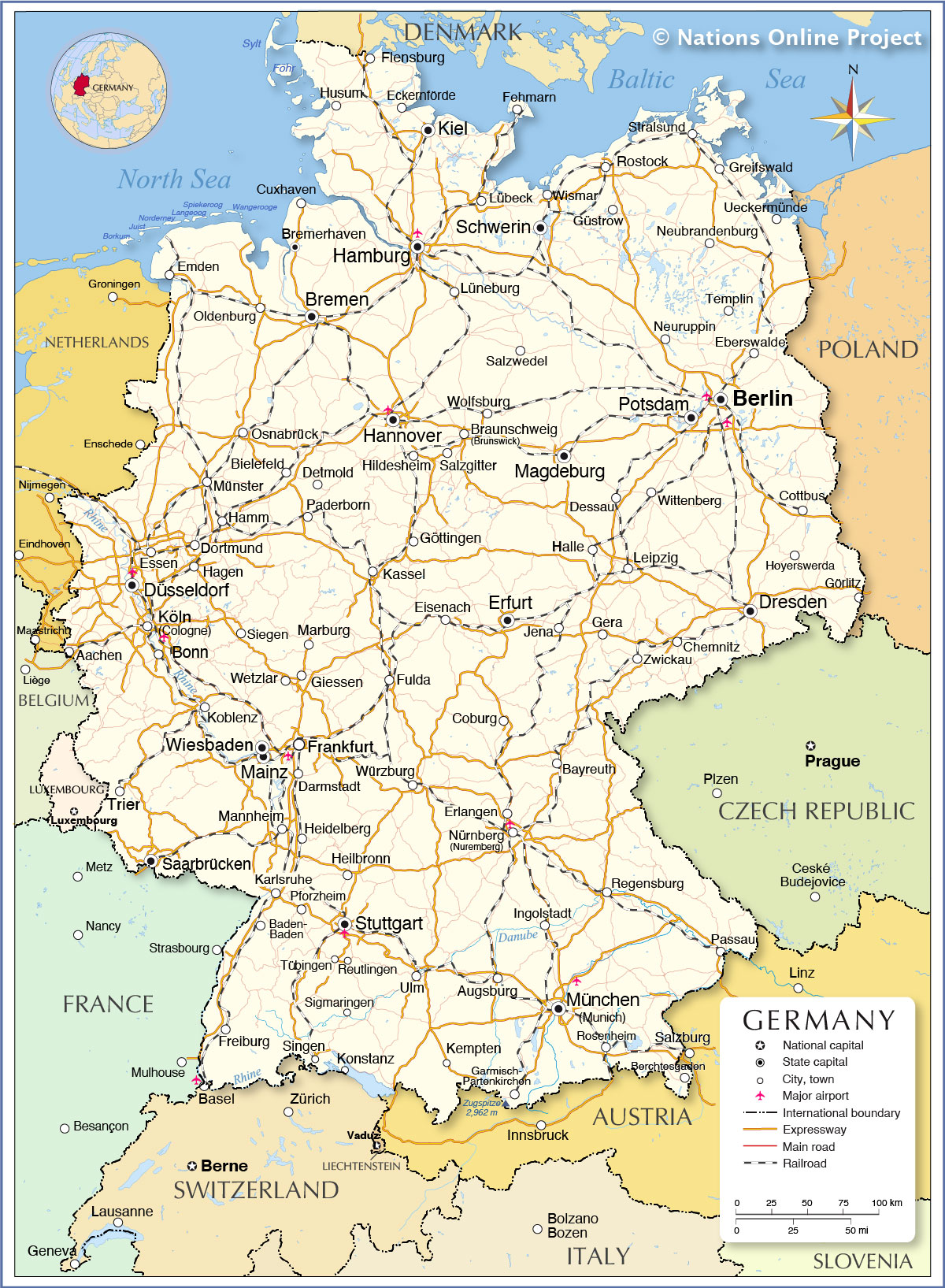
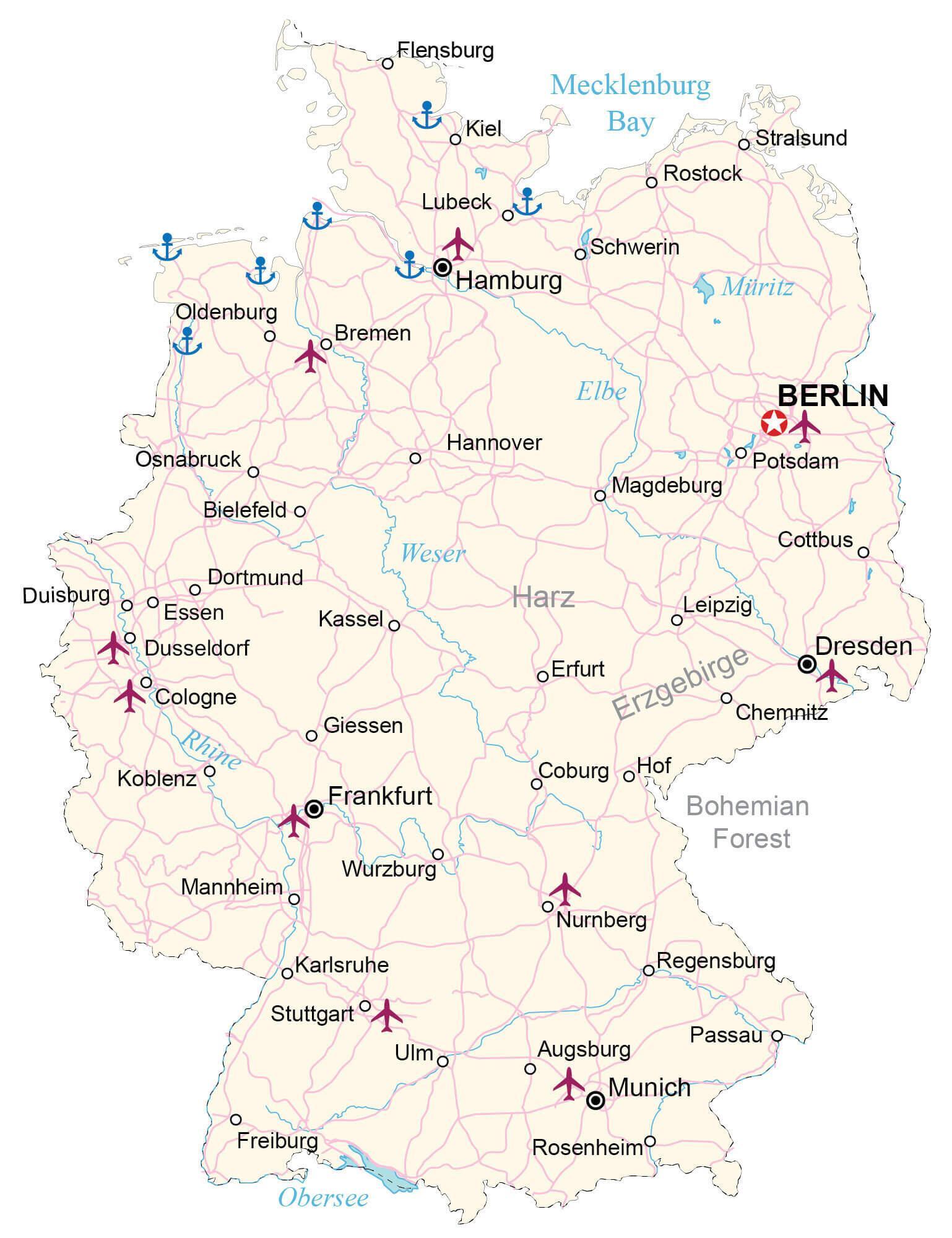
As observed on the map above, the country is drained by dozens of rivers. The longest river in Germany is the Rhine. Rising in the Alps of Switzerland, its overall length runs (820 miles) (1,319 km), and along with it, path numerous tributaries and branches stretch in all directionsAnother river of note is the Danube, which rises in the Black Forest to then stretch across central Europe all the way to the Black Sea. Additional rivers of size include the Elbe, Ems, Havel, Isr, Lahn, Lech, Main, Moselle, Oder, Spree and Weser.
The largest lakes include Chiemsee and Muritz and Lake Constance along the Swiss border in the south.
The lowest point (natural) in Germany is Neuendorf-Sachsenbande in Wilstermarsch at 3.54 m (11.6 ft) below sea-level.
Across Germany, many human-made canals join navigable rivers, creating thousands of miles of interconnecting inland waterways. They’re used for commercial and local traffic and by large fleets of cruising riverboats and charter barges.
| Flag: |  |
|---|---|
| Legal Name: | Federal Republic of Germany |
| Capital Value: | Berlin |
| Official languages: | German |
| Demonym(s): | German |
| Government: | Federal parliamentary republic |
| Legislature: | Bundestag, Bundesrat |
| Total Area: | 357,022 km² |
| Land Area: | 348,672 km² |
| Water Area: | 8,350 km² |
| Population: | 83,132,799 |
| Density: | 232/km (600.9/sq mi) (58th) |
| GDP: | $3.85 Trillion |
| GDP Per Capita: | $46,258.88 |
| Currency Value: | Euros (EUR) |
| Driving side: | right |
| Calling code: | +49 |
| Internet TLD: | .de |
From the bustling metropolises of Berlin and Munich to the gorgeous Black Forest and the majestic Alps, Germany is a country of stunning natural beauty and fascinating cities. This map of Germany showcases its stunning geography, highlighting its major cities, rivers, and geographic features. It also features a satellite and elevation map which displays Germany’s unique topography and highest peak, the Zugspitze.
Germany is a diverse country full of stunning landscapes and fascinating cities. From the bustling metropolises of Berlin and Munich to the gorgeous Black Forest and the majestic Alps, this map of Germany showcases its stunning geography and highlights its major cities, rivers, and geographic features. It also features a satellite and elevation map which displays Germany’s unique topography and highest peak, the Zugspitze. Explore this map to discover the beauty of Germany!
Online Interactive Political Map
Click on ![]() to view map in "full screen" mode.
to view map in "full screen" mode.
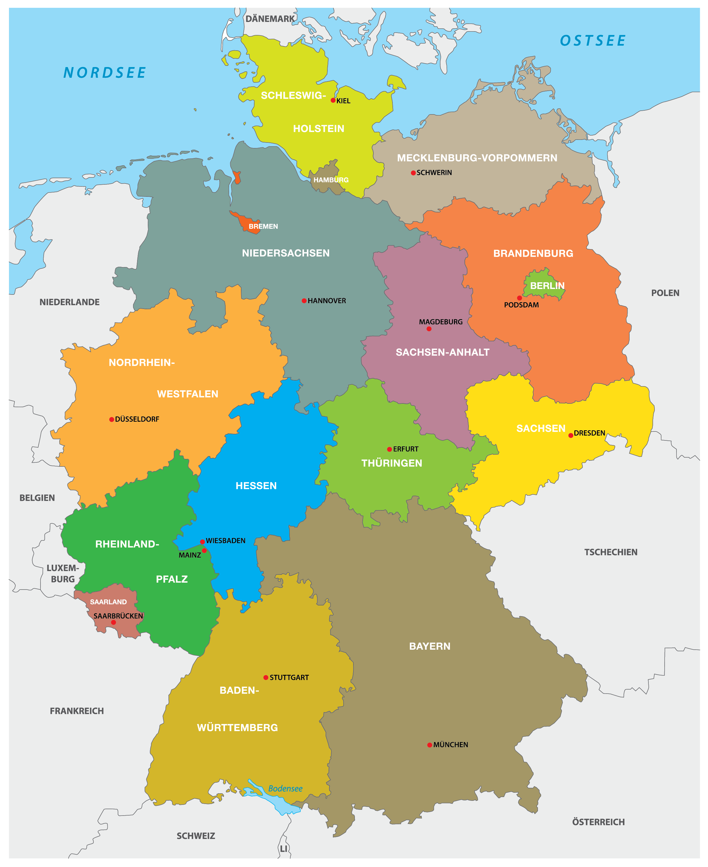
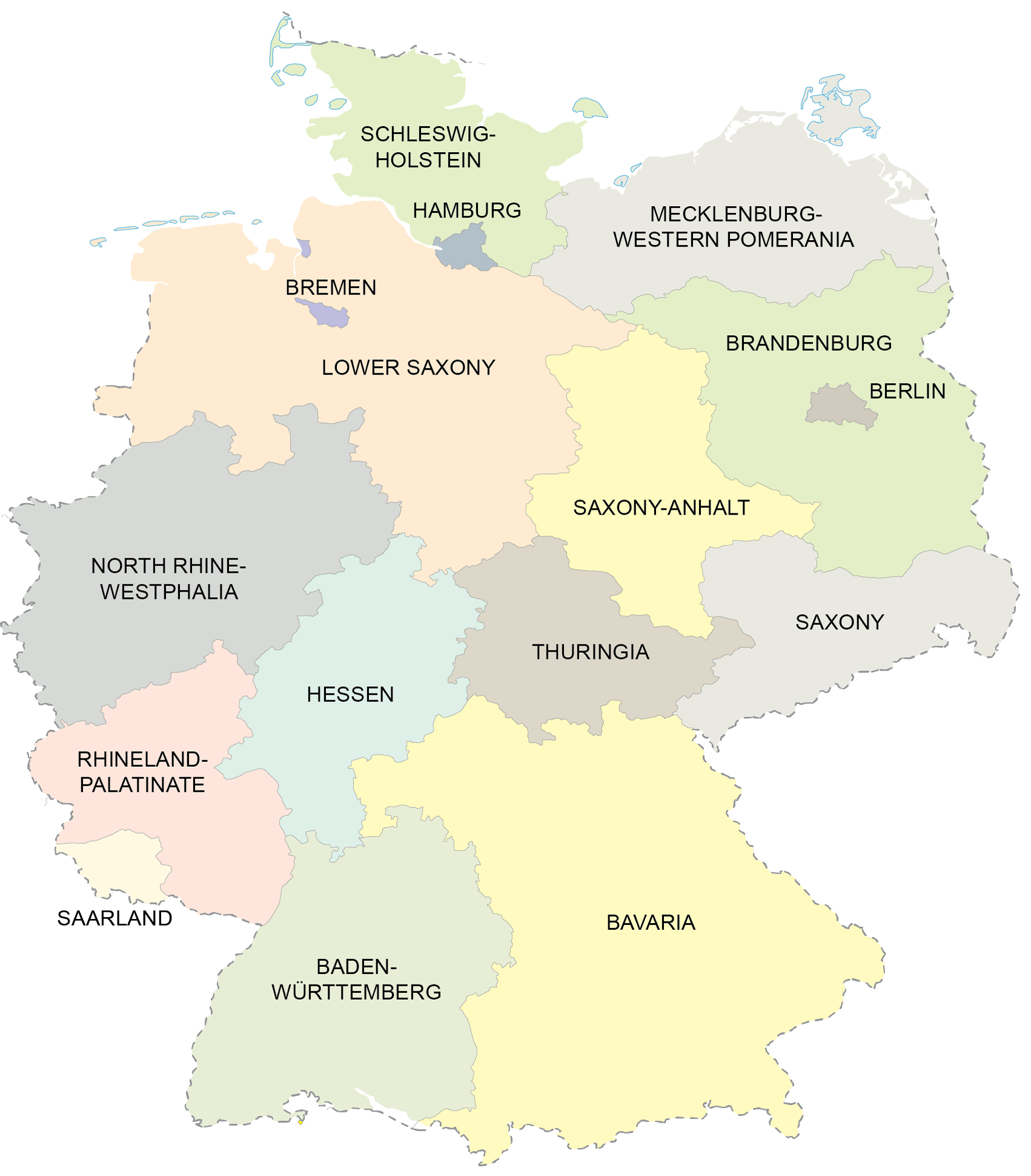
Germany (officially, the Federal Republic of Germany) is divided into 16 states (Lander, sing. Land) [commonly, referred to as Bundeslander (federal states)]. In alphabetical order, the states are: Baden-Wuerttemberg, Bayern (Bavaria), Berlin, Brandenburg, Bremen, Hamburg, Hessen (Hesse), Mecklenburg-Vorpommern (Mecklenburg-Western Pomerania), Niedersachsen (Lower Saxony), Nordrhein-Westfalen (North Rhine – Westphalia), Rheinland-Pfalz (Rhineland-Palatinate), Saarland, Sachsen (Saxony), Sachsen-Anhalt (Saxony-Anhalt), Schleswig-Holstein and Thueringen (Thuringia).
The states are further divided into 401 administrative districts, of which there are 294 rural districts (Kreise) and 107 urban districts (Kreisfreie Stadte).
[Note: Bayern, Sachsen and Thueringen refer to themselves as Free states (Freistaaten, sing. Freistaat), while Bremen calls itself a Free Hanseatic City (Freie Hansestadt) and Hamburg considers itself a Free and Hanseatic City (Freie und Hansestadt)]
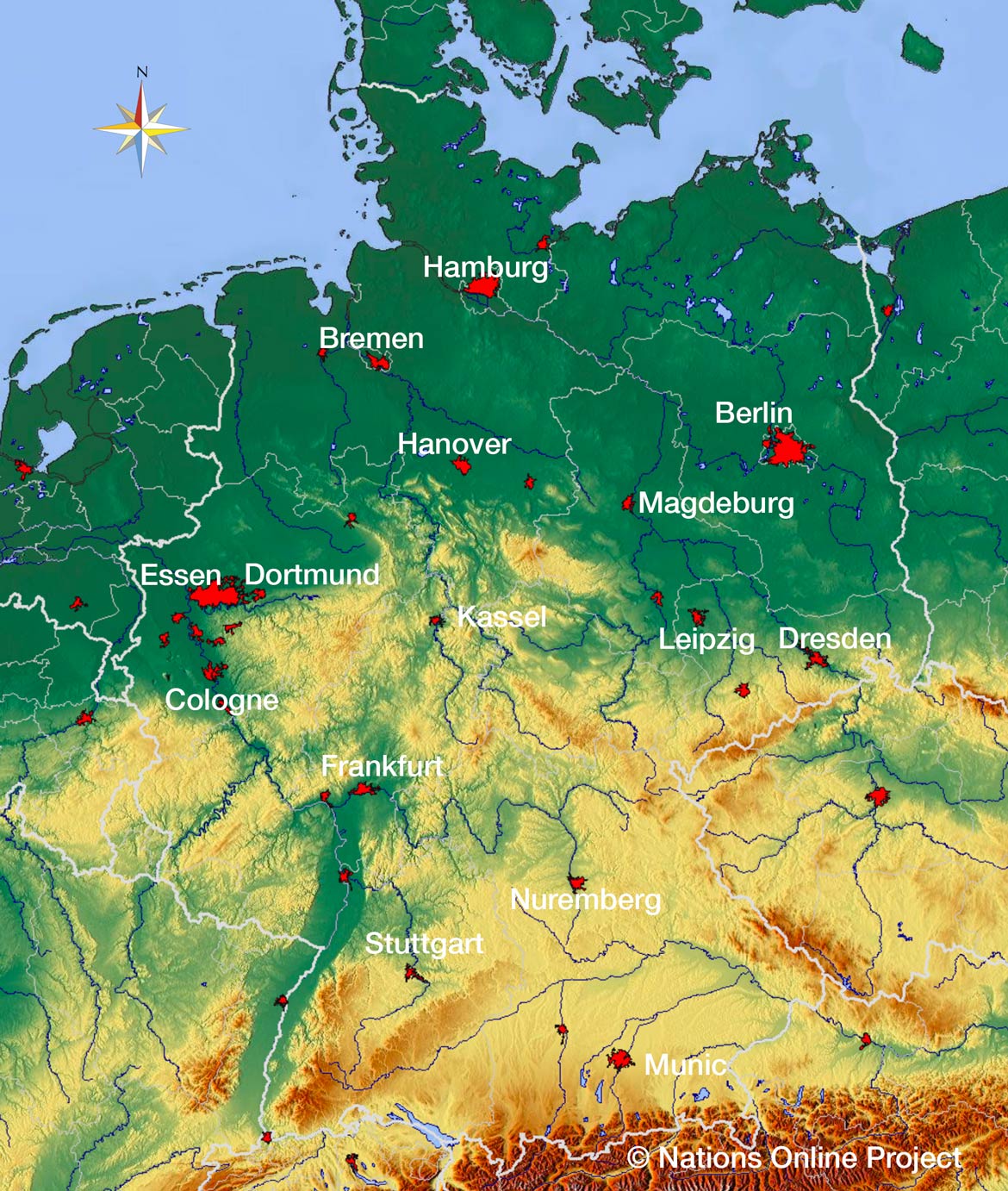
With an area of 357,022 sq. km, Germany is the 7th largest country in Europe. It is also the 2nd most populous country in Europe and the most populous member-state of EU. Located in north eastern Germany, in the east of Elbe River is, Berlin – the capital and the largest city of Germany. It is also the most populous city of EU. The city of Frankfurt is the financial center of the country, while the city of Ruhr is the largest urban area in Germany.
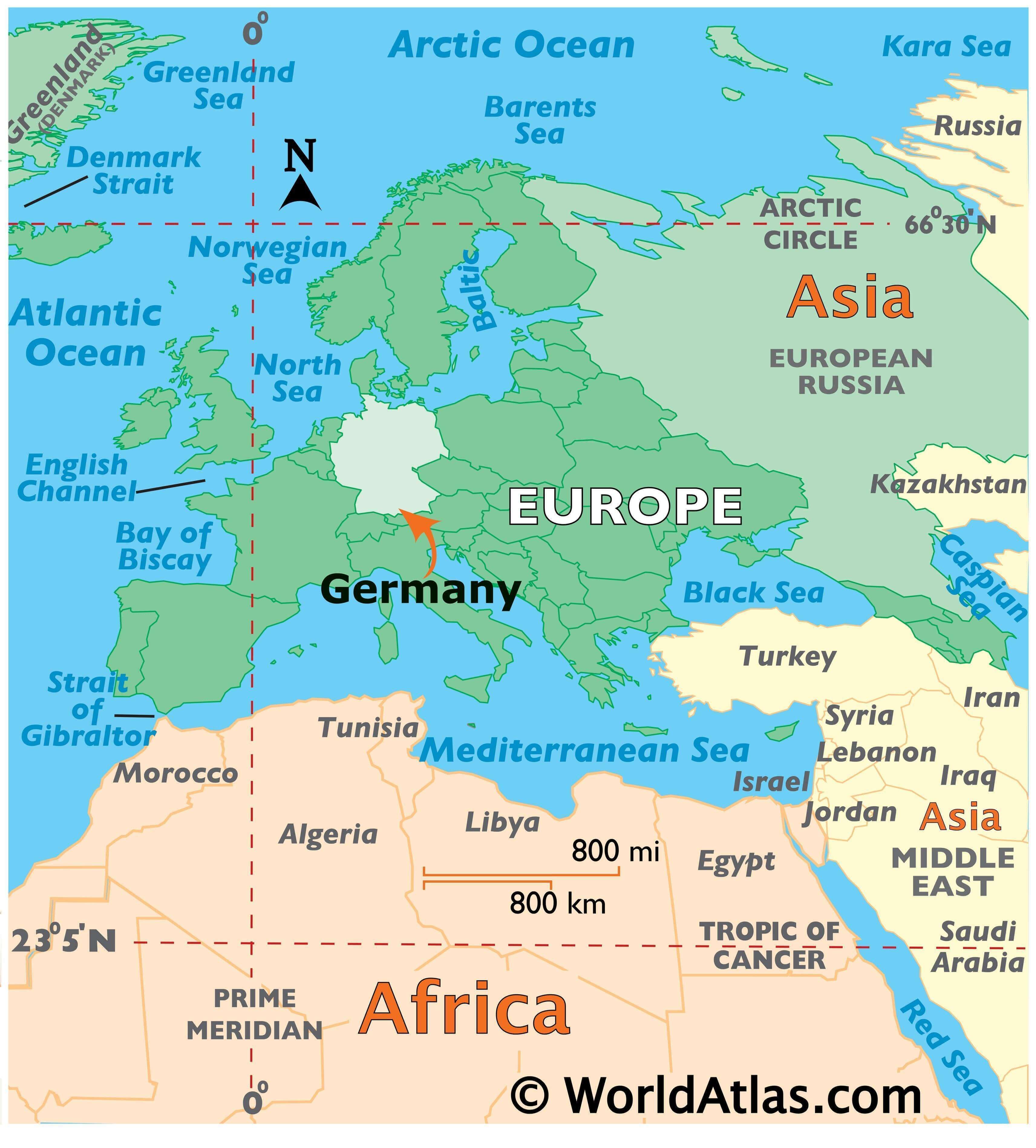
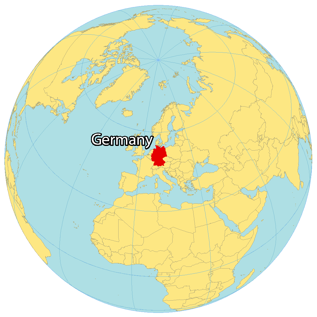
Location Maps
Where is Germany?
Germany is a country located in Central Europe, boasting a population of over 83 million people. Its capital city is Berlin, with other major cities including Hamburg, Munich, Cologne, and Frankfurt. The landscape in Germany is incredibly varied, featuring forests, mountains, rivers, and plains.
Germany is bordered by Denmark to the north, Poland and the Czech Republic to the east, Austria to the southeast, Switzerland to the south, France to the southwest, Luxembourg, Belgium, and the Netherlands to the west. Additionally, Germany has a coast on both the North Sea to the northwest and the Baltic Sea to the northeast (also known as the German Riviera).

High Definition Political Map of Germany

Germany Administrative Map
Physical Map of Germany
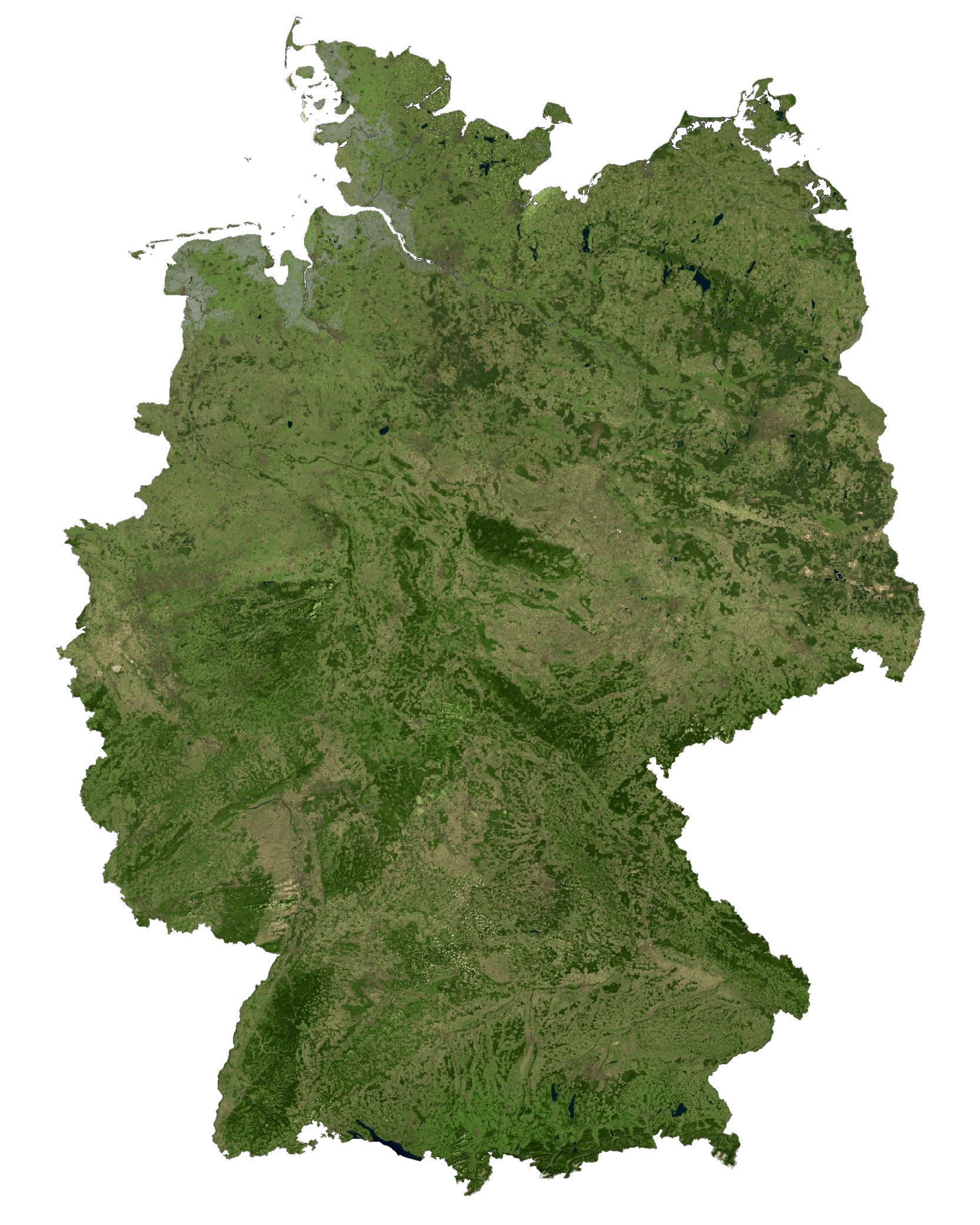
Germany Satellite Map
Topo Map
Elevation Map