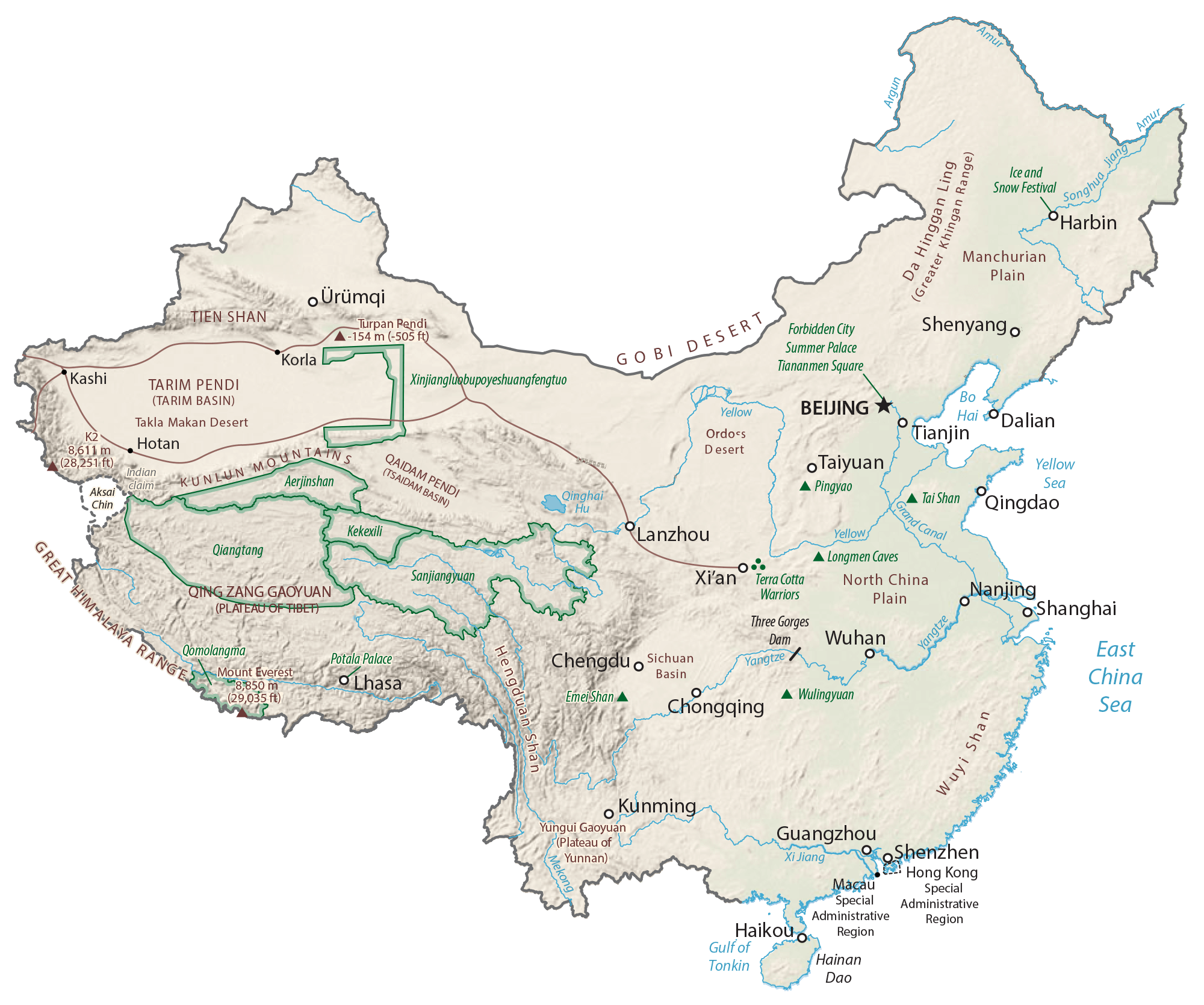
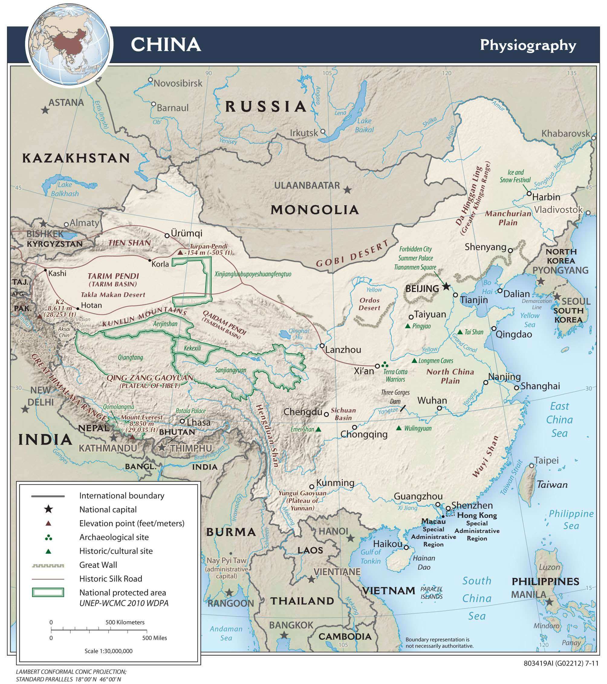
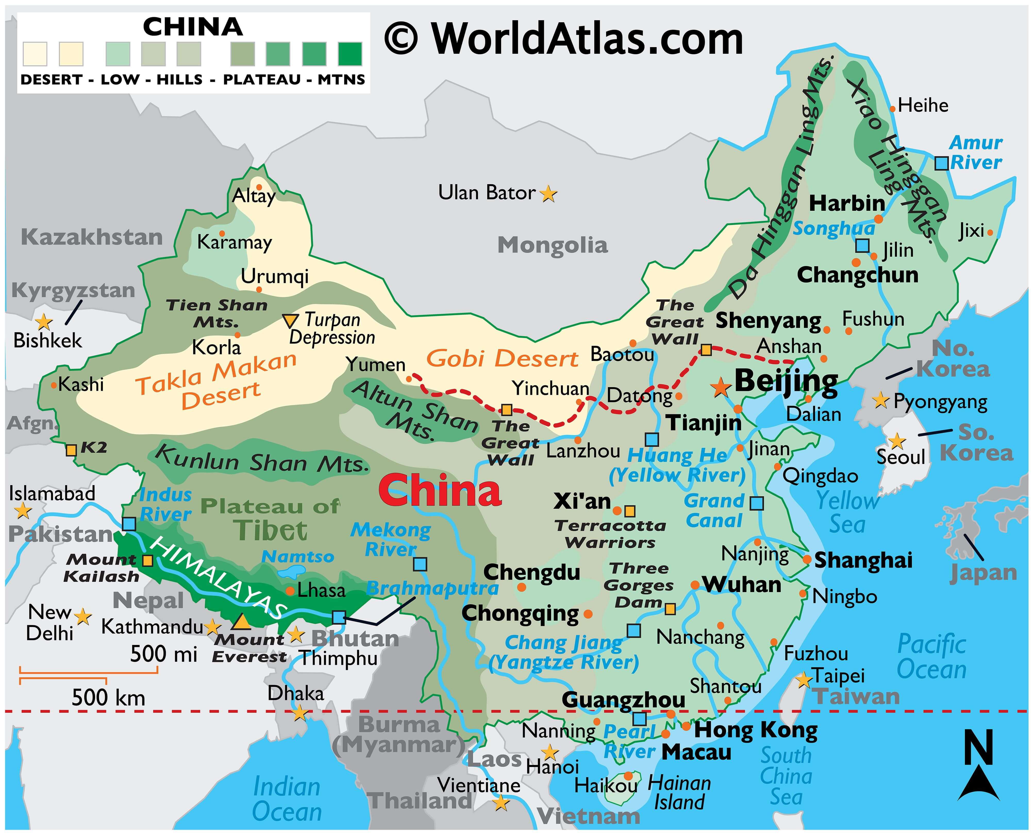
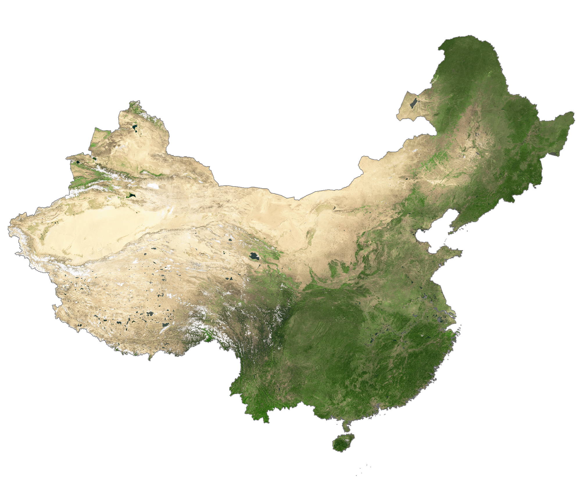
China covers an area of about 9.6 million sq. km in East Asia. As observed on the physical map of China above, the country has a highly varied topography including plains, mountains, plateaus, deserts, etc.
In the vast western reaches of China – mountains, high plateaus and deserts dominate the landscape, while in the central and east areas, the land slopes into broad plains and deltas.
The Himalayas, the world’s most elevated mountain range, form its southwestern borders with India, Nepal and Bhutan, and contain the highest peaks in the world. Located within the Himalayas is China’s highest point, the famed Mt. Everest, which is also the tallest mountain in the world, and whose summit reaches 29,025 ft. (8.850 m). Numerous rivers arise in the Himalayas, including the Indus and Brahmaputra rivers.
As can be observed on the map, in the far northeast, high mountains ring China’s border with the Russian Federation.
The Gobi Desert runs west to east along the border with Mongolia. Here the topography varies from sand desert, into the low mountain foothills and plateaus that stretch into Mongolia. Prolonged drought in the area result in debilitating dust storms, and have caused China to lose a million acres a year to desertification. China’s lowest point, and the third lowest point on the Earth’s surface, is the arid Turpan Depression located in the far western part of the country.
From the higher elevations in the west literally thousands of rivers drain the country; the most significant include the Yangtze (third longest river on the planet), and the Heilong (Amur), Mekong, Pearl and Yellow.
| Flag: |  |
|---|---|
| Legal Name: | People’s Republic of China |
| Capital Value: | Beijing |
| Official languages: | Standard Chinese |
| Demonym(s): | Chinese |
| Government: | Unitary Marxist–Leninist one-party socialist republic |
| Legislature: | National People’s Congress |
| Total Area: | 9,596,960 km² |
| Land Area: | 9,326,410 km² |
| Water Area: | 270,550 km² |
| Population: | 1,397,715,000 |
| Density: | 145/km (375.5/sq mi) (83rd) |
| GDP: | $14.34 Trillion |
| GDP Per Capita: | $10,261.68 |
| Currency Value: | Renminbi yuan (RMB) |
| Driving side: | right (Mainland) left (Hong Kong and Macau) |
| Calling code: | +86 (Mainland) +852 (Hong Kong) +853 (Macau) |
| Internet TLD: |
|
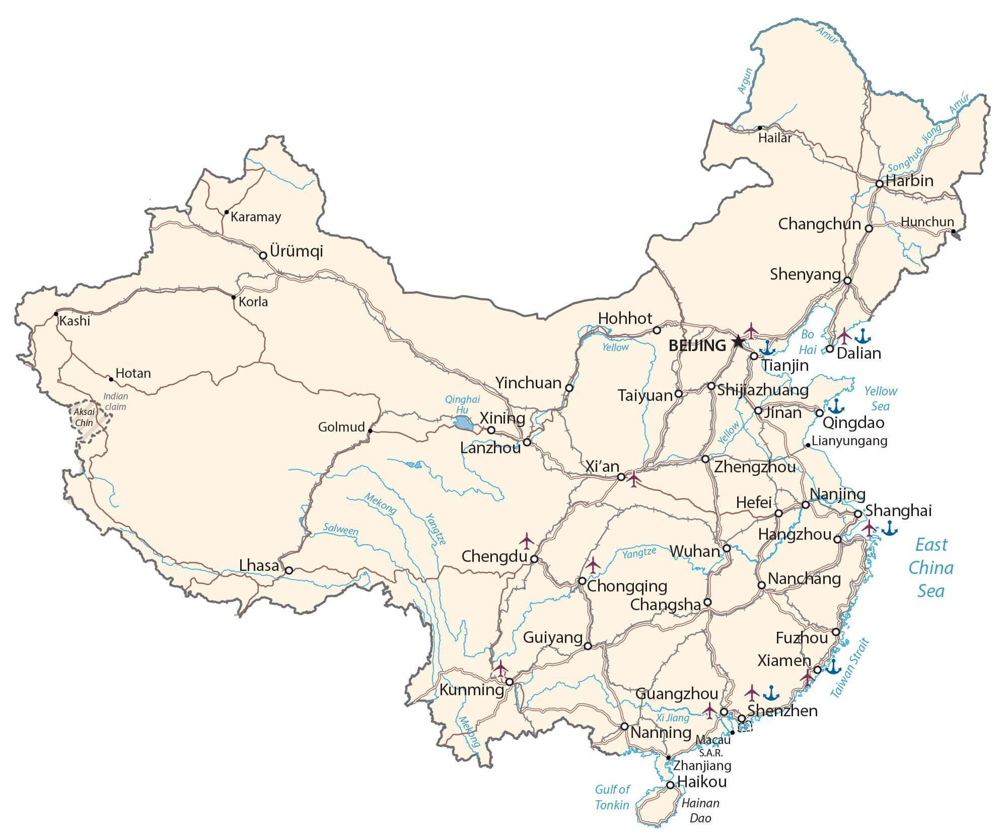
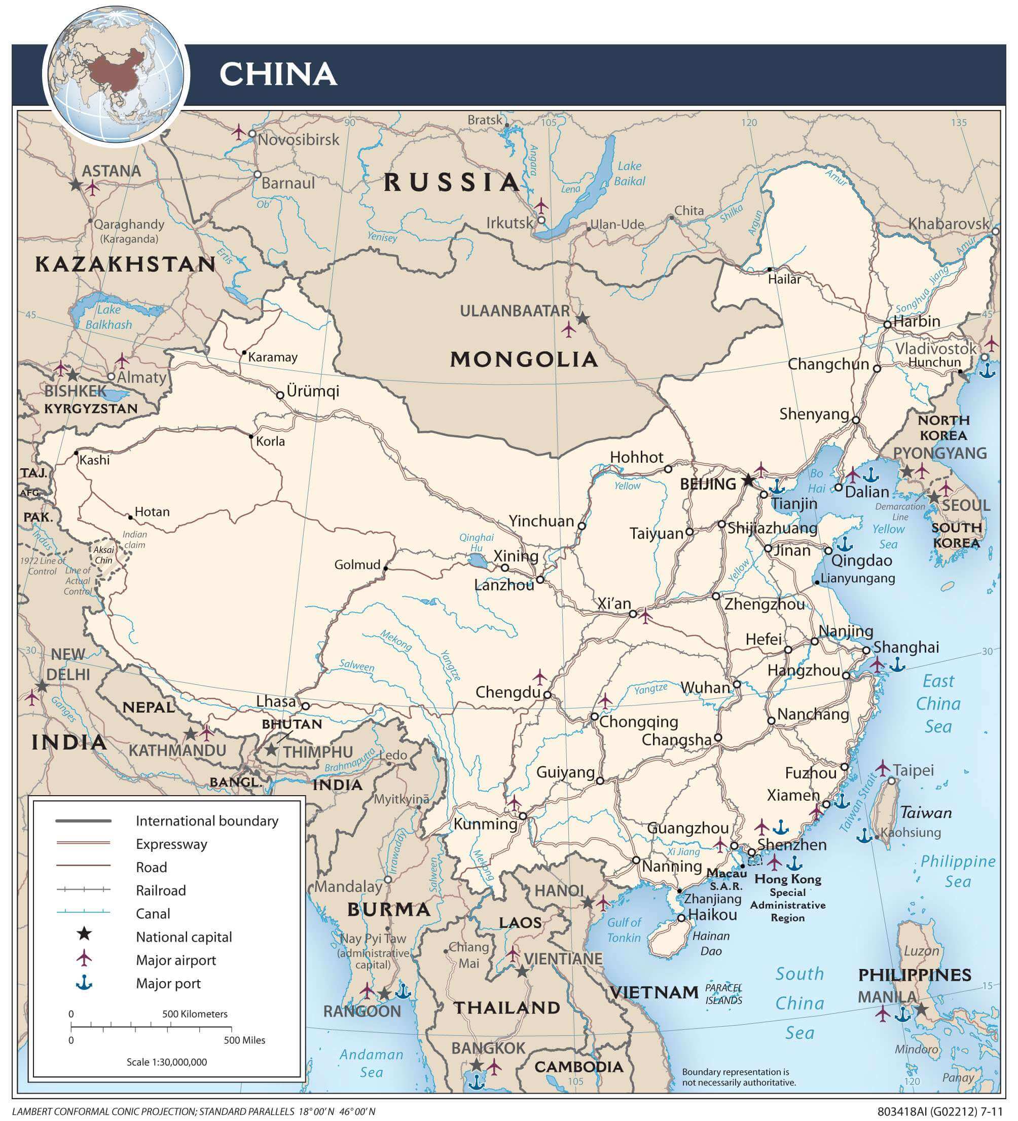
Explore the wonders of China with this comprehensive map! Featuring major cities, towns, roads, rivers and the Gobi Desert, this map of China is a great way to get an understanding of the country’s geographical features. With satellite imagery and a provincial map of China, you can travel through the country and get a better appreciation of its beauty.
Online Interactive Political Map
Click on ![]() to view map in "full screen" mode.
to view map in "full screen" mode.
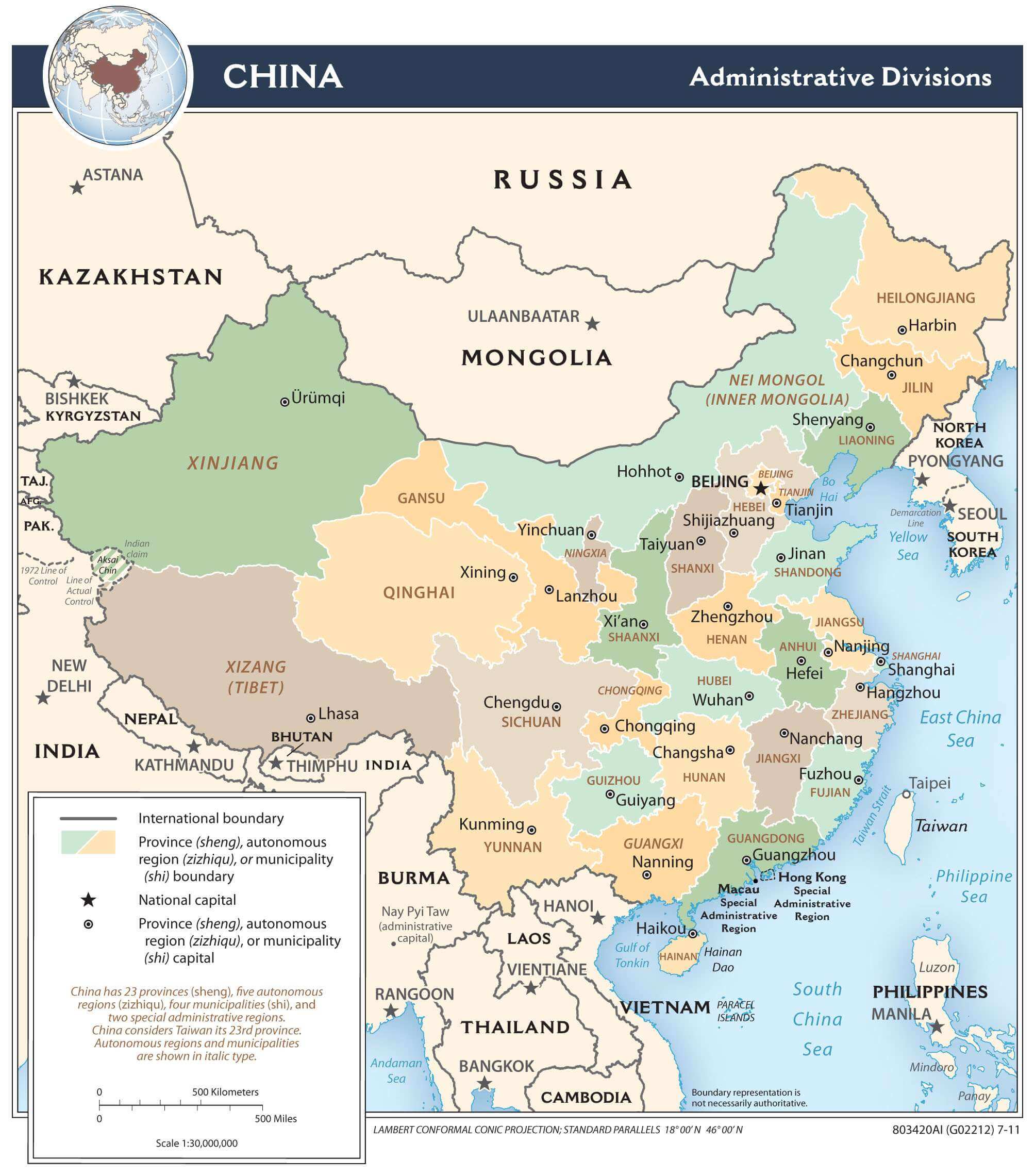
China (officially, People’s Republic of China) is divided into 22 administrative provinces (sheng), 5 autonomous regions (zizhiqu), 4 municipalities (shi) and 2 special administrative regions.
In alphabetical order, these provinces are: Anhui, Fujian, Gansu, Guangdong, Guizhou, Hainan, Hebei, Heilongjiang, Henan, Hubei, Hunan, Jiangsu, Jiangxi, Jilin, Liaoning, Qinghai, Shaanxi, Shandong, Shanxi, Sichuan, Yunan and Zhejiang. The 5 autonomous regions are: Guangxi, Nei Mongol (Inner Mongolia), Ningxia, Xinjiang Uygur and Xizang (Tibet). The 4 municipalities are: Beijing, Chongqing, Shanghai and Tianjin. The 2 special administrative regions are Hong Kong and Macau.
With an area of 9.6 million sq. km, China occupies major parts of the East Asian landmass. With a population of about 1.4 billion people, China is the most populous country in the world. Located in North China, is Beijing – the capital of China. Beijing is the world’s most populous capital city with over 21 million residents. It is also one of the world’s as well as China’s leading cultural, administrative, educational and economic centers. Based on the urban population, Beijing is the 2nd largest city in China. Located in the east coast of China, on the Yangtze estuary is Shanghai – the largest city and the most populous urban area in China.
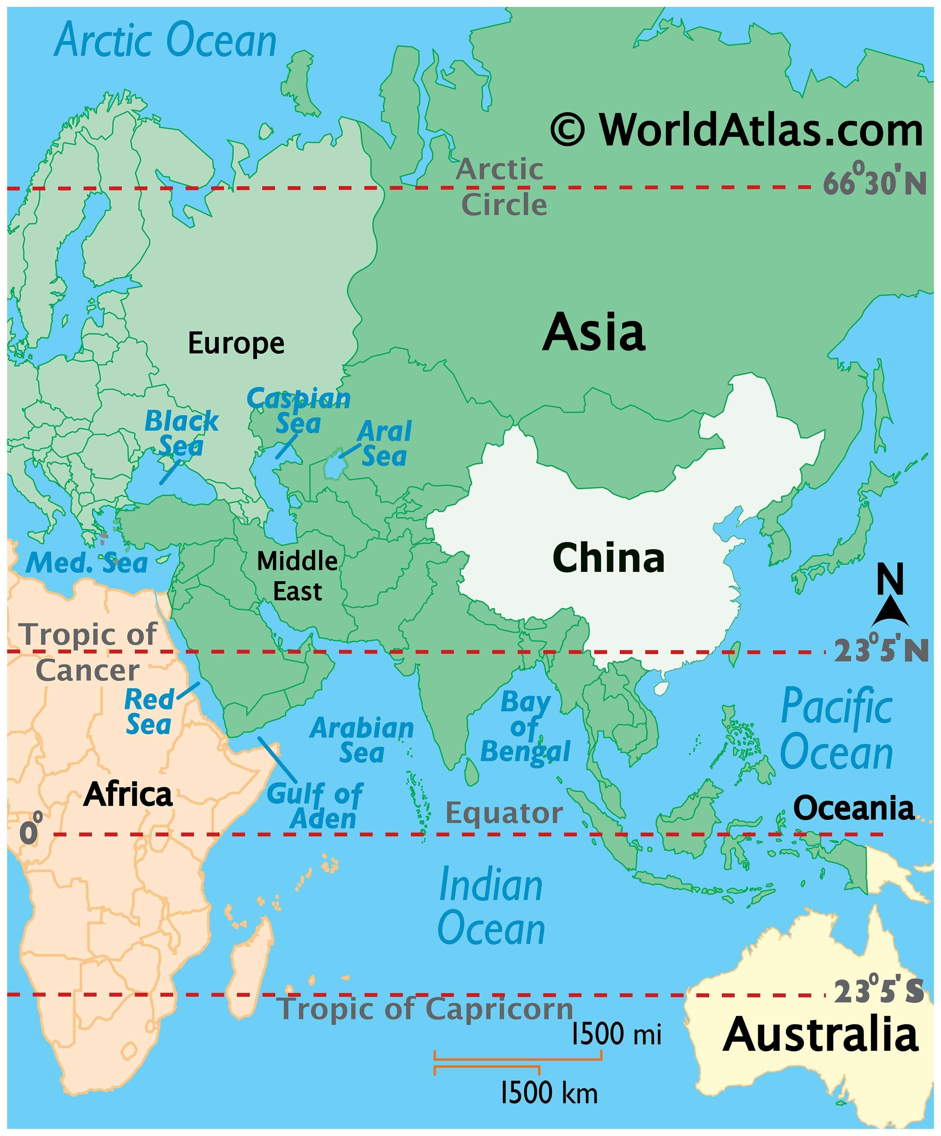
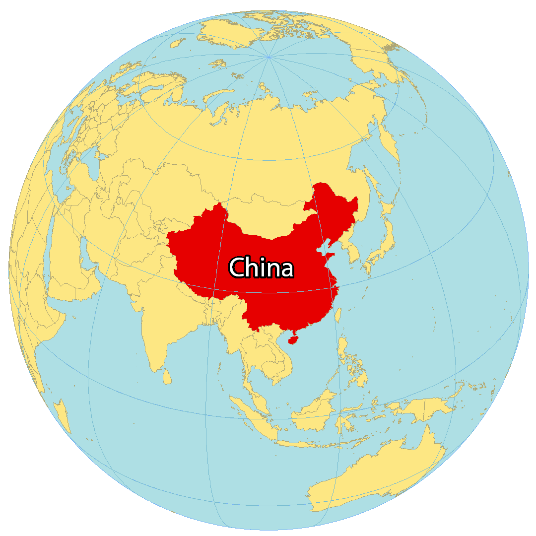
Location Maps
Where is China?
China is the third-largest landmass among countries, following Russia and Canada. It is slightly bigger than the United States, which is the fourth largest country in the world. China is a rapidly growing economy and is the most populous in the world with over 1.4 billion people. The capital city is Beijing, however, its largest city is Shanghai, located on the coast of the East China Sea. It borders Mongolia, Burma (Myanmar), Russia, Kazakhstan, Pakistan, India, Bhutan, Laos, Vietnam, North Korea, Nepal, Afghanistan, Tajikistan, and Kyrgyzstan. Additionally, China’s coastlines total 14,500 km (9,010 mi) along the Yellow Sea, East China Sea, and the South China Sea.
High Definition Political Map of China
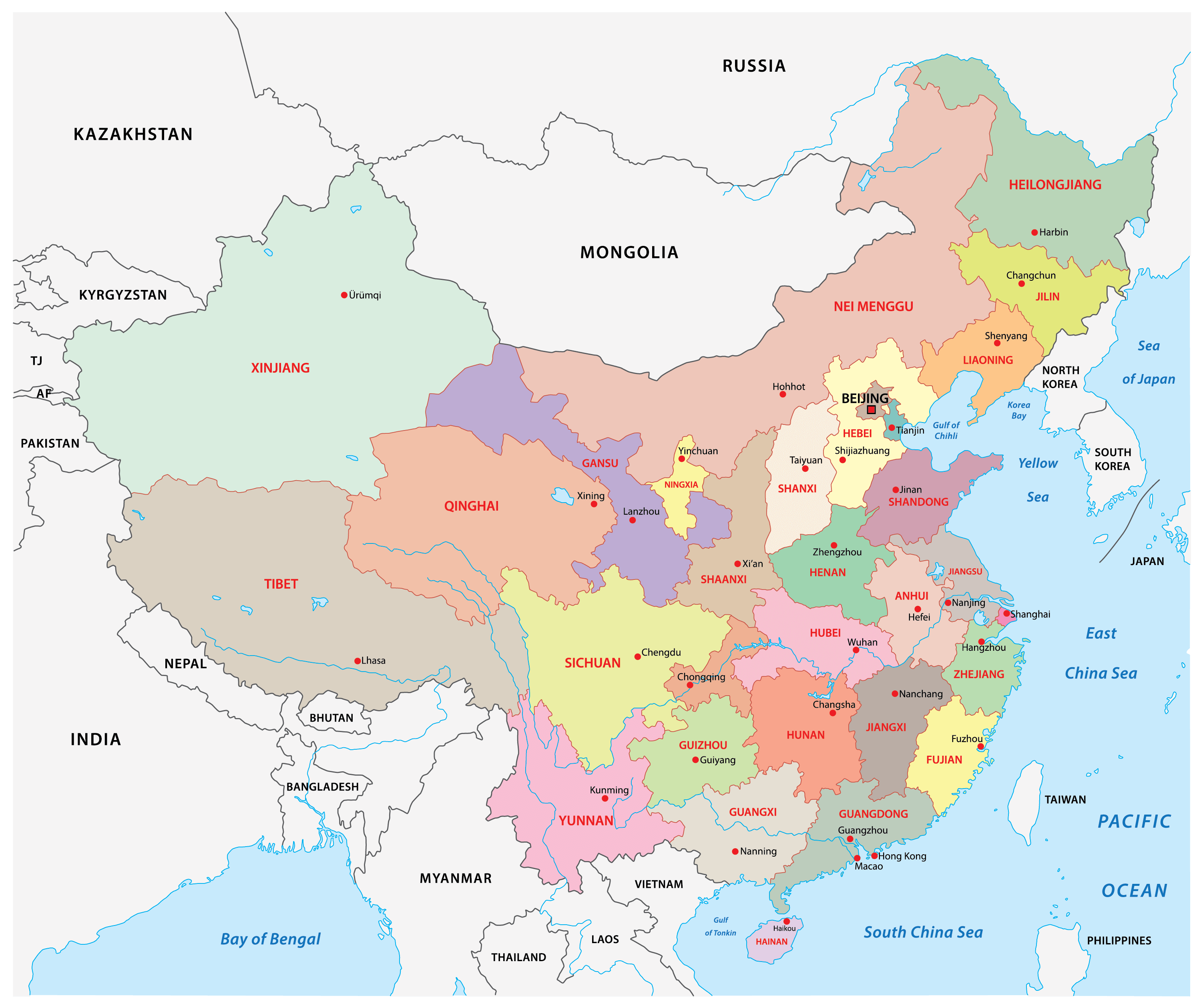
China Administrative Map

Physical Map of China
Transportation Map of China
China Satellite Map
Elevation Map