France, a Western European country that includes several overseas territories and regions, has 640,679 km2 (247,368 sq mi).
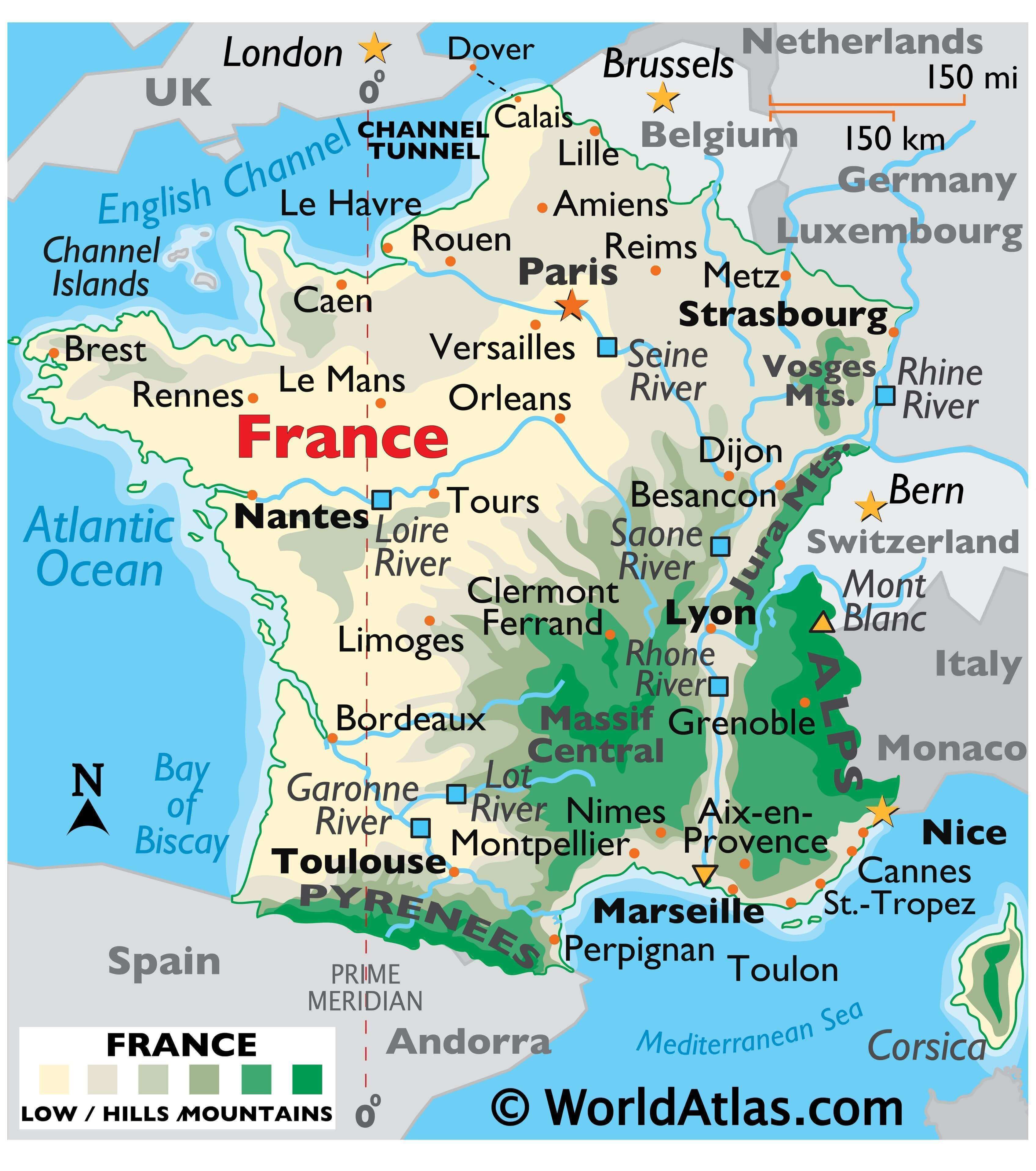
As observed on France’s physical map above, the country is partially covered central, north and west by a relatively flat plain that’s punctuated by some time-worn low rolling hills and mountains.
Rugged cliffs front its coastline along the English Channel. There, to the northwest of Caen, the Cotentin Peninsulashields the Channel Islands, while a bit further to the west, the Brittany Peninsula juts into the Atlantic Ocean. Assorted coastal islands dot the western coastline south of Brest, where white-sandy beaches stretch along the Atlantic Ocean to the border with Spain. A few scattered islands are found along the pebbled beaches of the Mediterranean coast. Corsica, a mountainous island and the country’s largest island, is located 160 km (99 miles) southeast of Nice. Mountains dominate eastern, south-central and southern France, including the snowcapped Alps that stretch along its border with Italy, then on into Switzerland and across southern Europe. The country’s highest point and the second-highest point in Europe are located here; Mont Blanc at 15,770 ft. (4,807m) (marked on the map above).
Further to the north, the limestone peaks of the Jura range front the country’s eastern border with Switzerland. The heavily forested Vosges Mountains in the far-northeast stretch along the Rhine River valley. In the far-southeast, directly to the west of Nice and dissected by the Verdon River, the Gorges du Verdon. This spectacular and massive canyon is up to 700 meters deep in places and about 11 miles long. Volcanic in origin, the Massif Central is a mountainous plateau divided by steep canyons and valleys. These mountains (or Massifs) stretch south toward the Mediterranean Sea. The Pyrenees, a jagged mountain range, covers the entire southern borders with Andorra and Spain. Dozens and dozens of rivers drain the country. The longest river in France is the Loire, at 630 miles (1,020 km) in length. Other significant rivers include the Garonne, Lot, Rhine, Rhone Seine, each with many smaller tributaries.
| Flag: |  |
|---|---|
| Legal Name: | French Republic |
| Capital Value: | Paris |
| Demonym(s): | French |
| Government: | Unitary semi-presidential republic |
| Legislature: | Parliament |
| Total Area: | 643,801 km² |
| Land Area: | 640,427 km² |
| Water Area: | 3,374 km² |
| Population: | 67,059,887 |
| Density: | 105.4627/km (106th) |
| GDP: | $2.72 Trillion |
| GDP Per Capita: | $40,493.93 |
| Currency Value: | Euros (EUR) |
| Driving side: | right |
| Calling code: | +33 |
| Internet TLD: | .fr |
Explore the diverse landscape of France with this detailed map. Discover fascinating facts about the country’s major cities, rivers, and mountain ranges. Zoom in to uncover the stunning topography and highest peak of France. From the English Channel to the Mediterranean Sea, you can explore France’s boundaries and beyond with this interactive map.
Online Interactive Political Map
Click on ![]() to view map in "full screen" mode.
to view map in "full screen" mode.
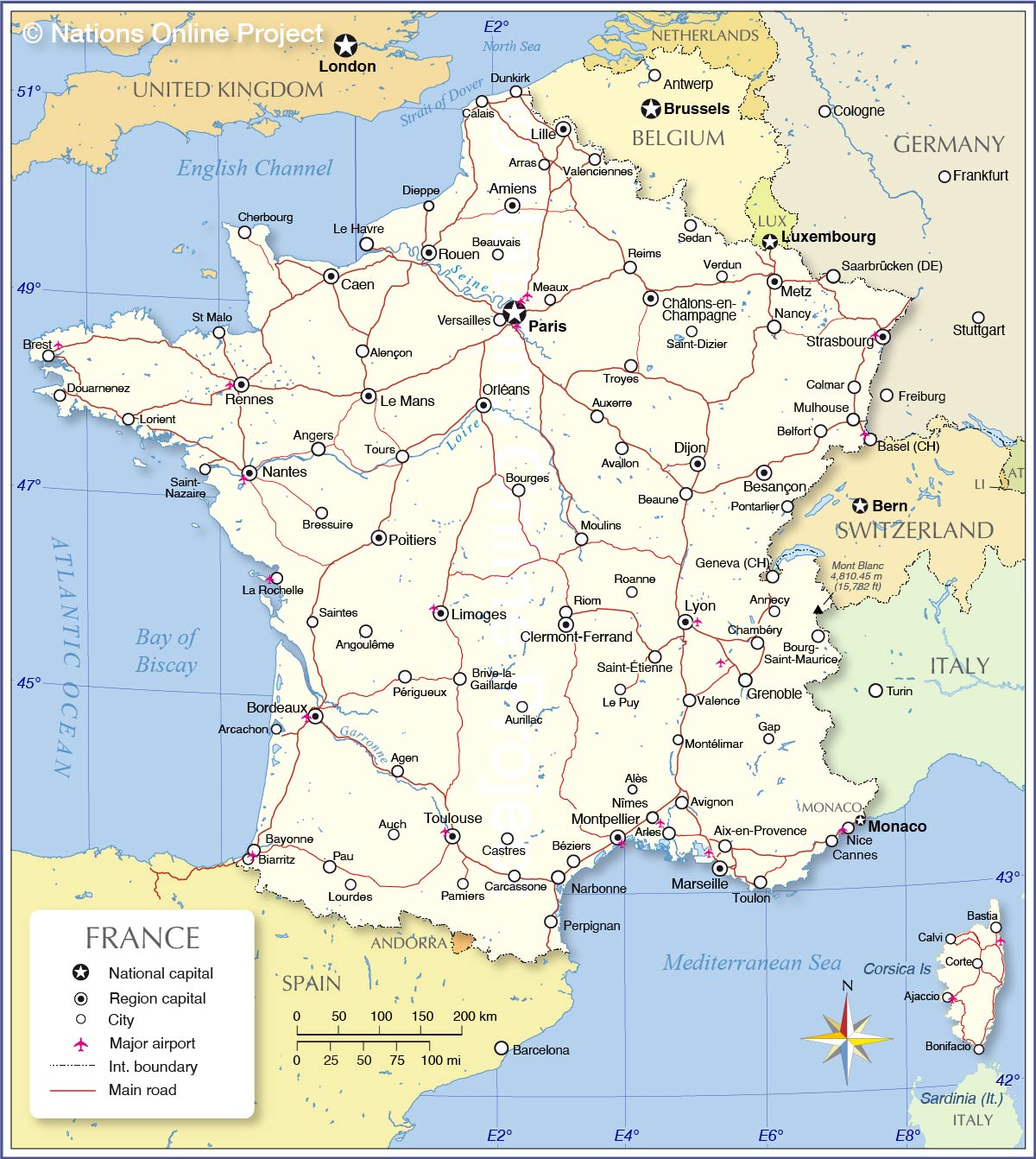
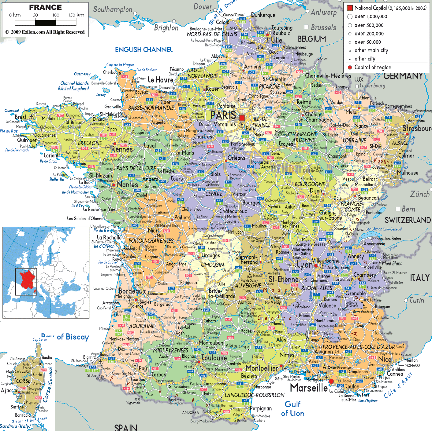
France (officially, the French Republic) is divided into 18 integral administrative regions (regions, singular – region). In alphabetical order, the regions are: Auvergne-Rhone-Alpes, Bretagne (Brittany), Bourgogne-Franche-Comte (Burgundy-Free County), Corse (Corsica), Centre-Val de Loire (Center-Loire Valley), Grand Est (Grand East), Hauts-de-France (Upper France), Ile-de-France, Nouvelle-Aquitaine (New Aquitaine), Normandie (Normandy), Occitanie (Occitania), Pays de la Loire (Lands of the Loire) and Provence-Alpes-Coted’Azur. These 13 regions are located in Metropolitan France in the European continent. The 5 overseas regions are: Mayotte and Reunion in Indian Ocean off the African coast; Guyane (French Guiana) is in South America; Guadeloupe and Martinique in Antilles in the Carribean Sea.
Located in the north-central part of the country is Paris – the capital, the largest and the most populous France. It is a major administrative, cultural and commercial center of the country.
Location Maps
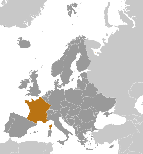
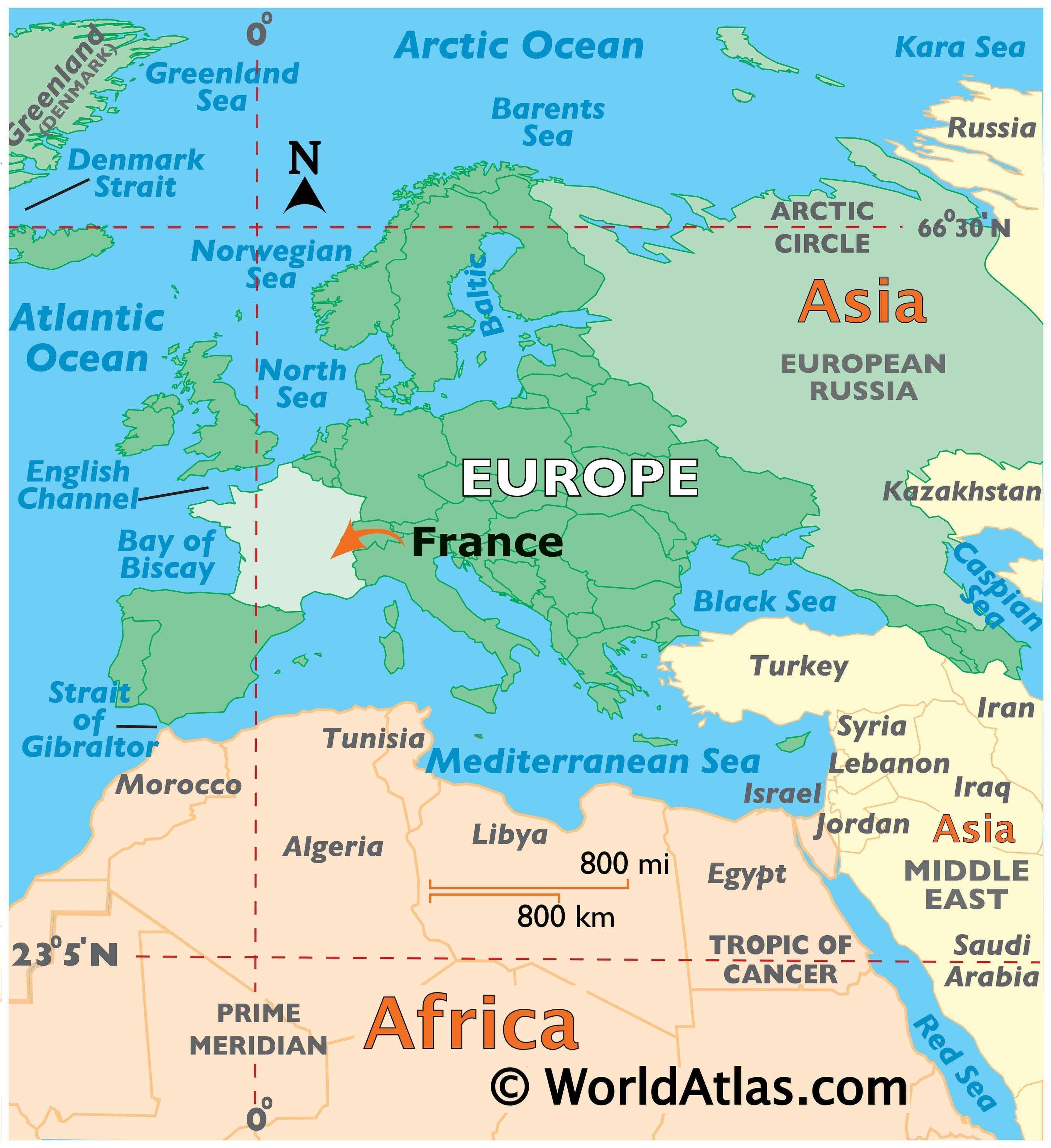
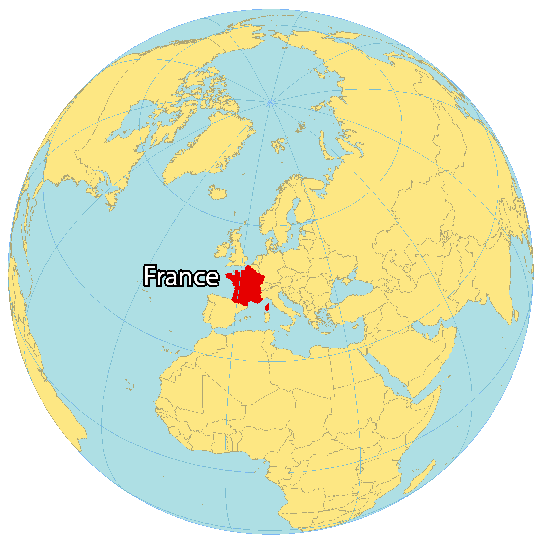
Where is France?
France is the largest country in Western Europe, second only to Spain. It is renowned as a popular tourist destination, boasting iconic landmarks such as the Eiffel Tower in Paris. France is neighbored by several European countries including Belgium, Germany, Luxembourg, Switzerland, Italy, and Spain. Additionally, the United Kingdom is accessible by France via the English Channel. The geography of France is varied, with different regions offering different landscapes and experiences. In the north there are the rolling hills of Picardy and Normandy, while in the south there are the sun-drenched beaches of the Cote d’Azur. Central France is home to the picturesque wine country of Burgundy and the majestic mountain range of the Alps to the east.
High Definition Political Map of France
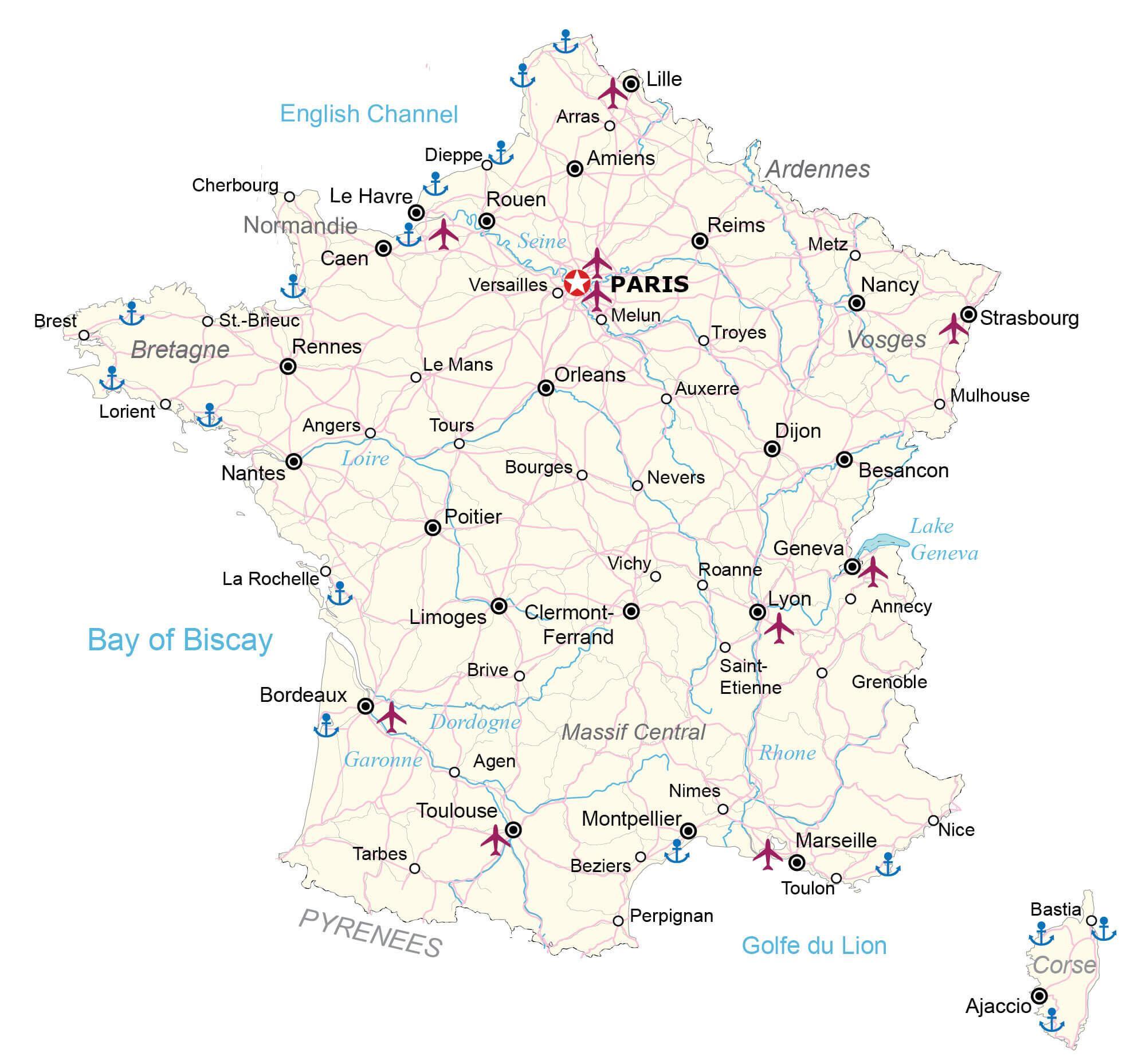

Physical Map of France