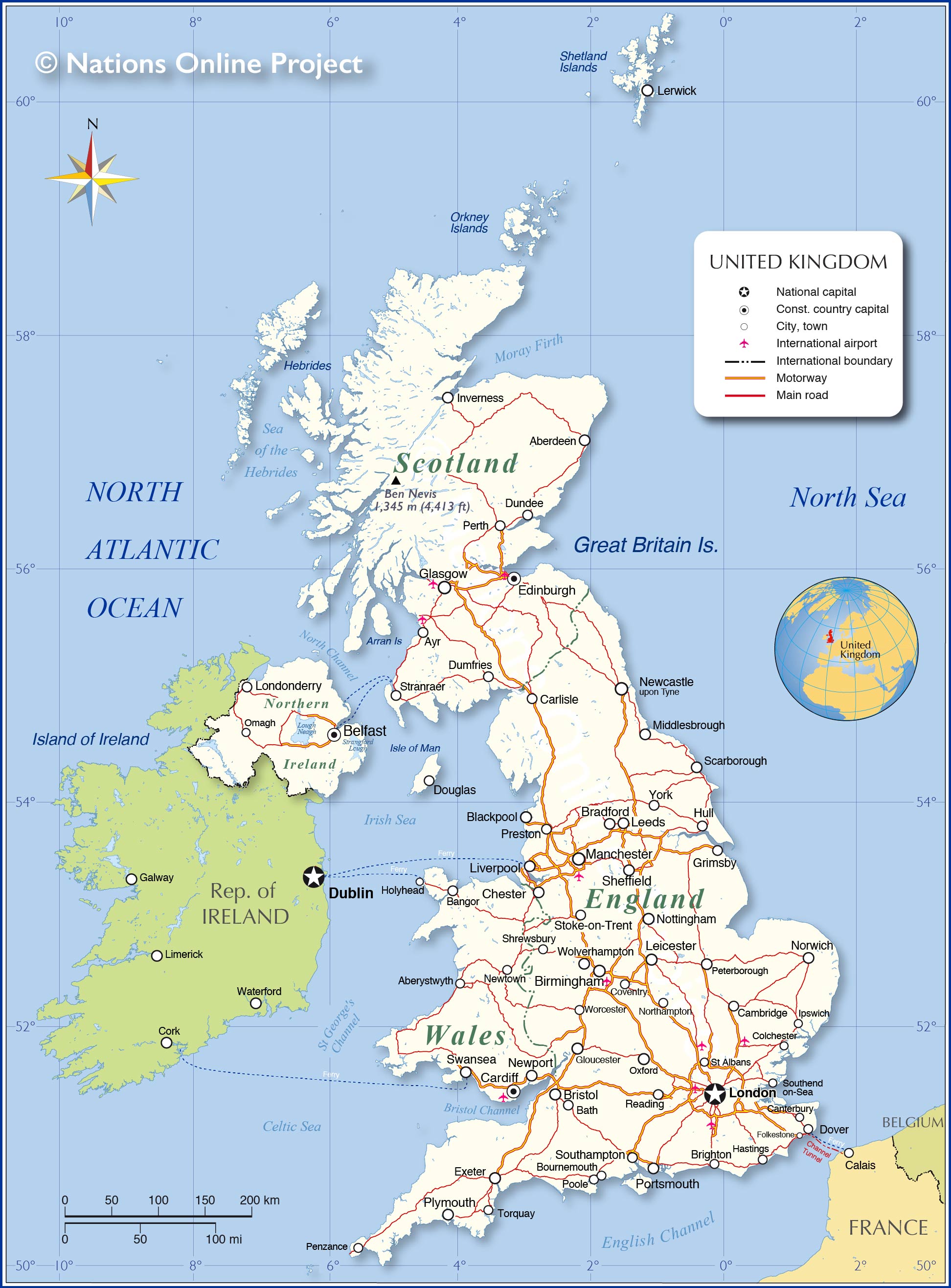
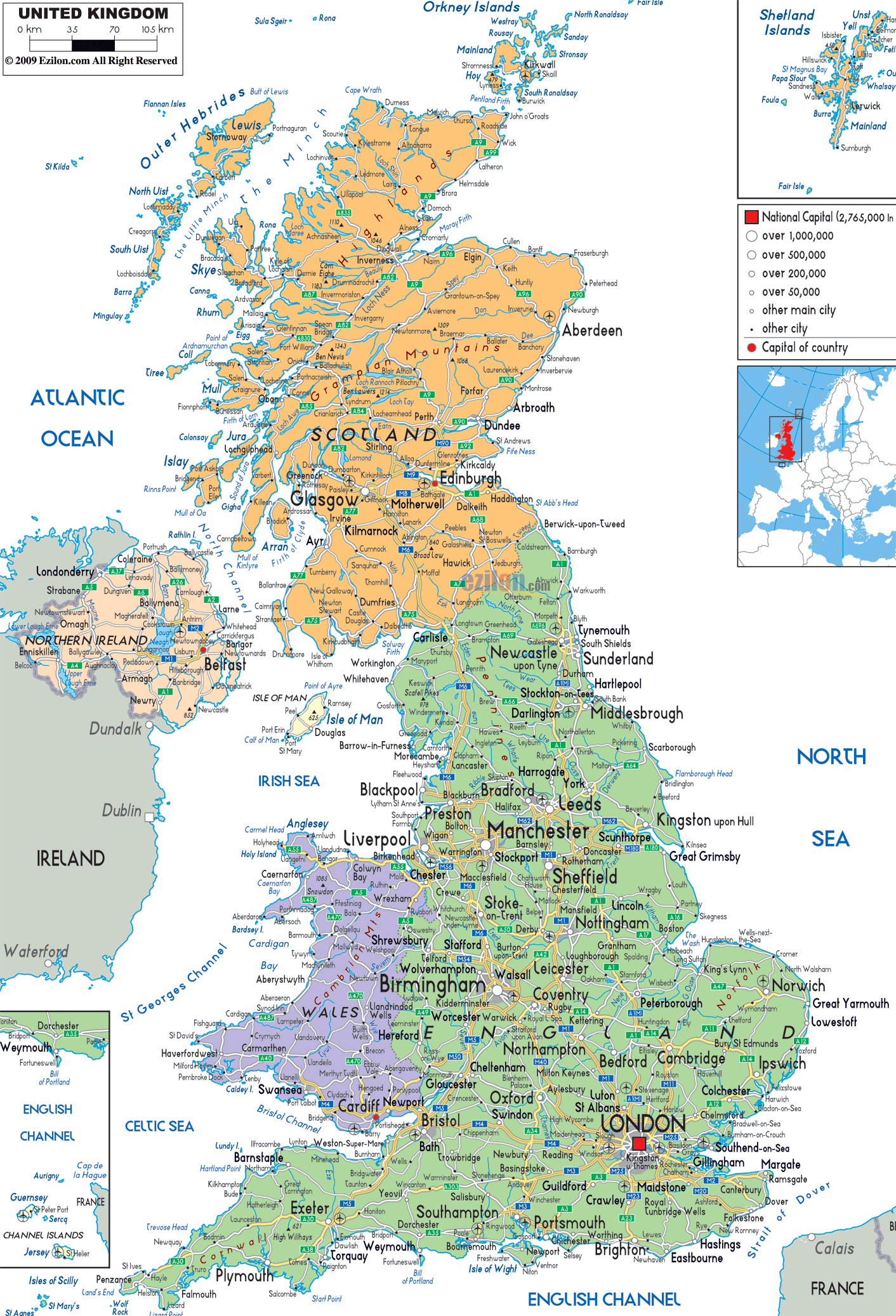
Covering an area of 244,820 sq.km, the United Kingdom is a part of the British Isles – which includes the two principal islands of Great Britain and Ireland along with several smaller offshore islands. The Great Britain is the larger of the two islands while Ireland is the 2nd largest.
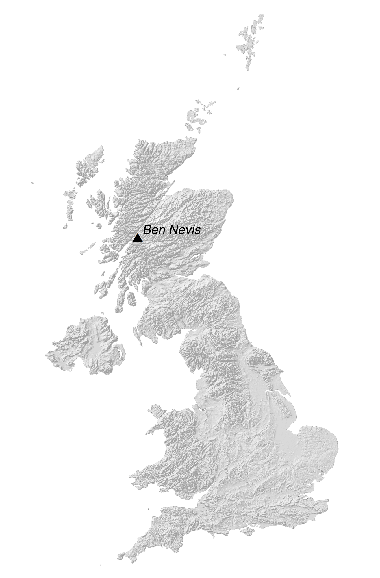
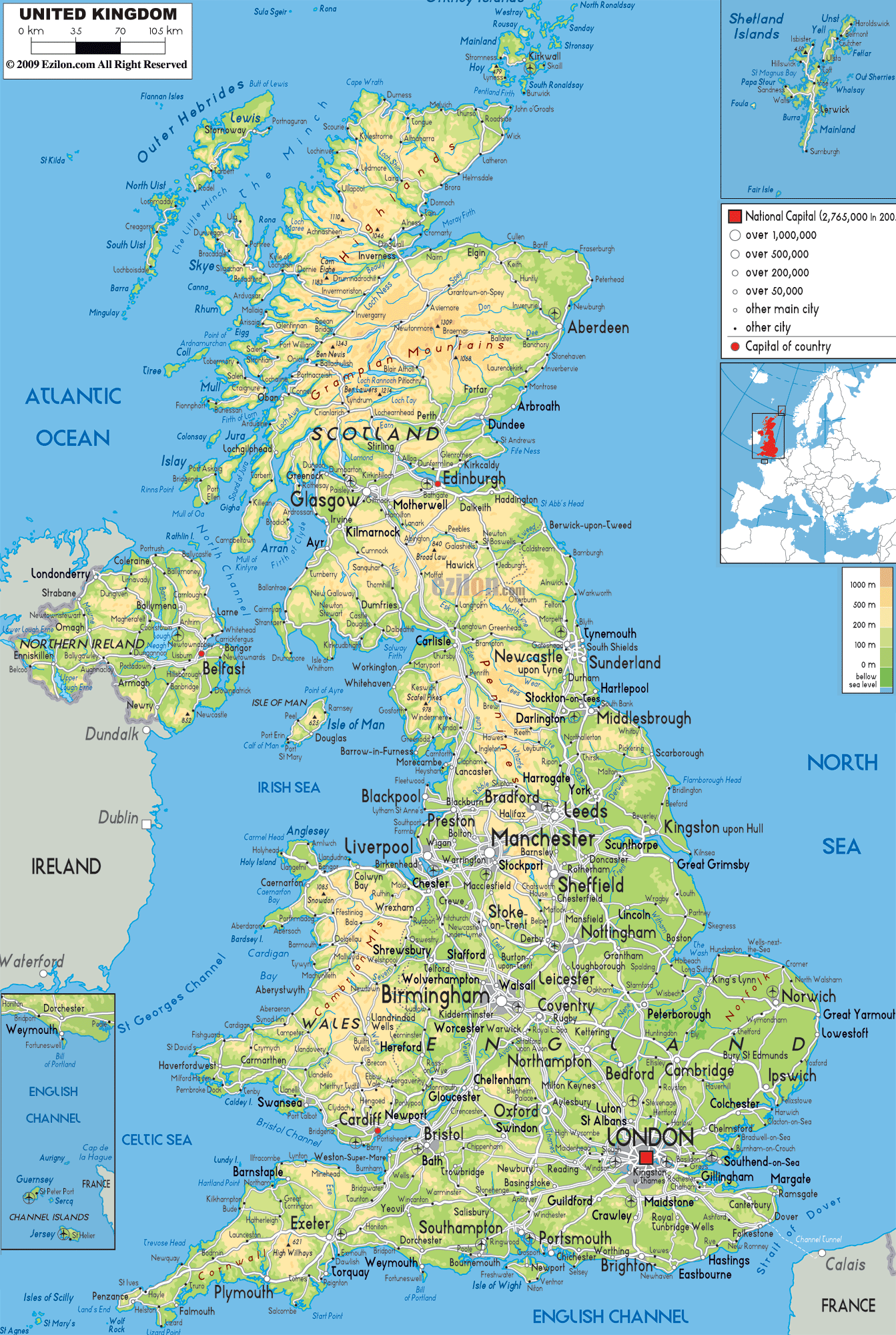
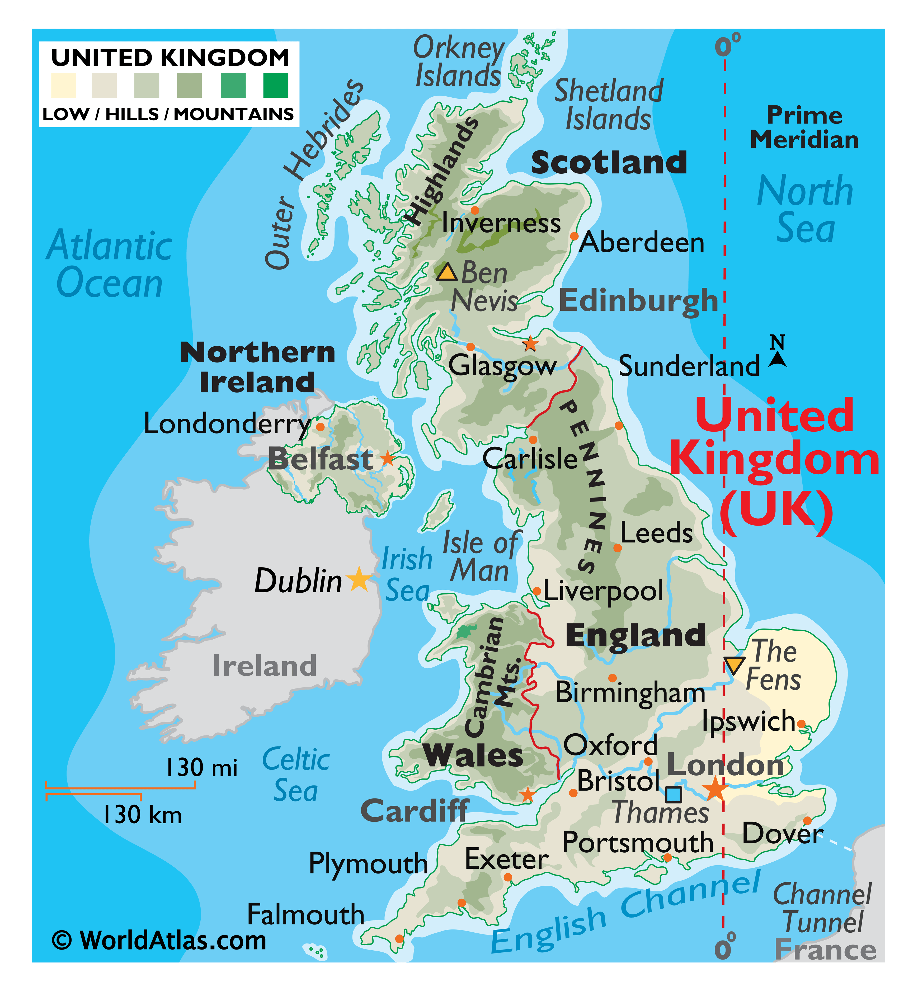
As observed on the map, Scotland is the most mountainous part of the United Kingdom and is divided into two distinct regions namely – Highlands and the Lowlands. The rugged mountainous highland region occupies the north and west portion and includes the highest point of the United Kingdom – Ben Nevis, that rises to an elevation of 1,345m (4,413ft). In England, the Pennine highlands are present in the northern part while the Cambrian Mountains are found in Wales. As marked on the map, by an upside-down triangle is, the very low region of marsh area known as The Fens, or Fenlands; which at (-4m) or (-13ft) is the lowest point of the United Kingdom.
| Flag: |  |
|---|---|
| Legal Name: | United Kingdom of Great Britain and Northern Ireland; note – the island of Great Britain includes England, Scotland, and Wales |
| Capital Value: | London |
| Demonym(s): |
|
| Government: | Unitary parliamentary constitutional monarchy |
| Legislature: | Parliament |
| Total Area: | 243,610 km² |
| Land Area: | 241,930 km² |
| Water Area: | 1,680 km² |
| Population: | 66,834,405 |
| Density: | 270.7/km (701.1/sq mi) (50th) |
| GDP: | $2.83 Trillion |
| GDP Per Capita: | $42,300.27 |
| Currency Value: | British pounds (GBP) |
| Driving side: | left |
| Calling code: | +44 |
| Internet TLD: | .uk |
Explore the United Kingdom through this interactive map. Discover the four countries that make up the United Kingdom – England, Scotland, Wales, and Northern Ireland. View the satellite and elevation map of the United Kingdom to see its topography and highest peak.
Online Interactive Political Map
Click on ![]() to view map in "full screen" mode.
to view map in "full screen" mode.
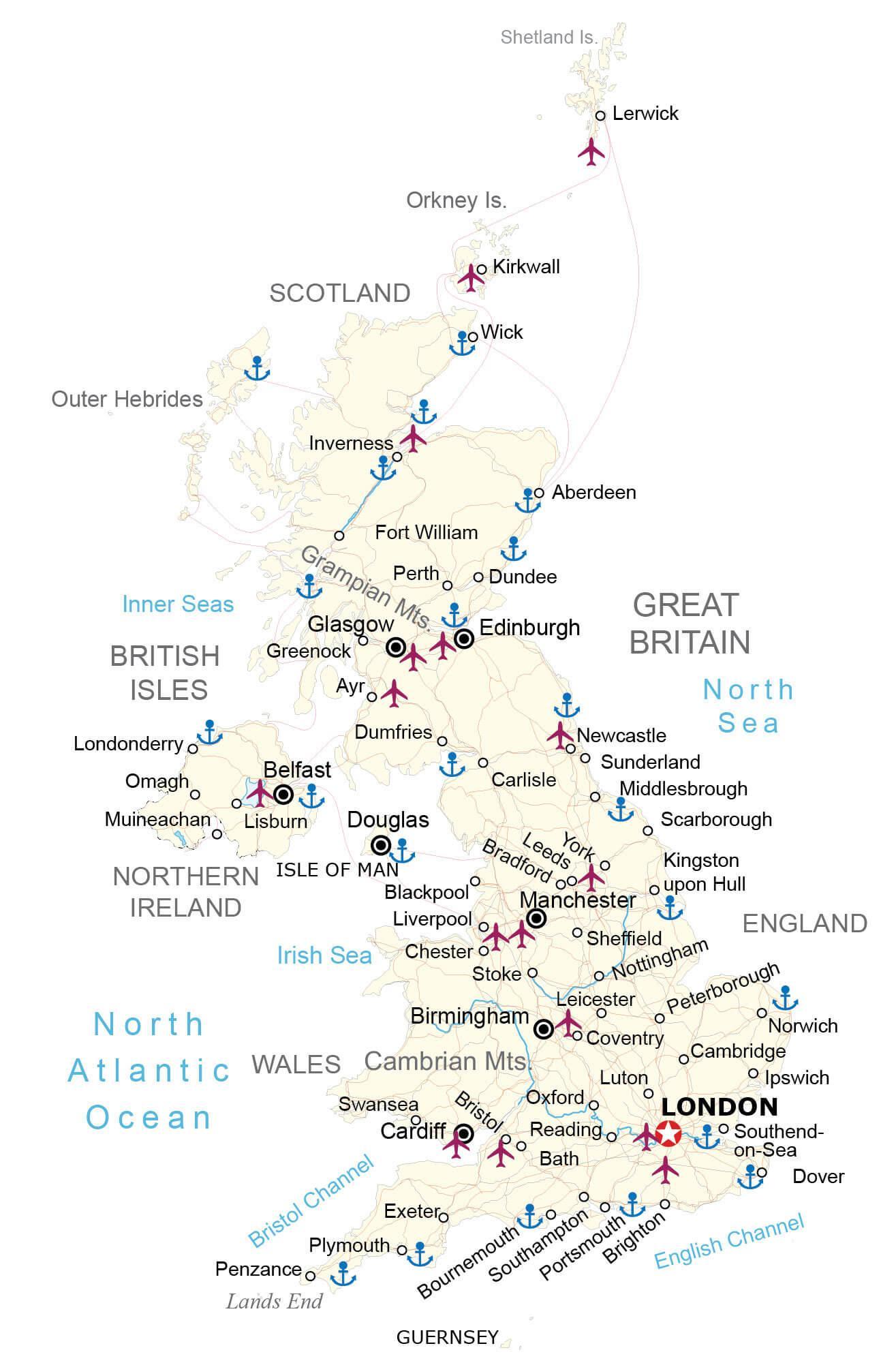
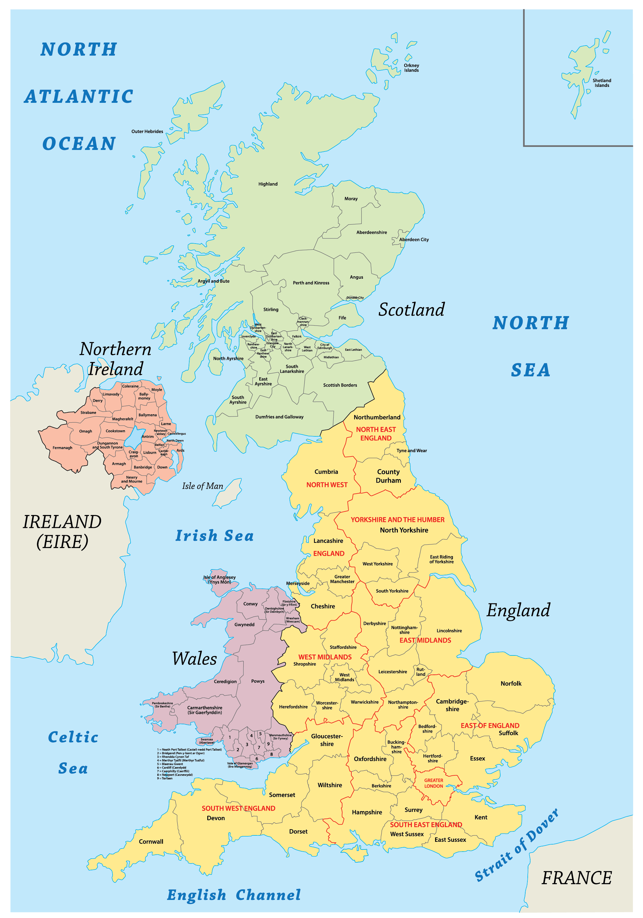
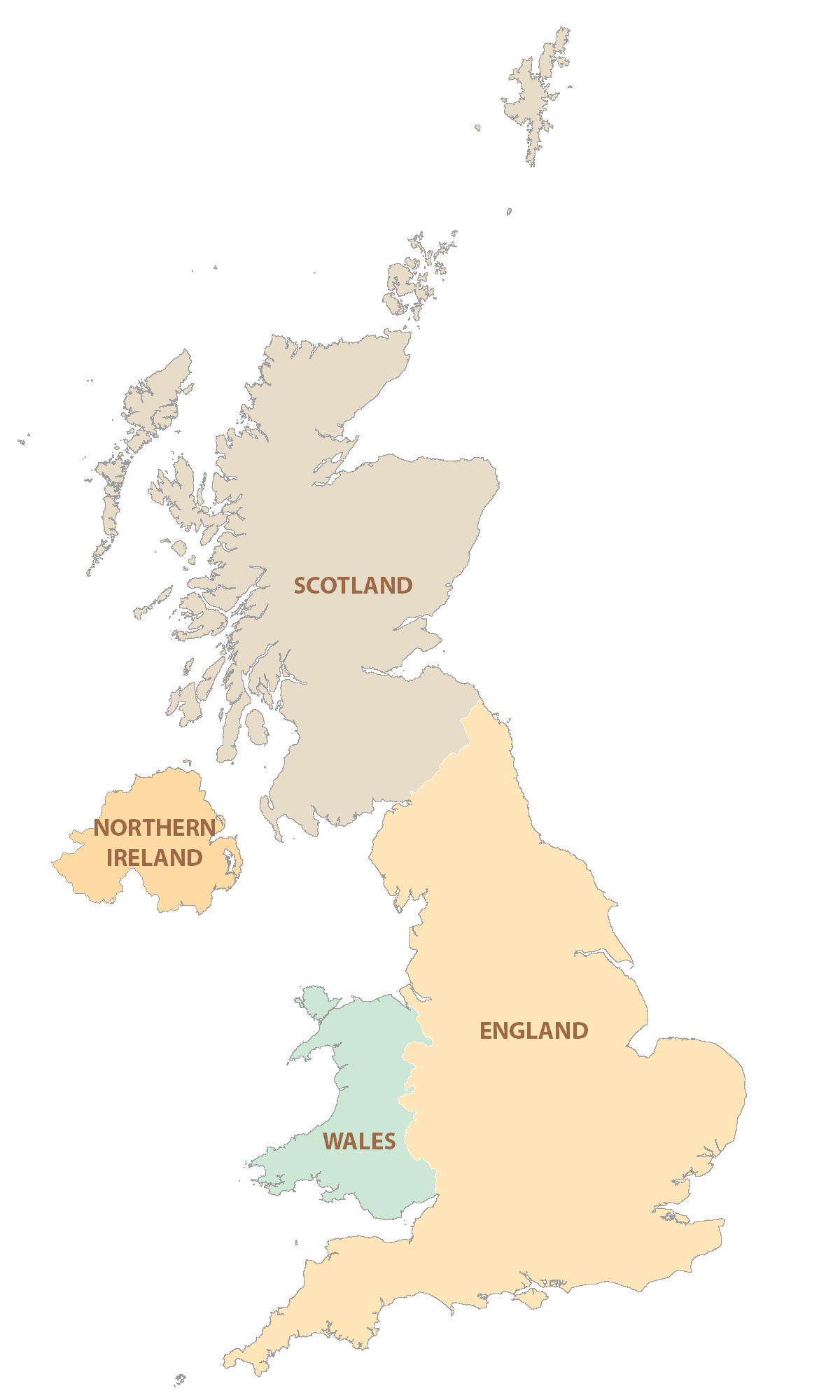
The United Kingdom comprises of a union of the individual countries of England, Scotland and Wales (collectively, Great Britain) and the constitutionally distinct region of Northern Ireland. The individual countries of England, Scotland, Wales and Northern Ireland are further divided into a number of boroughs, cities, council areas, counties and districts.
Covering an area of 240,000 sq.km, the United Kingdom is a part of the British Isles – which includes Great Britain, Ireland and several smaller islands. Located in the southeastern part of England on the banks of the Thames River is London – the capital and the largest city of United Kingdom. It is also the capital of England and is the administrative, economic, financial, commercial and cultural center of the entire United Kingdom.
Location Maps
Where is United Kingdom?
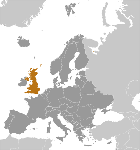
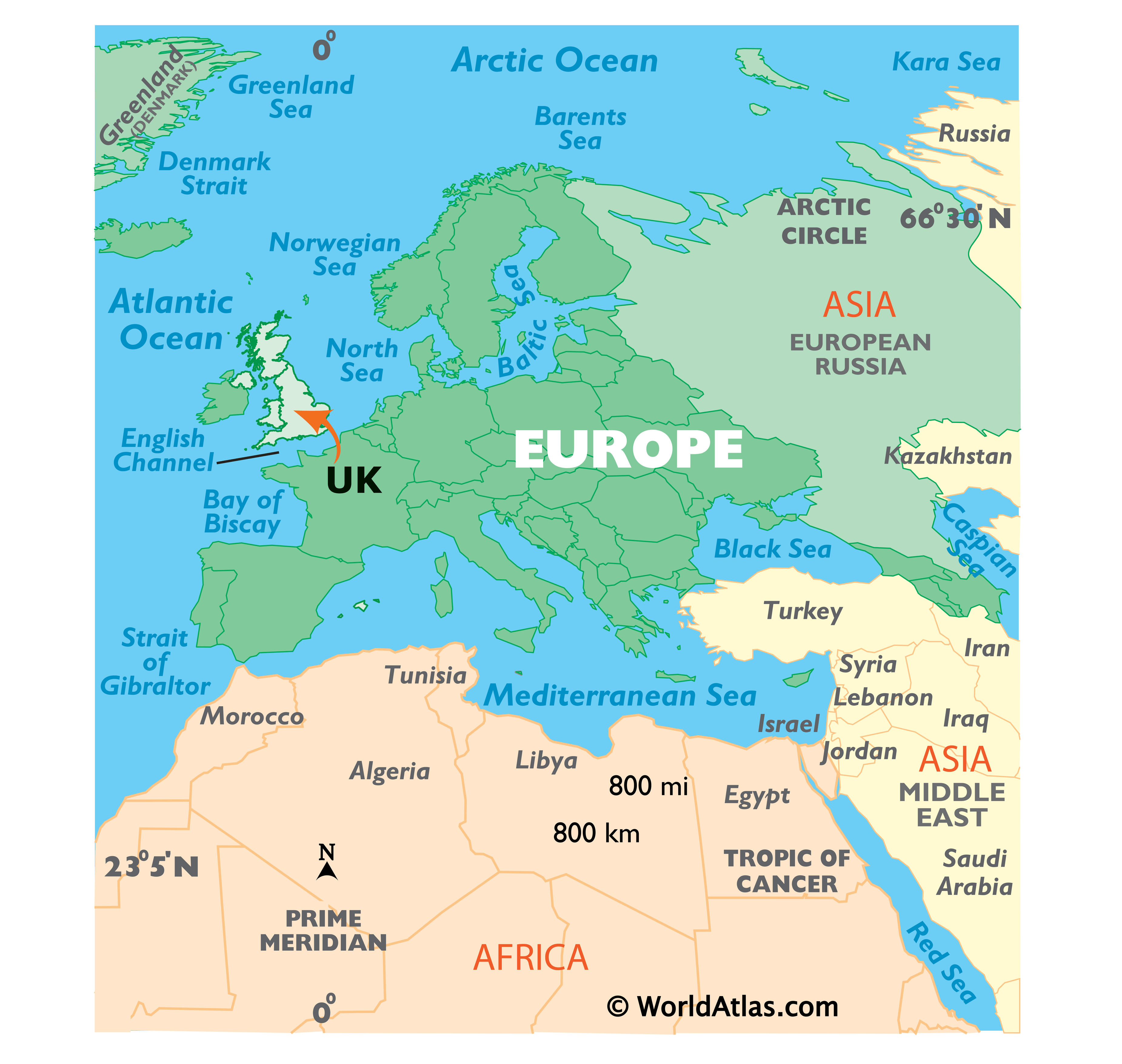
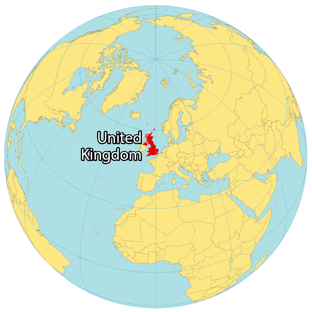
The United Kingdom is an island nation located in western Europe, and is part of the British Isles archipelago. It is situated northwest of France and east of Ireland. Great Britain is comprised of England, Scotland, and Wales, while Northern Ireland and several small islands make up the rest of the nation. The total area of the United Kingdom is divided into England (53%), Scotland (32%), Wales (9%), and Northern Ireland (6%). The country is surrounded by the Atlantic Ocean and the Irish Sea to the west and the North Sea to the east.
High Definition Political Map of United Kingdom
United Kingdom Administrative Map
Physical Map of United Kingdom
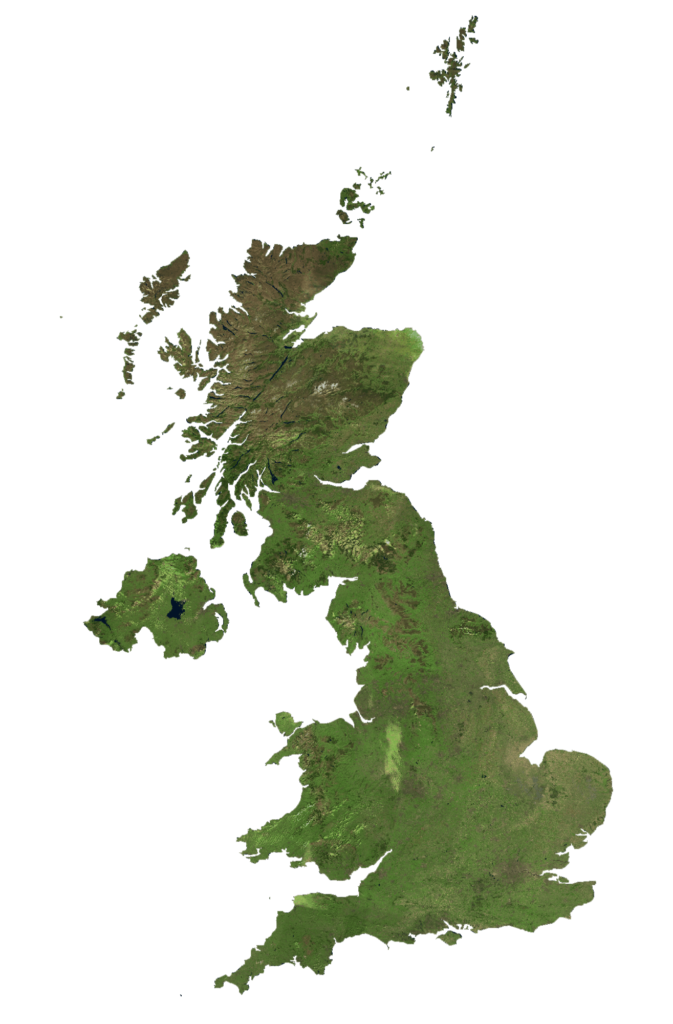
United Kingdom Satellite Map
Topo Map
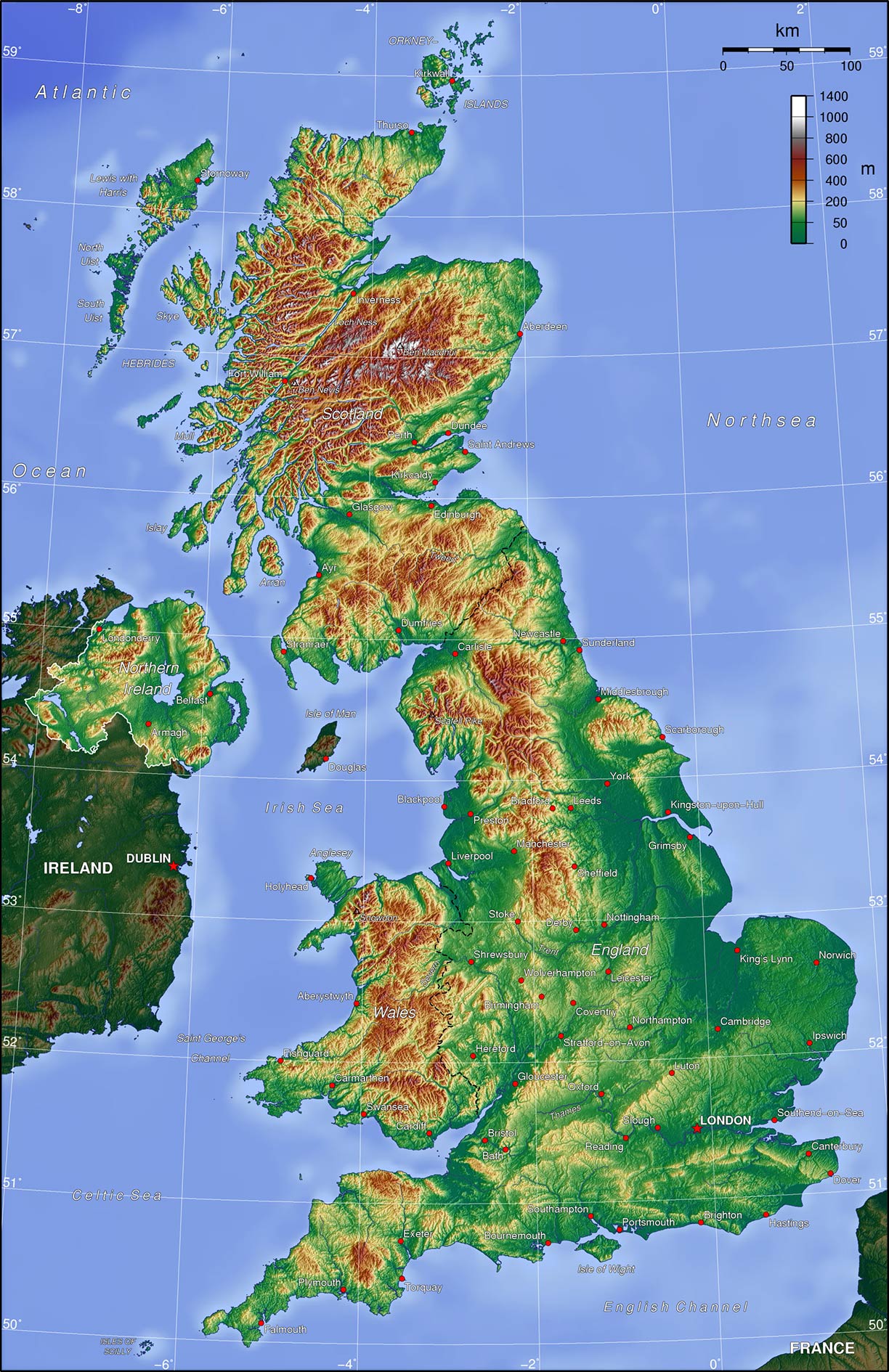
Elevation Map