Currently, there are many world maps with various advantages and disadvantages. Each type of world map has different ways of representation and methods in transforming the spherical surface of the Earth into a flat form. Depending on the purpose of use, there may be common types of maps such as administrative maps of countries, natural geography maps, weather maps, remote sensing maps, etc. Based on the method of flattening the map, we can mention the most common projections such as the Mercator projection, the Robinson projection. Let’s explore and discover more details through the maps that Địa Ốc Thông Thái has compiled below.
High-definition world map
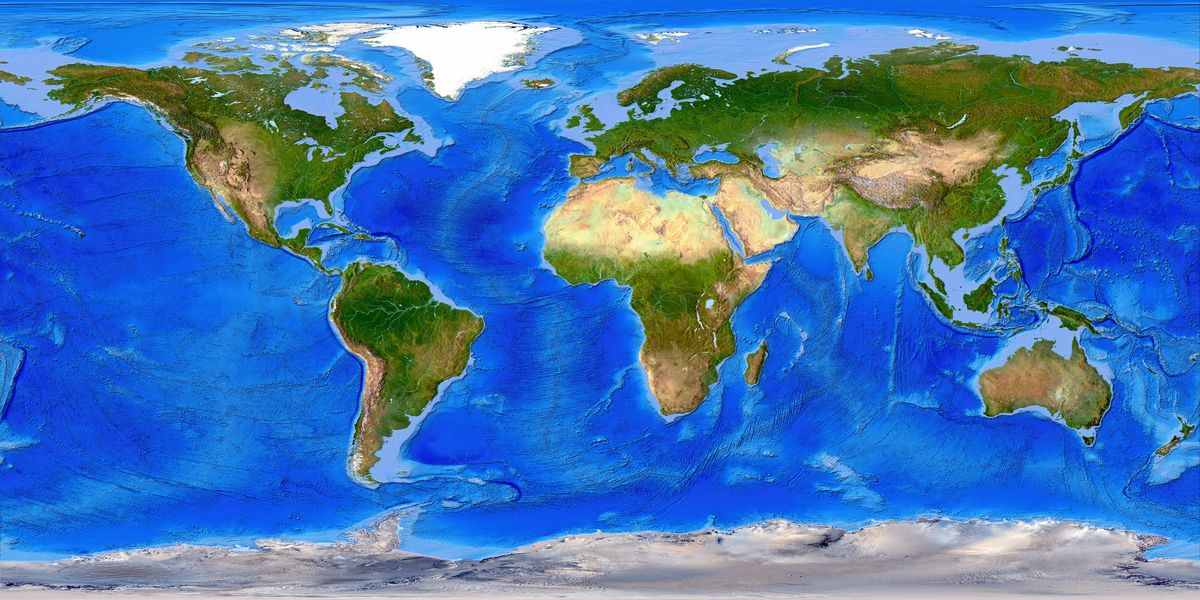
Below is a large-scale world map that effectively depicts the positions and boundaries of countries, continents, and oceans while also illustrating natural geographical features such as terrain elevation, lines of longitude, and latitude. This map employs the Robinson projection, invented by a Canadian university professor named Arthur H. Robinson in the early 1960s.
With the Robinson projection technique, the maps achieve a better balance between size and shape for high-latitude regions compared to the Mercator projection. Countries near the poles, such as Russia and Canada, are accurately represented in terms of size, while Greenland may still appear slightly oversized when viewed larger than reality.
Download above map with link below:
Physical Map
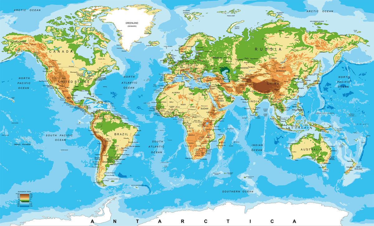
Discover the rich tapestry of our planet’s physical features with the following world map, meticulously detailing the division between land and oceans, as well as highlighting plains, mountains, rivers, lakes, and more. This map employs the Mercator projection, presenting a comprehensive view in an overall rectangular format.
Covering a vast surface area of 510.1 million km², Earth’s landmass occupies approximately 29.2% (148.9 million km²), distributed across six continents. Oceans encompass over 70% of the Earth’s surface.
In this visual representation, seas and oceans are depicted in varying shades of blue, with lighter hues indicating shallow areas and darker tones signifying deeper ocean regions. White areas denote year-round snow-covered regions. Land features are visually distinguished: green signifies low-lying plains, yellow-orange marks deserts and areas with average elevation, and brown denotes mountainous regions, with darker shades indicating higher elevations.
Embark on a virtual journey to explore Earth’s physical diversity through this detailed and informative map.
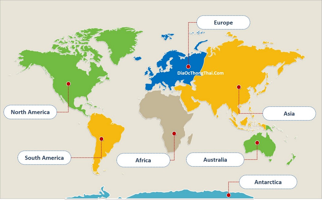
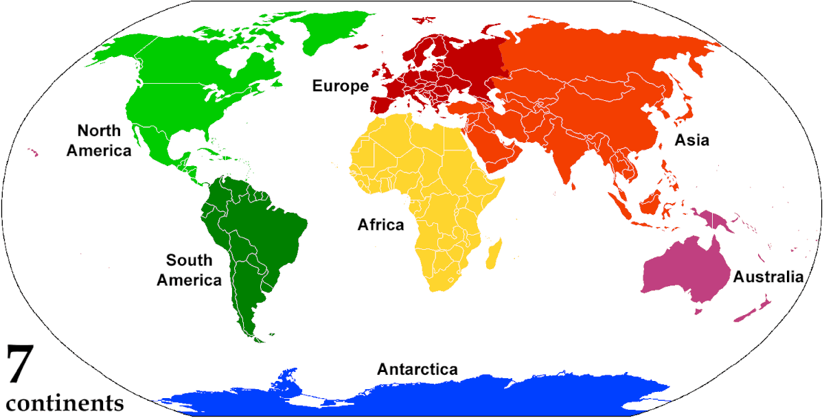
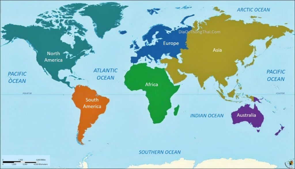
World Continents Map
The Earth’s landmass is divided into six continents, each characterized by its unique geography and cultural diversity. Here is an overview of these continents:
- Asia: 44,580,000 km²
- Europe: 10,180,000 km²
- Africa: 30,370,000 km²
- North America: 42,550,000 km²
- Oceania: 8,526,000 km²
- Antarctica: 14,000,000 km²
While the continents are typically recognized as six, it’s worth noting that North and South America can be considered separate entities, making a case for a total of seven continents. These continents are categorized into six major landmasses: Asia-Europe, America, Africa, Australia, and Antarctica. Explore the diversity of our world through the lens of these continents and discover the unique characteristics that define each one.
World Oceans Map
On June 8, 2021, the National Geographic Society officially acknowledged the Southern Ocean as the fifth ocean. Prior to this recognition, the world had only recognized four oceans, not considering the Southern Ocean as an independent entity. Geographers and scientists had debated for years about assigning a distinct name to the waters surrounding the South Pole. While many geographers agreed on a separate designation, some believed it was merely an extension southward of the Pacific, Atlantic, and Indian Oceans.
The Southern Ocean is defined by ocean currents rather than geographical location and tectonic plates, as is the case with the previously recognized four oceans. It is the only ocean that interfaces with three other oceans and encompasses an entire continent without being bordered by other continents, setting it apart from the other four oceans. This recognition marks a significant milestone in our understanding and classification of Earth’s vast and interconnected oceans.
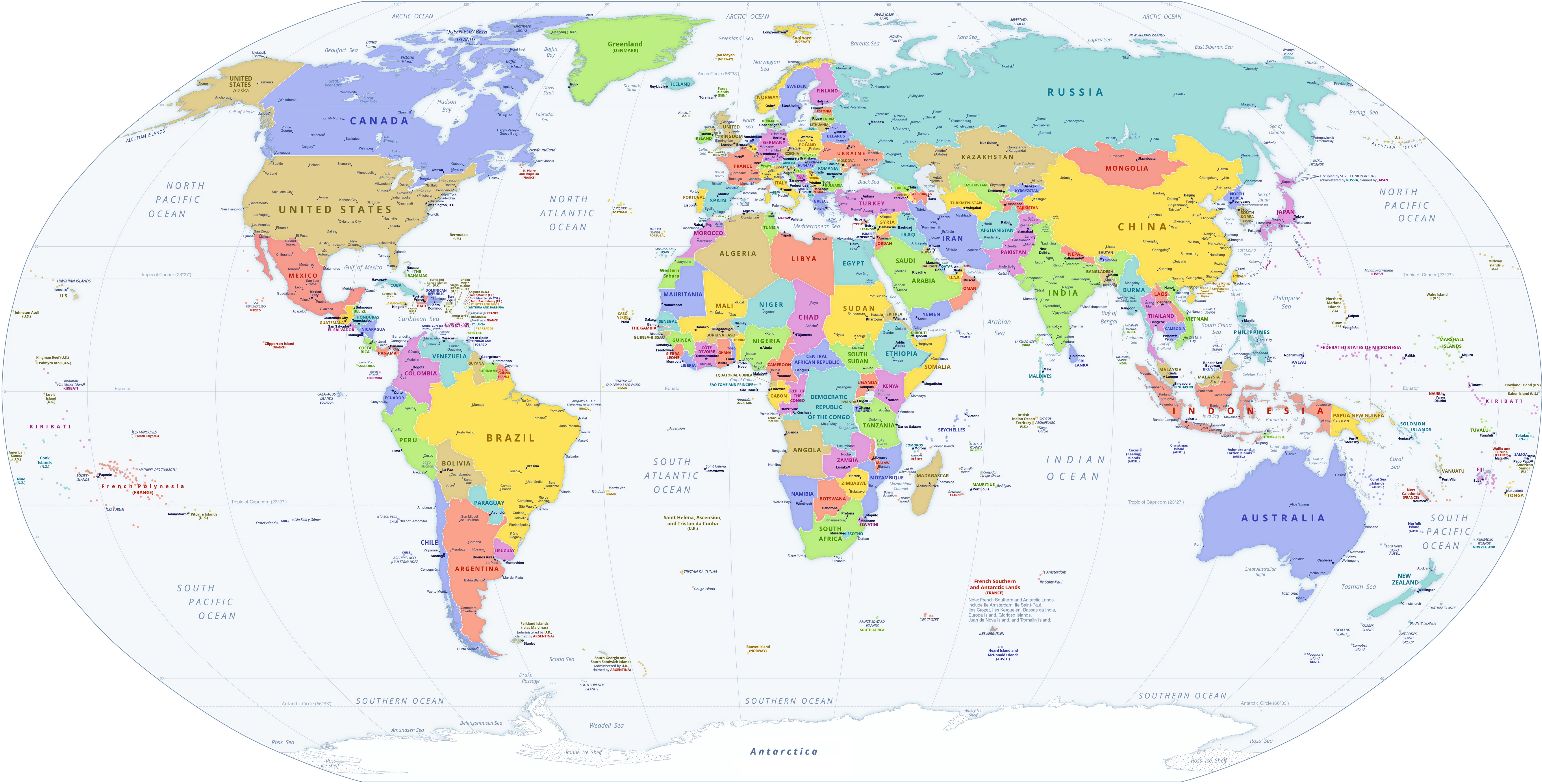
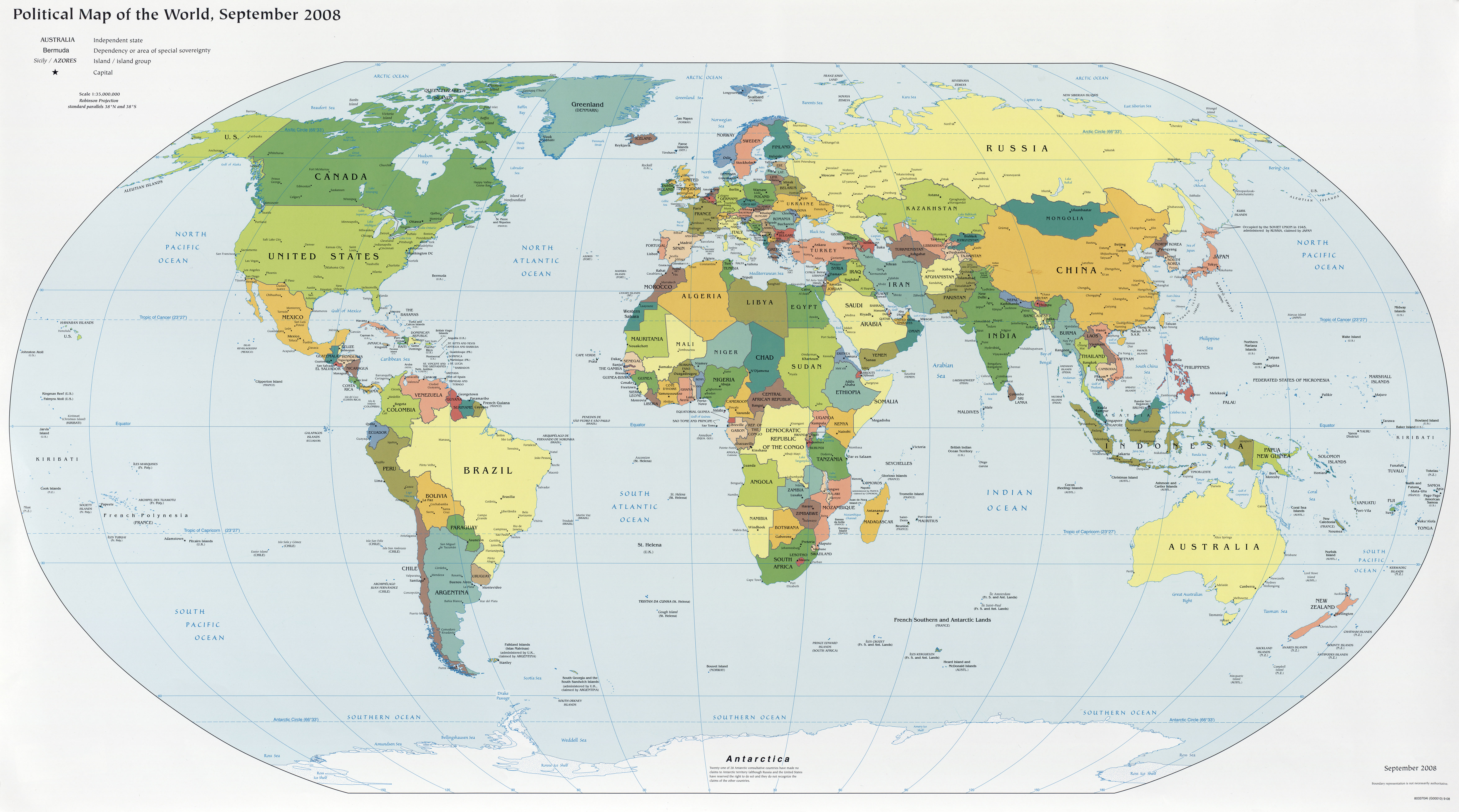
Political Map of the World
The map shows the world with countries, sovereign states, and dependencies or areas of special sovereignty with international borders, the surrounding oceans, seas, large islands and archipelagos.
The image file has been downsized compared to the original. CLICK HERE to download original full size map image.
The image file has been downsized compared to the original. CLICK HERE to download original full size map image.
The image file has been downsized compared to the original. CLICK HERE to download original full size map image.
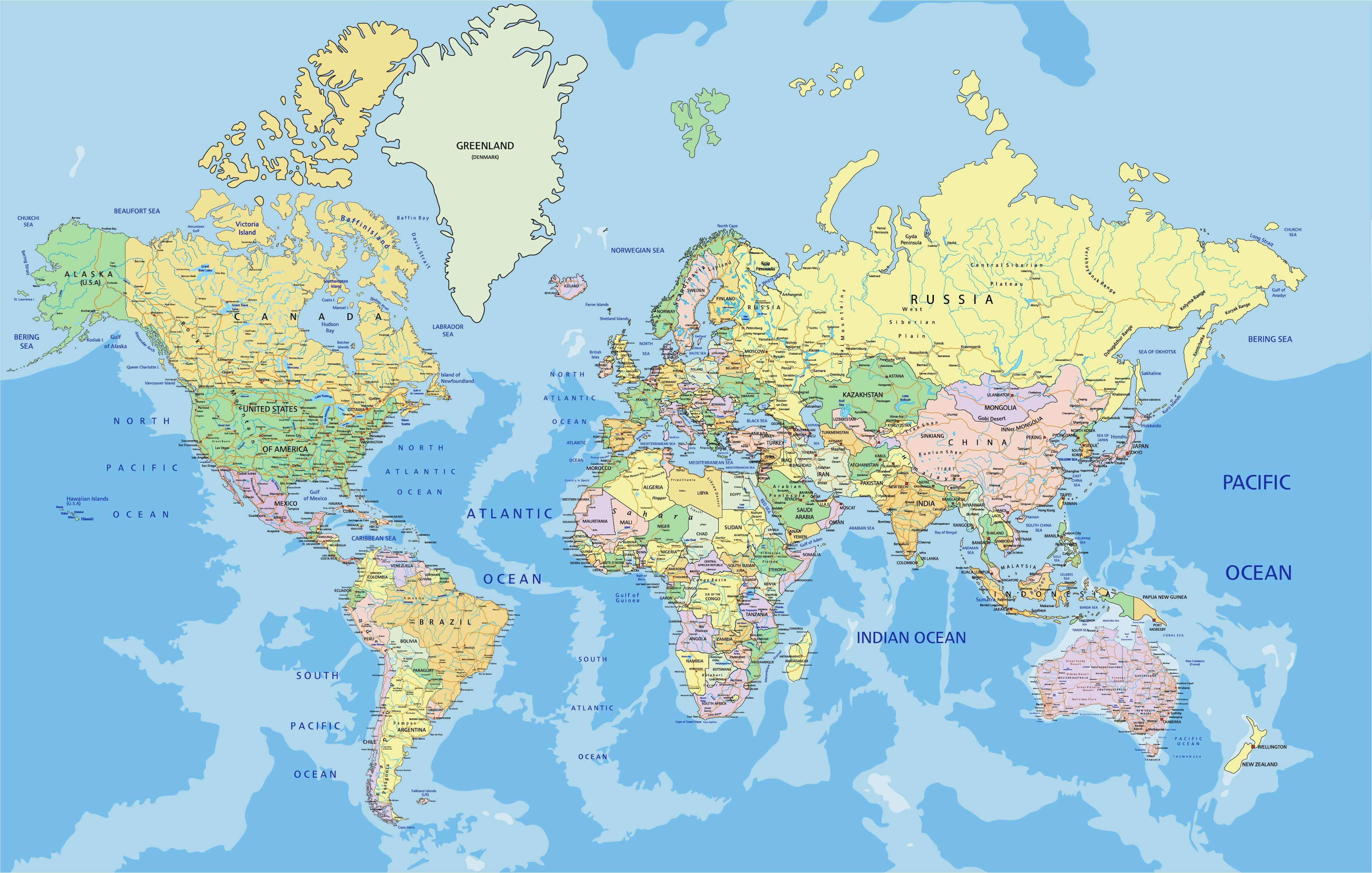
World Topographic Map.
A topographic map is a highly detailed illustration of geographical features, offering insights into the contours, elevations, and structures that sculpt the terrain. By utilizing contour lines, these maps vividly portray the highs and lows of the land, providing a three-dimensional perspective on the Earth’s surface.
The world’s topographic map stands as an invaluable resource, extending beyond the conventional representation of countries and continents. It unveils the intricate details of our planet’s diverse landscapes, encompassing both natural wonders and human-made structures. Going beyond geopolitical boundaries, these maps offer a comprehensive portrayal, enriching our understanding and appreciation for the complex tapestry that shapes the surface of our Earth.