Italy is a sovereign nation occupying 301,340 km2(116,350 sq mi) in southern Europe.
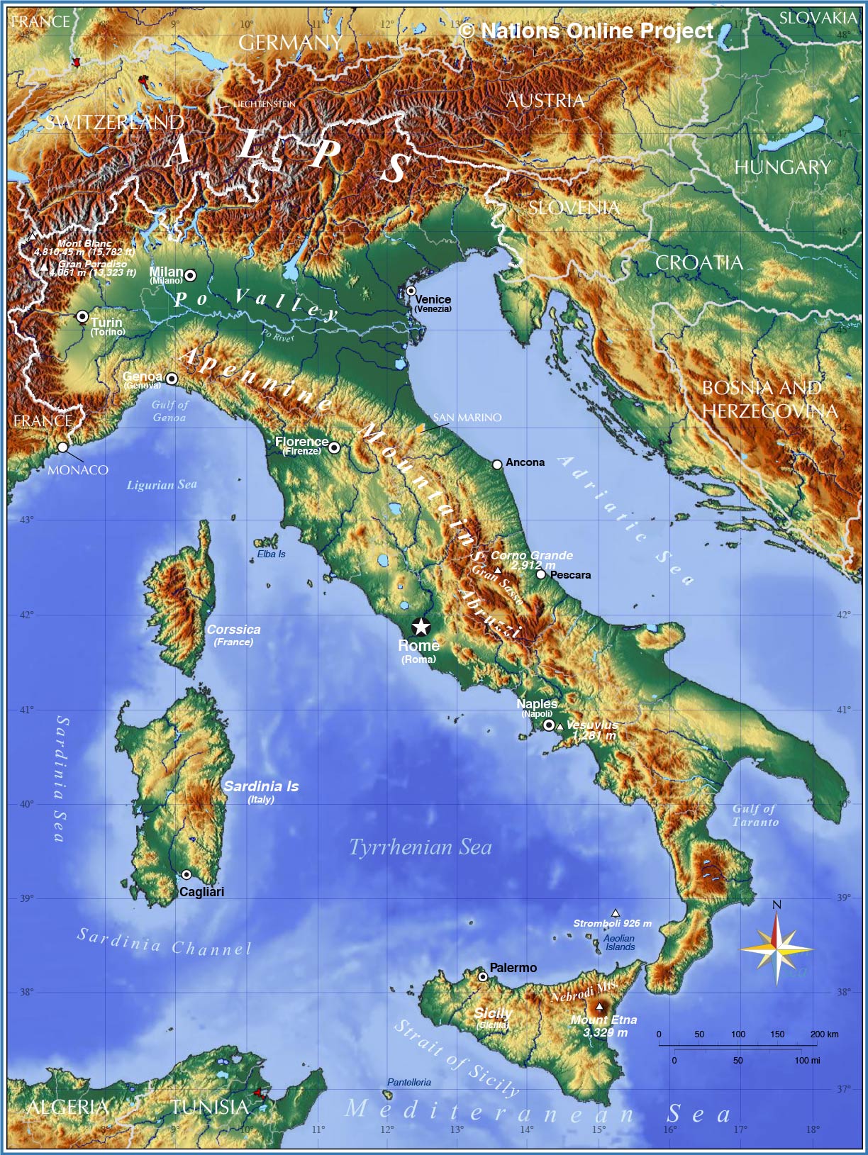
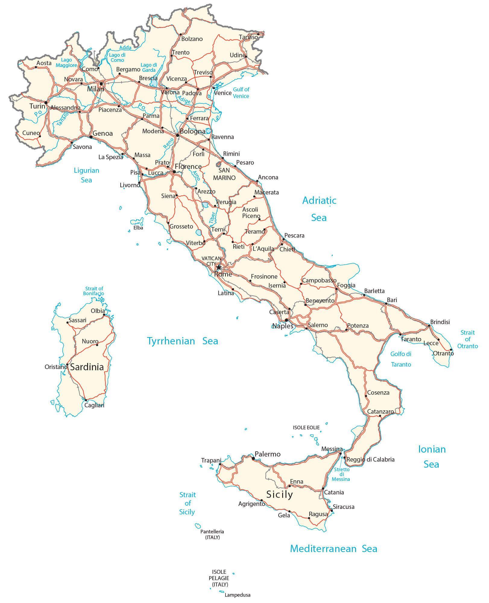
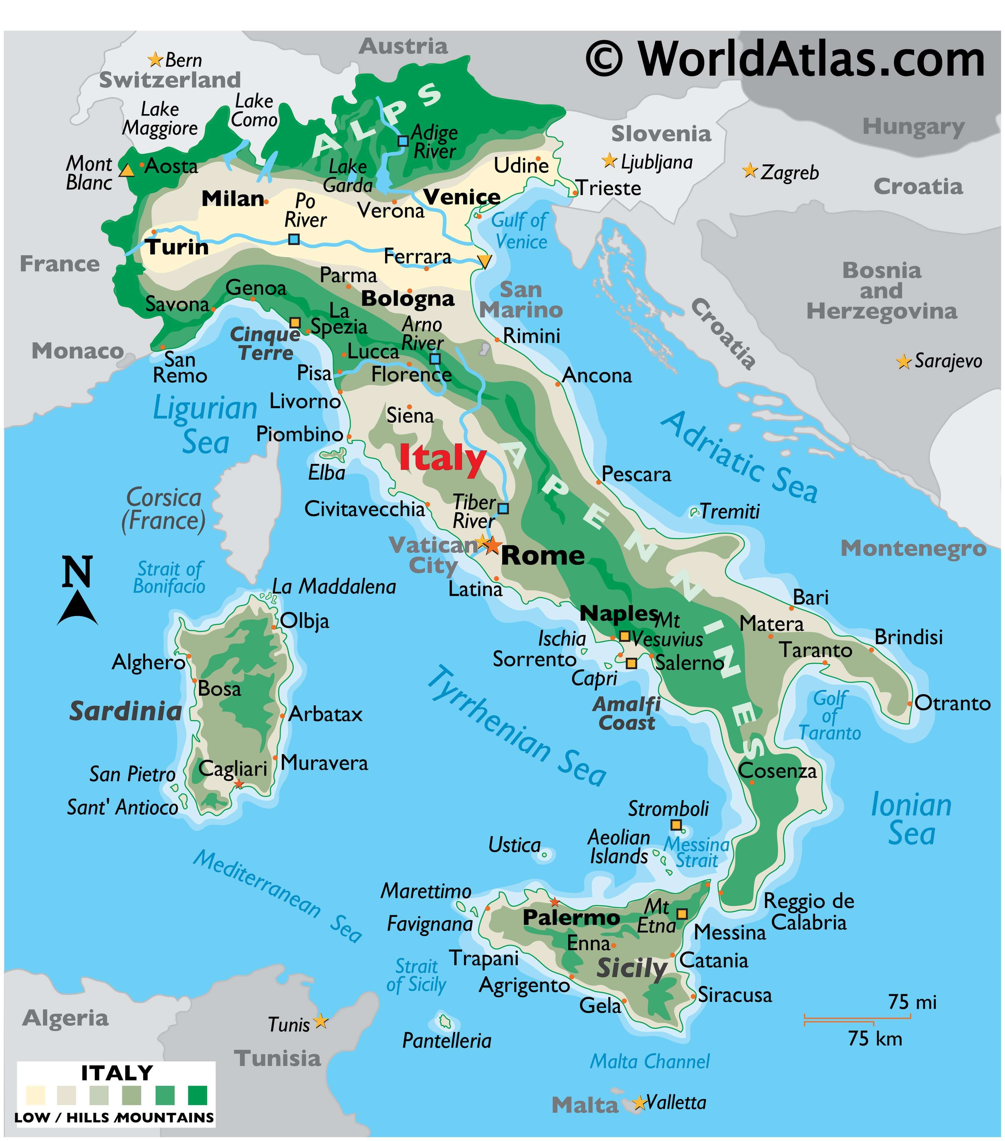
As observed on Italy’s physical map, mainland Italy extends southward into the Mediterranean Sea as a large boot-shaped peninsula. This extension of land has forced the creation of individual water bodies, namely the Adriatic Sea, the Ionian Sea, the Ligurian Sea, and the Tyrrhenian Sea.
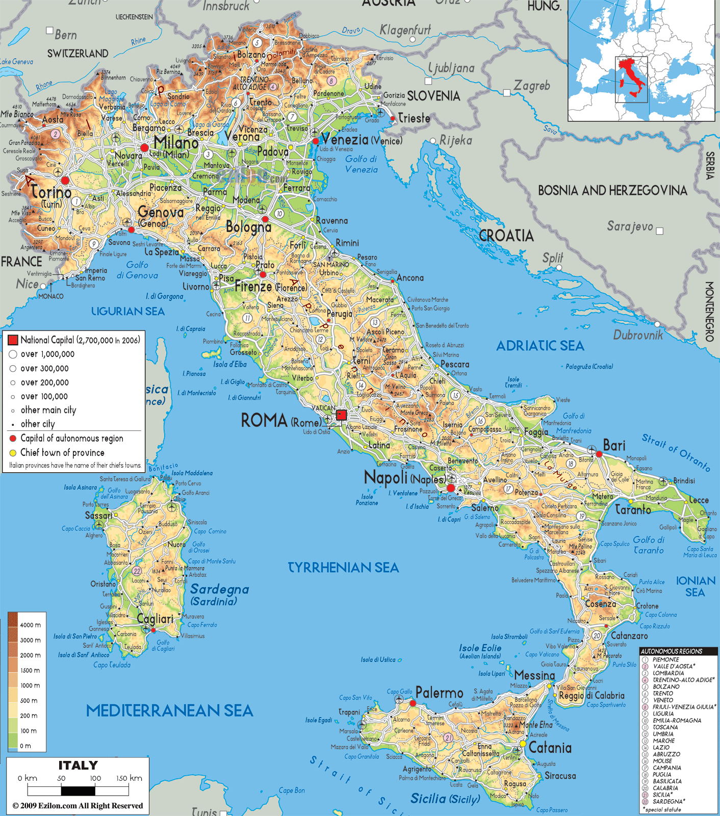
Varied ranges of the Alps dominate the country’s northern reaches, a massive stretch of mountains that extends from France to Austria and then south along the Adriatic Sea. Italy’s highest point near the summit of Mont Blanc (or Monte Bianco), a mountain it shares with France, rises to 4,748 m. A yellow triangle marks its position on the map above.
The beautiful and rugged Lake District of northern Italy includes many mountain lakes, with the major ones being Como, Garda and MaggioreThe Po River Valley is positioned directly south of the Alps and runs from Turin to Venice. Rising in the Alps, the Po River is Italy’s longest, and the valley it dissects is the country’s most fertile farmland.
As observed on the map above, the Apennine Mountains (a range of the Alps) from the Italian peninsula’s backbone extend south through Italy, then directly beneath the narrow Strait of Messina to cover much of Sicily. These mountains consist of several chains, and they form the peninsula’s watershed, as several rivers rise in the upper elevations, including the Arno and the Tiber.
About 30% of Italy’s land area consists of plains with some low, marshy areas, especially along the Adriatic Sea, from Ancona north to Venice. The coastline of the country features numerous large and small bays, as well as gulfs.
The Amalfi Coast south of Naples and the Cinque Terra to the north of Pisa offers some of the most spectacular coastal scenery imaginable as steep rocky slopes rush down to the sea, and tiny villages with colourful houses pack much of the cliffs.
Italy is renowned for its many rugged islands, most volcanic in origin. Significant ones include the large islands of Sardinia and Sicily and the smaller islands of Capri, Elba, Ischia, and the Aeolian Islands group. Much of Italy is volcanic in origin, and today a few of its many volcanoes are active, including Sicily’s Mt. Etna, Stromboli in the Aeolian Islands. Volcanologists are constantly monitoring Mt. Vesuvius near Naples, as it has the potential to erupt at any time.
| Flag: |  |
|---|---|
| Legal Name: | Italian Republic |
| Capital Value: | Rome |
| Official languages: | Italian |
| Demonym(s): | Italian |
| Government: | Unitary parliamentary republic |
| Legislature: | Parliament |
| Total Area: | 301,340 km² |
| Land Area: | 294,140 km² |
| Water Area: | 7,200 km² |
| Population: | 60,297,396 |
| Density: | 201.3/km (521.4/sq mi) (71st) |
| GDP: | $2.00 Trillion |
| GDP Per Capita: | $33,189.57 |
| Currency Value: | Euros (EUR) |
| Driving side: | right |
| Calling code: | +39 |
| Internet TLD: | .it |
Explore the beauty and diversity of Italy with this interactive map. From the Alpine peaks of the north to the Mediterranean shores of Sicily, discover the country’s culture, history, and natural wonders. Zoom in to find major cities, towns, roads, lakes, and rivers. Satellite imagery and a terrain map show its topography like the Alps, the Apennines, and Po Valley.
Online Interactive Political Map
Click on ![]() to view map in "full screen" mode.
to view map in "full screen" mode.
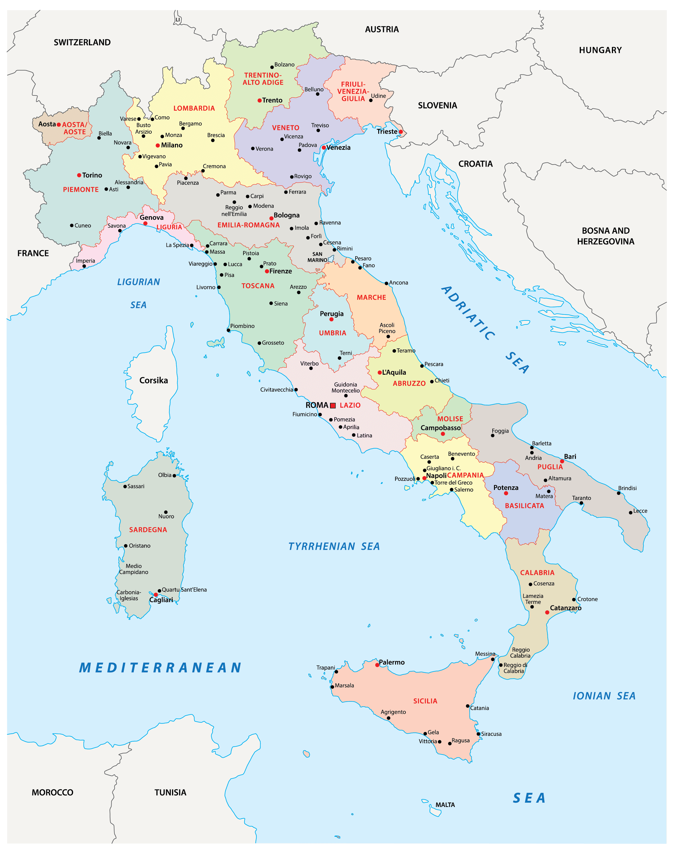
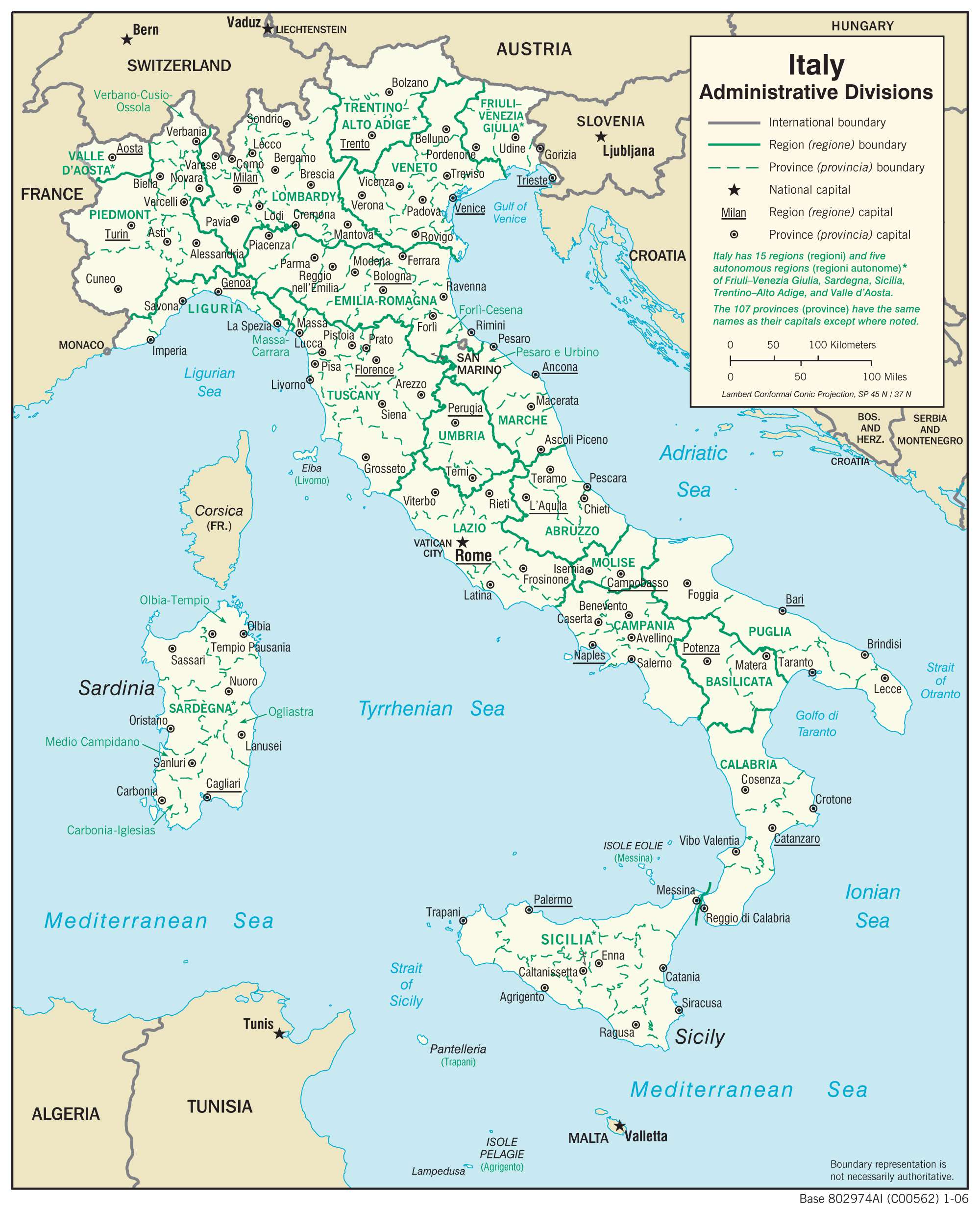
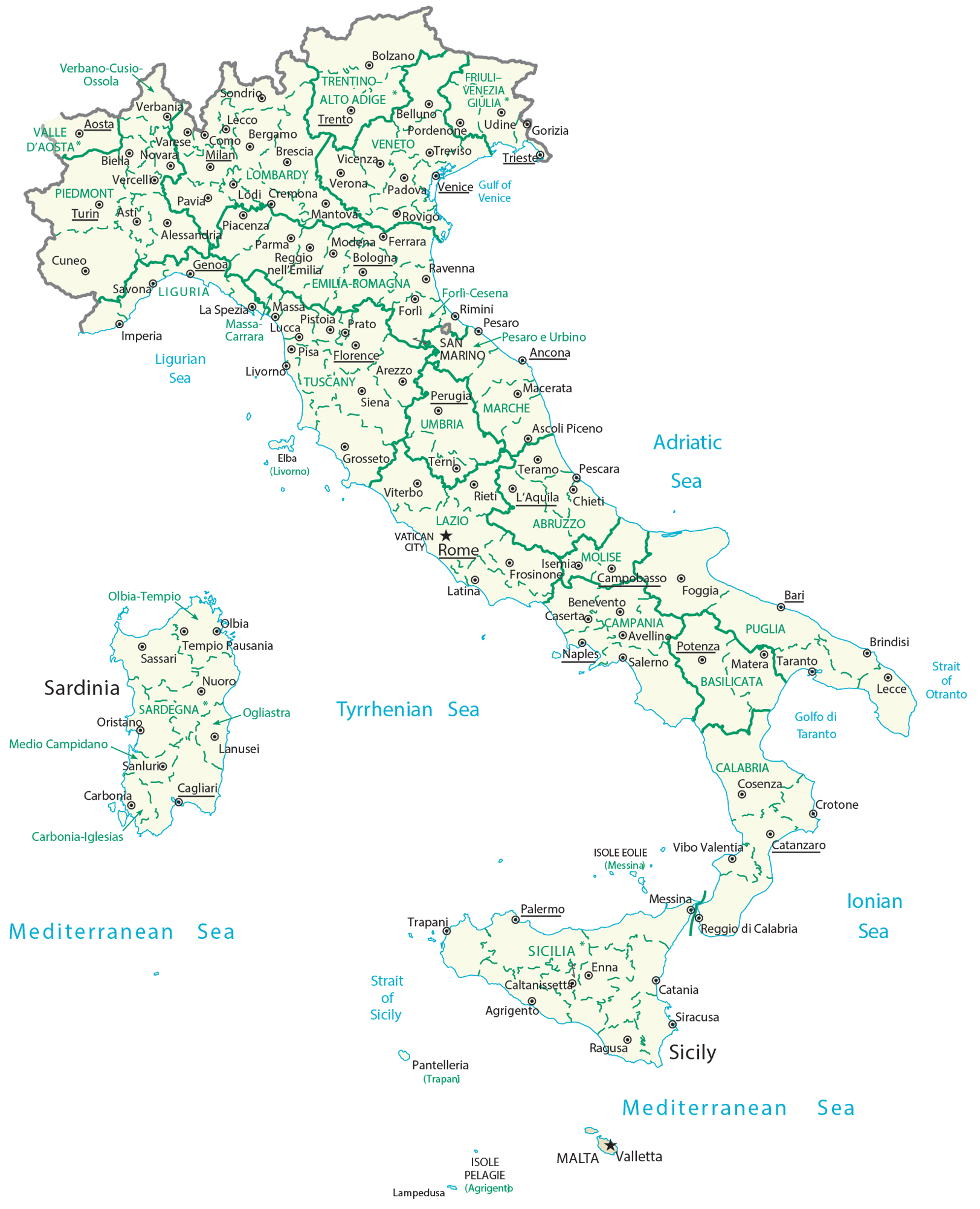
Italy (officially, the Italian Republic) comprises of 15 regions (regioni, singular – regione) and 5 autonomous regions (regioni autonome, singular – regione autonoma). The regions are: Abruzzo, Basilicata, Calabria, Campania, Emilia-Romagna, Lazio (Latium), Liguria, Lombardia, Marche, Molise, Piemonte (Piedmont), Puglia (Apulia), Toscana (Tuscany), Umbria, and Veneto. The autonomous regions are: Friuli Venezia Giulia; Sardegna (Sardinia); Sicilia (Sicily); Trentino-Alto Adige (Trentino-South Tyrol) or Trentino-Suedtirol (German); Valle d’Aosta (Aosta Valley) or Vallee d’Aoste (French).
The regions are further subdivided into 107 provinces, of which 14 are metropolitan cities. The different provinces comprise 7960 municipalities (comuni).
With an area of 301,340 sq. km, Italy is the 3rd most populous member state of EU. Located in the central-western portion of the Italian Peninsula, along the shores of the Tiber River, Rome is the capital and the largest city of Italy. It is also the country’s most populated city and the 4th most populous city in EU. Rome is often referred as ‘capital of two states’ – as Vatican City is an independent state within the boundaries of Rome.
Location Maps
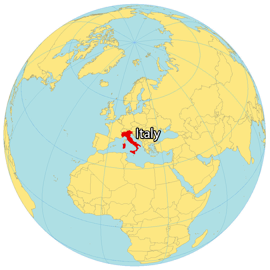
Where is Italy?
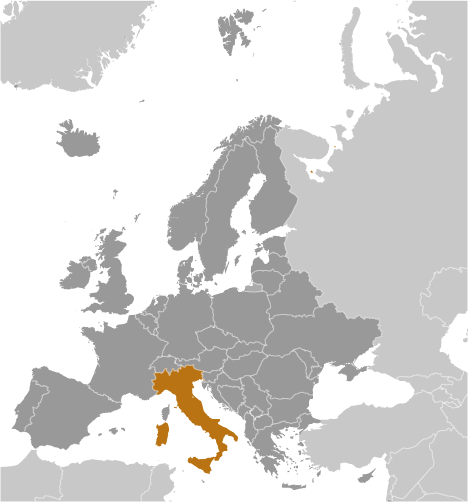
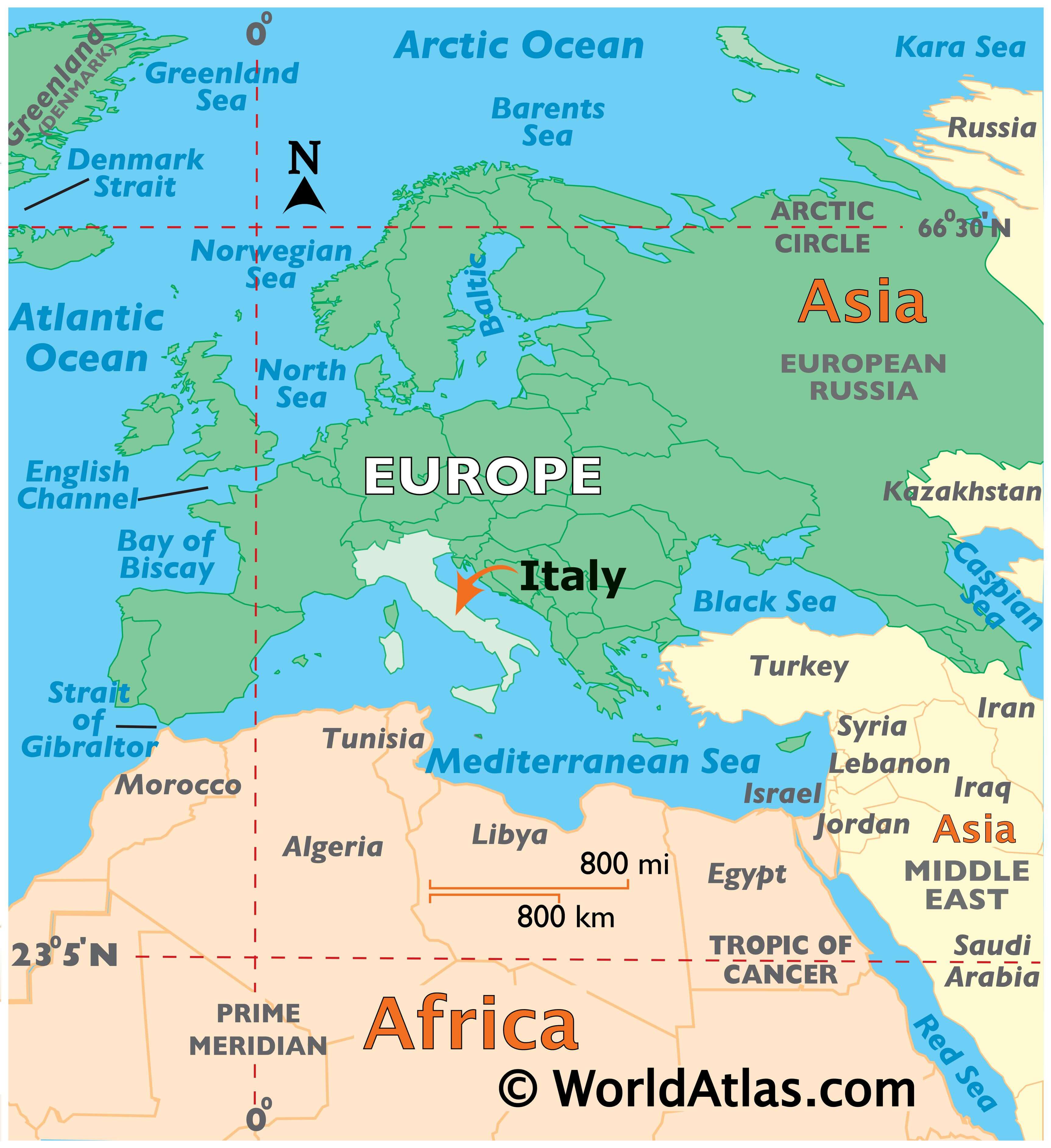
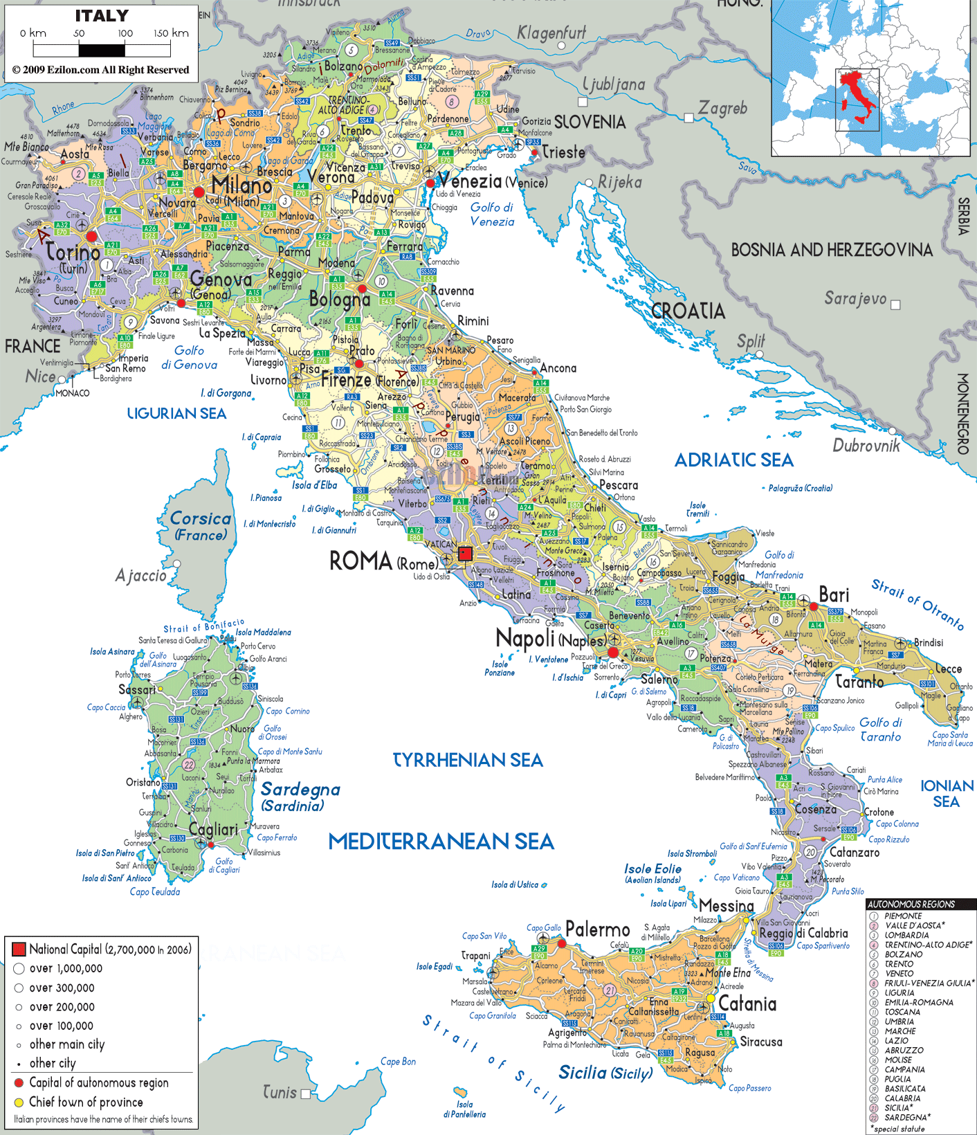
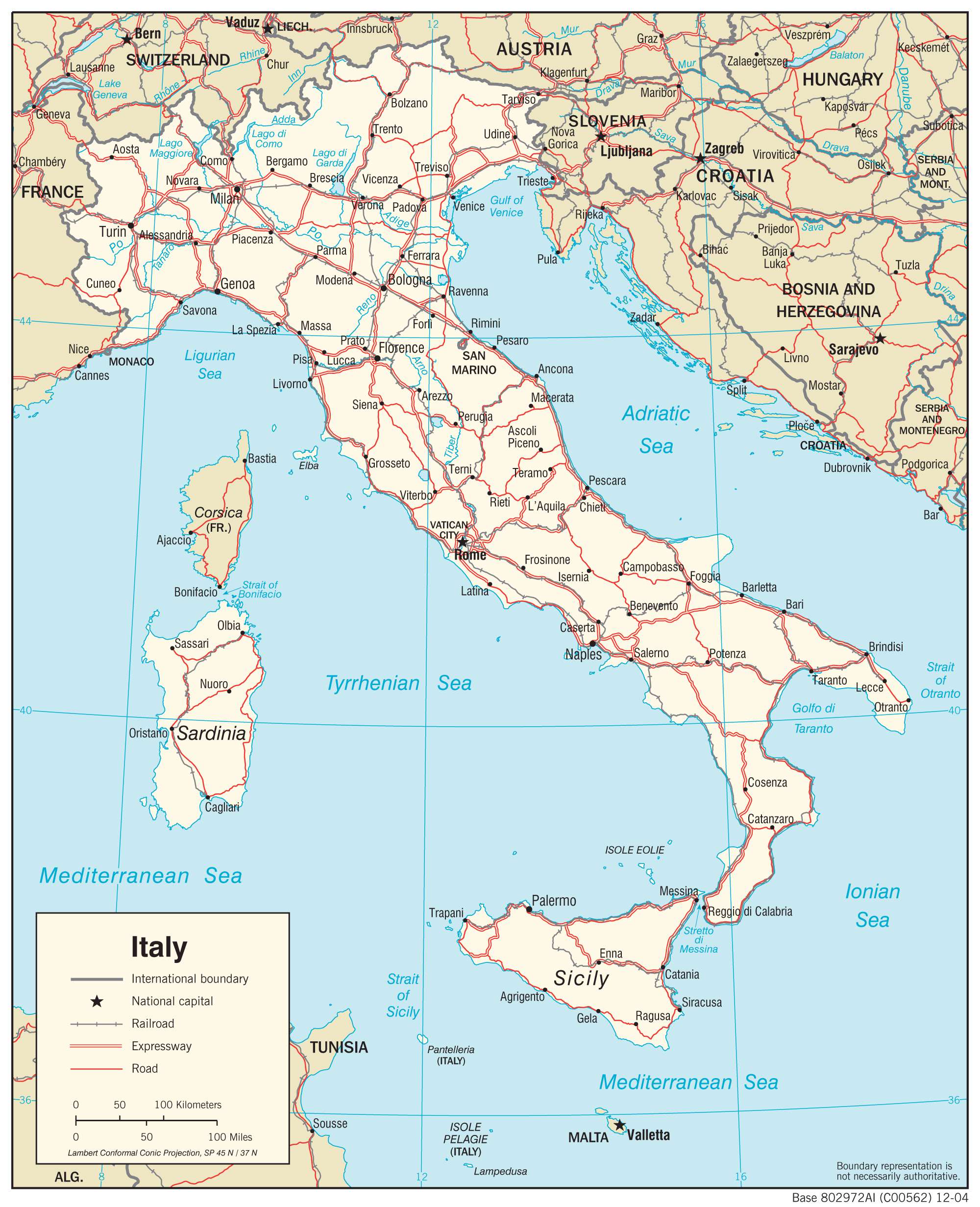
Italy is located in southern Europe along the Mediterranean Sea. It borders four countries to the north including France, Switzerland, Austria, and Slovenia. The microstates of San Marino and Vatican City are also located within Italy’s borders, completely surrounded by the country.
Italy is renowned for its art, architecture, culture, fashion, and food. Rome is the capital and largest city in Italy, but Milan, Naples, and Turin are also significant cities. The country is shaped like a boot due to its peninsula that stretches southward into the Mediterranean Sea. Sicily and the island of Sardinia in the west, across the Tyrrhenian Sea, are also part of Italy’s landmass.
High Definition Political Map of Italy

Italy Administrative Map
Physical Map of Italy
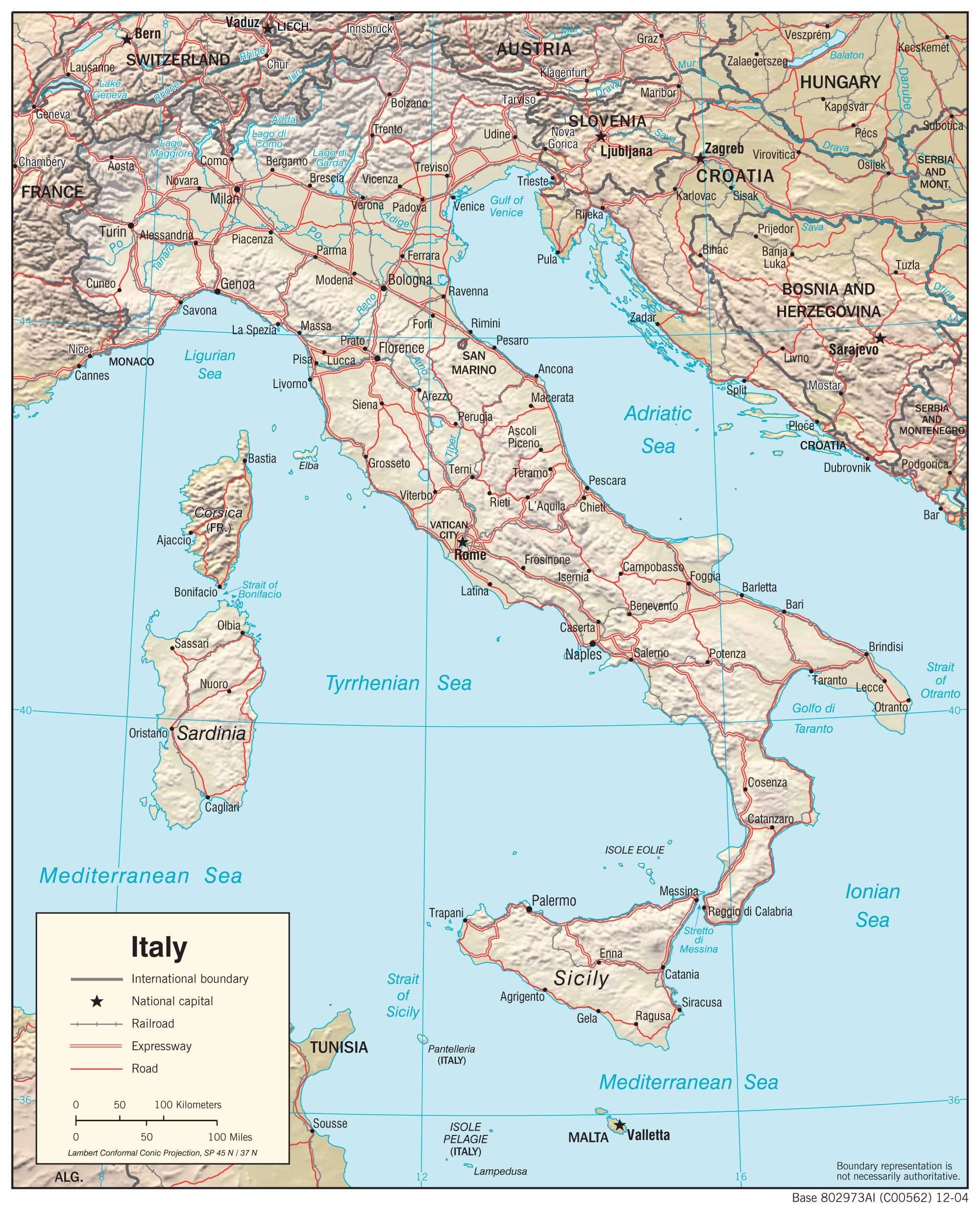
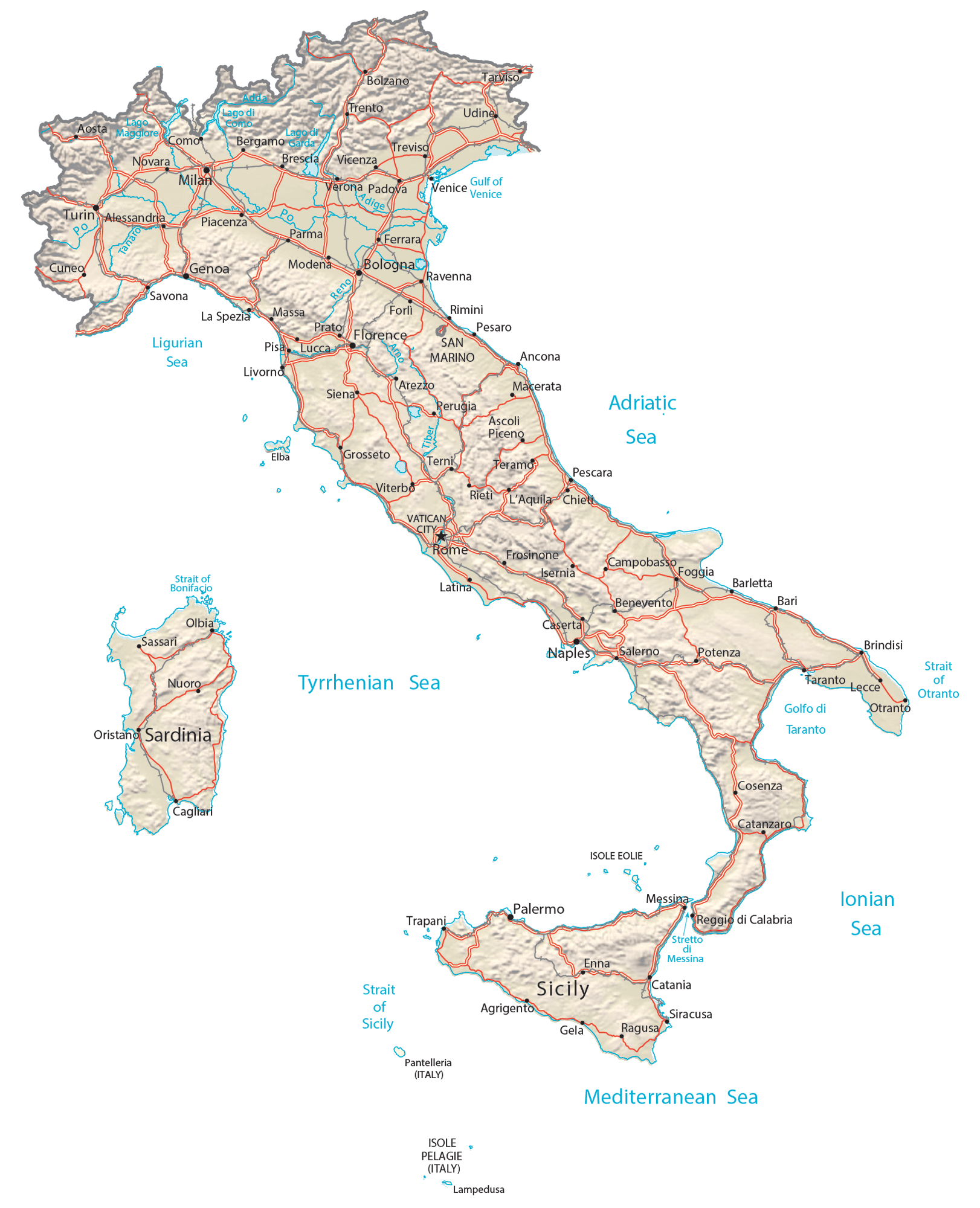
Transportation Map of Italy
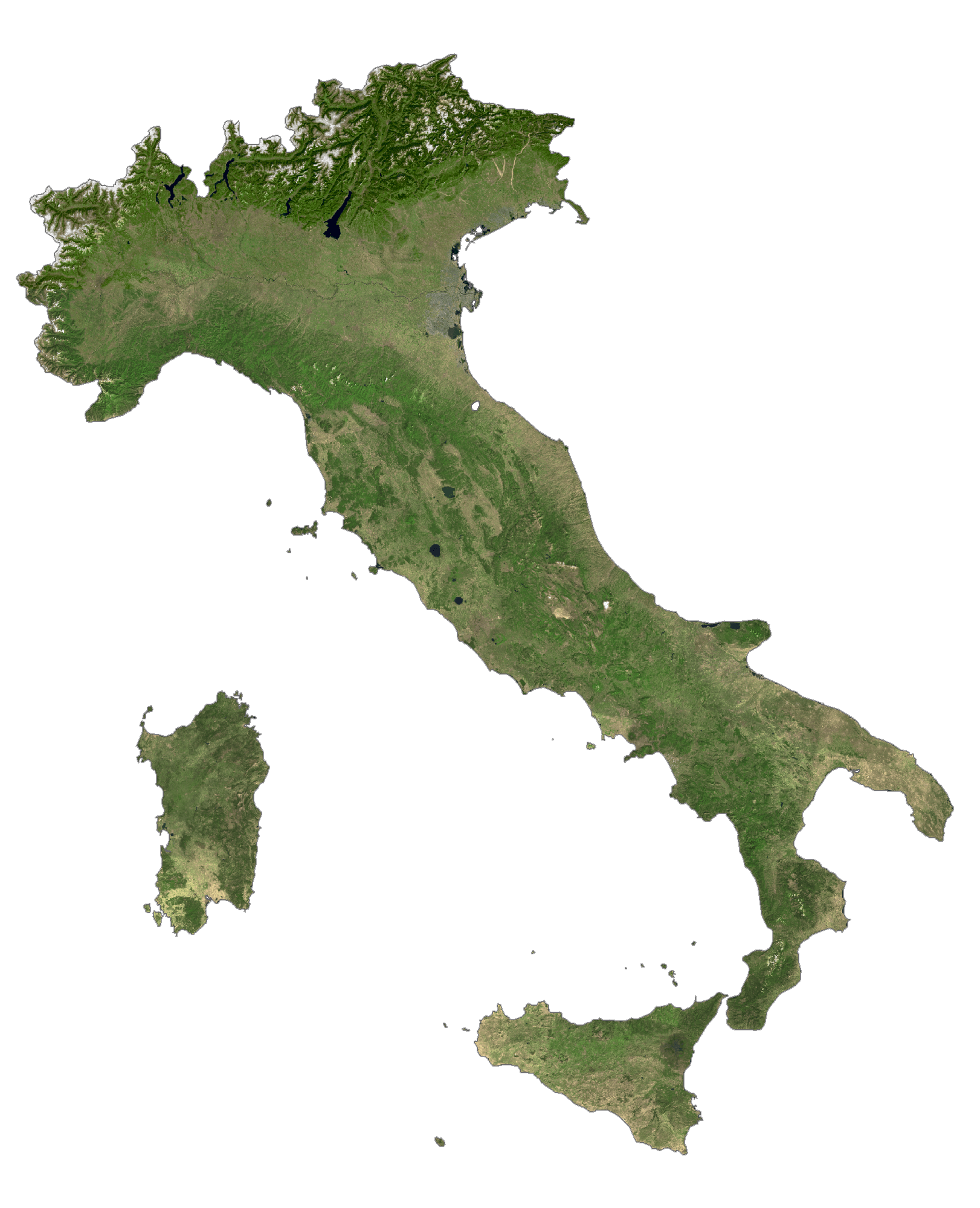
Italy Satellite Map
Topo Map