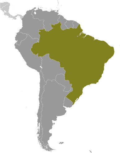
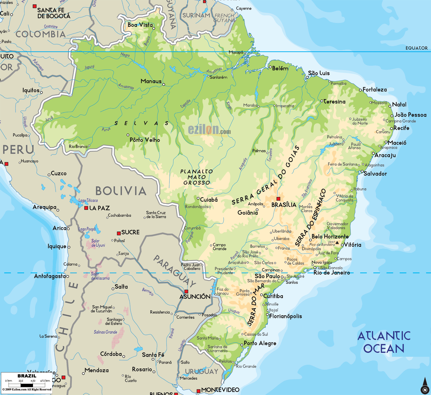
Located in central-eastern part of South America and covering an area of 8.5 million sq.km (3,287,956 sq mi), Brazil is the world’s 5th largest country as well as the largest country in South America and in the Southern Hemisphere. Brazil is divided into 5 primary geographic areas: the northern Guiana Highlands; Brazilian Highlands (or plateau) in central and east; the massive Amazon River Basin; the Pantanal wetland areas of the southwest; and the Southern Highlands – to the west and south of Curitiba.
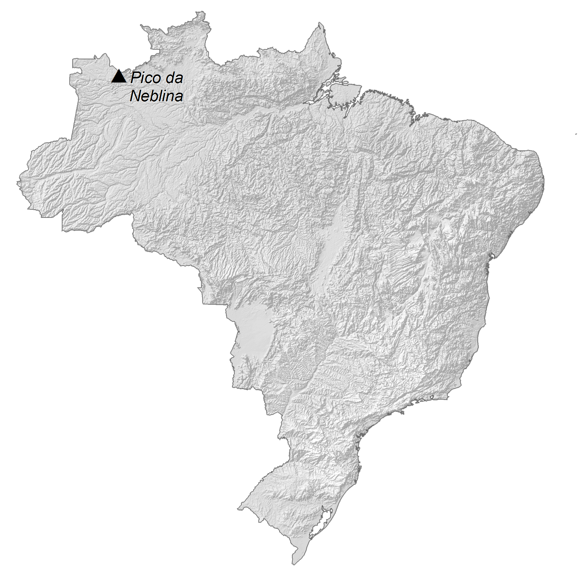
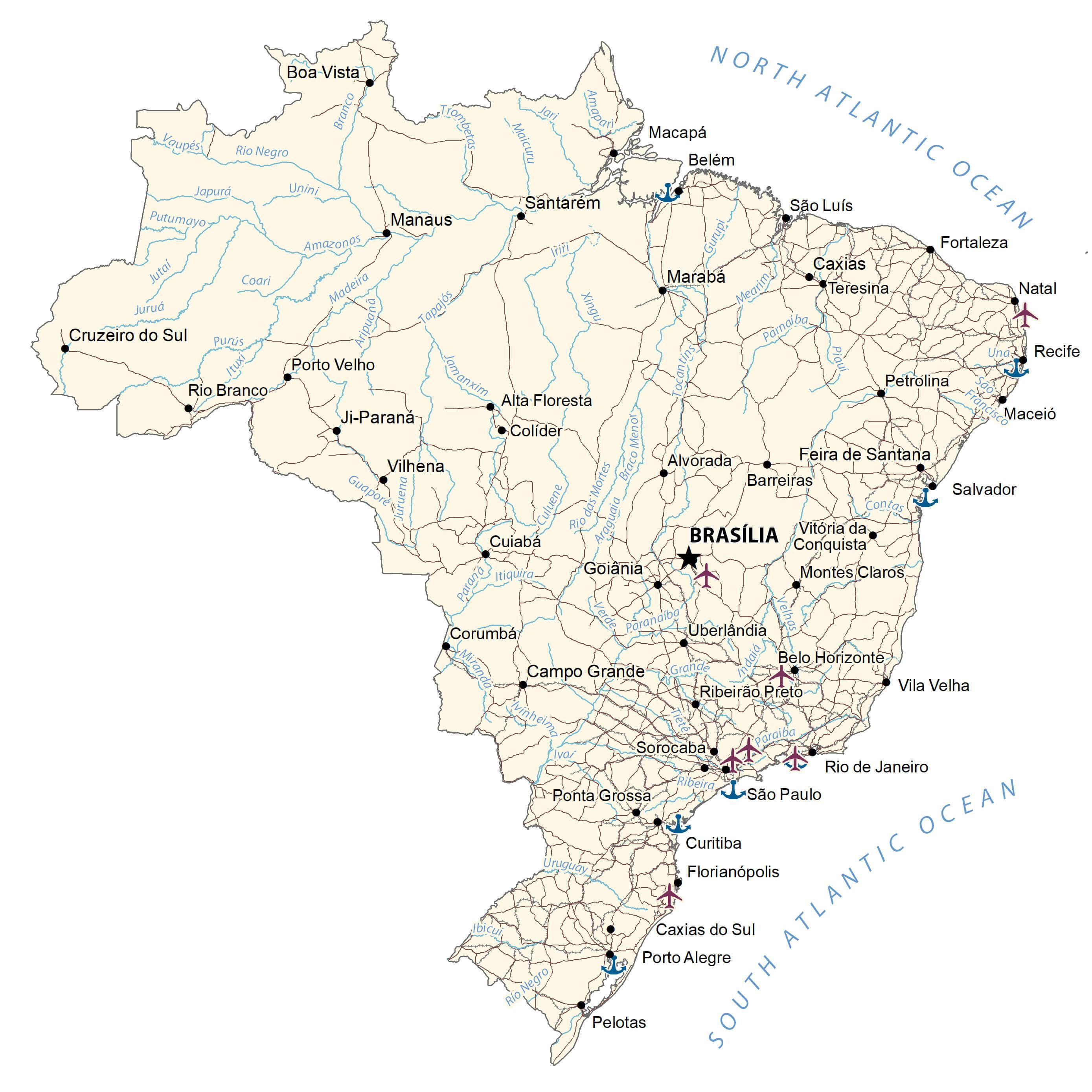
As observed on the physical map of Brazil above, the Brazilian Highlands are covered by low mountain ranges and forested river valleys. From Rio de Janeiro – north to Fortaleza, a series of higher mountain ranges form a natural barrier between the Atlantic Ocean and the country’s interior. The Pantanal is the world’s largest freshwater wetland, a seasonally flooded plain fed by the tributaries of many rivers. For size comparison, it’s almost 10 times the size of the Florida Everglades. The Amazon is the world’s largest tropical rainforest. It is drained by the huge Amazon River, and more than 200 of its tributaries – with more than a dozen of those tributaries being on (The Longest Rivers of the World) list. The Sao Francisco is the longest river completely within Brazil’s borders. The Guiana Highlands, a relatively flat-topped mountainous area covered by rainforest, stretches across much of northern South America. It’s home to many of the planet’s most spectacular waterfalls, and Brazil’s highest point : Pico da Neblina at 9,823ft (2,999m) (marked on the map by a yellow upright triangle). The lowest point is at the Atlantic Ocean.
| Flag: |  |
|---|---|
| Legal Name: | Federative Republic of Brazil |
| Capital Value: | Brasilia |
| Demonym(s): | Brazilian |
| Government: | Federal presidential constitutional republic |
| Legislature: | National Congress |
| Total Area: | 8,515,770 km² |
| Land Area: | 8,358,140 km² |
| Water Area: | 157,630 km² |
| Population: | 211,049,527 |
| Density: | 25/km (64.7/sq mi) (193rd) |
| GDP: | $1.84 Trillion |
| GDP Per Capita: | $8,717.19 |
| Currency Value: | Reals (BRL) |
| Driving side: | right |
| Calling code: | +55 |
| Internet TLD: | .br |
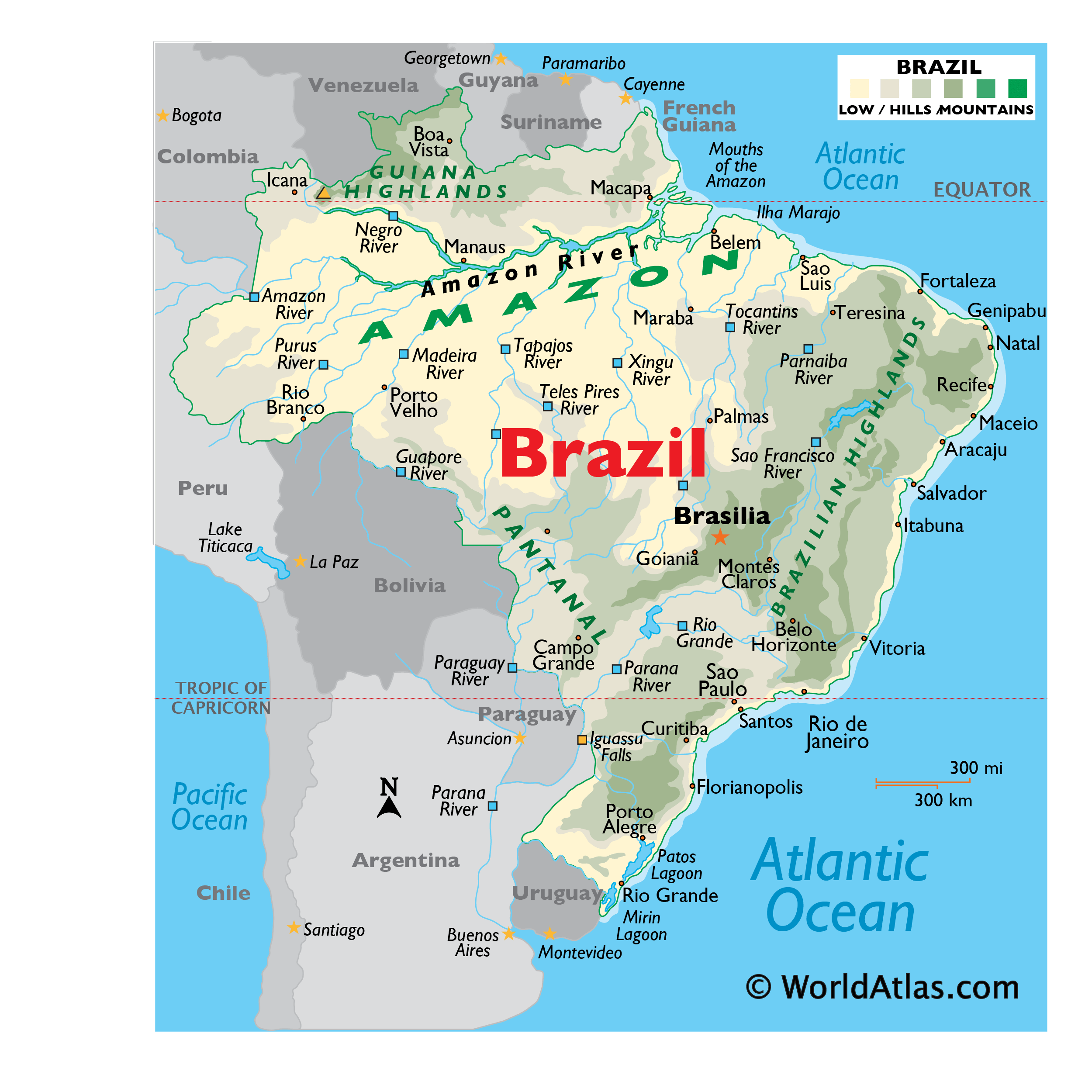
Brazil is a country of remarkable beauty and diversity. Its vast expanse of territory encompasses some of the most breathtaking natural wonders in the world, from the Amazon Basin to the mighty Iguazu Falls. The largest country in South America, Brazil is home to the world’s longest river, the Amazon, as well as the largest waterfall, the Iguazu Falls. This map of Brazil captures the grandeur of the country, showing its major cities, rainforests, and mountain ranges in vivid detail.
From the glistening white sands of Copacabana Beach to the lush Amazon rainforest, Brazil is a country of spectacular natural beauty. This map of Brazil shows its major cities, rivers, and mountain ranges in stunning detail, allowing you to appreciate the full beauty of this remarkable and diverse country. From the mighty Amazon Basin to the majestic Iguazu Falls, this map will help you explore the many wonders of Brazil.
Online Interactive Political Map
Click on ![]() to view map in "full screen" mode.
to view map in "full screen" mode.
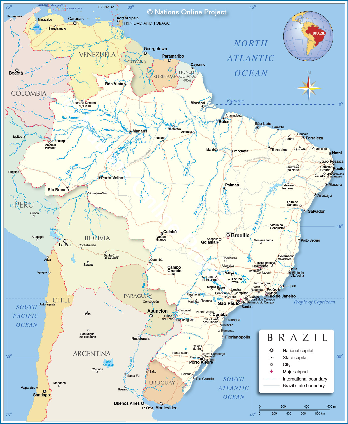
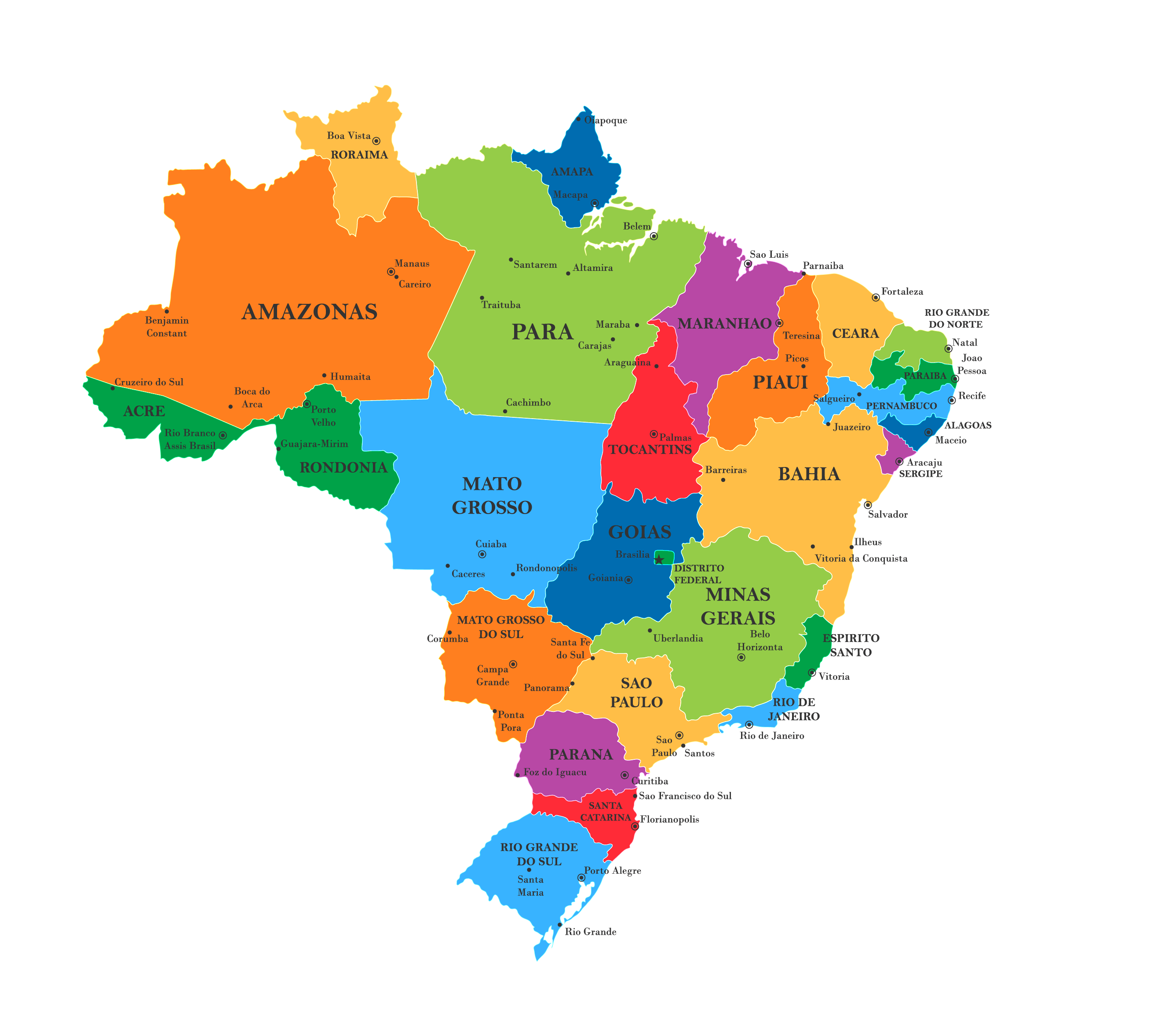
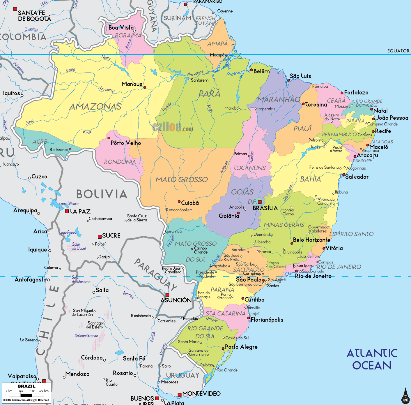
Brazil (officially, the Federative Republic of Brazil) comprises of the union of 26 states (estados, singular – estado) and 1 Federal District (distrito federal). In alphabetical order, the states are: Acre, Alagoas, Amapa, Amazonas, Bahia, Ceara, Espirito Santo, Goias, Maranhao, Mato Grosso, Mato Grosso do Sul, Minas Gerais, Para, Paraiba, Parana, Pernambuco, Piaui, Rio de Janeiro, Rio Grande do Norte, Rio Grande do Sul, Rondonia, Roraima, Santa Catarina, Sao Paulo, Sergipe and Tocantins. These states are further subdivided into a total of 5,570 municipalities. The Federal District has no municipalities but is divided into 31 administrative regions.
Covering an area of 8.5 million sq.km, Brazil is the world’s 5th largest country as well as the largest country in South America and in the Southern hemisphere. It is also the 6th most populous country in the world. Located in the central–west region of the country, at the top of the Brazilian Highlands is, Brasilia – the federal capital city of Brazil. Situated on a plateau of the Brazilian Highlands in southeastern Brazil is Sao Paulo – the largest and the most populous city in Brazil, as well as in the Americas and in the Western and Southern hemispheres. Sao Paulo is the major cultural, financial, economic and industrial center of Brazil and the world’s largest Portuguese-speaking city. Rio de Janeiro is Brazil’s most famous city.
Location Maps
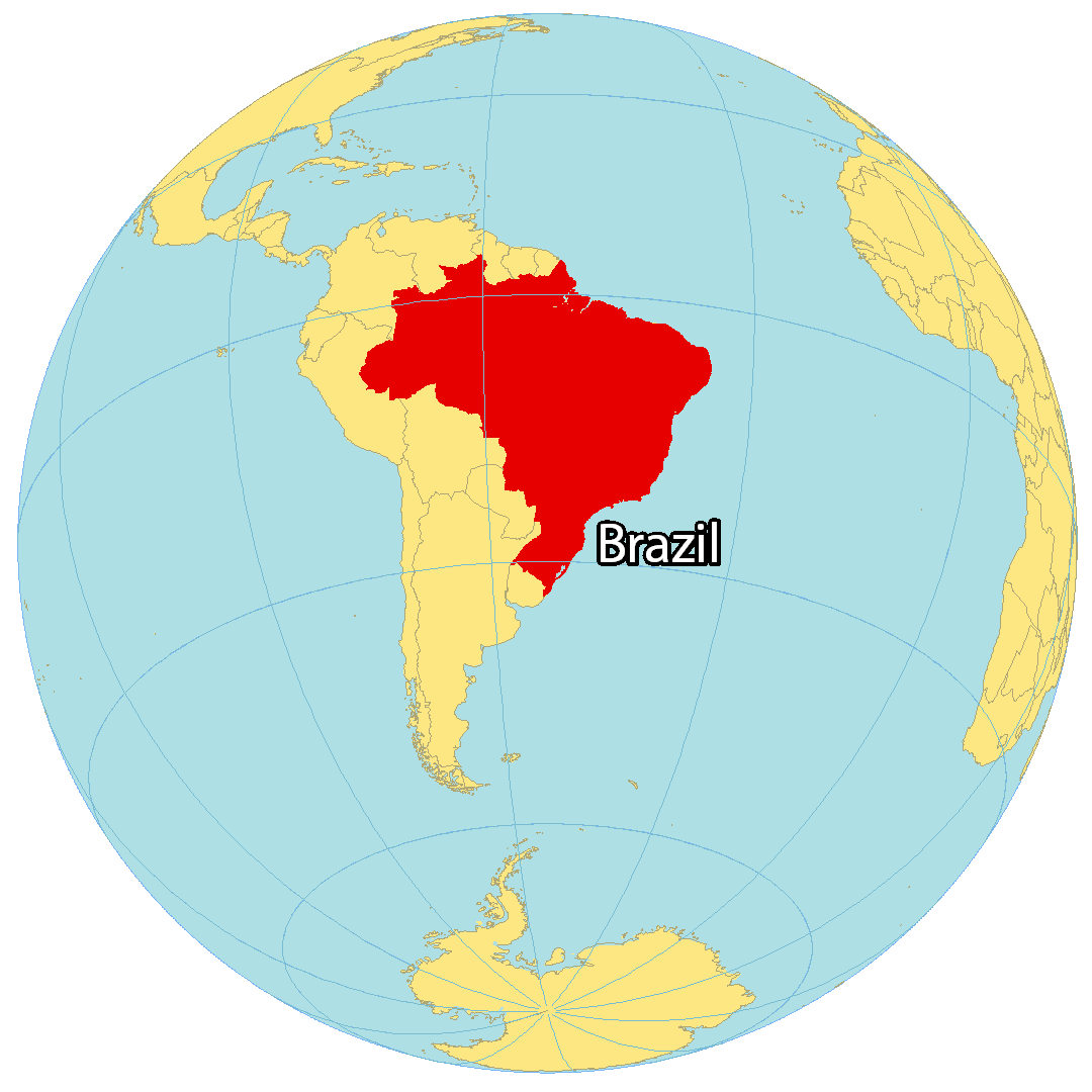
Where is Brazil?
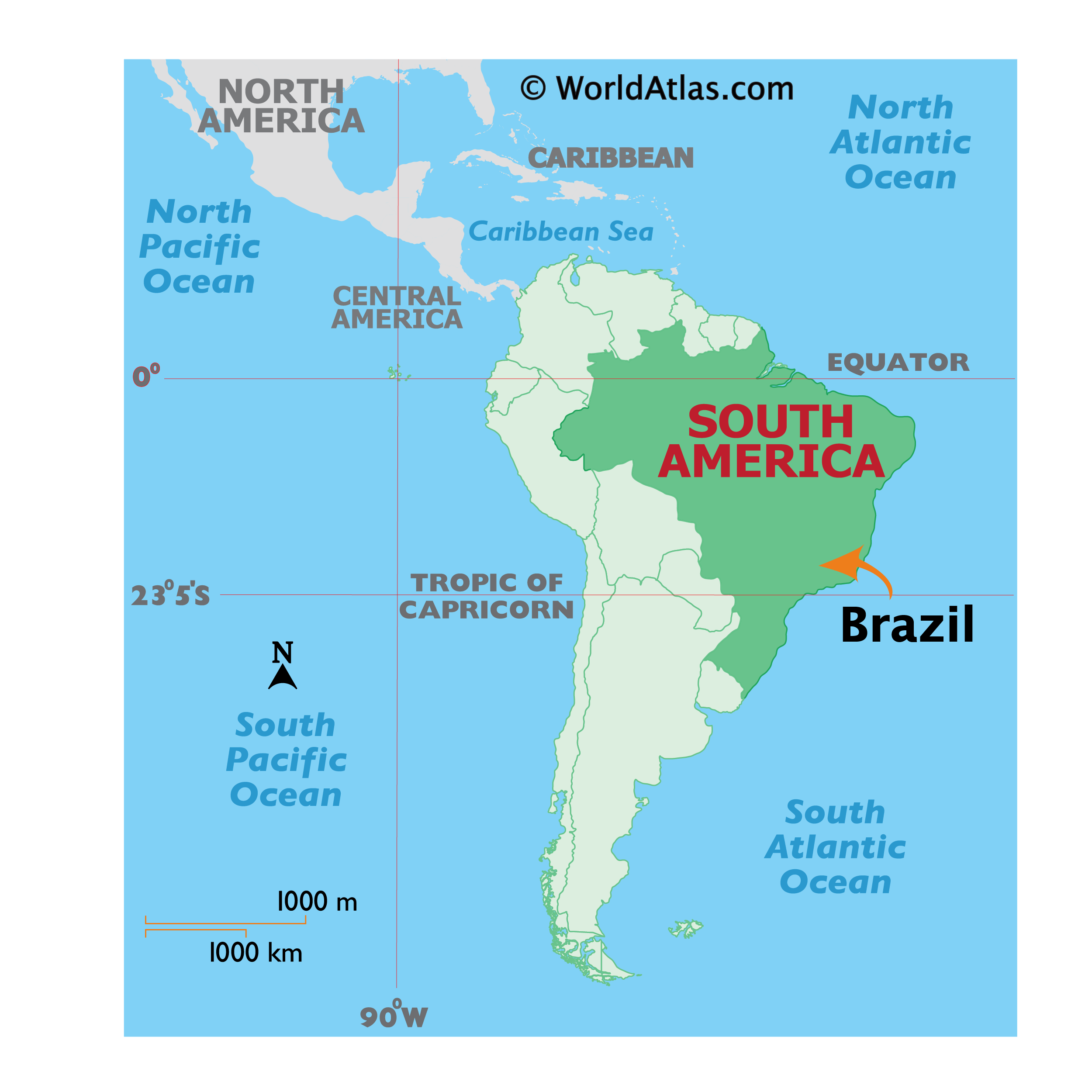
Brazil is located in eastern South America and is the fifth largest country in the world. Not only is it the largest country in South America, but it’s also the largest country in the entire southern hemisphere. It’s so large that it shares common boundaries with every South American country except Chile and Ecuador. As the longest north-south directional country in the world, it also shares a 4,600 miles (7,400 km) coastline with the Atlantic Ocean along the east coast. While the capital of Brazil is Brasília, the largest city is São Paulo with Rio de Janeiro as the second largest.
High Definition Political Map of Brazil
Physical Map of Brazil
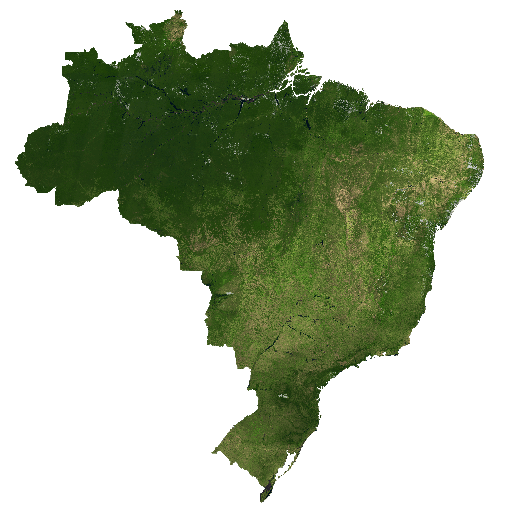
Brazil Satellite Map
Elevation Map