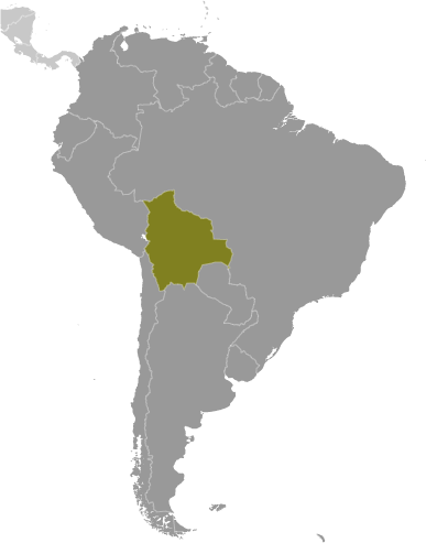
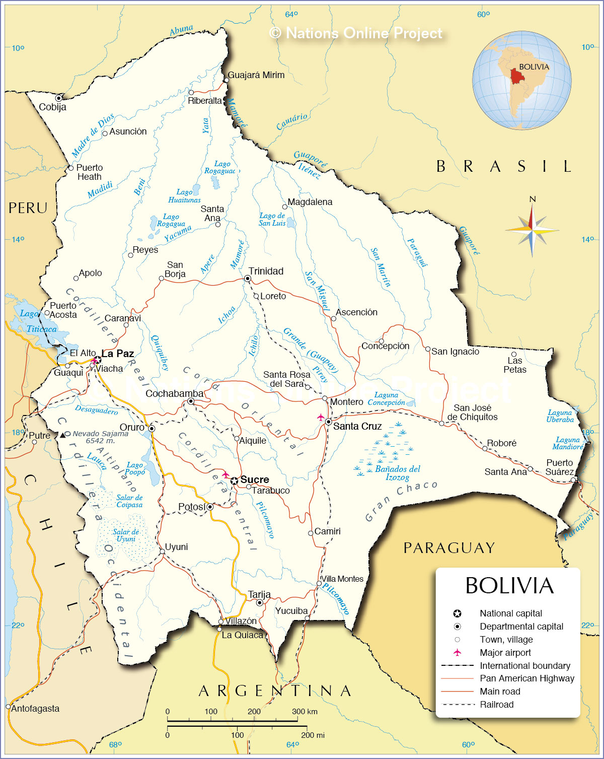
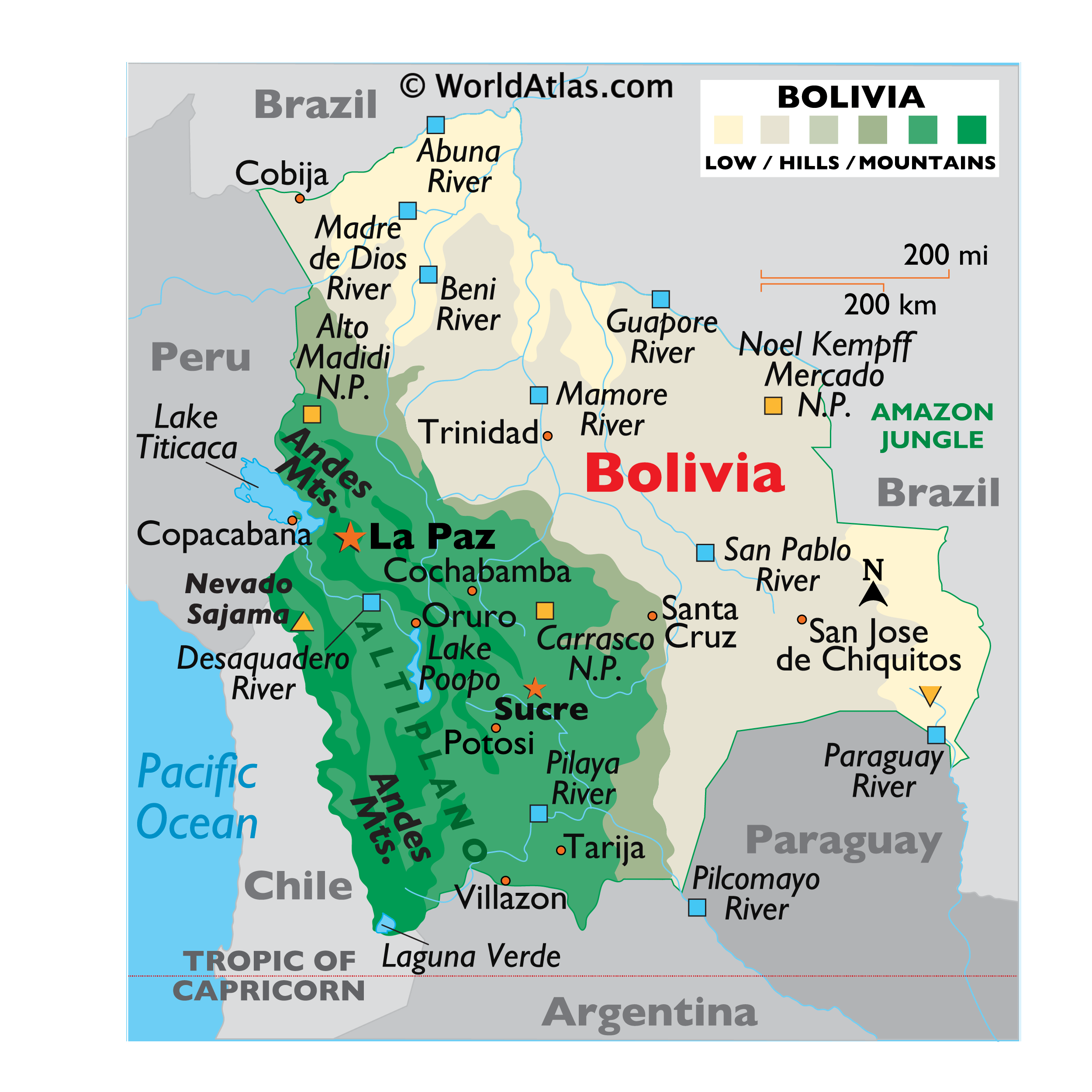
Bolivia is a landlocked nation located in west-central South America. Covering an area of 1,098,581 sq.km (424,164 sq mi), Bolivia is the 5th largest country in South America and the largest landlocked nation in the Southern Hemisphere.
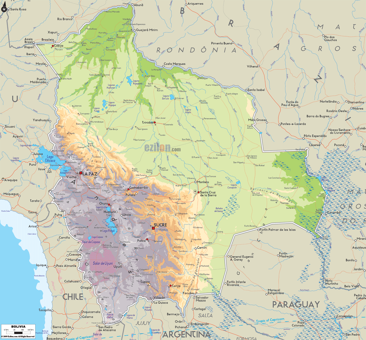
As observed on the physical map of Bolivia above, the country’s western half is covered by the Andes – as three meandering high mountain chains dominate the landscape. The Cordillera Occidental (in the west) is a long line of mostly bleak, dormant volcanoes; the Cordillera Central stands in the middle, while the (eastern) Cordillera Oriental is a massive snow-capped series of stunning granite mountains.
The Altiplano (a high plateau) is sandwiched between the Cordilleras. Once just deep valleys (or rifts) between the three mountain ranges, over eons of time it filled with sedimentary debris washed down from the surrounding peaks. The eastern slopes of the Cordillera Oriental descend gently into rolling hills; numerous rivers flow eastward here, forming long valleys.
The highest point in Bolivia, as marked on the map as a yellow upright triangle is Nevado Sajama at 21,463ft (6,542m); while the lowest point is Paraguay River at 230ft (70m). Northeast of La Paz, the landscape descends into fertile semi tropical valleys, drained by narrow rivers. The southeast is covered by semi-arid plains that turn swampy during heavy rains.
Bolivia’s Altiplano contains several salt flats, the dried remnants of ancient lakes; Uyuni Saltpan (Salar de Uyuni) is the largest one, covering almost 3500 sq.miles.
Also marked on the map above is Bolivia’s most important lake, Lake Titicaca, located in the western part of the country along the border with Peru.Deep and cold, Lake Titicaca is at 3810 meters above sea level, being the highest lake in South America, is the highest commercially navigable body of water in the world.
Salty Lake Poopo is the largest inland lake, varying greatly in size based on rainfall.
Most of Bolivia’s significant rivers (or rios) are located central and north. Countrywide, important ones included the Beni, Desaquadero, Guapore, Madre de Dios and Mamore.
| Flag: |  |
|---|---|
| Legal Name: | Plurinational State of Bolivia |
| Capital Value: | La Paz (administrative capital); Sucre (constitutional [legislative and judicial] capital) |
| Official languages: | Spanish |
| Demonym(s): | Bolivian |
| Government: | Unitary presidential republic |
| Legislature: | Plurinational Legislative Assembly |
| Total Area: | 1,098,581 km² |
| Land Area: | 1,083,301 km² |
| Water Area: | 15,280 km² |
| Population: | 11,513,100 |
| Density: | 10.4/km (26.9/sq mi) (224th) |
| GDP: | $40.90 Billion |
| GDP Per Capita: | $3,552.07 |
| Currency Value: | Bolivianos (BOB) |
| Driving side: | right |
| Calling code: | +591 |
| Internet TLD: | .bo |
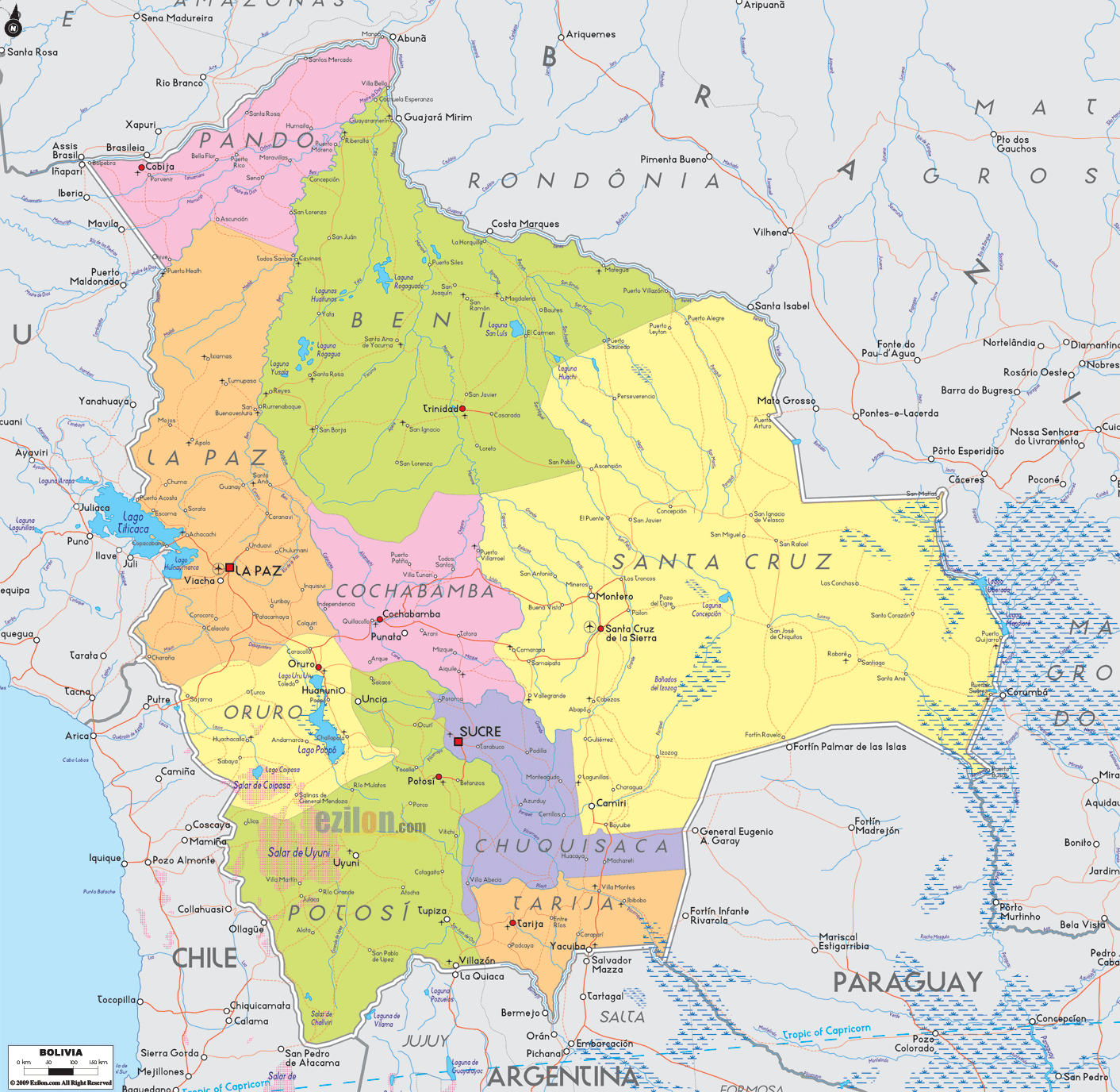
From the towering Andes mountains to the lush Amazon basin, Bolivia is a country of incredible geographical diversity. This map of Bolivia highlights some of the main features of this fascinating country, including the Andes Mountains, the Altiplano Plateau, the Atacama Desert, and the Amazon Basin Rainforest. The map also includes cities, towns, roads, lakes, rivers, and administrative units, allowing you to explore the country in more detail.
Online Interactive Political Map
Click on ![]() to view map in "full screen" mode.
to view map in "full screen" mode.
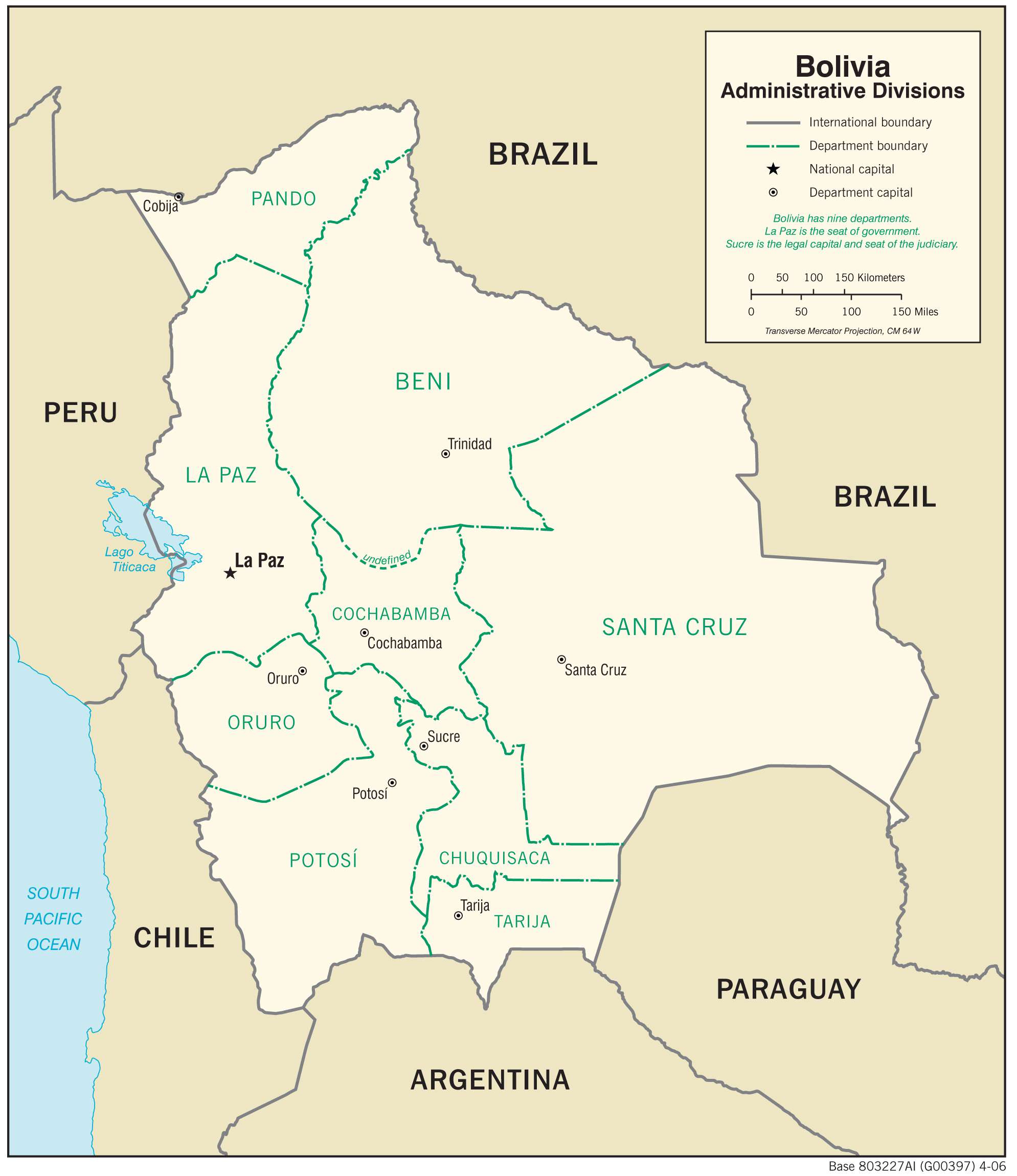
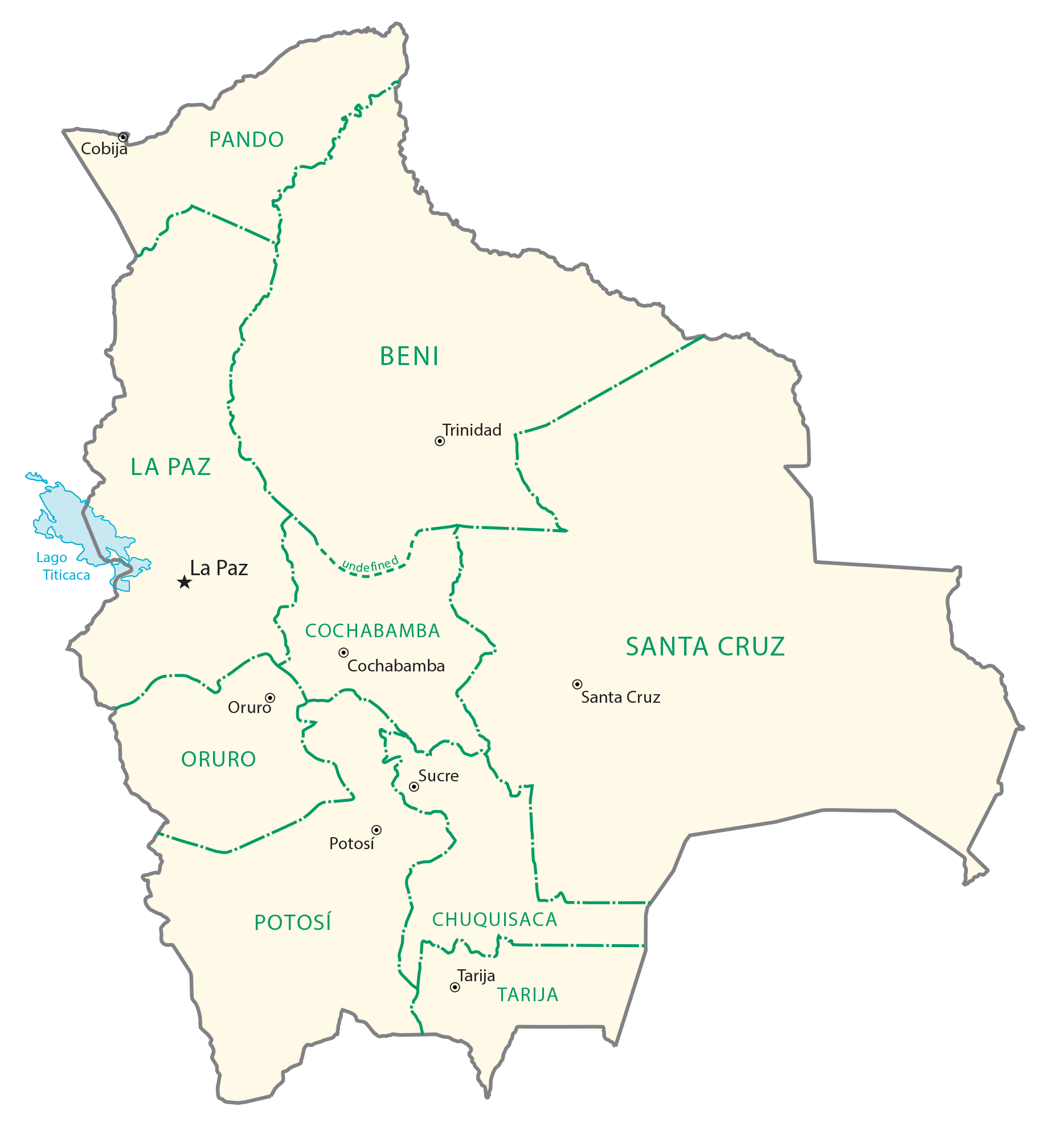
Bolivia (officially, the Plurinational State of Bolivia) is administratively divided into 9 departments (departamentos, singular – departamento). In alphabetical order, these departments are: Beni, Chuquisaca, Cochabamba, La Paz, Oruro, Pando, Potosi, Santa Cruz, and Tarija. The departments are divided into a total of 112 provinces; which are further subdivided into 339 municipalities and 1374 cantons.
Covering an area of 1,098,581 sq.km, Bolivia is the world’s 28th largest country and the 5th largest country in South America. It is also the 7th largest landlocked nation in the world and the largest landlocked nation in the Southern hemisphere. Located in the south-central part of the nation, at an elevation of 9,214 ft is, Sucre – the constitutional and judicial capital of Bolivia. Located in west-central part of the nation, in the southeast of Lake Titicaca, at an elevation of 11,975 ft is, La Paz – the executive and legislative (administrative) capital of Bolivia. It is the 3rd most populous city of the country and the highest national capital in the world. Situated in east-central part of the nation, in the tropical Lowlands is, Santa Cruz de la Sierra – the largest and the most populous city of Bolivia. It is the chief commercial, industrial and economic center of the country.
Location Maps
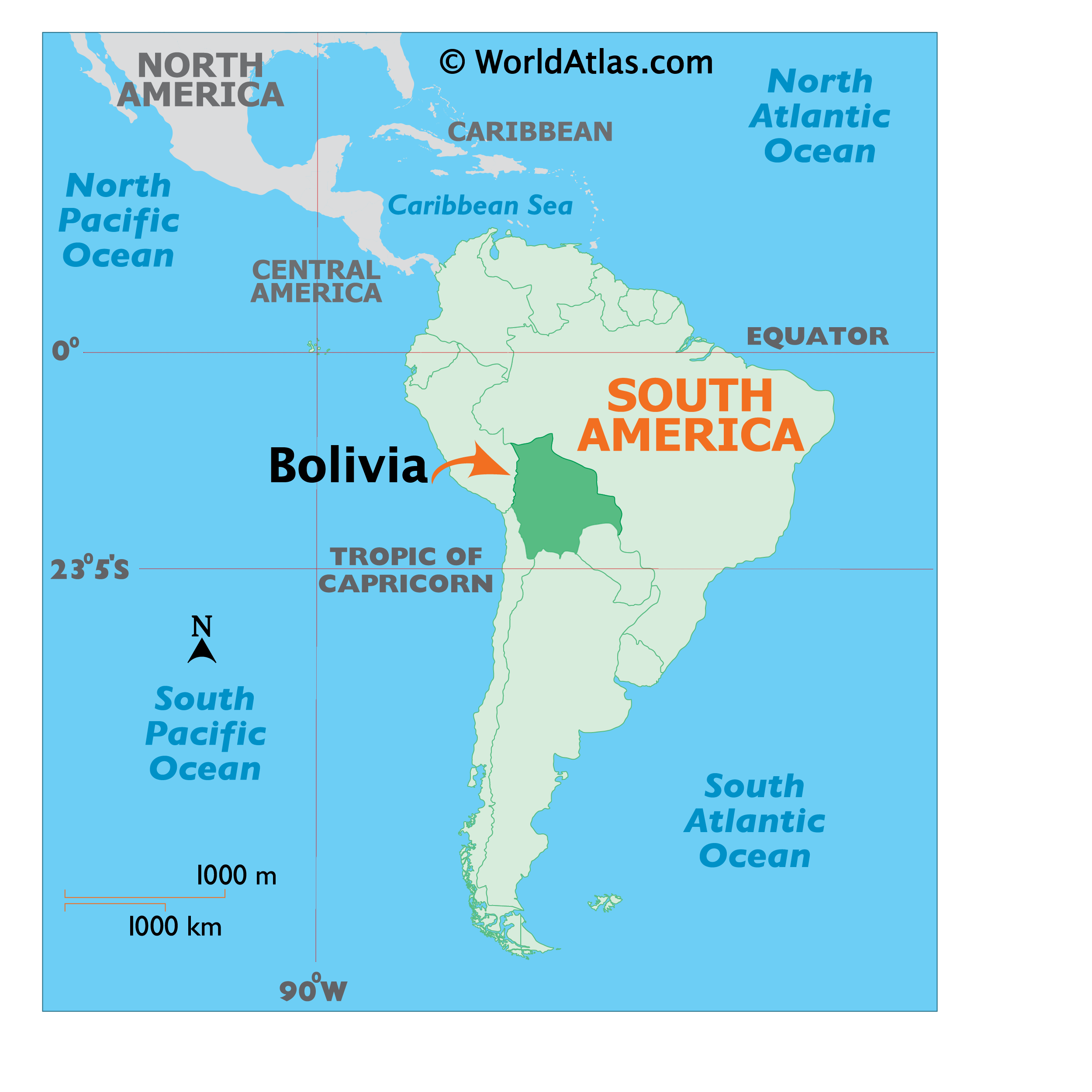
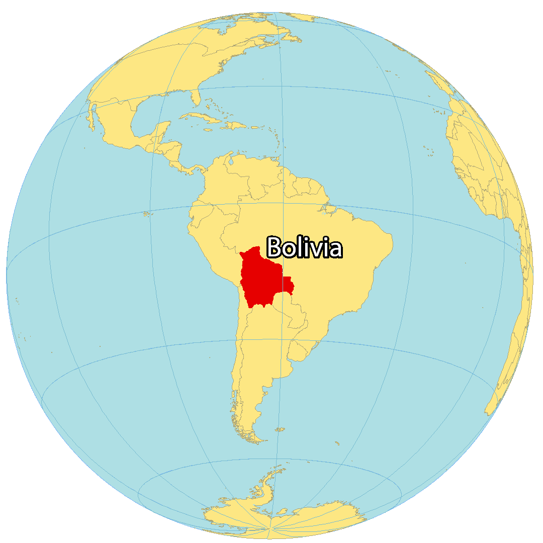
Where is Bolivia?
Bolivia is a landlocked country situated in central South America. It is bordered by Peru to the northwest, Brazil to the northeast, Paraguay to the southeast, Argentina to the south, and Chile to the southwest. The constitutional capital of Bolivia is Sucre, while the executive capital and seat of government is La Paz. The country is one of the highest and most isolated in South America, with the presence of the Andes and Altiplano Plateau.
High Definition Political Map of Bolivia
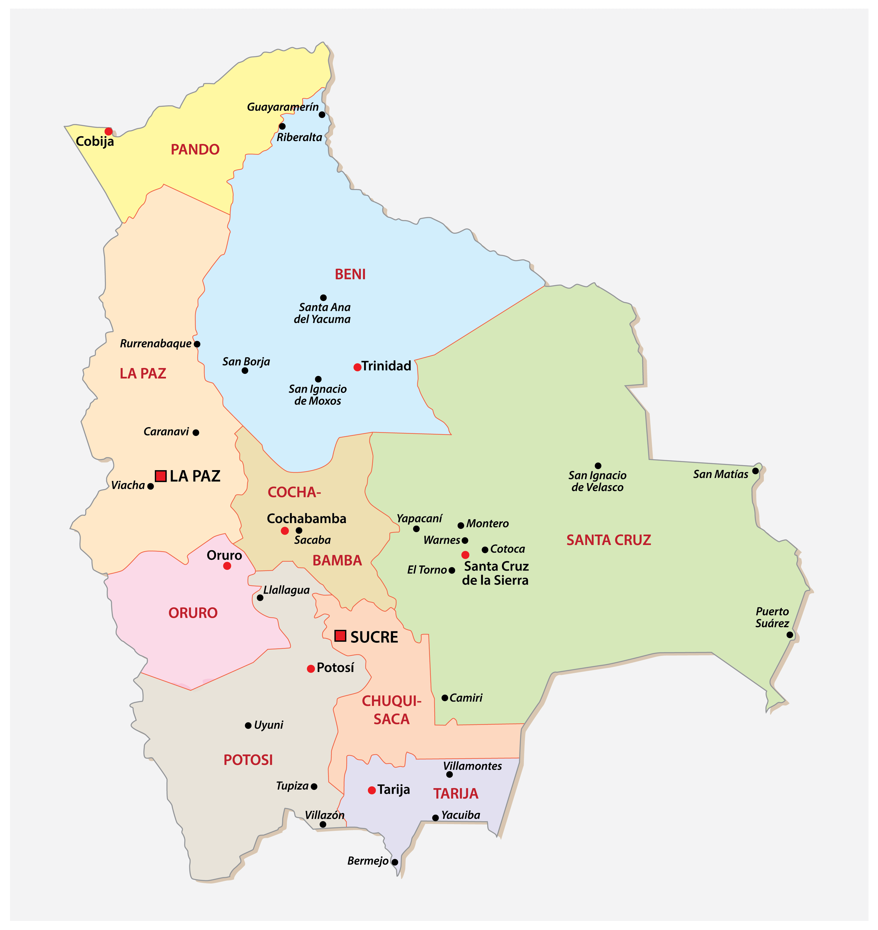
Bolivia Administrative Map
Physical Map of Bolivia
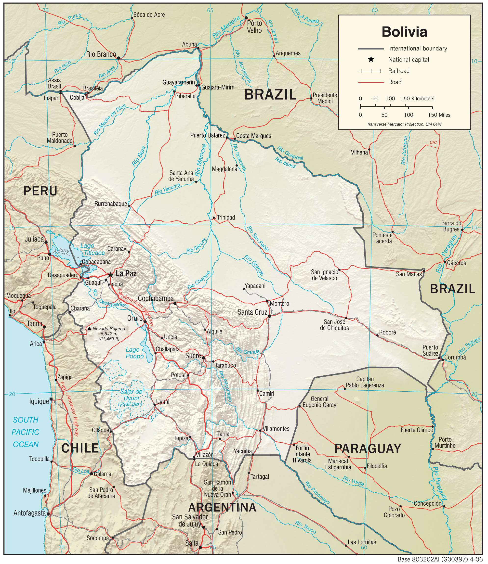
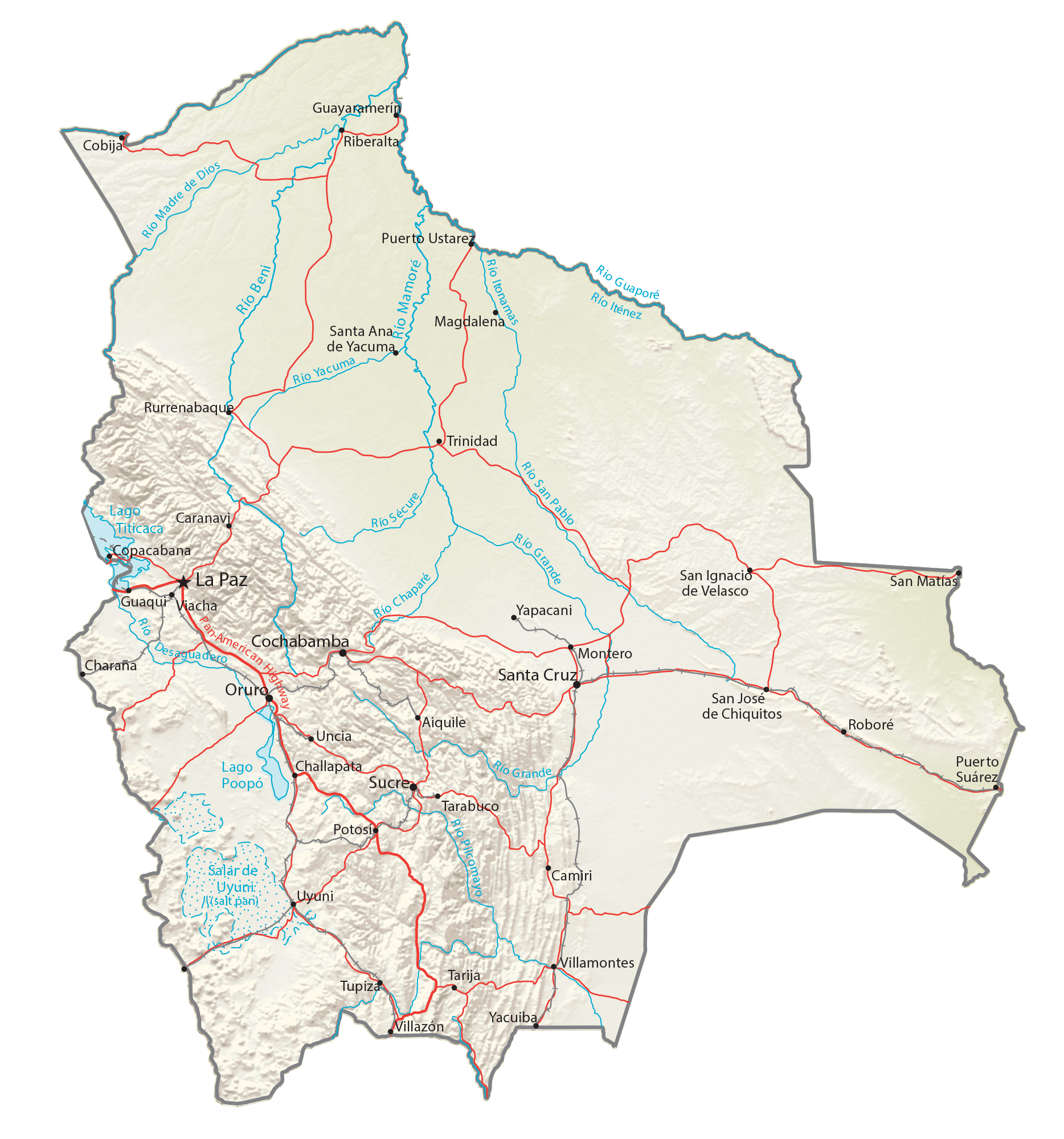
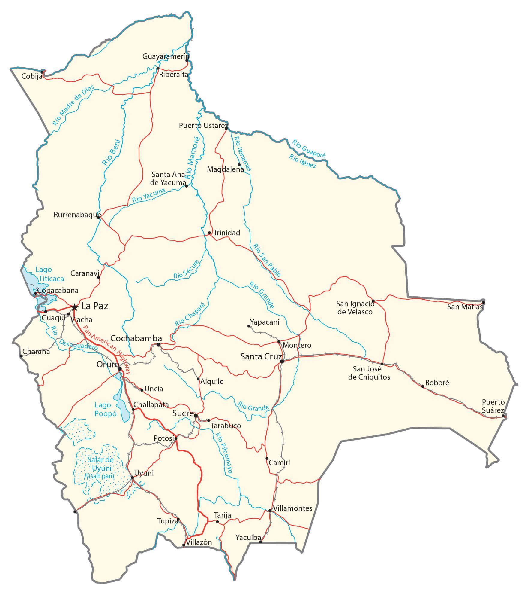
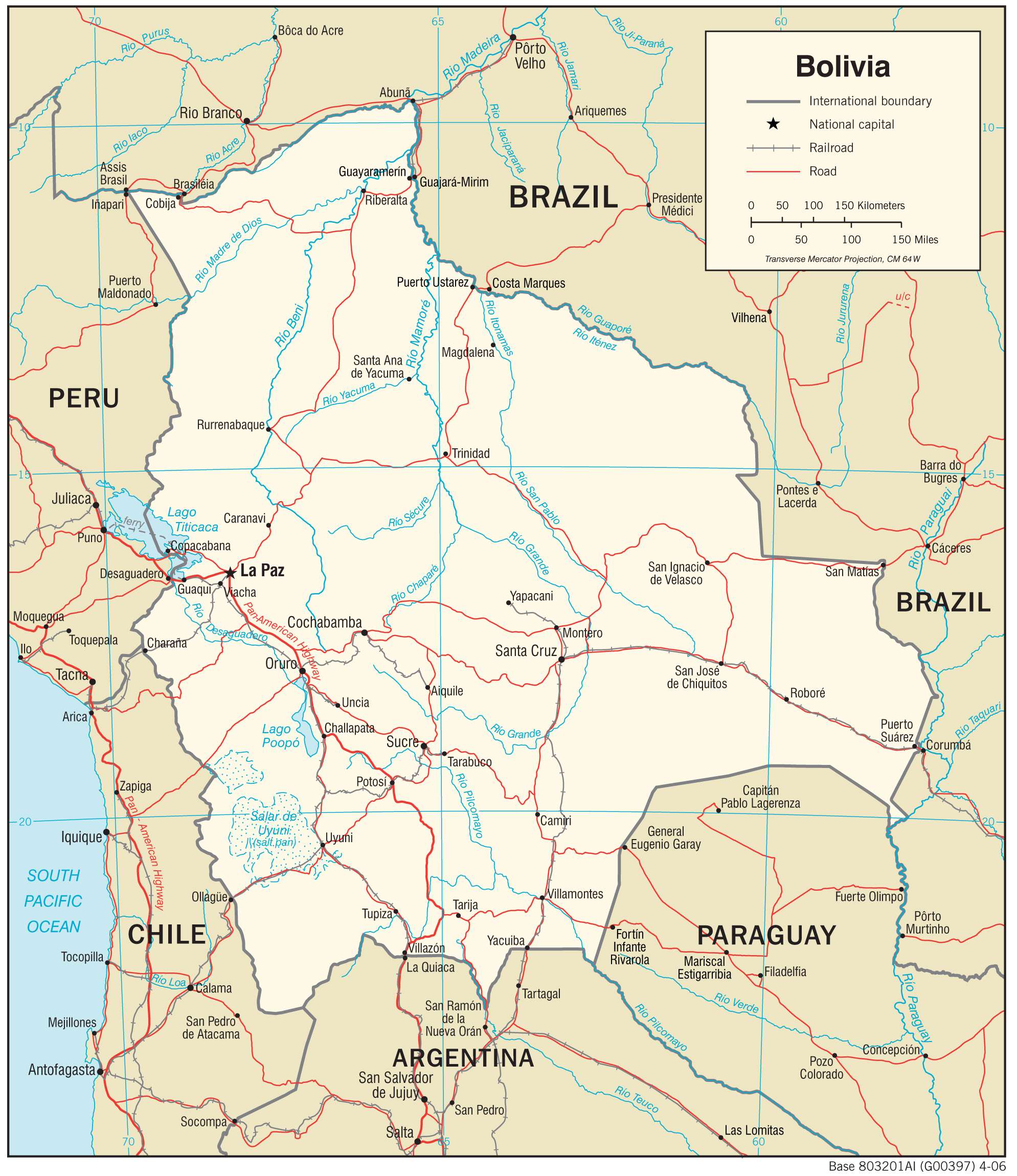
Transportation Map of Bolivia
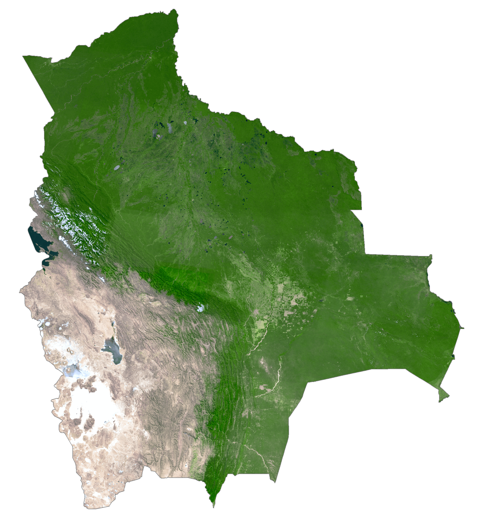
Bolivia Satellite Map