The Democratic Republic of the Congo occupies an area of 2,345,409 sq. km in Central Africa. It is the largest country in sub-Saharan Africa.
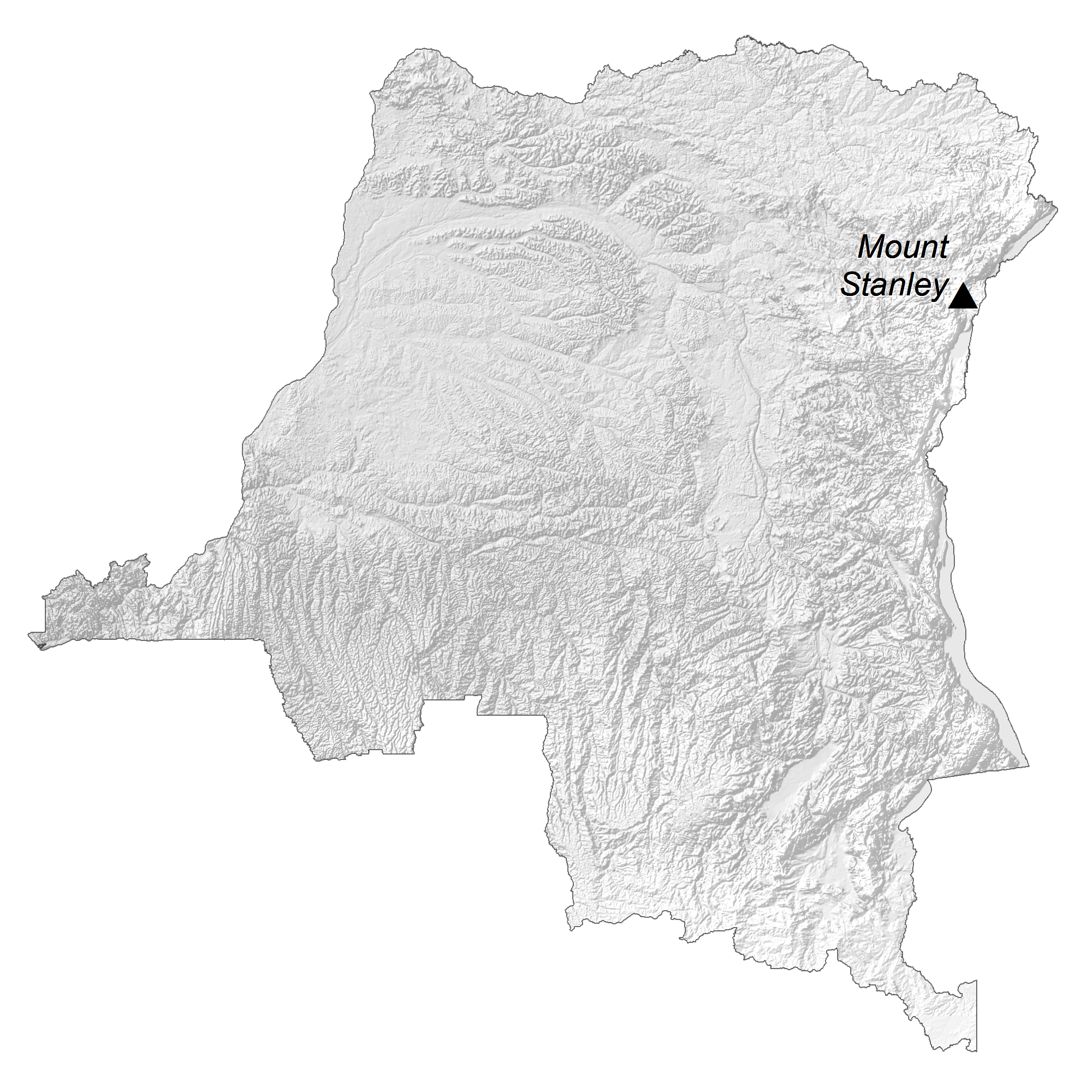
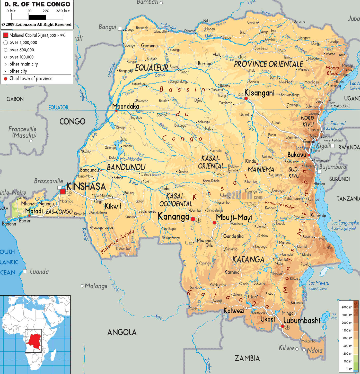
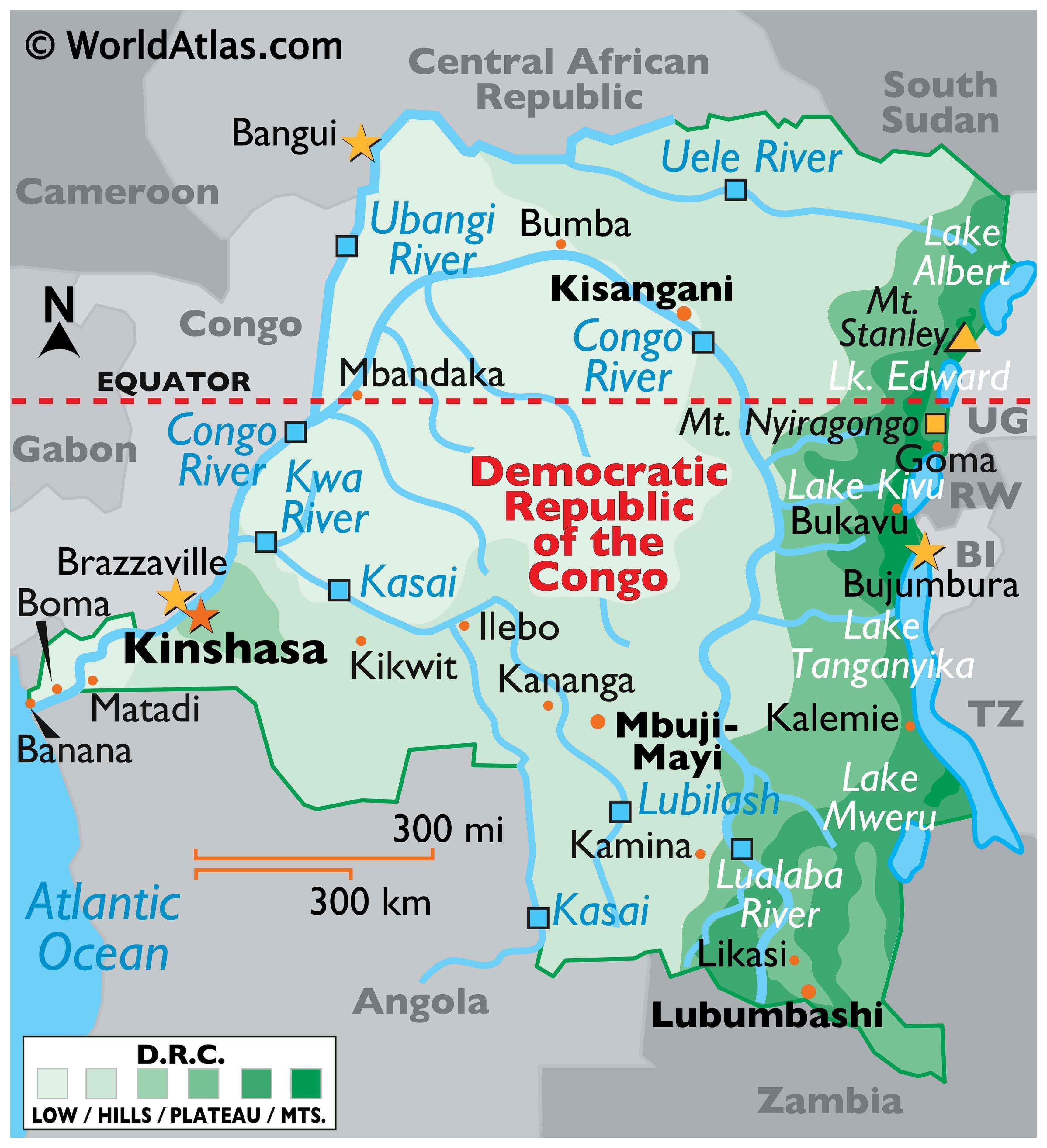
The physical map above illustrates the country of the Democratic Republic of Congo, with the massive expanse of the Congo Rainforest, the second-largest rainforest in the world after the Amazon. Most of the central and western parts of the country are part of the Congo River basin, The Congo River system is the second largest river in Africa. The Congo River is 4,398 km long. This area of the DRC is surrounded by plateaus merging into savannas in the south and southwest, by mountainous terraces in the west, and by dense grasslands extending beyond the Congo River in the north. In the east, the land rises into a plateau with heights over 1,524 m and then into the higher glaciated and volcanic mountains of the Great Rift Valley. Southeast, the land rises into the peaks of the Shaba Plateau.
The highest point of the Democratic Republic of the Congo has been marked on the map with an orange triangle. It is Mt. Stanley at 5,110 m; the lowest point of the country is the Atlantic Ocean (0 m).
As observed on the map, several lakes front the country’s eastern borders, including lakes Albert, Edward, Kivu, Mweru, and Tanganyika.
| Flag: |  |
|---|---|
| Legal Name: | Democratic Republic of the Congo |
| Capital Value: | Kinshasa |
| Official languages: | French |
| Demonym(s): | Congolese |
| Government: | Unitary semi-presidential republic |
| Legislature: | Parliament |
| Total Area: | 2,344,858 km² |
| Land Area: | 2,267,048 km² |
| Water Area: | 77,810 km² |
| Population: | 86,790,567 |
| Density: | 46.3/km (119.9/sq mi) |
| GDP: | $47.32 Billion |
| GDP Per Capita: | $545.22 |
| Currency Value: | Congolese francs (CDF) |
| Driving side: | right |
| Calling code: | +243 |
| Internet TLD: | .cd |
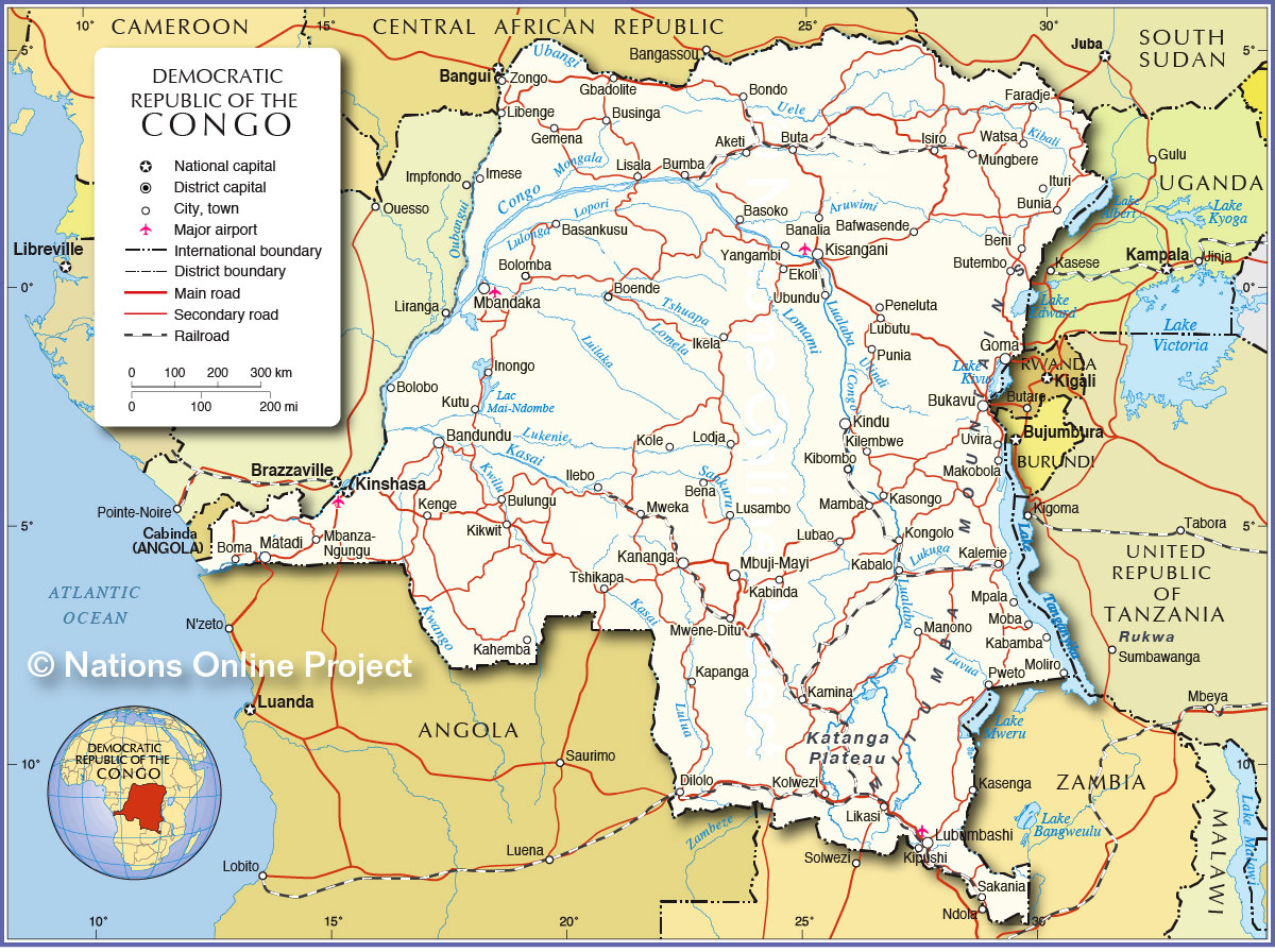
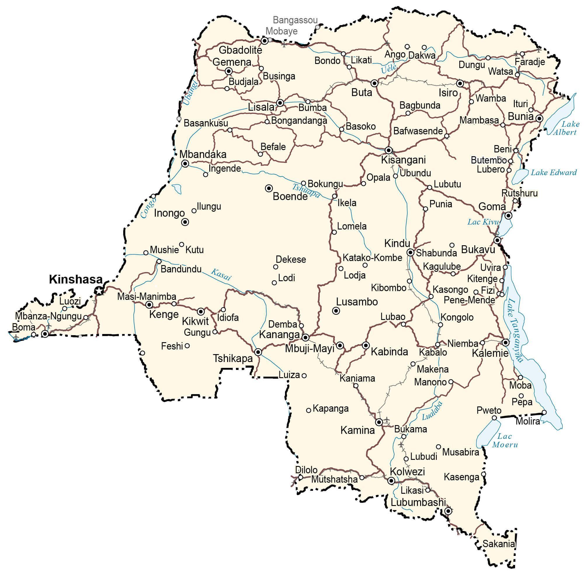
Explore the beauty and diversity of the Democratic Republic of Congo with this interactive map. From the vastness of its forests to the swamps and jungles, this map gives you an insight into the country’s mosaic of landscapes. See the major cities, towns and roads, as well as an elevation and satellite map to help you explore this beautiful country.
Online Interactive Political Map
Click on ![]() to view map in "full screen" mode.
to view map in "full screen" mode.
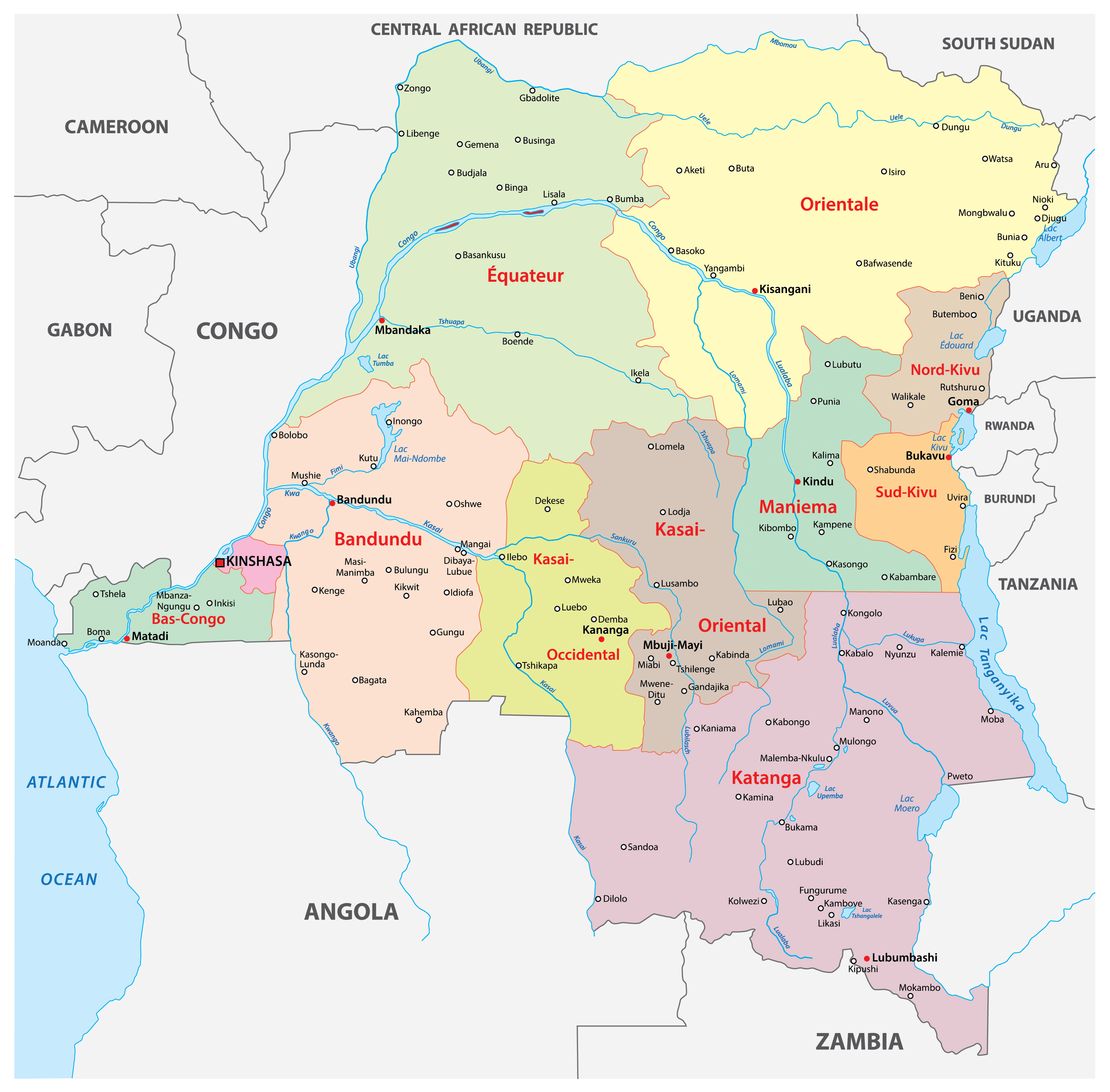
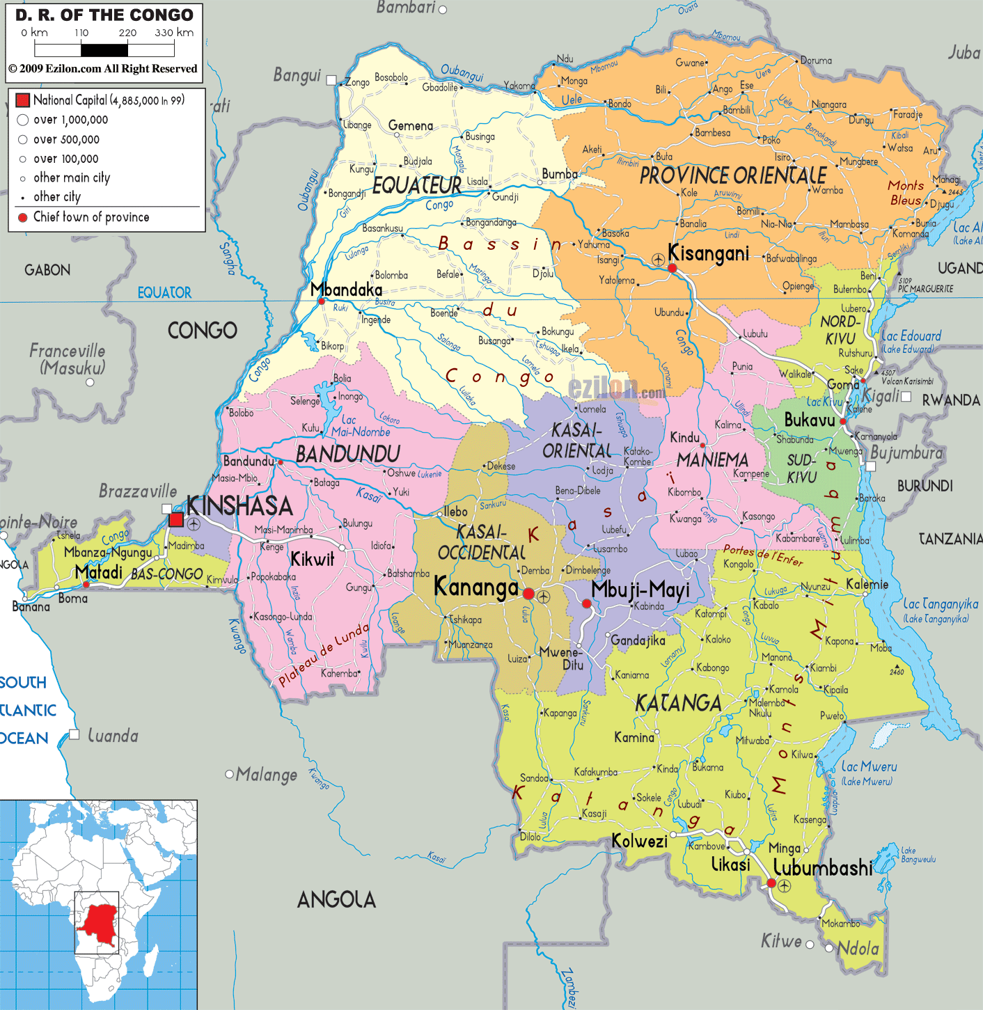
DRC is divided into 25 provinces. In addition, the capital city of Kinshasa is also treated as equivalent to a province. Thus, the 26 provinces of the country in alphabetical order are as follows: Bas-Uele (Lower Uele), Equateur, Haut-Katanga (Upper Katanga), Haut-Lomami (Upper Lomami), Haut-Uele (Upper Uele), Ituri, Kasai, Kasai-Central, Kasai-Oriental (East Kasai), Kinshasa, Kongo Central, Kwango, Kwilu, Lomami, Lualaba, Mai-Ndombe, Maniema, Mongala, Nord-Kivu (North Kivu), Nord-Ubangi (North Ubangi), Sankuru, Sud-Kivu (South Kivu), Sud-Ubangi (South Ubangi), Tanganyika, Tshopo, and Tshuapa.
With an area of 199,567 sq. km, Tshpo is the largest province by area while Kinshasa is the most populous one.
Location Maps
Where is Democratic Republic of the Congo?
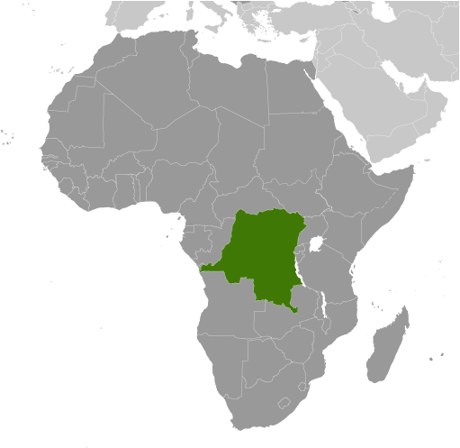
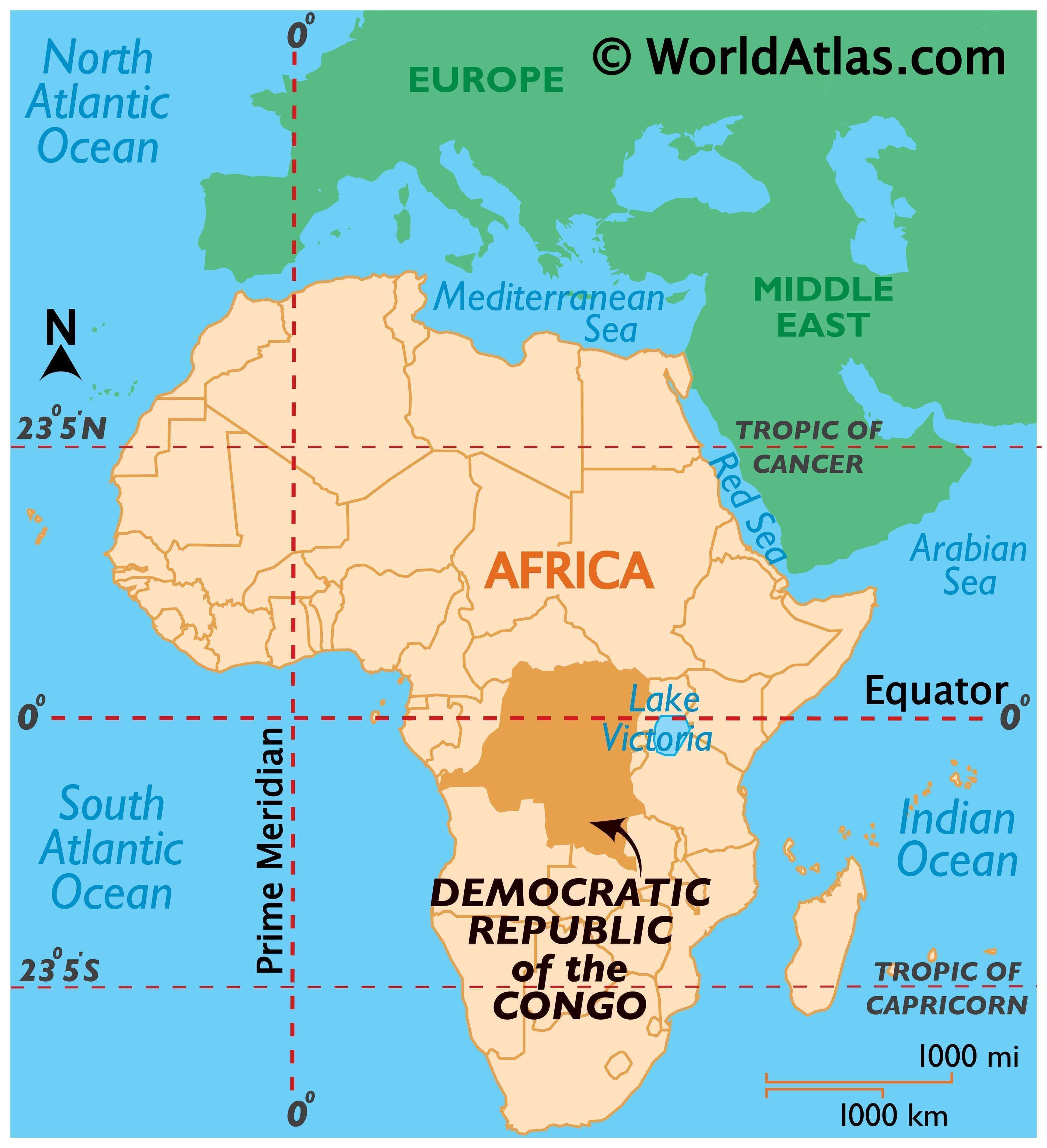
The Democratic Republic of Congo (DR Congo) is a country in Central Africa. Previously, it was known as Zaire until 1997, when it was changed. With a size of 2,345,409 square kilometers (905,567 sq mi), it is the second-largest country in all of Africa (after Algeria) and the 11th-largest in the world. DR Congo is also the 4th-most populous country in Africa (after Nigeria, Ethiopia, and Egypt) and the 15th-most populous country in the world. It borders 9 other countries, including Congo, Central Africa Republic, South Sudan, Uganda, Rwanda, Burundi, Tanzania, Zambia, and Angola. The capital and largest city of the Democratic Republic of Congo is Kinshasa.
High Definition Political Map of Democratic Republic of the Congo
Physical Map of Democratic Republic of the Congo
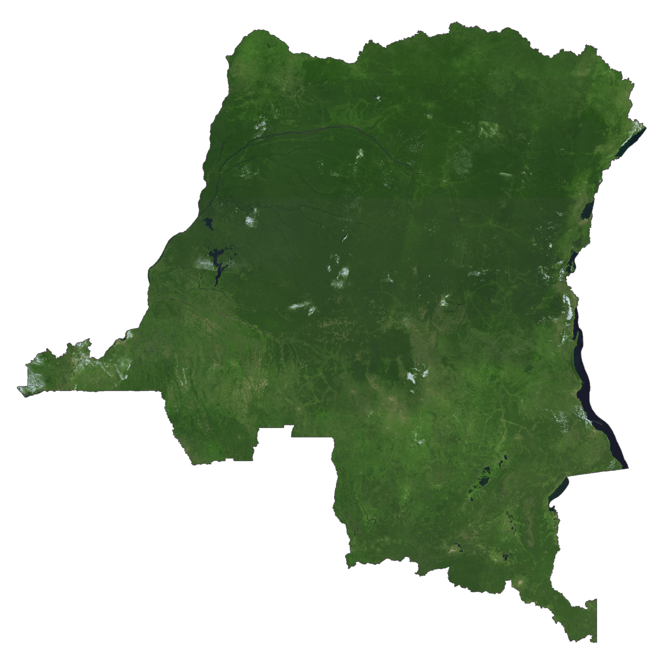
Democratic Republic of the Congo Satellite Map
Elevation Map