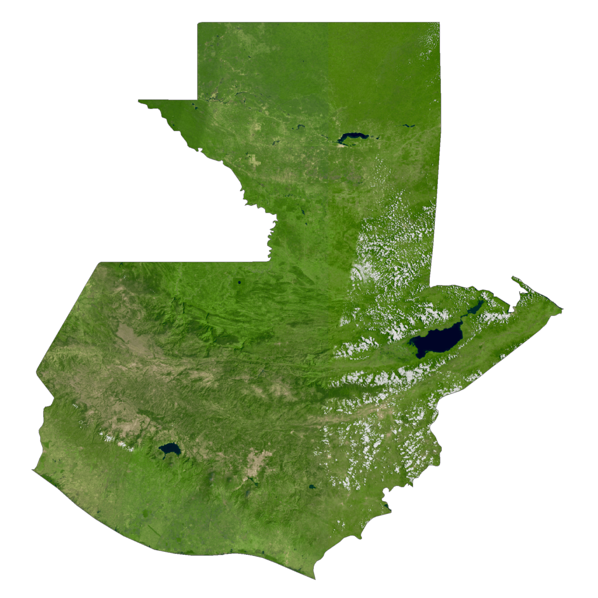
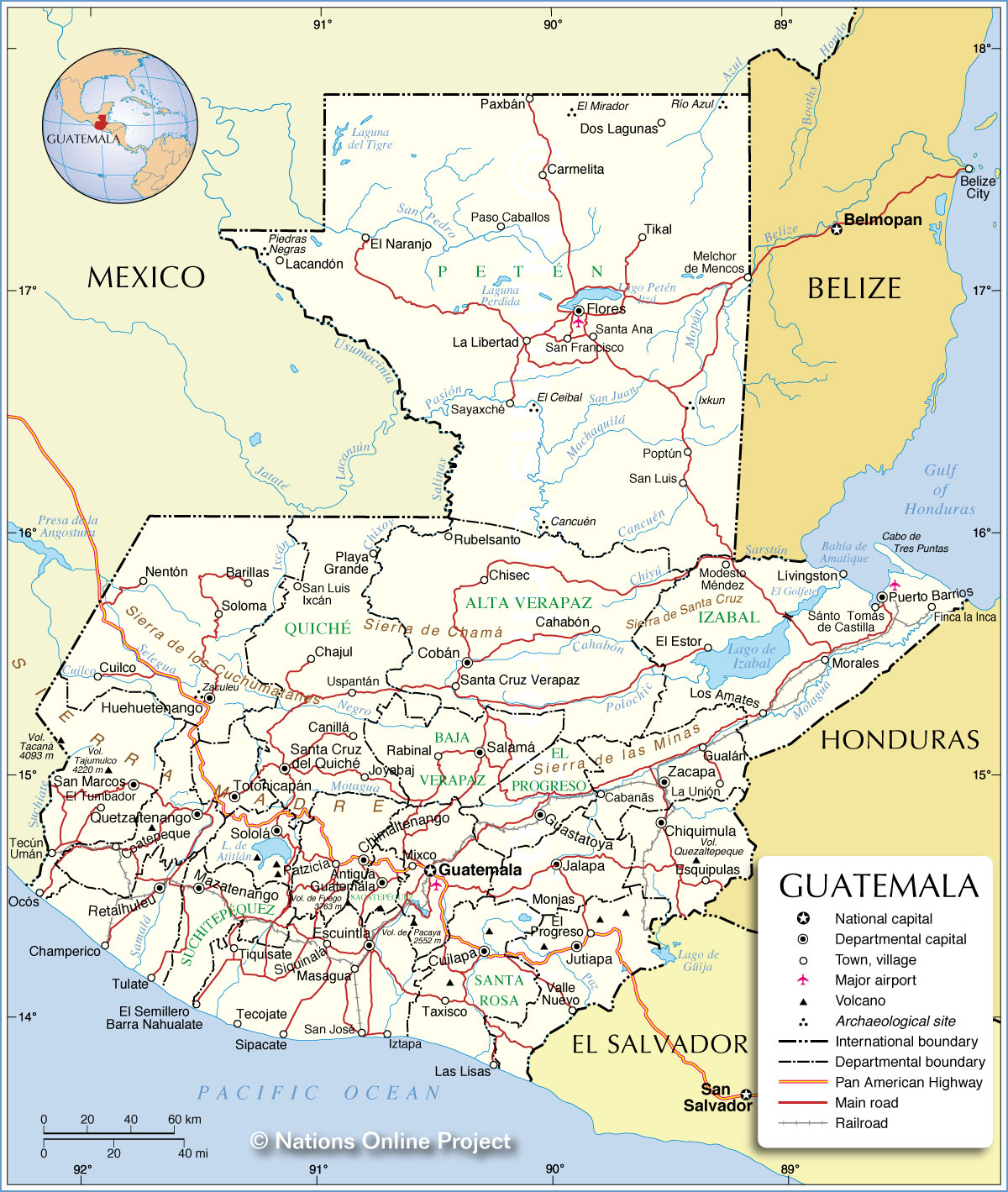
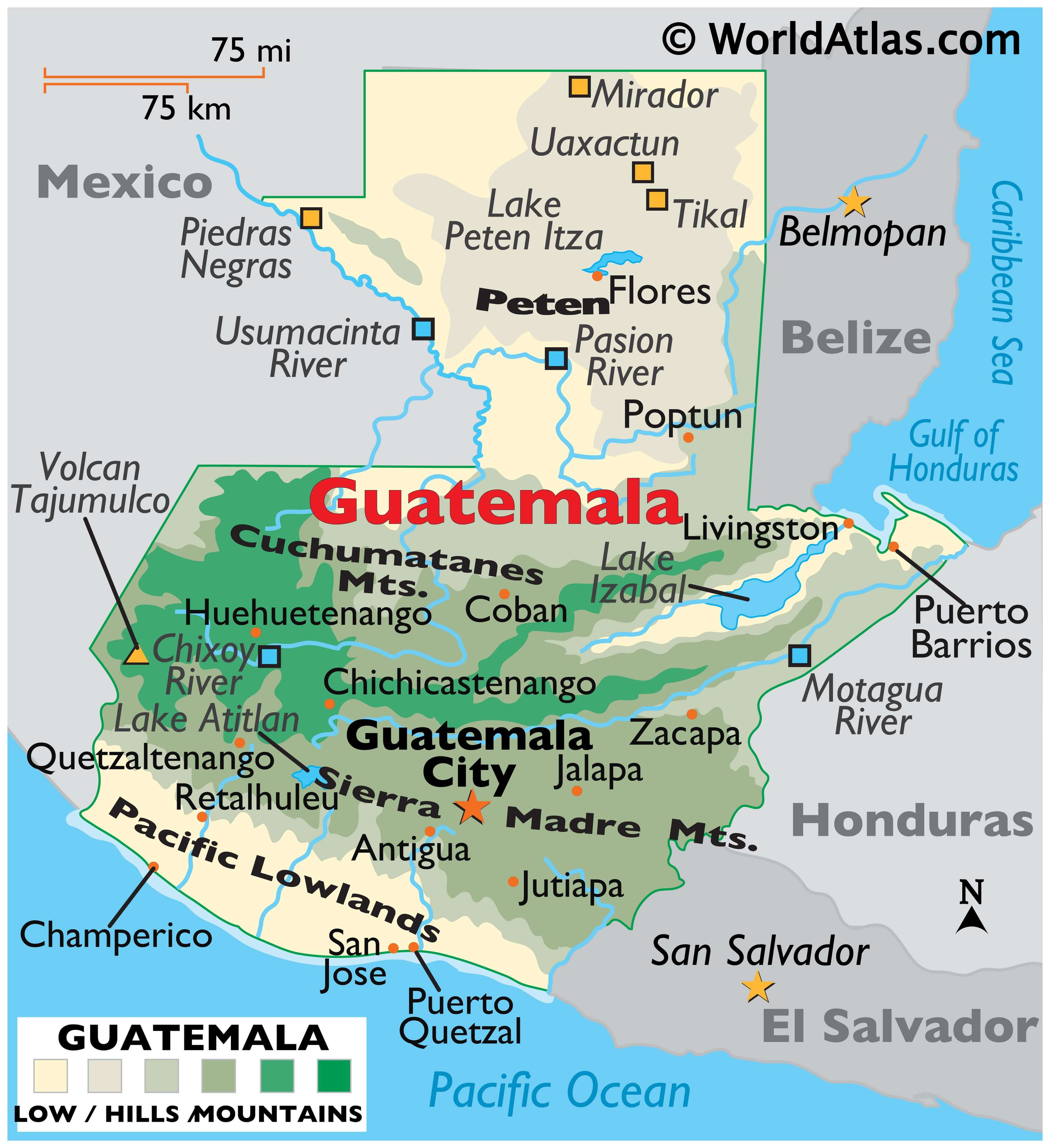
A Central American country, Guatemala covers an area of 108,889 sq. km (42,042 sq mi). As observed on the physical map of Guatemala, the country is largely mountainous with rolling hills, plateaus, deep river valleys, and numerous volcanoes. Some of the volcanoes are active.
Major regions include the Central Highlands that separate the Cuchumatanes Mountains of the northwest from the volcanic ranges of the Sierra Madre Mountains of the south and east.
The highest point in the country is the 4,220 m or 13,845 ft high Tajumulco Volcano. The lowest point is the Pacific Ocean at 0 m.
Peten, a limestone plateau covered by grasslands and tropical rainforest blankets most of the northern third of the country.
Atlantic Lowlands that front the swampy edges of the Gulf of Honduras, and the grassy farmland, volcanic sand beaches and rivers of the Pacific Lowlands.
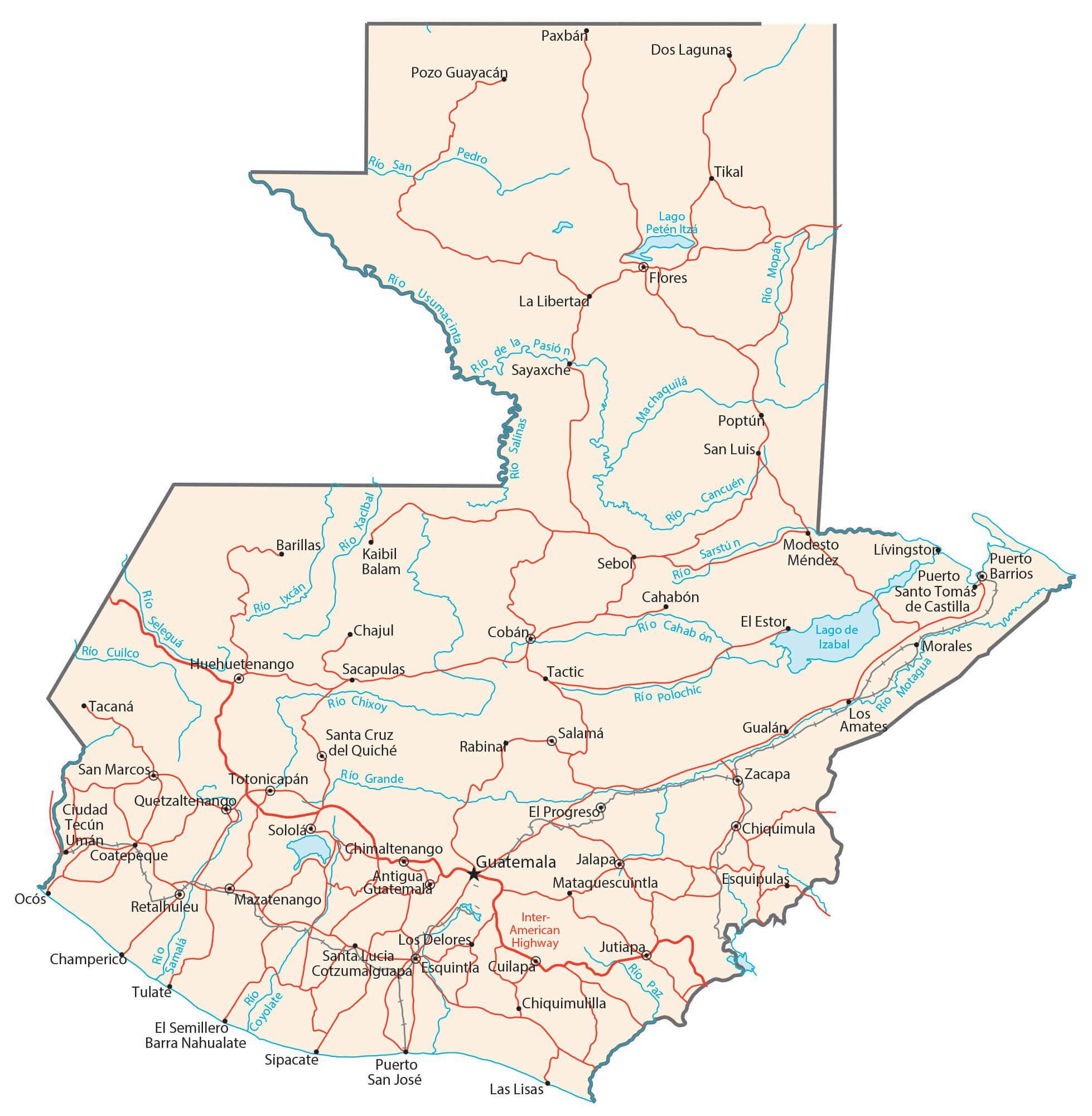
Guatemala is drained by numerous rivers; the Motagua, the country’s longest river, rises in the Central Highlands and flows to the Caribbean Sea. Lake Izabal is the most significant lake.
| Flag: |  |
|---|---|
| Legal Name: | Republic of Guatemala |
| Capital Value: | Guatemala City |
| Largest City: |
Ciudad de Guatemala (Guatemala City) (2,934,841) |
| Official languages: | Spanish |
| Demonym(s): | Guatemalan Chapín |
| Government: | Unitary presidential republic |
| Legislature: | Congress of the Republic |
| Total Area: | 108,889 km² |
| Land Area: | 107,159 km² |
| Water Area: | 1,730 km² |
| Population: | 16,604,026 |
| Density: | 129/km (334.1/sq mi) (85th) |
| GDP: | $76.71 Billion |
| GDP Per Capita: | $4,619.99 |
| Currency Value: | Quetzales (GTQ) |
| Driving side: | right |
| Calling code: | +502 |
| Internet TLD: | .gt |
Explore the beauty of Guatemala with this interactive map! View cities, lakes, rivers, railroads, and highways, as well as satellite imagery and an elevation map to understand the topography of this Central American country. With this map, you can easily explore the diverse landscape that Guatemala has to offer.
Online Interactive Political Map
Click on ![]() to view map in "full screen" mode.
to view map in "full screen" mode.
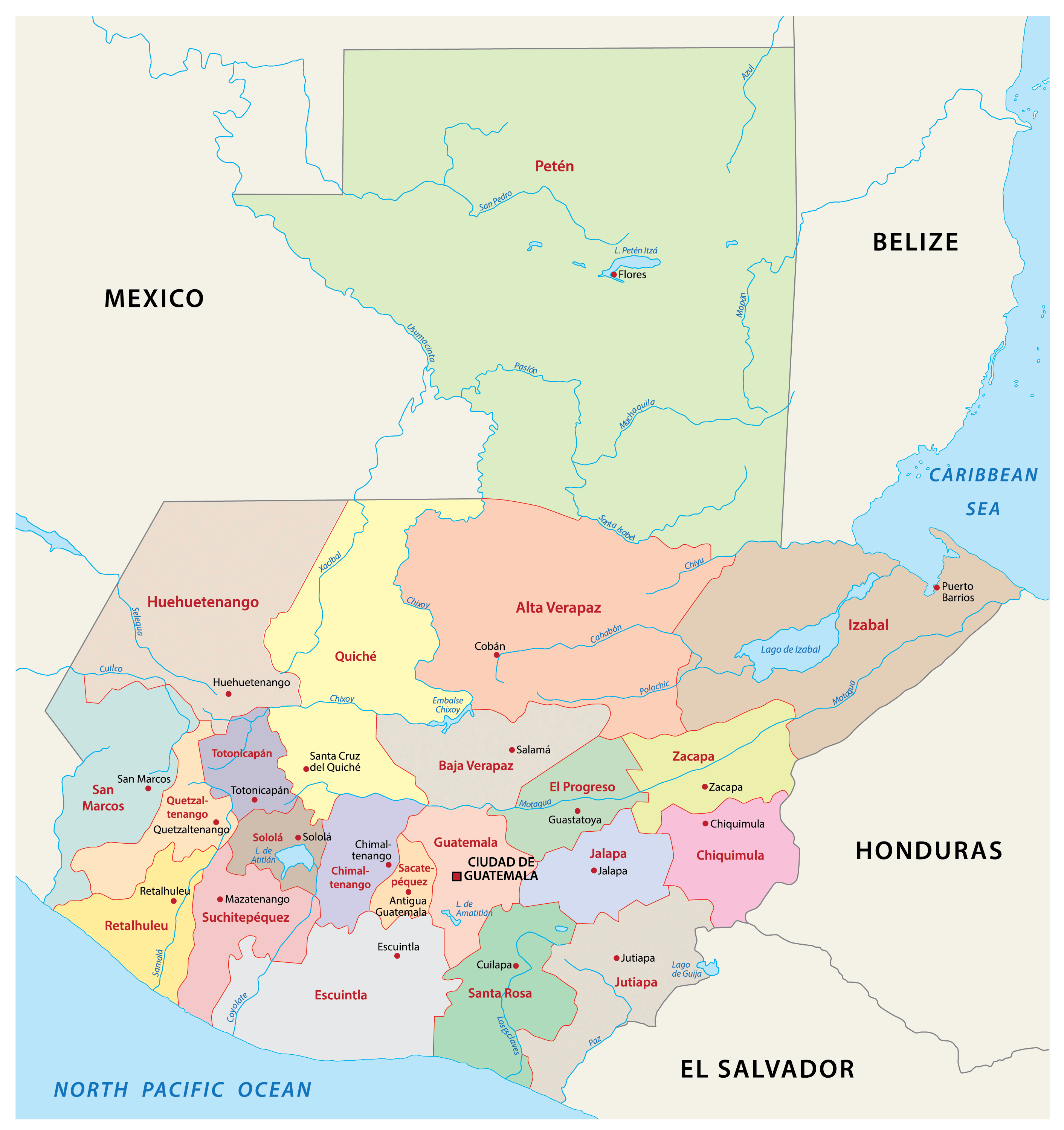
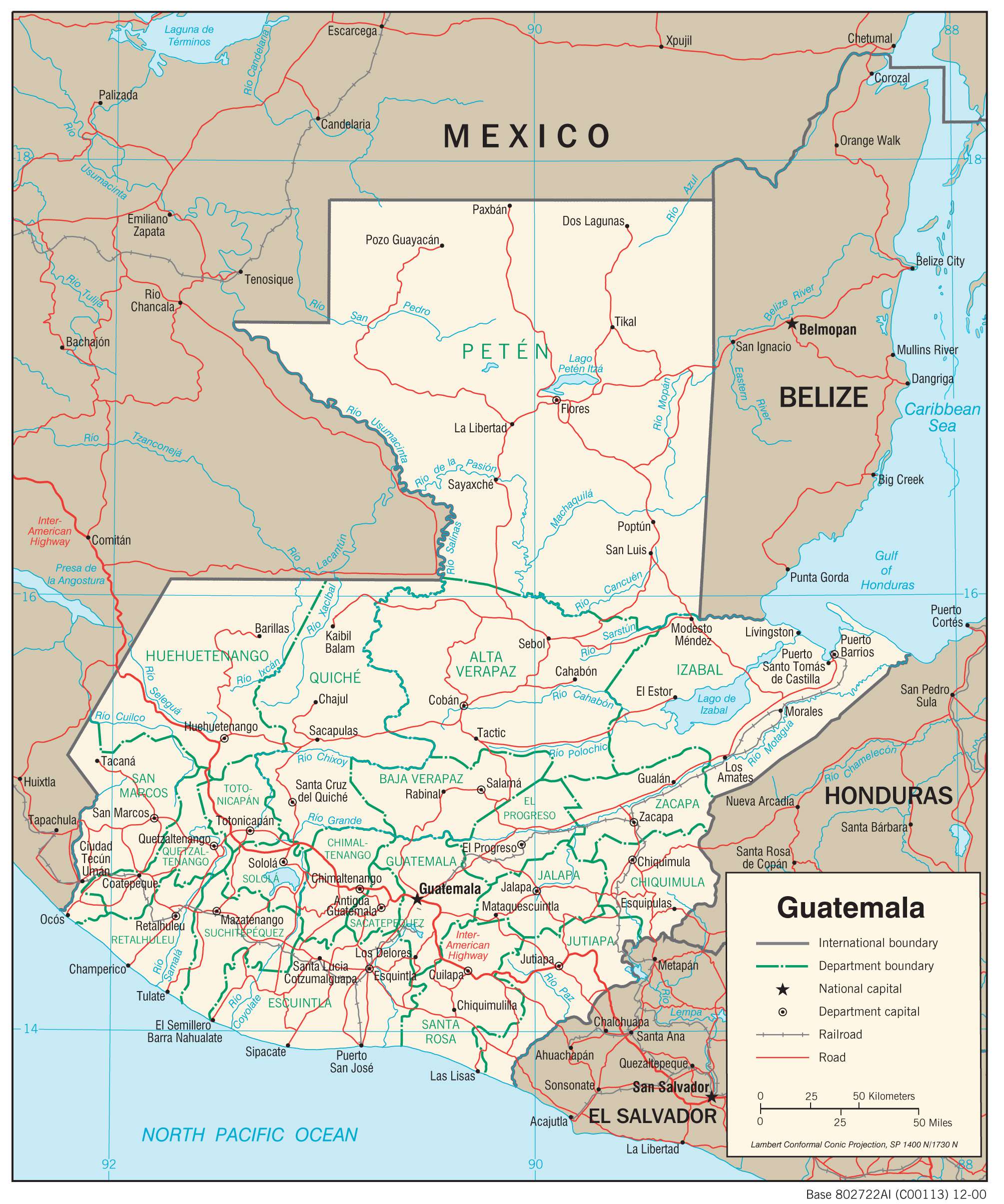
Guatemala (officially, the Republic of Guatemala) is divided into 22 departments (departamentos, sing. departamento). In alphabetical order, the departments are: Alta Verapaz, Baja Verapaz, Chimaltenango, Chiquimula, El Progreso, Escuintla, Guatemala, Huehuetenango, Izabal, Jalapa, Jutiapa, Peten, Quetzaltenango, Quiche, Retalhuleu, Sacatepequez, San Marcos, Santa Rosa, Solola, Suchitepequez, Totonicapan and Zacapa. These departments are further subdivided into 340 municipalities.
Located in the south-central region of the country, in Valle de la Ermita of the Central Highlands is Guatemala City (Nueva Guatemala de la Asuncion) – the capital, the largest and the most populous city of Guatemala. It is also the administrative, cultural and economic center of the country. Guatemala City is the largest city in Central America and also Central America’s most highly populated urban area.
Location Maps
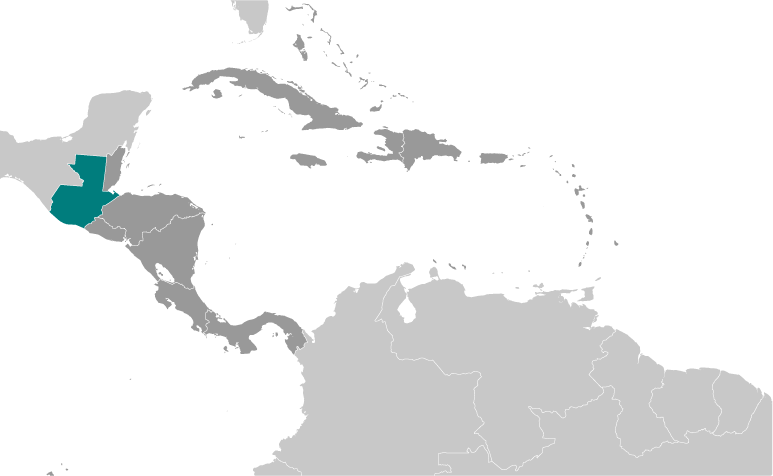
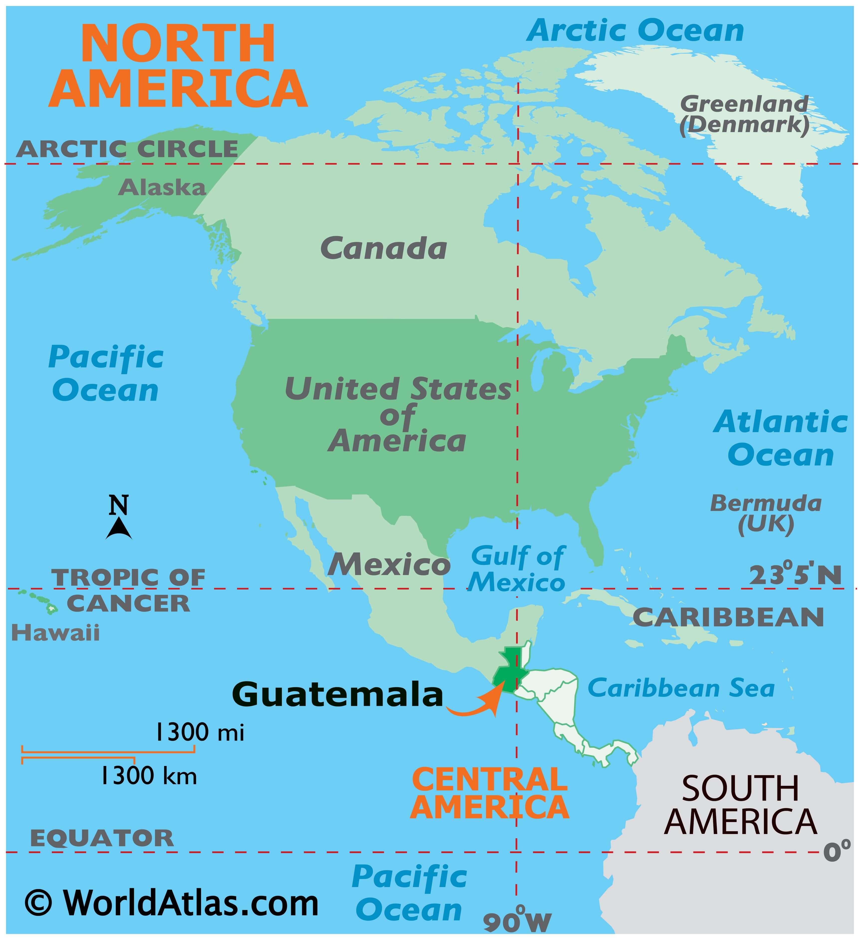
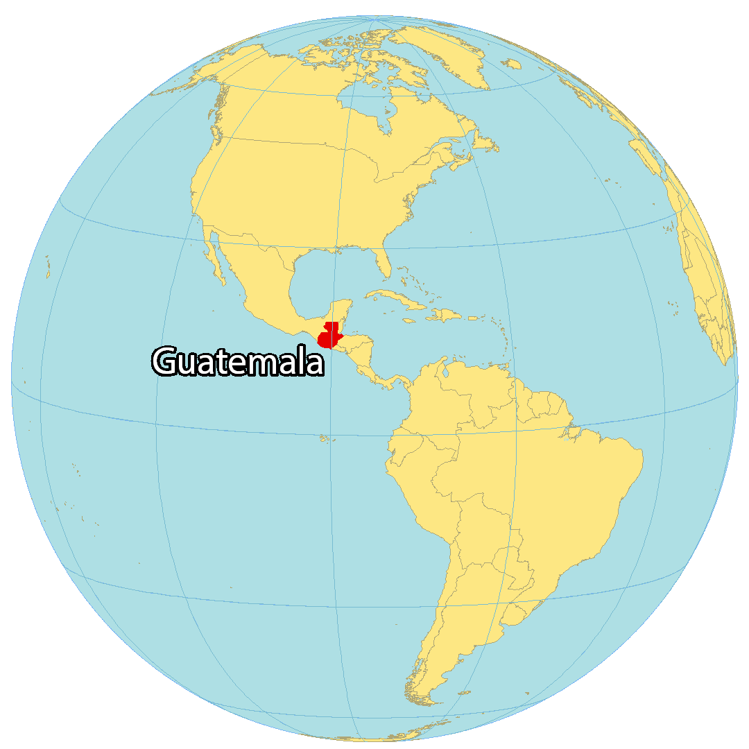
Where is Guatemala?
Nestled in the heart of Central America, Guatemala is home to ancient Mayan ruins, numerous volcanoes, and dense rainforests. The country has a strong indigenous culture, especially of Mayan descent, which makes it different from other Central American nations. Guatemala borders four countries: Mexico to the northwest, Belize to the north, El Salvador and Honduras to the southeast. The capital and largest city, Guatemala City, is the most populous urban area in Guatemala and all of Central America.
High Definition Political Map of Guatemala

Physical Map of Guatemala


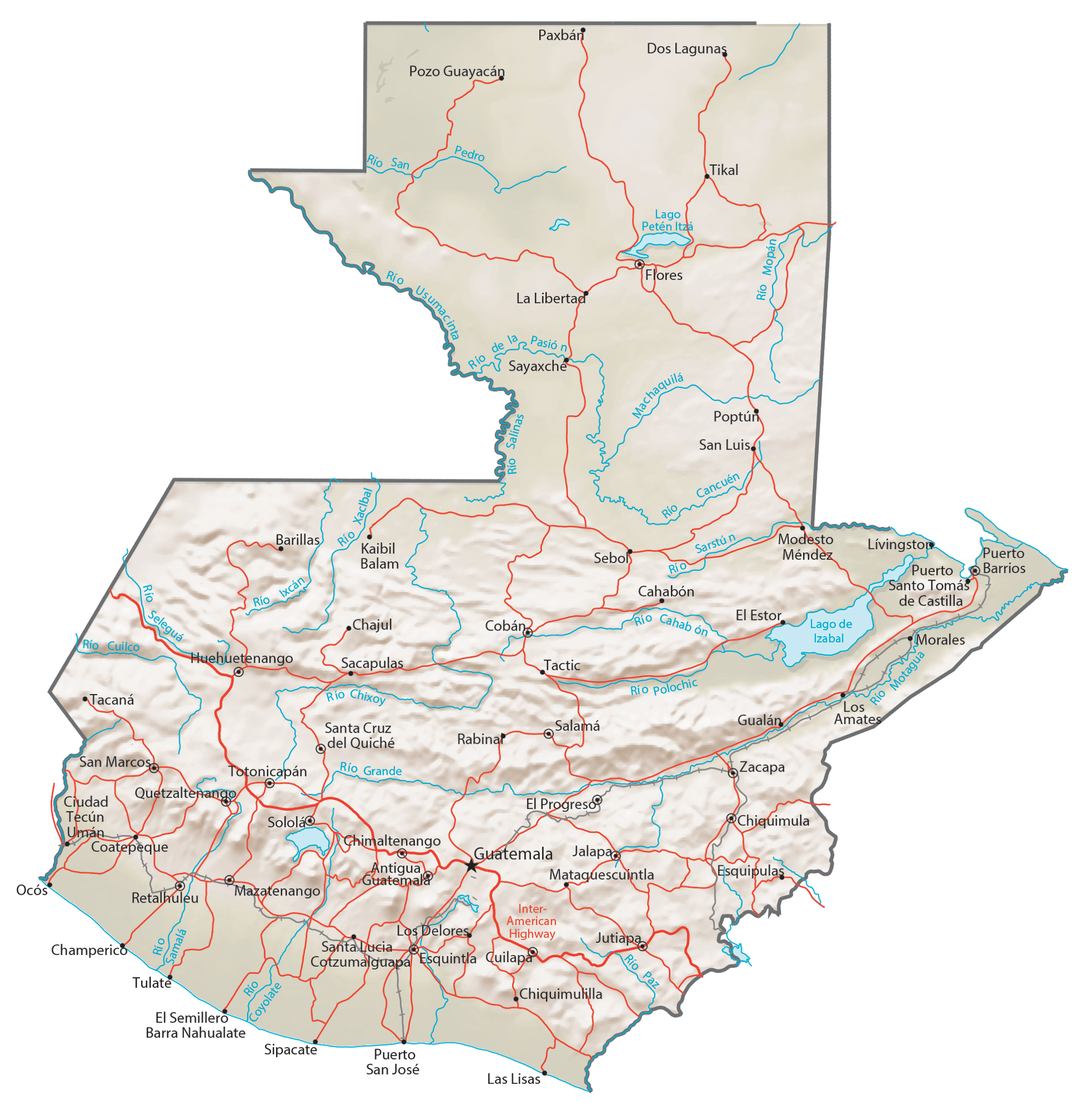
Transportation Map of Guatemala
Guatemala Satellite Map