Oman occupies an area of 309,500 sq. km in the southeastern coast of the Arabian Peninsula.
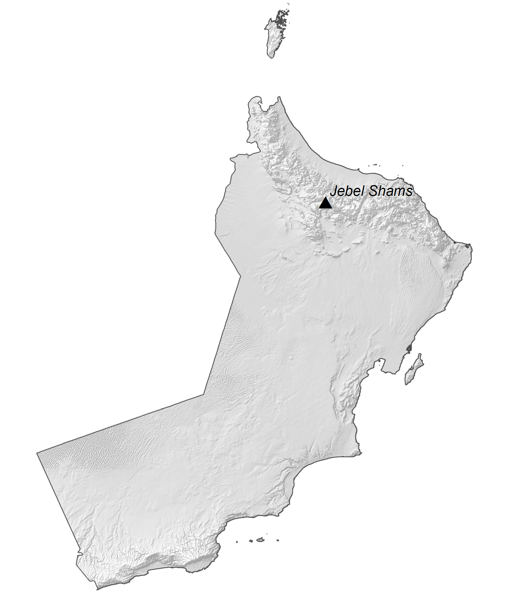
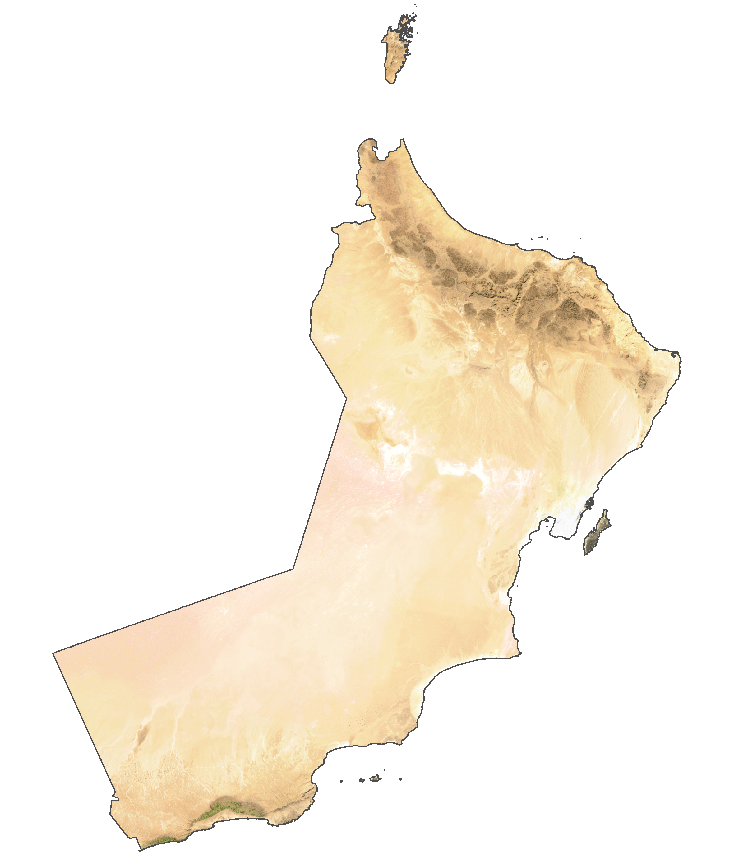
As observed on the physical map of Oman, the northernmost part of Oman, the Musandam Peninsula, is separated from the rest of the country by a strip of land belonging to the United Arab Emirates. The peninsula is comprised mostly of low hills and mountains.
In the rest of the country, a narrow and fertile coastal plain fronts the Gulf of Oman in the north; from there the land rises into the rugged Hajar Mountains. Oman’s highest point is Jabal Akhdar which reaches 9,776 ft. (2,980 m) and is marked on the map by a yellow triangle, is located in this mountain region.
Central and southeast, a few scrubby hills and low mountains dot the central desert landscape and coastal areas.
As observed on the map, to the west, the pebbly, desert-like land slopes gently into the sands of the Rub’ Al Khali Desert.
There are no perennial rivers or lakes of note. The Gulf of Oman has the lowest point in the country at 0 m.
The country also has several islands some of which like the Masirah Island, Al Halaaniyaat Islands have been marked on the map above.
| Flag: |  |
|---|---|
| Legal Name: | Sultanate of Oman |
| Capital Value: | Muscat |
| Official languages: | Arabic |
| Demonym(s): | Omani |
| Government: | Unitary Islamic absolute monarchy |
| Legislature: | Council of Oman |
| Total Area: | 309,500 km² |
| Land Area: | 309,500 km² |
| Population: | 4,974,986 |
| Density: | 15/km (38.8/sq mi) (177th) |
| GDP: | $76.98 Billion |
| GDP Per Capita: | $15,474.03 |
| Currency Value: | Omani rials (OMR) |
| Driving side: | right |
| Calling code: | +968 |
| Internet TLD: | .om, عمان. |
Explore Oman’s breathtaking landscapes with this interactive map. Discover its cities, towns, populated places, highways, and wadis through satellite imagery and an elevation map. From its vast deserts to its majestic mountain ranges, Oman offers a unique and unforgettable experience.
Online Interactive Political Map
Click on ![]() to view map in "full screen" mode.
to view map in "full screen" mode.
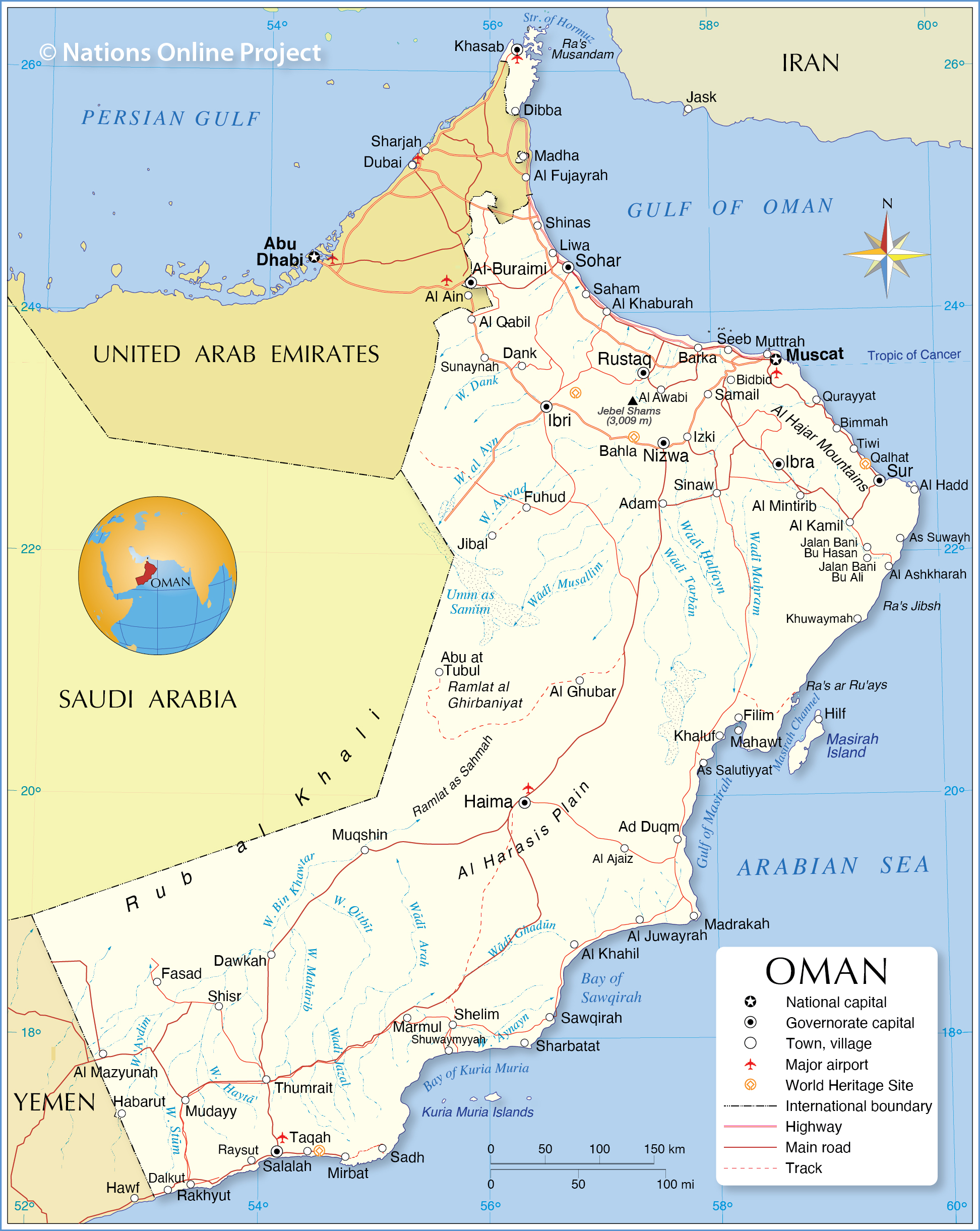
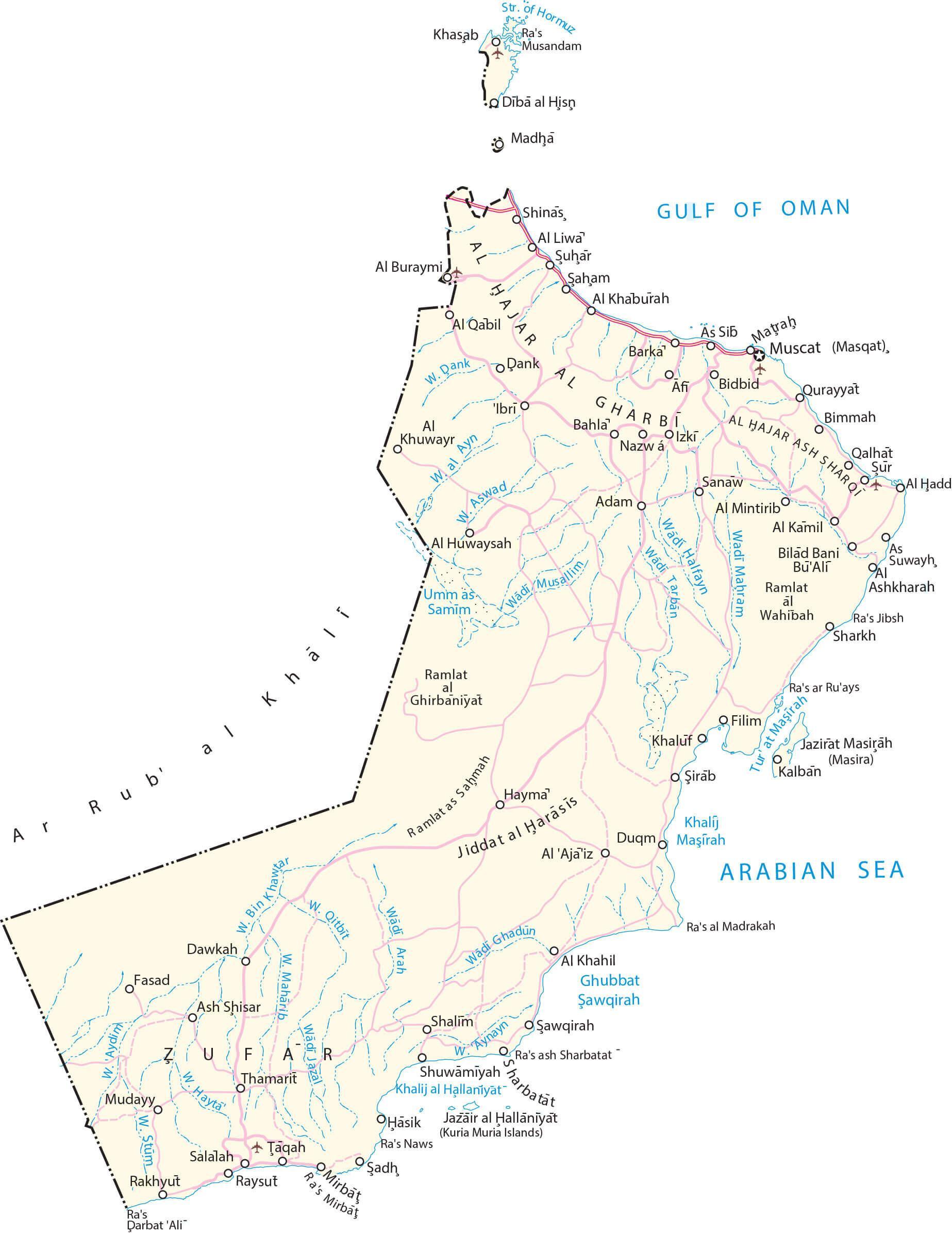
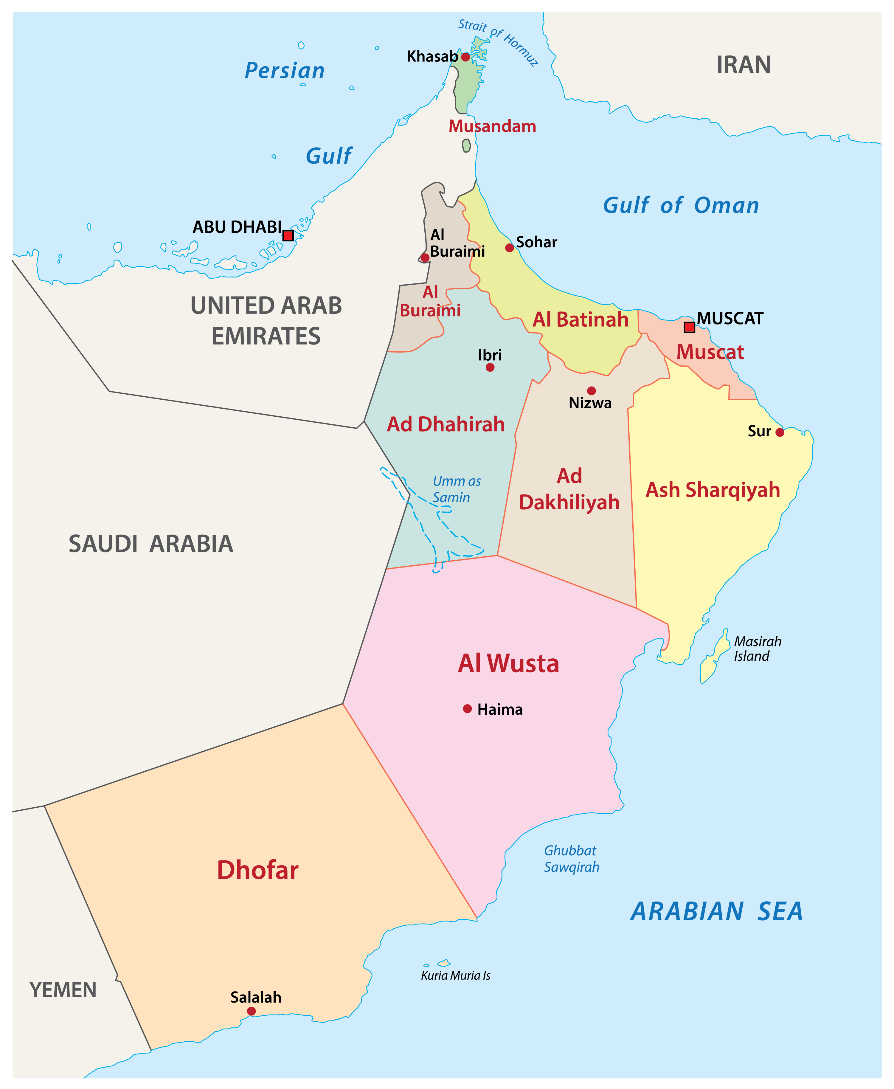
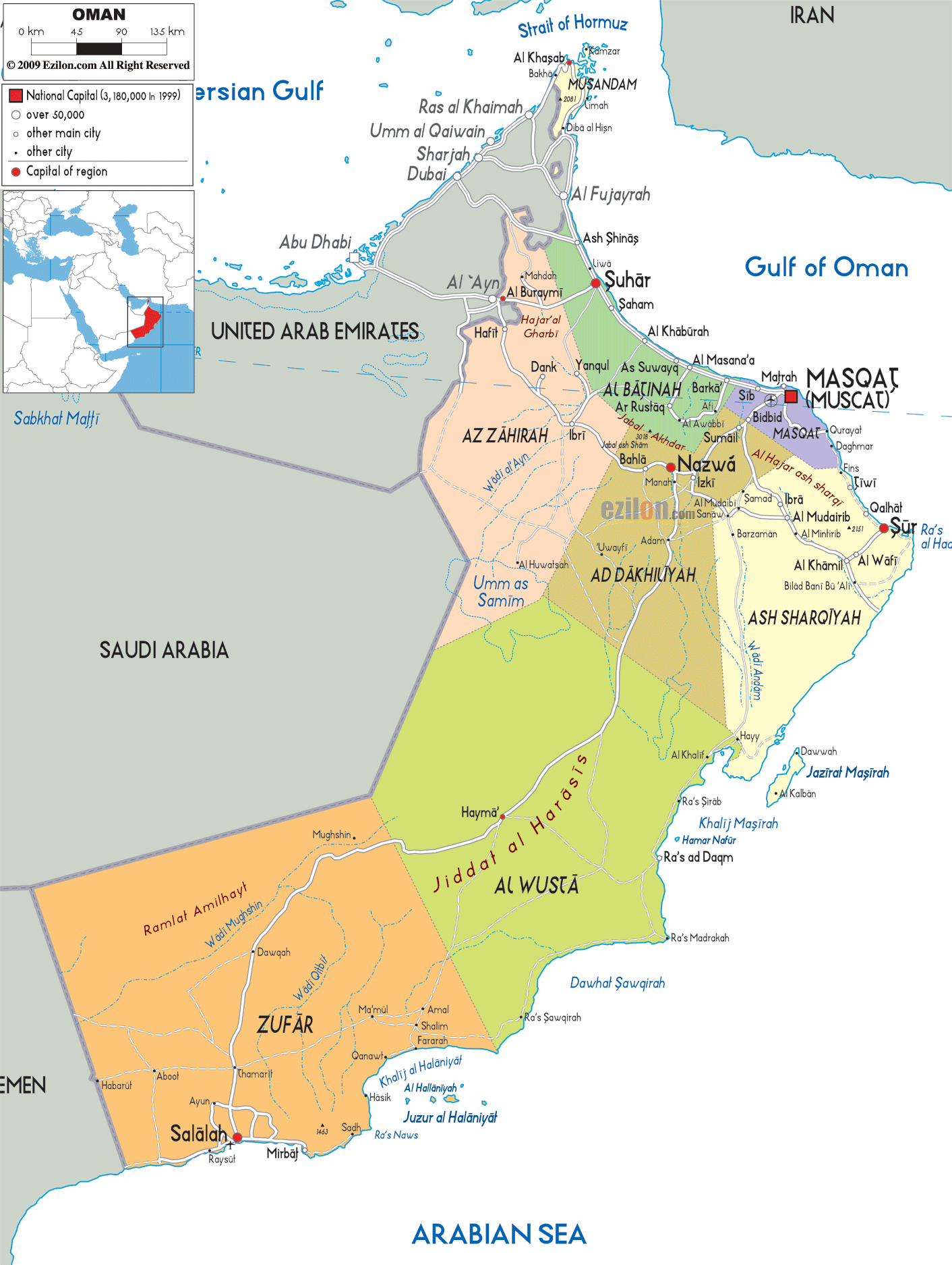
Oman (officially, The Sultanate of Oman) is divided into 11 administrative governorates (muhafazah). In alphabetical order, these governorates are: Ad Dakhiliyah, Ad Dhahirah, Al Batinah North, Al Batinah South, Al Buraymi, Al Wusta, Ash Sharqiyah North, Ash Sharqiyah South, Dhofar, Muscat and Musandam. These governorates are further subdivided into a total of 59 provinces (wilayat).
Located along the Gulf of Oman, in the northeastern part of the country, Muscat is the capital and largest city of Oman. It is also the country’s political, economic and administrative center. Strategically located on the Arabian Sea, Salalah is the second-largest city of Oman. The Port of Salalah is the largest port in Oman as well as the biggest seaport in the Arabian Peninsula.
Location Maps
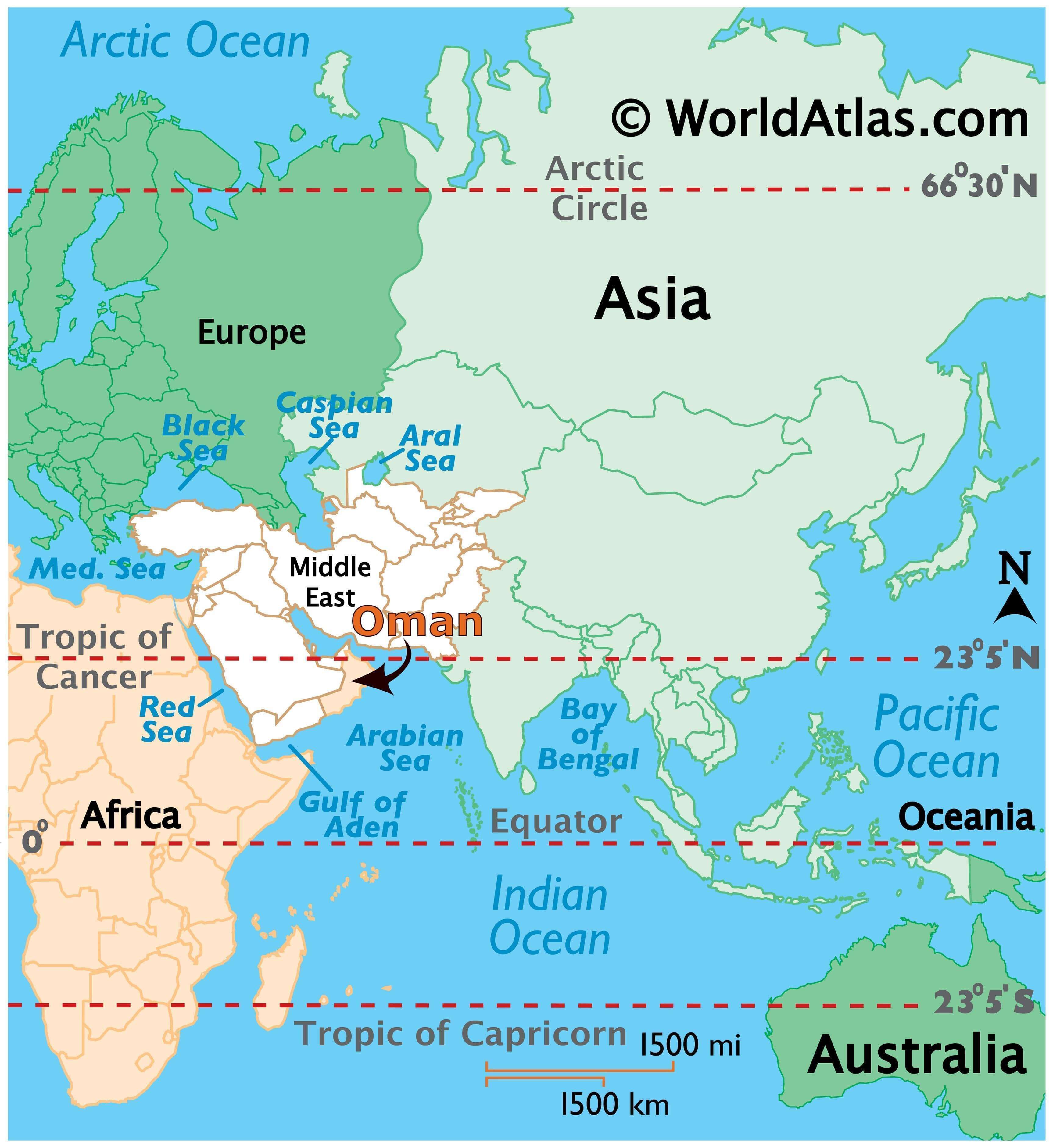
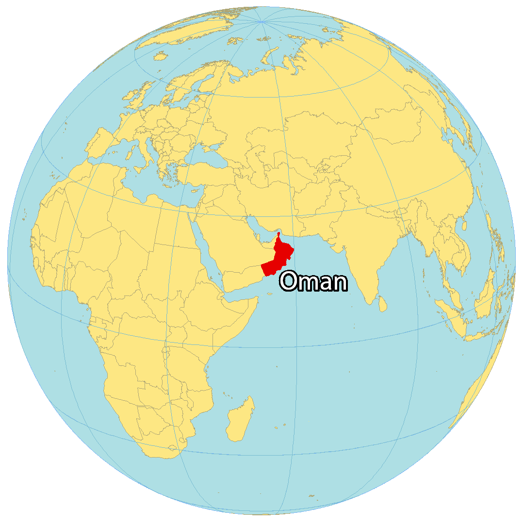
Where is Oman?
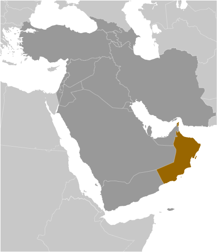
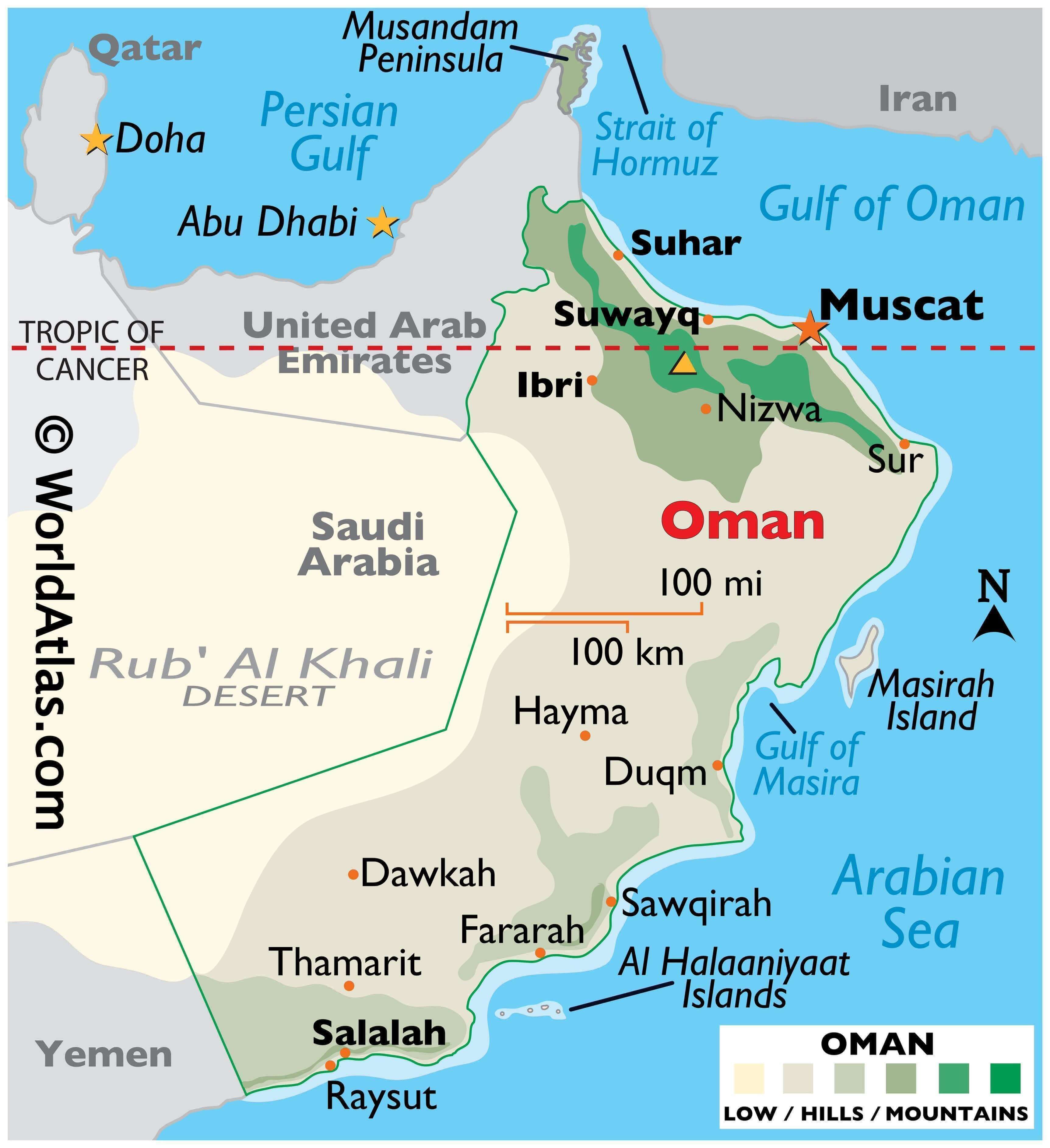
Oman is an Arabian Peninsula country and the longest standing independent state in the Arab world. It shares land borders with the United Arab Emirates to the northwest, Saudi Arabia to the west and Yemen to the southwest. Additionally, its coastline stretches 3,165 kilometers (1,967 mi) along the Gulf of Oman and the Arabian Sea. Oman is a hub for trading and commerce because of its advantageous location in the Persian Gulf and is also renowned for its oil reserves, meteorites, mosques, wadis, and long-serving rulers.
The capital and largest city is Muscat, with other major cities being Seeb, Salalah and Bawshar.
High Definition Political Map of Oman
Physical Map of Oman

Oman Satellite Map
Elevation Map