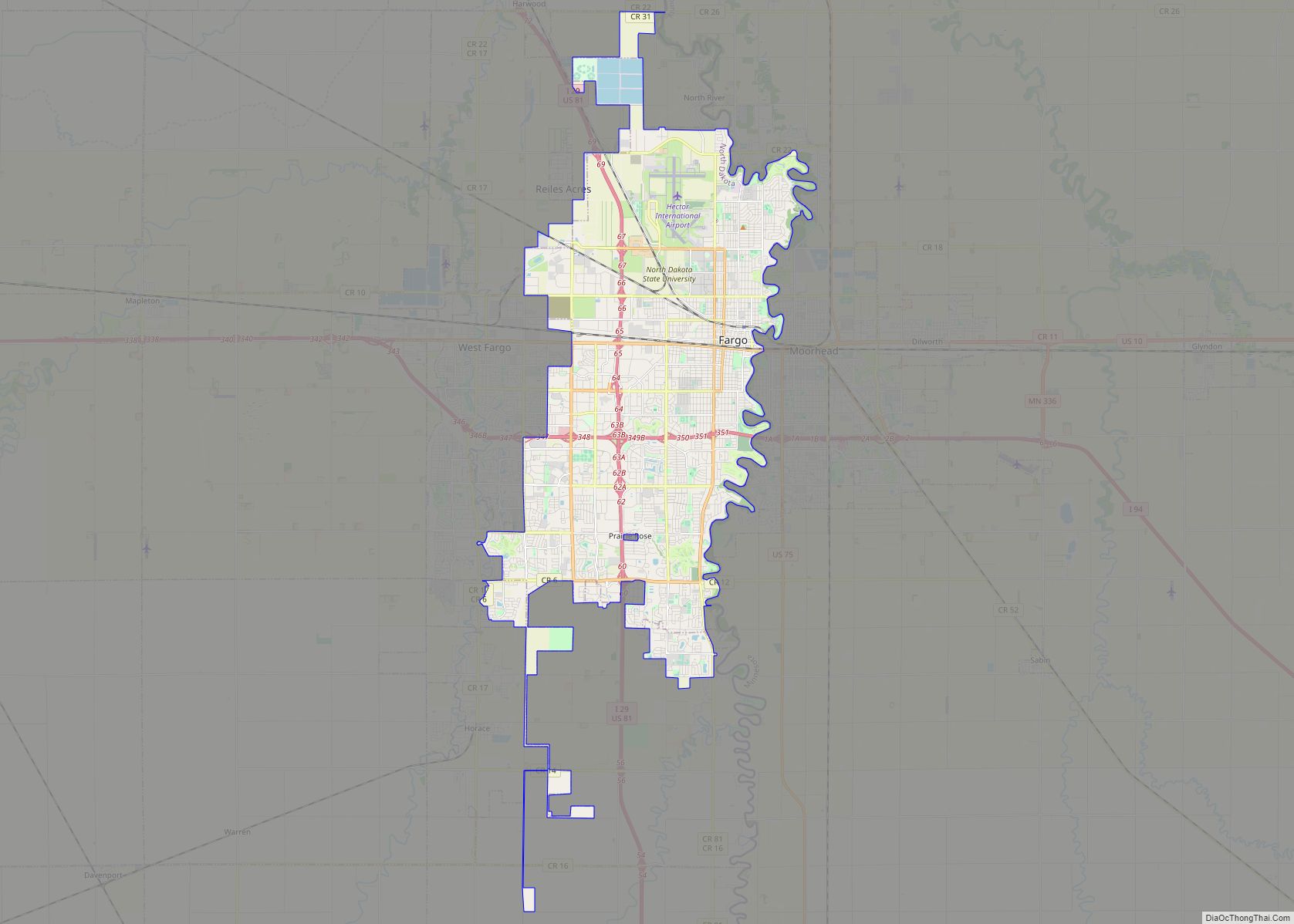
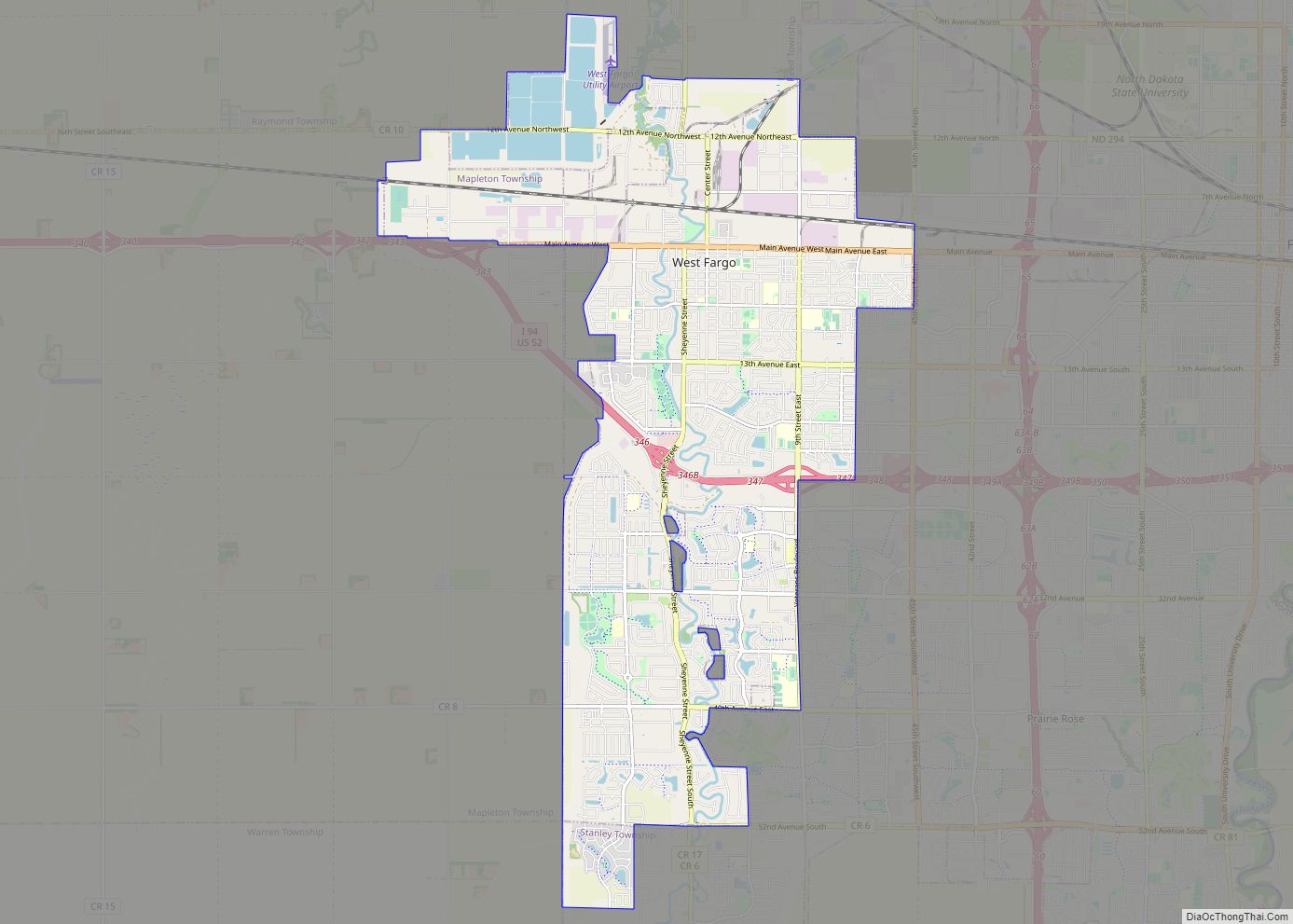
Map of Minot city

Map of Minot city

Minot (/ˈmaɪnɒt/ (listen) MY-not) is a city in and the county seat of Ward County, North Dakota, United States, in the state’s north-central region. It is most widely known for the Air Force base approximately 15 miles (24 km) north of the city. With a population of 48,377 at the 2020 census, Minot is the state’s … Read more

Map of Bismarck city, North Dakota

Map of Bismarck city, North Dakota

Bismarck (/ˈbɪzmɑːrk/) is the capital of the U.S. state of North Dakota and the county seat of Burleigh County. It is the state’s second-most populous city, after Fargo. The city’s population was 73,622 in the 2020 census, while its metropolitan population was 133,626. In 2020, Forbes magazine ranked Bismarck as the seventh fastest-growing small city … Read more

Map of Abercrombie city

Map of Abercrombie city

Abercrombie is a city in Richland County, North Dakota, United States. The population was 244 at the 2020 census. Abercrombie was founded in 1884. Abercrombie city overview: Name: Abercrombie city LSAD Code: 25 LSAD Description: city (suffix) State: North Dakota County: Richland County Founded: 1884 Elevation: 938 ft (286 m) Total Area: 0.32 sq mi (0.84 km²) Land Area: 0.32 sq mi … Read more

Map of Anamoose city

Map of Anamoose city

Anamoose is a city in McHenry County, North Dakota, United States. The population was 230 at the 2020 census. It is part of the Minot Micropolitan Statistical Area. Anamoose was established along the main line of the Soo Line Railroad in 1898 by Romanians who had come from Saskatchewan, Canada. The name is a corruption … Read more

Map of Amidon city

Map of Amidon city

Amidon (/ˈæmɪdɒn/ AM-i-don) is a city in, and the county seat of Slope County, North Dakota, United States. Amidon was the smallest incorporated county seat at the 2000 census. When the 2020 census reported its population as 24, it became the second-smallest incorporated county seat after Brewster, Nebraska, with a population of 17. In 2000, … Read more

Map of Amenia city

Map of Amenia city, North Dakota

Amenia (/əˈmiːniə/ ə-MEE-nee-ə) is a city in Cass County, North Dakota, United States. The population was 85 at the 2020 census. Amenia was founded in 1880. The town is the site of several transmitter towers of Fargo broadcast television and radio stations. Amenia was the home of North Dakota governor William L. Guy before and … Read more

Map of Ambrose city, North Dakota

Map of Ambrose city, North Dakota

Ambrose is a city in Divide County, North Dakota, United States. The population was 24 at the 2020 census. Ambrose was founded in 1906. Ambrose city overview: Name: Ambrose city LSAD Code: 25 LSAD Description: city (suffix) State: North Dakota County: Divide County Founded: 1906 Elevation: 2,070 ft (631 m) Total Area: 1.01 sq mi (2.61 km²) Land Area: 1.01 sq mi … Read more

Map of Alsen city

Map of Alsen city

Alsen is a city in Cavalier County, North Dakota, United States. The population was 32 at the 2020 census. Alsen was founded in 1905. Alsen city overview: Name: Alsen city LSAD Code: 25 LSAD Description: city (suffix) State: North Dakota County: Cavalier County Founded: 1905 Elevation: 1,581 ft (482 m) Total Area: 29.88 sq mi (77.38 km²) Land Area: 29.36 sq mi … Read more

Map of Almont city, North Dakota

Map of Almont city, North Dakota

Almont is a city in Morton County, North Dakota, United States. It is part of the “Bismarck, ND Metropolitan Statistical Area” or “Bismarck–Mandan”. The population was 100 at the 2020 census. Almont was founded in 1906, incorporated in 1936, and reached a peak population of 232 in 1940. The Northern Pacific Railroad tracks were removed … Read more