Almont is a city in Morton County, North Dakota, United States. It is part of the “Bismarck, ND Metropolitan Statistical Area” or “Bismarck–Mandan”. The population was 100 at the 2020 census. Almont was founded in 1906, incorporated in 1936, and reached a peak population of 232 in 1940. The Northern Pacific Railroad tracks were removed in 1947 when the mainline was rerouted, and the city has since withered to just above 100 residents.
| Name: | Almont city |
|---|---|
| LSAD Code: | 25 |
| LSAD Description: | city (suffix) |
| State: | North Dakota |
| County: | Morton County |
| Founded: | 1906 |
| Elevation: | 1,919 ft (585 m) |
| Total Area: | 2.49 sq mi (6.46 km²) |
| Land Area: | 2.49 sq mi (6.46 km²) |
| Water Area: | 0.00 sq mi (0.00 km²) |
| Total Population: | 100 |
| Population Density: | 40.10/sq mi (15.48/km²) |
| ZIP code: | 58520 |
| Area code: | 701 |
| FIPS code: | 3801700 |
| GNISfeature ID: | 1027687 |
| Website: | sims-almont.us |
Online Interactive Map
Click on ![]() to view map in "full screen" mode.
to view map in "full screen" mode.
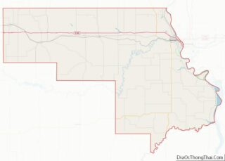
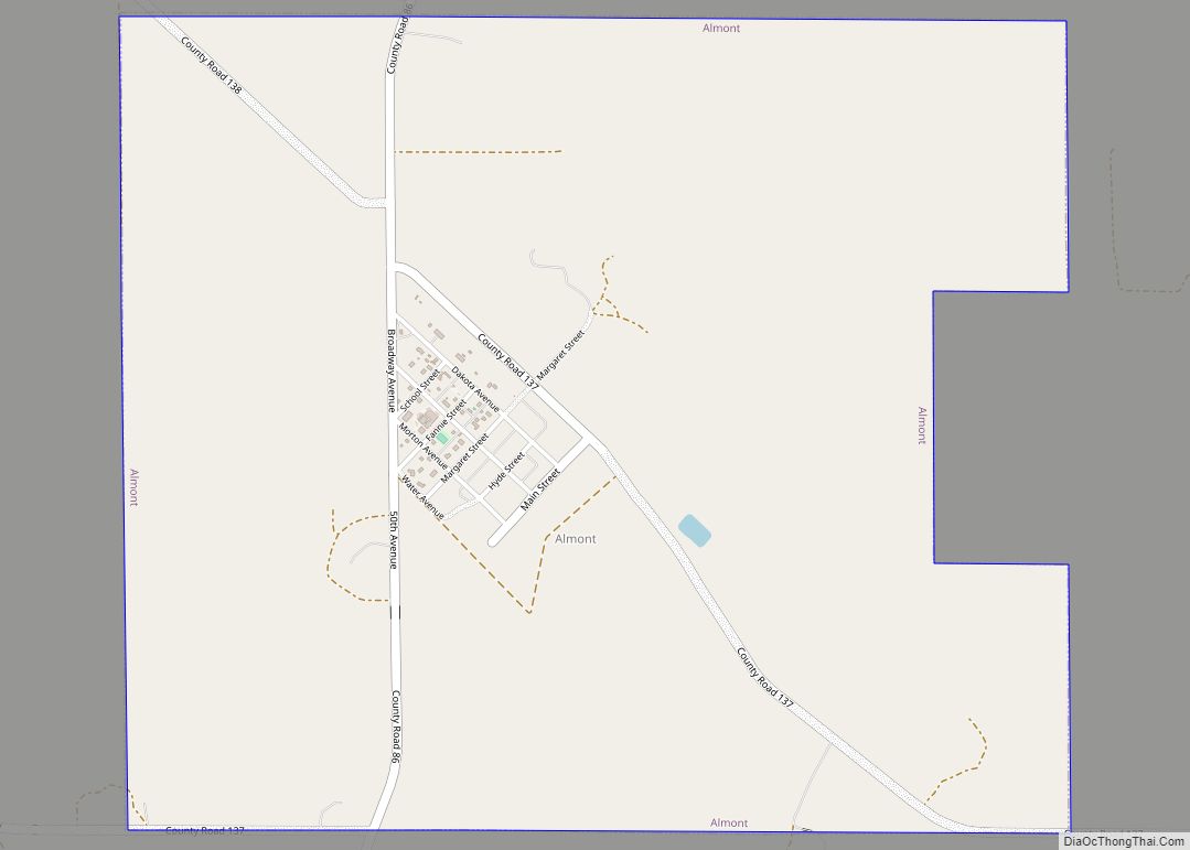
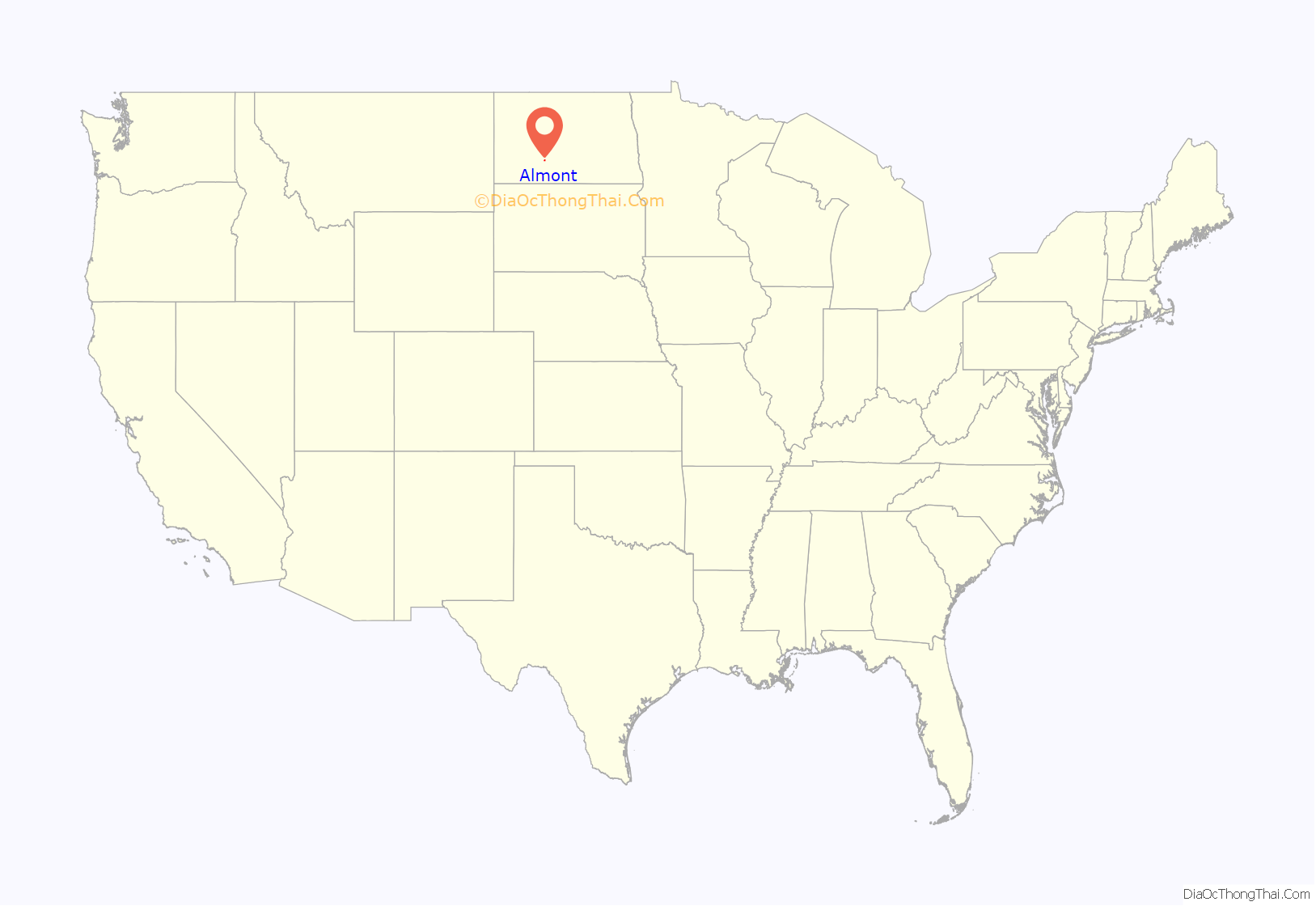
Almont location map. Where is Almont city?

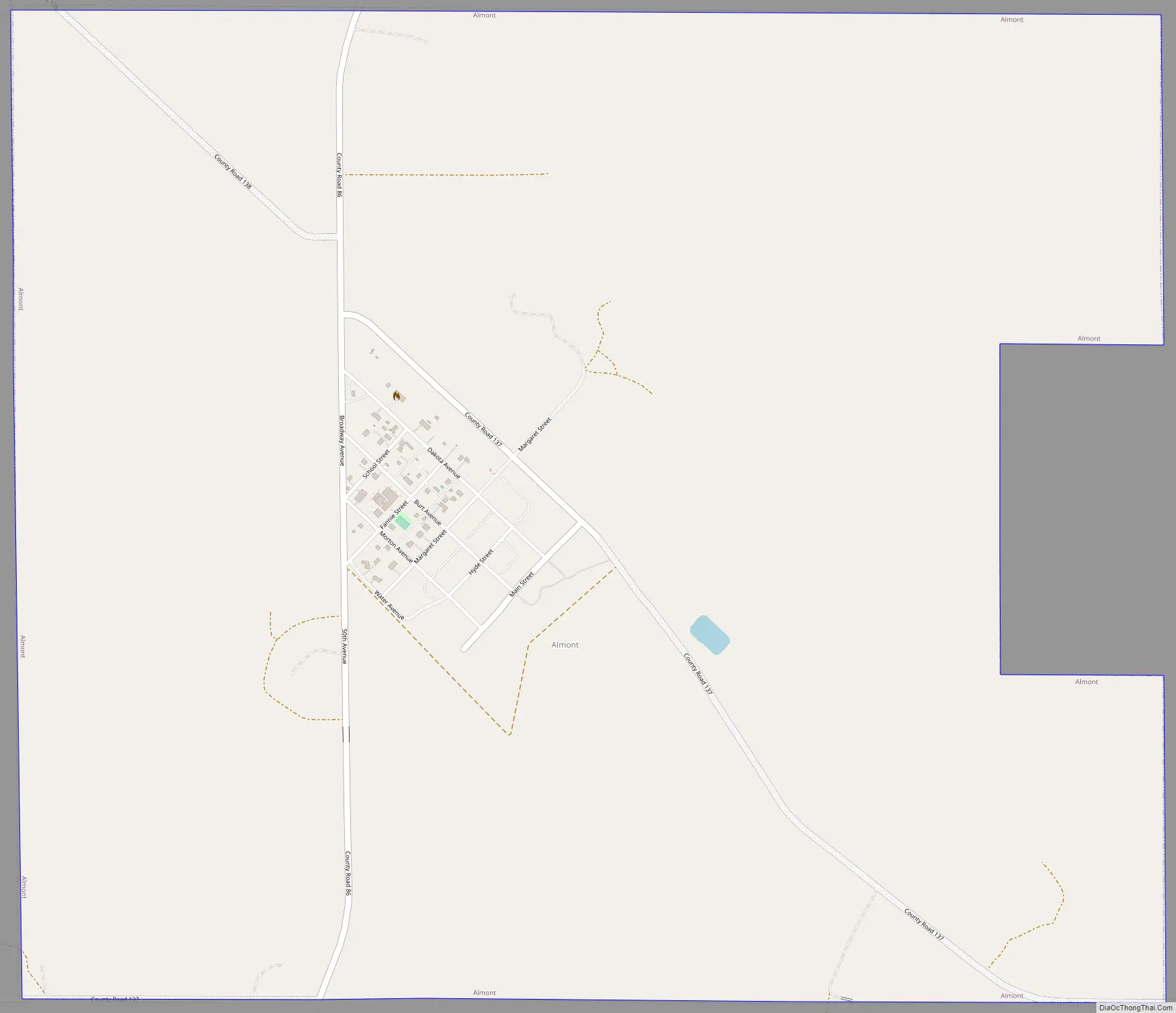
Almont Road Map
Almont city Satellite Map

Geography
Almont is on County Road 86, about 10 miles (16 km) south of Interstate 94.
According to the United States Census Bureau, the city has an area of 2.64 square miles (6.84 km), all land.
See also
Map of North Dakota State and its subdivision:- Adams
- Barnes
- Benson
- Billings
- Bottineau
- Bowman
- Burke
- Burleigh
- Cass
- Cavalier
- Dickey
- Divide
- Dunn
- Eddy
- Emmons
- Foster
- Golden Valley
- Grand Forks
- Grant
- Griggs
- Hettinger
- Kidder
- Lamoure
- Logan
- McHenry
- McIntosh
- McKenzie
- McLean
- Mercer
- Morton
- Mountrail
- Nelson
- Oliver
- Pembina
- Pierce
- Ramsey
- Ransom
- Renville
- Richland
- Rolette
- Sargent
- Sheridan
- Sioux
- Slope
- Stark
- Steele
- Stutsman
- Towner
- Traill
- Walsh
- Ward
- Wells
- Williams
- Alabama
- Alaska
- Arizona
- Arkansas
- California
- Colorado
- Connecticut
- Delaware
- District of Columbia
- Florida
- Georgia
- Hawaii
- Idaho
- Illinois
- Indiana
- Iowa
- Kansas
- Kentucky
- Louisiana
- Maine
- Maryland
- Massachusetts
- Michigan
- Minnesota
- Mississippi
- Missouri
- Montana
- Nebraska
- Nevada
- New Hampshire
- New Jersey
- New Mexico
- New York
- North Carolina
- North Dakota
- Ohio
- Oklahoma
- Oregon
- Pennsylvania
- Rhode Island
- South Carolina
- South Dakota
- Tennessee
- Texas
- Utah
- Vermont
- Virginia
- Washington
- West Virginia
- Wisconsin
- Wyoming