Fargo (/ˈfɑrɡoʊ/) is a city in and the county seat of Cass County, North Dakota, United States. According to the 2020 census, its population was 125,990, making it the most populous city in the state and the 219th-most populous city in the United States. Fargo, along with its twin city of Moorhead, Minnesota, and the adjacent cities of West Fargo, North Dakota and Dilworth, Minnesota, form the core of the Fargo, ND – Moorhead, MN Metropolitan Statistical Area (MSA). The MSA had a population of 248,591 in 2020.
Fargo was founded in 1871 on the Red River of the North floodplain. It is a cultural, retail, health care, educational, and industrial center for southeastern North Dakota and northwestern Minnesota. North Dakota State University is located in the city.
| Name: | Fargo city |
|---|---|
| LSAD Code: | 25 |
| LSAD Description: | city (suffix) |
| State: | North Dakota |
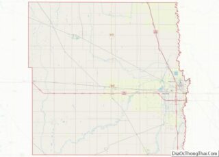
| County: | Cass County |
| Founded: | 1871 |
| Elevation: | 906 ft (276 m) |
| Population Density: | 2,481.68/sq mi (958.19/km²) |
| Area code: | 701 |
| FIPS code: | 3825700 |
| GNISfeature ID: | 1036030 |
| Website: | fargond.gov |
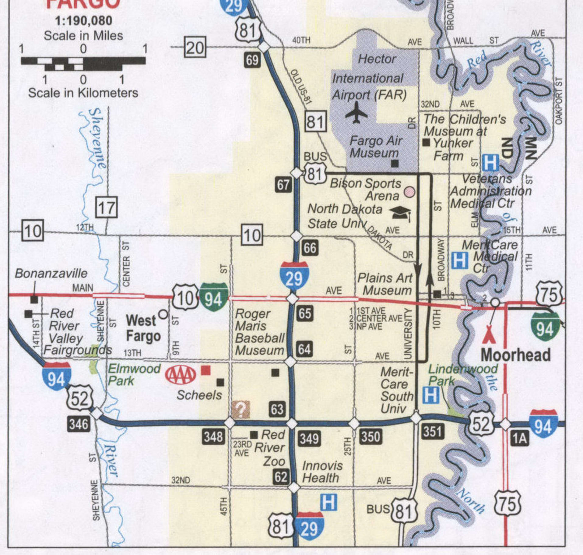
Our Fargo map collection displays highways/roads, points of reference, and a list of top things to do when traveling there. The city has become popular not only in the movie “Fargo” but also in the TV show. Fargo is the largest city in North Dakota with a population of about 125,000 people. It is a major transportation and agriculture hub in the northern United States. The city is located along the Red River and is just west of the Minnesota state boundary. Let’s tour the city with our interactive map to see where you want to go and discover the top things to do in Fargo.
Online Interactive Map
Click on ![]() to view map in "full screen" mode.
to view map in "full screen" mode.
Get to know the city through the lens of this interactive map. Use the zoom feature and explore Fargo North Dakota in more detail than ever before. Locate the most popular attractions, hotels, and restaurants in town. This map is made for you to explore Fargo, North Dakota. You will have all the necessary information to know what to do, where to go, where to eat, and where to stay.
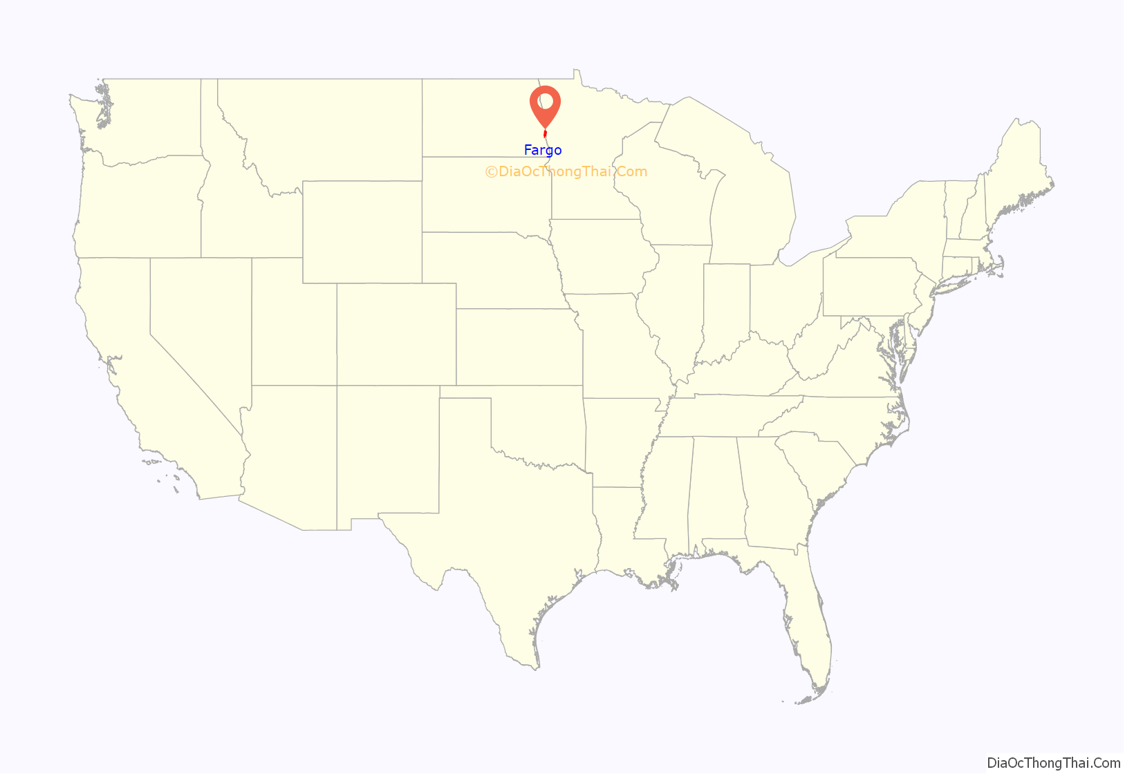
Fargo location map. Where is Fargo city?
History
Early history
Historically part of Sioux (Dakota) territory, the area that is present-day Fargo was an early stopping point for steamboats traversing the Red River during the 1870s and 1880s. The city was originally named “Centralia,” but was later renamed “Fargo” after Northern Pacific Railway director and Wells Fargo Express Company founder William Fargo (1818–1881). The area started to flourish after the arrival of the Northern Pacific Railroad and the city became known as the “Gateway to the West.”
During the 1880s, Fargo became the “divorce capital” of the Midwest because of lenient divorce laws.
A major fire struck the city on June 7, 1893, destroying 31 blocks of downtown Fargo, but the city was immediately rebuilt with new buildings made of brick, new streets, and a water system. More than 246 new buildings were built within one year. There were several rumors concerning the cause of the fire.
The North Dakota Agricultural College was founded in 1890 as North Dakota‘s land-grant university, becoming first accredited by the North Central Association in 1915. In 1960, NDAC became known as North Dakota State University.
20th century
Early in the century, the automobile industry flourished, and in 1905, Fargo became home to the Pence Automobile Company.
On Labor Day in 1910, Theodore Roosevelt visited Fargo to lay the cornerstone of the college’s new library. To a crowd of 30,000, Roosevelt spoke about his first visit to Fargo 27 years earlier, and credited his experience homesteading in North Dakota for his eventual rise to the presidency.
Fargo-Moorhead boomed after World War II, and the city grew rapidly despite a violent F5 tornado in 1957 that destroyed a large part of the north end of the city. Ted Fujita, famous for his Fujita tornado scale, analyzed pictures of the Fargo tornado, helping him develop his ideas for “wall cloud” and “tail cloud.” These were the first major scientific descriptive terms associated with tornadoes. The construction of two interstates (I-29 and I-94) revolutionized travel in the region and pushed growth of Fargo to the south and west of the city limits. In 1972, the West Acres Shopping Center, the largest shopping mall in North Dakota, was constructed near the intersection of the two Interstates. This mall became a catalyst for retail growth in the area.
Recent history
Fargo has continued to expand rapidly but steadily. Since the mid-1980s, the bulk of new residential growth has occurred in the south and southwest areas of the city due to geographic constraints on the north side. The city’s major retail districts on the southwest side have likewise seen rapid development.
Downtown Fargo has been gentrified due in part to investments by the city and private developers in the Renaissance Zone. Most older neighborhoods, such as Horace Mann, have either avoided decline or been revitalized through housing rehabilitation promoted by planning agencies to strengthen the city’s core.
NDSU has grown rapidly into a major research university and forms a major component of the city’s identity and economy. Most students live off-campus in the surrounding Roosevelt neighborhood. The university has established a presence downtown through both academic buildings and apartment housing. In addition, NDSU Bison Football has gained a significant following among many area residents.
Since the late 1990s, the Fargo-Moorhead Metropolitan Statistical Area has consistently had one of the lowest unemployment rates among MSAs in the United States. Coupled with Fargo’s low crime rate and the decent supply of affordable housing in the community, this has prompted Money magazine to rank the city near the top of its annual list of America’s most livable cities throughout the late 1990s and early 2000s.
Recently Fargo has been ranked by ZipRecruiter as the “#1 Hottest Job Market”. Zippia ranked Fargo as the “#1 city to start a career.” Today ranked Fargo as the “#3 best place to raise kids.”
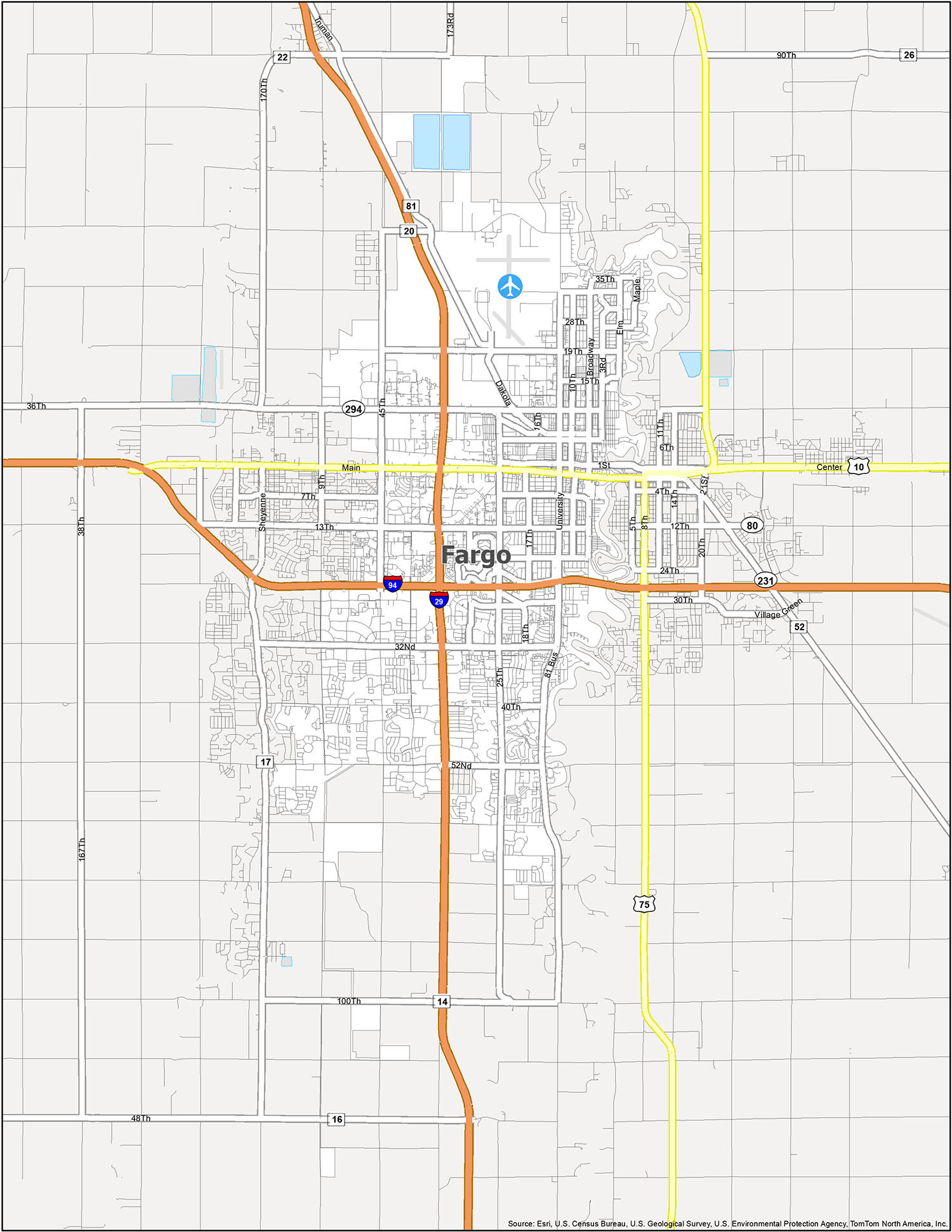
Fargo Road Map
If you are new to this city, this map is a must-have. Get your bearings with this detailed map of Fargo North Dakota — without having to worry about getting lost. Learn about our major interstate highways like I-29 and I-94. This Fargo North Dakota map shows you the transportation network in one easy-to-view map. But if you’re going outside the city, take a look at this North Dakota road map for more highway and street information.
Interstate Highways: I-29, I-94
US Highways: 10, 16, 20, 24, 81, 294
Major Roads: 1st Ave, 3rd St, 5th Ave, 5th St, 6th Ave, 7th Ave, 8th Ave, 9th St, 10th St, 12th Ave, 13 1/2 St, 13th Ave, 15th Ave, 16, 17th Ave, 18th St, 19th Ave, 20th Ave, 24th Ave, 25th Ave, 25th St, 26th Ave, 28th Ave, 29th Ave, 32nd Ave, 32nd St, 35th Ave, 40th Ave, 45th St, 52nd Ave, 100th Ave, Broadway St, Dakota Dr, Elm St, Gateway Cir, Great Northern Dr, Joe Parmer Dr, Main Ave, Maple St, Meadowlark Ln, Prairiewood Dr, University Dr, Westrac Dr
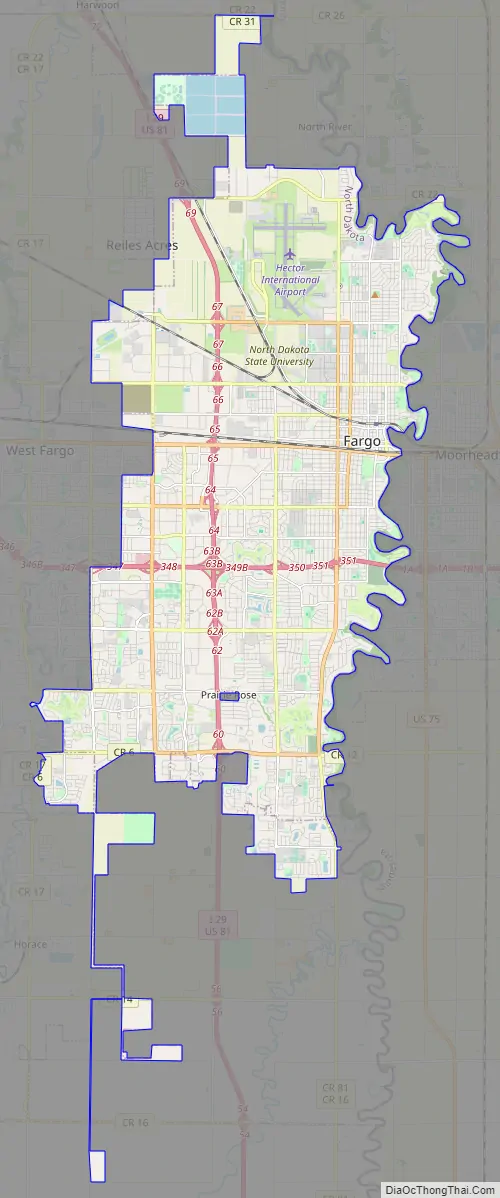
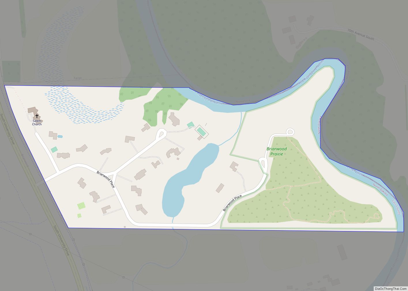
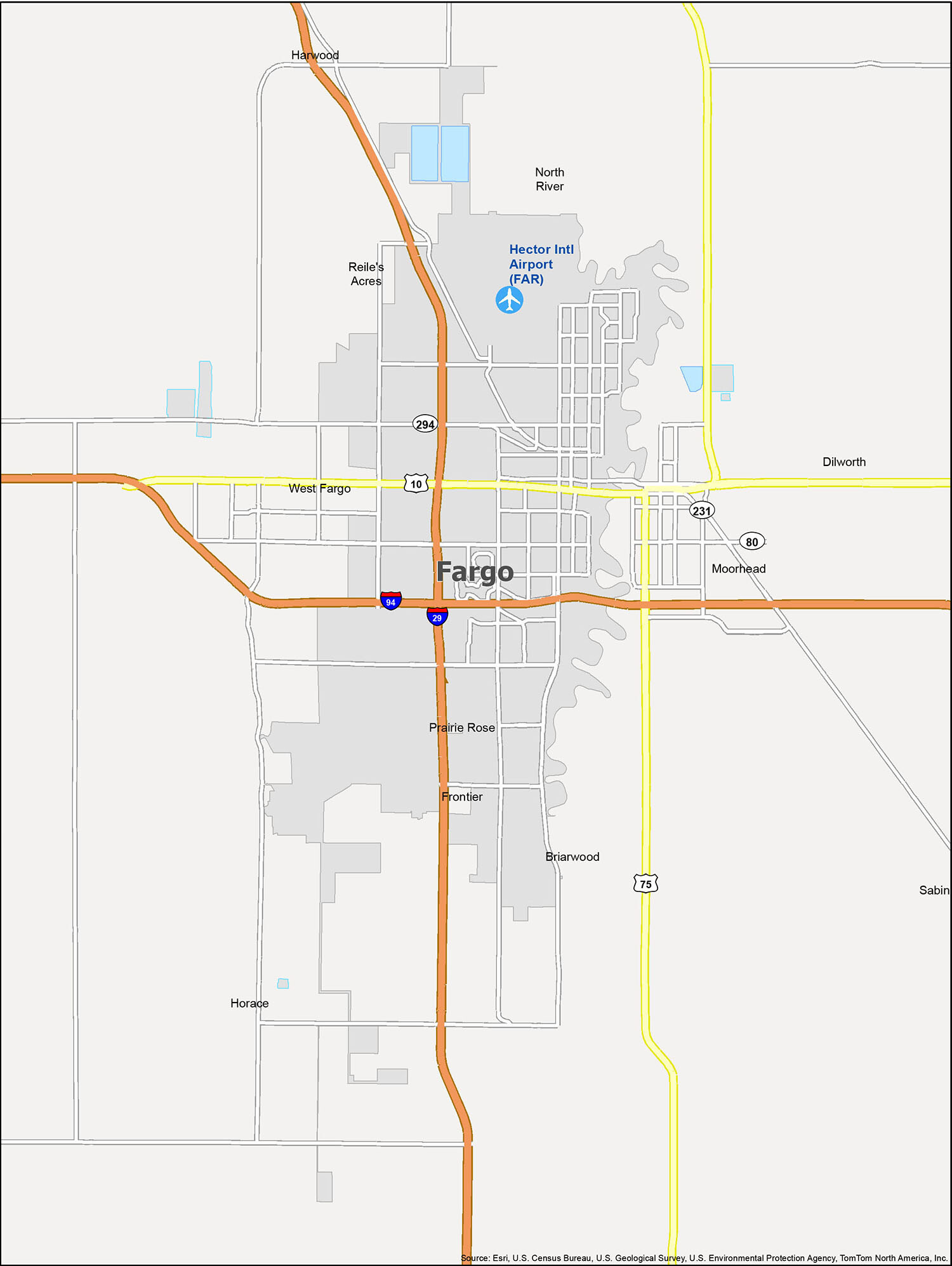
Fargo, North Dakota is a vibrant city with a lot to offer. Whether you’re planning a trip or just want to explore, this map will help you stay on top of things. The map shows the boundaries of the city in relation to other cities, towns, and villages, as well as the location of the Hector International Airport (FAR). It also highlights the cities of Briarwood, Dilworth, Fargo, Frontier, Harwood, Horace, Moorhead, North River, Prairie Rose, Reile’s Acres, Sabin, and West Fargo, as well as the Red River. With this map, you can easily find your way around the Fargo area.
10 things to do in Fargo city
Fargo is a great city to explore and discover, and with the help of this map, you can be sure to find the best places to visit. From the Bonanzaville USA to the Red River Zoo, these are the top 10 attractions you must visit when you travel to Fargo, North Dakota.
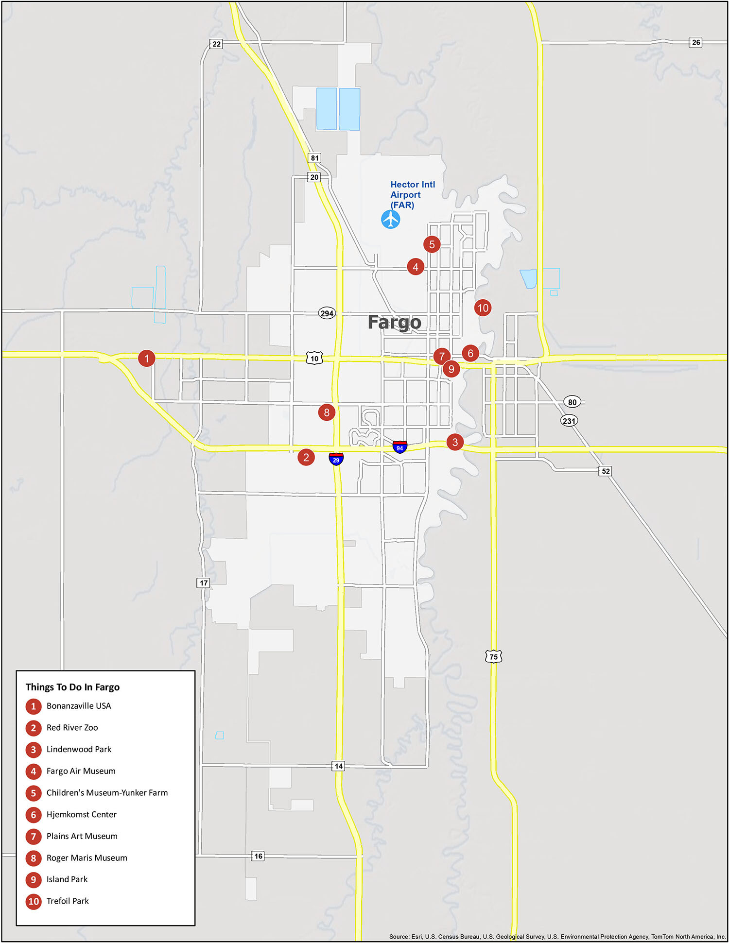
For those looking for a list of things to do in Fargo, North Dakota, look no further! This map provides a comprehensive list of the city’s most popular places to visit. Whether you’re interested in exploring the Bonanzaville USA, the Red River Zoo, Lindenwood Park, or the Fargo Air Museum, this map has it all. Other attractions include the Children’s Museum-Yunker Farm, Hjemkomst Center, Plains Art Museum, Roger Maris Museum, Island Park, and Trefoil Park. So, if you’re planning a trip to Fargo, North Dakota, make sure to check out this map for the best attractions and activities the city has to offer!
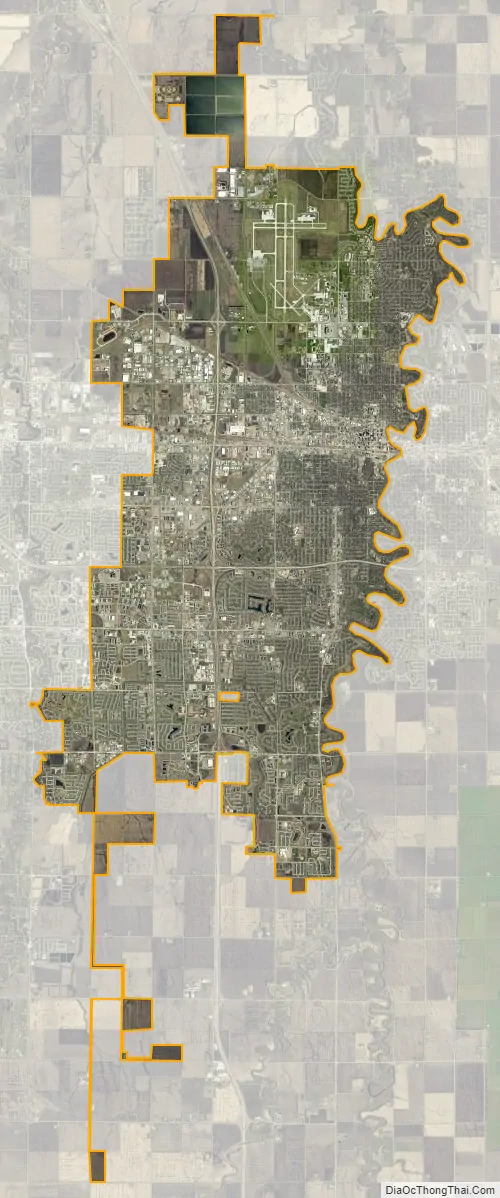
Fargo city Satellite Map
Geography
Fargo is a core city of the Fargo-Moorhead metropolitan area, which also includes Moorhead, West Fargo, and Dilworth and outlying communities.
Fargo sits on the western bank of the Red River of the North in a flat geographic region known as the Red River Valley. The Red River Valley resulted from the withdrawal of glacial Lake Agassiz, which drained away about 9,300 years ago. The lake sediments deposited from Lake Agassiz made the land around Fargo some of the richest in the world for agricultural uses.
Seasonal floods due to the rising water of the Red River, which flows from the United States into Lake Winnipeg in Manitoba, Canada, have presented challenges. The Red flows northward, which means melting snow and river ice, as well as runoff from its tributaries, often create ice dams causing the river to overflow. Fargo’s surrounding Red River Valley terrain is essentially flat, leading to overland flooding. Since the potentially devastating 2009 Red River flood, both Fargo and Moorhead have taken great strides in flood protection; only a near-record flood would cause concern today. Work on the FM Diversion has begun and upon completion, it will permanently floodproof the metro for 500-year floods.
Its location makes the city vulnerable to flooding during seasons with above-average precipitation. The Red River’s minor flood stage in Fargo begins at a level of 18 feet, with major flooding categorized at 30 feet and above. Many major downtown roadways and access to Moorhead are closed off at this level. Record snowfalls late in 1996 led to flooding in 1997, causing the Red to rise to a record crest of 39.5 feet, nearly overtaking city defenses. In 2008–2009, significant fall precipitation coupled with rapid snowmelt in March 2009 caused the Red to rise to a new record level of 40.84 feet, but again Fargo remained safe, in large part due to flood mitigation efforts instituted after the 1997 event and sandbagging efforts by the city residents. Further upgrades were made to city infrastructure and additional resources brought to bear following the 2009 flood, which caused no issues for the city in 2010 despite another rapid melt that caused the Red to rise to 37 feet (which ranks among the top-ten highest levels ever recorded). The estimated $1.5 billion FM diversion project is under construction and will channel the Red’s water away from the city. As of 2012, Fargo has bought 700 houses in flood-prone areas.
According to the United States Census Bureau, the city has an area of 48.82 square miles (126.44 km), all land.
Climate
Because of its location in the Great Plains and its distance from both mountains and oceans, Fargo has an extreme humid continental climate (Köppen Dfb), featuring long, bitterly cold winters and warm to hot, humid summers. It lies in USDA Plant hardiness zone 4a. The city features winters among the coldest in the contiguous United States; the coldest month of January has a normal mean temperature of 9.2 °F (−12.7 °C). There is an annual average of 43 days with a minimum of 0 °F (−18 °C) or lower. Snowfall averages 51.4 inches (131 cm) per season. Spring and autumn are short and highly variable seasons. Summers have frequent thunderstorms, and the warmest month, July, has a normal mean temperature of 70.7 °F (21.5 °C); highs reach 90 °F (32 °C) on an average of 12.7 days each year. Annual precipitation of 24.0 inches (610 mm) is concentrated in the warmer months. Record temperatures have ranged from −48 °F (−44 °C) on January 8, 1887, to 114 °F (46 °C) on July 6, 1936; the record coldest daily maximum is −29 °F (−34 °C) on January 22, 1936, while, conversely, the record warmest daily minimum was 82 °F (28 °C), set four days after the all-time record high. On average, the first and last dates to see a minimum at or below the freezing mark are September 30 and May 8, respectively, allowing a growing season of 144 days.
In 2011, Fargo won The Weather Channel’s “America’s Toughest Weather City” poll. After almost 850,000 votes, blizzards, cold, and floods secured the title for the city.
See also
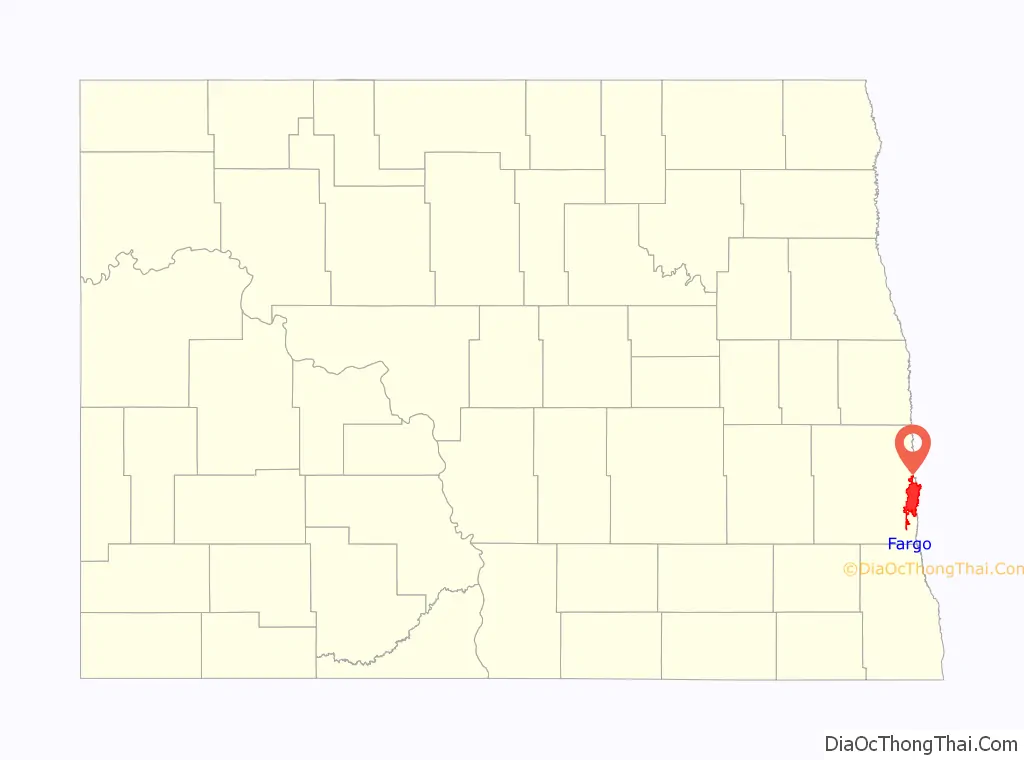
Map of North Dakota State and its subdivision:- Adams
- Barnes
- Benson
- Billings
- Bottineau
- Bowman
- Burke
- Burleigh
- Cass
- Cavalier
- Dickey
- Divide
- Dunn
- Eddy
- Emmons
- Foster
- Golden Valley
- Grand Forks
- Grant
- Griggs
- Hettinger
- Kidder
- Lamoure
- Logan
- McHenry
- McIntosh
- McKenzie
- McLean
- Mercer
- Morton
- Mountrail
- Nelson
- Oliver
- Pembina
- Pierce
- Ramsey
- Ransom
- Renville
- Richland
- Rolette
- Sargent
- Sheridan
- Sioux
- Slope
- Stark
- Steele
- Stutsman
- Towner
- Traill
- Walsh
- Ward
- Wells
- Williams
- Alabama
- Alaska
- Arizona
- Arkansas
- California
- Colorado
- Connecticut
- Delaware
- District of Columbia
- Florida
- Georgia
- Hawaii
- Idaho
- Illinois
- Indiana
- Iowa
- Kansas
- Kentucky
- Louisiana
- Maine
- Maryland
- Massachusetts
- Michigan
- Minnesota
- Mississippi
- Missouri
- Montana
- Nebraska
- Nevada
- New Hampshire
- New Jersey
- New Mexico
- New York
- North Carolina
- North Dakota
- Ohio
- Oklahoma
- Oregon
- Pennsylvania
- Rhode Island
- South Carolina
- South Dakota
- Tennessee
- Texas
- Utah
- Vermont
- Virginia
- Washington
- West Virginia
- Wisconsin
- Wyoming