Amenia (/əˈmiːniə/ ə-MEE-nee-ə) is a city in Cass County, North Dakota, United States. The population was 85 at the 2020 census. Amenia was founded in 1880.
The town is the site of several transmitter towers of Fargo broadcast television and radio stations.
Amenia was the home of North Dakota governor William L. Guy before and after holding office.
| Name: | Amenia city |
|---|---|
| LSAD Code: | 25 |
| LSAD Description: | city (suffix) |
| State: | North Dakota |
| County: | Cass County |
| Founded: | 1880 |
| Elevation: | 951 ft (290 m) |
| Total Area: | 1.49 sq mi (3.86 km²) |
| Land Area: | 1.49 sq mi (3.86 km²) |
| Water Area: | 0.00 sq mi (0.00 km²) |
| Total Population: | 85 |
| Population Density: | 57.09/sq mi (22.04/km²) |
| ZIP code: | 58004 |
| Area code: | 701 |
| FIPS code: | 3801940 |
| GNISfeature ID: | 1027695 |
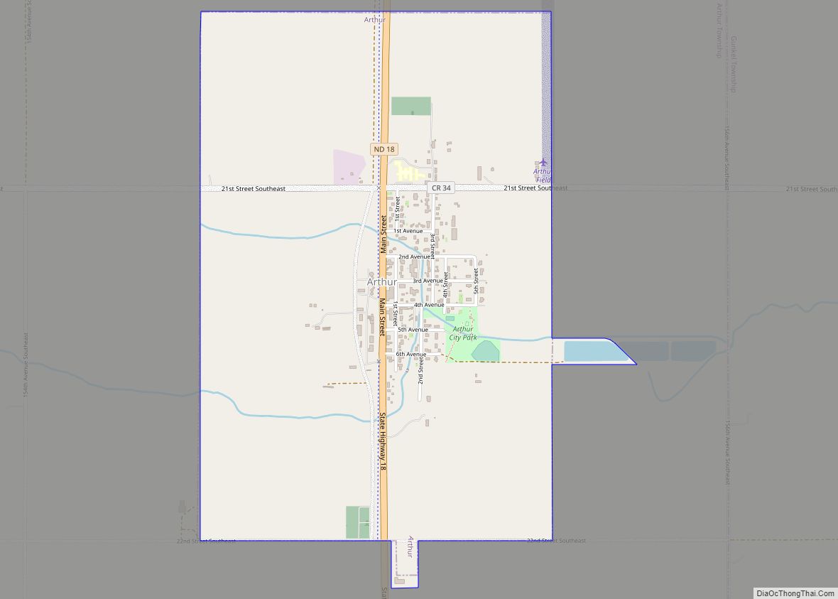
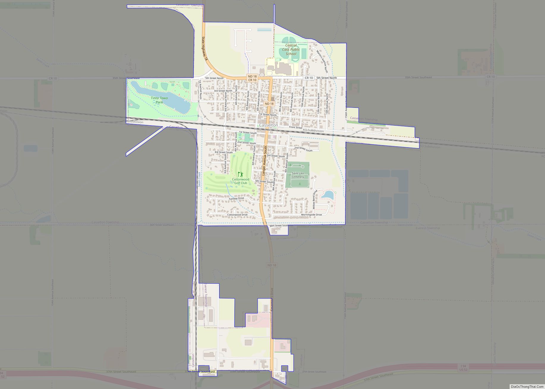
Online Interactive Map
Click on ![]() to view map in "full screen" mode.
to view map in "full screen" mode.
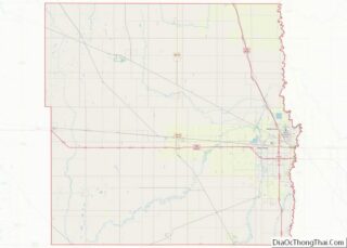
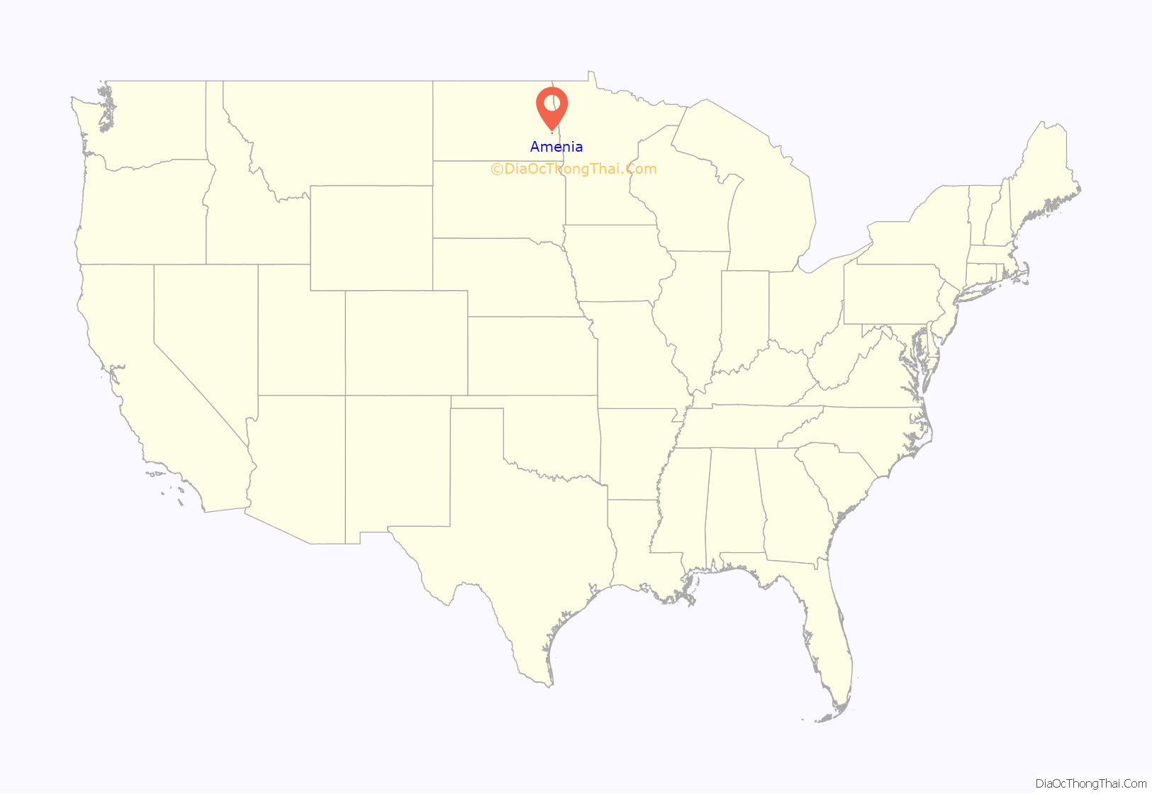
Amenia location map. Where is Amenia city?

History
The town of Amenia traces its roots to a group of wealthy New England investors from the villages of Amenia, New York and Sharon, Connecticut which formed the Amenia and Sharon Land Company and, in July 1875, under the representation of Eben W. Chaffee, purchased 27,832 acres (11,263 ha) of land from the then bankrupt Northern Pacific Railroad. The stockholders’ plan had been to develop the land enough to sell it to settlers, thus quickly realizing a return on the investors shares. However, taking notice of the success of the Cass-Cheney-Dalrymple bonanza farm near Casselton, North Dakota, and the exceptional fertility of the soil, Chaffee convinced the stockholders to hold the land and break the prairie sod for the production of wheat. The company built a depot and, in 1881, a grain elevator in order to move their product to market. Around them grew the village of Amenia. By the mid-1880s, the town had grown enough to require school services and to build a Congregational church. Chaffee was among its earliest residents and continued to be a central figure in the development of the town.
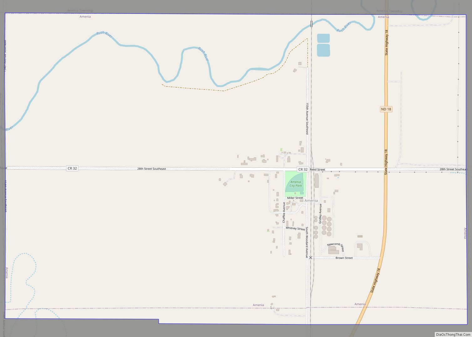
Amenia Road Map

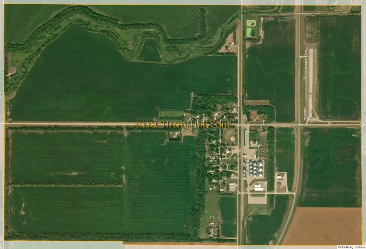
Amenia city Satellite Map
Geography
According to the United States Census Bureau, the city has a total area of 1.43 square miles (3.70 km), all land.
Climate
This climatic region is typified by large seasonal temperature differences, with warm to hot (and often humid) summers and cold (sometimes severely cold) winters. According to the Köppen Climate Classification system, Amenia has a humid continental climate, abbreviated “Dfb” on climate maps.
See also
Map of North Dakota State and its subdivision:- Adams
- Barnes
- Benson
- Billings
- Bottineau
- Bowman
- Burke
- Burleigh
- Cass
- Cavalier
- Dickey
- Divide
- Dunn
- Eddy
- Emmons
- Foster
- Golden Valley
- Grand Forks
- Grant
- Griggs
- Hettinger
- Kidder
- Lamoure
- Logan
- McHenry
- McIntosh
- McKenzie
- McLean
- Mercer
- Morton
- Mountrail
- Nelson
- Oliver
- Pembina
- Pierce
- Ramsey
- Ransom
- Renville
- Richland
- Rolette
- Sargent
- Sheridan
- Sioux
- Slope
- Stark
- Steele
- Stutsman
- Towner
- Traill
- Walsh
- Ward
- Wells
- Williams
- Alabama
- Alaska
- Arizona
- Arkansas
- California
- Colorado
- Connecticut
- Delaware
- District of Columbia
- Florida
- Georgia
- Hawaii
- Idaho
- Illinois
- Indiana
- Iowa
- Kansas
- Kentucky
- Louisiana
- Maine
- Maryland
- Massachusetts
- Michigan
- Minnesota
- Mississippi
- Missouri
- Montana
- Nebraska
- Nevada
- New Hampshire
- New Jersey
- New Mexico
- New York
- North Carolina
- North Dakota
- Ohio
- Oklahoma
- Oregon
- Pennsylvania
- Rhode Island
- South Carolina
- South Dakota
- Tennessee
- Texas
- Utah
- Vermont
- Virginia
- Washington
- West Virginia
- Wisconsin
- Wyoming