Grand Forks is the third largest city in the state of North Dakota (after Fargo and Bismarck) and the county seat of Grand Forks County. According to the 2020 census, the city’s population was 59,166. Grand Forks, along with its twin city of East Grand Forks, Minnesota, forms the center of the Grand Forks, ND-MN Metropolitan Statistical Area, which is often called Greater Grand Forks or the Grand Cities.
Located on the western banks of the north-flowing Red River of the North, in a flat region known as the Red River Valley, the city is prone to flooding. The Red River Flood of 1997 devastated the city. Originally called Les Grandes Fourches by French fur traders from Canada, who had long worked and lived in the region, steamboat captain Alexander Griggs platted a community after being forced to winter there. The post office was established in 1870, and the town was incorporated on February 22, 1881. The city was named for its location at the fork of the Red River and the Red Lake River.
Initially dependent on local agriculture, the city’s economy has since broadened to include a wide variety of industries, including higher education, defense, health care, manufacturing, food processing, and scientific research. Grand Forks is served by Grand Forks International Airport and Grand Forks Air Force Base. The city’s University of North Dakota is the oldest institution of higher education in the state. The Alerus Center and Ralph Engelstad Arena host athletic and other events, while the Empire Arts Center and Chester Fritz Auditorium are the city’s largest cultural venues.
| Name: | Grand Forks city |
|---|---|
| LSAD Code: | 25 |
| LSAD Description: | city (suffix) |
| State: | North Dakota |
| County: | Grand Forks County |
| Founded: | June 15, 1870 |
| Incorporated: | February 22, 1881 |
| Elevation: | 843 ft (257 m) |
| Land Area: | 27.99 sq mi (72.49 km²) |
| Water Area: | 0.19 sq mi (0.49 km²) |
| Population Density: | 2,113.83/sq mi (816.16/km²) |
| ZIP code: | 58201–58203 |
| Area code: | 701 |
| FIPS code: | 3832060 |
| GNISfeature ID: | 1029197 |
| Website: | grandforksgov.com |
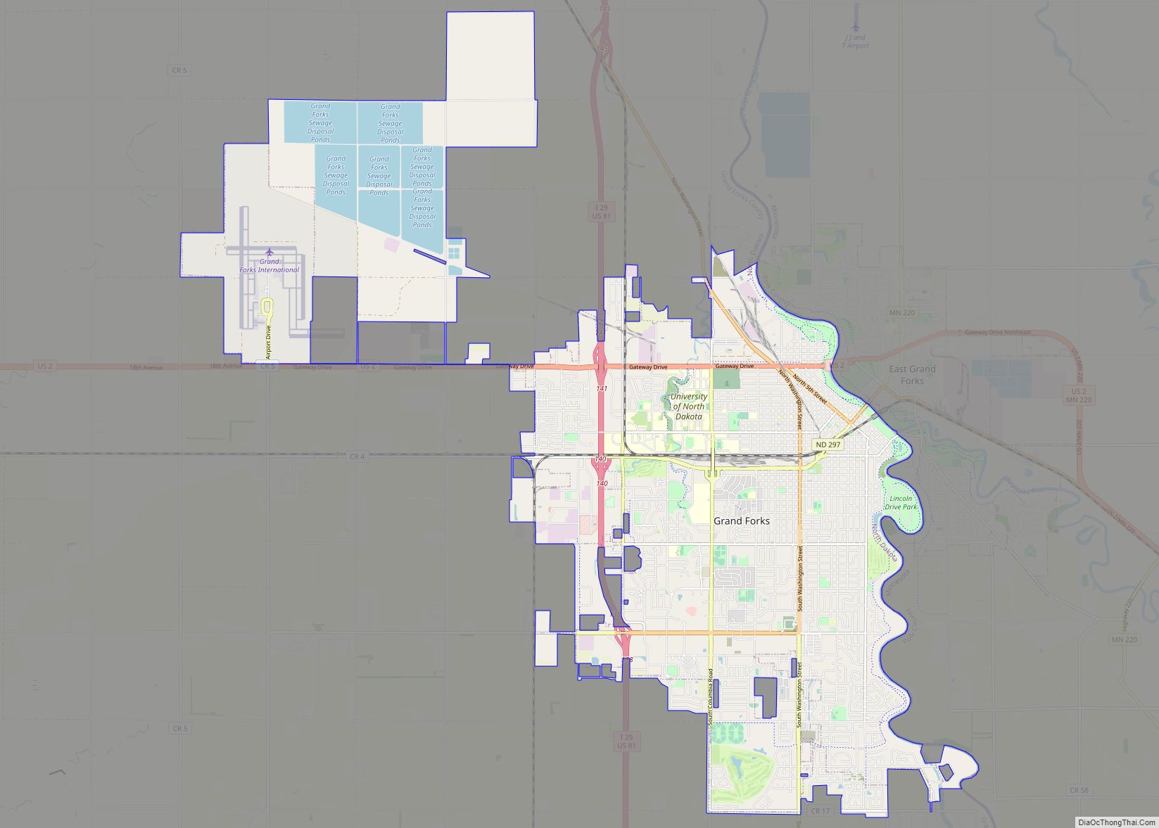
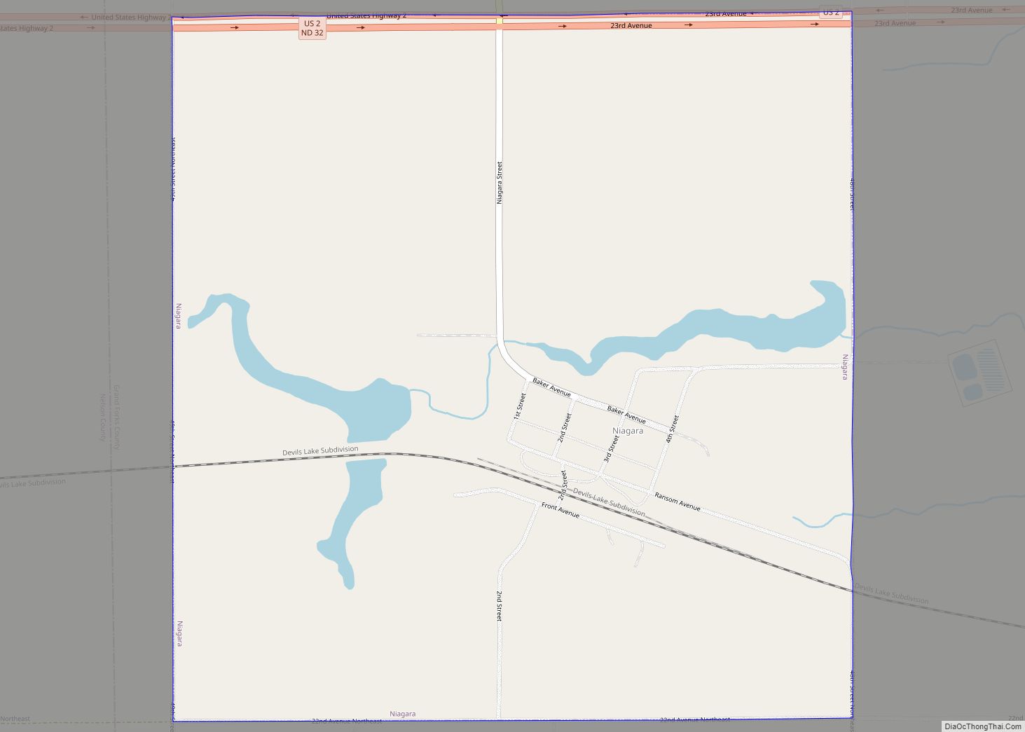
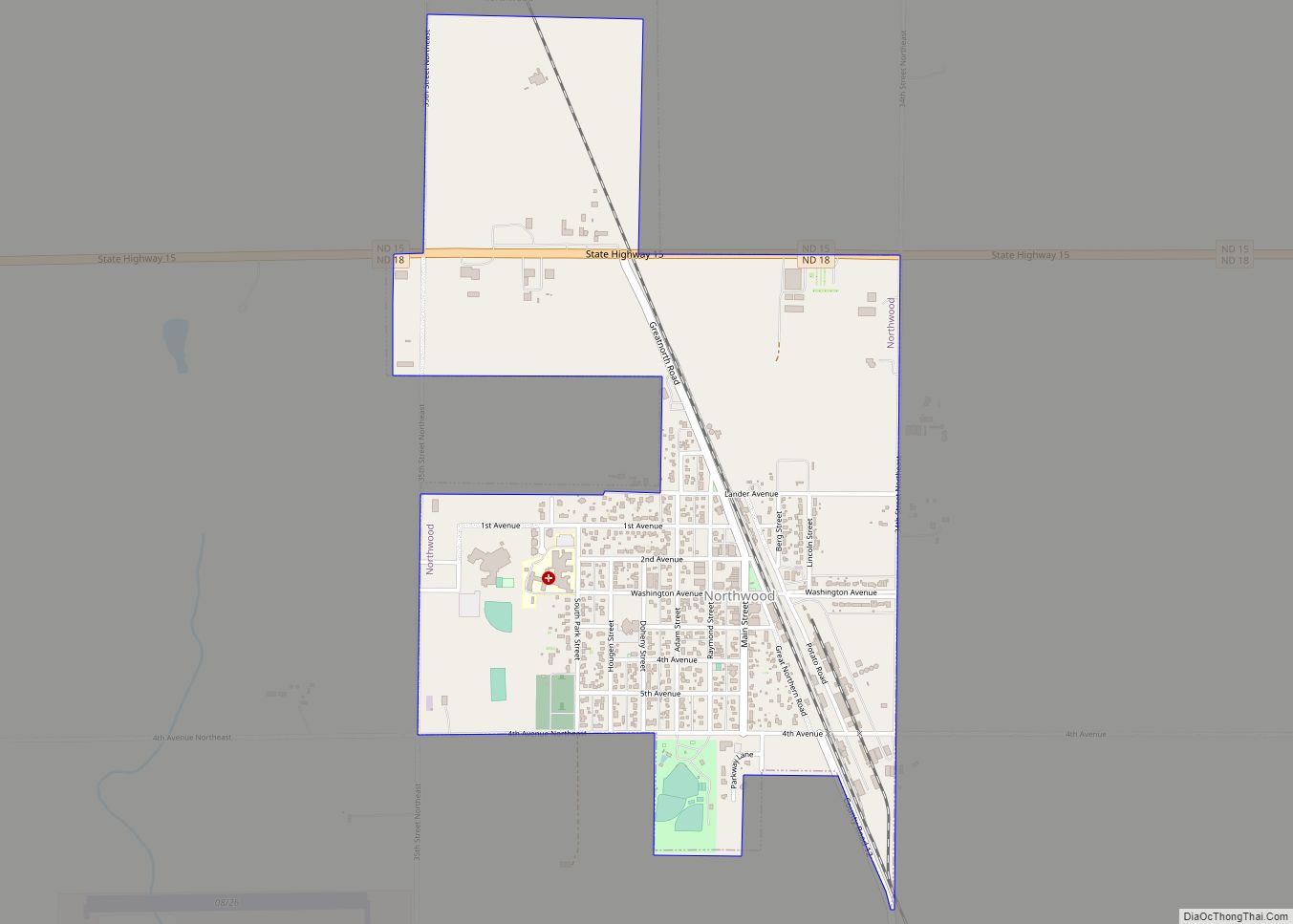
Online Interactive Map
Click on ![]() to view map in "full screen" mode.
to view map in "full screen" mode.
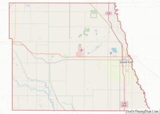
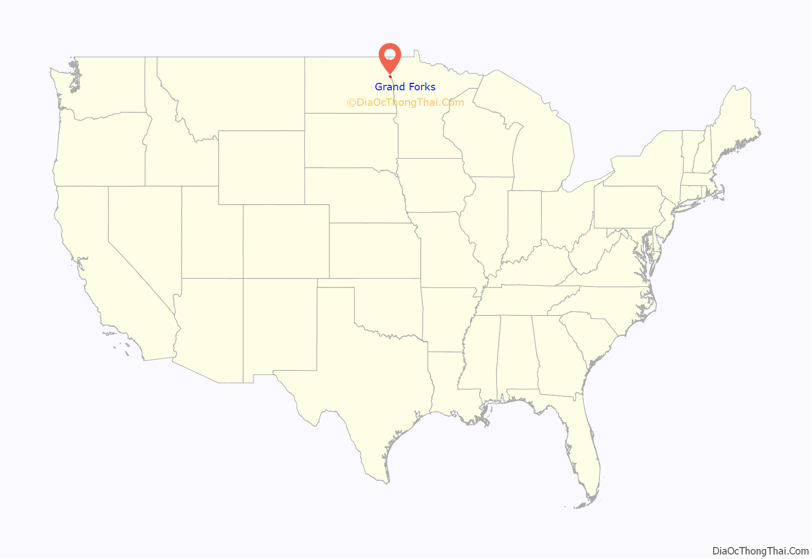
Grand Forks location map. Where is Grand Forks city?
History
Prior to settlement by Europeans, the area where the city developed, at the forks of the Red River and Red Lake River for thousands of years, had been an important meeting and trading point for Native Americans. Early French explorers, fur trappers, and traders called the area Les Grandes Fourches, meaning “The Grand Forks”. By the 1740s, French fur trappers relied on Les Grandes Fourches as an important trading post. This was French colonial territory.
The United States acquired the territory from British Rupert’s Land with the Treaty of 1818, but indigenous tribes dominated the area until the late 19th century. After years of warfare, the United States made treaties to extinguish the land claims of the Ojibwe and other Native American peoples. When a U.S. post office was established on the site on June 15, 1870, the name was changed to the English “Grand Forks”. Alexander Griggs, a steamboat captain, is regarded as “The Father of Grand Forks”. Griggs’ steamboat froze in the Red River on a voyage in late 1870, forcing the captain and his crew to spend the winter camping at Grand Forks. Griggs platted a community in 1875, and Grand Forks was officially incorporated on February 22, 1881.
Thousands of settlers were attracted to the Dakota Territory in the 1870s and 1880s for its cheap land, and the population began to rise. Many established small family farms, but some investors bought thousands of acres for bonanza farms, where they supervised the cultivation and harvesting of wheat as a commodity crop. The city grew quickly after the arrival of the Great Northern Railway in 1880 and the Northern Pacific Railway in 1887. In 1883, the University of North Dakota was established, six years before North Dakota was admitted as an independent state born from the Dakota Territory. During the first half of the 20th century, new residential neighborhoods were developed south and west of downtown Grand Forks. In the 1920s, the state-owned North Dakota Mill and Elevator was constructed on the city’s north side.
In 1954, Grand Forks was chosen as the site for an Air Force base. Grand Forks Air Force Base brought thousands of new jobs and residents to the community. The military base and the University of North Dakota became integral to the city’s economy. With construction of federal highways, during the postwar years residential and business development became suburbanized, spreading to new areas as land was available. Interstate 29 was built on the western side of the city, and two enclosed shopping malls—South Forks Plaza and Columbia Mall—were built on the south side.
The Red River had a history of seasonal flooding, aggravated by the broad ancient lake bed that formed the Red River Valley. The 1997 Red River flood caused extensive damage in the city. Fargo was upstream from the bulk of the flood waters that season, and Winnipeg had built an extensive system of flood control structures in the 1960s. In 1997, Grand Forks suffered the most damage of any major city in the Red River Valley. During the height of the flooding, a major fire destroyed 11 buildings in the downtown area. The government began developing a new levee system to protect the city, which was completed 10 years later. It required the relocation of numerous residents, as some neighborhoods were emptied for this construction.
The floodplain bordering the Red River was later converted into a large park known as the Greater Grand Forks Greenway. This provided new recreation space for city residents on both sides of the river, as well as space for future floodwaters to be absorbed naturally by trees and other plants, without damage to infrastructure.
New public and private developments have continued to expand Grand Forks’s footprint since the 1997 flood. Two new, large sports venues opened in 2001: the Alerus Center and the Ralph Engelstad Arena. Six years later, the Winnipeg-based Canad Inns hotel chain added a 13-story hotel and waterpark connected to the Alerus Center. Grand Forks also surpassed pre-flood level population, area employment, and taxable sales in 2007.
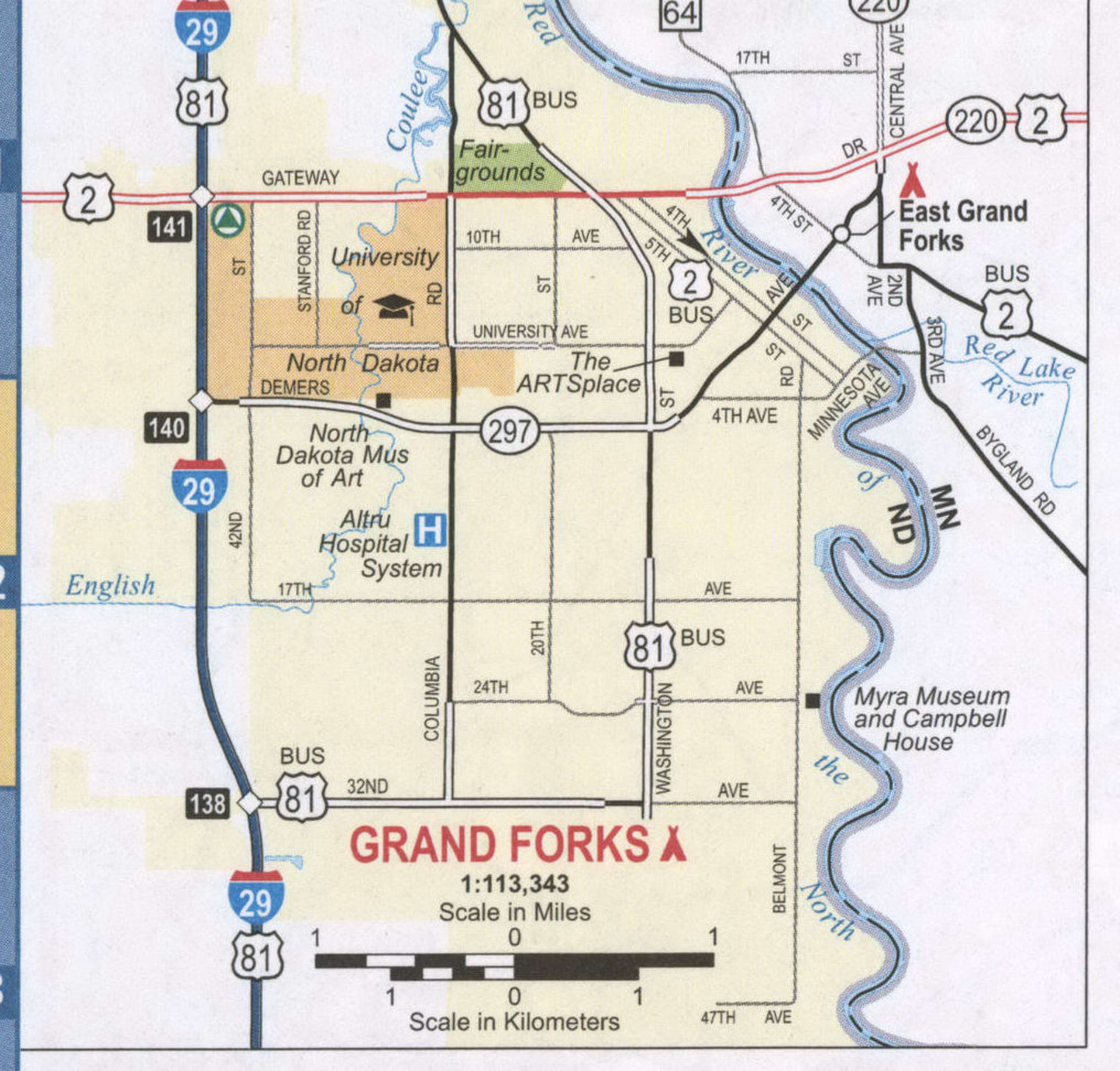
Grand Forks Road Map
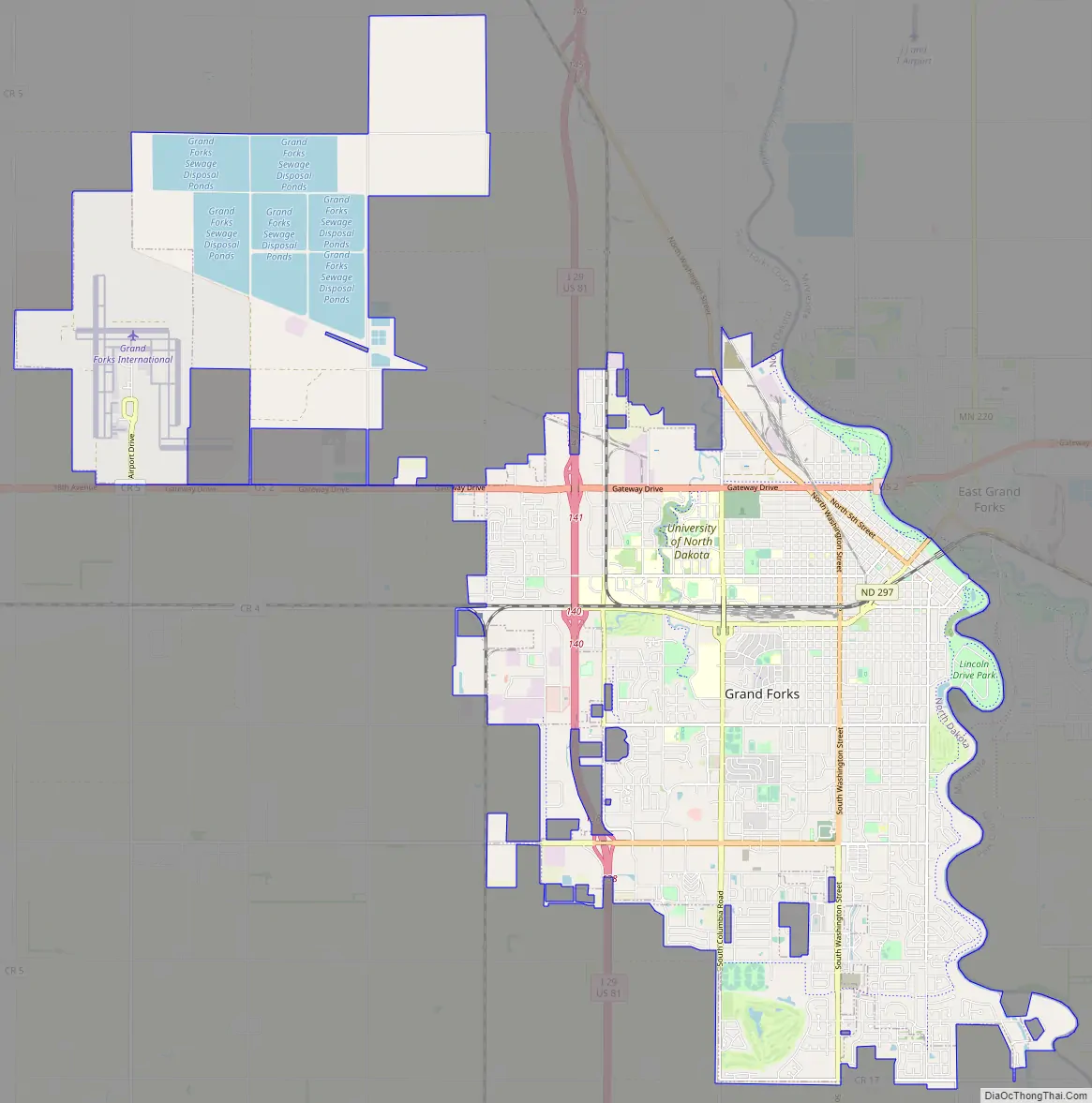
Grand Forks city Satellite Map

Geography
Grand Forks is 74 miles (119 km) north of the Fargo-Moorhead area and 145 miles (233 km) south of Winnipeg, Manitoba. Grand Forks is on the western bank of the Red River of the North in an area known as the Red River Valley. The term “forks” refers to the forking of the Red River with the Red Lake River near downtown Grand Forks. According to the U.S. Census Bureau, the city has a total area of 20.09 square miles (52.03 km), of which 19.91 square miles (51.57 km) is land and 0.18 square miles (0.47 km) is water. Since it is in one of the flattest parts of the world, the city has few differences in elevation. There are no lakes within the city limits of Grand Forks, but the meandering Red River and the English Coulee flow through the community and provide some break in the terrain.
The Red River Valley is the result of an ancient glacier carving its way south during the last ice age. Once the glacier receded, it formed a glacial lake called Lake Agassiz. The valley is formed from the ancient lake bed. The ancient beaches can still be seen as rolling hills west of the city.
Cityscape
Grand Forks has several distinct neighborhoods. The area adjacent to the Red River developed first; this is where some of the oldest neighborhoods, including the downtown area, can be found. The area between downtown and the University of North Dakota campus was another early growth area, and historic properties can be found here, as well.
Downtown Grand Forks contains many recognized historic buildings. It is the governmental center of the city and county. It is also used as a gathering place for large community events and festivals. A farmer’s market takes place every Saturday from mid-June to mid-September in the Town Square at the corner of 3rd Street S. and DeMers Avenue.
In 2006, city leaders and developers announced plans to convert older office buildings into high-end condos and apartments, and to construct new buildings for the same purpose to provide for residents downtown. Directly south of downtown, the streets of the Near Southside Historic District are lined with classic houses. Reeves Drive was once one of the city’s most fashionable neighborhoods. It has many historic mansions exhibiting several unique architectural styles. This neighborhood has areas of original granitoid paving, several historic churches, and Lincoln Drive Park. The Near Southside neighborhood has been designated as a “national historic district” and is listed on the National Register of Historic Places.
The newer neighborhoods of Grand Forks developed in the city’s southern and western parts. The 32nd Avenue South corridor has been the commercial center of the city since 1978, when the Columbia Mall opened. Many big box stores and restaurants are now along the avenue. A large strip mall, called the Grand Forks Marketplace, opened in 2001 near the Columbia Mall.
University Village is a new commercial district built on vacant lands owned by the University of North Dakota. The centerpiece of the Village is the Ralph Engelstad Arena, used by the university’s North Dakota men’s ice hockey team. All the buildings in the village have been built in a style similar style to those on the nearby UND campus. Restaurants and retail stores, as well as the university bookstore, were developed in the area to stimulate community life. In 2006, the university opened a new wellness center for its students on the village’s west side.
Climate
Due to its location in the Great Plains and its distance from both mountains and oceans, Grand Forks has a humid continental climate (Köppen: Dfb), USDA Plant Hardiness Zone 4a. It has four very distinct seasons and great variation in temperatures over very short periods of time. Its location in the flat Red River Valley makes the city susceptible to spring flooding from the Red River of the North, and year-round windy conditions.
As there are no nearby mountain ranges or bodies of water to ameliorate the climatic conditions, Grand Forks lies exposed to numerous weather systems, including bitterly cold Arctic high pressure systems. The city has long, cold, and snowy winters. Summers are often warm to hot and often quite humid with frequent thunderstorms. Although warm weather normally ends soon after Labor Day, a few warm days sometimes occur as late as October. Spring and autumn are short and highly variable seasons. Record temperature extremes range from −43 °F (−42 °C) on January 11, 1912, to 109 °F (43 °C) on July 12, 1936.
The daily mean temperatures of the Grand Forks winters are associated with subarctic climates with frequent subzero temperatures. Due to the extended warm period of daily means above 50 °F (10 °C) from May to September, the city’s climate is still classified within the humid continental temperature range.
See also
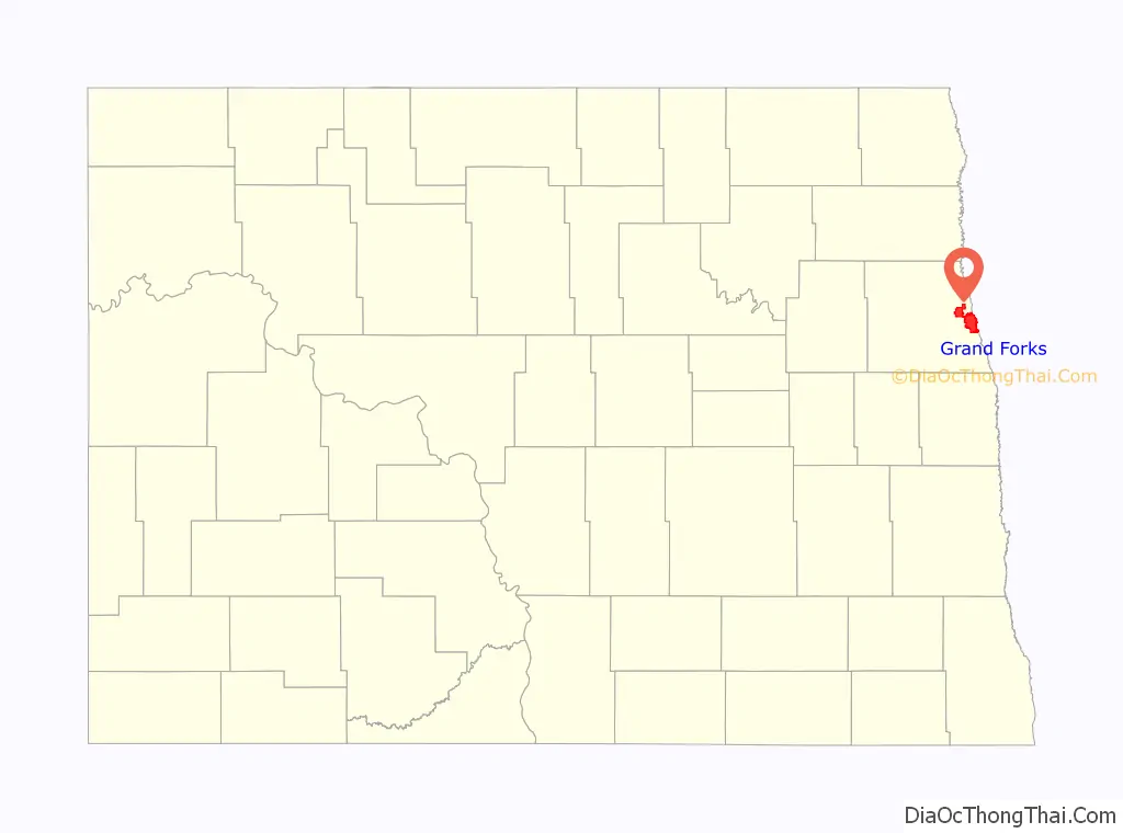
Map of North Dakota State and its subdivision:- Adams
- Barnes
- Benson
- Billings
- Bottineau
- Bowman
- Burke
- Burleigh
- Cass
- Cavalier
- Dickey
- Divide
- Dunn
- Eddy
- Emmons
- Foster
- Golden Valley
- Grand Forks
- Grant
- Griggs
- Hettinger
- Kidder
- Lamoure
- Logan
- McHenry
- McIntosh
- McKenzie
- McLean
- Mercer
- Morton
- Mountrail
- Nelson
- Oliver
- Pembina
- Pierce
- Ramsey
- Ransom
- Renville
- Richland
- Rolette
- Sargent
- Sheridan
- Sioux
- Slope
- Stark
- Steele
- Stutsman
- Towner
- Traill
- Walsh
- Ward
- Wells
- Williams
- Alabama
- Alaska
- Arizona
- Arkansas
- California
- Colorado
- Connecticut
- Delaware
- District of Columbia
- Florida
- Georgia
- Hawaii
- Idaho
- Illinois
- Indiana
- Iowa
- Kansas
- Kentucky
- Louisiana
- Maine
- Maryland
- Massachusetts
- Michigan
- Minnesota
- Mississippi
- Missouri
- Montana
- Nebraska
- Nevada
- New Hampshire
- New Jersey
- New Mexico
- New York
- North Carolina
- North Dakota
- Ohio
- Oklahoma
- Oregon
- Pennsylvania
- Rhode Island
- South Carolina
- South Dakota
- Tennessee
- Texas
- Utah
- Vermont
- Virginia
- Washington
- West Virginia
- Wisconsin
- Wyoming