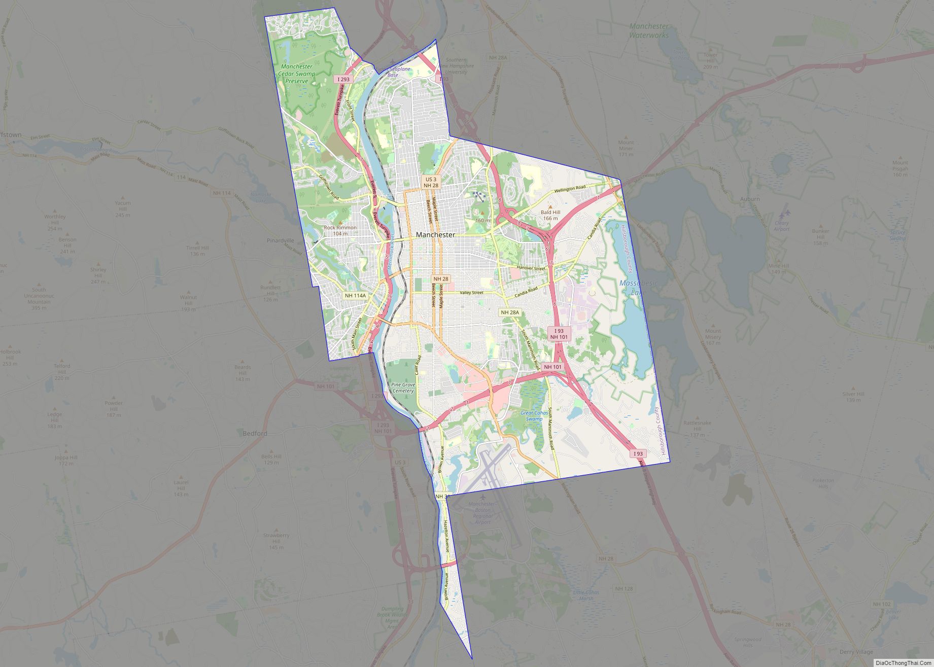
Map of Blodgett Landing CDP

Map of Blodgett Landing CDP

Blodgett Landing (frequently spelled Blodgetts Landing or Blodgett’s Landing) is a census-designated place in the town of Newbury, Merrimack County, New Hampshire, United States. It had a population of 152 at the 2020 census, up from 101 at the 2010 census. Blodgett Landing CDP overview: Name: Blodgett Landing CDP LSAD Code: 57 LSAD Description: CDP … Read more

Map of Bethlehem CDP, New Hampshire

Map of Bethlehem CDP, New Hampshire

Bethlehem is a census-designated place (CDP) and the main village in the town of Bethlehem in Grafton County, New Hampshire, United States. The population of the CDP was 826 at the 2020 census, out of 2,484 in the entire town. Bethlehem CDP overview: Name: Bethlehem CDP LSAD Code: 57 LSAD Description: CDP (suffix) State: New … Read more

Map of Berlin city, New Hampshire

Map of Berlin city, New Hampshire

Berlin (/ˈbɜːrlɪn/ BUR-lin) is a city along the Androscoggin River in Coös County in northern New Hampshire, United States. It is the northernmost city in New Hampshire and the only city in Coös County. The population was 9,425 at the 2020 census, down from 10,051 at the 2010 census. It includes the village of Cascade … Read more

Map of Bennington CDP, New Hampshire

Map of Bennington CDP, New Hampshire

Bennington is a census-designated place (CDP) and the main village in the town of Bennington in Hillsborough County, New Hampshire, United States. The population of the CDP was 338 at the 2020 census, out of 1,501 in the entire town. Bennington CDP overview: Name: Bennington CDP LSAD Code: 57 LSAD Description: CDP (suffix) State: New … Read more

Map of Belmont CDP, New Hampshire

Map of Belmont CDP, New Hampshire

Belmont is a census-designated place (CDP) and the main village in the town of Belmont in Belknap County, New Hampshire, United States. The population was 1,285 at the 2020 census, out of 7,314 in the entire town of Belmont. Belmont CDP overview: Name: Belmont CDP LSAD Code: 57 LSAD Description: CDP (suffix) State: New Hampshire … Read more

Map of Bartlett CDP, New Hampshire

Map of Bartlett CDP, New Hampshire

Bartlett is a census-designated place (CDP) and the main village in the town of Bartlett in Carroll County, New Hampshire, United States. The population was 351 at the 2020 census, out of 3,200 in the entire town of Bartlett. Bartlett CDP overview: Name: Bartlett CDP LSAD Code: 57 LSAD Description: CDP (suffix) State: New Hampshire … Read more