Nashua is a city in southern New Hampshire, United States. At the 2020 census, it had a population of 91,322, the second-largest in northern New England after nearby Manchester. Along with Manchester, it is a seat of New Hampshire’s most populous county, Hillsborough.
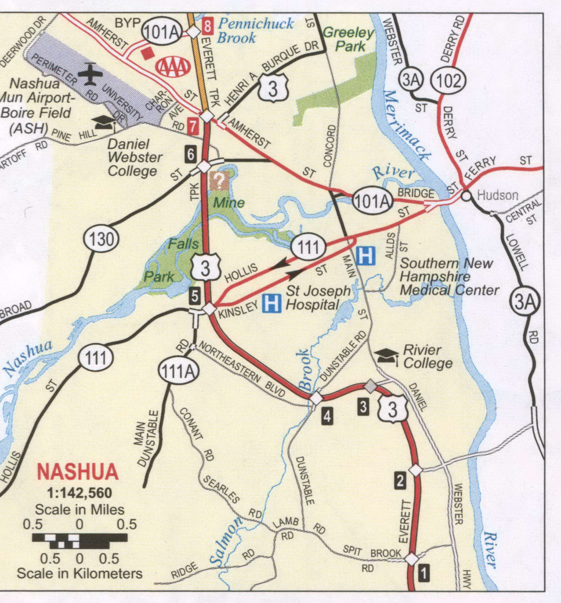
Built around the now-departed textile industry, in recent decades Nashua’s economy has shifted to the financial services, high tech, and defense industries as part of the economic recovery that started in the 1980s in the Greater Boston region. Major private employers in the city include Nashua Corporation, BAE Systems, and Teradyne. The city also hosts two major regional medical centers, Southern New Hampshire Medical Center and St. Joseph Hospital. The South Nashua commercial district is a major regional shopping destination, lying directly on the Massachusetts border and taking advantage of New Hampshire’s lack of sales tax. It is anchored by the Pheasant Lane Mall and numerous smaller shopping centers.
It is one of several U.S. cities nicknamed Gate City, which references a reputation for being a travel gateway – in this case between the Boston region and New Hampshire. A number of civic groups and institutions have adopted the title.
| Name: | Nashua city |
|---|---|
| LSAD Code: | 25 |
| LSAD Description: | city (suffix) |
| State: | New Hampshire |
| County: | Hillsborough County |
| Elevation: | 151 ft (46 m) |
| Land Area: | 30.83 sq mi (79.86 km²) |
| Water Area: | 0.90 sq mi (2.33 km²) 2.84% |
| Population Density: | 2,961.73/sq mi (1,143.52/km²) |
| ZIP code: | 0306003061030620306303064 |
| Area code: | 603 |
| FIPS code: | 3350260 |
| GNISfeature ID: | 0868677 |
| Website: | www.nashuanh.gov |
Online Interactive Map
Click on ![]() to view map in "full screen" mode.
to view map in "full screen" mode.
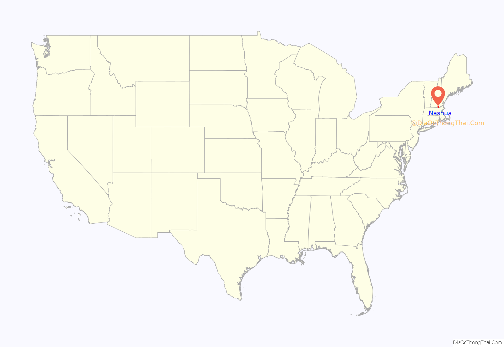
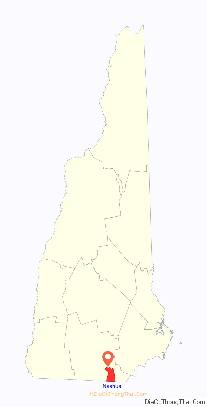
Nashua location map. Where is Nashua city?
History
The area was part of a 200-square-mile (520 km) tract of land in Massachusetts called “Dunstable”, named after Edward Tyng of Dunstable in England. Located at the confluence of the Nashua and Merrimack rivers, Dunstable was first settled about 1654 as a fur trading town. Nashua lies approximately in the center of the original 1673 grant. In 1732, Dunstable was split along the Merrimack River, with the town of Nottingham West (now the town of Hudson, New Hampshire) created out of the eastern portion. The previously disputed boundary between Massachusetts and New Hampshire was fixed in 1741 when the governorships of the two provinces were separated. As a result, the township of Dunstable was divided in two. Tyngsborough and some of Dunstable remained in Massachusetts, while Dunstable, New Hampshire, was incorporated in 1746 from the northern section of the town.
Like many 19th century riverfront New England communities, New Hampshire’s Dunstable was developed during the Industrial Revolution with textile mills operated from water power. In 1823, the Nashua Manufacturing Company was incorporated. The company eventually had four mills and employed approximately 1,000 people. The following year, the Jackson Manufacturing Company was incorporated.
In 1836, the New Hampshire half of Dunstable was renamed “Nashua”, after the Nashua River; the Dunstable name lives on across the Massachusetts border. The Nashua River was named by the Nashaway people, and in the Penacook language it means “beautiful stream with a pebbly bottom”, with an alternative meaning of “land between two rivers”. In 1842, the town split into two towns. Eleven years later, they joined back together under the name “Nashua”, and were re-incorporated as a city. During the split, the northern area, known today as “French Hill”, called itself “Nashville”, while the southern part kept the name Nashua.
Six railroad lines crossed the mill town, namely the Nashua and Lowell, Worcester and Nashua, Nashua and Acton, Nashua and Wilton, Concord and Nashua, and Rochester railroads.
Like the rival Amoskeag Manufacturing Company upriver in Manchester, the Nashua mills prospered until about World War I, after which a slow decline set in. Water power was replaced with newer forms of energy to run factories, such as coal, and cotton could be manufactured into fabric where it grew, saving transportation costs. The textile business started moving to the South during the Great Depression, with the last mill near Nashua closing in 1949.
But then Sanders Associates, a newly created defense firm that is now part of BAE Systems, moved into one of the closed mills and helped restart the city’s economy. Sanders Associates also played a key role in the development of the home video game console market. Ralph H. Baer, an employee of Sanders, developed what would become the Magnavox Odyssey, the first commercial home video game system. The arrival of Digital Equipment Corp., now part of Hewlett-Packard, in the 1970s made the city part of the Boston-area high-tech corridor.
An 1883 bird’s-eye engraving of Nashua
The Nashua Millyard
Canal St. Bridge, c. 1908
The Willows, c. 1910; the road is now Route 101A near Somerset Plaza
Hunt Memorial Library in 2006
Nashua Road Map
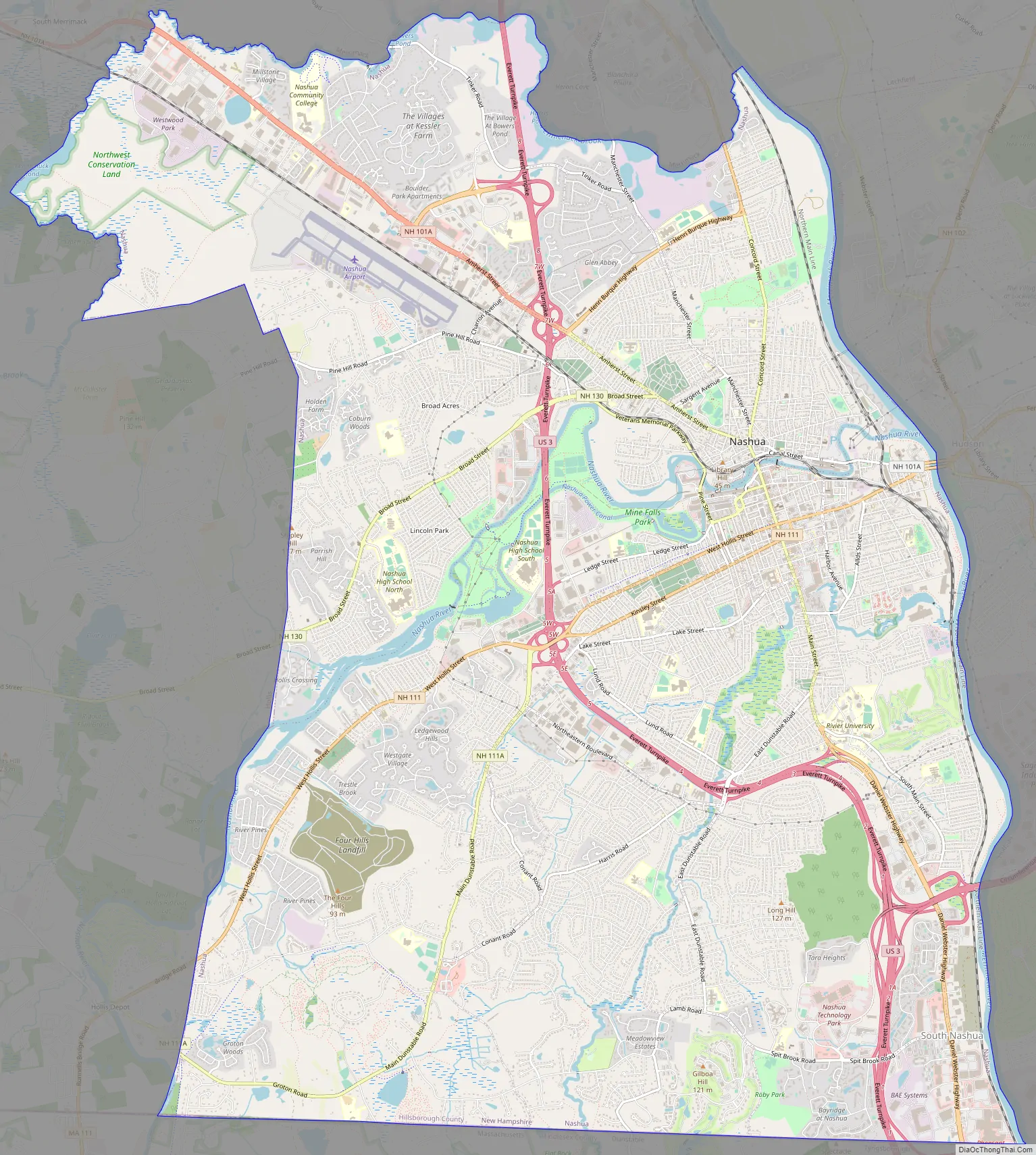
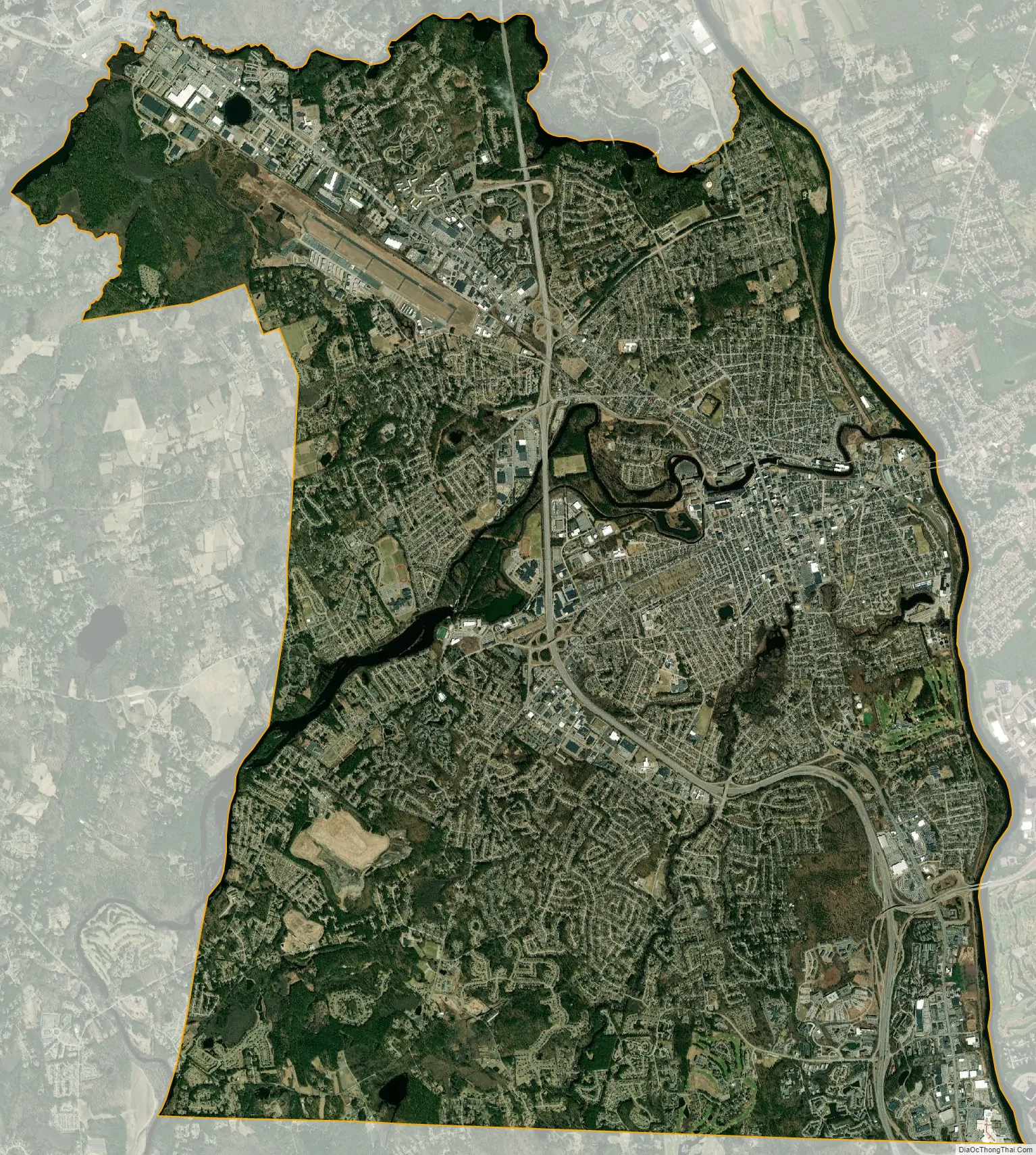
Nashua city Satellite Map
Geography
Nashua is in southeastern Hillsborough County. It is bordered to the south by Middlesex County, Massachusetts.
According to the United States Census Bureau, the city has a total area of 31.7 square miles (82.2 km), of which 30.8 square miles (79.9 km) are land and 0.89 square miles (2.3 km) are water, comprising 2.84% of the city. The eastern boundary of Nashua is formed by the Merrimack River, and the city is drained by the Nashua River and Salmon Brook, tributaries of the Merrimack. The Nashua River roughly bisects the city. Pennichuck Brook forms the city’s northern boundary. The highest point in Nashua is Gilboa Hill in the southern part of the city, at 426 feet (130 m) above sea level.
Climate
Nashua has a four-season humid continental climate (Köppen Dfb), with short spring and autumn transitions, long humid and warm summers, and cold winters full of snow. Spring and autumn in between are relatively brief transitions. The monthly daily average temperature ranges from 22.7 °F (−5.2 °C) in January to 70.9 °F (21.6 °C) in July. On average, there are 9.4 days of 90 °F (32 °C)+ highs and 8.7 days of sub-0 °F (−18 °C) lows. Precipitation is well-spread throughout the year, though winter is the driest. Snowfall, the heaviest of which typically comes from nor’easters, averages around 55 inches (140 cm) per season, but can vary widely from year to year.
See also
Map of New Hampshire State and its subdivision: Map of other states:- Alabama
- Alaska
- Arizona
- Arkansas
- California
- Colorado
- Connecticut
- Delaware
- District of Columbia
- Florida
- Georgia
- Hawaii
- Idaho
- Illinois
- Indiana
- Iowa
- Kansas
- Kentucky
- Louisiana
- Maine
- Maryland
- Massachusetts
- Michigan
- Minnesota
- Mississippi
- Missouri
- Montana
- Nebraska
- Nevada
- New Hampshire
- New Jersey
- New Mexico
- New York
- North Carolina
- North Dakota
- Ohio
- Oklahoma
- Oregon
- Pennsylvania
- Rhode Island
- South Carolina
- South Dakota
- Tennessee
- Texas
- Utah
- Vermont
- Virginia
- Washington
- West Virginia
- Wisconsin
- Wyoming