Bartlett is a census-designated place (CDP) and the main village in the town of Bartlett in Carroll County, New Hampshire, United States. The population was 351 at the 2020 census, out of 3,200 in the entire town of Bartlett.
| Name: | Bartlett CDP |
|---|---|
| LSAD Code: | 57 |
| LSAD Description: | CDP (suffix) |
| State: | New Hampshire |
| County: | Carroll County |
| Elevation: | 671 ft (205 m) |
| Total Area: | 1.51 sq mi (3.92 km²) |
| Land Area: | 1.49 sq mi (3.85 km²) |
| Water Area: | 0.02 sq mi (0.06 km²) |
| Total Population: | 351 |
| Population Density: | 235.89/sq mi (91.06/km²) |
| ZIP code: | 03812 |
| Area code: | 603 |
| FIPS code: | 3303620 |
| GNISfeature ID: | 2629712 |
Online Interactive Map
Click on ![]() to view map in "full screen" mode.
to view map in "full screen" mode.
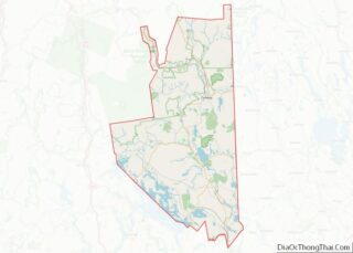
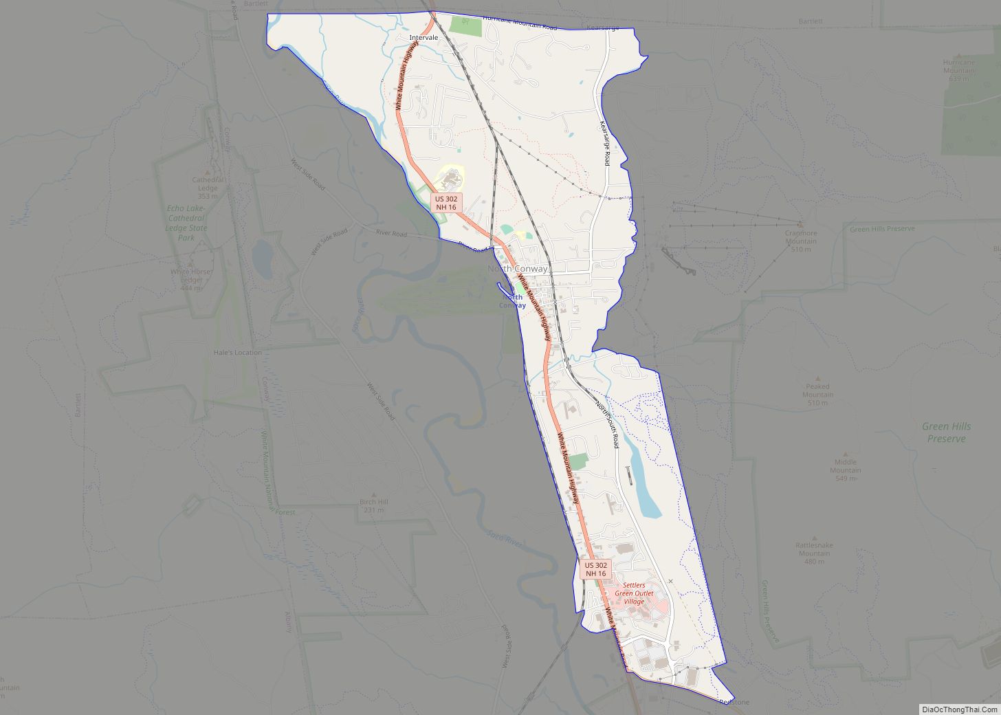
Bartlett location map. Where is Bartlett CDP?


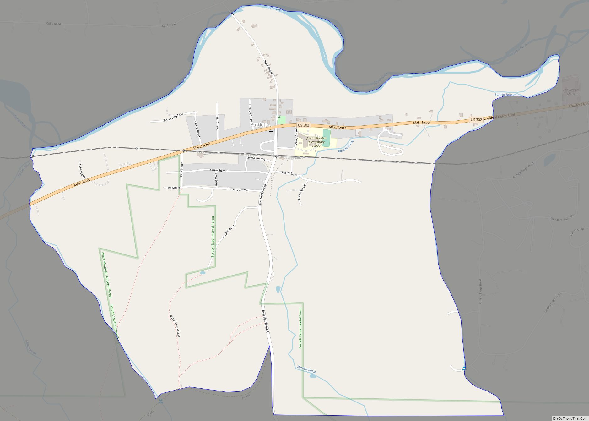
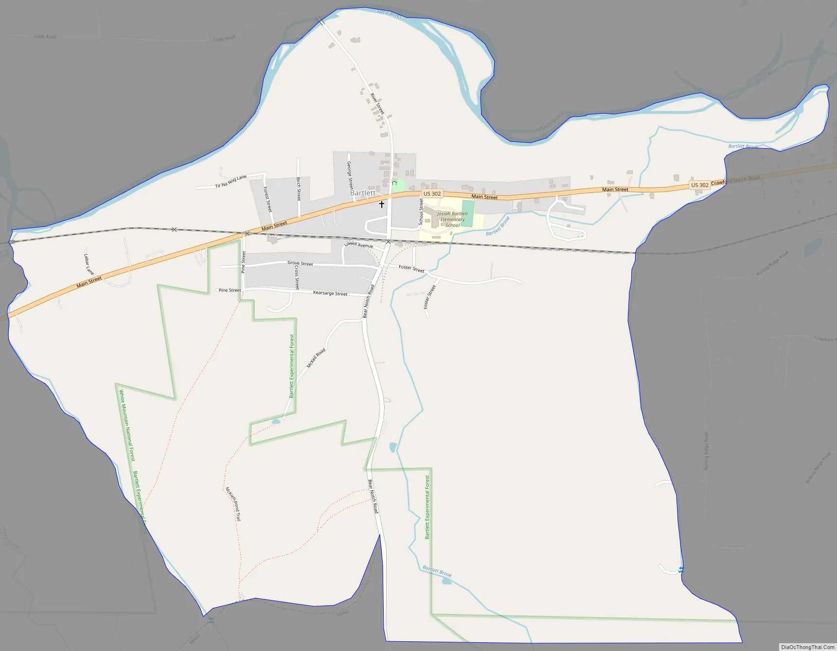
Bartlett Road Map
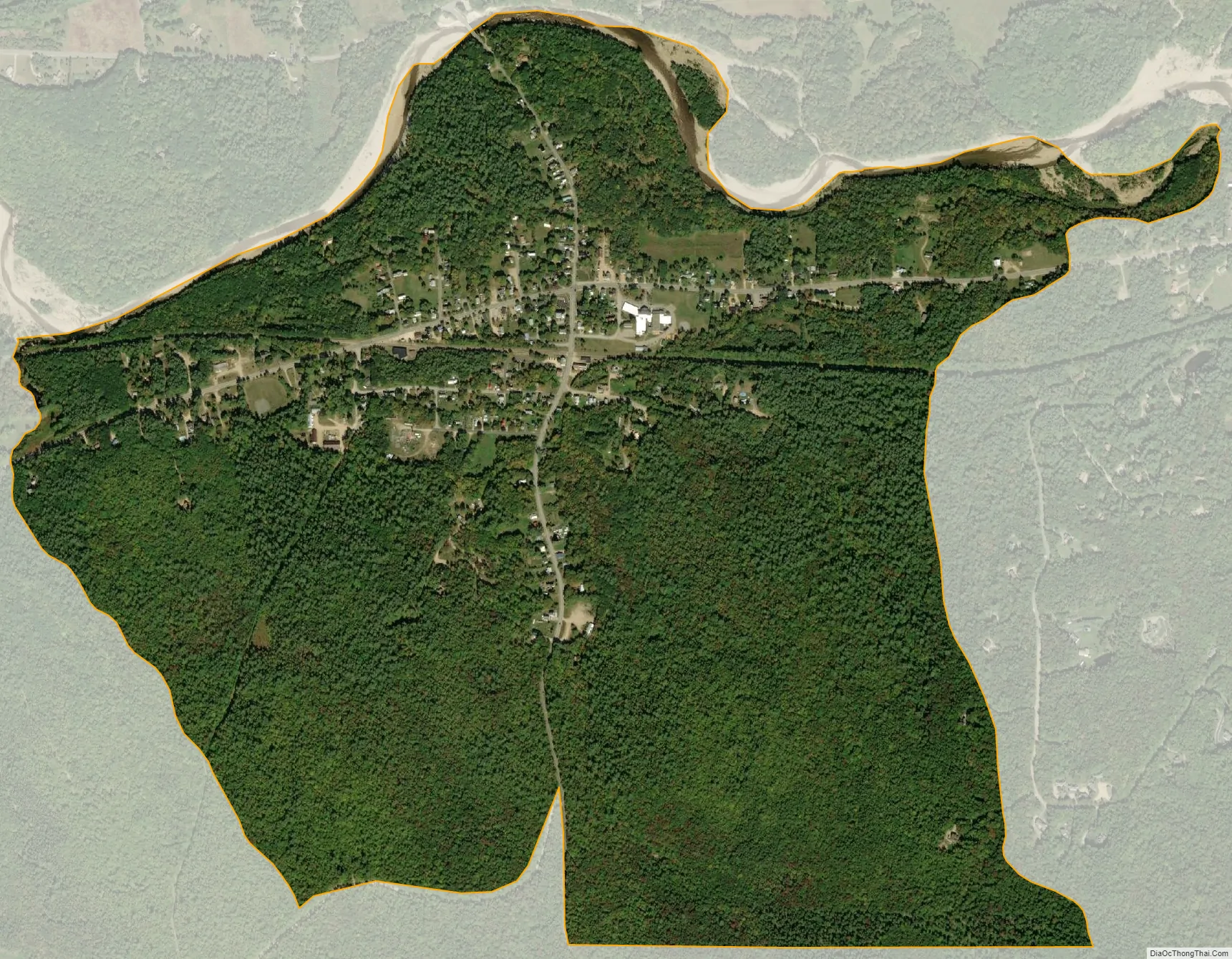
Bartlett city Satellite Map
Geography
The CDP is in the western part of the town of Bartlett, at the junction of U.S. Route 302 with Bear Notch Road. US 302 leads east and south 11 miles (18 km) to North Conway and northwest through Crawford Notch in the White Mountains 36 miles (58 km) to Littleton. Bear Notch Road leads south 9 miles (14 km) across Bear Notch to New Hampshire Route 112 (the Kancamagus Highway) in Albany, New Hampshire.
The Bartlett CDP is bordered to the north by the Saco River, to the west by an unnamed brook east of Albany Brook, to the south by the White Mountain National Forest, and to the east by an unnamed brook that comes down the west side of Big Attitash Mountain, separating the CDP from residential development connected to the Attitash Mountain Resort.
According to the U.S. Census Bureau, the Bartlett CDP has a total area of 1.5 square miles (3.9 km), of which 0.02 square miles (0.06 km), or 1.57%, are water.
See also
Map of New Hampshire State and its subdivision: Map of other states:- Alabama
- Alaska
- Arizona
- Arkansas
- California
- Colorado
- Connecticut
- Delaware
- District of Columbia
- Florida
- Georgia
- Hawaii
- Idaho
- Illinois
- Indiana
- Iowa
- Kansas
- Kentucky
- Louisiana
- Maine
- Maryland
- Massachusetts
- Michigan
- Minnesota
- Mississippi
- Missouri
- Montana
- Nebraska
- Nevada
- New Hampshire
- New Jersey
- New Mexico
- New York
- North Carolina
- North Dakota
- Ohio
- Oklahoma
- Oregon
- Pennsylvania
- Rhode Island
- South Carolina
- South Dakota
- Tennessee
- Texas
- Utah
- Vermont
- Virginia
- Washington
- West Virginia
- Wisconsin
- Wyoming