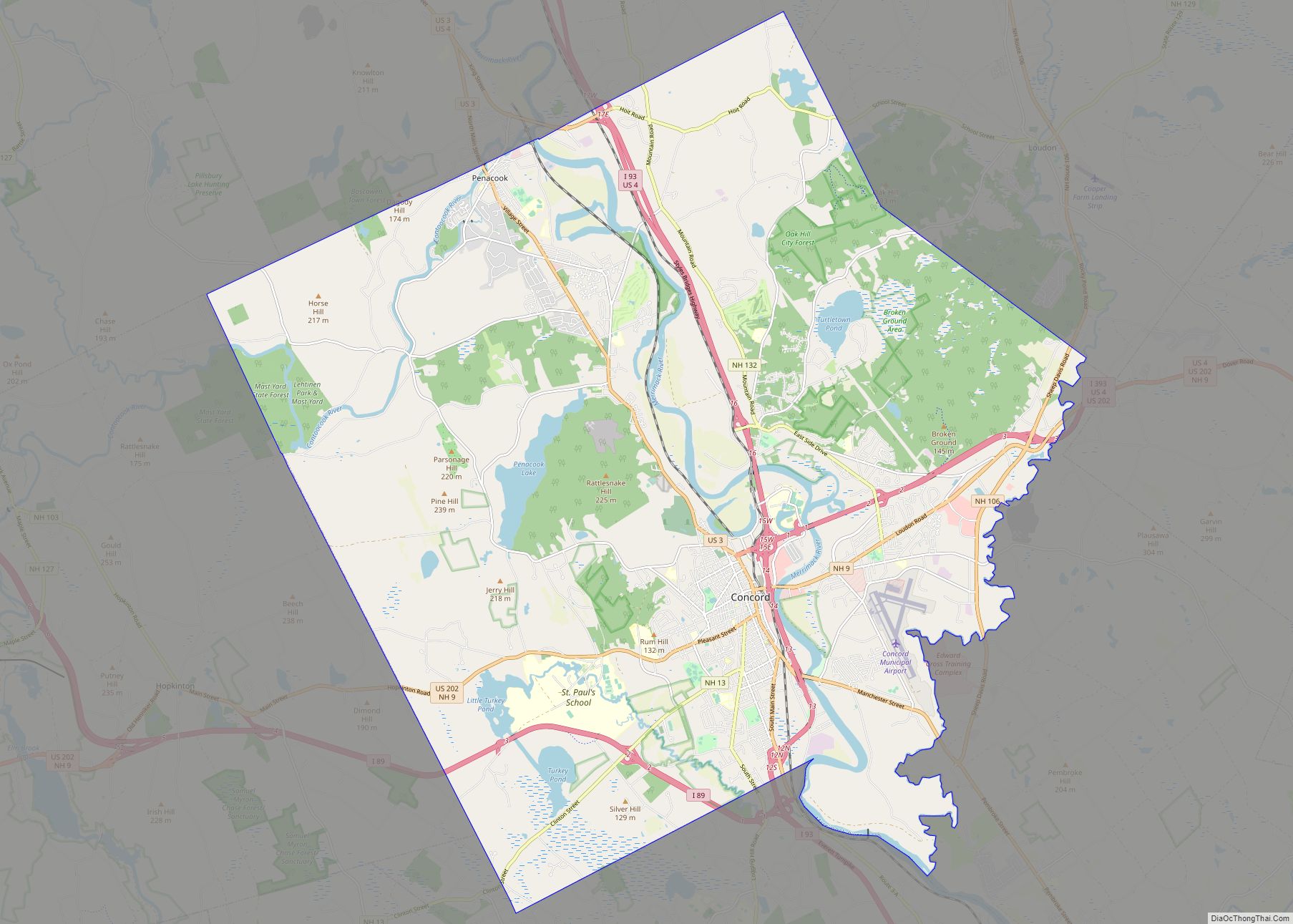
Concord (/ˈkɒŋkərd/) is the capital city of the U.S. state of New Hampshire and the seat of Merrimack County. As of the 2020 census the population was 43,976, making it the third largest city in New Hampshire behind Manchester and Nashua.
The village of Penacook is in the northern part of the city. Concord is home to the University of New Hampshire School of Law, New Hampshire’s only law school; St. Paul’s School, a private preparatory school; NHTI, a two-year community college; the New Hampshire Police Academy; and the New Hampshire Fire Academy. Concord’s Old North Cemetery is the final resting place of Franklin Pierce, 14th President of the United States.
| Name: | Concord city |
|---|---|
| LSAD Code: | 25 |
| LSAD Description: | city (suffix) |
| State: | New Hampshire |
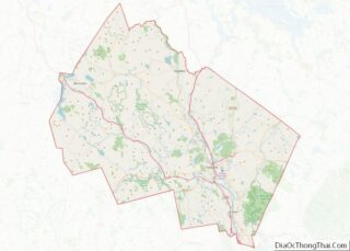
| County: | Merrimack County |
| Incorporated: | 1733 |
| Elevation: | 272 ft (83 m) |
| Total Area: | 67.19 sq mi (174.02 km²) |
| Land Area: | 63.96 sq mi (165.66 km²) |
| Water Area: | 3.23 sq mi (8.36 km²) |
| Total Population: | 43,976 |
| Population Density: | 687.52/sq mi (265.46/km²) |
| Area code: | 603 |
| FIPS code: | 3314200 |
| GNISfeature ID: | 873303 |
| Website: | www.concordnh.gov |
Online Interactive Map
Click on ![]() to view map in "full screen" mode.
to view map in "full screen" mode.
Concord location map. Where is Concord city?


History
The area that would become Concord was originally settled thousands of years ago by Abenaki Native Americans called the Pennacook. The tribe fished for migrating salmon, sturgeon, and alewives with nets strung across the rapids of the Merrimack River. The stream was also the transportation route for their birch bark canoes, which could travel from Lake Winnipesaukee to the Atlantic Ocean. The broad sweep of the Merrimack River valley floodplain provided good soil for farming beans, gourds, pumpkins, melons and maize.
The area was first settled by Europeans in 1659 as Penacook, after the Abenaki word “pannukog” meaning “bend in the river,” referencing the steep bends of the Merrimack River through the area. On January 17, 1725, the Province of Massachusetts Bay, which then claimed territories west of the Merrimack, granted the Concord area as the Plantation of Penacook. It was settled between 1725 and 1727 by Captain Ebenezer Eastman and others from Haverhill, Massachusetts. On February 9, 1734, the town was incorporated as “Rumford”, from which Sir Benjamin Thompson, Count Rumford, would take his title. It was renamed “Concord” in 1765 by Governor Benning Wentworth following a bitter boundary dispute between Rumford and the town of Bow; the city name was meant to reflect the new concord, or harmony, between the disputant towns. Citizens displaced by the resulting border adjustment were given land elsewhere as compensation. In 1779, New Pennacook Plantation was granted to Timothy Walker Jr. and his associates at what would be incorporated in 1800 as Rumford, Maine, the site of Pennacook Falls.
Concord grew in prominence throughout the 18th century, and some of the earliest houses from this period survive at the northern end of Main Street. In the years following the Revolution, Concord’s central geographical location made it a logical choice for the state capital, particularly after Samuel Blodget in 1807 opened a canal and lock system to allow vessels passage around the Amoskeag Falls downriver, connecting Concord with Boston by way of the Middlesex Canal. In 1808, Concord was named the official seat of state government, and in 1816 architect Stuart Park was commissioned to design a new capitol building for the state legislature on land sold to the state by local Quakers. Construction on the State House was completed in 1819, and it remains the oldest capitol in the nation in which the state’s legislative branches meet in their original chambers. Concord was also named the seat of Merrimack County in 1823, and the Merrimack County Courthouse was constructed in 1857 in the North End at the site of the Old Town House.
In the early 19th century, much of the city’s economy was dominated by furniture-making, printing, and granite quarrying; granite had become a popular building material for many monumental halls in the early United States, and Concord granite was used in the construction of both the New Hampshire State House and the Library of Congress in Washington, D.C. In 1828, Lewis Downing joined J. Stephens Abbot to form Abbot and Downing. Their most famous product was their Concord coach, widely used in the development of the American West, and their enterprise largely boosted and changed the city economy in the mid-19th century. In subsequent years, Concord would also become a hub for the railroad industry, with Penacook a textile manufacturing center using water power from the Contoocook River. The city also around this time started to become a center for the emerging healthcare industry, with New Hampshire State Hospital opening in 1842 as one of the first psychiatric hospitals in the United States. The State Hospital continued to expand throughout the following decades, and in 1891 Concord Hospital opened its doors as Margaret Pillsbury General Hospital, the first general hospital in the state of New Hampshire.
Concord’s economy changed once again in the 20th century with the declining railroad and textile industry. The city developed into a center for national politics due to New Hampshire’s first-in-the-nation primary, and many presidential candidates still visit the Concord area during campaign season. The city also developed an identity within the emerging space industry, with the McAuliffe-Shepard Discovery Center opening in 1990 to commemorate Alan Shepard, the first American in space from nearby Derry, and Christa McAuliffe, a teacher at Concord High School who died in the 1986 Space Shuttle Challenger disaster. Today, Concord remains a center for politics, law, healthcare, and insurance companies.
First Concord Bridge, 1795
State House c. 1906
Main Street c. 1908
City Hall in 1913
Old Library c. 1915
Old Post Office in 1910
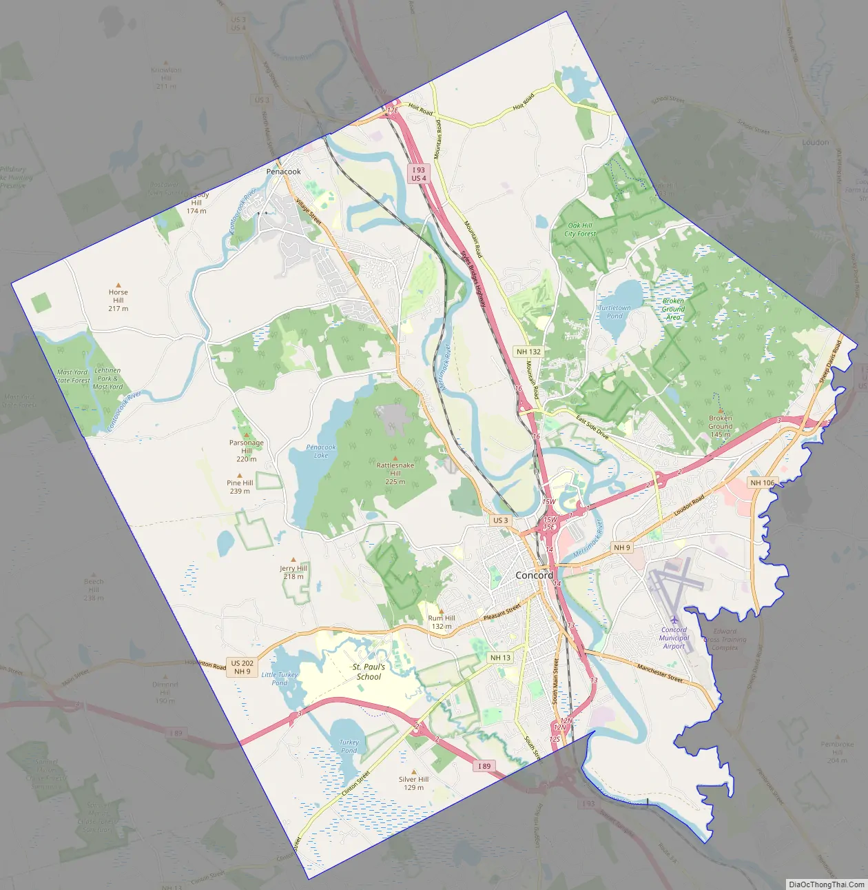
Concord Road Map

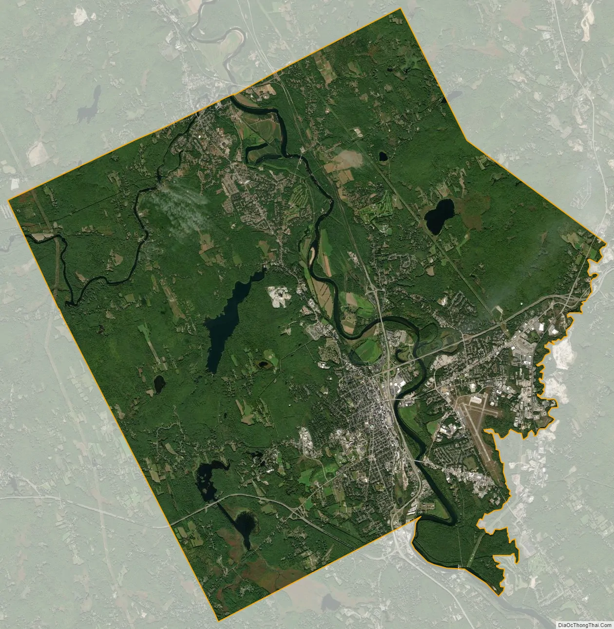
Concord city Satellite Map
Geography
Concord is located in south-central New Hampshire at 43°12′24″N 71°32′17″W / 43.20667°N 71.53806°W / 43.20667; -71.53806 (43.2070, −71.5371). It is 38 miles (61 km) north of the Massachusetts border, 40 miles (64 km) west of the Maine border, 54 miles (87 km) east of the Vermont border, and 170 miles (270 km) south of the Canadian border at Pittsburg.
According to the United States Census Bureau, the city has a total area of 67.2 square miles (174.0 km). 64.0 square miles (165.7 km) of it are land and 3.2 square miles (8.4 km) of it are water, comprising 4.81% of the city. Concord is drained by the Merrimack River. Penacook Lake, the largest lake in the city and its main source of water, is in the west. The highest point in Concord is 860 feet (260 m) above sea level on Oak Hill, just west of the hill’s 970-foot (300 m) summit in neighboring Loudon.
Concord lies fully within the Merrimack River watershed and is centered on the river, which runs from northwest to southeast through the city. Downtown is located on a low terrace to the west of the river, with residential neighborhoods climbing hills to the west and extending southwards towards the town of Bow. To the east of the Merrimack, atop a 100-foot (30 m) bluff, is a flat, sandy plain known as Concord Heights, which has seen most of the city’s commercial development since 1960. The eastern boundary of Concord (with the town of Pembroke) is formed by the Soucook River, a tributary of the Merrimack. The Turkey River winds through the southwestern quarter of the city, passing through the campus of St. Paul’s School before entering the Merrimack River in Bow. In the northern part of the city, the Contoocook River enters the Merrimack at the village of Penacook.
Concord is 16 miles (26 km) north of Manchester, New Hampshire’s largest city, and 66 miles (106 km) north of Boston.
Villages
The city of Concord is made up of its downtown, including its North End and South End neighborhoods, plus the four distinct villages of Penacook, Concord Heights, East Concord, and West Concord.
Adjacent municipalities
- Canterbury (north)
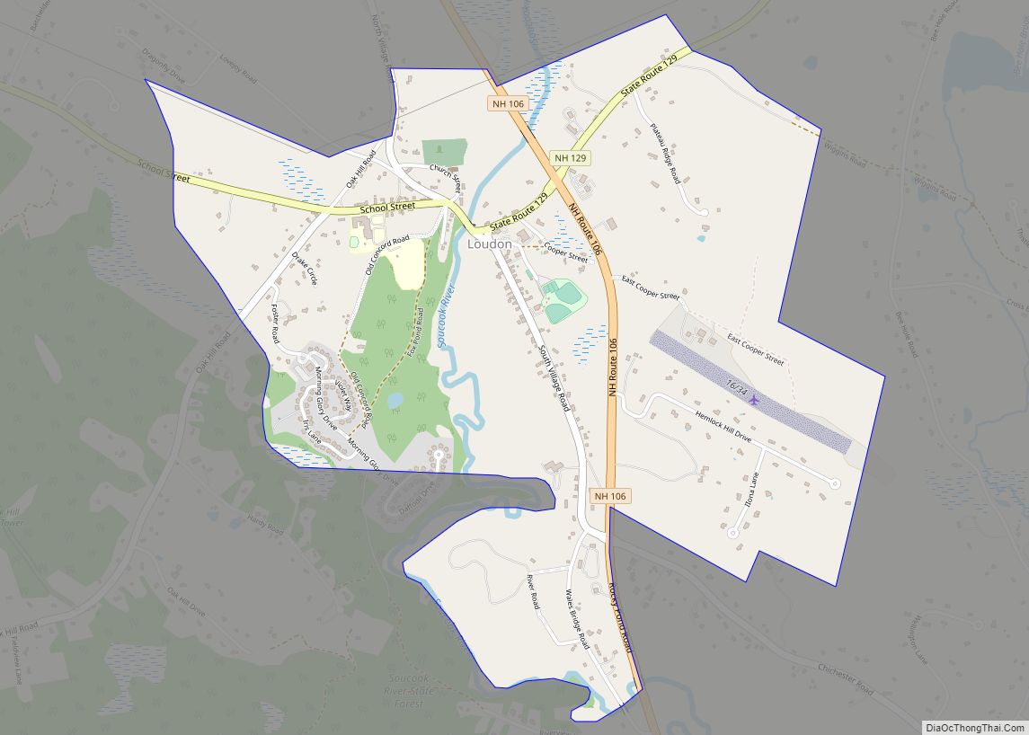
- Loudon (northeast)
- Pembroke (southeast)
- Bow (south)
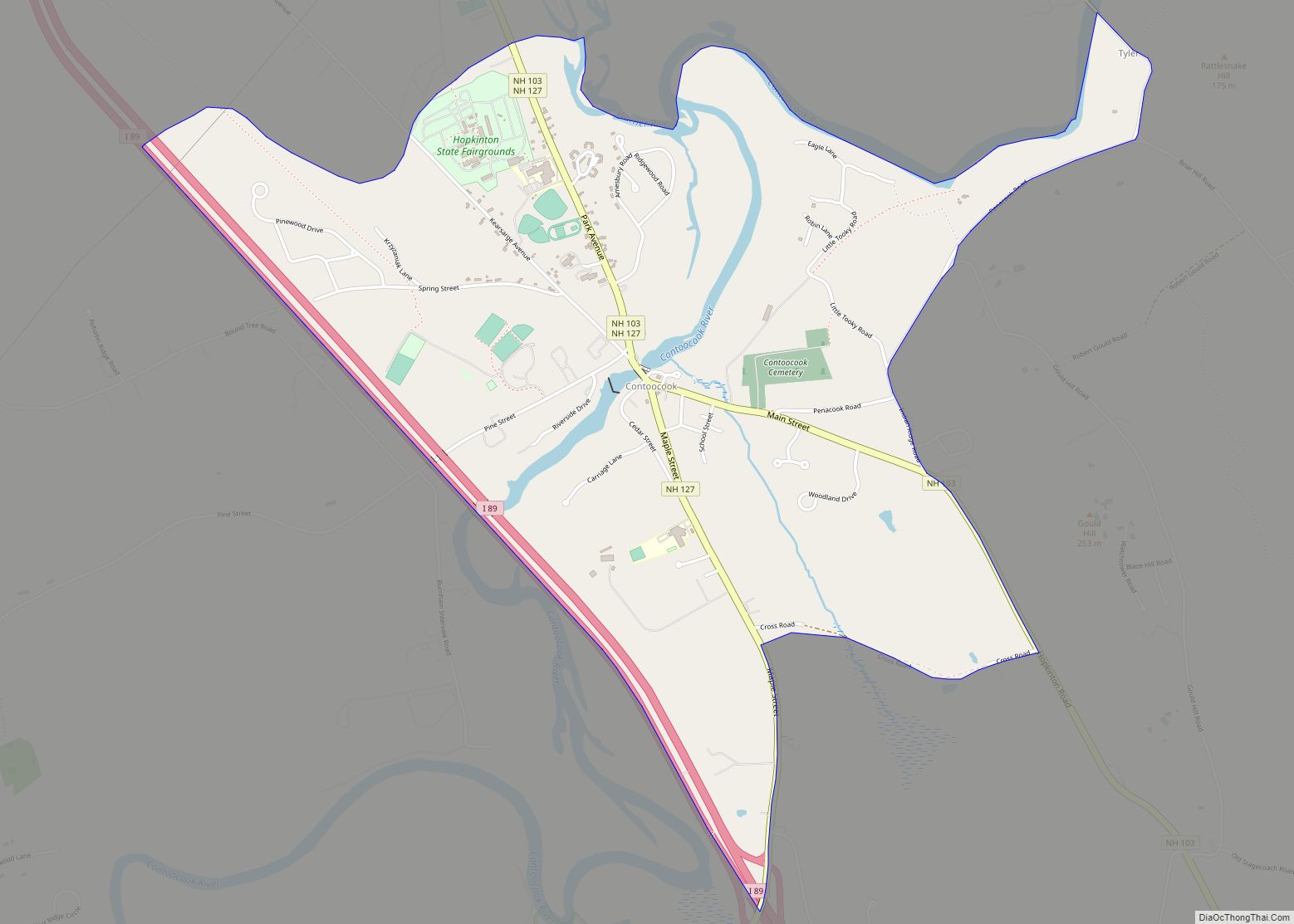
- Hopkinton (west)
- Webster (northwest)
- Boscawen (north-northwest)
Climate
Concord, as with much of New England, is within the humid continental climate zone (Köppen Dfb), with long, cold, snowy winters, warm (and at times humid) summers, and relatively brief autumns and springs. In winter, successive storms deliver moderate to at times heavy snowfall amounts, contributing to the relatively reliable snow cover. In addition, lows reach below 0 °F (−18 °C) on an average 15 nights per year, and the city straddles the border between USDA Hardiness Zone 5b and 6a. However, thaws are frequent, with one to three days per month with 50 °F (10 °C)+ highs from December to February. Summer can bring stretches of humid conditions as well as thunderstorms, and there is an average of 12 days of 90 °F (32 °C)+ highs annually. The window for freezing temperatures on average begins on September 27 and expires on May 14.
The monthly daily average temperature range from 20.6 °F (−6.3 °C) in January to 70.0 °F (21.1 °C) in July. Temperature extremes have ranged from −37 °F (−38 °C) in February 1943 to 102 °F (39 °C) in July 1966.
See also
Map of New Hampshire State and its subdivision: Map of other states:- Alabama
- Alaska
- Arizona
- Arkansas
- California
- Colorado
- Connecticut
- Delaware
- District of Columbia
- Florida
- Georgia
- Hawaii
- Idaho
- Illinois
- Indiana
- Iowa
- Kansas
- Kentucky
- Louisiana
- Maine
- Maryland
- Massachusetts
- Michigan
- Minnesota
- Mississippi
- Missouri
- Montana
- Nebraska
- Nevada
- New Hampshire
- New Jersey
- New Mexico
- New York
- North Carolina
- North Dakota
- Ohio
- Oklahoma
- Oregon
- Pennsylvania
- Rhode Island
- South Carolina
- South Dakota
- Tennessee
- Texas
- Utah
- Vermont
- Virginia
- Washington
- West Virginia
- Wisconsin
- Wyoming