Bennington is a census-designated place (CDP) and the main village in the town of Bennington in Hillsborough County, New Hampshire, United States. The population of the CDP was 338 at the 2020 census, out of 1,501 in the entire town.
| Name: | Bennington CDP |
|---|---|
| LSAD Code: | 57 |
| LSAD Description: | CDP (suffix) |
| State: | New Hampshire |
| County: | Hillsborough County |
| Elevation: | 670 ft (200 m) |
| Total Area: | 0.43 sq mi (1.12 km²) |
| Land Area: | 0.43 sq mi (1.12 km²) |
| Water Area: | 0.00 sq mi (0.00 km²) |
| Total Population: | 338 |
| Population Density: | 784.22/sq mi (302.94/km²) |
| ZIP code: | 03442 |
| Area code: | 603 |
| FIPS code: | 3304820 |
| GNISfeature ID: | 2629714 |
Online Interactive Map
Click on ![]() to view map in "full screen" mode.
to view map in "full screen" mode.
Bennington location map. Where is Bennington CDP?


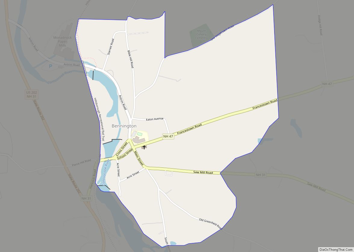
Bennington Road Map
Bennington city Satellite Map

Geography
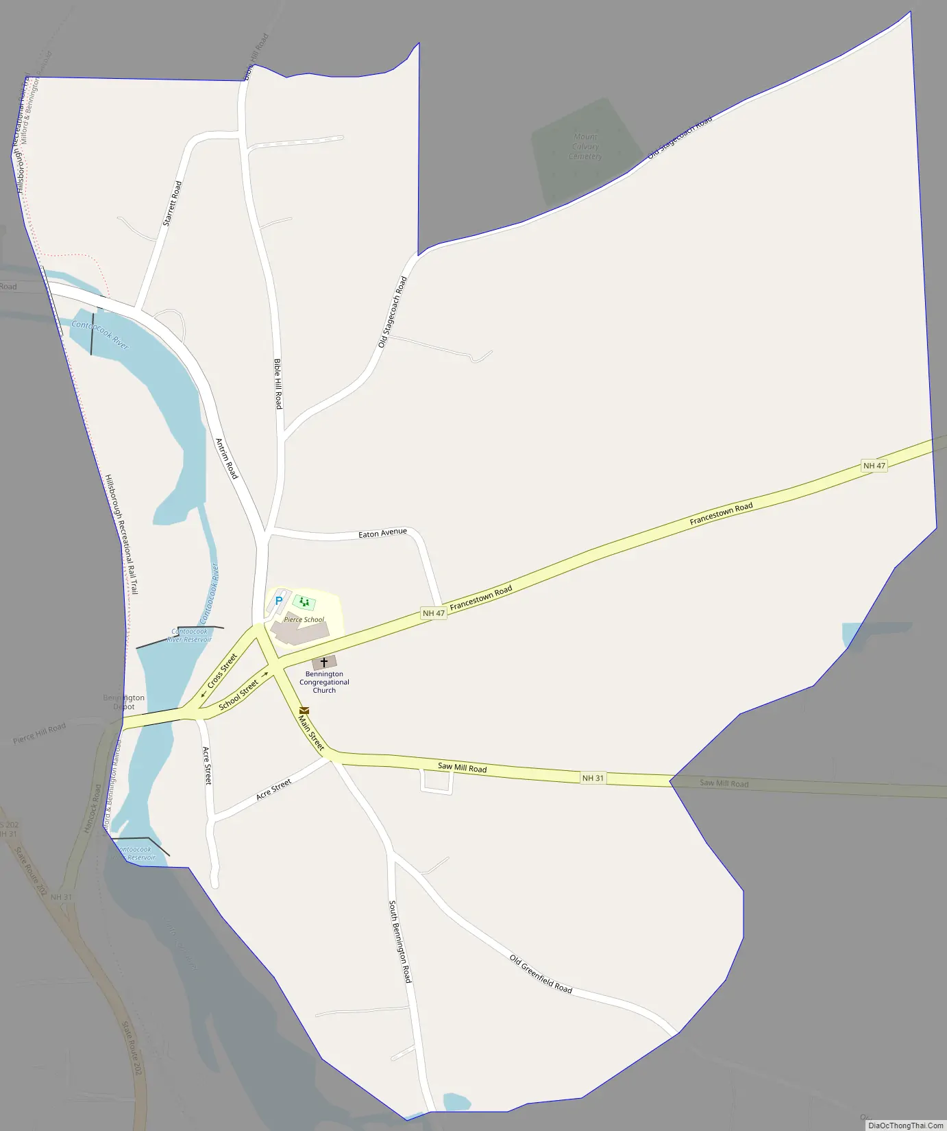
The CDP is in the western part of the town of Bennington, primarily on the east side of the Contoocook River at its Great Falls, which drop 70 feet (21 m) over 1.2 miles (1.9 km) after flowing out of Powder Mill Pond. The CDP is bordered to the west by the Contoocook and a former railroad line. The northern border is north of Starrett Road and follows Old Stagecoach Road. The eastern border of the CDP is east of the dense village development but west of Dodge Hill Road, while the southern border follows an unnamed brook back to the Contoocook.
New Hampshire Routes 31 and 47 pass through the center of the CDP. Route 31 (Greenfield Road) leads southeast 5 miles (8 km) to the center of Greenfield, and Route 47 (Francestown Road) leads east 7 miles (11 km) to the center of Francestown. U.S. Route 202 passes just west of the CDP, on the west side of the Contoocook River, and leads north 2 miles (3 km) to Antrim and south 10 miles (16 km) to Peterborough. NH 31 runs north with US 202 to Antrim, while NH 47 terminates at US 202 just west of the Bennington CDP.
According to the U.S. Census Bureau, the CDP has a total area of 0.42 square miles (1.1 km), all of it land.
See also
Map of New Hampshire State and its subdivision: Map of other states:- Alabama
- Alaska
- Arizona
- Arkansas
- California
- Colorado
- Connecticut
- Delaware
- District of Columbia
- Florida
- Georgia
- Hawaii
- Idaho
- Illinois
- Indiana
- Iowa
- Kansas
- Kentucky
- Louisiana
- Maine
- Maryland
- Massachusetts
- Michigan
- Minnesota
- Mississippi
- Missouri
- Montana
- Nebraska
- Nevada
- New Hampshire
- New Jersey
- New Mexico
- New York
- North Carolina
- North Dakota
- Ohio
- Oklahoma
- Oregon
- Pennsylvania
- Rhode Island
- South Carolina
- South Dakota
- Tennessee
- Texas
- Utah
- Vermont
- Virginia
- Washington
- West Virginia
- Wisconsin
- Wyoming