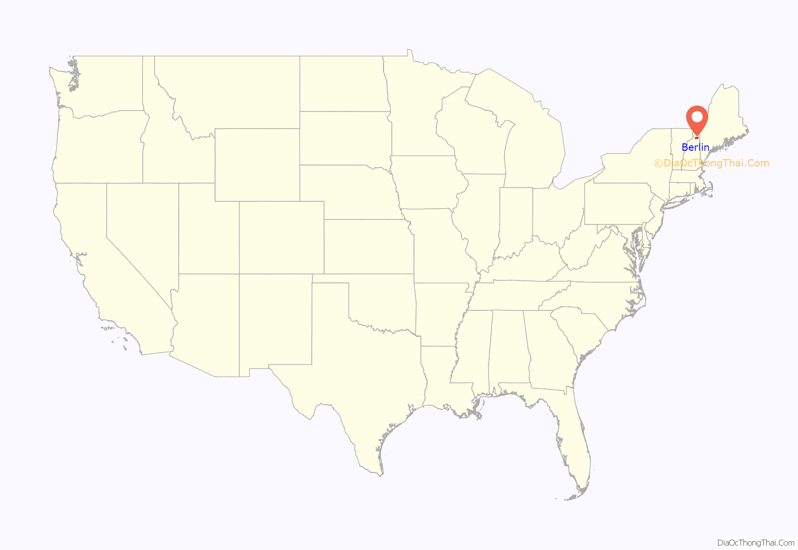
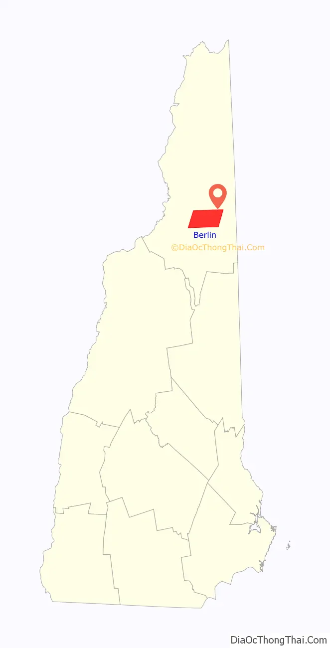
Berlin (/ˈbɜːrlɪn/ BUR-lin) is a city along the Androscoggin River in Coös County in northern New Hampshire, United States. It is the northernmost city in New Hampshire and the only city in Coös County. The population was 9,425 at the 2020 census, down from 10,051 at the 2010 census.
It includes the village of Cascade in the south part of the city. Located in New Hampshire’s Great North Woods Region or “North Country”, Berlin sits at the edge of the White Mountains, and the city’s boundaries extend into the White Mountain National Forest. Berlin is home to the Berlin and Coos County Historical Society’s Moffett House Museum & Genealogy Center, Service Credit Union Heritage Park, the Berlin Fish Hatchery, and the White Mountains Community College, member of the Community College System of New Hampshire.
Berlin is the principal city of the Berlin Micropolitan Statistical Area, which includes all of Coos County, New Hampshire and Essex County, Vermont. Because Quebec is less than 60 miles (100 km) away, Berlin has many people of French Canadian descent in its population. Around 65% of its residents speak a variant of New England French, which is known locally as “Berlin French”.
The pronunciation of Berlin was changed to BUR-lin, instead of Ber-LIN (as in Berlin, Germany), during World War I as a patriotic stand against Germany.
| Name: | Berlin city |
|---|---|
| LSAD Code: | 25 |
| LSAD Description: | city (suffix) |
| State: | New Hampshire |
| County: | Coos County |
| Elevation: | 1,020 ft (310 m) |
| Total Area: | 62.20 sq mi (161.10 km²) |
| Land Area: | 61.35 sq mi (158.89 km²) |
| Water Area: | 0.85 sq mi (2.21 km²) |
| Total Population: | 9,425 |
| Population Density: | 153.63/sq mi (59.32/km²) |
| ZIP code: | 03570 |
| Area code: | 603 |
| FIPS code: | 3305140 |
| GNISfeature ID: | 0871491 |
| Website: | www.berlinnh.gov |
Online Interactive Map
Click on ![]() to view map in "full screen" mode.
to view map in "full screen" mode.
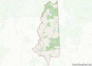
Berlin location map. Where is Berlin city?
History
Around 11,000 years ago, small groups of Native Americans camped around the area of what is now called Berlin. In later years, the Eastern Abenaki tribes came to Berlin to mine rhyolite in Mt. Jasper.
When English colonists came to America, Berlin was first granted on December 31, 1771, by Colonial Governor John Wentworth, as “Maynesborough” after Sir William Mayne. But the grantees did not take up their claims, which disappeared with the Revolution. In 1802, Seth Eames and Gideon Tirrell were sent by the descendants of Mayne to explore and mark lots for settlers, and still no one came. Maynesborough was settled in 1823–1824 by William Sessions and his nephew, Cyrus Wheeler. Both men were from Gilead, Maine. Farming was the first industry. With 65 inhabitants in 1829, the New England town was reincorporated on July 1 as Berlin with the help of Cyrus’ father, Thomas Wheeler.
Situated in a heavily forested region, the community developed early into a center for logging and wood industries. Falls on the Androscoggin River provided water power for sawmills. In 1826, a road was built to Gorham by Thomas, Amos, and Daniel Green. In 1851, the St. Lawrence & Atlantic Railroad entered Berlin, connecting it to other markets. Acquiring water, timber, and rail rights in the early 1850s, the H. Winslow & Company built a large sawmill at the head of “Berlin Falls”. In 1868, William Wentworth Brown and Lewis T. Brown bought a controlling interest in the business and changed its name to the Berlin Mills Company.
By 1885, the mill town was home to several pulp and paper mills, including the Riverside Mill, Forest Fibre Company and White Mountain Pulp & Paper Company. Because of the need for labor in the mills, immigrants arrived from Russia, Norway, Finland, Italy, Sweden, Ireland, and Germany. Many others were French Canadians from nearby Quebec.
In 1872, a group of Scandinavians founded the nation’s oldest ski club, which still exists today. It was originally called the North American Ski Club (in Norwegian, Nordamerikansk Skiklubben), but later was renamed the Nansen Ski Club. This was in honor of Fridtjof Nansen, who in 1888 skied across Greenland. In 1897, Berlin was incorporated as a city, the northernmost in the state.
As of 1874, the Boston and Maine Railway passed through the eastern portion of the town and operated on this line until the 1980s. The old railroad bed has since been converted for usage as an ATV trail.
Berlin’s main industry in the early 20th century was the pulp and paper industries, which have been in a long decline since that time. As jobs left the area, the population has decreased and is about half its peak of more than 20,000 in the 1930 census. In 1917, the Berlin Mills Company was renamed the Brown Company, because of World War I and anti-German feeling against the enemy of the time. A short time after the Great Depression, the Brown Company went into receivership. Surviving with governmental help, it was bought and sold several times after World War II.
In 2001, American Tissue filed for bankruptcy, before which it had stopped paying city taxes. Its facilities were purchased in 2002 by Fraser Papers of Canada. But in March 2006, Fraser Papers announced the closing of Berlin’s pulp mill. On May 6, 2006, 250 employees were displaced, some moving to Cascade’s paper finishing mill, but most were left unemployed.
On October 3, 2006, the North American Dismantling Corporation of Michigan announced that it had bought the 121-acre (49 ha) defunct pulp mill site of Fraser Paper, and would spend a year demolishing the property to allow redevelopment. Laidlaw Energy LLC has since purchased a portion of the former Fraser property, including a large recovery boiler which it intends to convert into a 66-megawatt biomass plant in 2010–2011.
In the 1990s, the local historian and author Paul “Poof” Tardiff began writing articles in The Berlin Daily Sun. He later collected these in a three-volume series titled Once Upon a Berlin Time, which documents local history. He continued to write articles for the newspaper every Tuesday and Thursday until his death in 2018.
Recent economic development has been based on the correctional industry. The 750-bed Northern New Hampshire Correctional Facility was built in 1999 and employs approximately 200 people. In 2012, the Federal Bureau of Prisons opened a federal, 1200-bed medium security facility, which employs approximately 350 people.
Main Street c. 1912
Mount Forest c. 1912
Main Street in 1914
Post Office Square c. 1914
City Hall in 1916
Gem Theatre in 1917
General view c. 1920
General view c. 2007
Main Street South in 2007
Grand Trunk Railroad Station 2007
Berlin waterfront, 2007
A group of Russian immigrants at the Holy Resurrection Orthodox Church in 1915
Berlin, c. 1905
City panorama from Mt. Forest, 1970
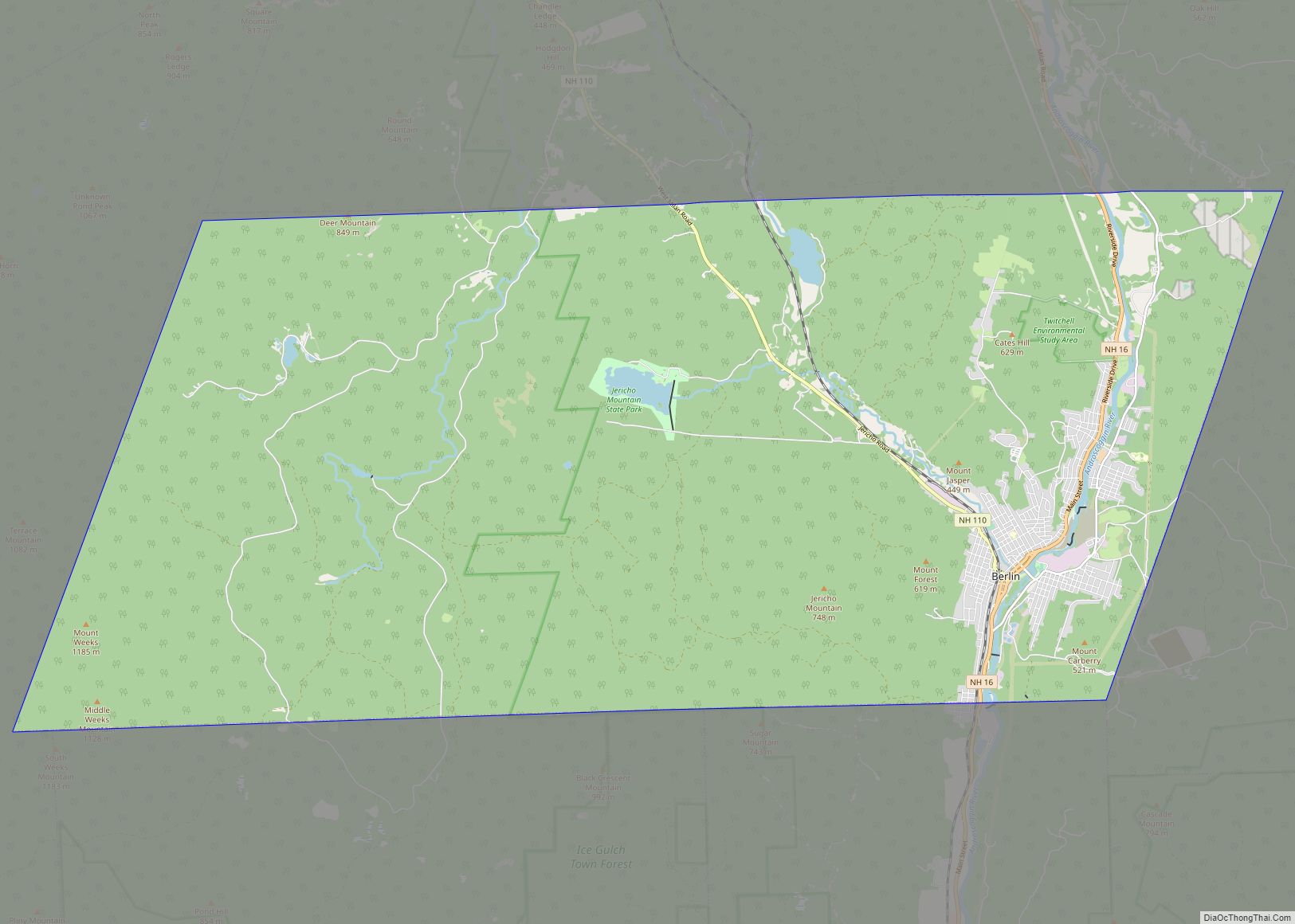
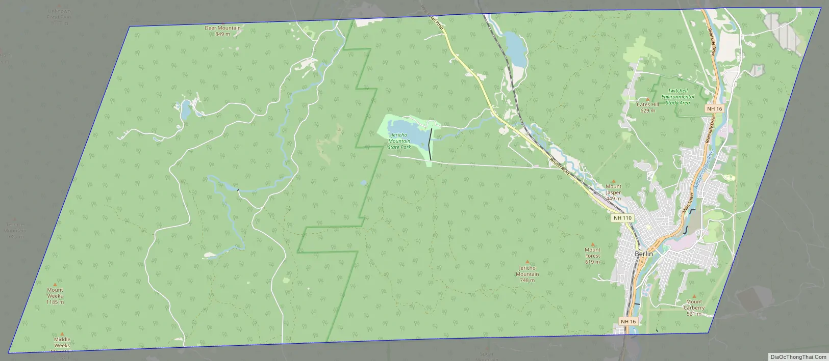
Berlin Road Map
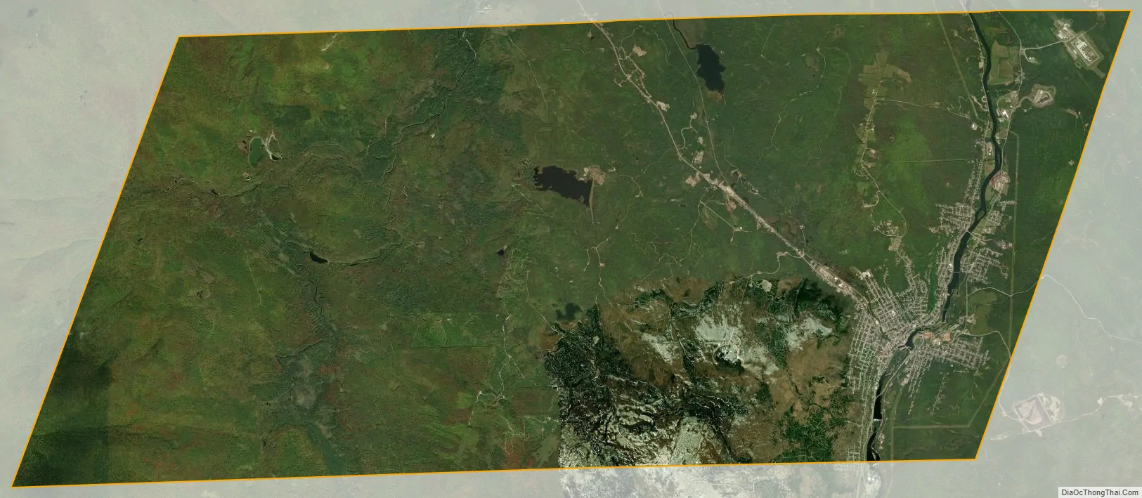
Berlin city Satellite Map
Geography
Berlin is located at 44°28′07″N 71°11′02″W / 44.46861°N 71.18389°W / 44.46861; -71.18389 (44.4686, −71.1839), in northern New Hampshire, north of the White Mountains, in the state’s North Country region. The city is bordered to the south by Randolph and Gorham, north by Milan, east by Success and west by Kilkenny. New Hampshire Route 16 passes through the center of the city, leading north to Errol and eventually to Rangeley, Maine, and leading south through Gorham and Pinkham Notch to North Conway and the Seacoast Region of New Hampshire. New Hampshire Route 110 leads northwest out of Berlin through West Milan to Groveton. NH 110 is known locally as the Berlin-Groveton Highway.
According to the United States Census Bureau, the city has a total area of 62.2 square miles (161.1 km), of which 61.4 square miles (158.9 km) are land and 0.8 square miles (2.2 km) are water, comprising 1.37% of the city. Berlin is situated at the confluence of the Androscoggin and Dead rivers. The Mahoosuc Range is to the southeast. Jericho Mountain State Park, created from a city park and from private land in 2005, is west of the city center and features a reservoir created in the 1970s and a network of ATV trails. The city’s highest point is Mount Weeks, at 3,901 feet (1,189 m) above sea level. A prominent feature in the landscape of Berlin is 2,031-foot (619 m) Mount Forist, rising over the west side of the city. Approximately half of Berlin lies within the Connecticut River watershed, and half lies in the Androscoggin River watershed.
Rivers
- Androscoggin River
- Dead River (New Hampshire)
- Upper Ammonoosuc River
Climate
Like all of northern New England, except the highest mountains, Berlin has a warm-summer humid continental climate (Köppen Dfb) characterized by cold, snowy winters and warm summers. Warm southerly or easterly airflows from an anticyclone in the Atlantic occasionally moderate the winters: on December 7, 2001 Berlin reached as warm as 68 °F or 20 °C. Blocks to the west, however, may drive very cold air from eastern Canada and the shallow, frozen Hudson Bay, providing extremely cold winters as occurred in 1917/1918, 1922/1923 and 1933/1934; the coldest temperature recorded in Berlin is −44 °F (−42.2 °C) on December 30 and 31, 1917. It can be expected that each year on average 68 afternoons will not top freezing, that 34.4 mornings will fall to or below 0 °F or −17.8 °C, and that 180.5 mornings will fall to or below freezing point. The average window for days not topping freezing is November 14 to March 29, and for subzero lows from December 11 to March 12. Snowfall is typically heavy at 79.7 inches or 2.02 metres, with the historical range being from 127 inches (3.23 m) between July 1995 and June 1996 to 34.2 inches (0.87 m) between July 1979 and June 1980.
Summer weather is generally moderate, though rain depressions moving from the tropics or strong frontal storms often produce heavy rainfall: the record daily rainfall is 6.50 inches (165.1 mm) on September 17, 1999, beating the previous record of 5.15 inches (130.8 mm) on the same day in 1932. The wettest month has however been September 1954 with 12.21 inches (310.1 mm) and the driest January 1981 with 0.14 inches (3.6 mm) actually consisting of 3.1 inches (0.08 m) of snow. Calendar year precipitation has ranged from a low of 29.47 inches (748.5 mm) in 2001 to 58.00 inches (1,473.2 mm) in 1954. Occasionally an offshore flow from the interior United States will produce very hot weather during the summer: the record high is 98 °F (36.7 °C) on four occasions: three consecutive days from June 3 to 5 in 1919 and on July 5, 1983.
See also
Map of New Hampshire State and its subdivision: Map of other states:- Alabama
- Alaska
- Arizona
- Arkansas
- California
- Colorado
- Connecticut
- Delaware
- District of Columbia
- Florida
- Georgia
- Hawaii
- Idaho
- Illinois
- Indiana
- Iowa
- Kansas
- Kentucky
- Louisiana
- Maine
- Maryland
- Massachusetts
- Michigan
- Minnesota
- Mississippi
- Missouri
- Montana
- Nebraska
- Nevada
- New Hampshire
- New Jersey
- New Mexico
- New York
- North Carolina
- North Dakota
- Ohio
- Oklahoma
- Oregon
- Pennsylvania
- Rhode Island
- South Carolina
- South Dakota
- Tennessee
- Texas
- Utah
- Vermont
- Virginia
- Washington
- West Virginia
- Wisconsin
- Wyoming