Manchester is the most populous city in the U.S. state of New Hampshire and in northern New England, a region comprising the states of Maine, New Hampshire, and Vermont. At the 2020 census, it had a population of 115,644.
Manchester is, along with the city of Nashua, one of two seats of New Hampshire’s most populous county, Hillsborough County. Manchester lies near the northern end of the Northeast megalopolis and straddles the banks of the Merrimack River. It was first named by the merchant and inventor Samuel Blodgett, namesake of Samuel Blodget Park and Blodget Street in the city’s North End. His vision was to create a great industrial center similar to that of the original Manchester in England, which was the world’s first industrialized city.
| Name: | Manchester city |
|---|---|
| LSAD Code: | 25 |
| LSAD Description: | city (suffix) |
| State: | New Hampshire |
| County: | Hillsborough County |
| Elevation: | 210 ft (60 m) |
| Land Area: | 33.07 sq mi (85.65 km²) |
| Water Area: | 1.87 sq mi (4.84 km²) 5.33% |
| Population Density: | 3,497.05/sq mi (1,350.23/km²) |
| Area code: | 603 |
| FIPS code: | 3345140 |
| GNISfeature ID: | 868243 |
| Website: | www.manchesternh.gov |
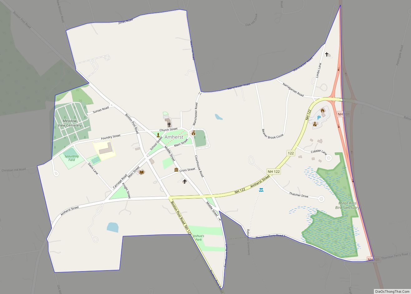
Online Interactive Map
Click on ![]() to view map in "full screen" mode.
to view map in "full screen" mode.
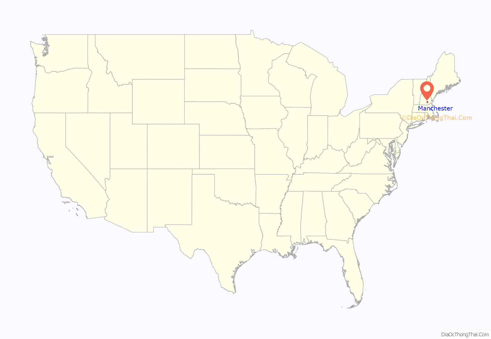
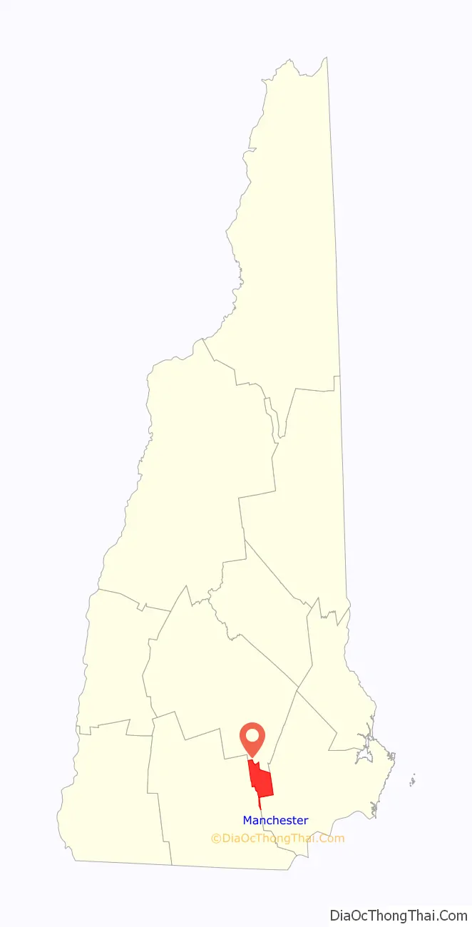
Manchester location map. Where is Manchester city?
History
The native Pennacook people called Amoskeag Falls on the Merrimack River—the area that became the heart of Manchester—Namaoskeag, meaning “good fishing place”. In 1722, John Goffe III settled beside Cohas Brook, later building a dam and sawmill at what was dubbed “Old Harry’s Town”. It was granted by Massachusetts in 1727 as “Tyngstown” to veterans of Queen Anne’s War who served in 1703 under Captain William Tyng. But at New Hampshire’s 1741 separation from Massachusetts, the grant was ruled invalid and substituted with Wilton, Maine, resulting in a 1751 rechartering by Governor Benning Wentworth as “Derryfield”—a name that lives on in Derryfield Park, Derryfield Country Club, and the private Derryfield School.
In 1807, Samuel Blodget opened a canal and lock system to allow vessels passage around the falls, part of a network developing to link the area with Boston. He envisioned a great industrial center arising, “the Manchester of America”, in reference to Manchester, England, then at the forefront of the Industrial Revolution. In 1809, Benjamin Prichard and others built a water-powered cotton spinning mill on the western bank of the Merrimack. Apparently following Blodgett’s suggestion, Derryfield was renamed “Manchester” in 1810, the year the mill was incorporated as the Amoskeag Cotton & Woolen Manufacturing Company. It would be purchased in 1825 by entrepreneurs from Massachusetts, expanded to three mills in 1826, and then incorporated in 1831 as the Amoskeag Manufacturing Company.
Amoskeag engineers and architects planned a model company town on the eastern bank, founded in 1838 with Elm Street as its main thoroughfare. Incorporation as a city followed for Manchester in 1846, soon home to the largest cotton mill in the world—Mill No. 11, stretching 900 feet (270 m) long by 103 feet (31 m) wide, and containing 4,000 looms. Other products made in the community included shoes, cigars, and paper. The Amoskeag foundry made rifles, sewing machines, textile machinery, fire engines, and locomotives in a division called the Amoskeag Locomotive Works (later, the Manchester Locomotive Works). The rapid growth of the mills demanded a large influx of workers, resulting in a flood of immigrants, particularly French Canadians. Many current residents descend from these workers. In 1871, the arch dam was built on the Merrimack River, enhancing the mill’s water power delivery system. By 1912, the production of woven cloth in the Millyard had reached a production rate of 50 miles in length per hour.
Throughout the late 19th century and the early 20th century, the city began to expand outward, and many streetcar suburbs such as Mast Road were built. Manchester was formerly home to a streetcar network, the Manchester Street Railway. The streetcar network was replaced with a bus network in the 1940s.
In 1922, 17,000 workers from two of the city’s largest companies (Amoskeag and Stark Manufacturing Companies) went on strike for a period of nine months. After the strike, the textile industry began a slow decline, with the Great Depression hitting the city particularly hard. The Amoskeag Manufacturing Company declared bankruptcy in 1935. During the Great Flood of 1936, the McGregor Bridge was destroyed and $2.5 million of damage was incurred to the city’s mills and buildings. After the flood, the Amoskeag Manufacturing Company reorganized out of bankruptcy as Amoskeag Industries, diversifying its manufacturing operations with new industries in the Millyard.
Manchester’s economy benefitted from World War II, as the city was already well-positioned and equipped with industry to handle war-time production. In 1941, Grenier Field, on the city’s border with Londonderry, was converted to a U.S. Army air base.
The city faced a decline in manufacturing in the 1950s and 1960s, with many Millyard buildings becoming abandoned during this time. An anthrax incident in 1957 led to the abandonment and later razing of the Arms Textile Mill along the river (today a parking lot in front of Arms Park). As part of urban renewal projects, the city filled in the Millyard canals to make room for roads and demolished several mill structures to make way for parking and roads. The Mall of New Hampshire opened in 1977, leading to further decline of downtown. However, during this time several important buildings were constructed in the downtown area, including the Hampshire Plaza in 1972 (the tallest building in New Hampshire until 1994, later renamed Brady Sullivan Plaza).
The 1980s brought renewed interest in the Millyard and downtown. The University of New Hampshire at Manchester opened a campus in the Millyard during this time, and Segway inventor Dean Kamen purchased two old mill buildings which became the headquarters for DEKA. Kamen purchased more buildings in 1984 and 1991, aiming to convert the Millyard into a high-tech center for smart manufacturing and offices. John Madden, a local developer, and Kamen worked with the city to implement capital improvements to the Millyard in the 1980s and early 1990s.
City Hall Plaza was built in downtown Manchester in 1992, to this day the tallest building in New Hampshire and northern New England. In 1991, the city went into economic decline as four major banks were shut down by federal regulators. Many shops and restaurants along the Elm Street thoroughfare closed during this time, as foot traffic declined. At the turn of the century, renewed interest in the Millyard led to a boom in development and business. Several high-tech firms opened offices or relocated to the Manchester Millyard in the 2000s, including Autodesk in 2000 and Dyn in 2004. Brady Sullivan, a local real estate developer, opened its first Millyard apartments in 2013.
Manchester has continued to grow steadily and transform itself into a cultural and commerce hub for the state of New Hampshire. The mill town’s 19th-century affluence left behind some of the finest Victorian commercial, municipal, and residential architecture in the state.
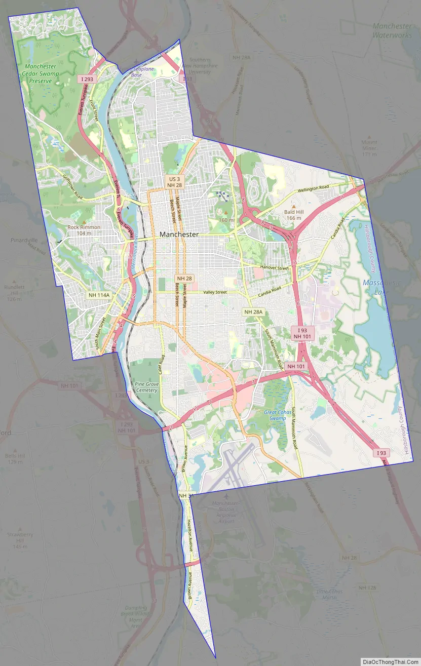
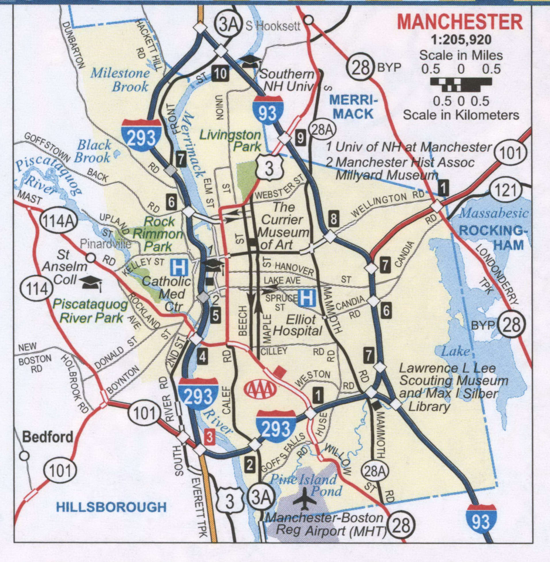
Manchester Road Map
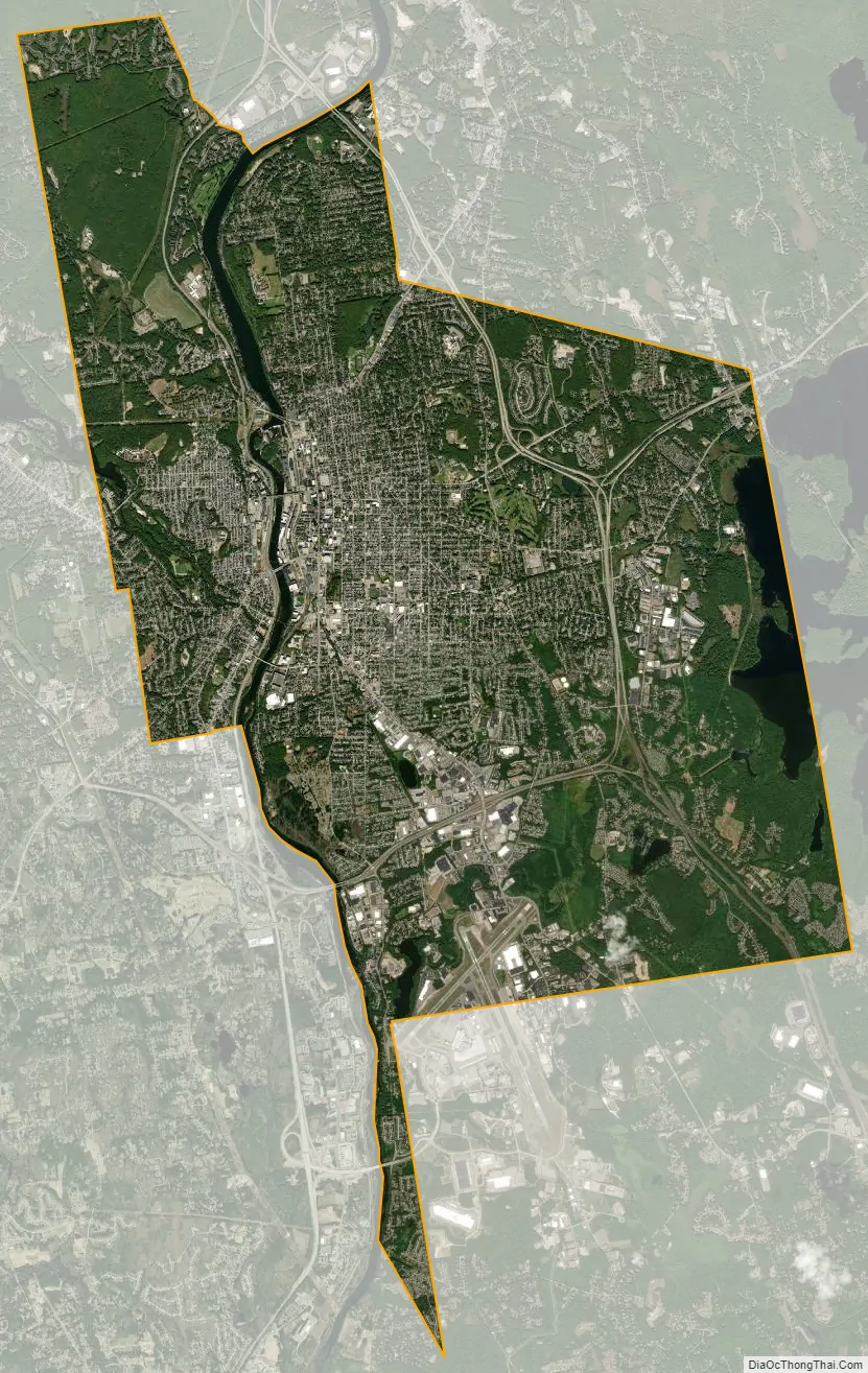
Manchester city Satellite Map
Geography
Manchester is in south-central New Hampshire, 18 miles (29 km) south of Concord, the state capital, and the same distance north of Nashua, the second-largest city in the state. Manchester is 51 miles (82 km) north-northwest of Boston, the largest city in New England.
According to the United States Census Bureau, the city has a total area of 34.9 square miles (90.5 km), of which 33.1 square miles (85.7 km) are land and 1.9 square miles (4.8 km) are water, comprising 5.33% of the city. Manchester is drained by the Merrimack River and its tributaries the Piscataquog River and Cohas Brook. Massabesic Lake is on the eastern border. The highest point in Manchester is atop Wellington Hill, where the elevation reaches 570 feet (170 m) above sea level.
Neighborhoods
The Manchester Planning Board, in its 2010 Master Plan, defines 25 neighborhoods within the city. LivableMHT has drawn maps of the neighborhoods and neighborhood village centers as defined by the city. Recognition of particular neighborhoods varies, with some having neighborhood associations, but none have any legal or political authority.
The major neighborhoods, historically, include Amoskeag, Rimmon Heights, Notre Dame/McGregorville and Piscataquog/Granite Square, also known as “Piscat”, on the West Side; the North End, Janeville/Corey Square, Hallsville and Bakersville on the East Side; and Youngsville and Goffes Falls on the periphery of the city.
In 2007, the city began a Neighborhood Initiatives program to “insure that our neighborhoods are vibrant, livable areas since these are the portions of the city where most of the residents spend their time living, playing, shopping and going to school.” The purpose of this initiative is to foster vibrancy and redevelopment in the neighborhoods, and to restore the sense of neighborhood communities that had been overlooked in the city for some time. The city began the program with street-scape and infrastructure improvements in the Rimmon Heights neighborhood of the West Side, which has spurred growth and investment in and by the community. Despite the success of the program in Rimmon Heights, it was unclear in recent years how the city planned to implement similar programs throughout the city. The city announced plans for extending the Neighborhood Initiatives program to the Hollow neighborhood in February 2012.
Climate
Manchester has a four-season humid continental climate (Köppen Dfa), with long, cold, snowy winters, and very warm and somewhat humid summers; spring and fall in between are crisp and relatively brief transitions. The monthly daily average temperature ranges from 25.6 °F (−3.6 °C) in January to 73.8 °F (23.2 °C) in July. On average, there are 16 days of highs at or above 90 °F (32 °C) and 3.0 days of lows at or below 0 °F (−18 °C) annually. Precipitation is well-spread throughout the year, though winter is the driest season while early spring tends to be the wettest. Record temperatures range from −29 °F (−34 °C) on February 16, 1943, up to 103 °F (39 °C) on July 22, 2011.
See also
Map of New Hampshire State and its subdivision: Map of other states:- Alabama
- Alaska
- Arizona
- Arkansas
- California
- Colorado
- Connecticut
- Delaware
- District of Columbia
- Florida
- Georgia
- Hawaii
- Idaho
- Illinois
- Indiana
- Iowa
- Kansas
- Kentucky
- Louisiana
- Maine
- Maryland
- Massachusetts
- Michigan
- Minnesota
- Mississippi
- Missouri
- Montana
- Nebraska
- Nevada
- New Hampshire
- New Jersey
- New Mexico
- New York
- North Carolina
- North Dakota
- Ohio
- Oklahoma
- Oregon
- Pennsylvania
- Rhode Island
- South Carolina
- South Dakota
- Tennessee
- Texas
- Utah
- Vermont
- Virginia
- Washington
- West Virginia
- Wisconsin
- Wyoming