Map of Lviv

Map of L’viv, Ukraine

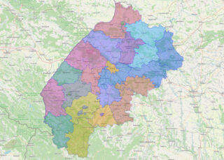
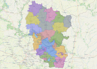
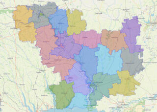
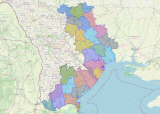
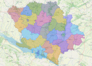
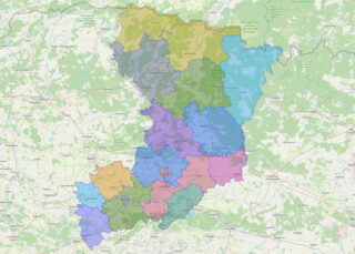
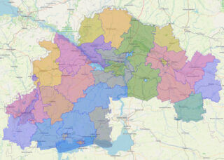
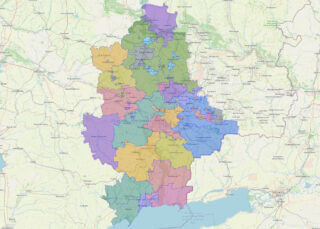
 Lviv Oblast (Ukrainian: Льві́вська о́бласть, romanized: Lvivska oblast, IPA: [ˈlʲʋʲiu̯sʲkɐ ˈɔbɫɐsʲtʲ]; Polish: Obwód lwowski), also referred to as Lvivshchyna (Ukrainian: Льві́вщина, IPA: [ˈlʲʋʲiu̯ʃt͡ʃɪnɐ]), is an oblast in western Ukraine. The administrative center of the oblast is the city of Lviv. The current population is 2,478,133 (2022 est.). Online subdivision map of L’viv oblast Are you planning to … Read more

Map of Luhansk

Map of Luhans’k, Ukraine

 Luhansk Oblast (Ukrainian: Луга́нська о́бласть, romanized: Luhanska oblast; Russian: Луганская область, romanized: Luganskaya oblast), also referred to as Luhanshchyna (Луга́нщина), is the easternmost oblast (province) of Ukraine. The oblast’s administrative center is Luhansk. The oblast was established in 1938 and bore the name Voroshilovgrad Oblast (Ukrainian: Ворошиловградська область, romanized: Voroshylovhradska oblast, until 1958 and again from 1970 … Read more

Map of Mykolayiv

Map of Mykolayiv, Ukraine

 Mykolaiv Oblast (Ukrainian: Микола́ївська о́бласть, romanized: Mykoláyivsʹka óblastʹ, IPA: [mɪkoˈɫɑjiu̯sʲkɐ ˈɔbɫɐsʲtʲ]), also referred to as Mykolayivshchyna (Микола́ївщина, IPA: [mɪkoˈɫɑjiu̯ʃt͡ʃɪnɐ]), is an oblast (province) of Ukraine. The administrative center of the oblast is the city of Mykolaiv. At the most recent estimate, the population of the oblast stood at 1,091,821 (2022 est.). Online subdivision map of Mykolayiv oblast … Read more

Map of Cherkasy

Map of Cherkasy, Ukraine

 Cherkasy Oblast (Ukrainian: Черка́ська о́бласть, romanized: Cherkaska oblast, pronounced [tʃerˈkɑsʲkɐ ˈɔblɐstʲ]), also referred to as Cherkashchyna (Черка́щина, IPA: [tʃerˈkɑʃtʃɪnɐ]) is an oblast (province) in central Ukraine located along the Dnieper River. The administrative center of the oblast is the city of Cherkasy. The current population of the oblast is 1,160,744 (2022 est.). Online subdivision map of Cherkasy … Read more

Map of Odessa

Map of Odessa, Ukraine

 Odesa Oblast (Ukrainian: Оде́ська о́бласть, romanized: Odeska oblast), also referred to as Odeshchyna (Ukrainian: Оде́щина) is an oblast (province) of southwestern Ukraine, located along the northern coast of the Black Sea. Its administrative centre is the city of Odesa (Ukrainian: Одеса). Population: 2,351,382 (2022 est.). The length of coastline (sea-coast and estuaries) reaches 300 km (190 mi), … Read more

Map of Chernihiv

Map of Chernihiv, Ukraine

 Chernihiv Oblast (Ukrainian: Черні́гівська о́бласть, romanized: Chernihivska oblast), also referred to as Chernihivshchyna (Черні́гівщина), is an oblast (province) in northern Ukraine. The administrative center of the oblast is the city of Chernihiv. Within the oblast are 1,511 settlements. Population: 959,315 (2022 est.). Online subdivision map of Chernihiv oblast Chernihiv oblast is a region located in … Read more

Map of Poltava

Map of Poltava, Ukraine

 Poltava Oblast (Ukrainian: Полта́вська о́бласть, romanized: Poltavska oblast; also referred to as Poltavshchyna – Ukrainian: Полта́вщина, literally ‘Poltava Country’) is an oblast (province) of central Ukraine. The administrative center of the oblast is the city of Poltava. Most of its territory is part of the historic Cossack Hetmanate (its southern regions: Poltava, Myrhorod, Lubny, and … Read more

Map of Chernivtsi

Map of Chernivtsi, Ukraine

 Chernivtsi Oblast (Ukrainian: Черніве́цька о́бласть, romanized: Chernivetska oblast), also referred to as Chernivechchyna (Ukrainian: Чернівеччина), is an oblast (province) in Western Ukraine, consisting of the northern parts of the regions of Bukovina and Bessarabia. It has an international border with Romania and Moldova. The oblast is the smallest in Ukraine both by area and population. … Read more

Map of Rivne

Map of Rivne, Ukraine

 Rivne Oblast (Ukrainian: Рі́вненська о́бласть, romanized: Rivnenska oblast), also referred to as Rivnenshchyna (Рі́вненщина), is an oblast (province) in western Ukraine. Its administrative center is Rivne. The surface area of the region is 20,100 square kilometres (7,800 sq mi). Its population is: 1,141,784 (2022 est.). Before its annexation by the Soviet Union during World War II, the … Read more

Map of Crimea

Map of Crimea and Ukraine

 Coordinates: 45°18′N 34°24′E / 45.3°N 34.4°E / 45.3; 34.4 The Autonomous Republic of Crimea, commonly known as Crimea, is an autonomous republic of Ukraine encompassing most of Crimea that was annexed by Russia in 2014. The Autonomous Republic of Crimea occupies most of the peninsula, while the City of Sevastopol (a city with special … Read more

Map of Sevastopol

Map of Sevastopol’, Ukraine

 Sevastopol (/ˌsɛvəˈstoʊpəl, səˈvæstəpoʊl/ SE-və-STOH-pəl, sə-VAS-tə-pohl), sometimes written Sebastopol, is the largest city in Crimea and a major port on the Black Sea. Due to its strategic location and the navigability of the city’s harbours, Sevastopol has been an important port and naval base throughout its history. Since the city’s founding in 1783 it has … Read more

Map of Dnipropetrovsk

Map of Dnipropetrovs’k, Ukraine

 Dnipropetrovsk Oblast (Ukrainian: Дніпропетро́вська о́бласть, romanized: Dnipropetrovska oblast), also referred to as Dnipropetrovshchyna (Ukrainian: Дніпропетро́вщина), is an oblast (province) of southeastern Ukraine, the most important industrial region of the country. It was created on February 27, 1932. Dnipropetrovsk Oblast has a population of about 3,096,485 (2022 est.), approximately 80% of whom live centering on administrative … Read more