Odesa Oblast (Ukrainian: Оде́ська о́бласть, romanized: Odeska oblast), also referred to as Odeshchyna (Ukrainian: Оде́щина) is an oblast (province) of southwestern Ukraine, located along the northern coast of the Black Sea. Its administrative centre is the city of Odesa (Ukrainian: Одеса). Population: 2,351,382 (2022 est.).
The length of coastline (sea-coast and estuaries) reaches 300 km (190 mi), while the state border stretches for 1,200 km (750 mi). The region has eight seaports and five of the biggest lakes, including Yalpuh Lake, in Ukraine. With over 80,000 ha (200,000 acres) of vineyards, it is also the largest wine-growing region in Ukraine.
| Unit Name | Odessa Oblast |
|---|---|
| Administrative center | Odessa |
| Total area | 33.314 km² (12.863 sq mi) |
| Area Rank | Rank 1st |
| Population (2021) | 2.368.107 |
| Time zone | UTC+2 (EET) |
| Summer (DST) | UTC+3 (EEST) |
| Postal code | 65000-68999 |
| Area code | +380-48 |
| ISO 3166 code | UA-51 |
| Website | www.oda.odessa.gov.ua |
| Flag |  |
| Coat of arms |  |
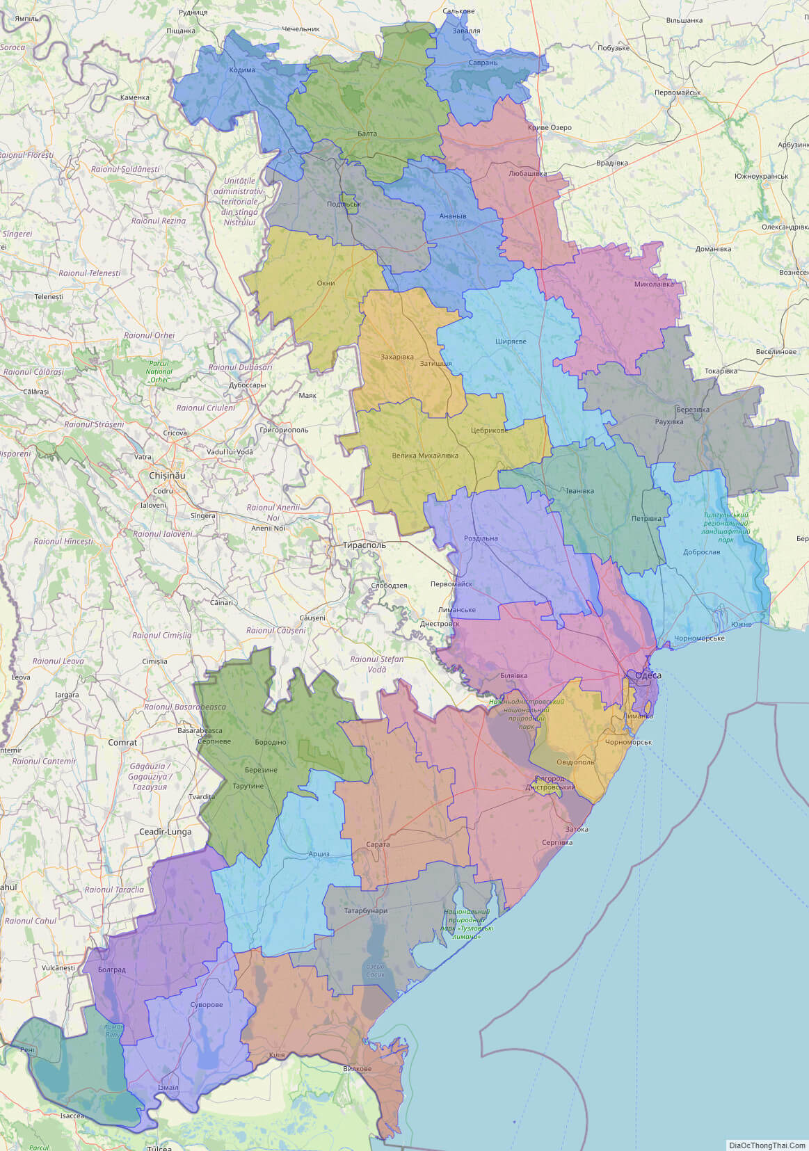
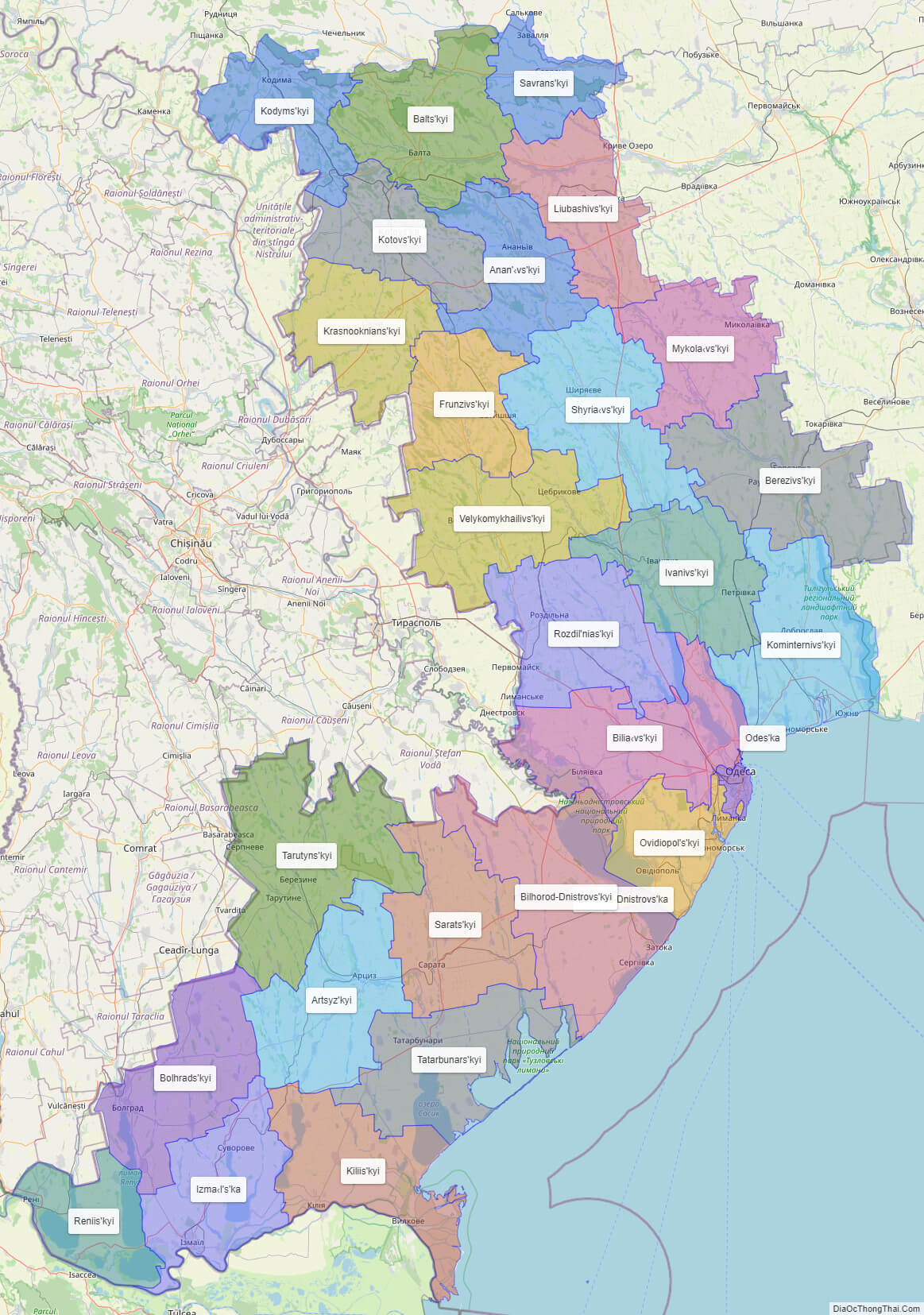
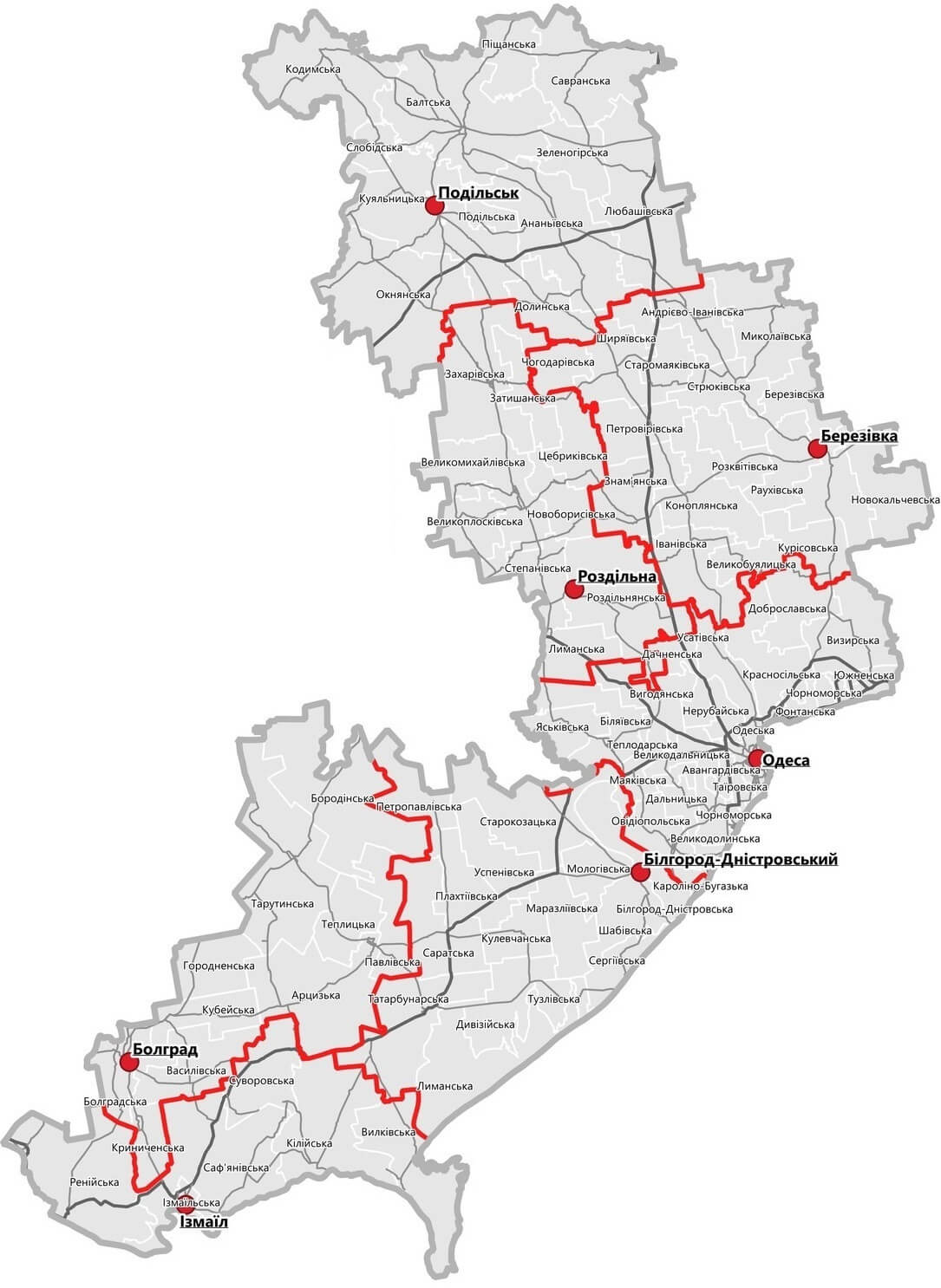
Online subdivision map of Odessa oblast
Odessa Oblast, located in southern Ukraine, is a vibrant and diverse region with a rich history and culture. Whether you’re a local or a visitor, an online subdivision map of the region can be a valuable tool for exploring everything it has to offer.
Using an online base map, such as OpenStreetMap or satellite imagery, you can explore Odessa Oblast and its various sub-administrative units in detail. The map includes a cover layer with different colors to show the borders and boundaries of each area, making it easy to distinguish between them.
You can zoom in and out of the map to get a closer look at the different towns, villages, and cities within Odessa Oblast. This allows you to discover the region’s unique architecture, landmarks, and natural beauty, including the Black Sea coast, the Danube Delta Biosphere Reserve, and the Bessarabian National Park.
Whether you’re planning a road trip or just curious about the region, an online subdivision map of Odessa Oblast can provide you with a wealth of information and insights. So why not take a virtual tour of the area today and discover all that this fascinating region has to offer?
Click on ![]() to view map in "full screen" mode.
to view map in "full screen" mode.
List administrative sub-division of Odessa oblast
| # | Name | Type |
|---|---|---|
| 1 | Bilhorod-Dnistrovs’ka | Mis’ka Rada |
| 2 | Izma‹l’s’ka | Misto |
| 3 | Kotovs’ka | Misto |
| 4 | Odes’ka | Misto |
| 5 | Anan’‹vs’kyi | Raion |
| 6 | Artsyz’kyi | Raion |
| 7 | Balts’kyi | Raion |
| 8 | Berezivs’kyi | Raion |
| 9 | Bilhorod-Dnistrovs’kyi | Raion |
| 10 | Bilia‹vs’kyi | Raion |
| 11 | Bolhrads’kyi | Raion |
| 12 | Frunzivs’kyi | Raion |
| 13 | Ivanivs’kyi | Raion |
| 14 | Kiliis’kyi | Raion |
| 15 | Kodyms’kyi | Raion |
| 16 | Kominternivs’kyi | Raion |
| 17 | Kotovs’kyi | Raion |
| 18 | Krasnooknians’kyi | Raion |
| 19 | Liubashivs’kyi | Raion |
| 20 | Mykola‹vs’kyi | Raion |
| 21 | Ovidiopol’s’kyi | Raion |
| 22 | Reniis’kyi | Raion |
| 23 | Rozdil’nias’kyi | Raion |
| 24 | Sarats’kyi | Raion |
| 25 | Savrans’kyi | Raion |
| 26 | Shyria‹vs’kyi | Raion |
| 27 | Tarutyns’kyi | Raion |
| 28 | Tatarbunars’kyi | Raion |
| 29 | Velykomykhailivs’kyi | Raion |
Explaination:
- Mis’ka Rada: City municipalities (governed by a mayor and a city council)
- Misto: city at least 10,000 people (not a town).
- Raion: often translated as “district”.
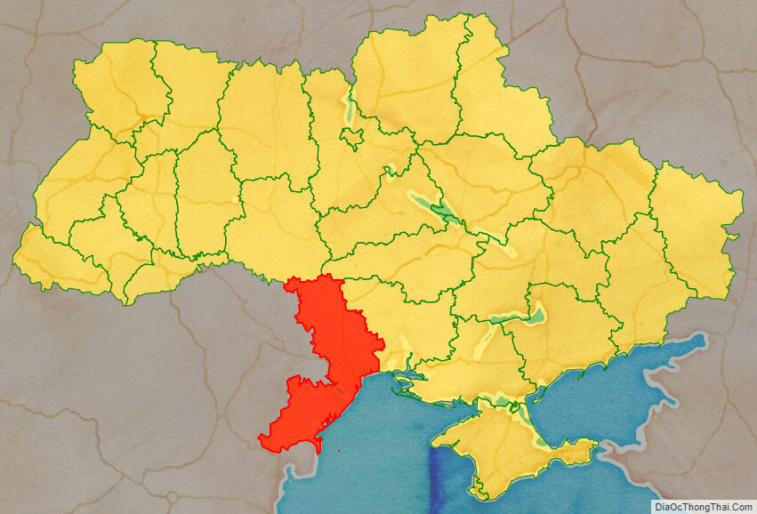
Location map of Odessa oblast, Ukraine

Political map of Odessa oblast
Detail map of Odessa oblast
Odessa oblast streeet map

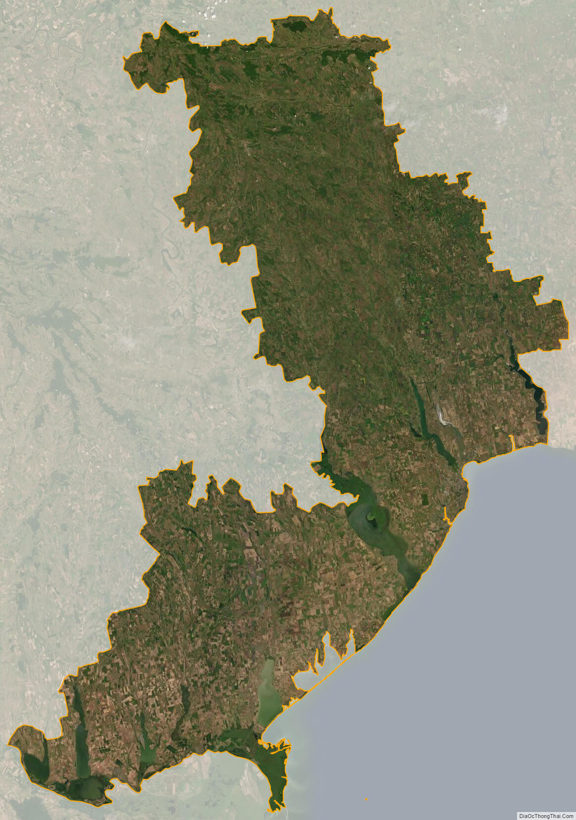
Odessa oblast satellite map