Lviv Oblast (Ukrainian: Льві́вська о́бласть, romanized: Lvivska oblast, IPA: [ˈlʲʋʲiu̯sʲkɐ ˈɔbɫɐsʲtʲ]; Polish: Obwód lwowski), also referred to as Lvivshchyna (Ukrainian: Льві́вщина, IPA: [ˈlʲʋʲiu̯ʃt͡ʃɪnɐ]), is an oblast in western Ukraine. The administrative center of the oblast is the city of Lviv. The current population is 2,478,133 (2022 est.).
| Unit Name | L'viv |
|---|---|
| Administrative center | Lviv |
| Total area | 21.833 km² (8.430 sq mi) |
| Area Rank | Rank 17th |
| Population (2021) | 2.497.750 |
| Time zone | UTC+2 (EET) |
| Summer (DST) | UTC+3 (EEST) |
| Postal code | 79-82 |
| Area code | +380-32 |
| ISO 3166 code | UA-46 |
| Website | www.loda.gov.ua |
| Flag |  |
| Coat of arms |  |
Online subdivision map of L’viv oblast
Are you planning to visit Lviv Oblast and want to get a better understanding of the area’s subdivisions? Look no further than an online subdivision map! With just a few clicks, you can access a wealth of information about the region’s sub-administrative units, including rayons, cities, towns, and villages.
Lviv Oblast is a fascinating destination with a rich history and culture. The area is home to many stunning landmarks, including the UNESCO World Heritage site of Lviv’s Old Town, as well as the breathtaking Carpathian Mountains. By using an online subdivision map, you can easily navigate the region and plan your trip accordingly.
The online subdivision map of Lviv Oblast features a base map that can be customized to your preferences, including OpenStreetMap and satellite views. Each sub-administrative unit is clearly marked with its own color and labeled with the appropriate name. Additionally, the map can be zoomed in or out to view different levels of detail, from streets and buildings to broader landscapes and natural features.
Whether you’re a local resident or a first-time visitor to Lviv Oblast, an online subdivision map is a valuable tool for exploring the area’s diverse regions and planning your trip with ease.
Click on ![]() to view map in "full screen" mode.
to view map in "full screen" mode.
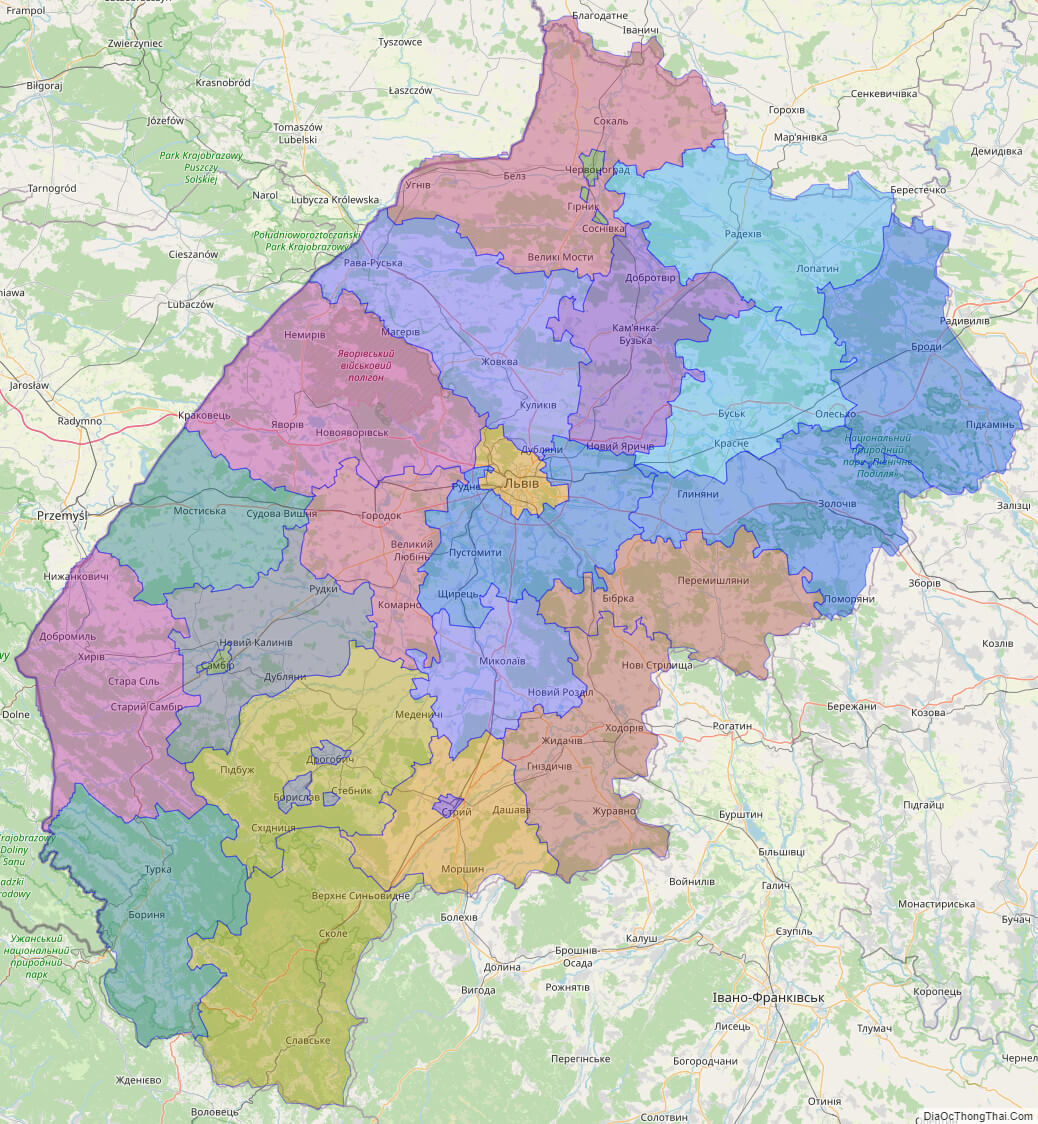
List administrative sub-division of L’viv oblast
| # | Name | Type |
|---|---|---|
| 1 | Chervonohrads’ka | Mis’ka Rada |
| 2 | Drohobyts’ka | Mis’ka Rada |
| 3 | L’vivs’ka | Mis’ka Rada |
| 4 | Sambirs’ka | Misto |
| 5 | Stryis’ka | Misto |
| 6 | Brodivs’kyi | Raion |
| 7 | Bus’kyi | Raion |
| 8 | Drohobyts’kyi | Raion |
| 9 | Horodots’kyi | Raion |
| 10 | Iavorivs’kyi | Raion |
| 11 | Kamianka-Buz’kyi | Raion |
| 12 | Mostys’kyi | Raion |
| 13 | Mykola‹vs’kyi | Raion |
| 14 | Peremyshlians’kyi | Raion |
| 15 | Pustomytivs’kyi | Raion |
| 16 | Radekhivs’kyi | Raion |
| 17 | Sambirs’kyi | Raion |
| 18 | Skolivs’kyi | Raion |
| 19 | Sokal’s’kyi | Raion |
| 20 | Starosambirs’kyi | Raion |
| 21 | Stryis’kyi | Raion |
| 22 | Turkivs’kyi | Raion |
| 23 | Zhovkivs’kyi | Raion |
| 24 | Zhydachivs’kyi | Raion |
| 25 | Zolochivs’kyi | Raion |
Explaination:
- Mis’ka Rada: City municipalities (governed by a mayor and a city council)
- Misto: city at least 10,000 people (not a town).
- Raion: often translated as “district”.
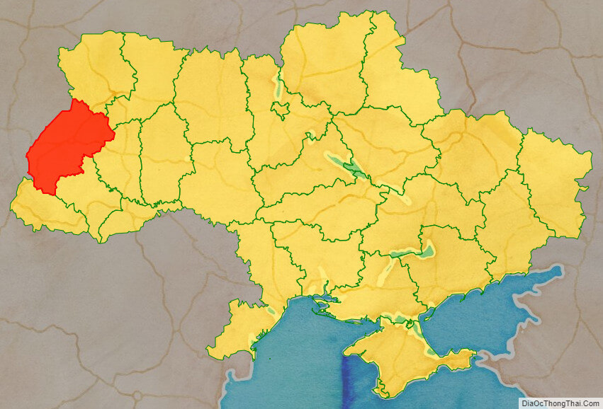
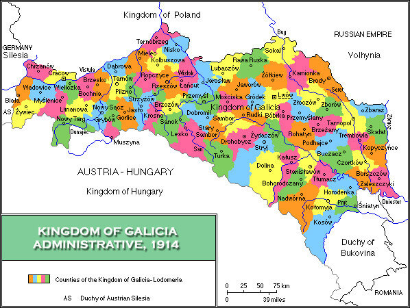
Location map of L’viv oblast, Ukraine

Political map of L’viv oblast
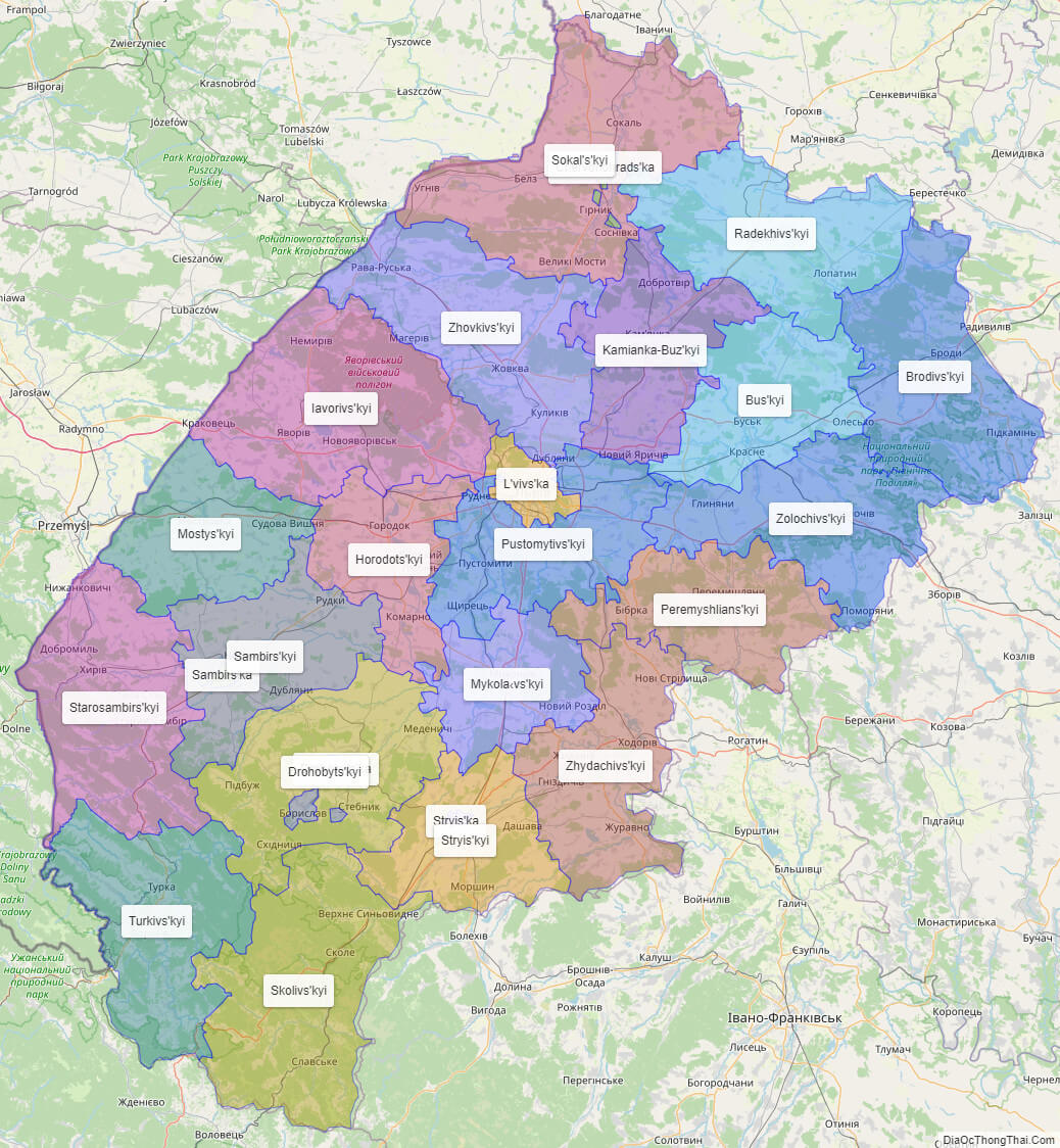
Detail map of L’viv oblast
L’viv oblast streeet map

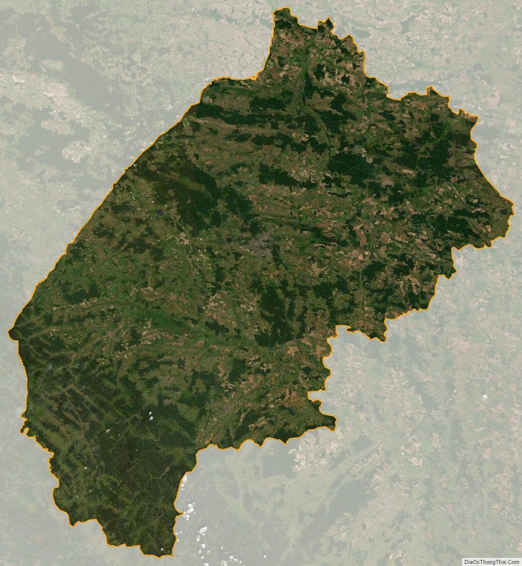
L’viv oblast satellite map