Chernivtsi Oblast (Ukrainian: Черніве́цька о́бласть, romanized: Chernivetska oblast), also referred to as Chernivechchyna (Ukrainian: Чернівеччина), is an oblast (province) in Western Ukraine, consisting of the northern parts of the regions of Bukovina and Bessarabia. It has an international border with Romania and Moldova. The oblast is the smallest in Ukraine both by area and population. Chernivtsi was part of Romania. In 1408, when it was a town in Moldavia and the chief centre of the area known as Bukovina. Chernivtsi later passed to the Turks and then in 1774 to Austria. After World War I it was ceded to Romania, and in 1940 the town was acquired by the Ukrainian SSR.
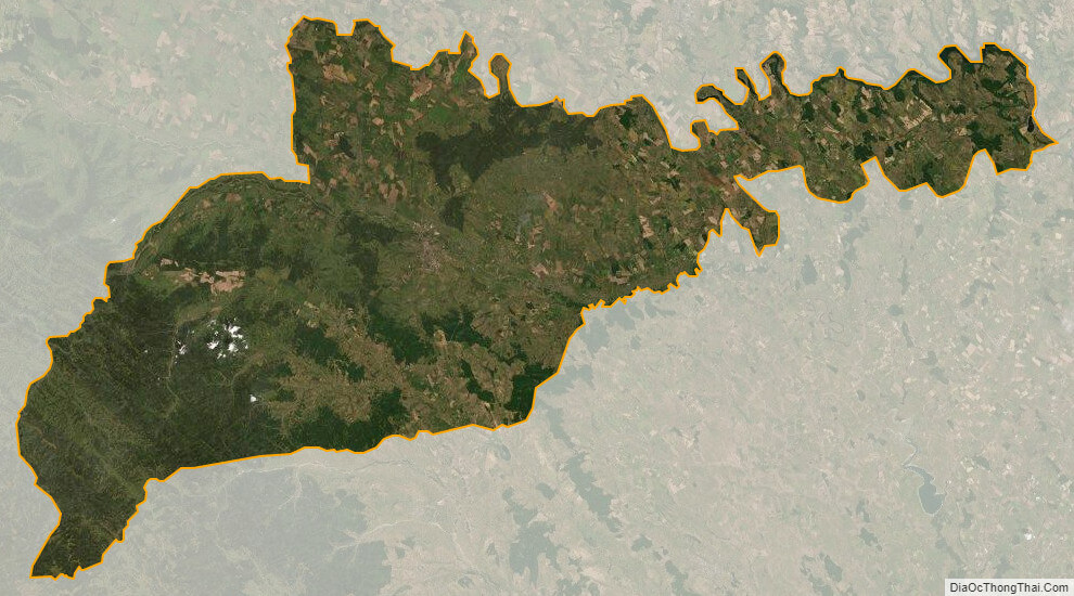
The oblast has a large variety of landforms: the Carpathian Mountains and picturesque hills at the foot of the mountains gradually change to a broad partly forested plain situated between the Dniester and Prut rivers. It has a population of 890,457 (2022 est.) and its capital is the city Chernivtsi. The region spans 8,100 km.
| Unit Name | Chernivtsi Oblast |
|---|---|
| Administrative center | Chernivtsi |
| Major cities | Chernivtsi, Novodnistrovsk |
| Total area | 8.097 km² (3.126 sq mi) |
| Area Rank | Rank 25th |
| Population (2021) | 896.566' |
| Time zone | UTC+2 (EET) |
| Summer (DST) | UTC+3 (EEST) |
| Postal code | 58-60xxx |
| Area code | +380-37 |
| ISO 3166 code | UA-77 |
| Website | www.oda.cv.ua www.rada.gov.ua |
| Flag |  |
| Coat of arms |  |
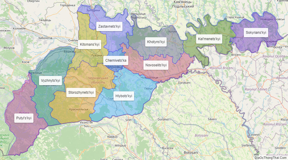
Online subdivision map of Chernivtsi oblast
Chernivtsi is an oblast located in western Ukraine, and its political subdivisions can be explored through an online subdivision map. This interactive map features a base layer that can be customized to your preference, including options for Open Street Map or satellite imagery. The map also includes a cover layer that uses a range of colors to differentiate between the various sub-administrative units, making it easy to identify their boundaries.
Whether you’re a local resident or a visitor to the area, this online subdivision map of Chernivtsi allows you to zoom in and out for a more detailed view of specific areas, including streets, buildings, and other points of interest. It’s a valuable tool for anyone looking to navigate the region or gain a better understanding of the political subdivisions within Chernivtsi oblast.
Click on ![]() to view map in "full screen" mode.
to view map in "full screen" mode.
List administrative sub-division of Chernivtsi oblast
| # | Name | Type |
|---|---|---|
| 1 | Chernivets’ka | Misto |
| 2 | Hlybots’kyi | Raion |
| 3 | Kel’menets’kyi | Raion |
| 4 | Khotyns’kyi | Raion |
| 5 | Kitsmans’kyi | Raion |
| 6 | Novoselits’kyi | Raion |
| 7 | Putyl’s’kyi | Raion |
| 8 | Sokyrians’kyi | Raion |
| 9 | Storozhynets’kyi | Raion |
| 10 | Vyzhnyts’kyi | Raion |
| 11 | Zastavnets’kyi | Raion |
Explaination:
- Mis’ka Rada: City municipalities (governed by a mayor and a city council)
- Misto: city at least 10,000 people (not a town).
- Raion: often translated as “district”.
Location map of Chernivtsi oblast, Ukraine
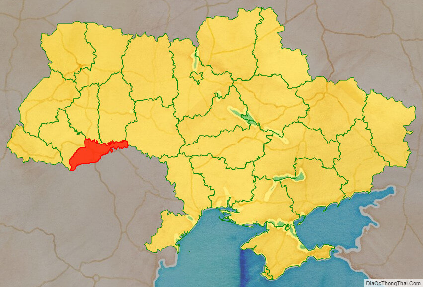

Political map of Chernivtsi oblast

Detail map of Chernivtsi oblast
Chernivtsi oblast streeet map

Chernivtsi oblast satellite map