Rivne Oblast (Ukrainian: Рі́вненська о́бласть, romanized: Rivnenska oblast), also referred to as Rivnenshchyna (Рі́вненщина), is an oblast (province) in western Ukraine. Its administrative center is Rivne. The surface area of the region is 20,100 square kilometres (7,800 sq mi). Its population is: 1,141,784 (2022 est.).
Before its annexation by the Soviet Union during World War II, the region was part of the Second Polish Republic’s Wołyń Voivodeship following the Polish–Soviet War. Previously it was part of the Volhynian Governorate.
The Rivne Nuclear Power Plant is located in the oblast, near the city of Varash.
| Unit Name | Rivne Oblast |
|---|---|
| Administrative center | Rivne |
| Total area | 20.047 km² (7.740 sq mi) |
| Area Rank | Rank 22th |
| Population (2021) | 1.148.456 |
| Time zone | UTC+2 (EET) |
| Summer (DST) | UTC+3 (EEST) |
| Postal code | 33xxx-35xxx |
| Area code | +380-36 |
| ISO 3166 code | UA-56 |
| Website | www.rv.gov.ua |
| Flag |  |
| Coat of arms |  |
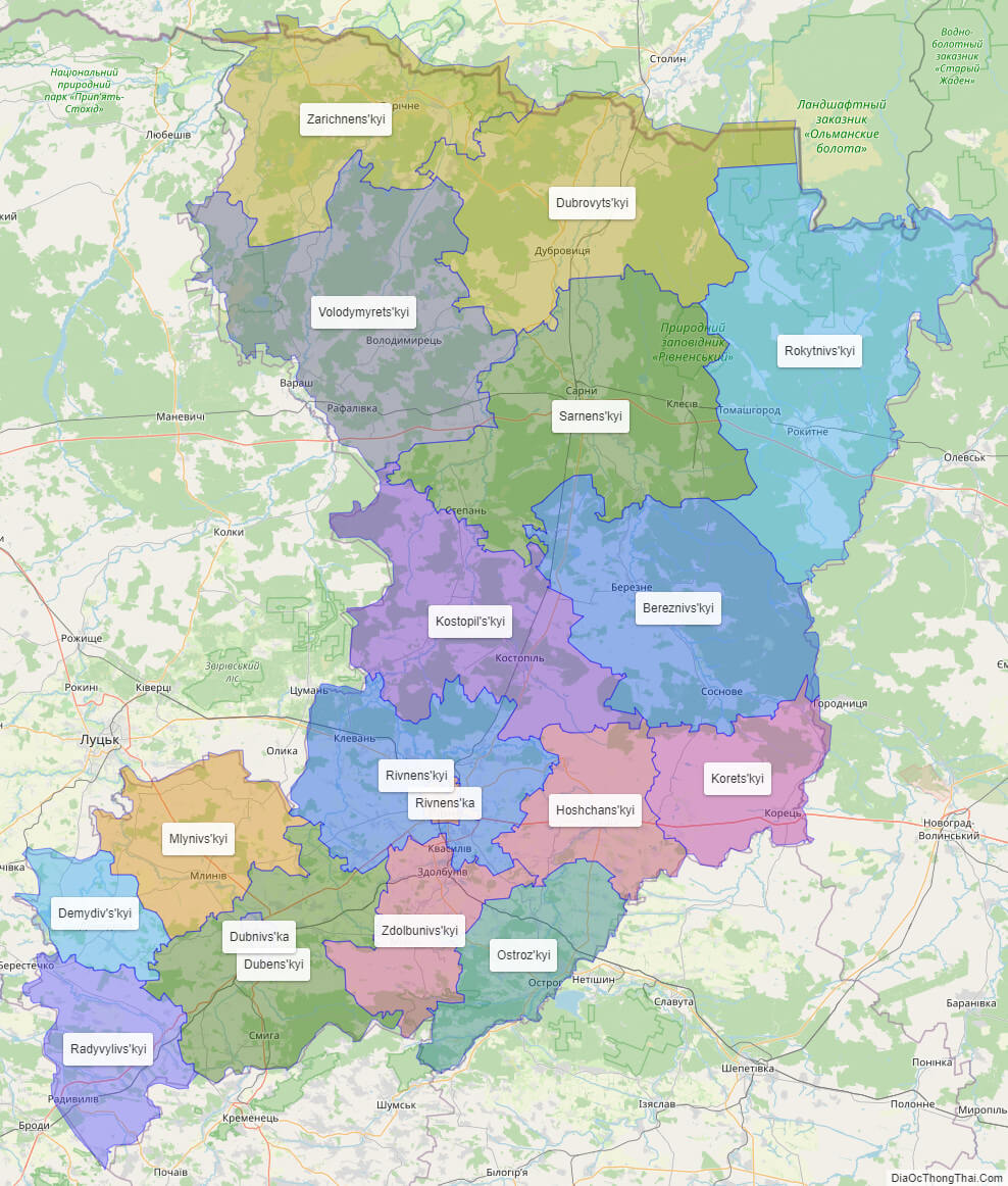
Online subdivision map of Rivne oblast
Rivne Oblast, located in western Ukraine, is a beautiful and diverse region with a rich history and culture. Whether you’re a local or a visitor, an online subdivision map of the region can be a valuable tool for exploring everything it has to offer.
Using an online base map, such as OpenStreetMap or satellite imagery, you can view the oblast and its various sub-administrative units in detail. The map includes a cover layer with different colors to show the borders and boundaries of each area, making it easy to distinguish between them.
You can zoom in and out of the map to get a closer look at the different towns, villages, and cities within Rivne Oblast. This allows you to explore the region’s unique architecture, landmarks, and natural beauty, including the stunning forests and lakes of the Rivne region.
Whether you’re planning a day trip or simply curious about the region, an online subdivision map of Rivne Oblast can provide you with a wealth of information and insights. So why not take a virtual tour of the area today?
Click on ![]() to view map in "full screen" mode.
to view map in "full screen" mode.
List administrative sub-division of Rivne oblast
| # | Name | Type |
|---|---|---|
| 1 | Dubnivs’ka | Misto |
| 2 | Rivnens’ka | Misto |
| 3 | Bereznivs’kyi | Raion |
| 4 | Demydiv’s’kyi | Raion |
| 5 | Dubens’kyi | Raion |
| 6 | Dubrovyts’kyi | Raion |
| 7 | Hoshchans’kyi | Raion |
| 8 | Korets’kyi | Raion |
| 9 | Kostopil’s’kyi | Raion |
| 10 | Mlynivs’kyi | Raion |
| 11 | Ostroz’kyi | Raion |
| 12 | Radyvylivs’kyi | Raion |
| 13 | Rivnens’kyi | Raion |
| 14 | Rokytnivs’kyi | Raion |
| 15 | Sarnens’kyi | Raion |
| 16 | Volodymyrets’kyi | Raion |
| 17 | Zarichnens’kyi | Raion |
| 18 | Zdolbunivs’kyi | Raion |
Explaination:
- Mis’ka Rada: City municipalities (governed by a mayor and a city council)
- Misto: city at least 10,000 people (not a town).
- Raion: often translated as “district”.
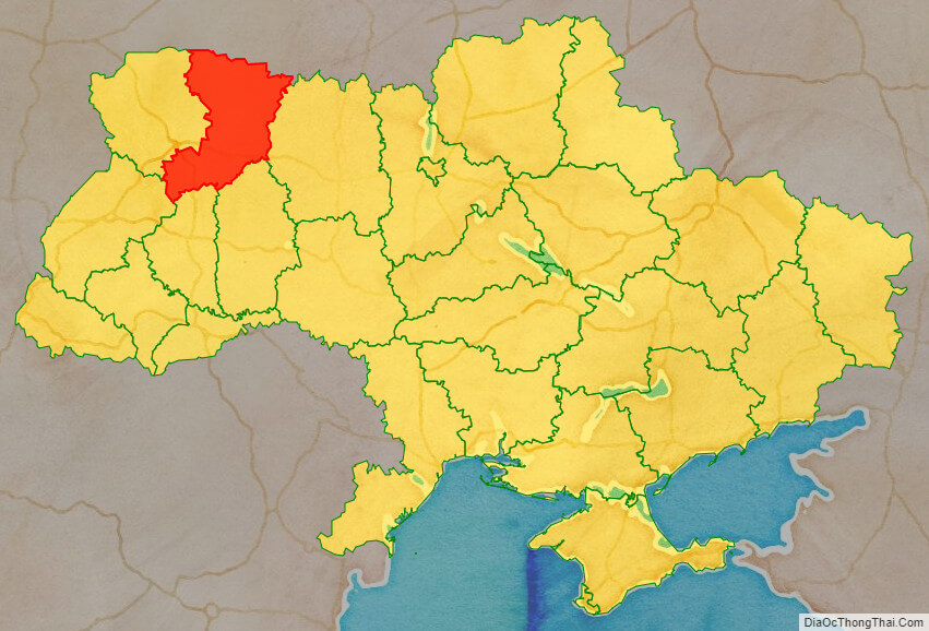
Location map of Rivne oblast, Ukraine

Political map of Rivne oblast

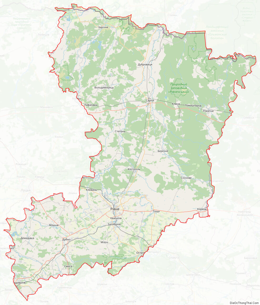
Rivne oblast streeet map
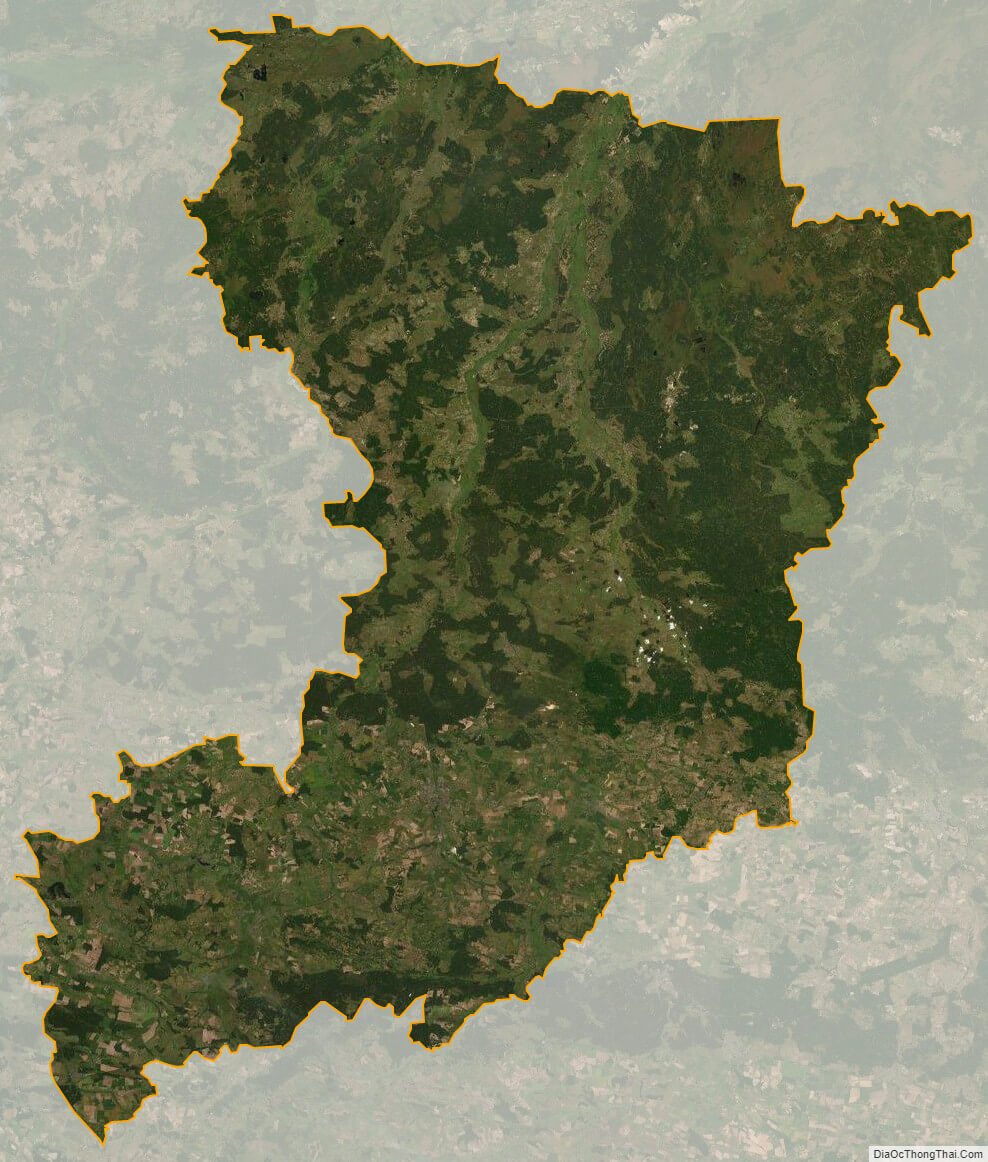
Rivne oblast satellite map