Mykolaiv Oblast (Ukrainian: Микола́ївська о́бласть, romanized: Mykoláyivsʹka óblastʹ, IPA: [mɪkoˈɫɑjiu̯sʲkɐ ˈɔbɫɐsʲtʲ]), also referred to as Mykolayivshchyna (Микола́ївщина, IPA: [mɪkoˈɫɑjiu̯ʃt͡ʃɪnɐ]), is an oblast (province) of Ukraine. The administrative center of the oblast is the city of Mykolaiv. At the most recent estimate, the population of the oblast stood at 1,091,821 (2022 est.).
| Unit Name | Mykolayiv Oblast |
|---|---|
| Administrative center | Mykolaiv |
| Total area | 24.598 km² (9.497 sq mi) |
| Area Rank | Rank 14th |
| Population (2021) | 1.108.394 |
| Time zone | UTC+2 (EET) |
| Summer (DST) | UTC+3 (EEST) |
| Postal code | 54000-56999 |
| Area code | +380-51 |
| ISO 3166 code | UA-48 |
| Website | www.mk.gov.ua www.mk-oblrada.gov.ua |
| Flag |  |
| Coat of arms |  |
Online subdivision map of Mykolayiv oblast
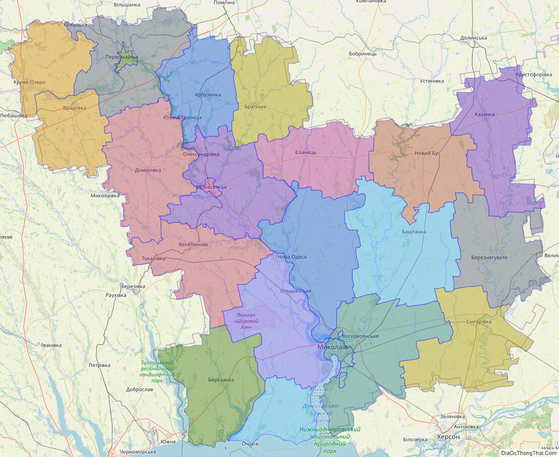
Mykolayiv Oblast, located in southern Ukraine, offers a wide range of sights and attractions for both locals and visitors. To explore this region in detail, an online subdivision map can be a valuable tool. Using an online base map like OpenStreetMap or satellite imagery, you can easily view the oblast and its various sub-administrative units. The map features a cover layer with different colors to indicate the borders and boundaries of each area, making it easy to navigate. By zooming in and out of the map, you can explore the unique features of Mykolayiv Oblast’s different towns, villages, and cities. Discover the stunning natural landscapes, including the Southern Buh River, the Black Sea coast, and the Kinburn Spit. You can also find notable landmarks like the Mykolayiv Zoo, the Museum of Shipbuilding and Fleet, and the Shabo Wine Culture Center. Whether you are planning a day trip or simply interested in learning more about the region, an online subdivision map of Mykolayiv Oblast can provide you with a wealth of information and insights. So why not take a virtual tour of the area today and explore all that this vibrant region has to offer?
Click on ![]() to view map in "full screen" mode.
to view map in "full screen" mode.
List administrative sub-division of Mykolayiv oblast
| # | Name | Type |
|---|---|---|
| 1 | Mykola‹vs’ka | Misto |
| 2 | Pervomais’ka | Misto |
| 3 | Voznesens’ka | Misto |
| 4 | Arbuzyns’kyi | Raion |
| 5 | Bashtans’kyi | Raion |
| 6 | Berezans’kyi | Raion |
| 7 | Bereznehuvats’kyi | Raion |
| 8 | Brats’kyi | Raion |
| 9 | Domanivs’kyi | Raion |
| 10 | Ielanets’kyi | Raion |
| 11 | Kazanetskyi | Raion |
| 12 | Kryvoozers’kyi | Raion |
| 13 | Mykola‹vs’kyi | Raion |
| 14 | Novobuz’kyi | Raion |
| 15 | Novoodes’kyi | Raion |
| 16 | Ochakivs’kyi | Raion |
| 17 | Pervomais’kyi | Raion |
| 18 | Snihurivs’kyi | Raion |
| 19 | Veselynivs’kyi | Raion |
| 20 | Voznesens’kyi | Raion |
| 21 | Vradi‹vs’kyi | Raion |
| 22 | Zhovtnevyi | Raion |
Explaination:
- Mis’ka Rada: City municipalities (governed by a mayor and a city council)
- Misto: city at least 10,000 people (not a town).
- Raion: often translated as “district”.
Location map of Mykolayiv oblast, Ukraine


Political map of Mykolayiv oblast

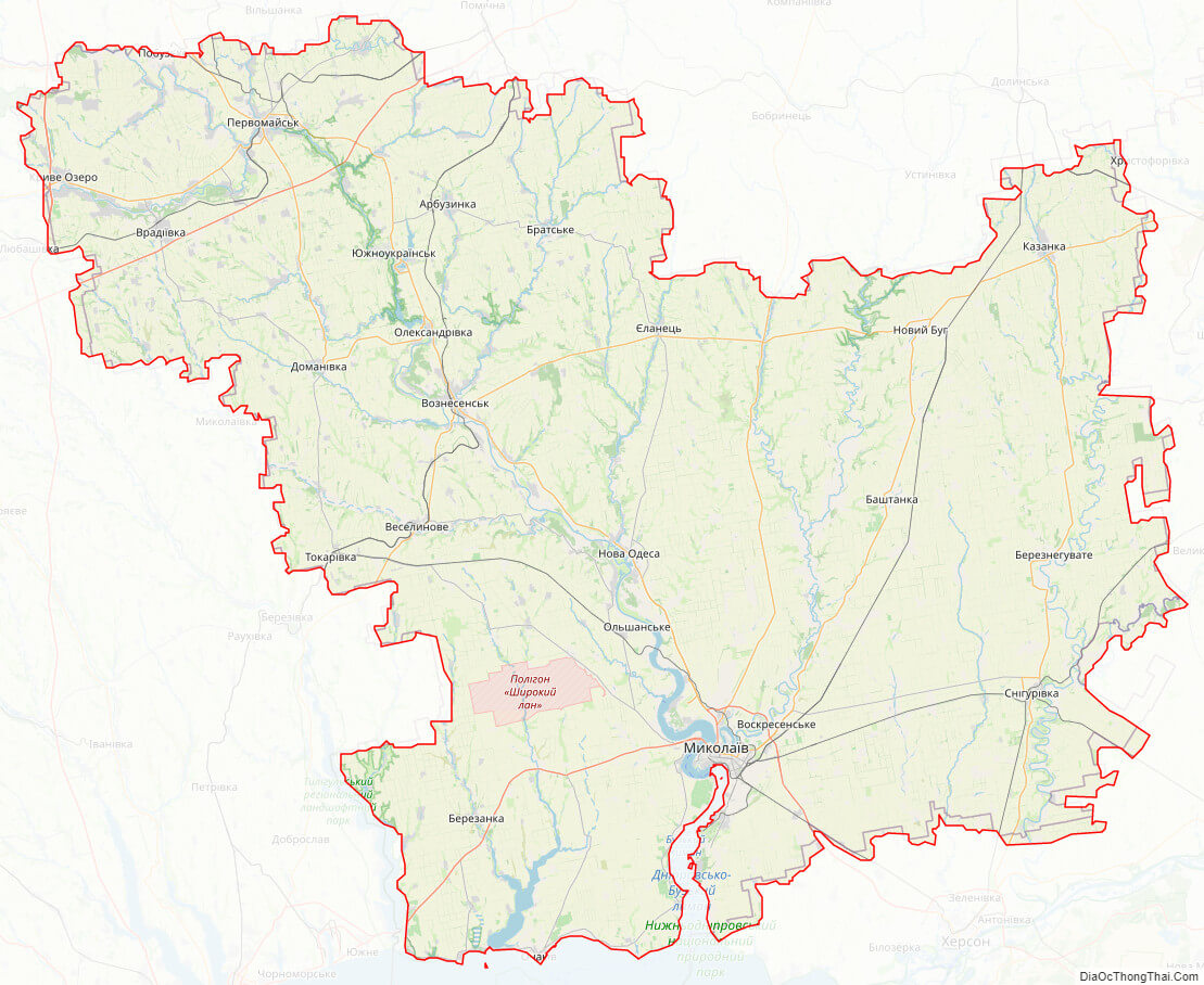
Mykolayiv oblast streeet map
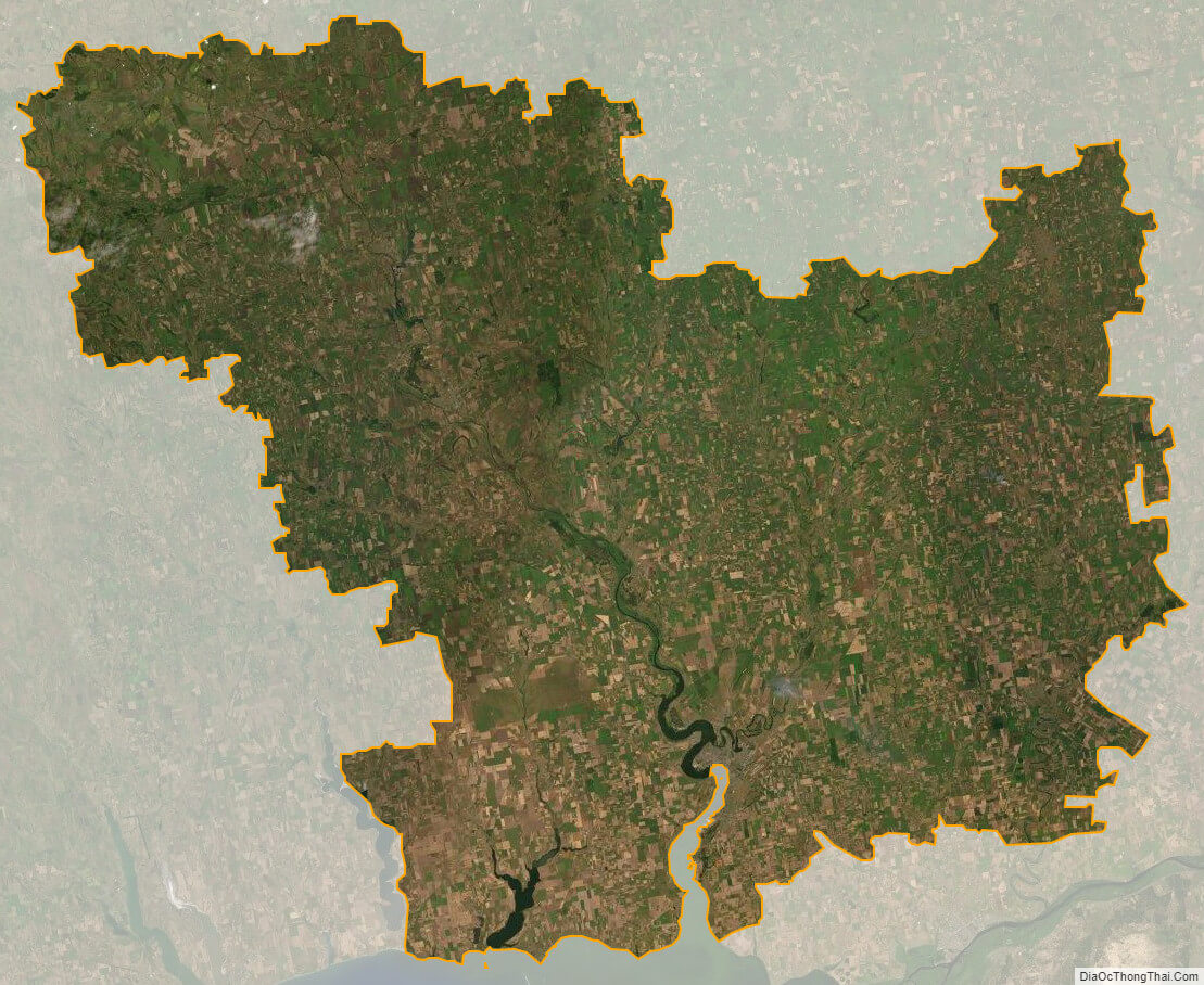
Mykolayiv oblast satellite map