Coordinates: 45°18′N 34°24′E / 45.3°N 34.4°E
The Autonomous Republic of Crimea, commonly known as Crimea, is an autonomous republic of Ukraine encompassing most of Crimea that was annexed by Russia in 2014. The Autonomous Republic of Crimea occupies most of the peninsula, while the City of Sevastopol (a city with special status within Ukraine) occupies the rest.
The Cimmerians, Bulgars, Greeks, Scythians, Goths, Huns, Khazars, the state of Kievan Rus’, Byzantine Greeks, Kipchaks, Ottoman Turks, Golden Horde Tatars and the Mongols each controlled Crimea in its earlier history. In the 13th century, it was partly controlled by the Venetians and by the Genoese. They were followed by the Crimean Khanate and the Ottoman Empire in the 15th to 18th centuries, the Russian Empire in the 18th to 20th centuries, Germany during World War II, and the Russian Soviet Federative Socialist Republic, and later the Ukrainian Soviet Socialist Republic, within the Soviet Union during the rest of the 20th century until Crimea became part of independent Ukraine with the breakup of the Soviet Union in 1991.
Following the February 2014 Ukrainian revolution that ousted Ukrainian president Viktor Yanukovych, pro-Russian separatists and Russian troops took control of the territory. A controversial Crimea-wide referendum was held on the issue of becoming part of Russia, which, according to the official results, was supported by the overwhelming majority of Crimeans who voted. Russia formally annexed Crimea on 18 March 2014, incorporating the Republic of Crimea and the federal city of Sevastopol as the 84th and 85th federal subjects of Russia. While Russia and 17 other UN member states recognize Crimea as part of the Russian Federation, Ukraine continues to claim Crimea as an integral part of its territory, supported by most foreign governments and United Nations General Assembly Resolution 68/262.
The Autonomous Republic of Crimea is an autonomous parliamentary republic within Ukraine and is governed by the Constitution of Crimea in accordance with the laws of Ukraine. The capital and administrative seat of the republic’s government is the city of Simferopol, located in the centre of the peninsula. Crimea’s area is 26,200 square kilometres (10,100 sq mi) and its population was 1,973,185 as of 2007. These figures do not include the area and population of the City of Sevastopol (2007 population: 379,200), which is administratively separate from the autonomous republic. The peninsula thus has 2,352,385 people (2007 estimate).
Crimean Tatars, a predominantly Muslim ethnic minority who in 2001 made up 12.10% of the population, formed in Crimea in the late Middle Ages, after the Crimean Khanate had come into existence. The Crimean Tatars were forcibly expelled to Central Asia by Joseph Stalin’s government. After the fall of the Soviet Union, Crimean Tatars began to return to the region. According to the 2001 Ukrainian population census 58% of the population of Crimea are ethnic Russians and 24% are ethnic Ukrainians. The region has the highest proportion of Muslims in Ukraine.
| Unit Name | Crimea |
|---|---|
| Thủ đô | Simferopol |
| Total area | 26.100 km² (10.100 sq mi) |
| Area Rank | Rank 13th |
| Population (2021) | 2.033.700 |
| Flag |  |
| Coat of arms |  |
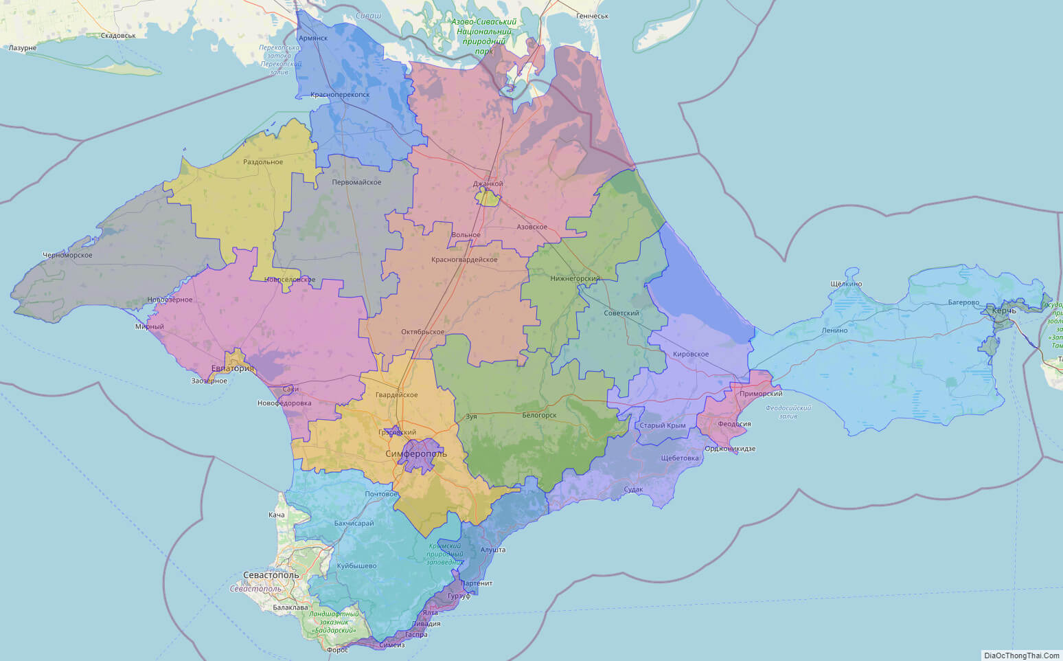
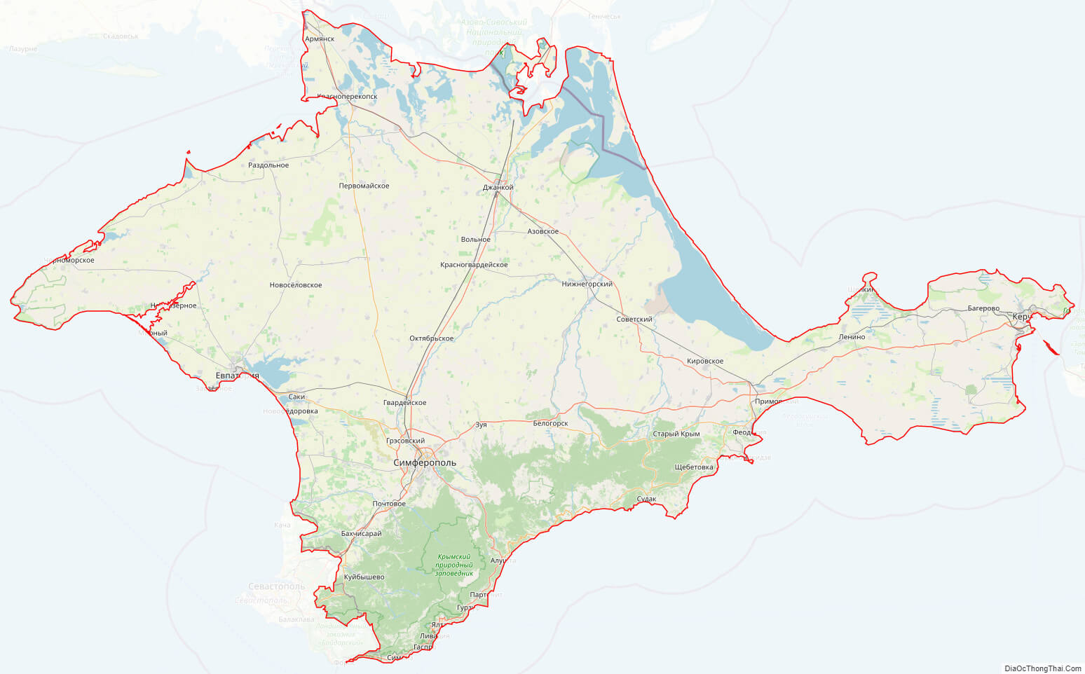
Online subdivision map of Crimea oblast
An online subdivision map of Crimea oblast can be a valuable tool for anyone looking to explore and learn more about this fascinating region. By using online base maps, such as OpenStreetMap or satellite imagery, you can view the Crimea oblast and its various sub-administrative units in detail.
The map includes a cover layer with different colors to show the borders and boundaries of each area, making it easy to distinguish between them. This allows you to zoom in and out of the map to get a closer look at the different towns, villages, and cities within Crimea oblast.
Whether you’re a researcher, a student, or simply curious about the region, an online subdivision map of Crimea oblast can provide you with a wealth of information and insights. You can explore the unique architecture, landmarks, and natural beauty of Crimea oblast, including its museums, parks, and historic sites.
So why not take advantage of this powerful tool and discover all that Crimea oblast has to offer?
Click on ![]() to view map in "full screen" mode.
to view map in "full screen" mode.
List administrative sub-division of Crimea oblast
| # | Name | Type |
|---|---|---|
| 1 | Alushtyns’ka | Mis’ka Rada |
| 2 | Simferopol’s’ka | Mis’ka Rada |
| 3 | Dzhankois’ka | Misto |
| 4 | Feodosiis’ka | Misto |
| 5 | Ialtyns’ka | Misto |
| 6 | Ievpatoriis’ka | Misto |
| 7 | Kerchens’ka | Misto |
| 8 | Saks’ka | Misto |
| 9 | Sudats’ka | Misto |
| 10 | Bakhchysarais’kyi | Raion |
| 11 | Bilohirs’kyi | Raion |
| 12 | Chornomors’kyi | Raion |
| 13 | Dzhankois’kyi | Raion |
| 14 | Kirovs’kyi | Raion |
| 15 | Krasnohvardiis’kyi | Raion |
| 16 | Krasnoperekops’kyi | Raion |
| 17 | Lenins’kyi | Raion |
| 18 | Nyzhn’ohirs’kyi | Raion |
| 19 | Pervomais’kyi | Raion |
| 20 | Rozdol’nens’kyi | Raion |
| 21 | Saks’kyi | Raion |
| 22 | Simferopol’s’kyi | Raion |
| 23 | Soviets’kyi | Raion |
Explaination:
- Mis’ka Rada: City municipalities (governed by a mayor and a city council)
- Misto: city at least 10,000 people (not a town).
- Raion: often translated as “district”.
Location map of Crimea oblast, Ukraine


Political map of Crimea oblast
Detail map of Crimea oblast
Crimea oblast streeet map
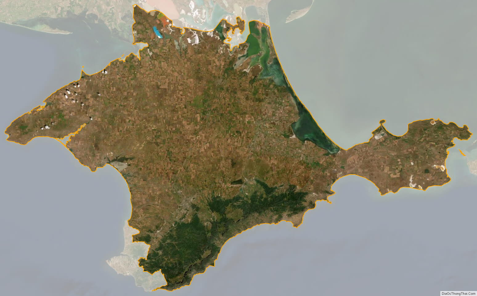
Crimea oblast satellite map