Poltava Oblast (Ukrainian: Полта́вська о́бласть, romanized: Poltavska oblast; also referred to as Poltavshchyna – Ukrainian: Полта́вщина, literally ‘Poltava Country’) is an oblast (province) of central Ukraine. The administrative center of the oblast is the city of Poltava. Most of its territory is part of the historic Cossack Hetmanate (its southern regions: Poltava, Myrhorod, Lubny, and Hadiach). Population: 1,352,283 (2022 est.).
Two other important cities there are Horishni Plavni and Kremenchuk.
| Unit Name | Poltava Oblast |
|---|---|
| Administrative center | Poltava |
| Total area | 28.748 km² (11.100 sq mi) |
| Area Rank | Rank 6th |
| Population (2021) | 1.371.529 |
| Time zone | UTC+2 (EET) |
| Summer (DST) | UTC+3 (EEST) |
| Postal code | 36000-38999 |
| Area code | +380-53 |
| ISO 3166 code | UA-53 |
| Website | www.oblrada-pl.gov.ua/ |
| Flag |  |
| Coat of arms |  |
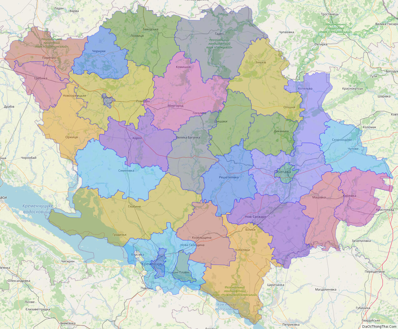
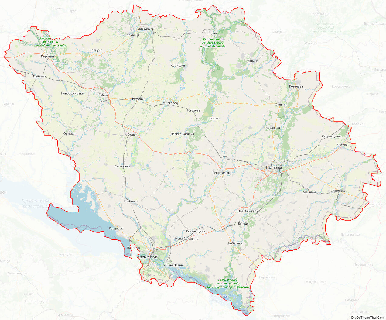
Online subdivision map of Poltava oblast
Poltava Oblast is a beautiful and historic region located in central Ukraine. Whether you’re a resident or a curious traveler, an online subdivision map of Poltava Oblast can be a helpful tool for exploring everything this fascinating region has to offer.
With the help of an online base map, such as OpenStreetMap or satellite imagery, you can easily navigate and explore the various sub-administrative units within Poltava Oblast. The map includes a color-coded cover layer that clearly shows the borders and boundaries of each area, making it easy to distinguish between them.
You can zoom in and out of the map to get a closer look at the different towns, villages, and cities within Poltava Oblast. This allows you to discover the region’s unique architecture, landmarks, and natural beauty, including the Kremenchuk Reservoir, the Vorskla River, and the vast fields of sunflowers that are characteristic of the area.
Whether you’re planning a weekend getaway or simply interested in learning more about the region’s history and culture, an online subdivision map of Poltava Oblast can provide you with valuable insights and information. So why not take a virtual tour of this charming region today and see what treasures you can uncover?
Click on ![]() to view map in "full screen" mode.
to view map in "full screen" mode.
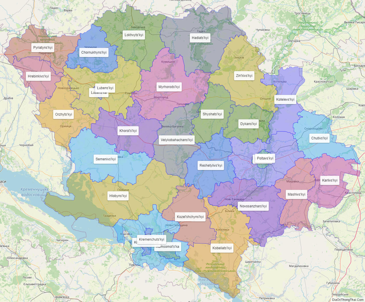
List administrative sub-division of Poltava oblast
| # | Name | Type |
|---|---|---|
| 1 | Komsomol’s’ka | Mis’ka Rada |
| 2 | Kremenchuts’ka | Misto |
| 3 | Lubens’ka | Misto |
| 4 | Poltavs’ka | Misto |
| 5 | Chornukhyns’kyi | Raion |
| 6 | Chutivs’kyi | Raion |
| 7 | Dykans’kyi | Raion |
| 8 | Hadiats’kyi | Raion |
| 9 | Hlobyns’kyi | Raion |
| 10 | Hrebinkivs’kyi | Raion |
| 11 | Karlivs’kyi | Raion |
| 12 | Khorol’s’kyi | Raion |
| 13 | Kobeliats’kyi | Raion |
| 14 | Kotelevs’kyi | Raion |
| 15 | Kozel’shchyns’kyi | Raion |
| 16 | Kremenchuts’kyi | Raion |
| 17 | Lokhvyts’kyi | Raion |
| 18 | Lubens’kyi | Raion |
| 19 | Mashivs’kyi | Raion |
| 20 | Myrhorods’kyi | Raion |
| 21 | Novosanzhars’kyi | Raion |
| 22 | Orzhyts’kyi | Raion |
| 23 | Poltavs’kyi | Raion |
| 24 | Pyriatyns’kyi | Raion |
| 25 | Reshetylivs’kyi | Raion |
| 26 | Semenivs’kyi | Raion |
| 27 | Shyshats’kyi | Raion |
| 28 | Velykobahachans’kyi | Raion |
| 29 | Zin’kivs’kyi | Raion |
Explaination:
- Mis’ka Rada: City municipalities (governed by a mayor and a city council)
- Misto: city at least 10,000 people (not a town).
- Raion: often translated as “district”.
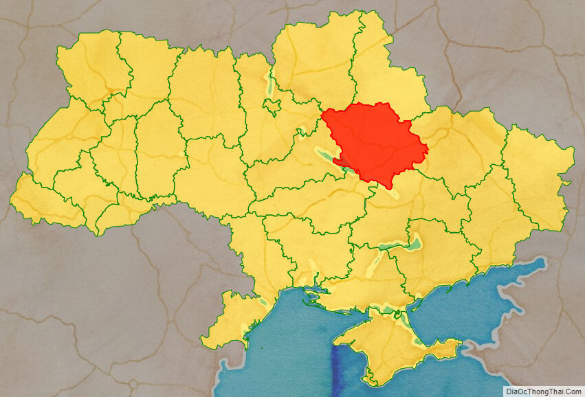
Location map of Poltava oblast, Ukraine

Political map of Poltava oblast
Poltava oblast streeet map
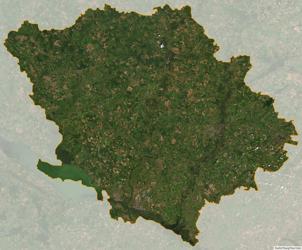
Poltava oblast satellite map