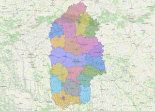
Ternopil Oblast (Ukrainian: Тернопі́льська о́бласть, romanized: Ternopilska oblast; also referred to as Ternopilshchyna, Терно́пільщина, or Ternopillia, Тернопілля) is an oblast (province) of Ukraine. Its administrative center is Ternopil, through which flows the Seret, a tributary of the Dniester. Population: 1,021,713 (2022 est.). One of the natural wonders of the region are its cave complexes. Although ... Read more
Zakarpattia Oblast (Rusyn and Ukrainian: Закарпатська область, romanized: Zakarpatska oblast; Hungarian: Kárpátalja) is an oblast in western Ukraine, mostly coterminous with the historical region of Carpathian Ruthenia. Its administrative centre is the city of Uzhhorod, Other major cities within the oblast include Mukachevo, Khust, Berehove, and Chop, the last of which is home to railroad ... Read more
Volyn Oblast (Ukrainian: Воли́нська о́бласть, romanized: Volýnsʹka óblastʹ; also referred to as Volyn or Lodomeria) is an oblast (province) in northwestern Ukraine. Its administrative centre is Lutsk. Kovel is the westernmost town and the last station in Ukraine on the rail line running from Kyiv to Warsaw. The population is 1,021,356 (2022 est.) Online subdivision ... Read more
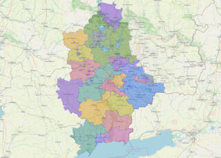
Zaporizhzhia Oblast (Ukrainian: Запорі́зька о́бласть, romanized: Zaporizka oblast), also referred to as Zaporizhzhia (Ukrainian: Запорі́жжя), is an oblast (province) of southeast Ukraine. Its capital is Zaporizhzhia. The oblast covers an area of 27,183 km (10,495 sq mi), and its population is 1,638,462 (2022 est.). This oblast is an important part of Ukraine’s industry and agriculture. Most of the ... Read more
Zhytomyr Oblast (Ukrainian: Жито́мирська о́бласть, romanized: Zhytomyrska oblast), also referred to as Zhytomyrshchyna (Ukrainian: Жито́мирщина) is an oblast (province) of northern Ukraine. The administrative center of the oblast is the city of Zhytomyr. Its population is approximately 1,179,032 (2022 est.). Online subdivision map of Zhytomyr oblast Located in northern-central Ukraine, Zhytomyr Oblast boasts a rich ... Read more
Sumy Oblast (Ukrainian: Сумська́ о́бласть, romanized: Sumska oblast), also known as Sumshchyna (Ukrainian: Су́мщина), is an oblast (province) in northeast Ukraine. The oblast was created in its most recent form, from the merging of raions from Kharkiv Oblast, Chernihiv Oblast, and Poltava Oblast in 1939 by the Presidium of the Supreme Soviet of the Soviet ... Read more
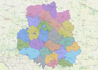
Donetsk Oblast (Ukrainian: Донецька область, romanized: Donetska oblast, IPA: [doˈnɛtsʲkɐ ˈɔblɐsʲtʲ]), also referred to as Donechchyna (Донеччина), is an oblast in eastern Ukraine. It is Ukraine’s most populous province, with around 4.1 million residents. Its administrative centre is Donetsk, though due to the ongoing Russo-Ukrainian War, the regional administration was moved to Kramatorsk. Historically, the region ... Read more
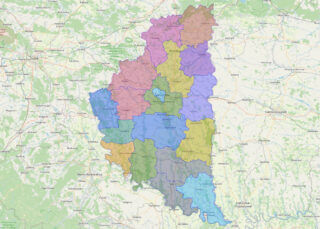
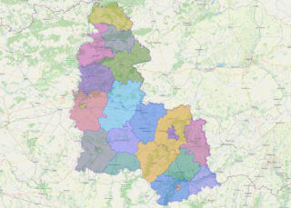
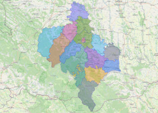
Ivano-Frankivsk Oblast (Ukrainian: Іва́но-Франкі́вська о́бласть, romanized: Ivano-Frankivska oblast), also referred to as Ivano-Frankivshchyna (Іва́но-Франкі́вщина), is an oblast (region) in western Ukraine. Its administrative center is the city of Ivano-Frankivsk. As is the case with most other oblasts of Ukraine this region has the same name as its administrative center – which was renamed by the ... Read more
Kharkiv Oblast (Ukrainian: Харківська́ о́бласть, romanized: Kharkivska oblast), also referred to as Kharkivshchyna (Ukrainian: Ха́рківщина), is an oblast (province) of eastern Ukraine. The oblast borders Russia to the north, Luhansk Oblast to the east, Donetsk Oblast to the south-east, Dnipropetrovsk Oblast to the south-west, Poltava Oblast to the west and Sumy Oblast to the north-west. ... Read more
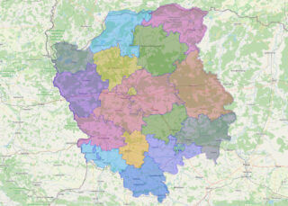
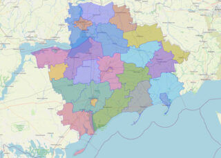
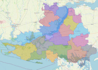
Kherson Oblast (Ukrainian: Херсо́нська о́бласть, romanized: Khersónsʹka óblastʹ, IPA: [xerˈsɔnʲsʲkɐ ˈɔbɫɐsʲtʲ]), also known as Khersonshchyna (Херсо́нщина, IPA: [xerˈsɔnʃt͡ʃɪnɐ]), is an oblast (province) in southern Ukraine. It is located just north of Crimea. Its administrative center is Kherson, on the west bank of the Dnieper which bisects the oblast. The area of the region is 28,461 km and the ... Read more
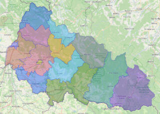
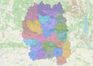
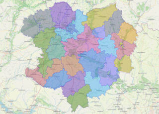
Khmelnytskyi Oblast (Ukrainian: Хмельни́цька о́бласть, romanized: Khmelnytska oblast), also known as Khmelnychchyna (Ukrainian: Хмельни́ччина), is an oblast (province) in western Ukraine covering portions of the historical regions of western Podolia and southern Volhynia. The administrative center of the oblast is the city of Khmelnytskyi. The current estimated population is around 1,228,829 (2022 est.). Created in ... Read more