Cherkasy Oblast (Ukrainian: Черка́ська о́бласть, romanized: Cherkaska oblast, pronounced [tʃerˈkɑsʲkɐ ˈɔblɐstʲ]), also referred to as Cherkashchyna (Черка́щина, IPA: [tʃerˈkɑʃtʃɪnɐ]) is an oblast (province) in central Ukraine located along the Dnieper River. The administrative center of the oblast is the city of Cherkasy. The current population of the oblast is 1,160,744 (2022 est.).
| Unit Name | Cherkasy Oblast |
|---|---|
| Administrative center | Cherkasy |
| Major cities | Cherkasy, Uman, Smila, Zolotonosha |
| Total area | 20.900 km² (8.100 sq mi) |
| Area Rank | Rank 18th |
| Population (2021) | 1.178.266 |
| Time zone | UTC+2 (EET) |
| Summer (DST) | UTC+3 (EEST) |
| Postal code | 18-20xxx |
| Area code | +380 47 |
| ISO 3166 code | UA-71 |
| Website | www.oda.ck.ua www.rada.gov.ua |
| Flag |  |
| Coat of arms |  |
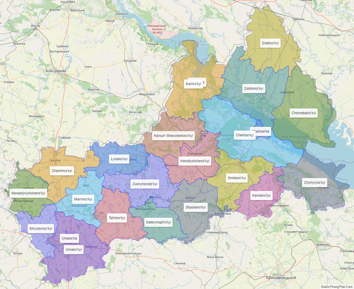
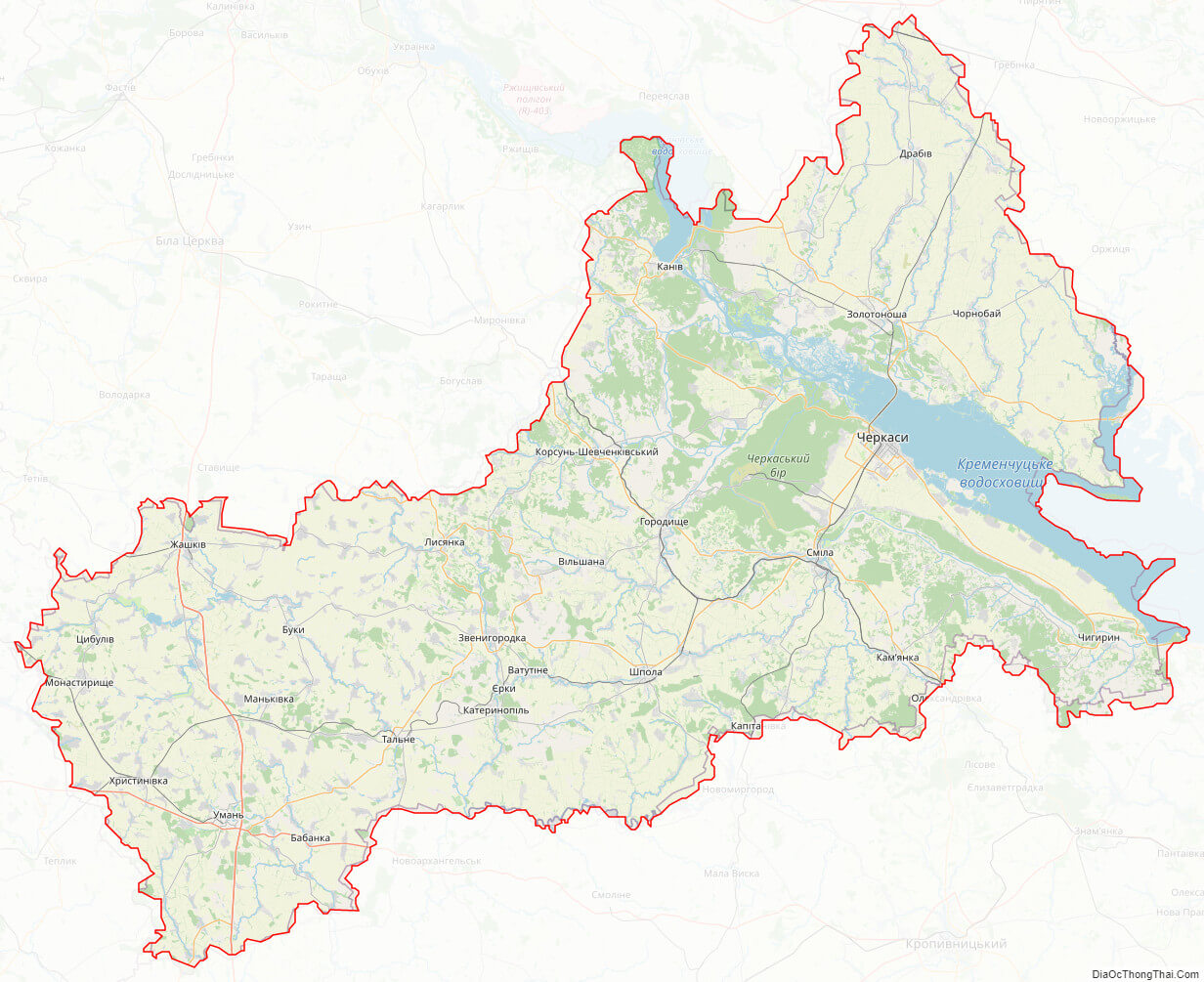
Online subdivision map of Cherkasy oblast
Cherkasy Oblast is a region located in central Ukraine. If you’re looking for a detailed and accurate map of the area, look no further than the online subdivision map of Cherkasy Oblast. This map uses various base maps, including OpenStreetMap and satellite imagery, allowing you to choose the one that suits your needs best.
The Cherkasy Oblast subdivision map features different colored cover layers that clearly show the boundaries and borders between each sub-administrative unit. Whether you’re trying to locate a specific town or village, or just want to get a sense of the geography of the region, this map is an invaluable tool. Additionally, the map is interactive, so you can zoom in and out as needed to see more detail, such as street names or even individual buildings.
For those interested in the political landscape of Cherkasy Oblast, there is also a political map available. This map highlights the different administrative divisions of the oblast, such as raions (districts) and cities, and can help you better understand the local government structure. No matter what your purpose for using a map of Cherkasy Oblast may be, the online subdivision and political maps are both easy-to-use and informative resources.
Click on ![]() to view map in "full screen" mode.
to view map in "full screen" mode.
List administrative sub-division of Cherkasy oblast
| # | Name | Type |
|---|---|---|
| 1 | Cherkas’ka | Mis’ka Rada |
| 2 | Kanivs’ka | Misto |
| 3 | Umans’ka | Misto |
| 4 | Cherkas’kyi | Raion |
| 5 | Chornobaivs’kyi | Raion |
| 6 | Chyhyryns’kyi | Raion |
| 7 | Drabivs’kyi | Raion |
| 8 | Horodyshchens’kyi | Raion |
| 9 | Kamians’kyi | Raion |
| 10 | Kanivs’kyi | Raion |
| 11 | Katerynopil’s’kyi | Raion |
| 12 | Khrystynivs’kyi | Raion |
| 13 | Korsun’-Shevchenkivs’kyi | Raion |
| 14 | Lysians’kyi | Raion |
| 15 | Man’kivs’kyi | Raion |
| 16 | Monastyryshchens’kyi | Raion |
| 17 | Shpolians’kyi | Raion |
| 18 | Smilians’kyi | Raion |
| 19 | Tal’nivs’kyi | Raion |
| 20 | Umans’kyi | Raion |
| 21 | Zhashkivs’kyi | Raion |
| 22 | Zolotonis’kyi | Raion |
| 23 | Zvenyhorods’kyi | Raion |
Explaination:
- Mis’ka Rada: City municipalities (governed by a mayor and a city council)
- Misto: city at least 10,000 people (not a town).
- Raion: often translated as “district”.
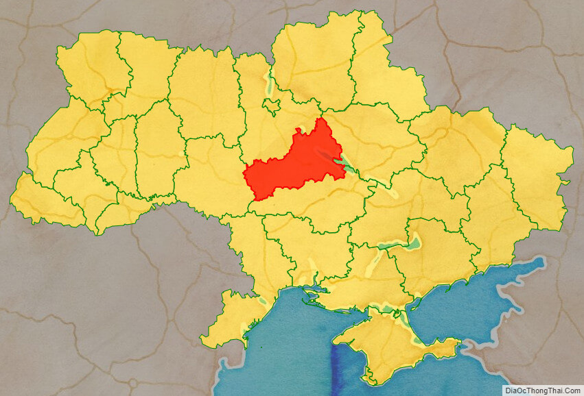
Location map of Cherkasy oblast, Ukraine

Political map of Cherkasy oblast
Detail map of Cherkasy oblast

Cherkasy oblast streeet map
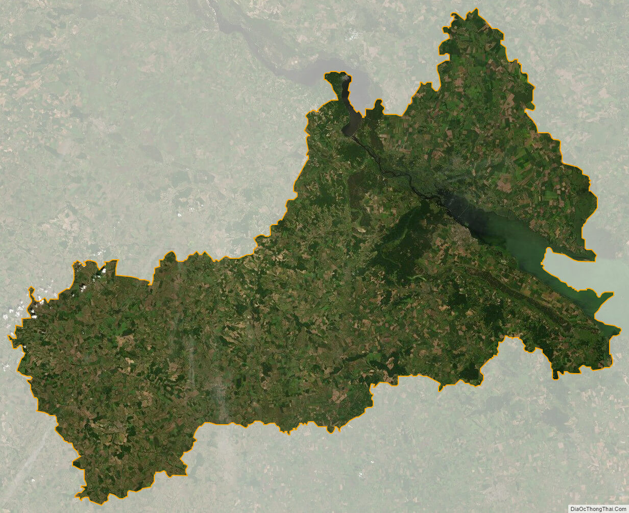
Cherkasy oblast satellite map