Luhansk Oblast (Ukrainian: Луга́нська о́бласть, romanized: Luhanska oblast; Russian: Луганская область, romanized: Luganskaya oblast), also referred to as Luhanshchyna (Луга́нщина), is the easternmost oblast (province) of Ukraine. The oblast’s administrative center is Luhansk. The oblast was established in 1938 and bore the name Voroshilovgrad Oblast (Ukrainian: Ворошиловградська область, romanized: Voroshylovhradska oblast, until 1958 and again from 1970 to 1991) in honor of Kliment Voroshilov. Its population is estimated as 2,102,921 (2022 est.)
Important cities within the oblast include Alchevsk, Antratsyt, Brianka, Kirovsk, Krasnyi Luch, Krasnodon, Lysychansk, Luhansk, Pervomaisk, Rovenky, Rubizhne, Sverdlovsk, Sievierodonetsk, and Kadiivka.
In 2014, parts of the oblast, including Luhansk, came under the control of Russian-backed separatists who declared the Luhansk People’s Republic, leading to a war against government forces. Since the 2022 Russian invasion of Ukraine, the oblast has come almost entirely under Russian occupation and has been the site of heavy fighting; Russia later declared the annexation of the entirety of the oblast as well as three other regions, though the annexation remains internationally unrecognized. As of January 2023, Ukraine is in control of roughly 6-7% of the region and controls only a few settlements like Bilohorivka, Zolotarivka, Chervonopopivka, Makiivka and the outskirts of Kreminna in the western part of the region.
| Unit Name | Luhans'k Oblast |
|---|---|
| Administrative center | Luhansk (de jure)Sievierodonetsk (de facto, due to war in Donbas) |
| Total area | 26.684 km² (10.303 sq mi) |
| Area Rank | Rank 10th |
| Population (2021) | 2.121.322 |
| Time zone | UTC+2 (EET) |
| Summer (DST) | UTC+3 (EEST) |
| Postal code | 91-94 |
| Area code | +380-64 |
| ISO 3166 code | UA-09 |
| Website | loga.gov.ua |
| Flag |  |
| Coat of arms |  |
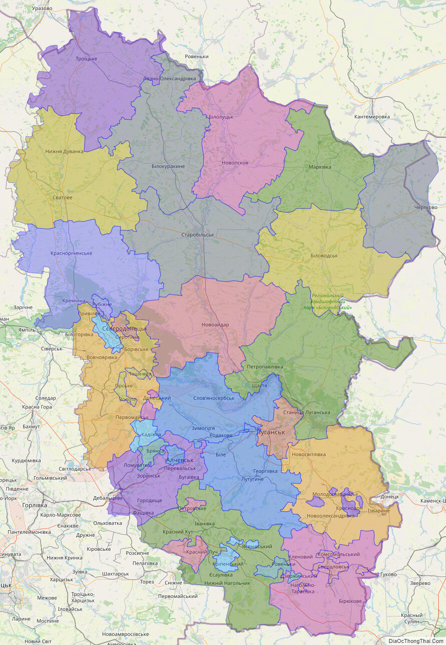
Online subdivision map of Luhans’k oblast
Luhansk Oblast is a region in eastern Ukraine with a rich diversity of landscapes and communities. An online subdivision map of Luhansk Oblast can be a valuable resource for residents and anyone interested in exploring the area. With the map, you can easily identify the different sub-administrative units, such as cities and districts, and distinguish them by color. You can also zoom in and out to see details like street names and building locations.
Whether you’re a local or simply curious about the region, the online subdivision map of Luhansk Oblast can help you navigate and discover the area’s unique features. You might find hidden parks, interesting architecture, or historic landmarks that you never knew existed. With its user-friendly interface and comprehensive coverage, the map is a useful tool for anyone interested in exploring the beauty and diversity of Luhansk Oblast.
Click on ![]() to view map in "full screen" mode.
to view map in "full screen" mode.
List administrative sub-division of Luhans’k oblast
| # | Name | Type |
|---|---|---|
| 1 | Antratsitivs’ka | Mis’ka Rada |
| 2 | Briankivs’ka | Mis’ka Rada |
| 3 | Kirovs’ka | Mis’ka Rada |
| 4 | Krasnodons’ka | Mis’ka Rada |
| 5 | Krasnoluts’ka | Mis’ka Rada |
| 6 | Luhans’ka | Mis’ka Rada |
| 7 | Lysychans’ka | Mis’ka Rada |
| 8 | Roven’kivs’ka | Mis’ka Rada |
| 9 | Sieverodonets’ka | Mis’ka Rada |
| 10 | Stakhanivs’ka | Mis’ka Rada |
| 11 | Sverdlovs’ka | Mis’ka Rada |
| 12 | Alchevs’ka | Misto |
| 13 | Rubezhans’ka | Misto |
| 14 | Antratsytivs’kyi | Raion |
| 15 | Bilokurakyns’kyi | Raion |
| 16 | Bilovods’kyi | Raion |
| 17 | Krasnodons’kyi | Raion |
| 18 | Kremins’kyi | Raion |
| 19 | Lutuhyns’kyi | Raion |
| 20 | Markivs’kyi | Raion |
| 21 | Milovs’kyi | Raion |
| 22 | Novoaidars’kyi | Raion |
| 23 | Novopskovs’kyi | Raion |
| 24 | Pereval’s’kyi | Raion |
| 25 | Popasnians’kyi | Raion |
| 26 | Slovianoserbs’kyi | Raion |
| 27 | Stanychno-Luhans’kyi | Raion |
| 28 | Starobil’s’kyi | Raion |
| 29 | Svativs’kyi | Raion |
| 30 | Sverdlovs’kyi | Raion |
| 31 | Tro‹ts’kyi | Raion |
| 32 | n.a. ( 182) |
Explaination:
- Mis’ka Rada: City municipalities (governed by a mayor and a city council)
- Misto: city at least 10,000 people (not a town).
- Raion: often translated as “district”.
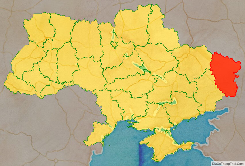
Location map of Luhans’k oblast, Ukraine

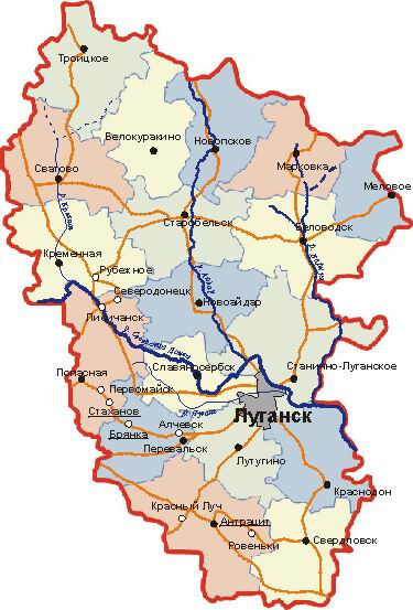
Political map of Luhans’k oblast
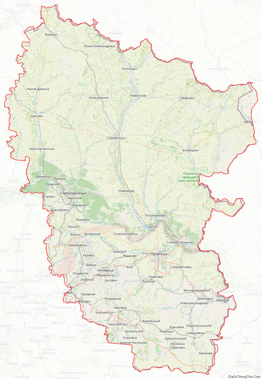
Detail map of Luhans’k oblast
Luhans’k oblast streeet map
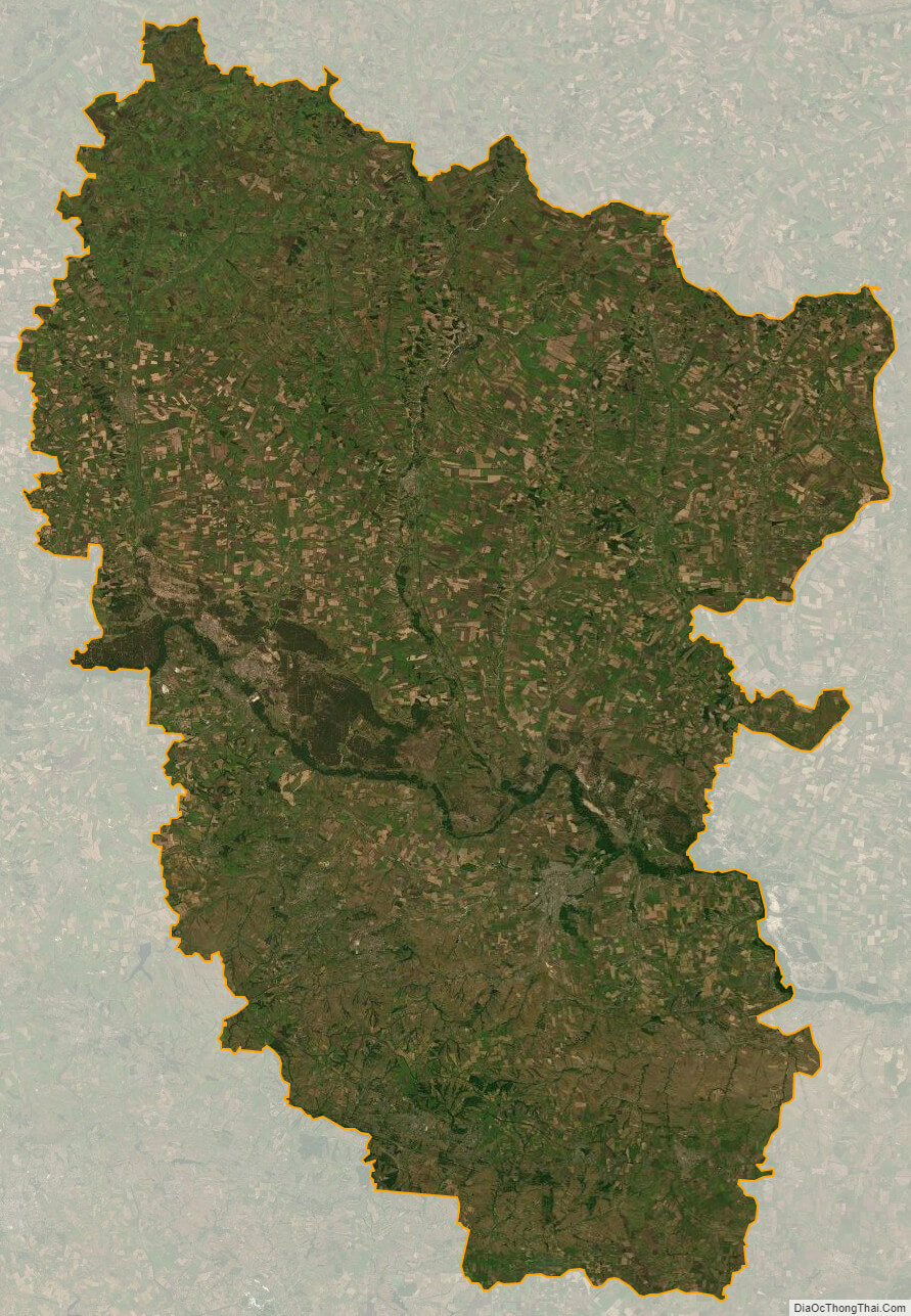
Luhans’k oblast satellite map