Cameroon is a Central African country covering an area of 475,442 sq. km.
Cameroon is sometimes called “Africa in miniature” as it features a variety of geographical regions like mountains, desert, savanna, rainforest, and coastal plains.
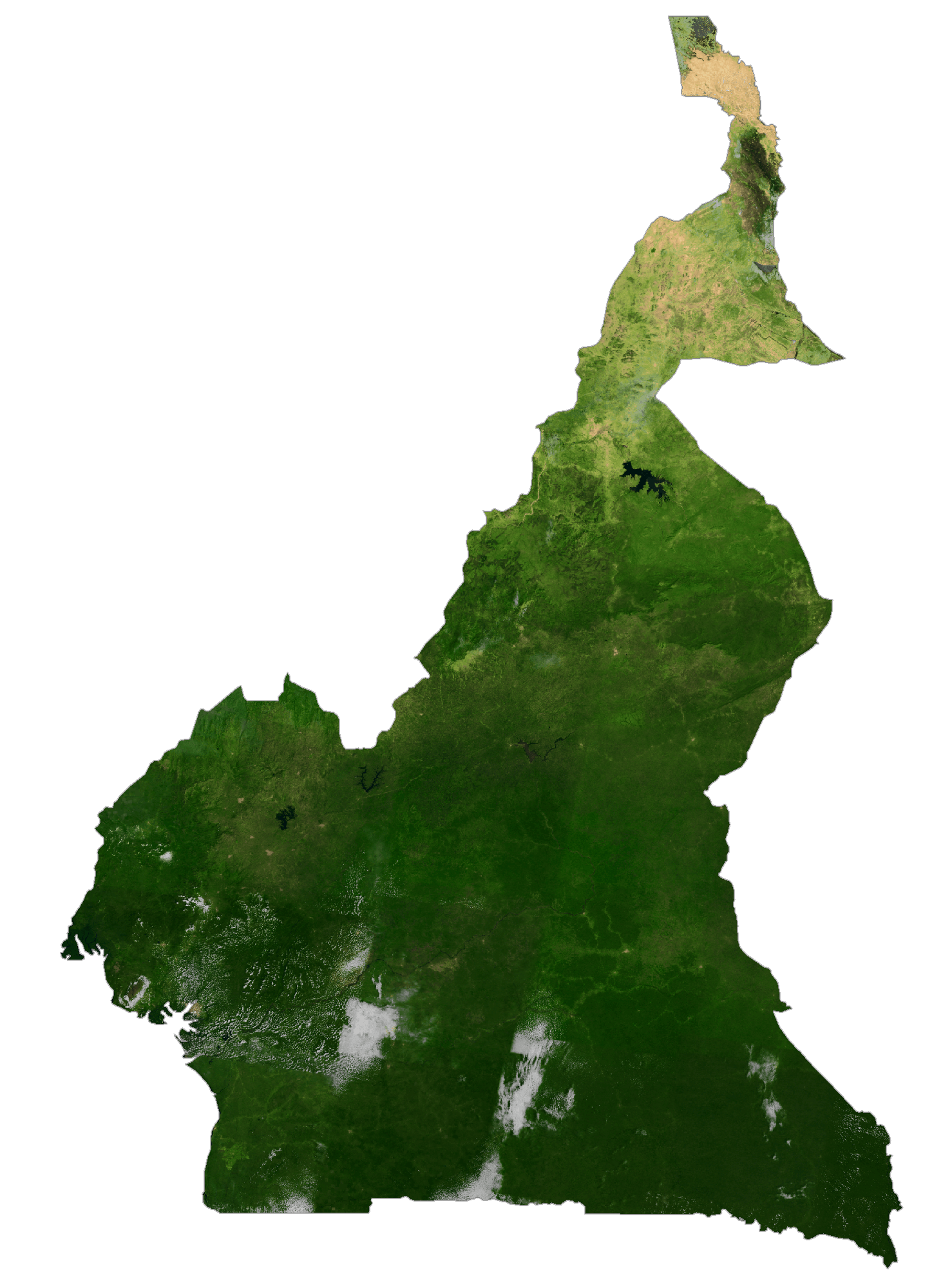
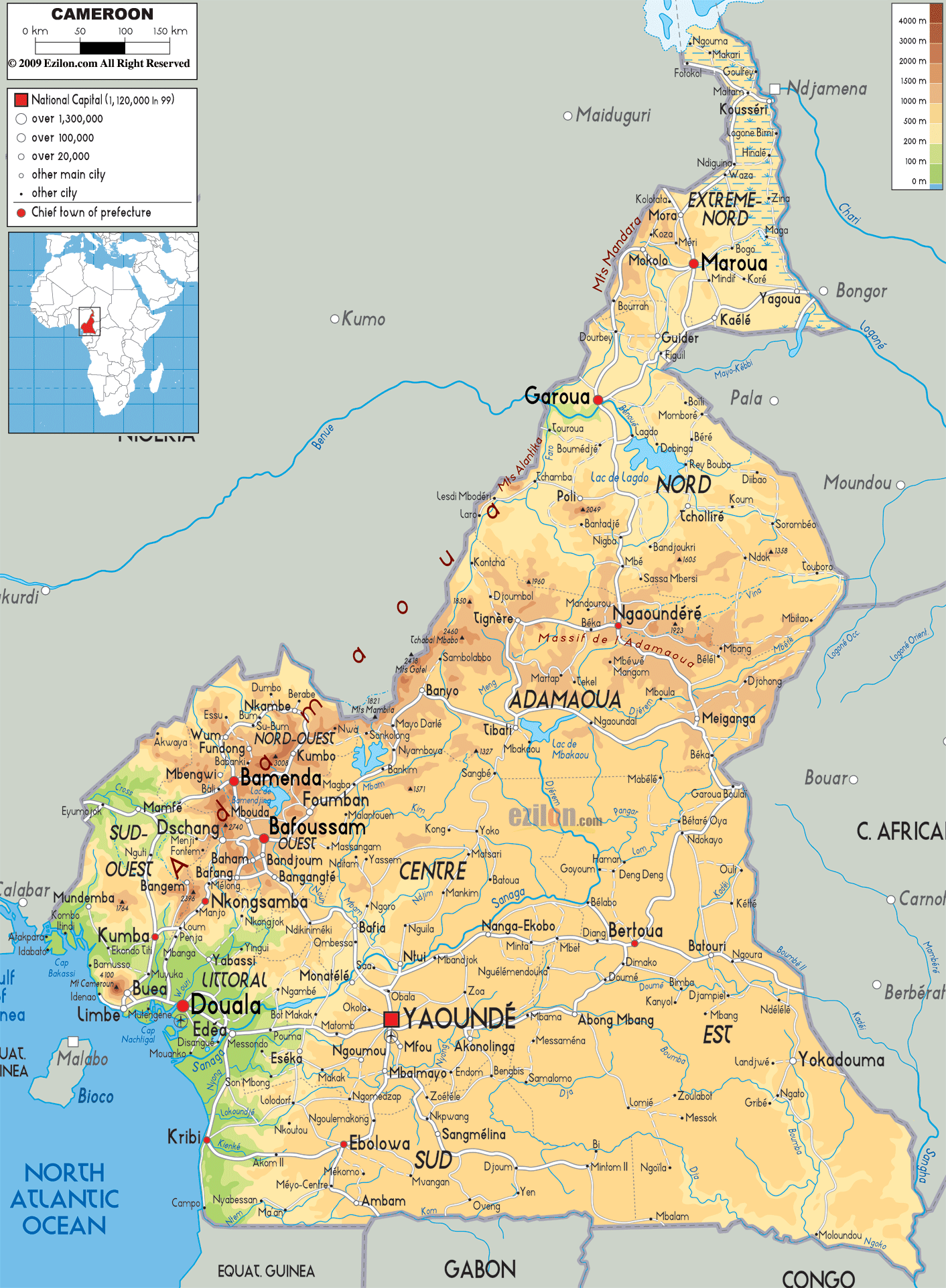
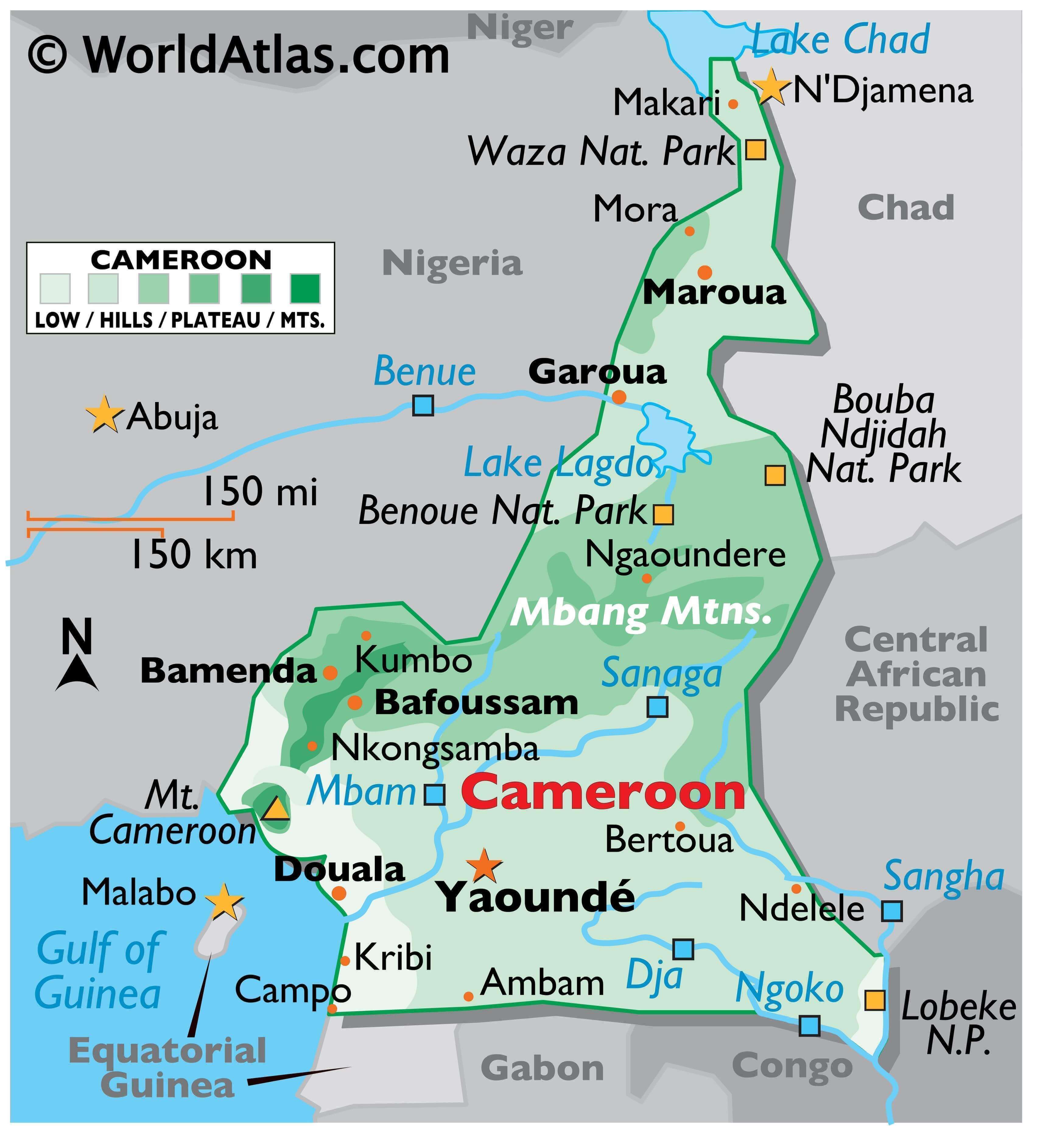
The physical map above illustrates the country of Cameroon, from the low and marshy coastal area in the south to shores of Lake Chad in the extreme north.
The densely forested coastal plain of the country stretching inland from the Gulf of Guinea is around 20 to 80 km wide. From there the elevation of the land rises to around 500 to 600 m in the central Mbang Mountains. The region is covered by dense tropical rainforest. To the north of Benoue National Park, the land slopes into a savanna plain that extends to the shores of Lake Chad. In the far southwest, on the edge of the Gulf of Guinea, Cameroon is mountainous. As marked on the map, this region has the active volcano of Mt Cameroon, which at 4,070m is the highest point in West Africa.
Significant rivers include the Dja, Nyong, and Sanaga. Cameroon’s lowest point is the Atlantic Ocean (0 m).
| Flag: |  |
|---|---|
| Legal Name: | Republic of Cameroon |
| Capital Value: | Yaounde |
| Official languages: | French • English |
| Demonym(s): | Cameroonian |
| Government: | Unitary dominant-party presidential republic under a dictatorship |
| Legislature: | Parliament |
| Total Area: | 475,440 km² |
| Land Area: | 472,710 km² |
| Water Area: | 2,730 km² |
| Population: | 25,876,380 |
| Density: | 39.7/km (102.8/sq mi) |
| GDP: | $38.76 Billion |
| GDP Per Capita: | $1,497.91 |
| Currency Value: | Cooperation Financiere en Afrique Centrale francs (XAF) |
| Driving side: | right |
| Calling code: | +237 |
| Internet TLD: | .cm |
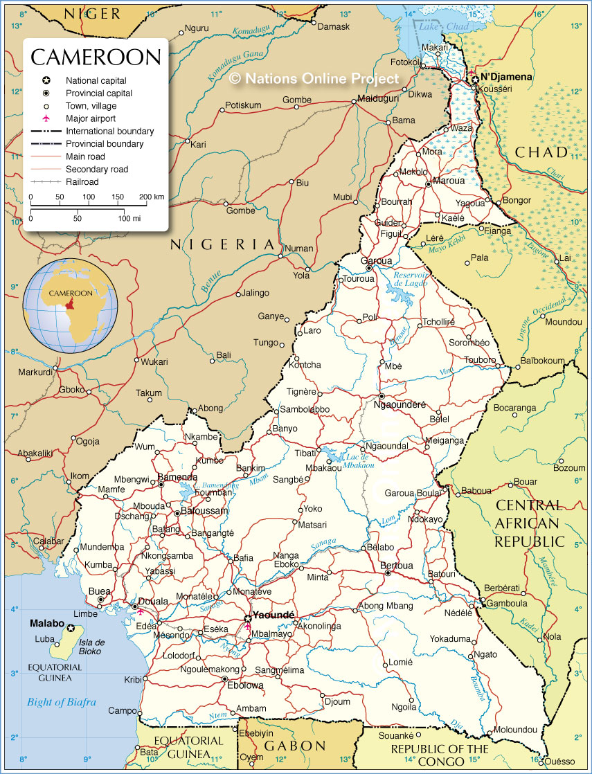
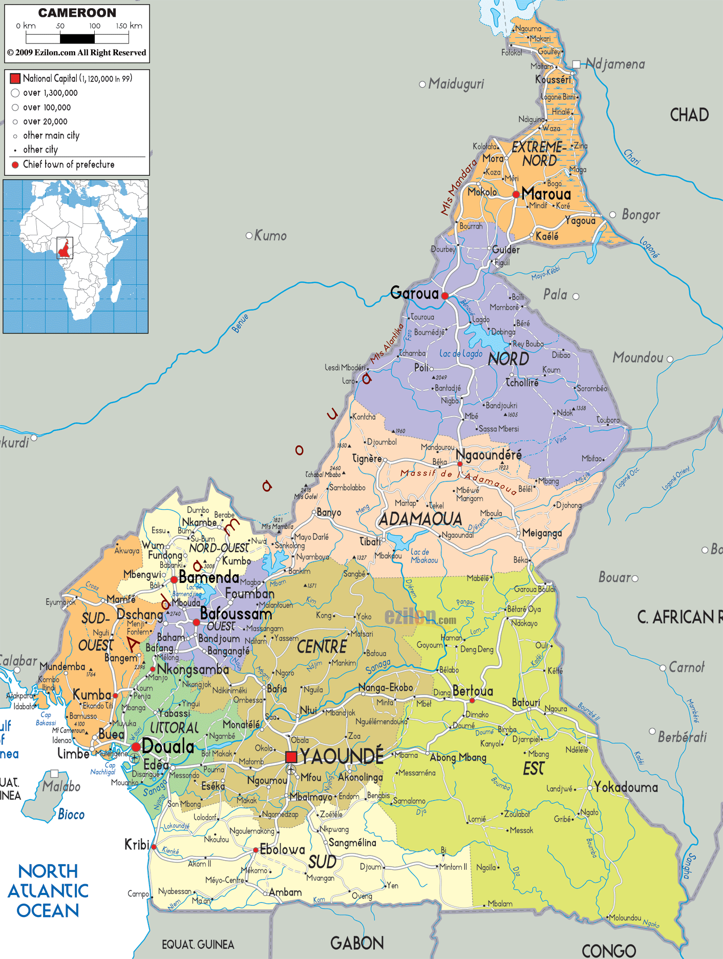
Take a look at this amazing map of Cameroon, with its major cities, towns, roads, lakes, and rivers. From its mountains to its plateau, explore the country in stunning satellite imagery and physical map. See for yourself why Cameroon is such an interesting and diverse destination!
Online Interactive Political Map
Click on ![]() to view map in "full screen" mode.
to view map in "full screen" mode.
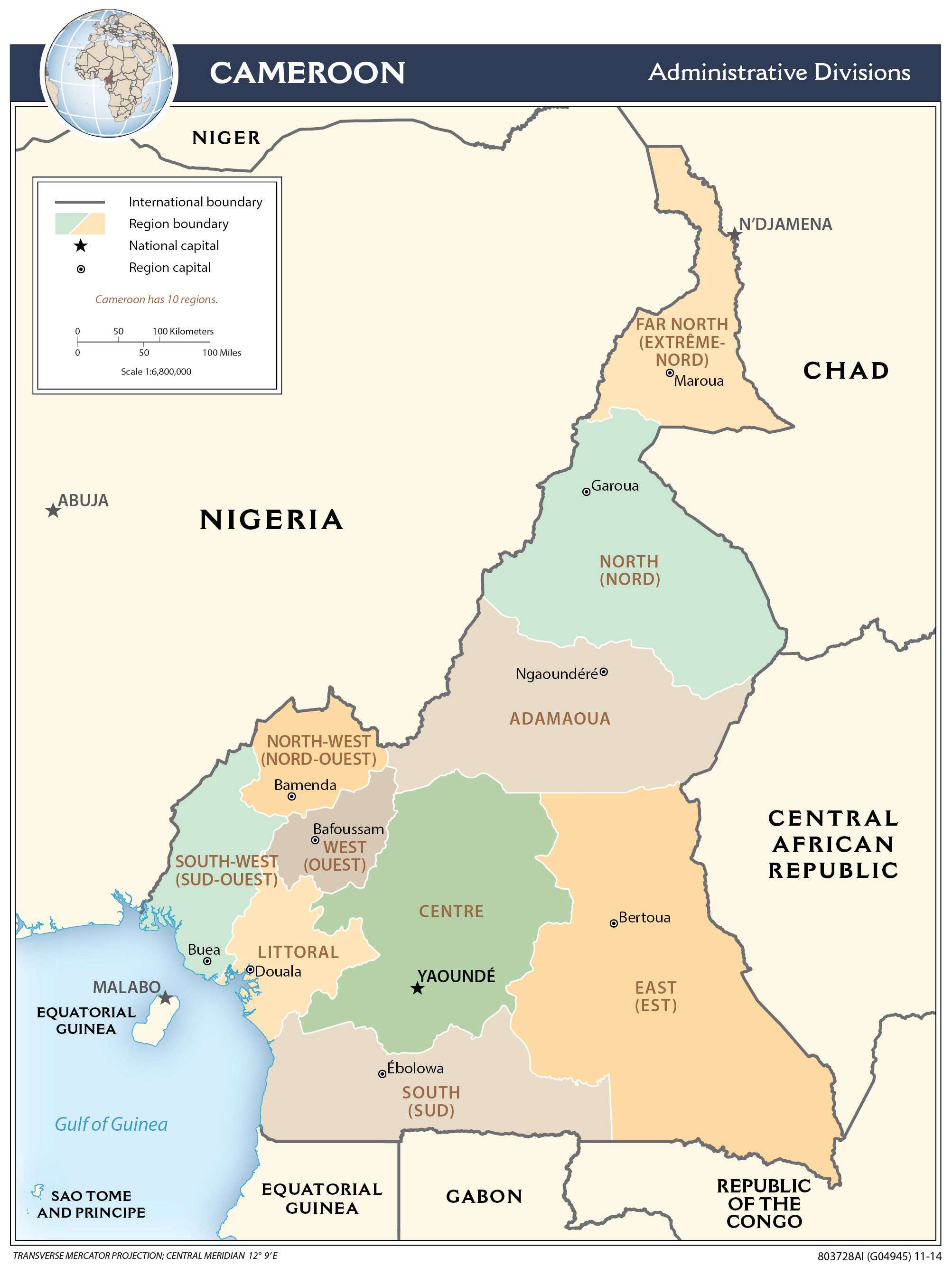
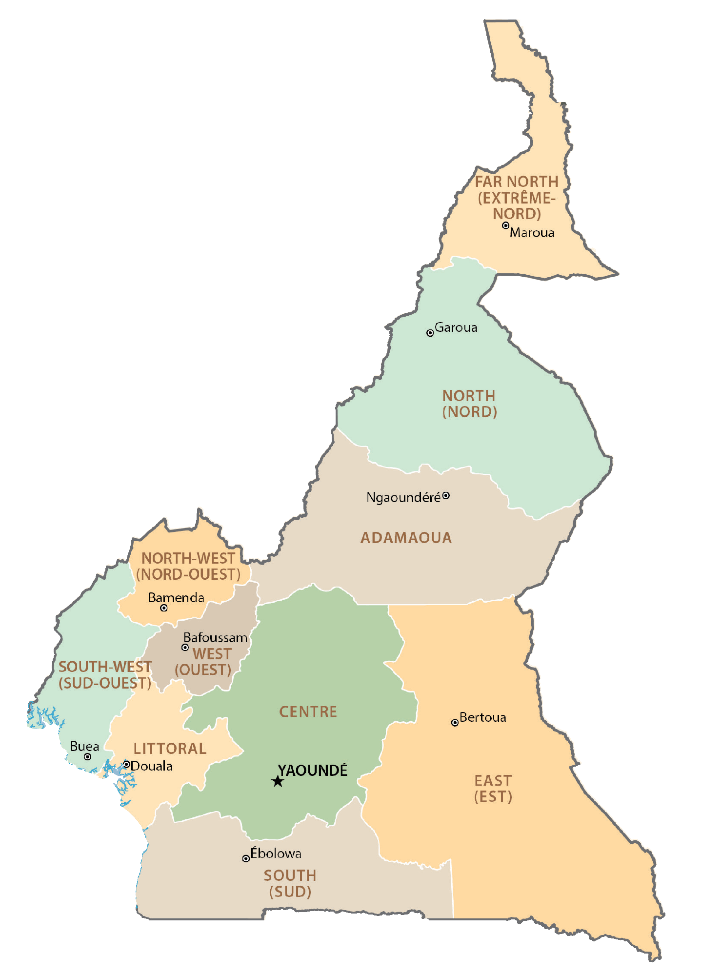
Cameroon is divided into 10 semi-autonomous regions that are subdivided into 58 divisions. These divisions are then divided into arrondissements and finally districts.
The 10 regions of Cameroon in alphabetical order are as follows: Adamaoua, Centre, East (Est), Far North (Extreme-Nord), Littoral, North (Nord), North-West (Nord-Ouest), West (Ouest), South (Sud), South-West (Sud-Ouest).
With an area of 109,002 sq. km, East Cameroon is the largest region and Central Cameroon is the most populous one. Yaoundé, located in the Centre Region, is the national capital city.
Location Maps
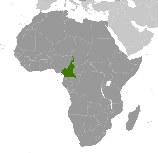
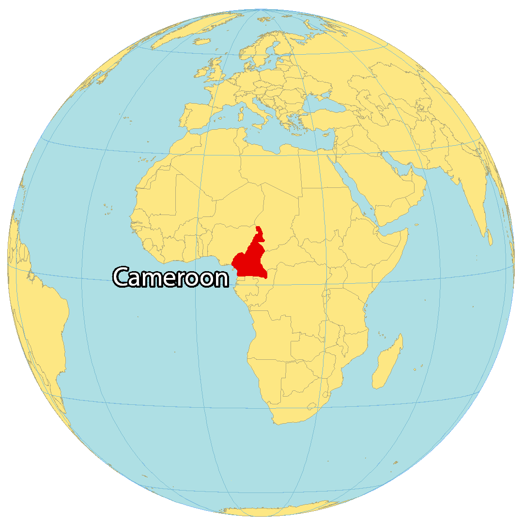
Where is Cameroon?
Cameroon is a country located in Central Africa and is known for its central geographic position in the continent. Lobeke National Park, situated in the far southeastern part of Cameroon, is considered as the center of Africa. This country is also like a hinge because it is located at a deflection point in the Gulf of Guinea. Cameroon borders six other countries, namely Nigeria in the northwest, Chad in the northeast, Central African Republic in the east, Equatorial Guinea, Gabon and the Republic of the Congo in the south. The capital of Cameroon is Yaoundé, while Douala is the largest metropolitan area.
High Definition Political Map of Cameroon
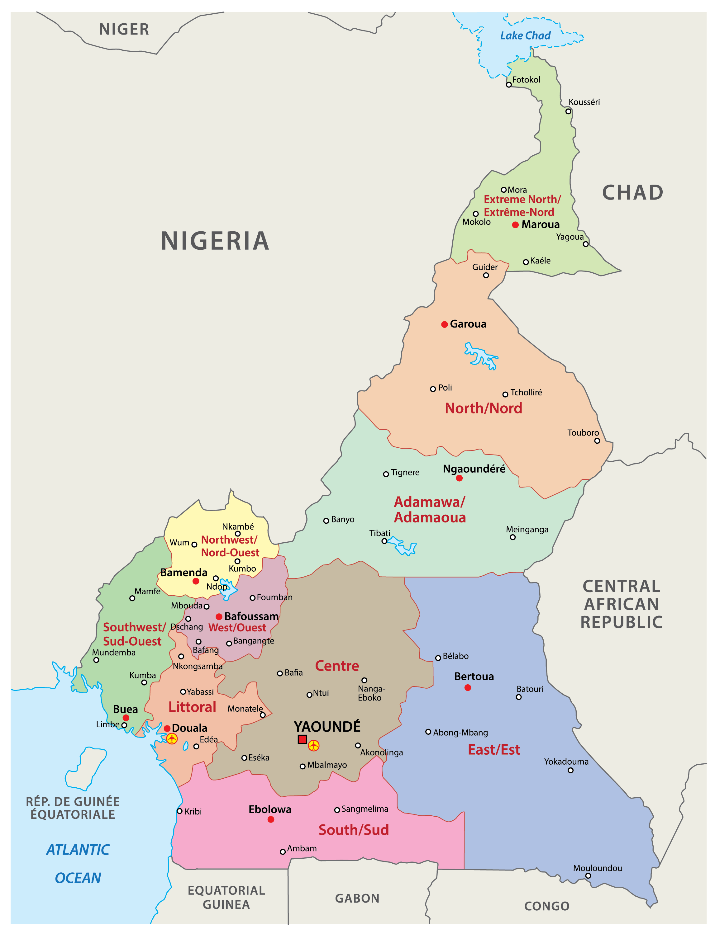
Cameroon Administrative Map
History
Early history
Present-day Cameroon was first settled in the Neolithic Era. The longest continuous inhabitants are groups such as the Baka (Pygmies). From there, Bantu migrations into eastern, southern and central Africa are believed to have occurred about 2,000 years ago. The Sao culture arose around Lake Chad, c. 500 AD, and gave way to the Kanem and its successor state, the Bornu Empire. Kingdoms, fondoms, and chiefdoms arose in the west.
Portuguese sailors reached the coast in 1472. They noted an abundance of the ghost shrimp Lepidophthalmus turneranus in the Wouri River and named it Rio dos Camarões (Shrimp River), which became Cameroon in English. Over the following few centuries, European interests regularised trade with the coastal peoples, and Christian missionaries pushed inland.
In 1896, Sultan Ibrahim Njoya created the Bamum script, or Shu Mom, for the Bamum language. It is taught in Cameroon today by the Bamum Scripts and Archives Project.
German rule
Germany began to establish roots in Cameroon in 1868 when the Woermann Company of Hamburg built a warehouse. It was built on the estuary of the Wouri River. Later Gustav Nachtigal made a treaty with one of the local kings to annex the region for the German emperor. The German Empire claimed the territory as the colony of Kamerun in 1884 and began a steady push inland; the natives resisted. Under the aegis of Germany, commercial companies were local administrations. These concessions used forced labour to run profitable banana, rubber, palm oil, and cocoa plantations. Even infrastructure projects relied on forced labor regimen. This economic policy was much criticised by the other colonial powers.
French and British rule
With the defeat of Germany in World War I, Kamerun became a League of Nations mandate territory and was split into French Cameroon (French: Cameroun) and British Cameroon in 1919. France integrated the economy of Cameroon with that of France and improved the infrastructure with capital investments and skilled workers, modifying the colonial system of forced labour.
The British administered their territory from neighbouring Nigeria. Natives complained that this made them a neglected “colony of a colony”. Nigerian migrant workers flocked to Southern Cameroons, ending forced labour altogether but angering the local natives, who felt swamped. The League of Nations mandates were converted into United Nations Trusteeships in 1946, and the question of independence became a pressing issue in French Cameroon.
France outlawed the pro-independence political party, the Union of the Peoples of Cameroon (Union des Populations du Cameroun; UPC), on 13 July 1955. This prompted a long guerrilla war waged by the UPC and the assassination of several of the party’s leaders, including Ruben Um Nyobè, Félix-Roland Moumié and Ernest Ouandie. In the British Cameroons, the question was whether to reunify with French Cameroon or join Nigeria; the British ruled out the option of independence.
Independence
On 1 January 1960, French Cameroun gained independence from France under President Ahmadou Ahidjo. On 1 October 1961, the formerly British Southern Cameroons gained independence from the United Kingdom by vote of the UN General Assembly and joined with French Cameroun to form the Federal Republic of Cameroon, a date which is now observed as Unification Day, a public holiday. Ahidjo used the ongoing war with the UPC to concentrate power in the presidency, continuing with this even after the suppression of the UPC in 1971.
His political party, the Cameroon National Union (CNU), became the sole legal political party on 1 September 1966 and on 20 May 1972, a referendum was passed to abolish the federal system of government in favour of a United Republic of Cameroon, headed from Yaoundé. This day is now the country’s National Day, a public holiday. Ahidjo pursued an economic policy of planned liberalism, prioritising cash crops and petroleum development. The government used oil money to create a national cash reserve, pay farmers, and finance major development projects; however, many initiatives failed when Ahidjo appointed unqualified allies to direct them.
The national flag was changed on 20 May 1975. Two stars were removed, replaced with a large central star as a symbol of national unity.
Ahidjo stepped down on 4 November 1982 and left power to his constitutional successor, Paul Biya. However, Ahidjo remained in control of the CNU and tried to run the country from behind the scenes until Biya and his allies pressured him into resigning. Biya began his administration by moving toward a more democratic government, but a failed coup d’état nudged him toward the leadership style of his predecessor.
An economic crisis took effect in the mid-1980s to late 1990s as a result of international economic conditions, drought, falling petroleum prices, and years of corruption, mismanagement, and cronyism. Cameroon turned to foreign aid, cut government spending, and privatised industries. With the reintroduction of multi-party politics in December 1990, the former British Southern Cameroons pressure groups called for greater autonomy, and the Southern Cameroons National Council advocated complete secession as the Republic of Ambazonia. The 1992 Labour Code of Cameroon gives workers the freedom to belong to a trade union or not to belong to any trade union at all. It is the choice of a worker to join any trade union in his occupation since there are more than one trade union in each occupation.
In June 2006, talks concerning a territorial dispute over the Bakassi peninsula were resolved. The talks involved President Paul Biya of Cameroon, then President Olusegun Obasanjo of Nigeria and then UN Secretary General Kofi Annan, and resulted in Cameroonian control of the oil-rich peninsula. The northern portion of the territory was formally handed over to the Cameroonian government in August 2006, and the remainder of the peninsula was left to Cameroon 2 years later, in 2008. The boundary change triggered a local separatist insurgency, as many Bakassians refused to accept Cameroonian rule. While most militants laid down their arms in November 2009, some carried on fighting for years.
In February 2008, Cameroon experienced its worst violence in 15 years when a transport union strike in Douala escalated into violent protests in 31 municipal areas.
In May 2014, in the wake of the Chibok schoolgirls kidnapping, presidents Paul Biya of Cameroon and Idriss Déby of Chad announced they were waging war on Boko Haram, and deployed troops to the Nigerian border. Boko Haram launched several attacks into Cameroon, killing 84 civilians in a December 2014 raid, but suffering a heavy defeat in a raid in January 2015. Cameroon declared victory over Boko Haram on Cameroonian territory in September 2018.
Since November 2016, protesters from the predominantly English-speaking Northwest and Southwest regions of the country have been campaigning for continued use of the English language in schools and courts. People were killed and hundreds jailed as a result of these protests. In 2017, Biya’s government blocked the regions’ access to the Internet for three months. In September, separatists started a guerilla war for the independence of the Anglophone region as the Federal Republic of Ambazonia. The government responded with a military offensive, and the insurgency spread across the Northwest and Southwest regions. As of 2019, fighting between separatist guerillas and government forces continues. During 2020, numerous terrorist attacks—many of them carried out without claims of credit—and government reprisals have led to bloodshed throughout the country. Since 2016, more than 450,000 people have fled their homes. The conflict indirectly led to an upsurge in Boko Haram attacks, as the Cameroonian military largely withdrew from the north to focus on fighting the Ambazonian separatists.
More than 30,000 people in northern Cameroon fled to Chad after ethnic clashes over access to water between Musgum fishermen and ethnic Arab Choa herders in December 2021.
Physical Map of Cameroon


Geography
At 475,442 square kilometres (183,569 sq mi), Cameroon is the world’s 53rd-largest country. The country is located in Central and West Africa, known as the hinge of Africa, on the Bight of Bonny, part of the Gulf of Guinea and the Atlantic Ocean. Cameroon lies between latitudes 1° and 13°N, and longitudes 8° and 17°E. Cameroon controls 12 nautical miles of the Atlantic Ocean.
Tourist literature describes Cameroon as “Africa in miniature” because it exhibits all major climates and vegetation of the continent: coast, desert, mountains, rainforest, and savanna. The country’s neighbours are Nigeria and the Atlantic Ocean to the west; Chad to the northeast; the Central African Republic to the east; and Equatorial Guinea, Gabon and the Republic of the Congo to the south.
Cameroon is divided into five major geographic zones distinguished by dominant physical, climatic, and vegetative features. The coastal plain extends 15 to 150 kilometres (9 to 93 mi) inland from the Gulf of Guinea and has an average elevation of 90 metres (295 ft). Exceedingly hot and humid with a short dry season, this belt is densely forested and includes some of the wettest places on earth, part of the Cross-Sanaga-Bioko coastal forests.
The South Cameroon Plateau rises from the coastal plain to an average elevation of 650 metres (2,133 ft). Equatorial rainforest dominates this region, although its alternation between wet and dry seasons makes it less humid than the coast. This area is part of the Atlantic Equatorial coastal forests ecoregion.
An irregular chain of mountains, hills, and plateaus known as the Cameroon range extends from Mount Cameroon on the coast—Cameroon’s highest point at 4,095 metres (13,435 ft)—almost to Lake Chad at Cameroon’s northern border at 13°05’N. This region has a mild climate, particularly on the Western High Plateau, although rainfall is high. Its soils are among Cameroon’s most fertile, especially around volcanic Mount Cameroon. Volcanism here has created crater lakes. On 21 August 1986, one of these, Lake Nyos, belched carbon dioxide and killed between 1,700 and 2,000 people. This area has been delineated by the World Wildlife Fund as the Cameroonian Highlands forests ecoregion.
The southern plateau rises northward to the grassy, rugged Adamawa Plateau. This feature stretches from the western mountain area and forms a barrier between the country’s north and south. Its average elevation is 1,100 metres (3,609 ft), and its average temperature ranges from 22 °C (71.6 °F) to 25 °C (77 °F) with high rainfall between April and October peaking in July and August. The northern lowland region extends from the edge of the Adamawa to Lake Chad with an average elevation of 300 to 350 metres (984 to 1,148 ft). Its characteristic vegetation is savanna scrub and grass. This is an arid region with sparse rainfall and high median temperatures.
Cameroon has four patterns of drainage. In the south, the principal rivers are the Ntem, Nyong, Sanaga, and Wouri. These flow southwestward or westward directly into the Gulf of Guinea. The Dja and Kadéï drain southeastward into the Congo River. In northern Cameroon, the Bénoué River runs north and west and empties into the Niger. The Logone flows northward into Lake Chad, which Cameroon shares with three neighbouring countries.
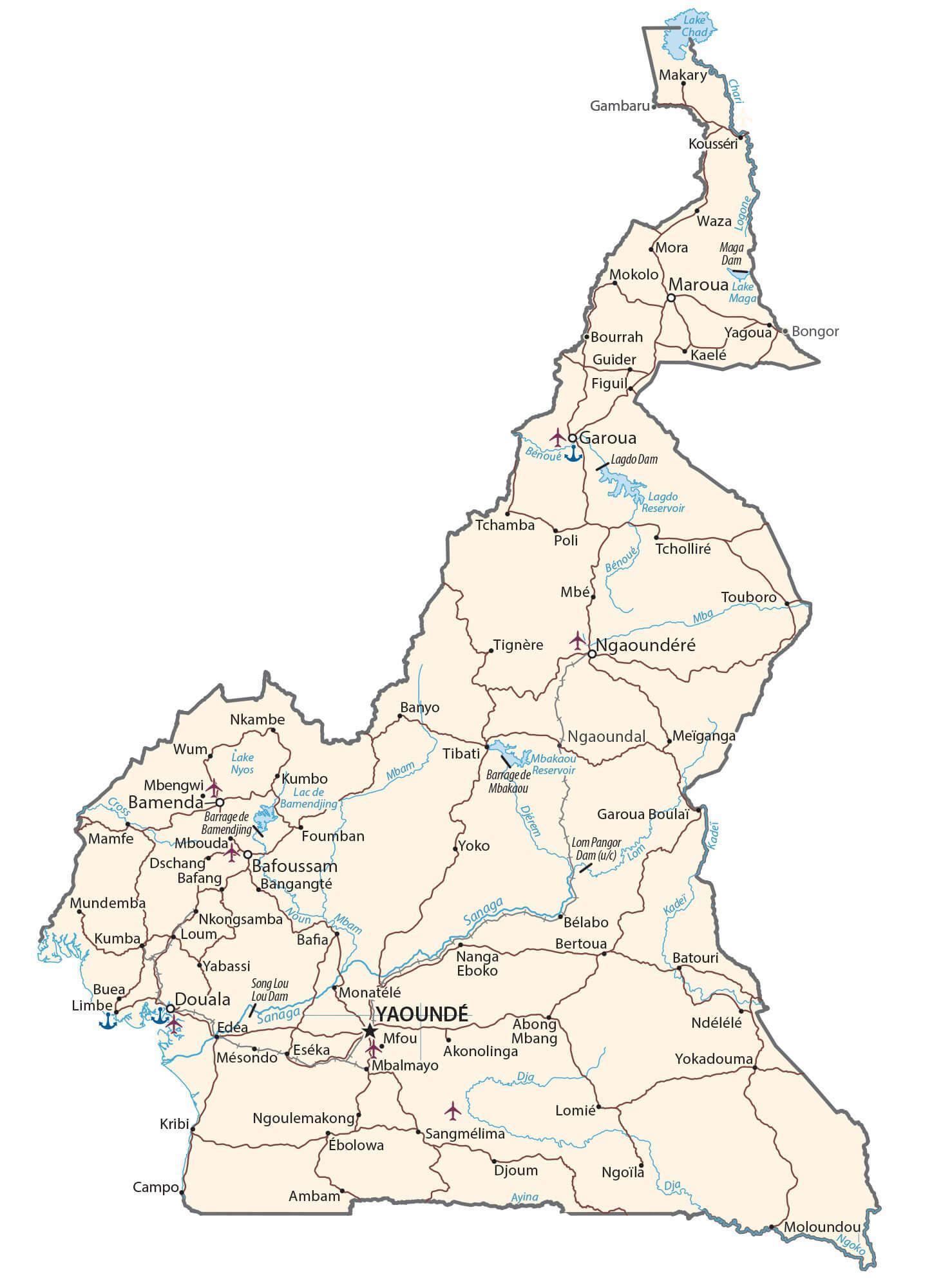
Transportation Map of Cameroon

Cameroon Satellite Map