Nigeria is a West African country occupying an area of 923,769 sq. km.
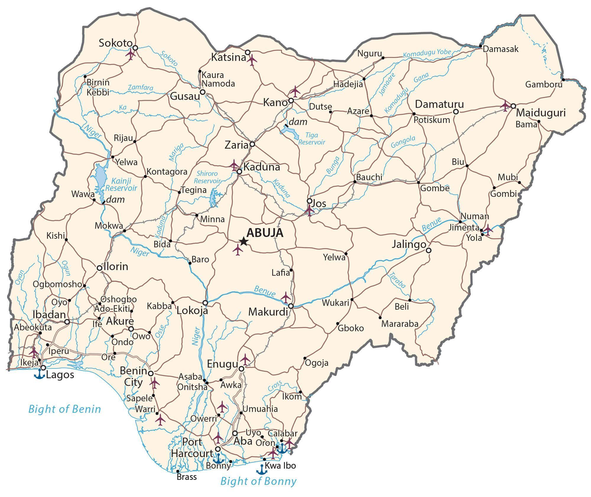
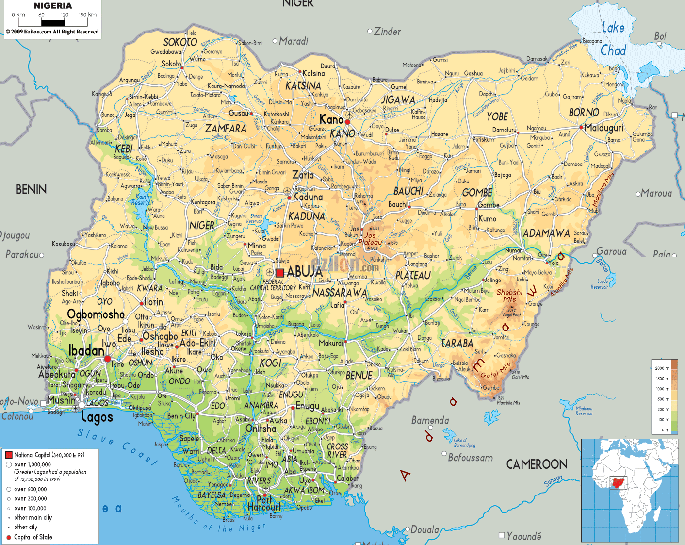
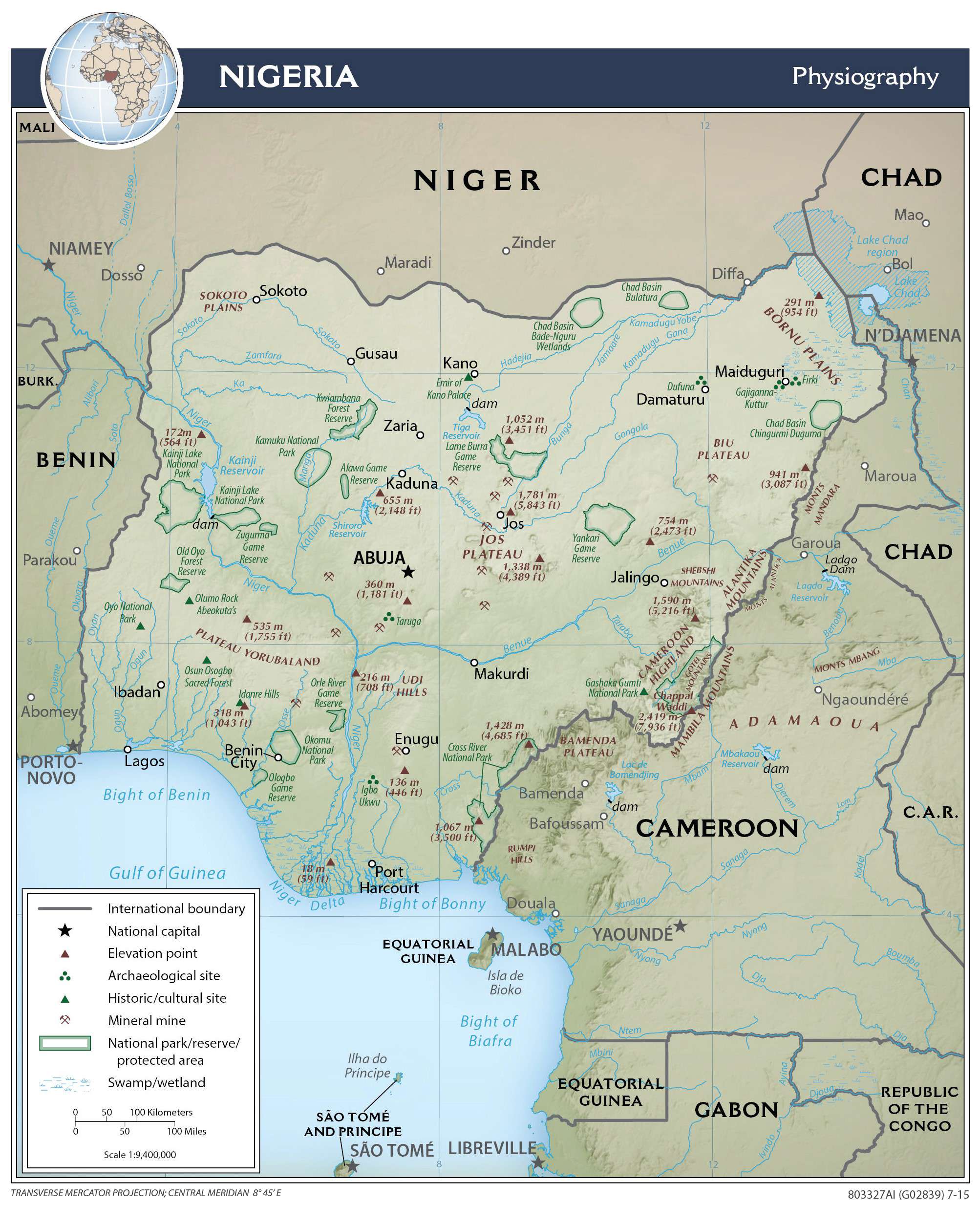
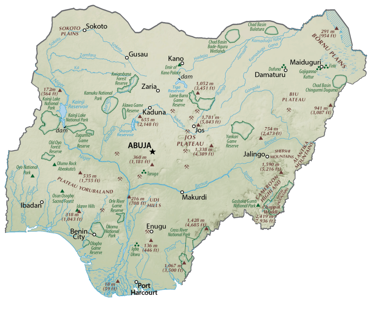
The country’s landscape features plains in the north and south. The central region has hills and plateaus. The Sokoto Plains and the Borno Plains are located in the northwestern and northeastern corners of the country respectively.
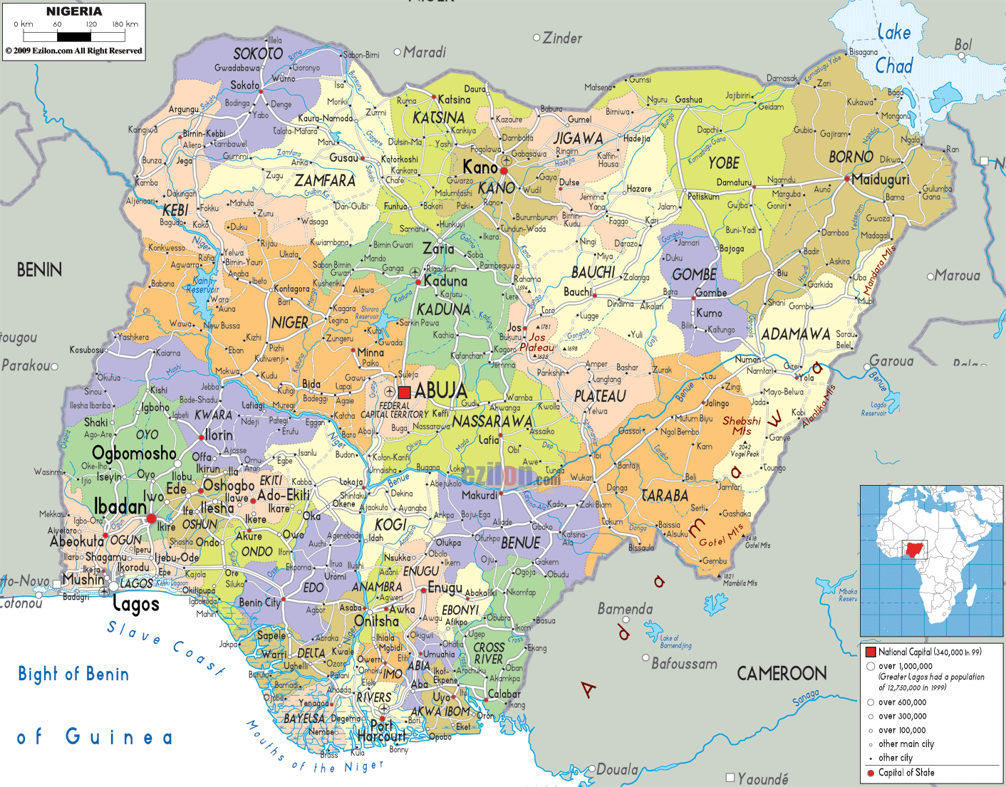
As shown on the map above, the country shares Lake Chad in the northeast with Niger, Chad and Cameroon.
The Jos Plateau (marked on the map) is a distinct physical feature located almost at the center of the country and features massive lava surfaces and extinct volcanoes. The rest of the central plateau region has high plains, shallow river valleys, and inselbergs.
The most mountainous area of the country is located to the southeast. The position of Nigeria’s highest point has been marked. It is the 2,419 m high Chappal Waddi.
The southern Atlantic coast is bordered by mangrove forests and swamps.
Lagos, the capital of Nigeria, is located on the Atlantic coast of the country.
The Niger and the Benue Rivers showed on the map are the major rivers of Nigeria. The Niger and Benue River valleys make up Nigeria’s most expansive region, merging into each other to form a distinctive ‘Y’ shape. The country’s rivers drain into primarily three drainage basins. These are the Lake Chad, Gulf of Guinea, and Niger-Benue basin.
| Flag: |  |
|---|---|
| Legal Name: | Federal Republic of Nigeria |
| Capital Value: | Abuja |
| Official languages: | English |
| Demonym(s): | Nigerian |
| Government: | Federal presidential republic |
| Legislature: | National Assembly |
| Total Area: | 923,768 km² |
| Land Area: | 910,768 km² |
| Water Area: | 13,000 km² |
| Population: | 200,963,599 |
| Density: | 218/km (564.6/sq mi) (42nd) |
| GDP: | $448.12 Billion |
| GDP Per Capita: | $2,229.86 |
| Currency Value: | Nairas (NGN) |
| Driving side: | right |
| Calling code: | +234 |
| Internet TLD: | .ng |
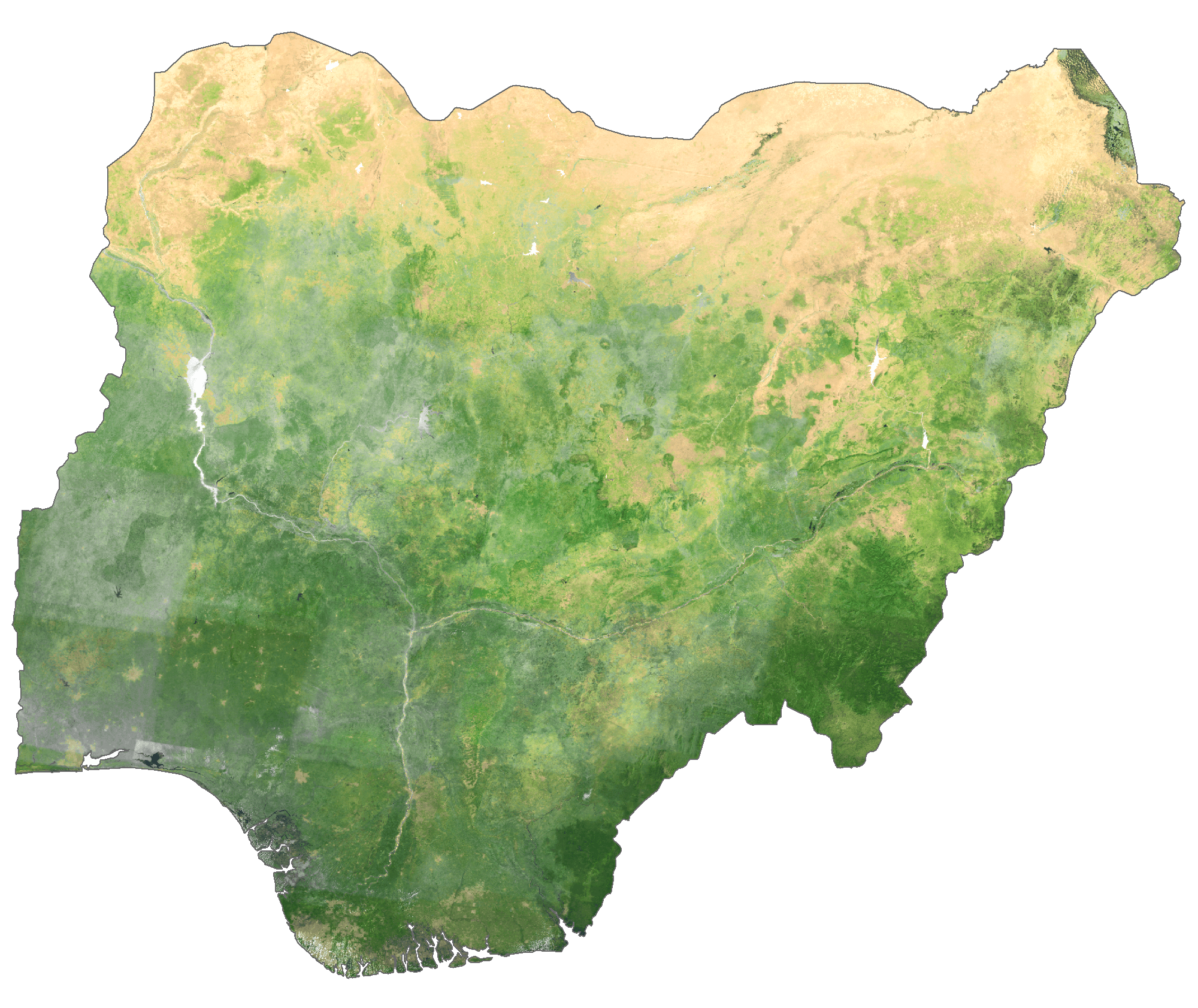
Explore the beauty and diversity of Nigeria with this detailed map. From the bustling cities of Lagos and Abuja to the rural communities of the far north, this map offers a comprehensive view of the country. Discover the state boundaries, rivers, roads, and other geographical features of the nation. Get an aerial view of the terrain and topography with the included satellite imagery and elevation map.
Whether you’re a traveler, a student, or a business professional, this map of Nigeria will help you gain a better understanding of the nation.
Discover the Beauty and Diversity of Nigeria with this Detailed Map
Explore the beauty and diversity of Nigeria with this detailed map. Discover the state boundaries, rivers, roads, and other geographical features of the nation. Get an aerial view of the terrain and topography with the included satellite imagery and elevation map. From the bustling cities of Lagos and Abuja to the rural communities of the far north, this map offers a comprehensive view of the country.
Whether you’re a traveler, a student, or a business professional, this map of Nigeria will help you gain a better understanding of the nation. See the major cities, towns, states, roads, and rivers of Nigeria with this interactive map.
Online Interactive Political Map
Click on ![]() to view map in "full screen" mode.
to view map in "full screen" mode.
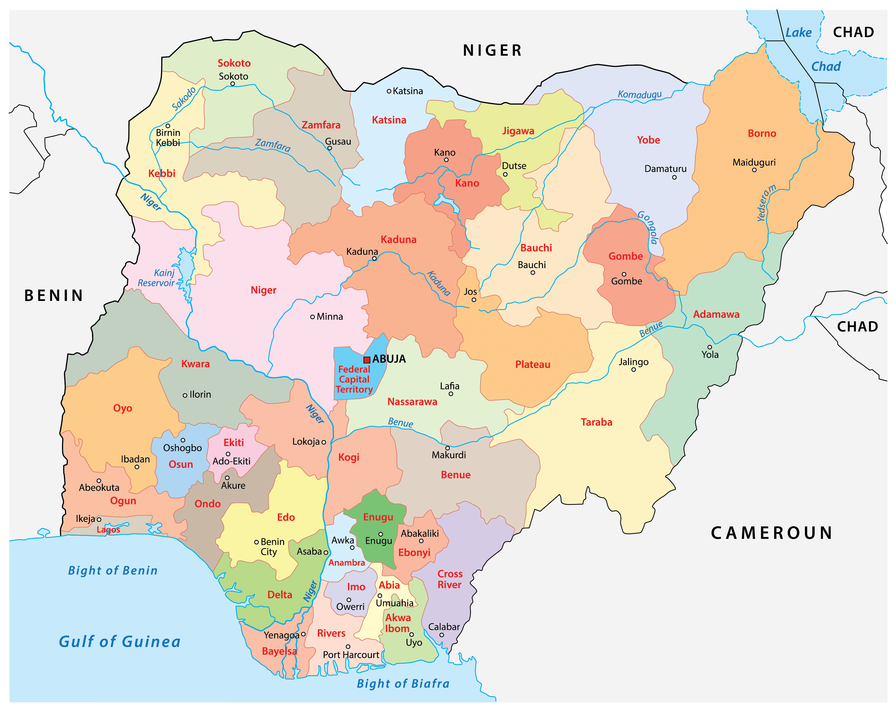
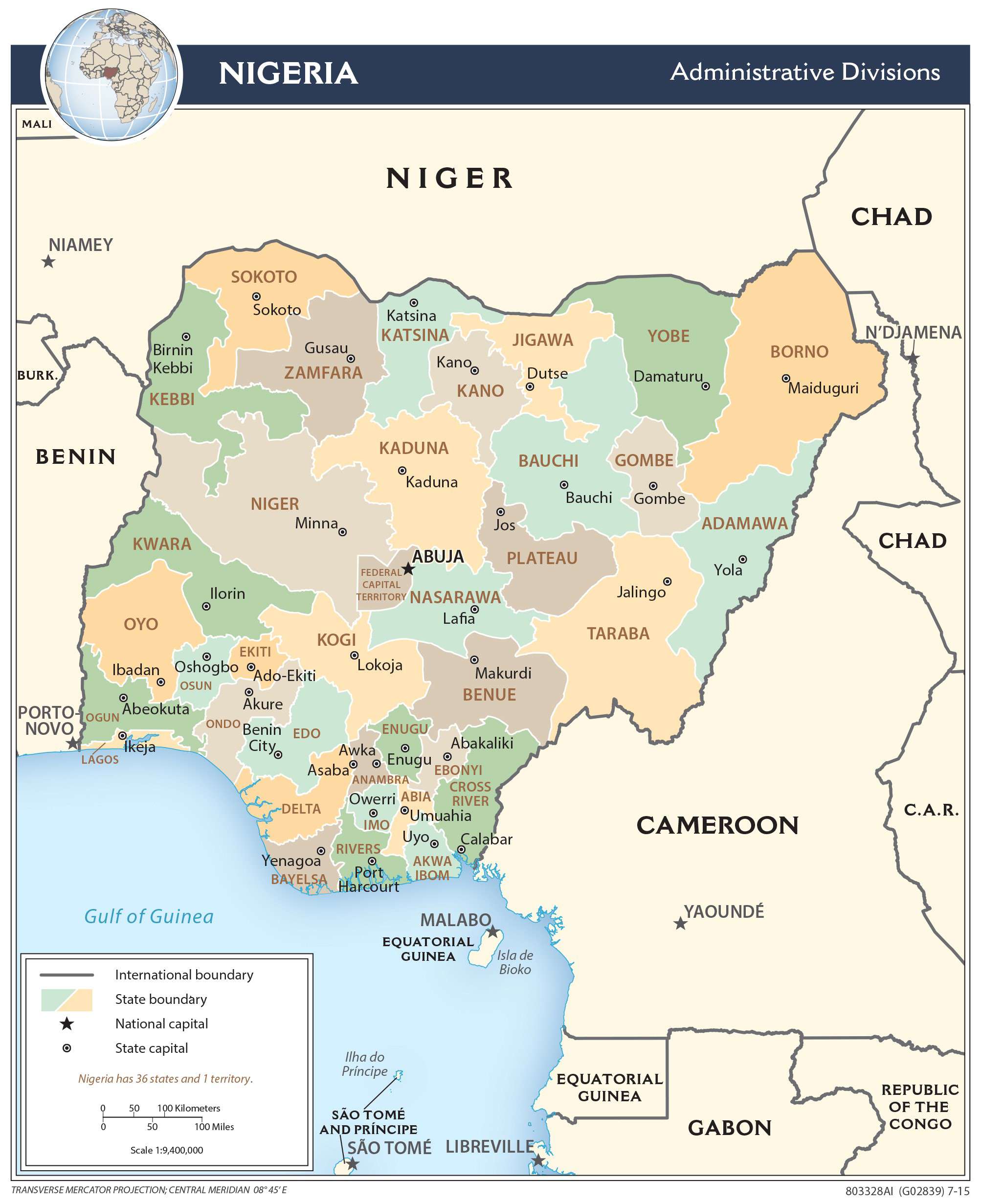
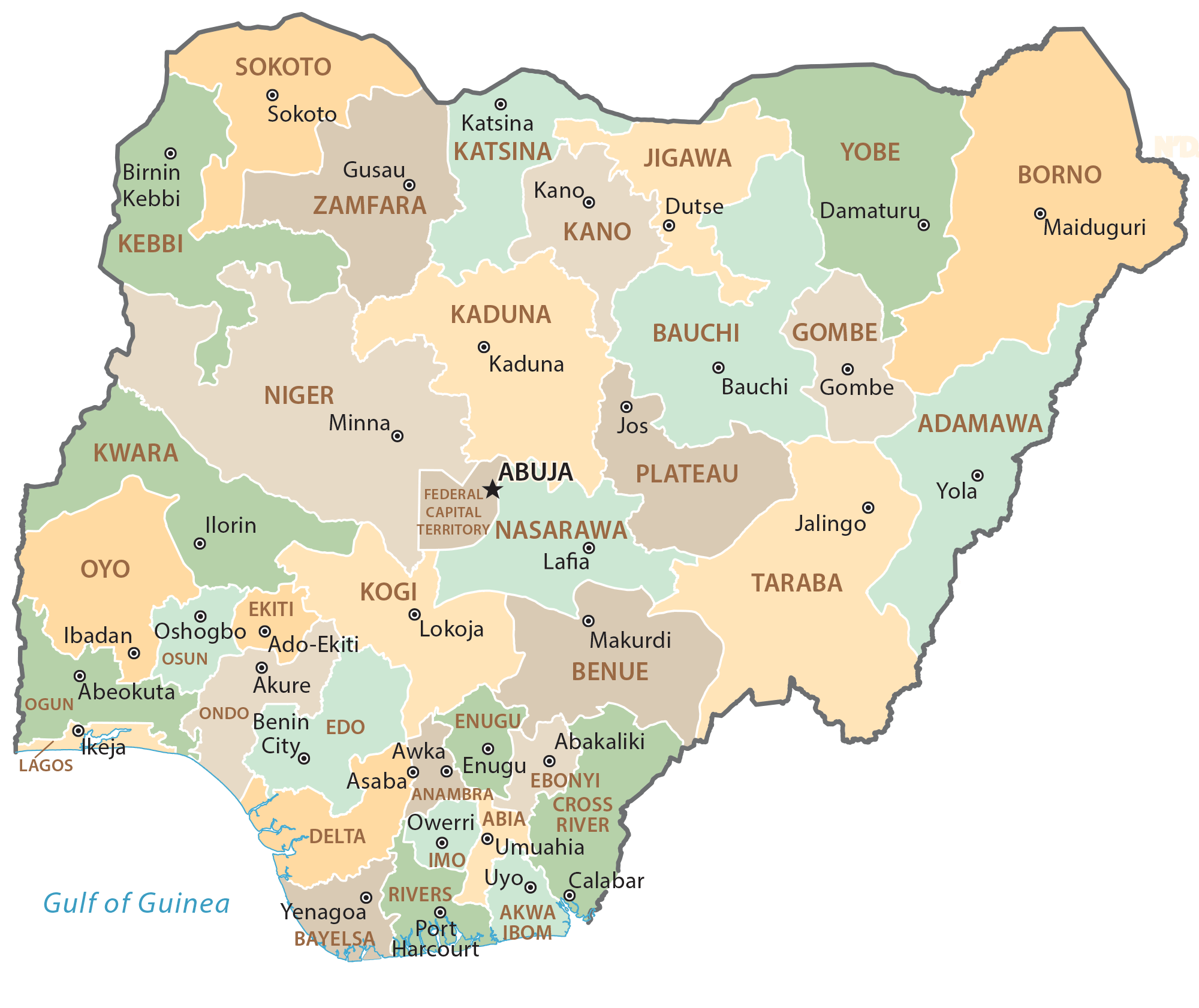
Nigeria has 36 states and a Federal Capital Territory. In alphabetical order, the states are as follows: Abia, Adamawa, Akwa Ibom, Anambra, Bauchi, Bayelsa, Benue, Borno, Cross River, Delta, Ebonyi, Edo, Ekiti, Enugu, Gombe, Imo, Jigawa, Kaduna, Kano, Katsina, Kebbi, Kogi, Kwara, Lagos, Nasarawa, Niger, Ogun, Ondo, Osun, Oyo, Plateau, Rivers, Sokoto, Taraba, Yobe, Zamfara.
The states are further divided into 774 Local Government Areas.
The Federal Capital Territory is located in Abuja, the national capital city of Nigeria.
Location Maps
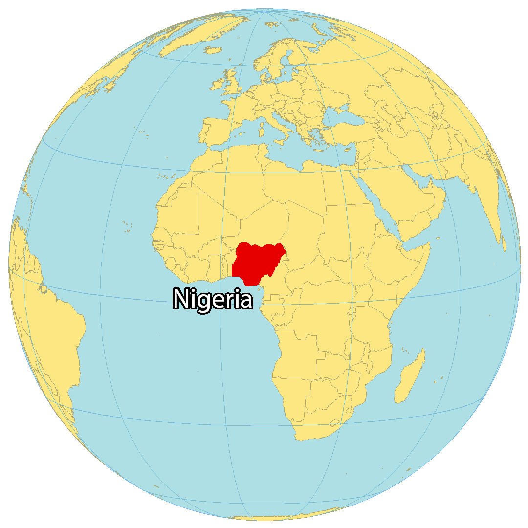
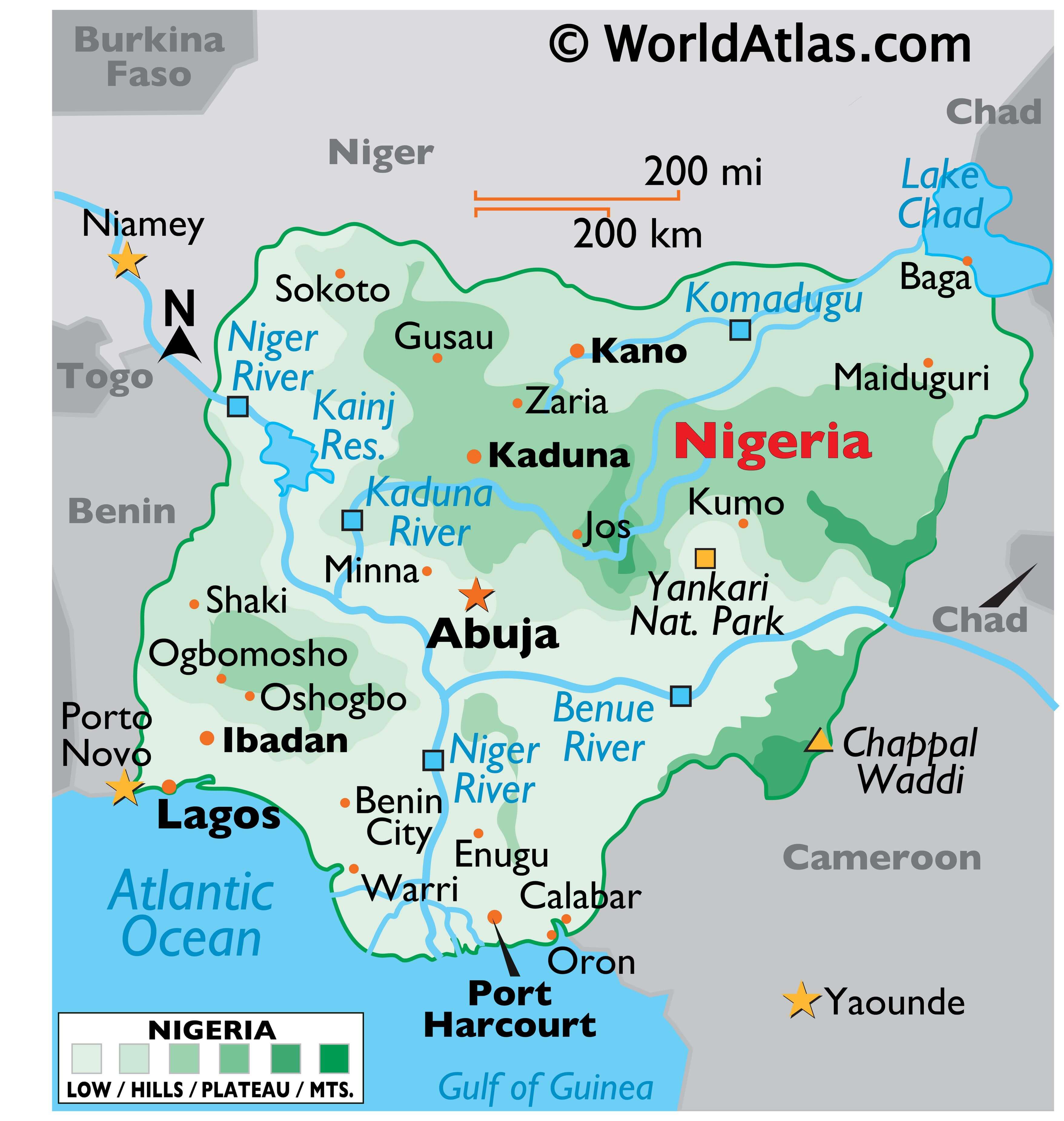
Where is Nigeria?
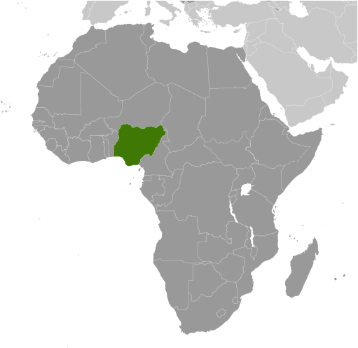
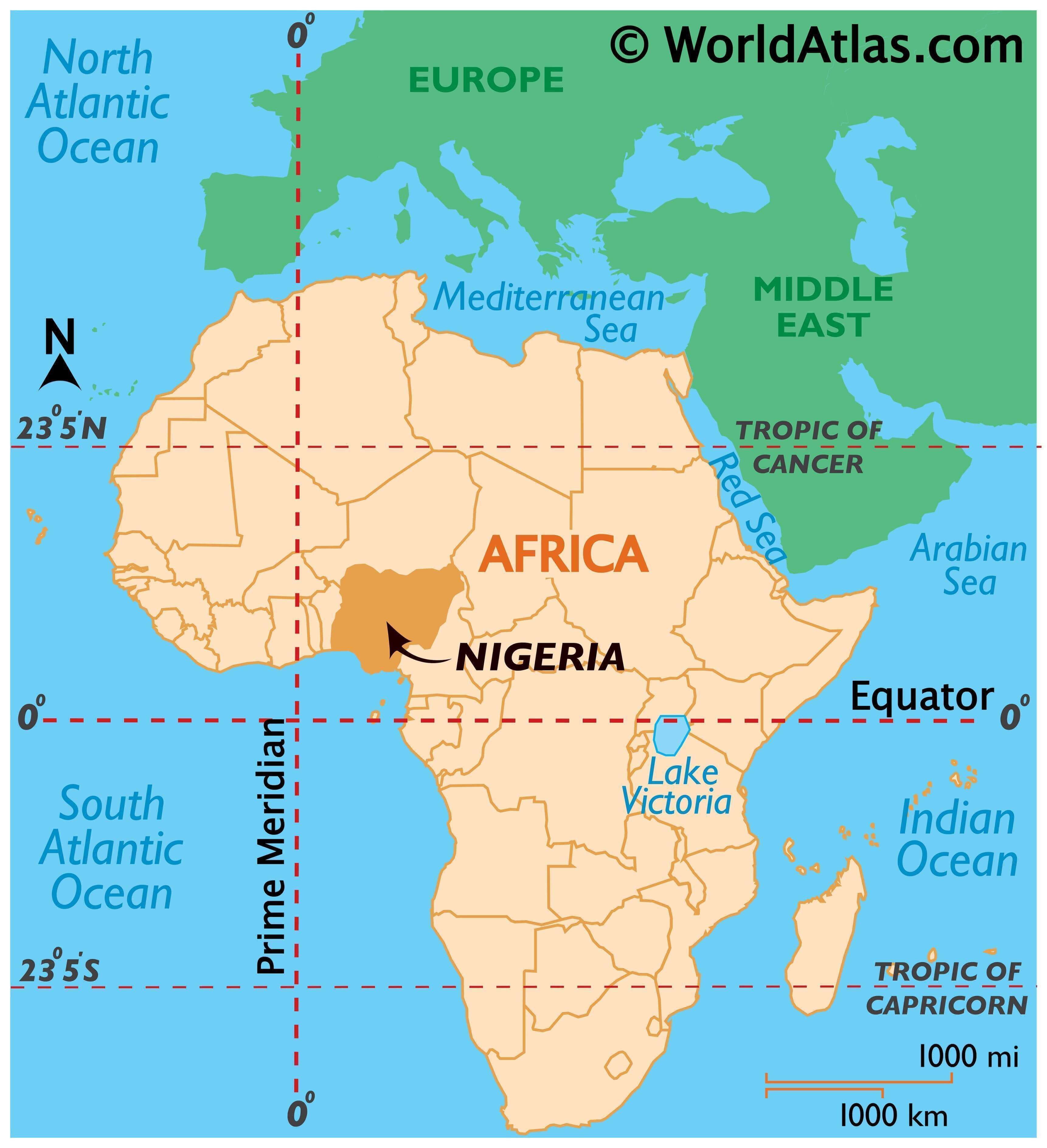
Nigeria is located in Western Africa, south of the Gulf of Guinea. It is bordered by four other African countries, namely Cameroon to the east, Chad to the northeast, Niger to the north, and Benin to the west. This nation is often referred to as the “Giant of Africa” due to its large landmass and the highest population out of all African countries.
Nigeria is unique from other African nations in many ways, including its multiethnicity, film industry, and the 725-meter tall monolith outside the capital city of Abuja, Zuma Rock. Despite the official language being English, there are over 500 different languages spoken in the country. Abuja is the capital city of Nigeria, while Lagos is the most populous city both in the country and in the whole of Africa.
High Definition Political Map of Nigeria
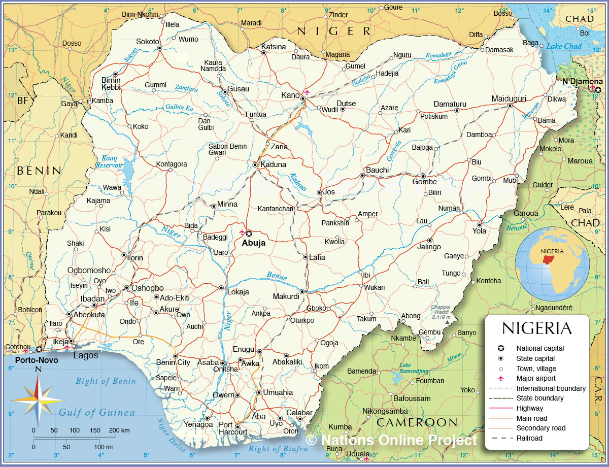
Nigeria Administrative Map
Physical Map of Nigeria
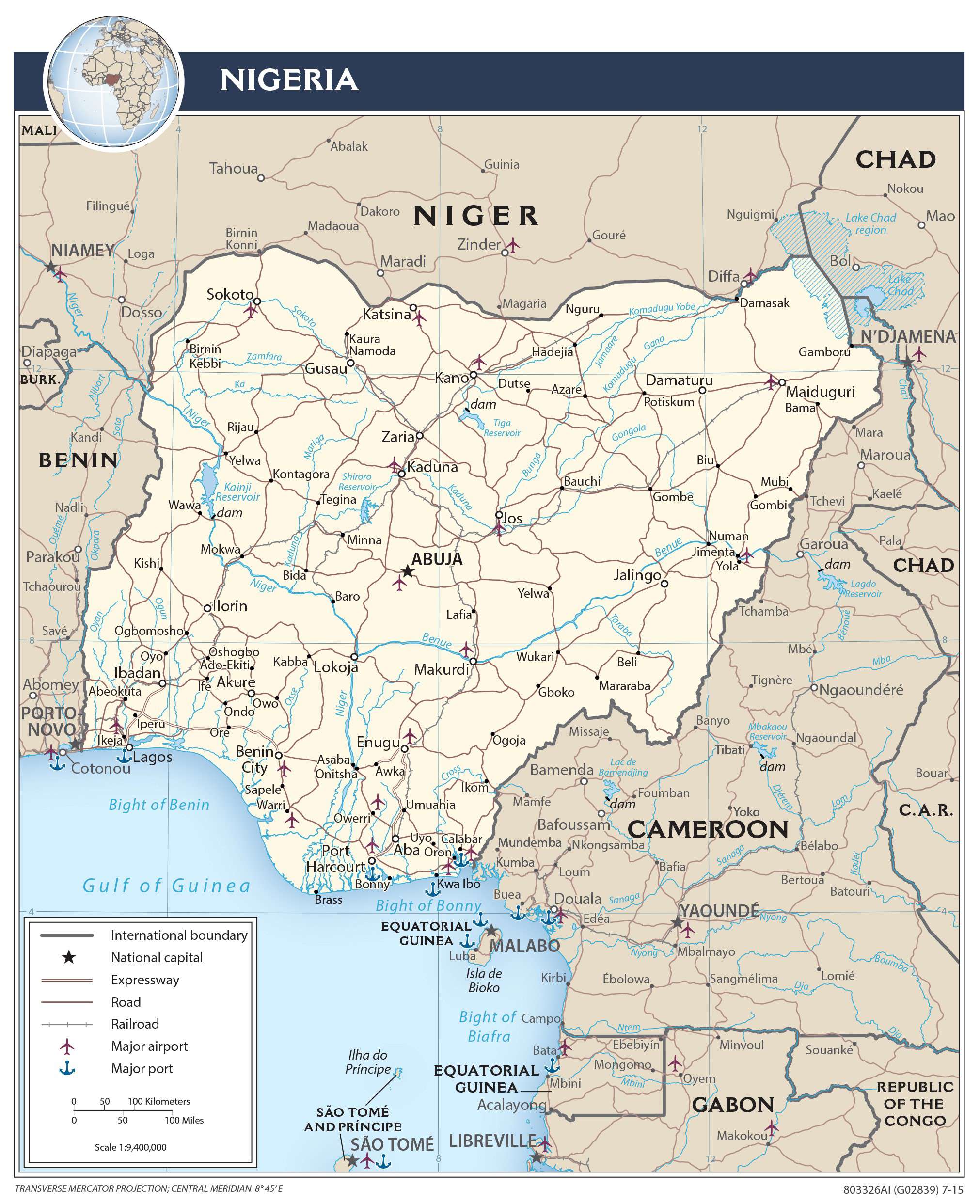
Transportation Map of Nigeria
Nigeria Satellite Map