The Republic of the Congo is located in northern Africa’s western coast with a coastline of 169 km along the Atlantic Ocean. The country occupies an area of 342,000 sq. km.
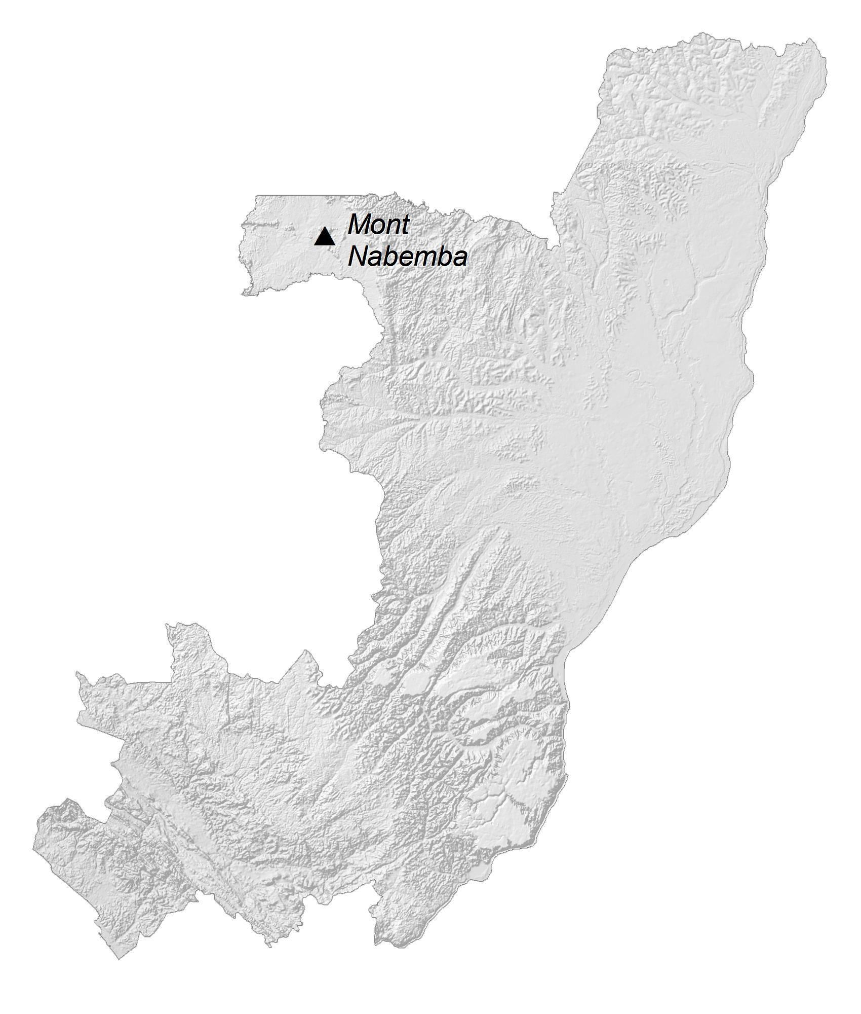
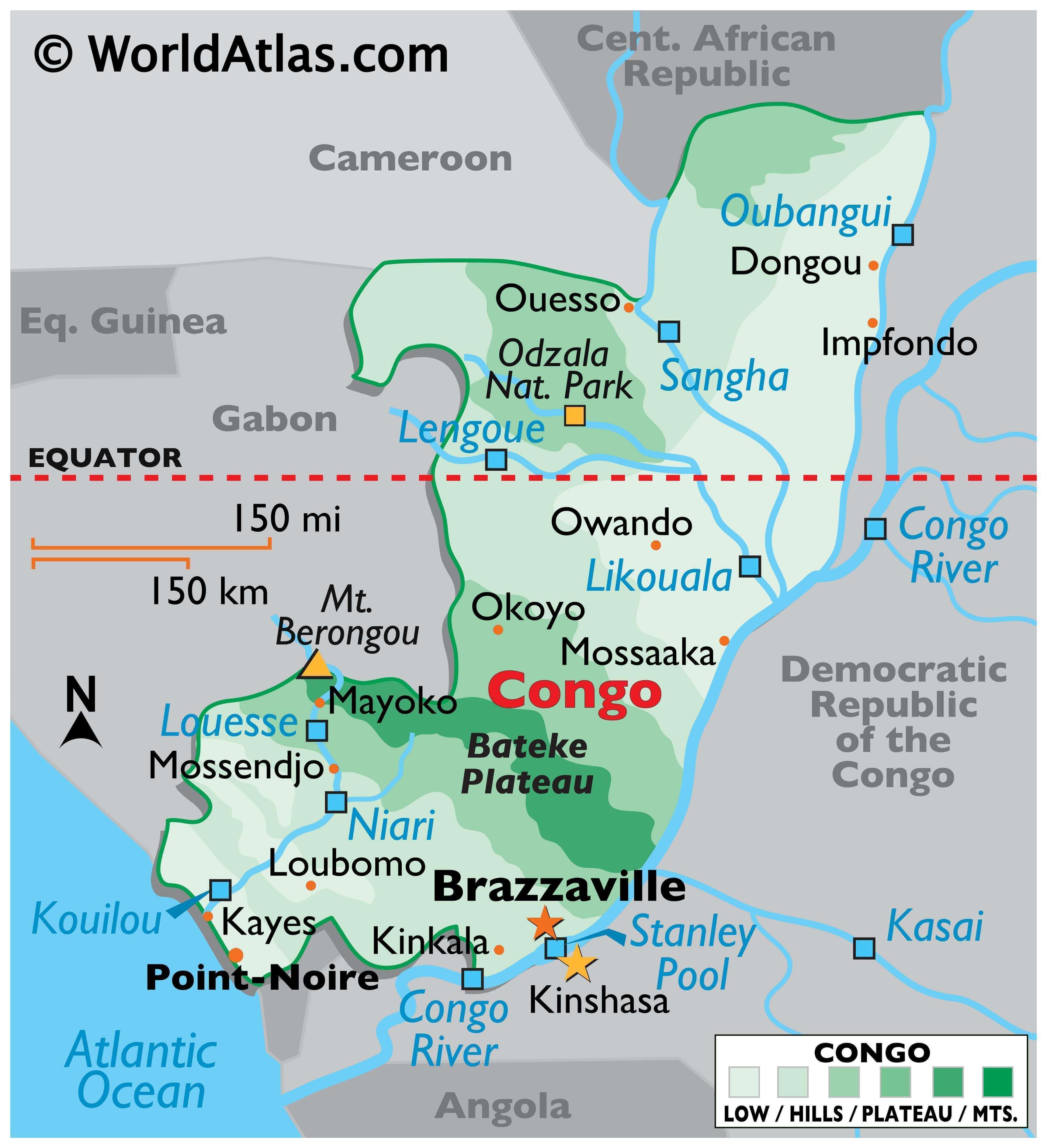
As observed on the physical map above, the country has varying terrain. It includes coastal plains, plateaus, fertile river valleys, and mountains with around 70% of the nation being covered by rainforest.
From the grasslands of the narrow coastal plain, the land rises into the rounded, low hills of the Bateka Plateau, and the elevated, mountainous regions along its western border with Gabon. Marked on the map, Mount Berongou, the Congo’s highest point, is located in the upper reaches of the Crystal Mountains on the border with Gabon. It rises to about 903 meters. Further inland and to the northeast, the land flattens, covered by dense equatorial rainforest.
The Congo River, the second-longest river in Africa and the sixth-longest river in the world, lies to the south and totals the length of 4,700 km. The Stanley Pool is a lake formed by the widening of the Congo River. It lies between the borders of the Republic of Congo and the Democratic Republic of the Congo. It covers an area that is about 35 kilometers (22 miles) long and 23 kilometers (14 miles) wide. The capital cities of both the Congo and the Democratic Republic of the Congo are located on the shores of Stanley Pool, and river ferries serve the area. The lowest point of the country is the Atlantic Ocean coastline (0 m).
| Flag: |  |
|---|---|
| Legal Name: | Republic of the Congo |
| Capital Value: | Brazzaville |
| Official languages: | French |
| Demonym(s): | Congolese |
| Government: | Unitary dominant-party semi-presidential republic |
| Legislature: | Parliament |
| Total Area: | 342,000 km² |
| Land Area: | 341,500 km² |
| Water Area: | 500 km² |
| Population: | 5,380,508 |
| Density: | 17/km (44.0/sq mi) |
| GDP: | $10.82 Billion |
| GDP Per Capita: | $2,011.07 |
| Currency Value: | Cooperation Financiere en Afrique Centrale francs (XAF) |
| Driving side: | right |
| Calling code: | +242 |
| Internet TLD: | .cg |
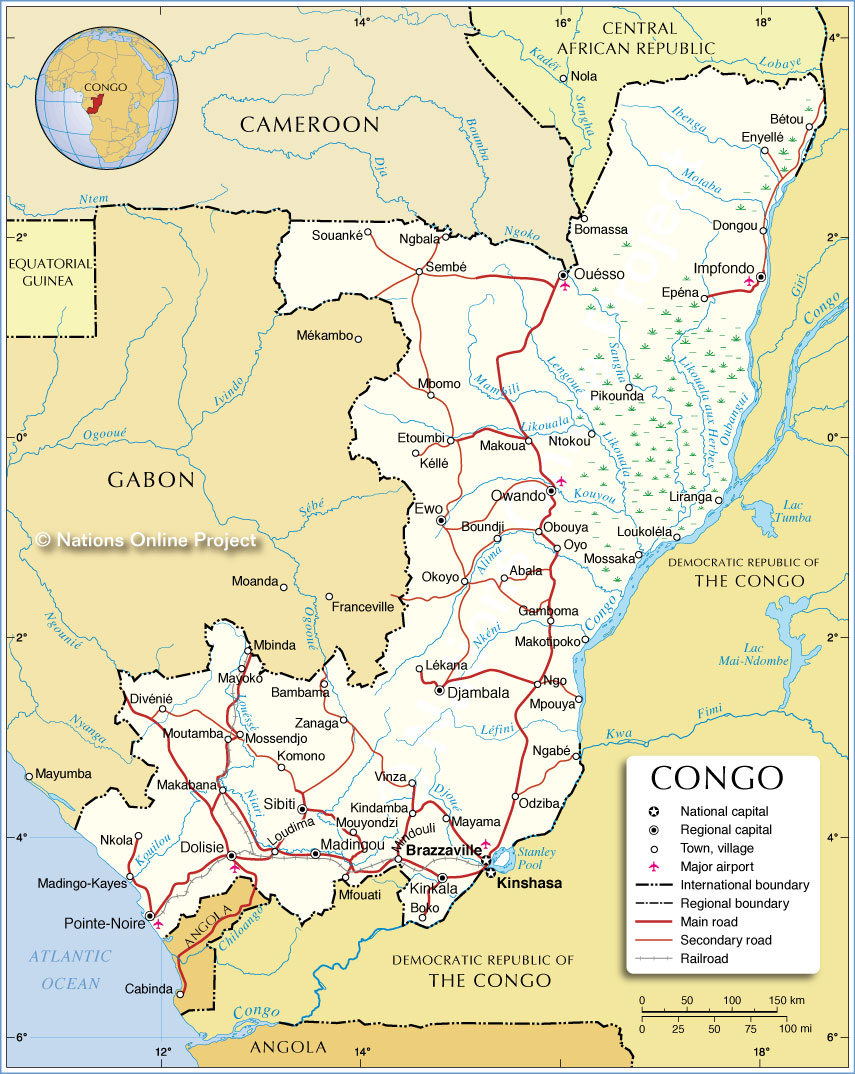
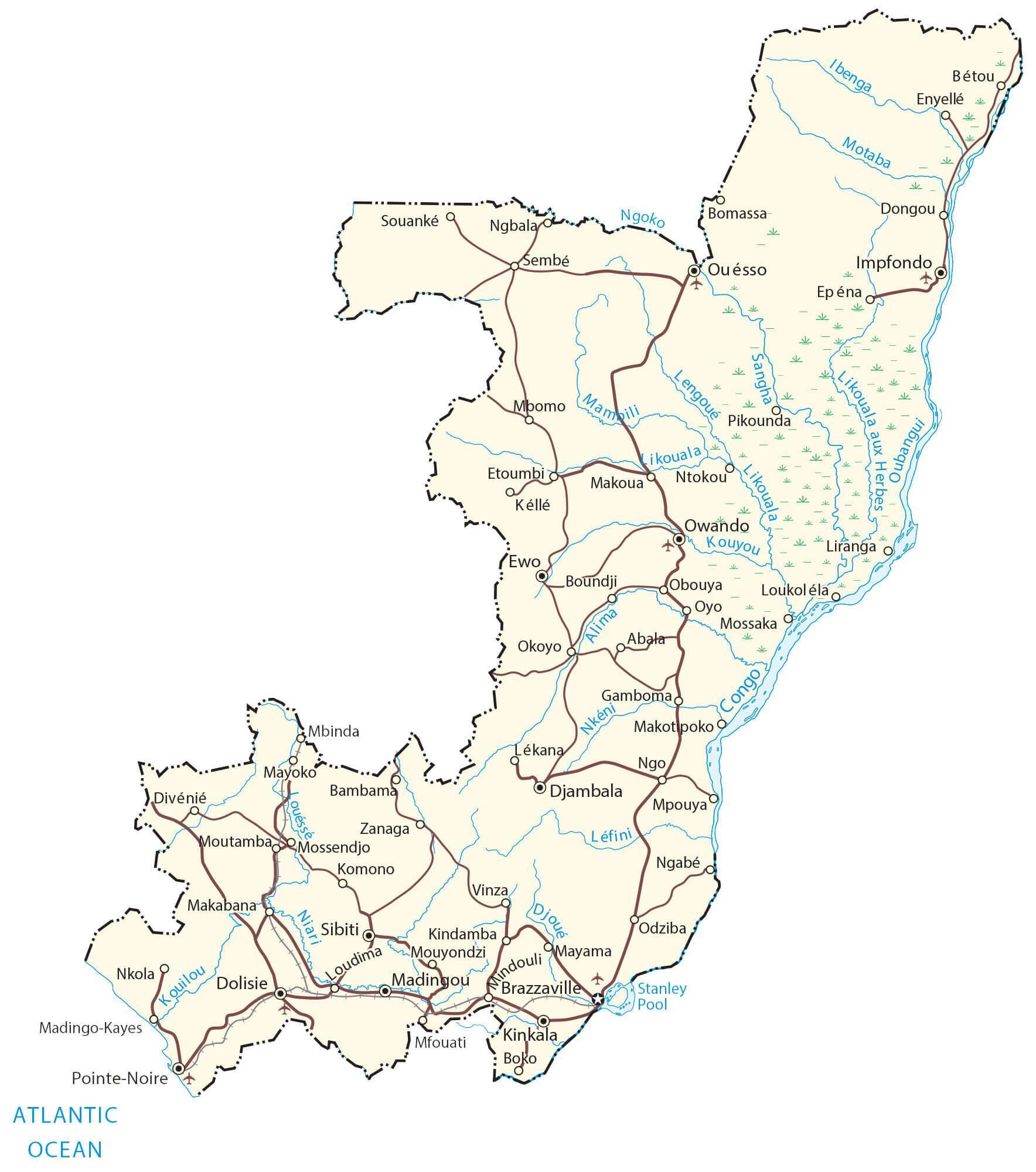
Explore the Republic of Congo with this detailed map. See the Congo River, its major cities, towns, and roads, as well as the Congo Basin. Enjoy an elevation map and satellite imagery of the region to get a better view of this beautiful African country.
Online Interactive Political Map
Click on ![]() to view map in "full screen" mode.
to view map in "full screen" mode.
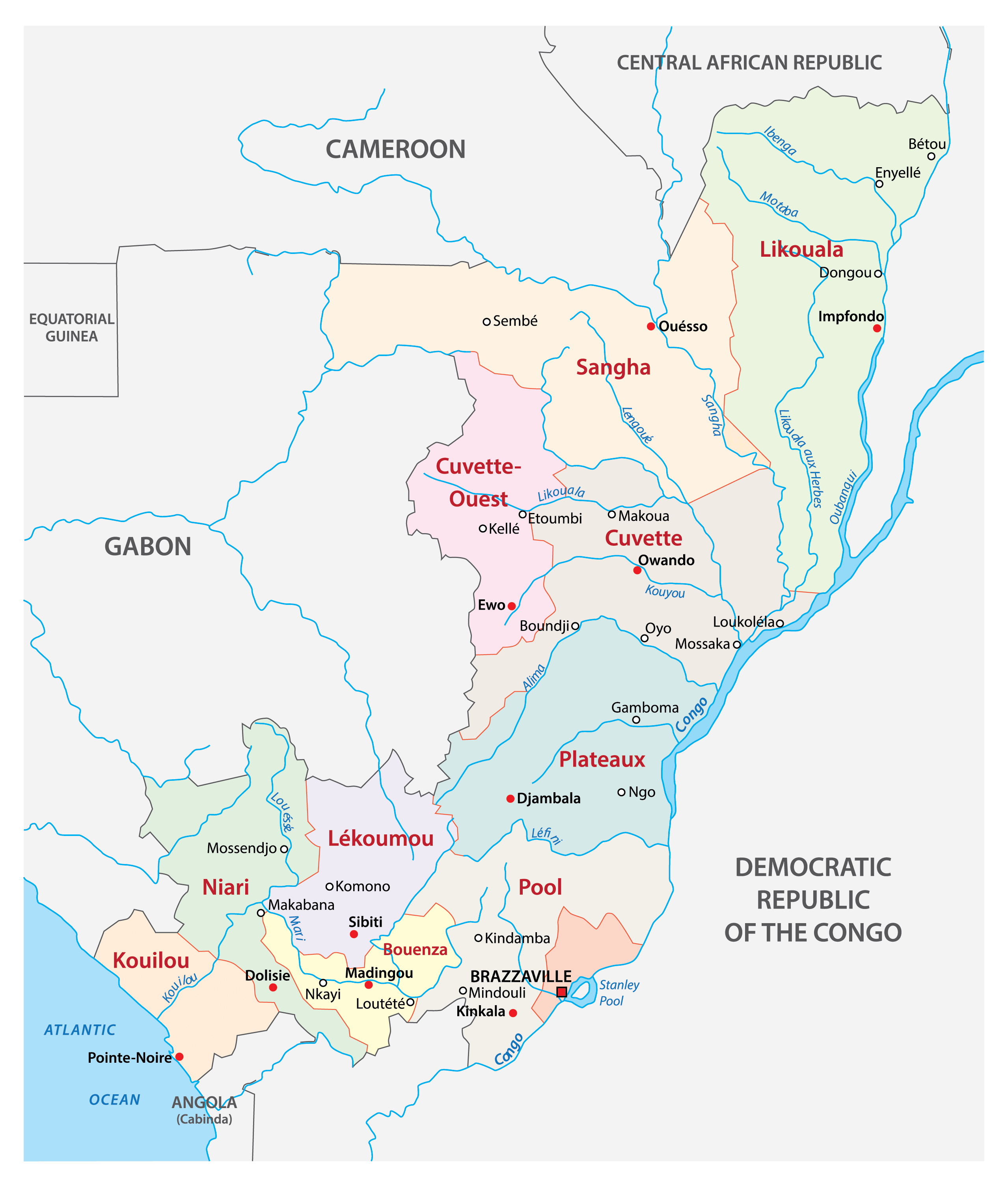
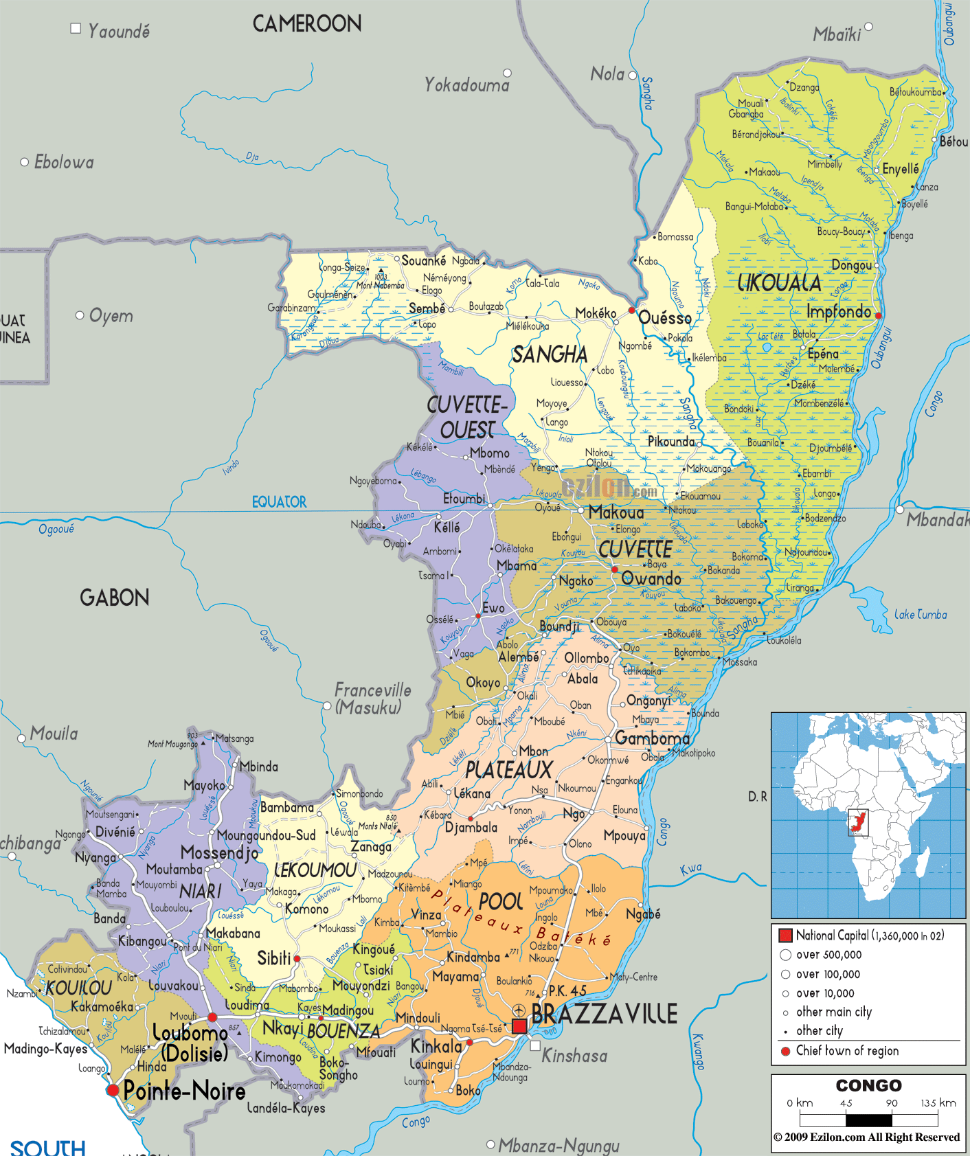
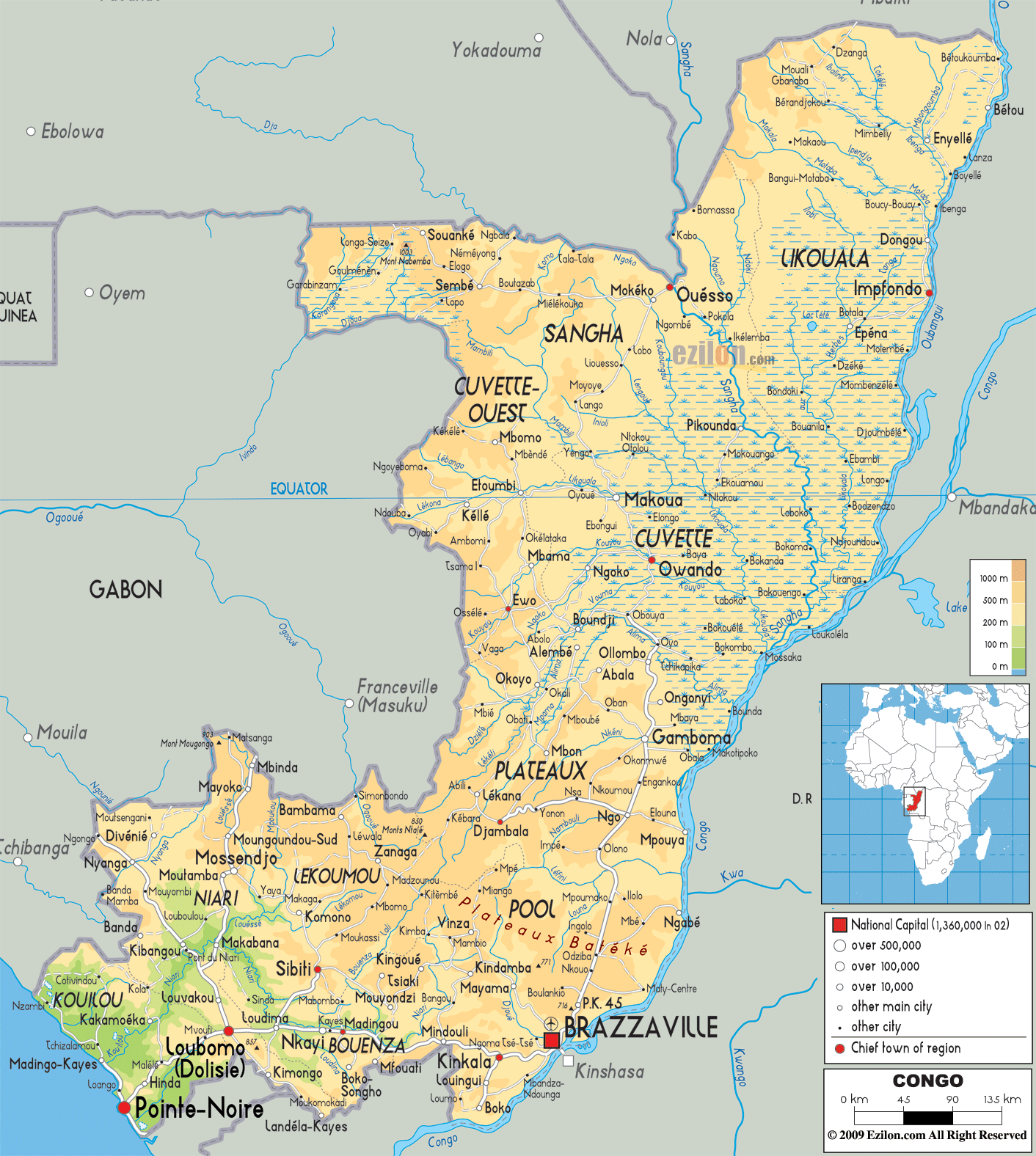
The Republic of the Congo has 12 departments as the top-level administrative division. In alphabetical order, they are: Bouenza, Brazzaville, Cuvette, Cuvette-Ouest, Kouilou, Lekoumou, Likouala, Niari, Plateaux, Pointe-Noire, Pool, Sangha.
These departments are further divided into districts and communes.
With an area of 66,044 sq. km, Likouala is the largest department and Brazzaville, the national capital, is the most populous one.
Location Maps
Where is Republic of the Congo?
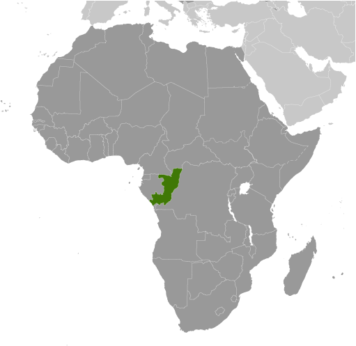
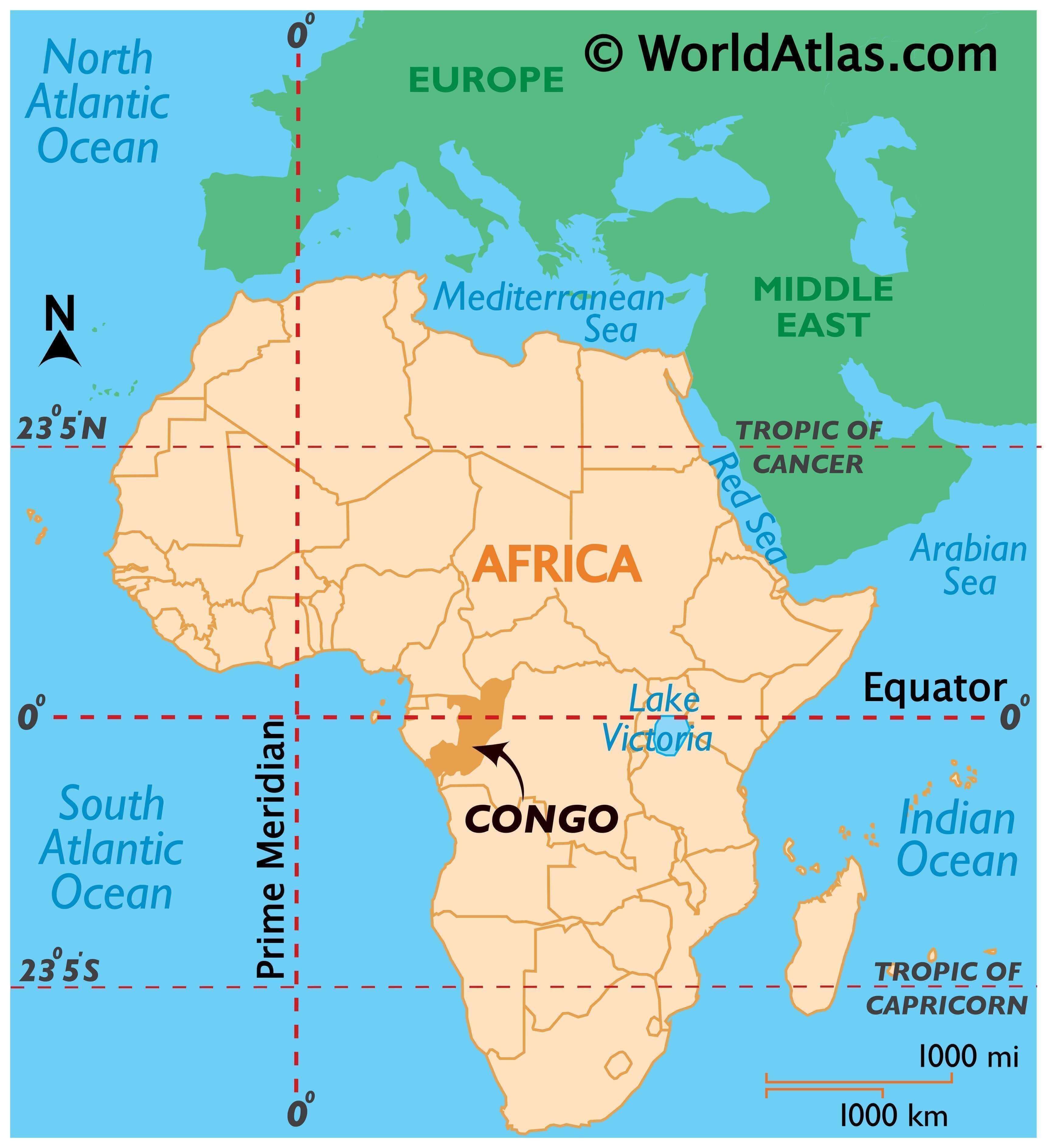
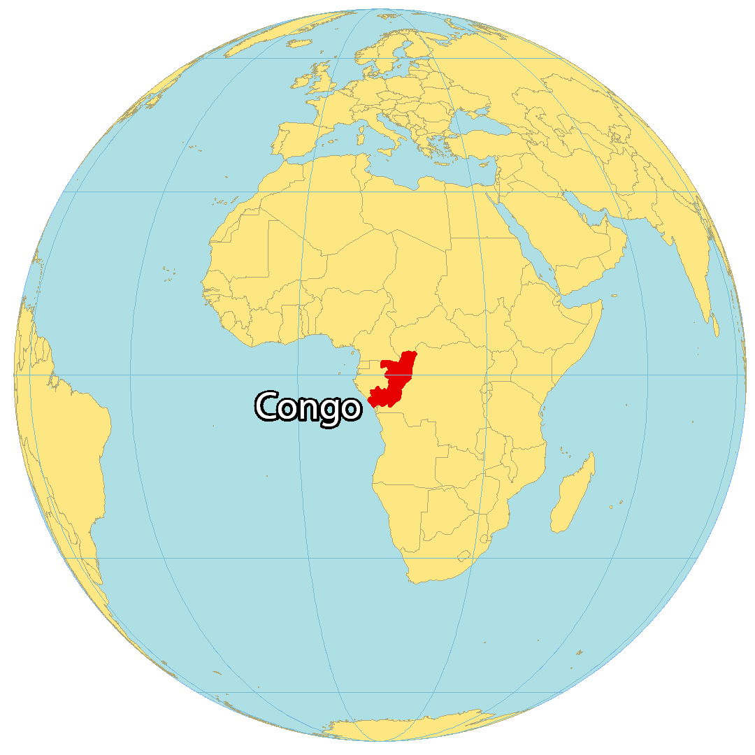
The Republic of Congo (also known as the Congo) is located in west-central Africa, along the equator between 4°N and 5°S latitude. It has a 169 kilometers (105 mi) coastline with the Atlantic Ocean, and its capital and largest city is Brazzaville, located in the southeast corner of the country. Approximately 5.4 million people live in the Republic of Congo and its official language is French.
Congo borders Gabon to the west, Cameroon to the northwest, the Central African Republic to the north, the Angola exclave of Cabinda to the southwest, and DR Congo to the east, separated by the Congo River.
High Definition Political Map of Republic of the Congo
History
Bantu-speaking peoples who founded tribes during the Bantu expansions mostly displaced and absorbed the earlier inhabitants of the region, the Pygmy people, about 1500 BC. The Bakongo, a Bantu ethnic group that occupied parts of what later is Angola, Gabon, and the Democratic Republic of the Congo, formed the basis for ethnic affinities and rivalries among those countries. Some Bantu kingdoms—including those of the Kongo, the Loango, and the Teke—built trade links leading into the Congo River basin.
The Portuguese explorer Diogo Cão reached the mouth of the Congo in 1484. Commercial relationships grew between the inland Bantu kingdoms and European merchants who traded in commodities, manufactured goods, and people captured and enslaved in the hinterlands. After centuries as a central hub for transatlantic trade, direct European colonization of the Congo river delta began in the 19th century, subsequently eroding the power of the Bantu societies in the region.
The area north of the Congo River came under French sovereignty in 1880 as a result of Pierre de Brazza’s treaty with King Makoko of the Bateke. After the death of Makoko, his widow Queen Ngalifourou upheld the terms of the treaty and became an ally to the colonizers. This Congo Colony became known first as French Congo, then as Middle Congo in 1903.
In 1908, France organized French Equatorial Africa (AEF), comprising the Middle Congo, Gabon, Chad, and Oubangui-Chari (what later is Central African Republic). The French designated Brazzaville as the federal capital. Economic development during the first 50 years of colonial rule in Congo centered on natural-resource extraction. Construction of the Congo-Ocean Railway following World War I has been estimated to have cost at least 14,000 lives.
During the Nazi occupation of France during World War II, Brazzaville functioned as the symbolic capital of Free France between 1940 and 1943. The Brazzaville Conference of 1944 heralded a period of reform in French colonial policy. Congo “benefited” from the postwar expansion of colonial administrative and infrastructure spending as a result of its central geographic location within AEF and the federal capital at Brazzaville. It had a local legislature after the adoption of the 1946 constitution that established the Fourth Republic.
Following the revision of the French constitution that established the Fifth Republic in 1958, AEF dissolved into its constituent parts, each of which became an autonomous colony within the French Community. During these reforms, Middle Congo became known as the Republic of the Congo in 1958 and published its first constitution in 1959. Antagonism between the Mbochis (who favored Jacques Opangault) and the Laris and Kongos (who favored Fulbert Youlou, the first black mayor elected in French Equatorial Africa) resulted in a series of riots in Brazzaville in February 1959, which the French Army subdued.
Elections took place in April 1959. By the time the Congo became independent in August 1960, Opangault, the former opponent of Youlou, agreed to serve under him. Youlou, an avid anti-communist, became the first President of the Republic of the Congo. Since the political tension was so high in Pointe-Noire, Youlou moved the capital to Brazzaville.
The Republic of the Congo became fully independent from France on 15 August 1960. Youlou ruled as the country’s first president until labor elements and rival political parties instigated a 3-day uprising that ousted him. The Congolese military took over the country and installed a civilian provisional government headed by Alphonse Massamba-Débat.
Under the 1963 constitution, Massamba-Débat was elected president for a 5-year term. During Massamba-Débat’s term in office, the regime adopted “scientific socialism” as the country’s constitutional ideology. In 1964, Congo for the first time sent an official team with a single athlete at the Olympic Games. In 1965, Congo established relations with the Soviet Union, the People’s Republic of China, North Korea, and North Vietnam. On the economic and social level, Massamba-Débat led a healthy and rigorous management. Under his presidency, the Congo began to industrialize and the standard of living of the Congolese improved. Some large production units with large workforces were built: the textile factory of Kinsoundi, the palm groves of Etoumbi, the match factory of Bétou, the shipyards of Yoro, etc. Health centers were created as well as school groups (colleges and elementary school). The country’s school enrollment rate became the highest in Black Africa. At the same time, Brazzaville became a center for left-wing exiles from all over Central Africa. On the night of February 14 to 15, 1965, 3 public officials of the Republic of the Congo were kidnapped: Lazare Matsocota [fr] (prosecutor of the Republic), Joseph Pouabou [fr] (President of the Supreme Court), and Anselme Massouémé [fr] (director of the Congolese Information Agency). The bodies of 2 of these men were later found, mutilated, by the Congo River. Massamba-Débat’s regime invited some hundred Cuban army troops into the country to train his party’s militia units. These troops helped his government survive a coup d’état in 1966 led by paratroopers loyal to future President Marien Ngouabi. Massamba-Débat was unable to reconcile institutional, tribal, and ideological factions within the country and his regime ended with a bloodless coup in September 1968.
Marien Ngouabi, who had participated in the coup, assumed the presidency on 31 December 1968. 1 year later, Ngouabi proclaimed the Congo Africa’s first “people’s republic”, the People’s Republic of the Congo, and announced the decision of the National Revolutionary Movement to change its name to the Congolese Labour Party (PCT). He survived an attempted coup in 1972 and was assassinated on 16 March 1977. An 11-member Military Committee of the Party (CMP) was then named to head an interim government, with Joachim Yhombi-Opango serving as president. 2 years later, Yhombi-Opango was forced from power, and Denis Sassou Nguesso became the new president.
Sassou Nguesso aligned the country with the Eastern Bloc and signed a 20-year friendship pact with the Soviet Union. Over the years, Sassou had to rely more on political repression and less on patronage to maintain his dictatorship. The collapse of the Soviet Union in 1991 resulted in the ending of Soviet aid to prop up the regime, and it abdicated power.
Pascal Lissouba who became Congo’s first elected president (1992–1997) during the period of multi-party democracy attempted to implement economic reforms with IMF backing to liberalize the economy. In June 1996, IMF approved a 3-year SDR69.5m (US$100m) enhanced structural adjustment facility (ESAF) and was on the verge of announcing a renewed annual agreement when civil war broke out in Congo in 1997.
Congo’s democratic progress was derailed in 1997 when Lissouba and Sassou started to fight for power in the civil war. As presidential elections scheduled for July 1997 approached, tensions between the Lissouba and Sassou camps mounted. On 5 June, President Lissouba’s government forces surrounded Sassou’s compound in Brazzaville, and Sassou ordered members of his private militia (known as “Cobras”) to resist. Thus began a 4-month conflict that destroyed or damaged some of Brazzaville and caused tens of thousands of civilian deaths. In October, the Angolan government began an invasion of Congo to install Sassou in power and the Lissouba government fell. After that, Sassou declared himself president.
In the elections in 2002, Sassou won with almost 90% of the vote cast. His 2 main rivals, Lissouba and Bernard Kolelas, were prevented from competing. A remaining rival, André Milongo advised his supporters to boycott the elections and then withdrew from the race. A constitution, agreed upon by referendum in January 2002, granted the president new powers, extended his term to 7 years and introduced a new bicameral assembly. International observers took issue with the organization of the presidential election and the constitutional referendum, both of which were reminiscent in their organization of Congo’s era of the 1-party state. Following the presidential elections, fighting restarted in the Pool region between government forces and rebels led by Pastor Ntumi; a peace treaty to end the conflict was signed in April 2003.
Sassou won the following presidential election in July 2009. According to the Congolese Observatory of Human Rights, a non-governmental organization, the election was marked by “very low” turnout and “fraud and irregularities”. In March 2015, Sassou announced that he wanted to run for yet another term in office and a constitutional referendum in October resulted in a changed constitution that allowed him to run during the 2016 presidential election. He won the election believed by some to be fraudulent. After violent protests in the capital, Sassou attacked the Pool region where the Ninja rebels of the civil war used to be based, in what was believed to be a distraction. This led to a revival of the Ninja rebels who launched attacks against the army in April 2016, leading 80,000 people to flee their homes. A ceasefire deal was signed in December 2017.
Physical Map of Republic of the Congo
Geography
Natural landscapes ranged from the savanna plains in the North Niari flooded forests, to the Congo River, to the rugged mountains and forests of Mayombe, and 170 km of beaches along the Atlantic coast.
Congo is located in the central-western part of sub-Saharan Africa, along the Equator, lying between latitudes 4°N and 5°S, and longitudes 11° and 19°E. To the south and east of it is the Democratic Republic of the Congo. It is bounded by Gabon to the west, Cameroon and the Central African Republic to the north, and Cabinda (Angola) to the southwest. It has a coast on the Atlantic Ocean.
The southwest is a coastal plain for which the primary drainage is the Kouilou-Niari River; the interior of the country consists of a central plateau between 2 basins to the south and north. Forests are under increasing exploitation pressure. Congo had a 2018 Forest Landscape Integrity Index mean score of 8.89/10, ranking it 12th globally out of 172 countries.
Congo lies within 4 terrestrial ecoregions: Atlantic Equatorial coastal forests, Northwestern Congolian lowland forests, Western Congolian swamp forests, and Western Congolian forest–savanna mosaic. Since the country is located on the Equator, the climate is more consistent year-round, with the average day temperature a humid 24 °C (75 °F) and nights generally between 16 °C (61 °F) and 21 °C (70 °F). The average yearly rainfall ranges from 1,100 millimetres (43 in) in the Niari Valley in the south to over 2,000 millimetres (79 in) in central parts. The dry season is from June to August, while in the majority of the country, the wet season has 2 rainfall maxima: 1 in March–May and another in September–November.
In 2006–07, researchers from the Wildlife Conservation Society studied gorillas in “heavily forested” regions centered on the Ouesso District of the Sangha Region. They suggest a population on the order of 125,000 western lowland gorillas whose isolation from humans has been mostly preserved by “inhospitable” swamps.
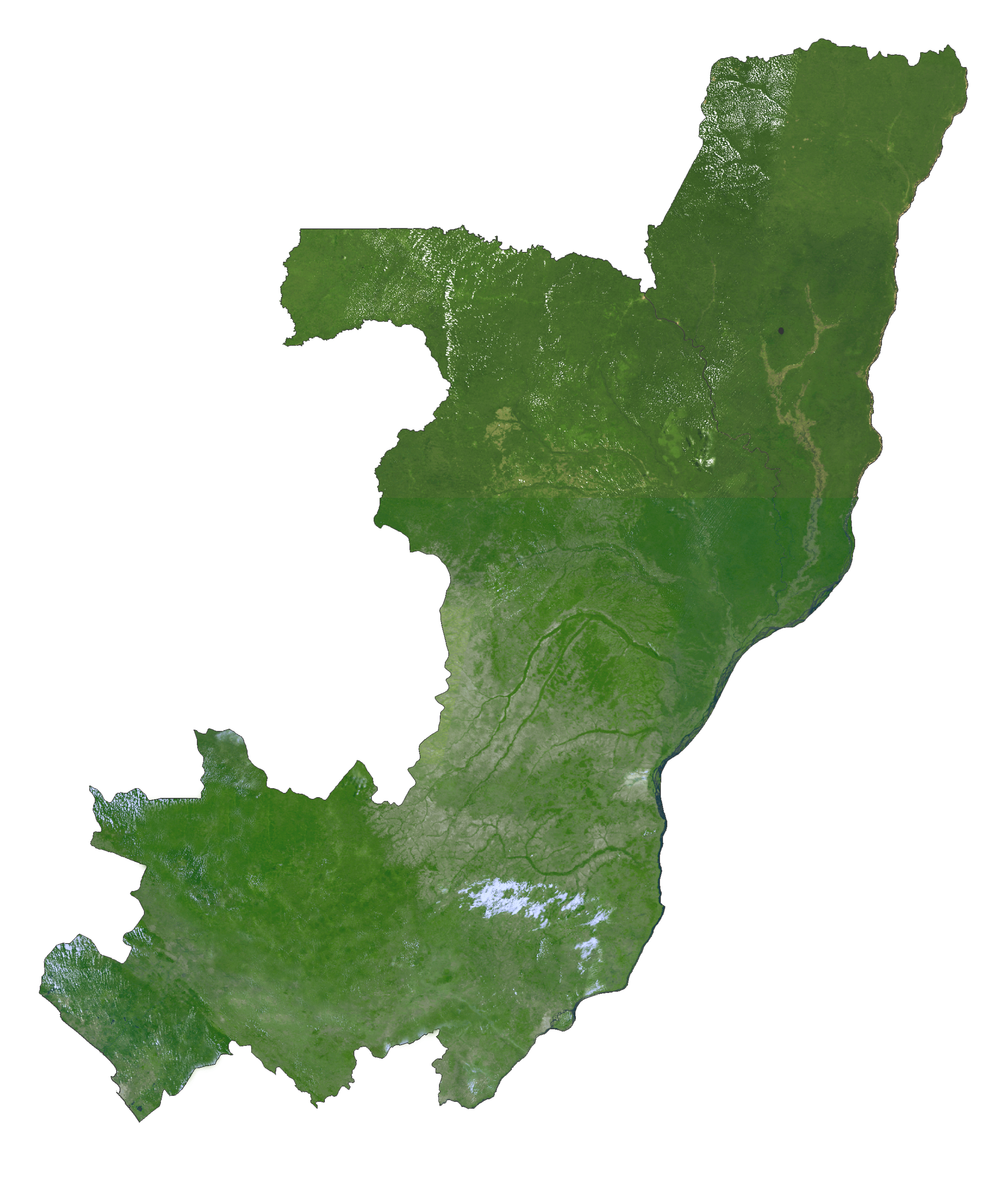
Republic of the Congo Satellite Map
Elevation Map