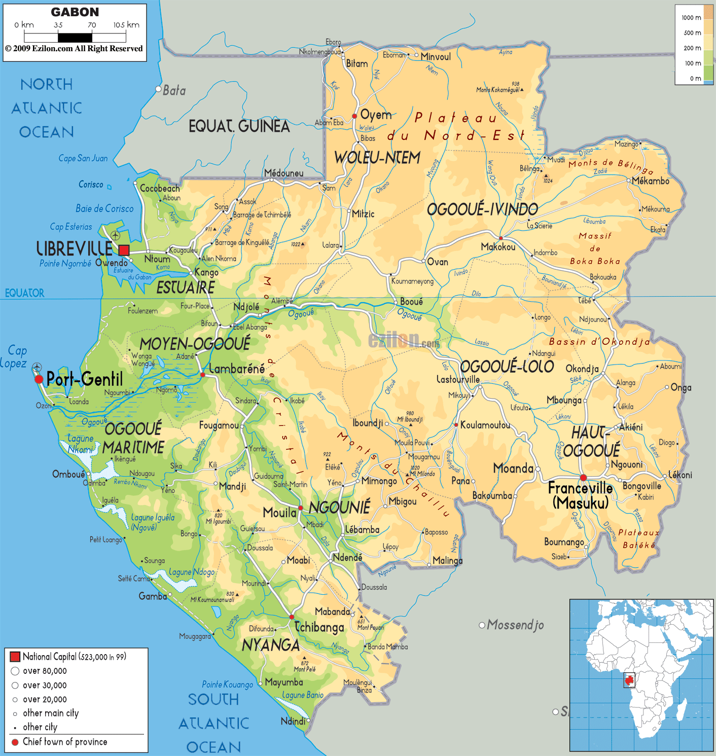
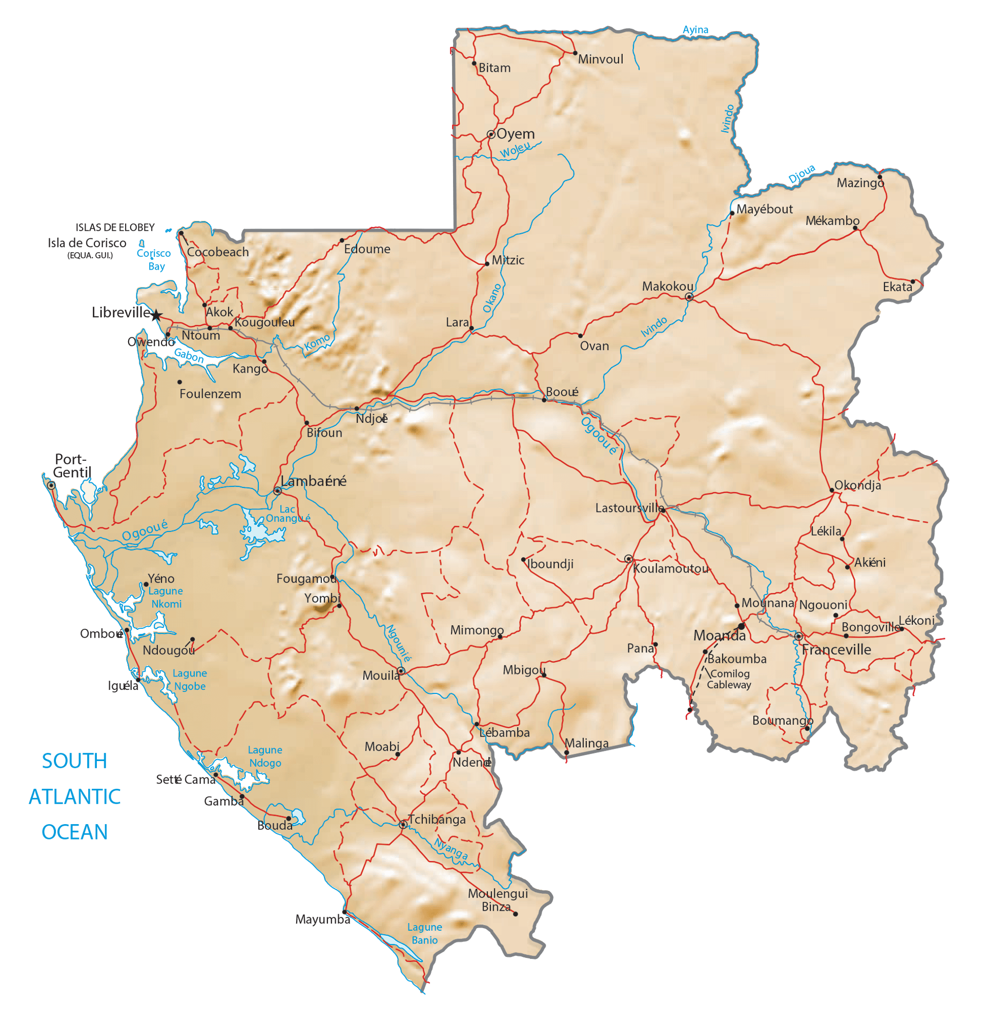
Gabon is easily divided into three distinct regions: a narrow coastal plain, a hilly mountainous interior, and a savanna in the far-east and south. Of note, rainforests cover nearly 85% of the country.
The coastal plains form a large section of the World Wildlife Fund’s Atlantic Equatorial coastal forests ecoregion and contain patches of Central African mangroves.
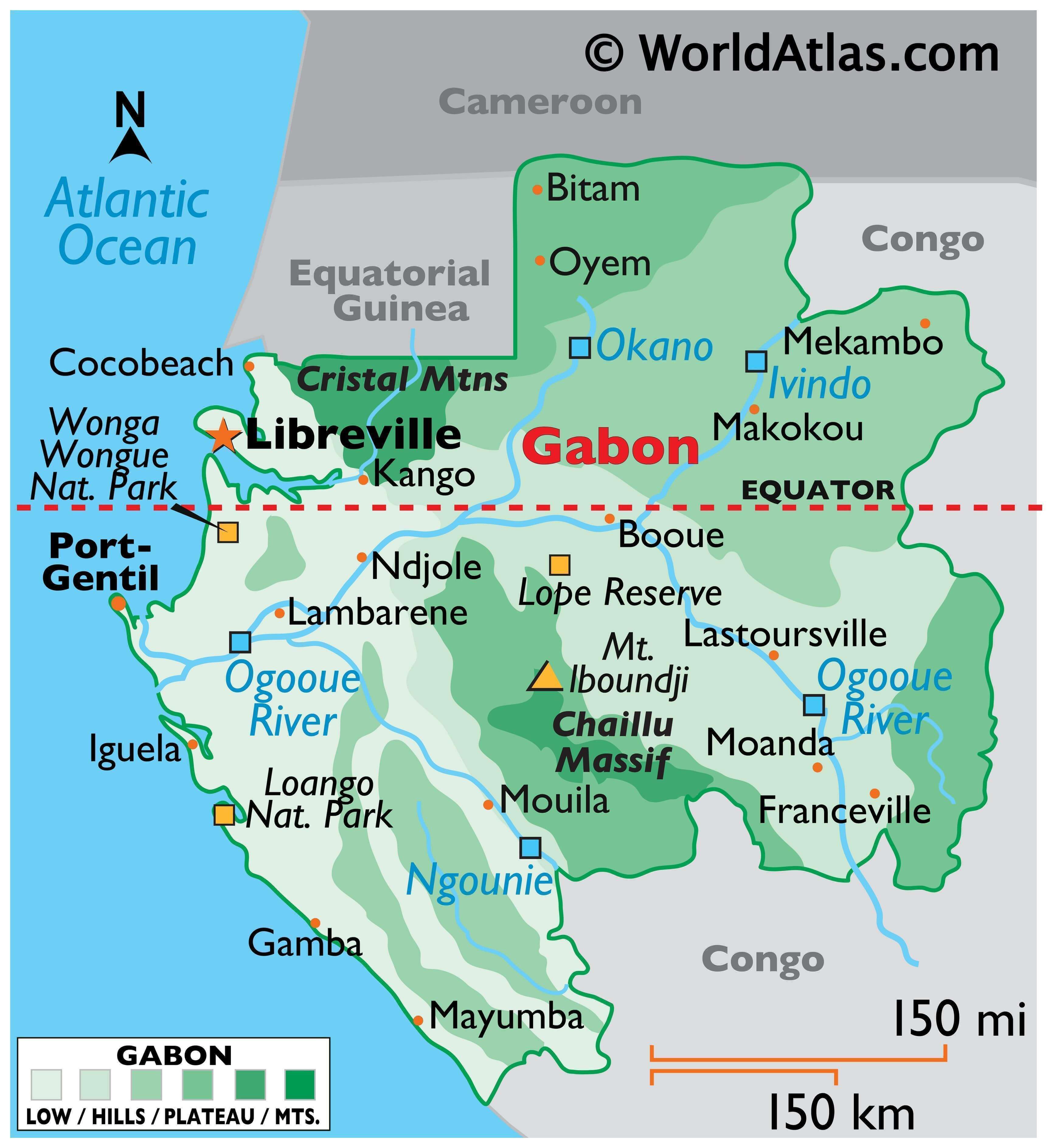
As marked on the physical map of Gabon, significant mountains include the Cristal Mountains in the northeast and the central Chaillu Massif (a large mountain mass).
The country also has hundreds of caves located in the dolomite and limestone rocks formations in the east central areas.
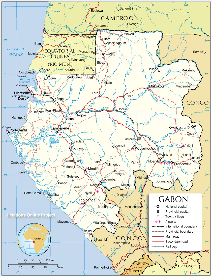
Gabon is drained by numerous rivers; the largest is the Ogooué which is 746 miles, (1,200 km) long. The course of the river through Gabon can be observed on the map above.
The highest point of the country is Mont Iboundji at 2,534 ft. (1,575 m), and the lowest point is the Atlantic Ocean (0 m).
| Flag: |  |
|---|---|
| Legal Name: | Gabonese Republic |
| Capital Value: | Libreville |
| Largest City: |
Libreville (834,204) |
| Official languages: | French |
| Demonym(s): |
|
| Government: | Unitary dominant-party presidential republic |
| Legislature: | Parliament |
| Total Area: | 267,667 km² |
| Land Area: | 257,667 km² |
| Water Area: | 10,000 km² |
| Population: | 2,172,579 |
| Density: | 7.9/km (20.5/sq mi) (216th) |
| GDP: | $16.66 Billion |
| GDP Per Capita: | $7,667.37 |
| Currency Value: | Cooperation Financiere en Afrique Centrale francs (XAF) |
| Driving side: | right |
| Calling code: | +241 |
| Internet TLD: | .ga |
Exploring Gabon with a Detailed Map
Gabon is a country with remarkable topographical features. From its savannas to its mountains and hills, this West African nation is home to a vast array of geographic wonders. To help you explore its many wonders, we’ve created this detailed map of Gabon. Featuring cities, rivers, and lakes, this map of Gabon can help you plan a trip or just get a better understanding of this incredible country.
Online Interactive Political Map
Click on ![]() to view map in "full screen" mode.
to view map in "full screen" mode.
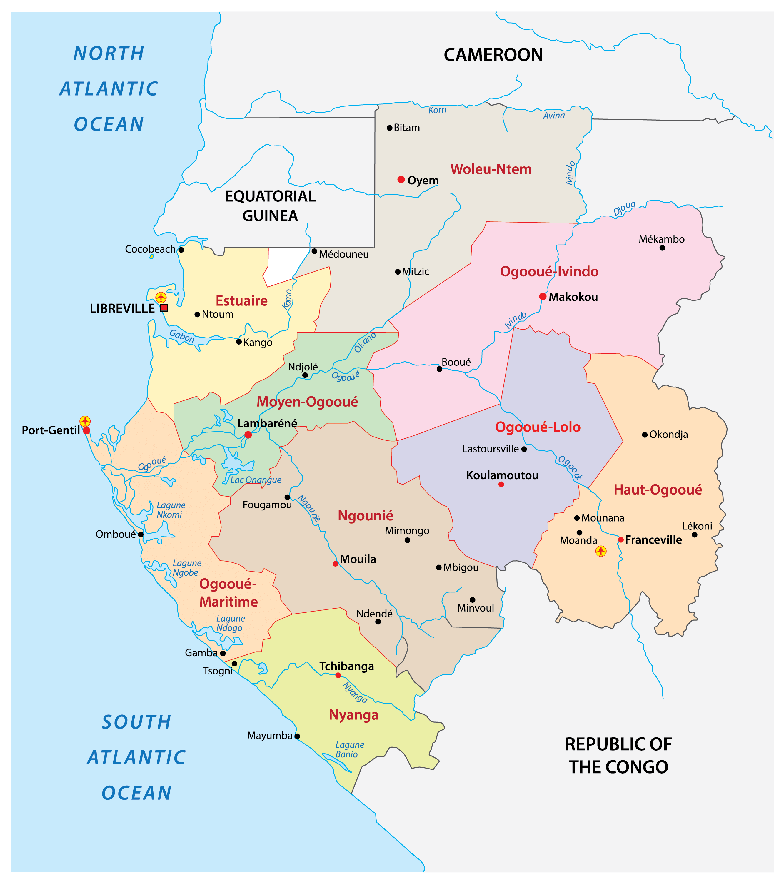
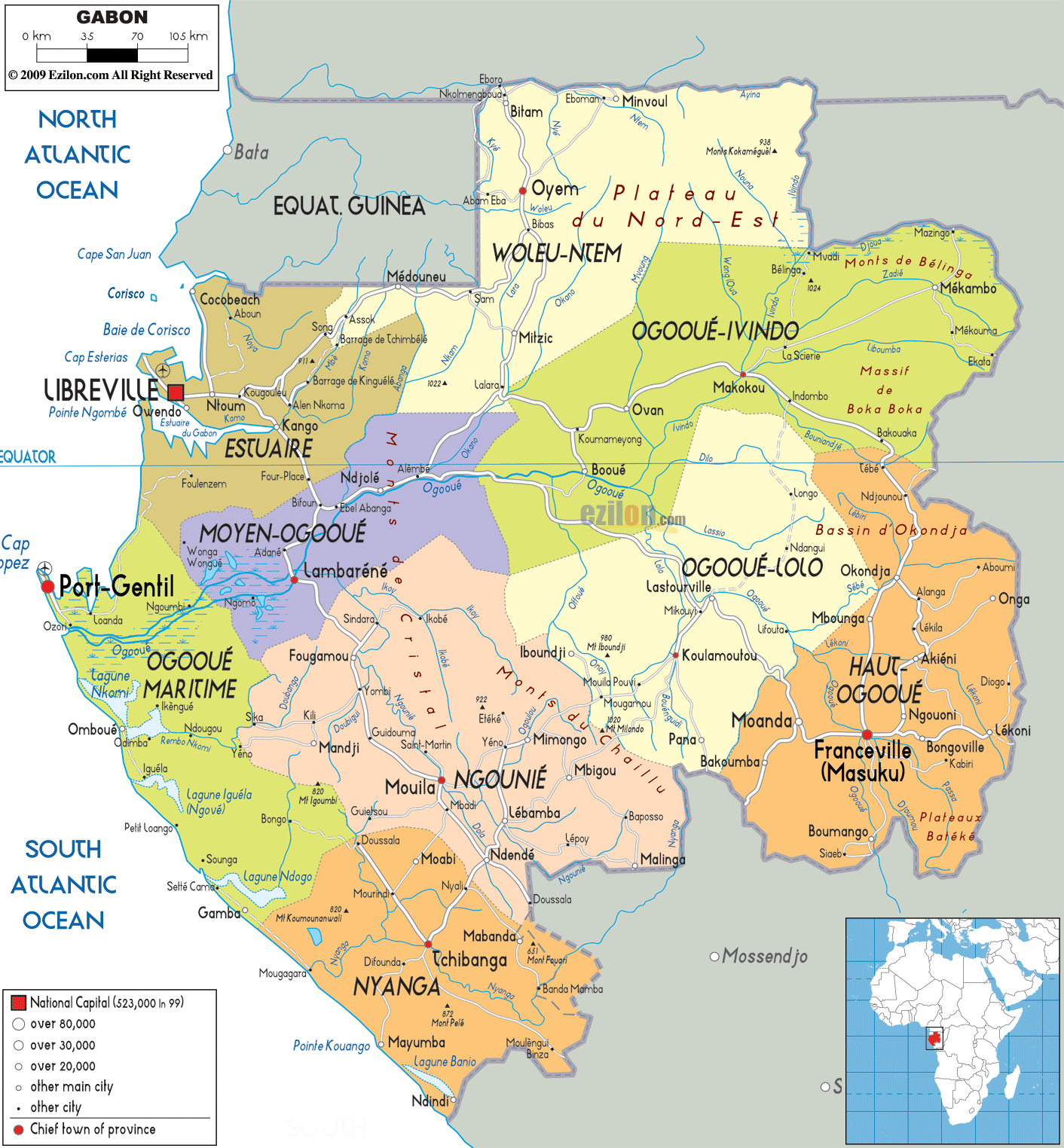
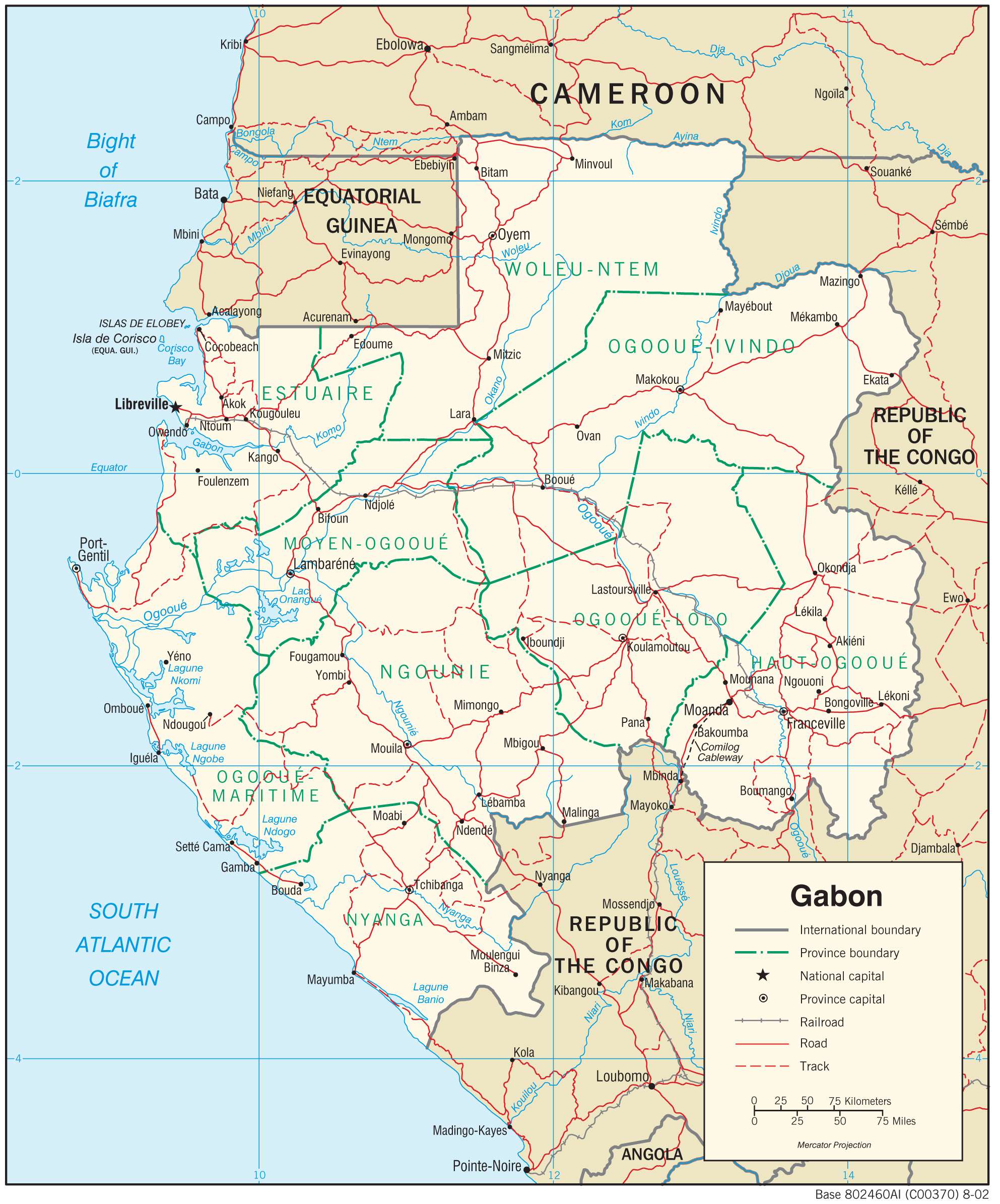
Gabon has nine provinces which are further subdivided into 50 departments. In alphabetical order, the provinces are as follows: Estuaire, Haut-Ogooue, Moyen-Ogooue, Ngounie, Nyanga, Ogooue-Ivindo, Ogooue-Lolo, Ogooue-Maritime, and Woleu-Ntem. These provinces are further subdivided into 50 departments. With an area of 46,075 sq. km, Ogooue-Ivindo is the largest province by area and Estuaire is the most populous one. The latter hosts the national capital of Libreville.
Location Maps
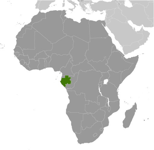
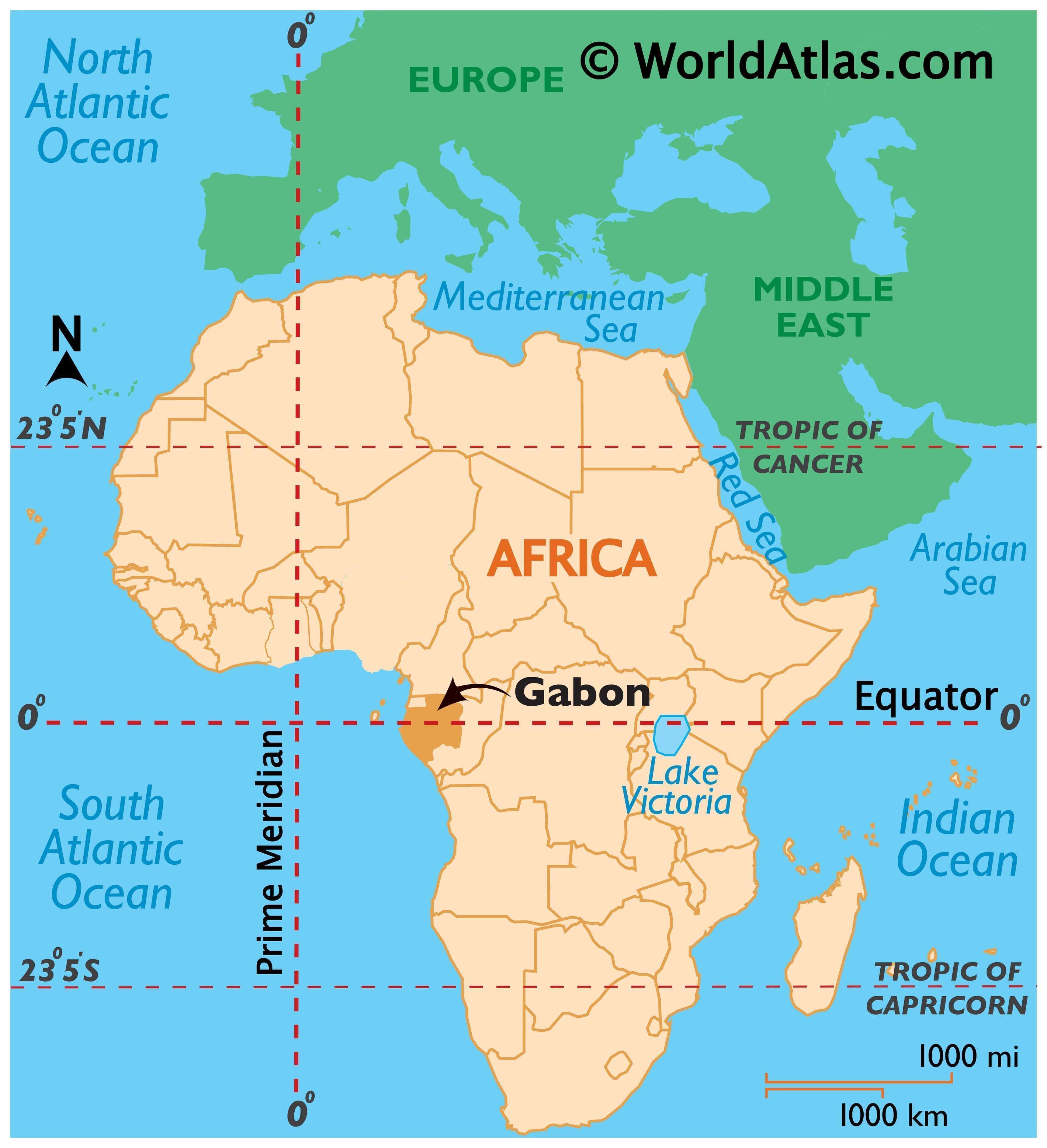
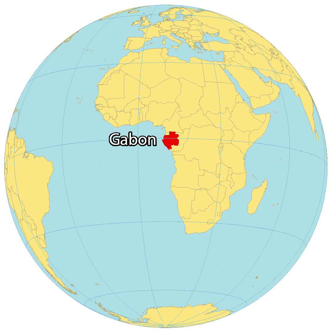
Where is Gabon?
Gabon, situated in Central Africa, lies along the Atlantic Ocean, just at the Equator. It has three neighboring countries – Cameroon and Equatorial Guinea in the north, and the Republic of the Congo in the south and east. Libreville is the capital and largest city of Gabon and is located on the equator along the west coast. Other major cities in Gabon are Mandji, Masuku and Oyem.
High Definition Political Map of Gabon
History
Pygmy peoples in the area were largely replaced and absorbed by Bantu tribes as they migrated. By the 18th century, a Myeni-speaking kingdom known as the Kingdom of Orungu formed as a trading centre with the ability to purchase and sell slaves, and fell with the demise of the slave trade in the 1870s.
Explorer Pierre Savorgnan de Brazza led his first mission to the Gabon-Congo area in 1875. He founded the town of Franceville and was later colonial governor. Some Bantu groups lived in the area when France officially occupied it in 1885.
In 1910, Gabon became a territory of French Equatorial Africa, a federation that survived until 1958. In World War II, the Allies invaded Gabon in order to overthrow the pro-Vichy France colonial administration. On 28 November 1958, Gabon became an autonomous republic within the French Community, and on 17 August 1960, it became fully independent.
The first president of Gabon, elected in 1961, was Léon M’ba, with Omar Bongo Ondimba as his vice president. After M’ba’s accession to power, the press was suppressed, political demonstrations suppressed, freedom of expression curtailed, other political parties gradually excluded from power, and the Constitution changed along French lines to vest power in the Presidency, a post that M’ba assumed himself. When M’ba dissolved the National Assembly in January 1964 to institute one-party rule, an army coup sought to oust him from power and restore parliamentary democracy. French paratroopers flew in within 24 hours to restore M’ba to power. After days of fighting, the coup ended and the opposition was imprisoned, with protests and riots.
When M’Ba died in 1967, Bongo replaced him as president. In March 1968, Bongo declared Gabon a 1-party state by dissolving BDG and establishing a new party – the Parti Democratique Gabonais (PDG). He invited all Gabonese, regardless of previous political affiliation, to participate. Bongo sought to forge a single national movement in support of the government’s development policies, using PDG as a tool to submerge the regional and tribal rivalries that had divided Gabonese politics in the past. Bongo was elected president in February 1975; in April 1975, the position of vice president was abolished and replaced by the position of prime minister, who had no right to automatic succession. Bongo was re-elected President in December 1979 and November 1986 to 7-year terms.
In 1990, economic discontent and a desire for political liberalization provoked demonstrations and strikes by students and workers. In response to grievances by workers, Bongo negotiated with them on a sector-by-sector basis, making wage concessions. He promised to open up PDG and to organize a national political conference in March–April 1990 to discuss Gabon’s future political system. PDG and 74 political organizations attended the conference. Participants essentially divided into 2 “loose” coalitions, ruling PDG and its allies, and the United Front of Opposition Associations and Parties, consisting of the breakaway Morena Fundamental and the Gabonese Progress Party.
The April 1990 conference approved political reforms, including creation of a national Senate, decentralization of the budgetary process, freedom of assembly and press, and cancellation of an exit visa requirement. In an attempt to guide the political system’s transformation to multiparty democracy, Bongo resigned as PDG chairman and created a transitional government headed by a new Prime Minister, Casimir Oye-Mba. The Gabonese Social Democratic Grouping (RSDG), as the resulting government was called, was smaller than the previous government and included representatives from some opposition parties in its cabinet. RSDG drafted a provisional constitution in May 1990 that provided a basic bill of rights and an independent judiciary and retained “strong” executive powers for the president. After further review by a constitutional committee and the National Assembly, this document came into force in March 1991.
Opposition to PDG continued after the April 1990 conference, and in September 1990, 2 coup d’état attempts were uncovered and aborted. With demonstrations after the death of an opposition leader, the first multiparty National Assembly elections in almost 30 years took place in September–October 1990, with PDG garnering a majority.
Following President Omar Bongo’s re-election in December 1993 with 51% of the vote, opposition candidates refused to validate the election results. Civil disturbances and violent repression led to an agreement between the government and opposition factions to work toward a political settlement. These talks led to the Paris Accords in November 1994, under which some opposition figures were included in a government of national unity. This arrangement broke down and the 1996 and 1997 legislative and municipal elections provided the background for renewed partisan politics. PDG won in the legislative election, and some cities, including Libreville, elected opposition mayors during the 1997 local election.
Facing a divided opposition, President Omar Bongo coasted to re-election in December 1998. While some of Bongo’s opponents rejected the outcome as fraudulent, some international observers characterized the results as representative “despite many perceived irregularities”. Legislative elections held in 2001–2002 were boycotted by a number of smaller opposition parties and were criticized for their administrative weaknesses, produced a National Assembly dominated by PDG and allied independents. In November 2005 President Omar Bongo was elected for his sixth term. He won re-election, and opponents claim that the balloting process was marred by irregularities. There were some instances of violence following the announcement of his win. National Assembly elections were held in December 2006. Some seats contested because of voting irregularities were overturned by the Constitutional Court, and the subsequent run-off elections in 2007 yielded a PDG-controlled National Assembly.
On 8 June 2009, President Omar Bongo died of cardiac arrest at a Spanish hospital in Barcelona. In accordance with the amended constitution, Rose Francine Rogombé, the President of the Senate, became Interim President on 10 June 2009. The first contested elections in Gabon’s history that did not include Omar Bongo as a candidate were held on 30 August 2009, with 18 candidates for president. The lead-up to the elections saw some isolated protests. Omar Bongo’s son, ruling party leader Ali Bongo Ondimba, was formally declared the winner after a 3-week review by the Constitutional Court; his inauguration took place on 16 October 2009. The court’s review had been prompted by claims of fraud by some opposition candidates, with the initial announcement of election results sparking violent protests in Port-Gentil. The citizens of Port-Gentil took to the streets, and some shops and residences were burned, including the French Consulate and a local prison. Officially, 4 deaths occurred during the riots. Gendarmes and the military were deployed to Port-Gentil to support the beleaguered police, and a curfew was in effect for more than 3 months.
A partial legislative by-election was held in June 2010. A coalition of parties, the Union Nationale (UN), participated for the first time. UN is composed mostly of PDG defectors who left the party after Omar Bongo’s death. Of the 5 contested seats, PDG won 3 and UN won 2; both sides claimed victory.
In January 2019, there was an attempted coup d’état led by soldiers against the President Ali Bongo; the coup ultimately failed.
In June 2022, Gabon and Togo joined the Commonwealth of Nations.
Physical Map of Gabon
Geography
It is located on the Atlantic coast of central Africa on the equator, between latitudes 3°N and 4°S, and longitudes 8° and 15°E. Gabon has an equatorial climate with a system of rainforests, with 89.3% of its land area forested.
There are coastal plains (ranging between 20 and 300 km [10 and 190 mi] from the ocean’s shore), the mountains (the Cristal Mountains to the northeast of Libreville, the Chaillu Massif in the centre), and the savanna in the east. The coastal plains form a section of the World Wildlife Fund’s Atlantic Equatorial coastal forests ecoregion and contain patches of Central African mangroves including on the Muni River estuary on the border with Equatorial Guinea.
Geologically, Gabon is primarily Archean and Paleoproterozoic igneous and metamorphic basement rock, belonging to the stable continental crust of the Congo Craton. Some formations are more than 2 billion years old. Some rock units are overlain by marine carbonate, lacustrine and continental sedimentary rocks, and unconsolidated sediments and soils that formed in the last 2.5 million years of the Quaternary. The rifting apart of the supercontinent Pangaea created rift basins that filled with sediments and formed the hydrocarbons. There are Oklo reactor zones, a natural nuclear fission reactor on Earth which was active 2 billion years ago. The site was discovered during uranium mining in the 1970s to supply the French nuclear power industry.
Its largest river is the Ogooué which is 1,200 kilometres (750 mi) long. It has 3 karst areas where there are hundreds of caves located in the dolomite and limestone rocks. A National Geographic Expedition visited some caves in the summer of 2008 to document them.
In 2002, President Omar Bongo Ondimba designated roughly 10% of the nation’s territory to be part of its national park system (with 13 parks in total). The National Agency for National Parks manages Gabon’s national park system. Gabon had a 2018 Forest Landscape Integrity Index mean score of 9.07/10, ranking it 9th globally out of 172 countries.
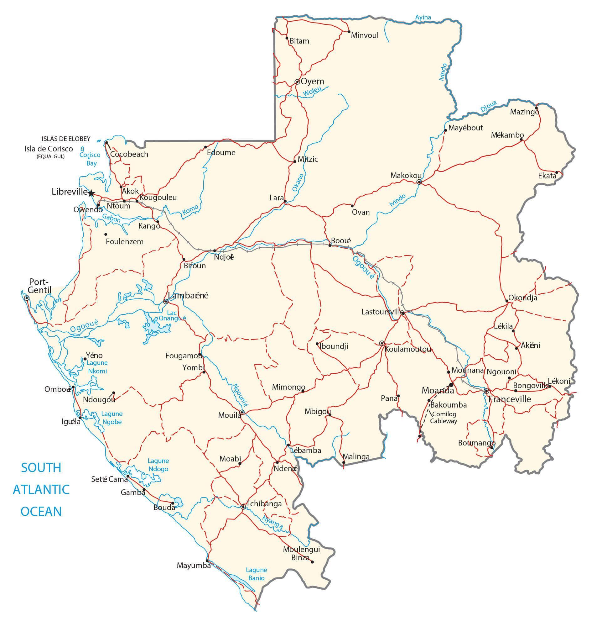
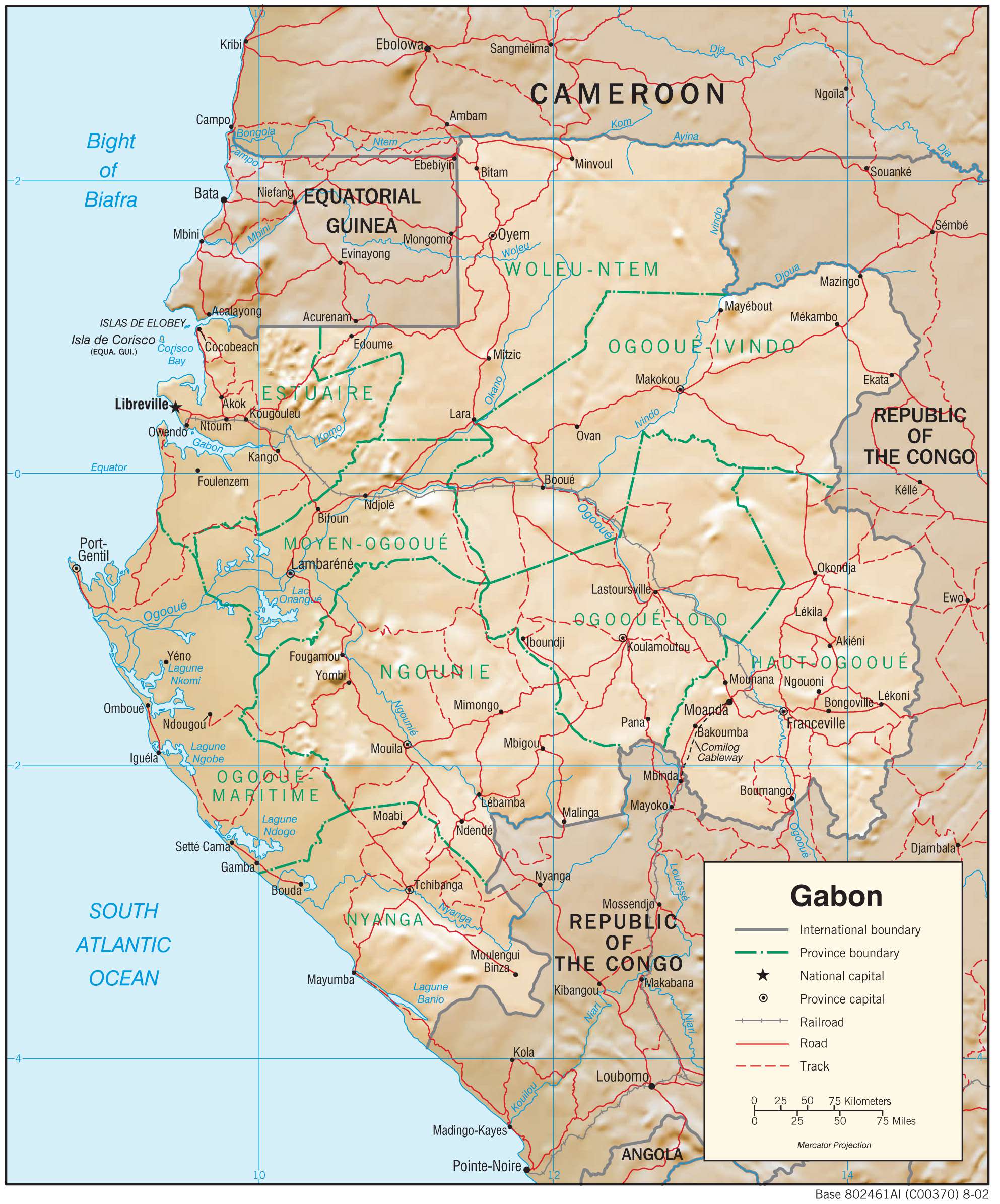
Transportation Map of Gabon
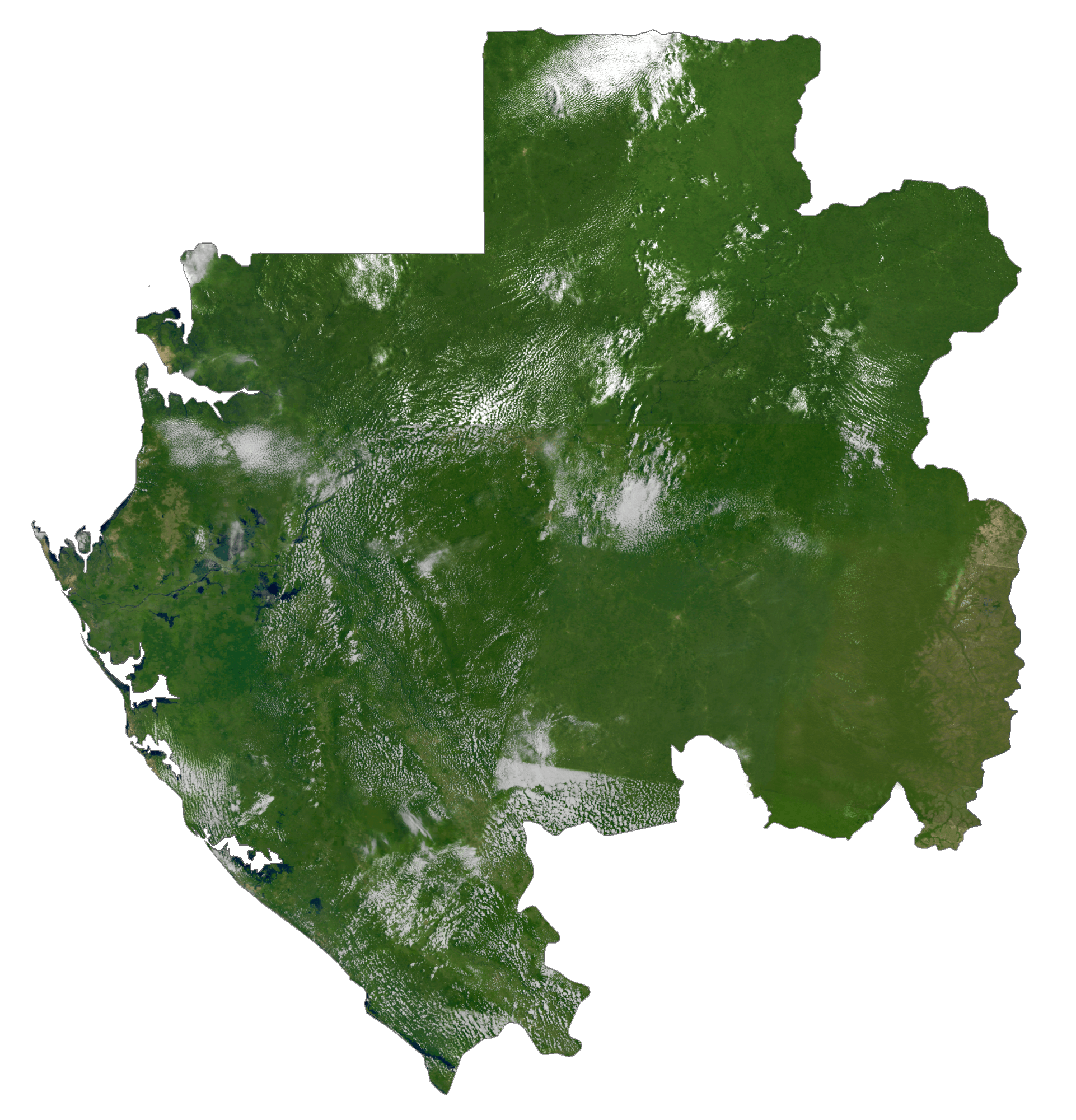
Gabon Satellite Map