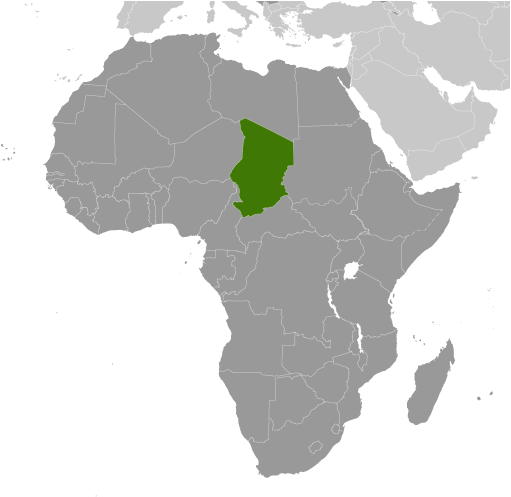
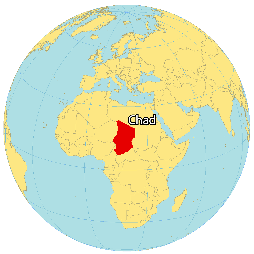
Chad is a landlocked country in North-Central Africa occupying an area of 1,284,000 sq. km.
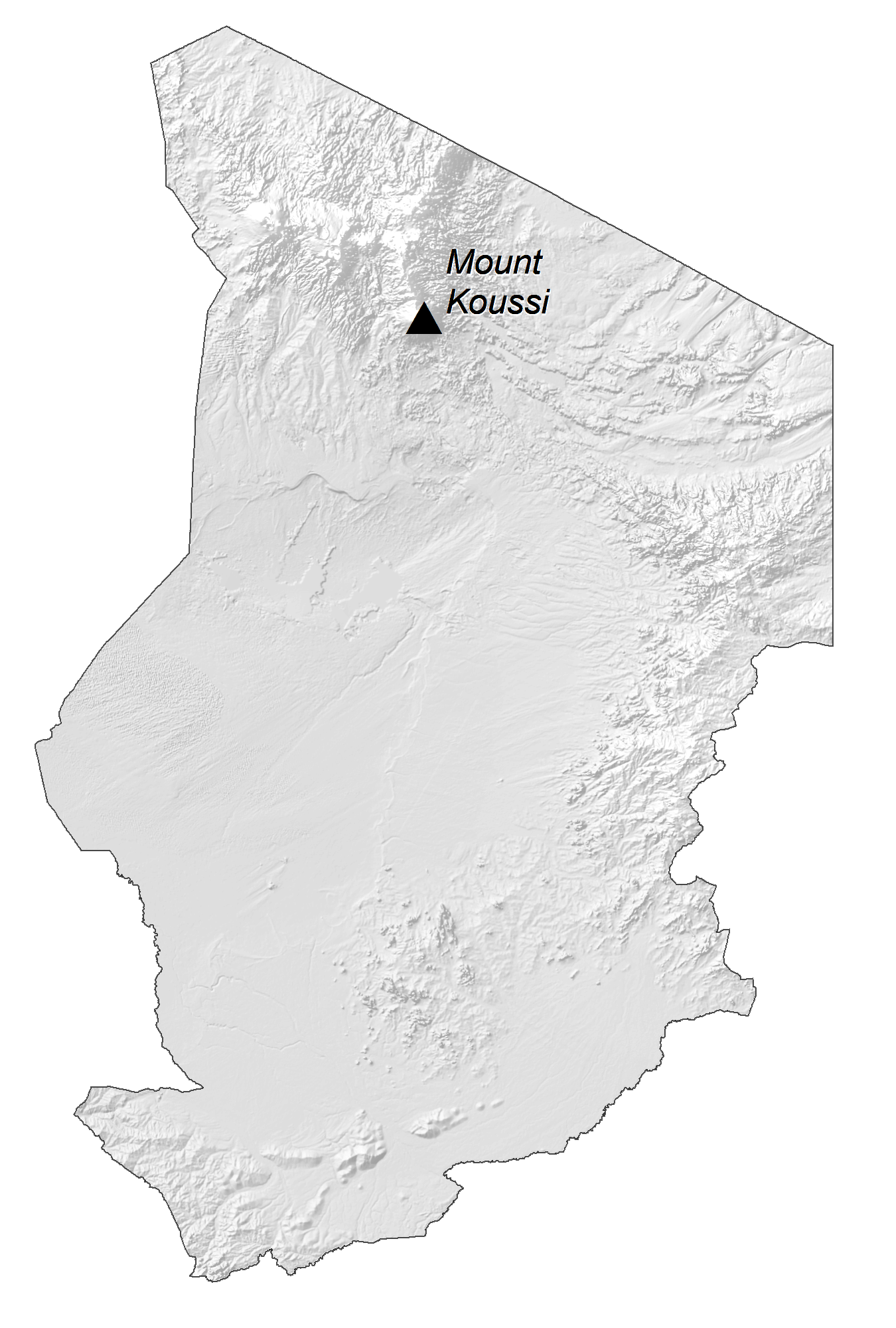
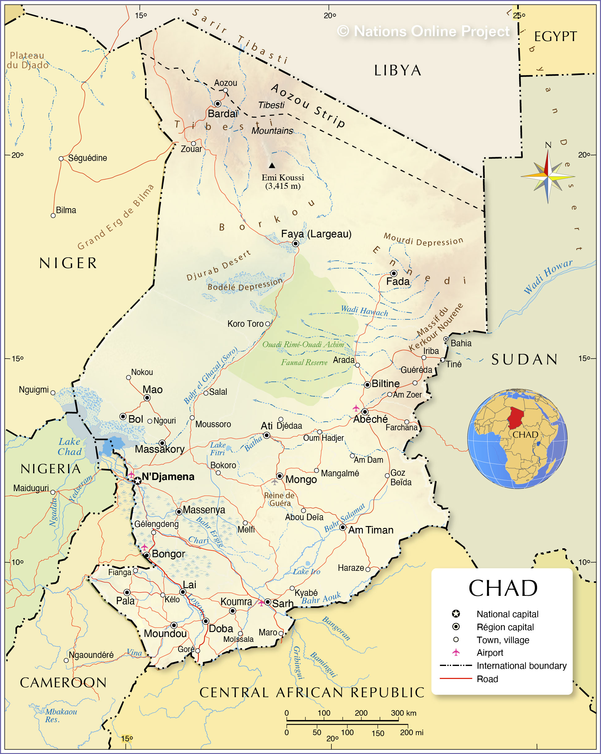
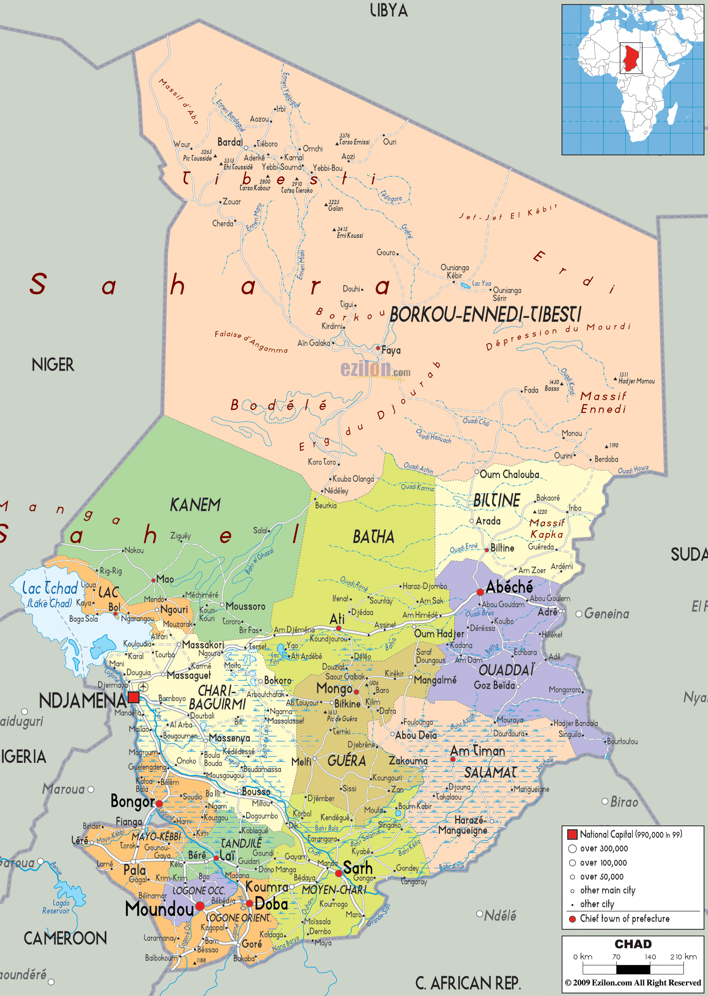
The map illustrates the country of Chad. In the northern reaches of the country, the Tibesti Mountains dominate the landscape of the surrounding Sahara Desert.
As observed on the map, the Sahel region, on the southern edges of the ever-expanding Sahara Desert to the north, is a transition zone between the dry areas of the north and the tropical areas of the south. It receives very little rain, and most of the vegetation is a savanna growth of sparse grasses and shrubs.
The land rises into the Ennedi and Wadai plateaus along the eastern border with Sudan, where elevations reach near 609 m. In the south, the forested land is nourished by the Chari and Logone Rivers both of which have been marked on the map.
Lake Chad is located in the centre of the western frontier. It has an elevation of 281 m. During the monsoon rains, Lake Chad often overflows, causing floods in the lowland depression of the south.
The highest point of Chad is Emi Koussi, which rises 3,415 m in the northern mountains. The lowest point of the country is the Djourab Depression at 160 m. Both these extreme points have been marked on the map above.
| Flag: |  |
|---|---|
| Legal Name: | Republic of Chad |
| Capital Value: | N’Djamena |
| Largest City: |
N’Djaména (1,422,547) |
| Official languages: |
|
| Demonym(s): | Chadian |
| Government: | Unitary republic under a hereditary military dictatorship |
| Legislature: | National Transitional Council |
| Total Area: | 1,000,000 km² |
| Land Area: | 1,259,200 km² |
| Water Area: | 24,800 km² |
| Population: | 15,946,876 |
| Density: | 8.6/km (22.3/sq mi) |
| GDP: | $11.31 Billion |
| GDP Per Capita: | $709.54 |
| Currency Value: | Cooperation Financiere en Afrique Centrale francs (XAF) |
| Driving side: | right |
| Calling code: | +235 |
| Internet TLD: | .td |
Discover the beauty and diversity of the Republic of Chad with this detailed map. From the sun-baked desert regions of the north to the more fertile lands of the south, you can explore the country’s unique features and stunning landscape. See major cities, towns, lakes, highways, and roads, as well as an elevation map and satellite imagery. Whether you’re travelling or simply curious about the region, this map of Chad will provide you with the information you need.
Online Interactive Political Map
Click on ![]() to view map in "full screen" mode.
to view map in "full screen" mode.
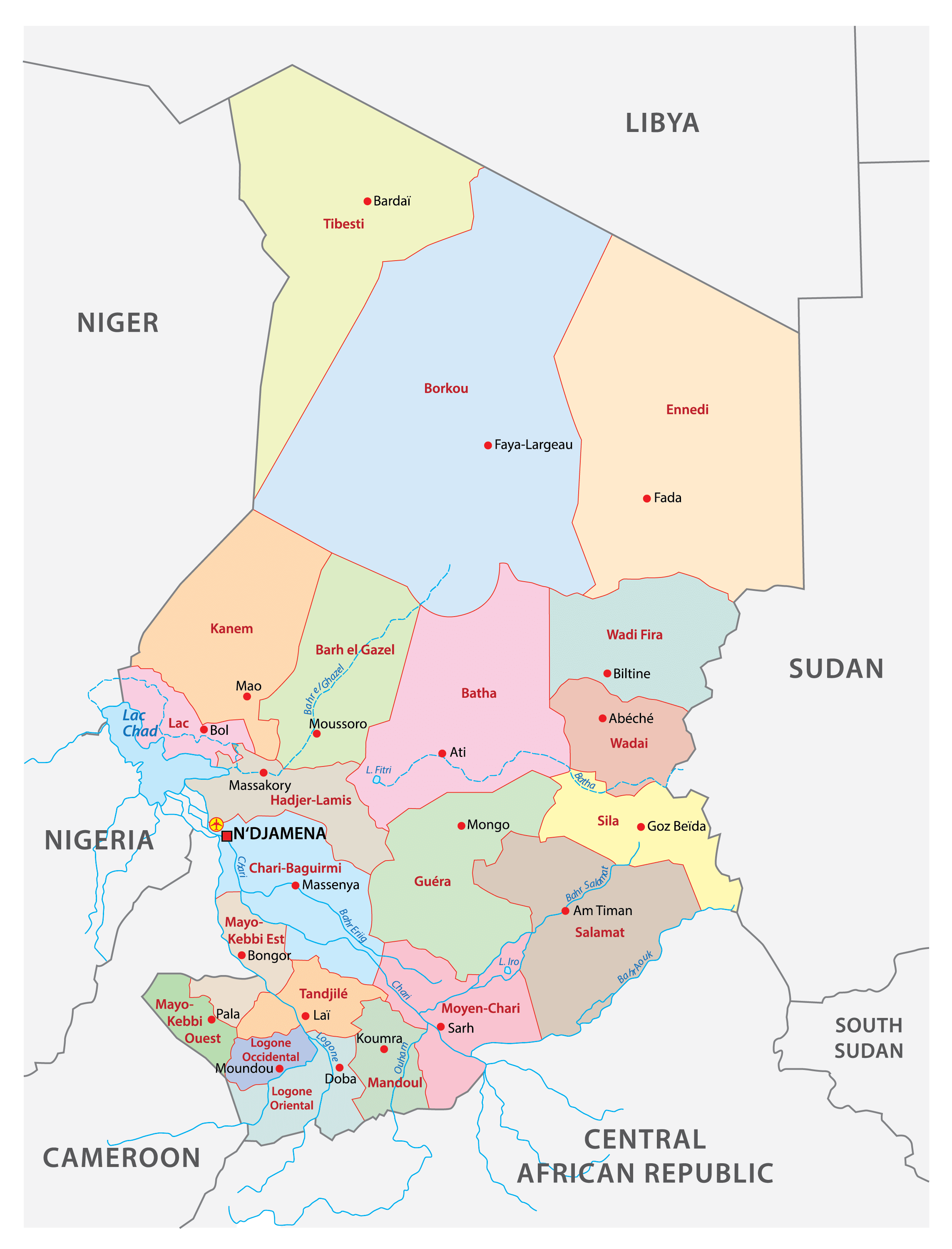
The administrative divisions of Chad have changed several times since 1900. Currently, the country is divided into 23 regions. In alphabetical order, these regions are: Barh el Gazel, Batha, Borkou, Chari-Baguirmi, Ennedi-Est, Ennedi-Ouest, Guera, Hadjer-Lamis, Kanem, Lac, Logone Occidental, Logone Oriental, Mandoul, Mayo-Kebbi Est, Mayo-Kebbi Ouest, Moyen-Chari, Ouaddai, Salamat, Sila, Tandjile, Tibesti, Ville de N’Djamena, and Wadi Fira.
The capital city of the country N’Djamena is located in the region of the same name.
Location Maps
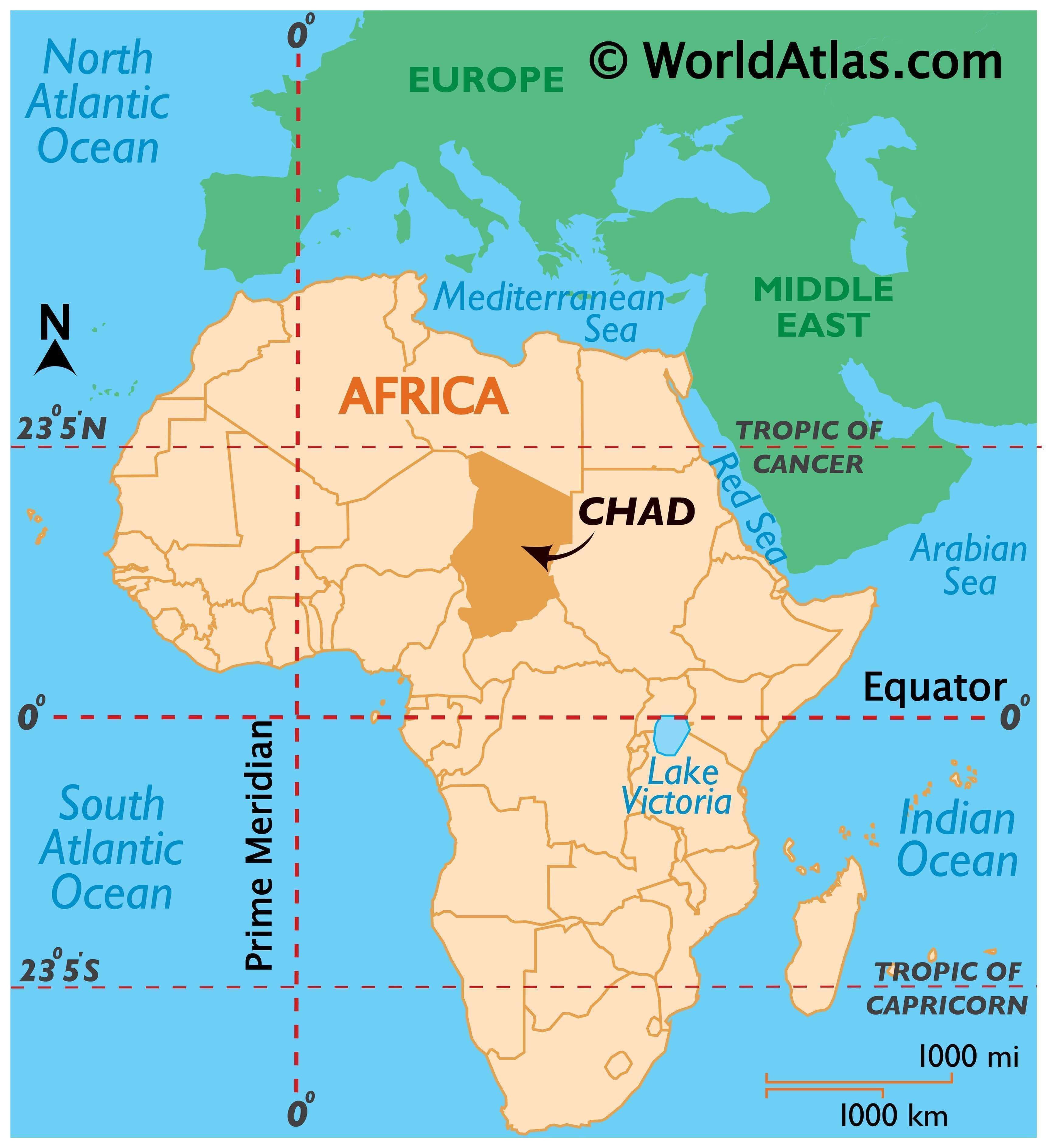
Where is Chad?
Chad is a landlocked country in Africa, bordered by Libya to the north, Sudan to the east, the Central African Republic to the south, Cameroon and Nigeria to the southwest, and Niger to the west. The country’s capital and largest city is N’Djamena, located near its western border with Cameroon. About 16 million people live in Chad.
The country is mainly known for its expansive deserts that cover most of the northern region. Its primary economic activities include mining (such as gold and uranium), oil production, and agriculture.
High Definition Political Map of Chad
History
In the 7th millennium BC, ecological conditions in the northern half of Chadian territory favored human settlement, and its population increased considerably. Some of the most important African archaeological sites are found in Chad, mainly in the Borkou-Ennedi-Tibesti Region; some date to earlier than 2000 BC.
For more than 2,000 years, the Chadian Basin has been inhabited by agricultural and sedentary people. The region became a crossroads of civilizations. The earliest of these was the legendary Sao, known from artifacts and oral histories. The Sao fell to the Kanem Empire, the first and longest-lasting of the empires that developed in Chad’s Sahelian strip by the end of the 1st millennium AD. Two other states in the region, Sultanate of Bagirmi and Wadai Empire, emerged in the 16th and 17th centuries. The power of Kanem and its successors was based on control of the trans-Saharan trade routes that passed through the region. These states, at least tacitly Muslim, never extended their control to the southern grasslands except to raid for slaves. In Kanem, about a third of the population were slaves.
French colonial expansion led to the creation of the Territoire Militaire des Pays et Protectorats du Tchad in 1900. By 1920, France had secured full control of the colony and incorporated it as part of French Equatorial Africa. French rule in Chad was characterised by an absence of policies to unify the territory and sluggish modernisation compared to other French colonies.
The French primarily viewed the colony as an unimportant source of untrained labour and raw cotton; France introduced large-scale cotton production in 1929. The colonial administration in Chad was critically understaffed and had to rely on the dregs of the French civil service. Only the Sara of the south was governed effectively; French presence in the Islamic north and east was nominal. The educational system was affected by this neglect.
After World War II, France granted Chad the status of overseas territory and its inhabitants the right to elect representatives to the National Assembly and a Chadian assembly. The largest political party was the Chadian Progressive Party (French: Parti Progressiste Tchadien, PPT), based in the southern half of the colony. Chad was granted independence on 11 August 1960 with the PPT’s leader, François Tombalbaye, an ethnic Sara, as its first president.
Two years later, Tombalbaye banned opposition parties and established a one-party system. Tombalbaye’s autocratic rule and insensitive mismanagement exacerbated inter-ethnic tensions. In 1965, Muslims in the north, led by the National Liberation Front of Chad (French: Front de libération nationale du Tchad, FRONILAT), began a civil war. Tombalbaye was overthrown and killed in 1975, but the insurgency continued. In 1979 the rebel factions led by Hissène Habré took the capital, and all central authority in the country collapsed. Armed factions, many from the north’s rebellion, contended for power.
The disintegration of Chad caused the collapse of France’s position in the country. Libya moved to fill the power vacuum and became involved in Chad’s civil war. Libya’s adventure ended in disaster in 1987; the French-supported president, Hissène Habré, evoked a united response from Chadians of a kind never seen before and forced the Libyan army off Chadian soil.
Habré consolidated his dictatorship through a power system that relied on corruption and violence with thousands of people estimated to have been killed under his rule. The president favoured his own Toubou ethnic group and discriminated against his former allies, the Zaghawa. His general, Idriss Déby, overthrew him in 1990. Attempts to prosecute Habré led to his placement under house arrest in Senegal in 2005; in 2013, Habré was formally charged with war crimes committed during his rule. In May 2016, he was found guilty of human-rights abuses, including rape, sexual slavery, and ordering the killing of 40,000 people, and sentenced to life in prison.
Déby attempted to reconcile the rebel groups and reintroduced multiparty politics. Chadians approved a new constitution by referendum, and in 1996, Déby easily won a competitive presidential election. He won a second term five years later. Oil exploitation began in Chad in 2003, bringing with it hopes that Chad would, at last, have some chances of peace and prosperity. Instead, internal dissent worsened, and a new civil war broke out. Déby unilaterally modified the constitution to remove the two-term limit on the presidency; this caused an uproar among the civil society and opposition parties.
In 2006 Déby won a third mandate in elections that the opposition boycotted. Ethnic violence in eastern Chad has increased; the United Nations High Commissioner for Refugees has warned that a genocide like that in Darfur may yet occur in Chad. In 2006 and in 2008 rebel forces attempted to take the capital by force, but failed on both occasions. An agreement for the restoration of harmony between Chad and Sudan, signed 15 January 2010, marked the end of a five-year war. The fix in relations led to the Chadian rebels from Sudan returning home, the opening of the border between the two countries after seven years of closure, and the deployment of a joint force to secure the border. In May 2013, security forces in Chad foiled a coup against President Idriss Déby that had been in preparation for several months.
Chad is currently one of the leading partners in a West African coalition in the fight against Boko Haram and other Islamist militants. Chad’s army announced the death of Déby on 20 April 2021, following an incursion in the northern region by the FACT group, during which the president was killed amid fighting on the front lines. Déby’s son, General Mahamat Idriss Déby, has been named interim president by a Transitional Council of military officers. That transitional council has replaced the Constitution with a new charter, granting Mahamat Déby the powers of the presidency and naming him head of the armed forces.
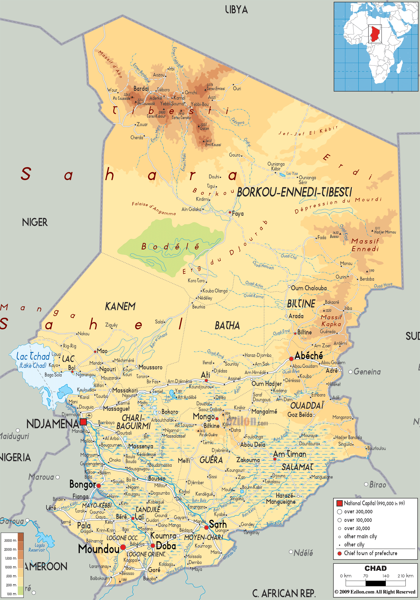
Physical Map of Chad
Geography
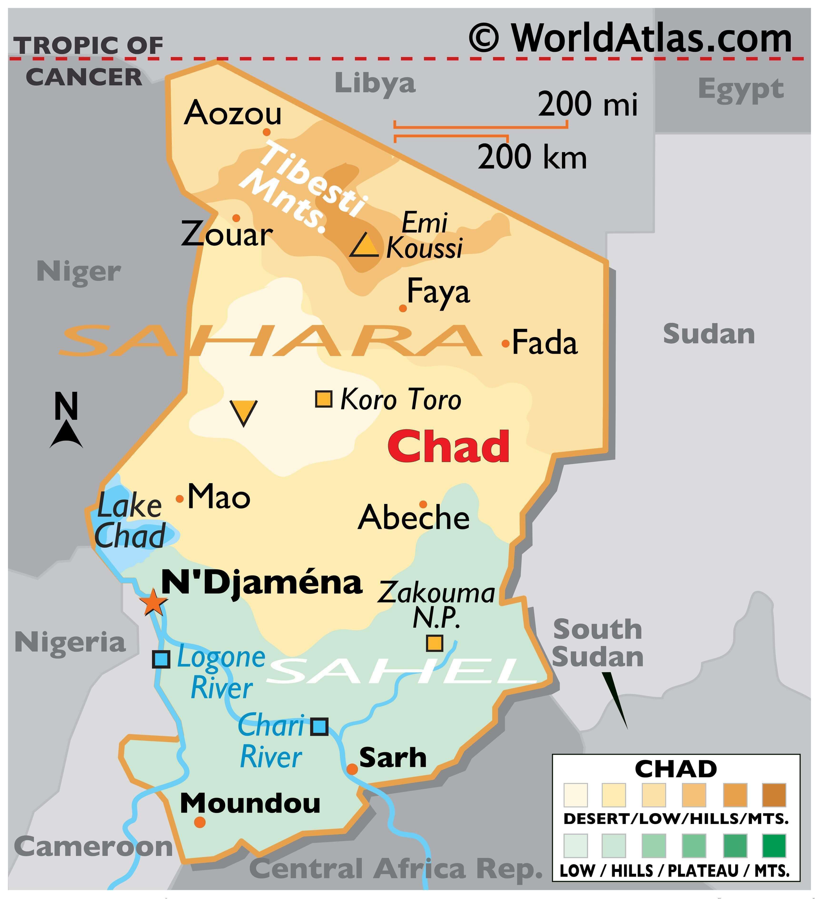
Chad is a large landlocked country spanning north-central Africa. It covers an area of 1,284,000 square kilometres (496,000 sq mi), lying between latitudes 7° and 24°N, and 13° and 24°E, and is the twentieth-largest country in the world. Chad is, by size, slightly smaller than Peru and slightly larger than South Africa.
Chad is bounded to the north by Libya, to the east by Sudan, to the west by Niger, Nigeria and Cameroon, and to the south by the Central African Republic. The country’s capital is 1,060 kilometres (660 mi) from the nearest seaport, Douala, Cameroon. Because of this distance from the sea and the country’s largely desert climate, Chad is sometimes referred to as the “Dead Heart of Africa”.
The dominant physical structure is a wide basin bounded to the north and east by the Ennedi Plateau and Tibesti Mountains, which include Emi Koussi, a dormant volcano that reaches 3,414 metres (11,201 ft) above sea level. Lake Chad, after which the country is named (and which in turn takes its name from the Kanuri word for “lake”), is the remains of an immense lake that occupied 330,000 square kilometres (130,000 sq mi) of the Chad Basin 7,000 years ago. Although in the 21st century it covers only 17,806 square kilometres (6,875 sq mi), and its surface area is subject to heavy seasonal fluctuations, the lake is Africa’s second largest wetland.
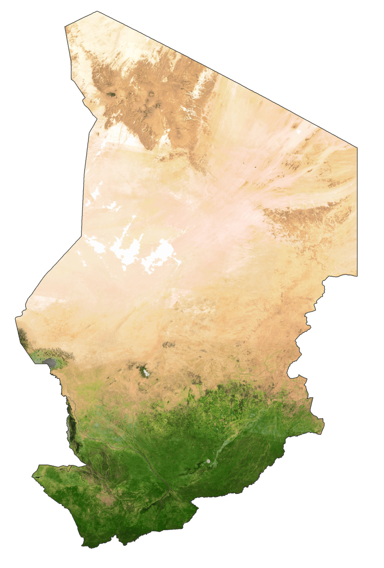
Chad is home to six terrestrial ecoregions: East Sudanian savanna, Sahelian Acacia savanna, Lake Chad flooded savanna, East Saharan montane xeric woodlands, South Saharan steppe and woodlands, and Tibesti-Jebel Uweinat montane xeric woodlands. The region’s tall grasses and extensive marshes make it favourable for birds, reptiles, and large mammals. Chad’s major rivers—the Chari, Logone and their tributaries—flow through the southern savannas from the southeast into Lake Chad.
Each year a tropical weather system known as the intertropical front crosses Chad from south to north, bringing a wet season that lasts from May to October in the south, and from June to September in the Sahel. Variations in local rainfall create three major geographical zones. The Sahara lies in the country’s northern third. Yearly precipitations throughout this belt are under 50 millimetres (2.0 in); only occasional spontaneous palm groves survive, all of them south of the Tropic of Cancer.
The Sahara gives way to a Sahelian belt in Chad’s centre; precipitation there varies from 300 to 600 mm (11.8 to 23.6 in) per year. In the Sahel, a steppe of thorny bushes (mostly acacias) gradually gives way to the south to East Sudanian savanna in Chad’s Sudanese zone. Yearly rainfall in this belt is over 900 mm (35.4 in).
Wildlife
Chad’s animal and plant life correspond to the three climatic zones. In the Saharan region, the only flora is the date-palm groves of the oasis. Palms and acacia trees grow in the Sahelian region. The southern, or Sudanic, zone consists of broad grasslands or prairies suitable for grazing. As of 2002, there were at least 134 species of mammals, 509 species of birds (354 species of residents and 155 migrants), and over 1,600 species of plants throughout the country.
Elephants, lions, buffalo, hippopotamuses, rhinoceroses, giraffes, antelopes, leopards, cheetahs, hyenas, and many species of snakes are found here, although most large carnivore populations have been drastically reduced since the early 20th century. Elephant poaching, particularly in the south of the country in areas such as Zakouma National Park, is a severe problem. The small group of surviving West African crocodiles in the Ennedi Plateau represents one of the last colonies known in the Sahara today.
Chad had a 2018 Forest Landscape Integrity Index mean score of 6.18/10, ranking it 83rd globally out of 172 countries. Extensive deforestation has resulted in loss of trees such as acacias, baobab, dates and palm trees. This has also caused loss of natural habitat for wild animals; one of the main reasons for this is also hunting and livestock farming by increasing human settlements. Populations of animals like lions, leopards and rhino have fallen significantly.
Efforts have been made by the Food and Agriculture Organization to improve relations between farmers, agro-pastoralists and pastoralists in the Zakouma National Park (ZNP), Siniaka-Minia, and Aouk reserve in southeastern Chad to promote sustainable development. As part of the national conservation effort, more than 1.2 million trees have been replanted to check the advancement of the desert, which incidentally also helps the local economy by way of financial return from acacia trees, which produce gum arabic, and also from fruit trees.
Poaching is a serious problem in the country, particularly of elephants for the profitable ivory industry and a threat to lives of rangers even in the national parks such as Zakouma. Elephants are often massacred in herds in and around the parks by organized poaching. The problem is worsened by the fact that the parks are understaffed and that a number of wardens have been murdered by poachers.
Chad Satellite Map
Elevation Map