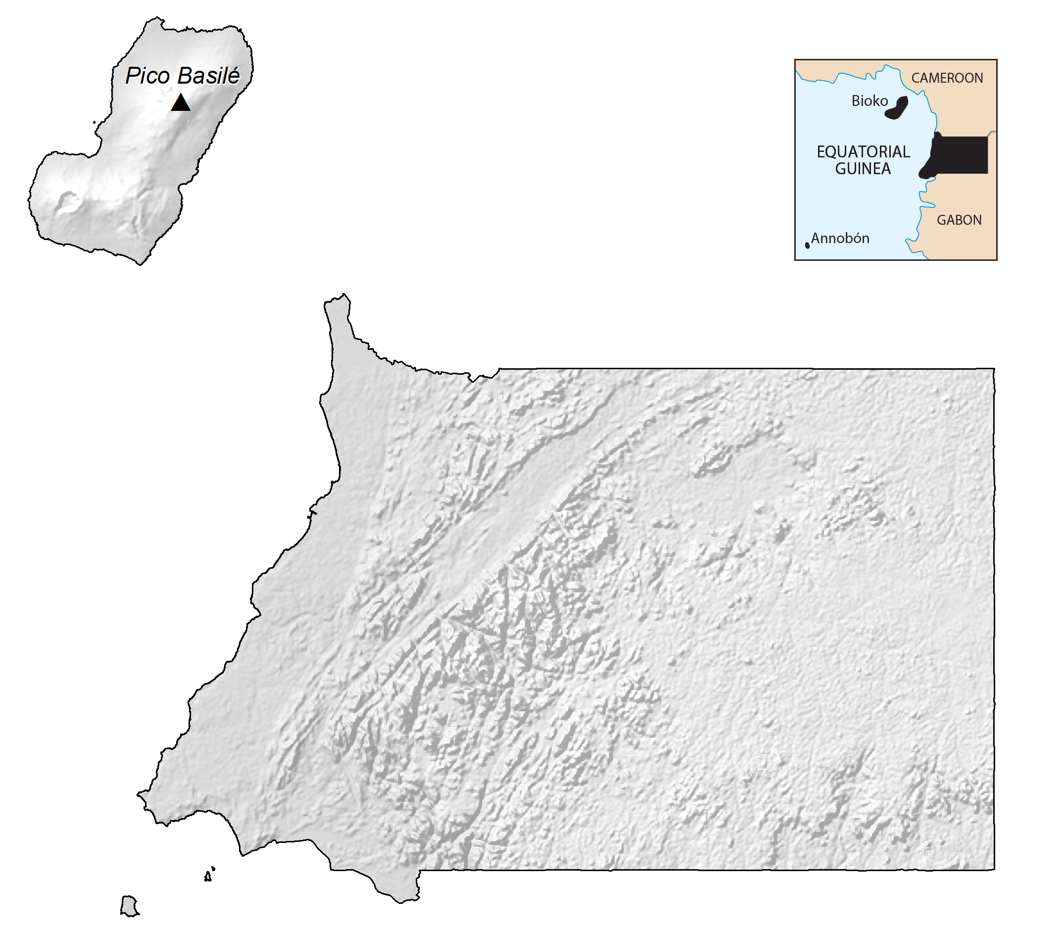
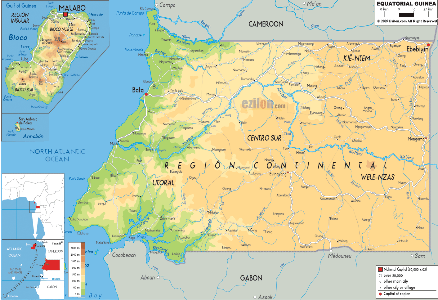
As observed on the physical map above, Equatorial Guinea in west-central Africa has two distinct regions, a mainland region, and an insular region. The country has a total land area of 28,051 sq. km.
The mainland of Equatorial Guinea begins on a narrow coastal plain, edged by mangrove swamps. From there, the land rises into an elevated plateau of thickly forested hills to its border with Gabon, reaching (in a few places) upwards of 1,219 m above sea level.
The major river, the Uola, snakes its way across the center of the country.
The offshore island of Bioko, volcanic in origin and very fertile, is dominated by three extinct volcanoes. Its coastline is steep and rugged south, but there are scenic beaches and harbors along the northern coast.
The highest point of Equatorial Guinea is Pico Basile at 3,008 m; the lowest point of the country is the Atlantic Ocean (0 m).
| Flag: |  |
|---|---|
| Legal Name: | Republic of Equatorial Guinea |
| Capital Value: | Malabo; note – a new capital of Oyala is being built on the mainland near Djibloho; Malabo is on the island of Bioko |
| Largest City: |
Bata (415,270) |
| Official languages: |
|
| Demonym(s): |
|
| Government: | Unitary dominant-party presidential republic under a dictatorship |
| Legislature: | Parliament |
| Total Area: | 28,051 km² |
| Land Area: | 28,051 km² |
| Population: | 1,355,986 |
| GDP: | $11.03 Billion |
| GDP Per Capita: | $8,131.92 |
| Currency Value: | Cooperation Financiere en Afrique Centrale francs (XAF) |
| Driving side: | right |
| Calling code: | +240 |
| Internet TLD: | .gq |
Explore Equatorial Guinea:
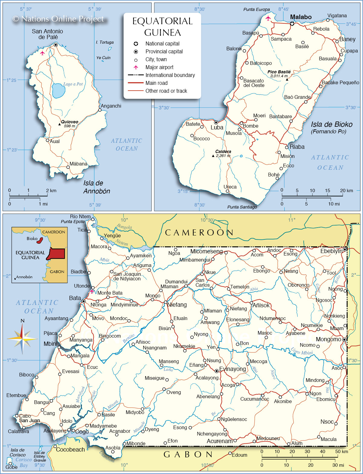
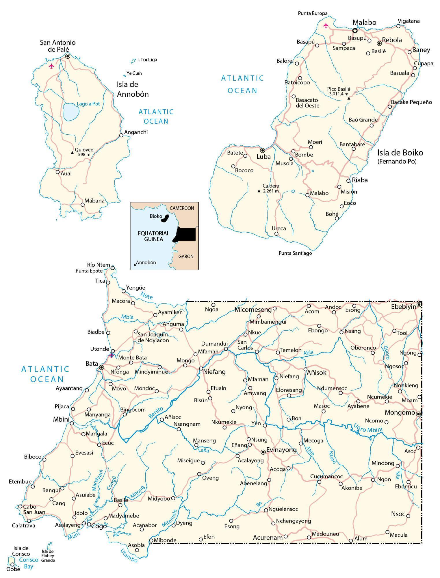
Discover the beauty and diversity of Equatorial Guinea with this detailed map. Located in Central Africa, Equatorial Guinea is bordered by Cameroon to the north, Gabon to the east and south, and the Gulf of Guinea to the west. This map contains major cities, roads, rivers, lakes, satellite imagery, and elevation. It also includes the islands Bioko and Annobon situated in the Atlantic Ocean.
Online Interactive Political Map
Click on ![]() to view map in "full screen" mode.
to view map in "full screen" mode.
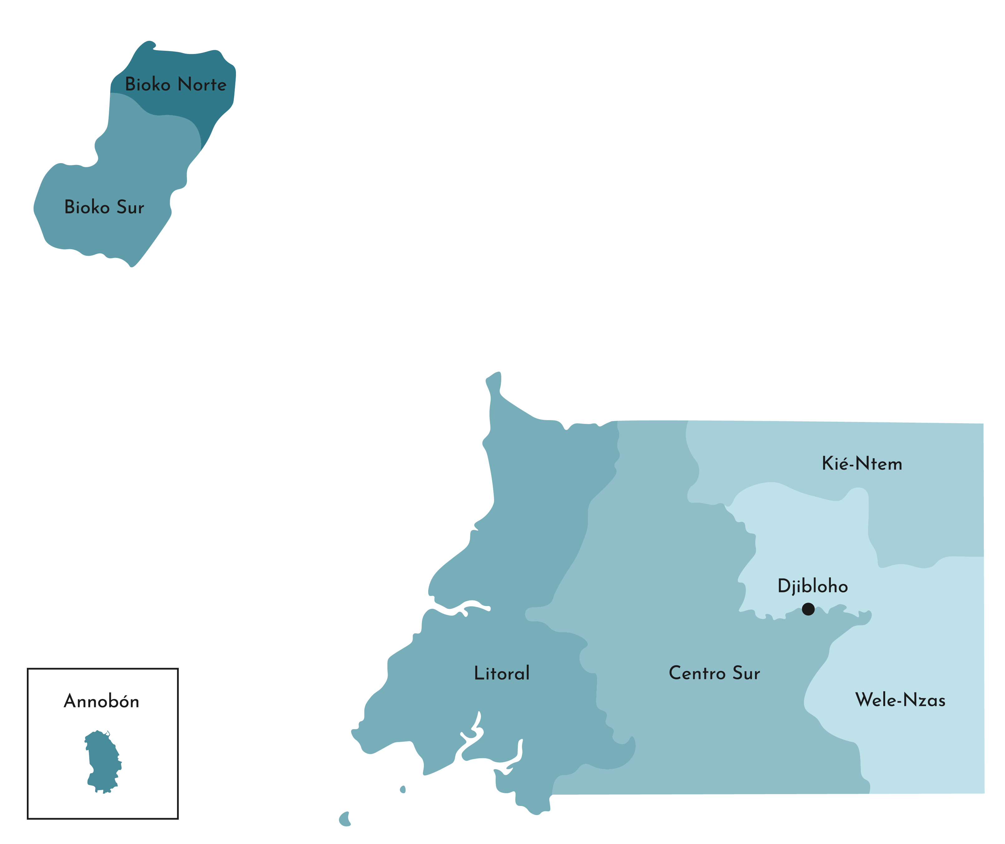
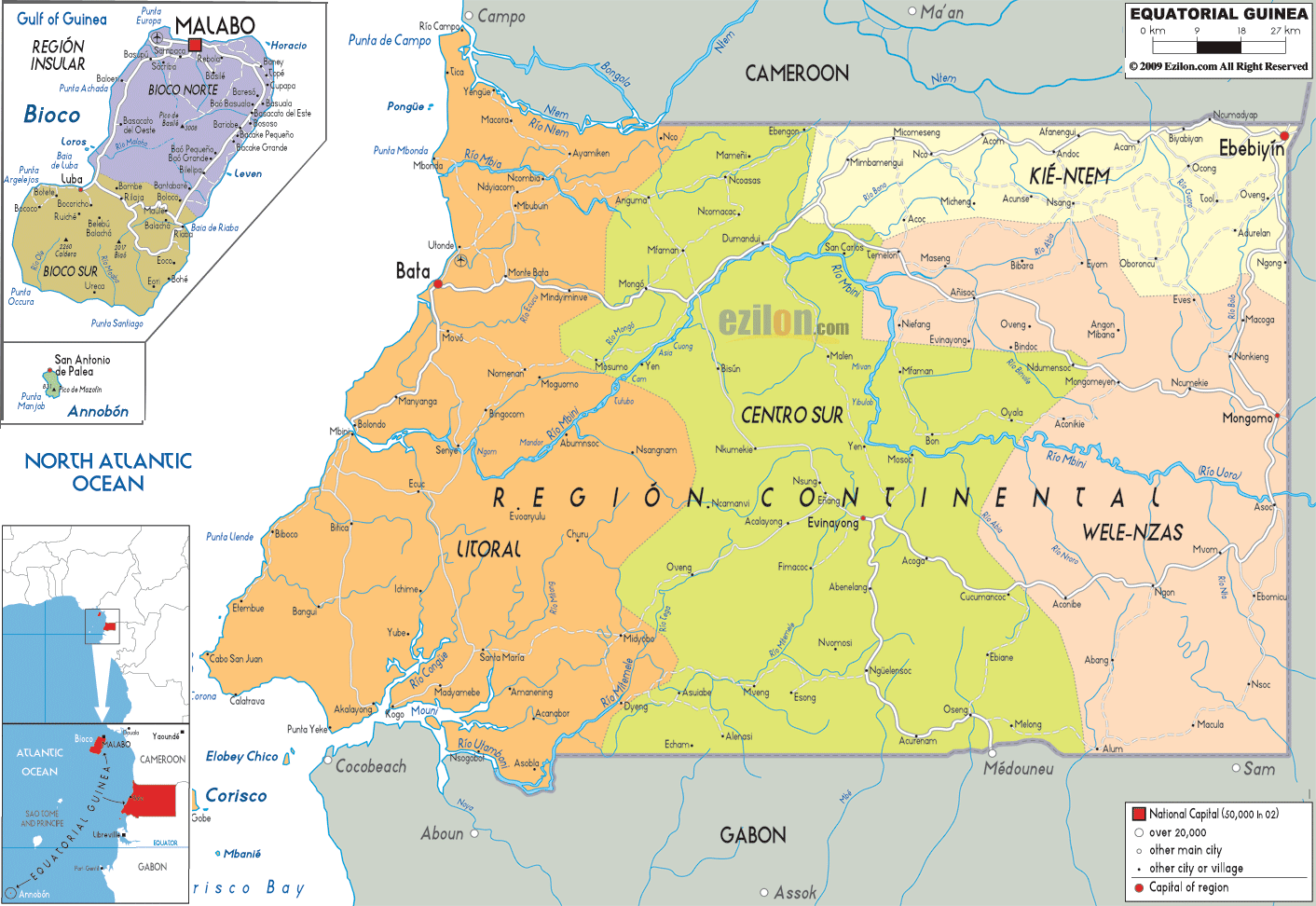
Equatorial Guinea has two regions, the mainland region of Río Muni with capital at Bata and the Insular Region with capital at Malabo. The regions are divided into 8 provinces which are as follows: Annobon, Bioko Norte, Bioko Sur, Centro Sur, Djibloho, Kie-Ntem, Litoral, and Wele-Nzas.
With an area of 9,931 sq. km, Centro Sur is the largest province by area and Litoral is the most populous one.
Location Maps
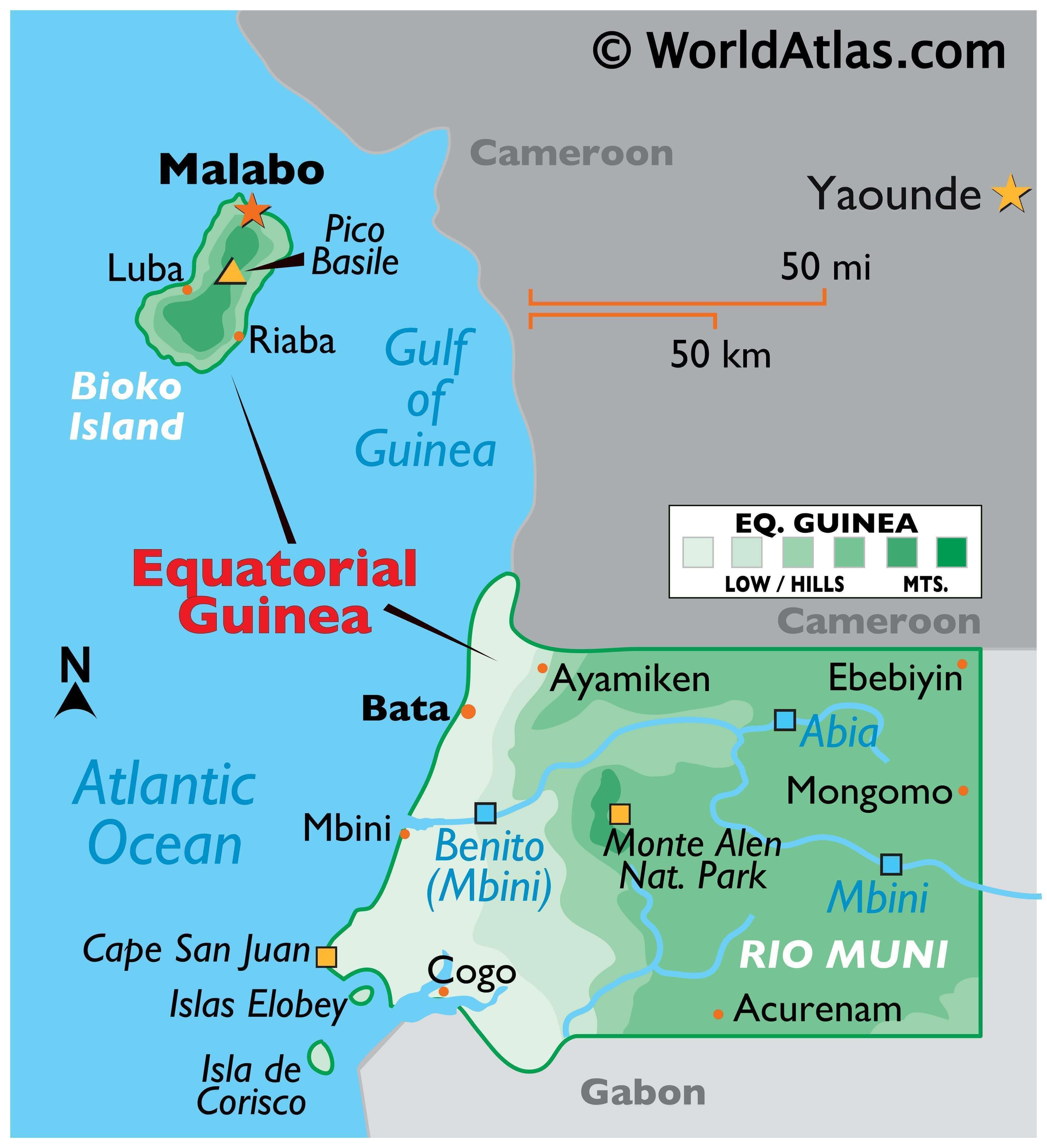
Where is Equatorial Guinea?
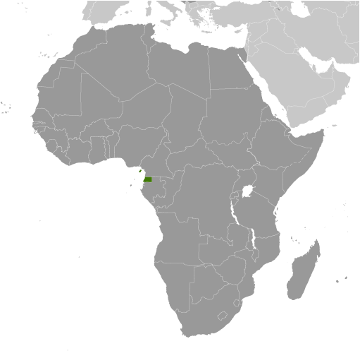
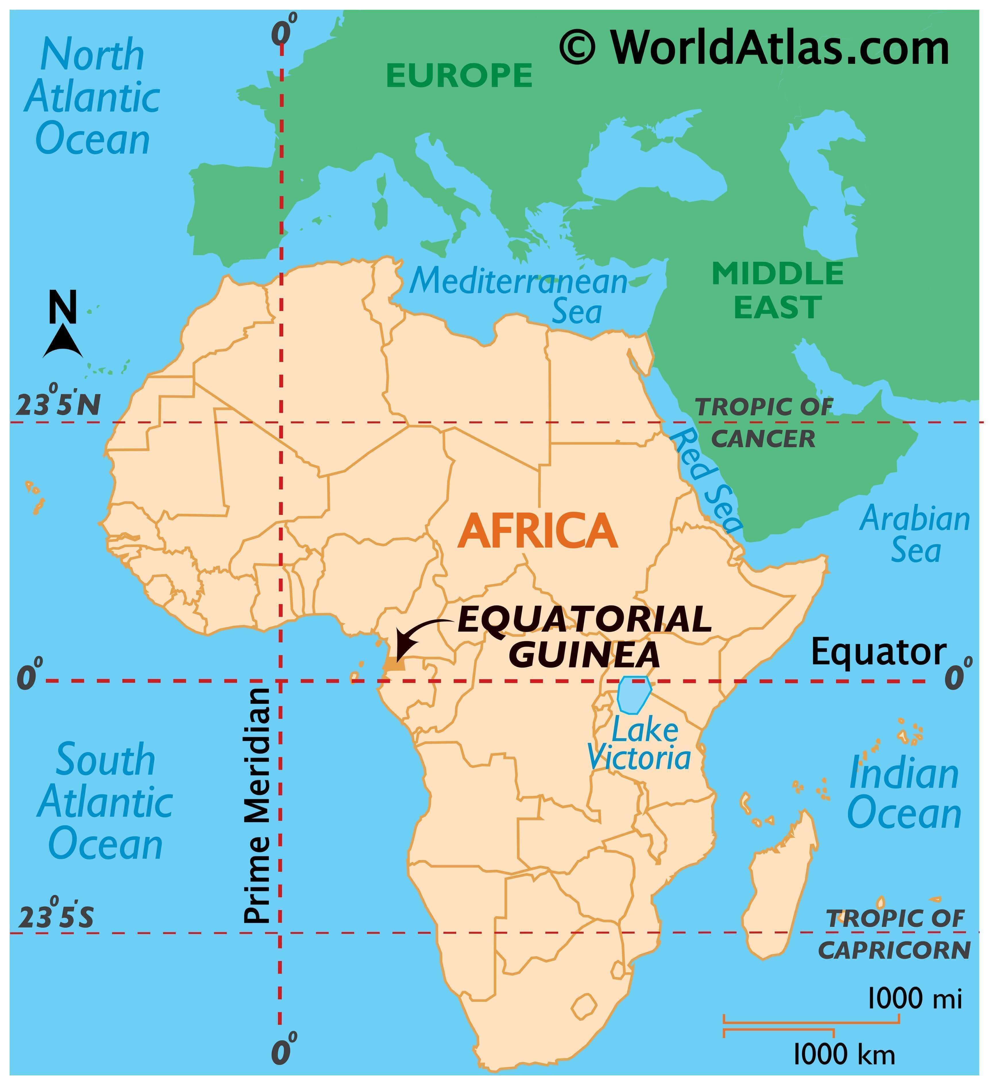
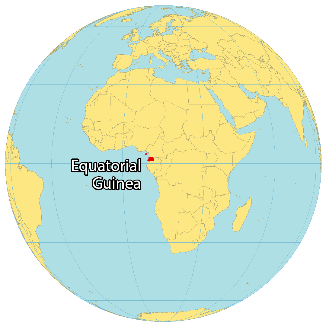
Equatorial Guinea is a small country located in Central Africa. It borders two other countries, Cameroon to the north, and Gabon which wraps around from the south to the east. The country also shares 296 kilometers (184 mi) with the Gulf of Guinea in the Atlantic Ocean to the west. Equatorial Guinea consists of its mainland on the coast of Central Africa, as well as 5 islands in the Atlantic Ocean. The largest of these is Bioko Island, which is home to the capital city of Malabo. Bata is the largest city, situated on the west coast of the mainland and known for being a port city. The population of Equatorial Guinea is about 1.3 million people, and it has one of the worst human rights records in the world.
High Definition Political Map of Equatorial Guinea
History
Equatorial Guinea is a small country located in Central Africa, with a complex history dating back thousands of years. The region was initially inhabited by various Bantu-speaking tribes, including the Fang and Bubi peoples.
In the late 15th century, Portuguese explorers arrived in the region and established trade relations with local rulers. The Portuguese were soon followed by other European powers, including the Spanish and the British, who sought to exploit the region’s resources, particularly its ivory and slaves.
Equatorial Guinea became a Spanish colony in 1778, and the country remained under Spanish rule until it gained independence in 1968. During the colonial period, the Spanish authorities suppressed local customs and traditions, and forced the population to adopt Catholicism.
After independence, Equatorial Guinea was ruled by President Francisco Macías Nguema, who established a one-party dictatorship and brutally suppressed political opposition. Macías Nguema’s regime was marked by corruption, nepotism, and human rights abuses, including torture and extrajudicial killings.
In 1979, Macías Nguema was overthrown in a coup led by his nephew, Teodoro Obiang Nguema Mbasogo. Obiang established a new government and began implementing economic and political reforms. However, his regime has also been marked by allegations of corruption, human rights abuses, and political repression.
Despite its small size, Equatorial Guinea is one of the richest countries in Africa, with significant oil and gas reserves. However, the country’s wealth has not translated into improved living conditions for most of its population, and Equatorial Guinea continues to face significant economic and social challenges.
Physical Map of Equatorial Guinea
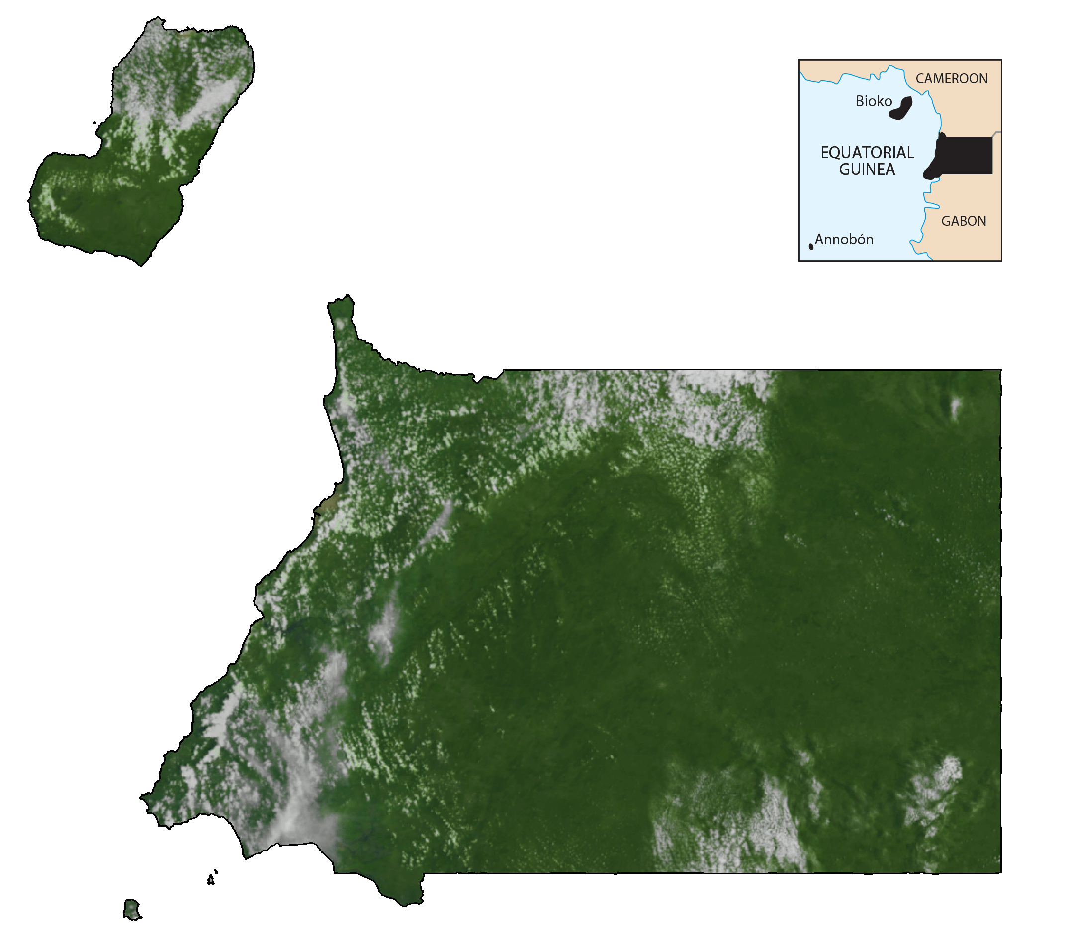
Equatorial Guinea Satellite Map
Elevation Map