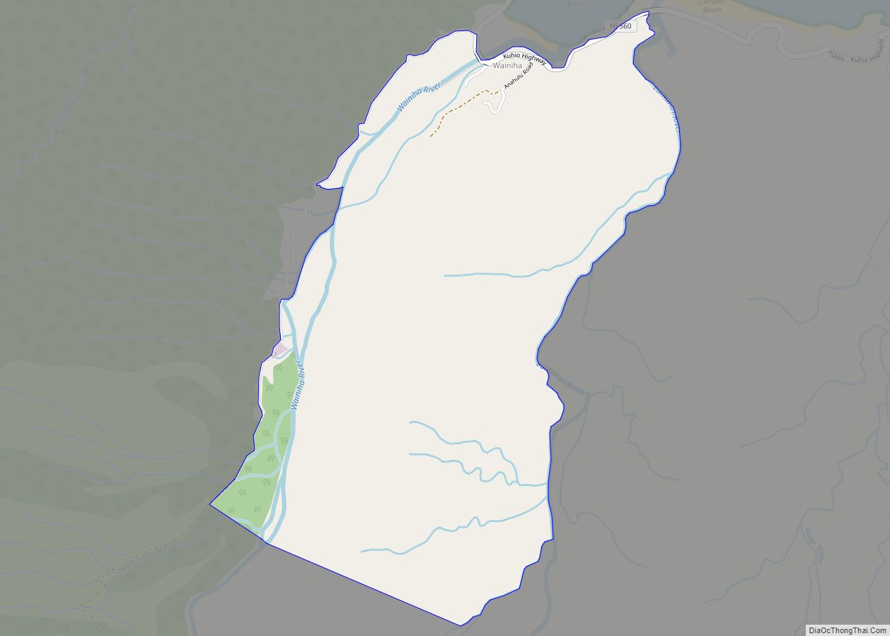
Wainaku is a census-designated place (CDP) in Hawaiʻi County, Hawaiʻi, United States. The population was 1,147 at the 2020 census. Wainaku CDP overview: Name: Wainaku CDP LSAD Code: 57 LSAD Description: CDP (suffix) State: Hawaii County: Hawaii County Elevation: 256 ft (78 m) Total Area: 1.47 sq mi (3.80 km²) Land Area: 1.32 sq mi (3.42 km²) Water Area: 0.15 sq mi (0.38 km²) Total Population: ... Read more
Hawaii Cities and Places
Waiʻōhinu (Hawaiian: Waiʻōhinu; translation: “Shiny Water”) is an unincorporated community and census-designated place (CDP) in the district of Kaʻu on the Big Island of Hawaiʻi, in the U.S. state of Hawaiʻi. Waiʻōhinu is the name of the community as well as the ahupua’a, Native Hawaiian subdivision. As of the 2020 census, the CDP had a ... Read more
Waipiʻo (Hawaiian pronunciation: [vɐjˈpiʔo]) is a census-designated place (CDP) located in the Ewa District of the island of Oʻahu in the City & County of Honolulu, Hawaii, United States. In Hawaiian, wai piʻo means “curved water”. As of the 2020 census, the CDP had a population of 12,082. The U.S. ZIP Code for Waipiʻo is 96797. ... Read more
Waipiʻo Acres is a census-designated place (CDP) in Honolulu County, Hawaiʻi, United States. The population was 5,531 at the 2020 census. Waipio Acres CDP overview: Name: Waipio Acres CDP LSAD Code: 57 LSAD Description: CDP (suffix) State: Hawaii County: Honolulu County Elevation: 735 ft (224 m) Total Area: 0.98 sq mi (2.54 km²) Land Area: 0.98 sq mi (2.54 km²) Water Area: 0.00 sq mi ... Read more
Waipahu (Hawaiian pronunciation: [vɐjˈpɐhu]) is a former sugarcane plantation town and now census-designated place (CDP) located in the ʻEwa District on the island of Oʻahu in the City & County of Honolulu, Hawaiʻi, United States. As of the 2020 census, the CDP population was 43,485. The U.S. postal code for Waipahu is 96797. Waipahu CDP overview: ... Read more
Whitmore Village is a census-designated place (CDP) in Honolulu County, Hawaiʻi, United States. The population was 4,887 at the 2020 census. Whitmore Village CDP overview: Name: Whitmore Village CDP LSAD Code: 57 LSAD Description: CDP (suffix) State: Hawaii County: Honolulu County Elevation: 1,001 ft (305 m) Total Area: 0.92 sq mi (2.37 km²) Land Area: 0.91 sq mi (2.36 km²) Water Area: 0.01 sq mi ... Read more
Wheeler Army Airfield (IATA: HHI, ICAO: PHHI, FAA LID: HHI), also known as Wheeler Field and formerly as Wheeler Air Force Base, is a United States Army post located in the City & County of Honolulu and in the Wahiawa District of the Island of O’ahu, Hawaii. It is a National Historic Landmark for its ... Read more
West Loch Estate is a census-designated place (CDP) in Honolulu County, Hawaiʻi, United States. The population was 5,523 at the 2020 census. West Loch Estate CDP overview: Name: West Loch Estate CDP LSAD Code: 57 LSAD Description: CDP (suffix) State: Hawaii County: Honolulu County Elevation: 10 ft (3 m) Total Area: 0.66 sq mi (1.72 km²) Land Area: 0.66 sq mi (1.71 km²) ... Read more