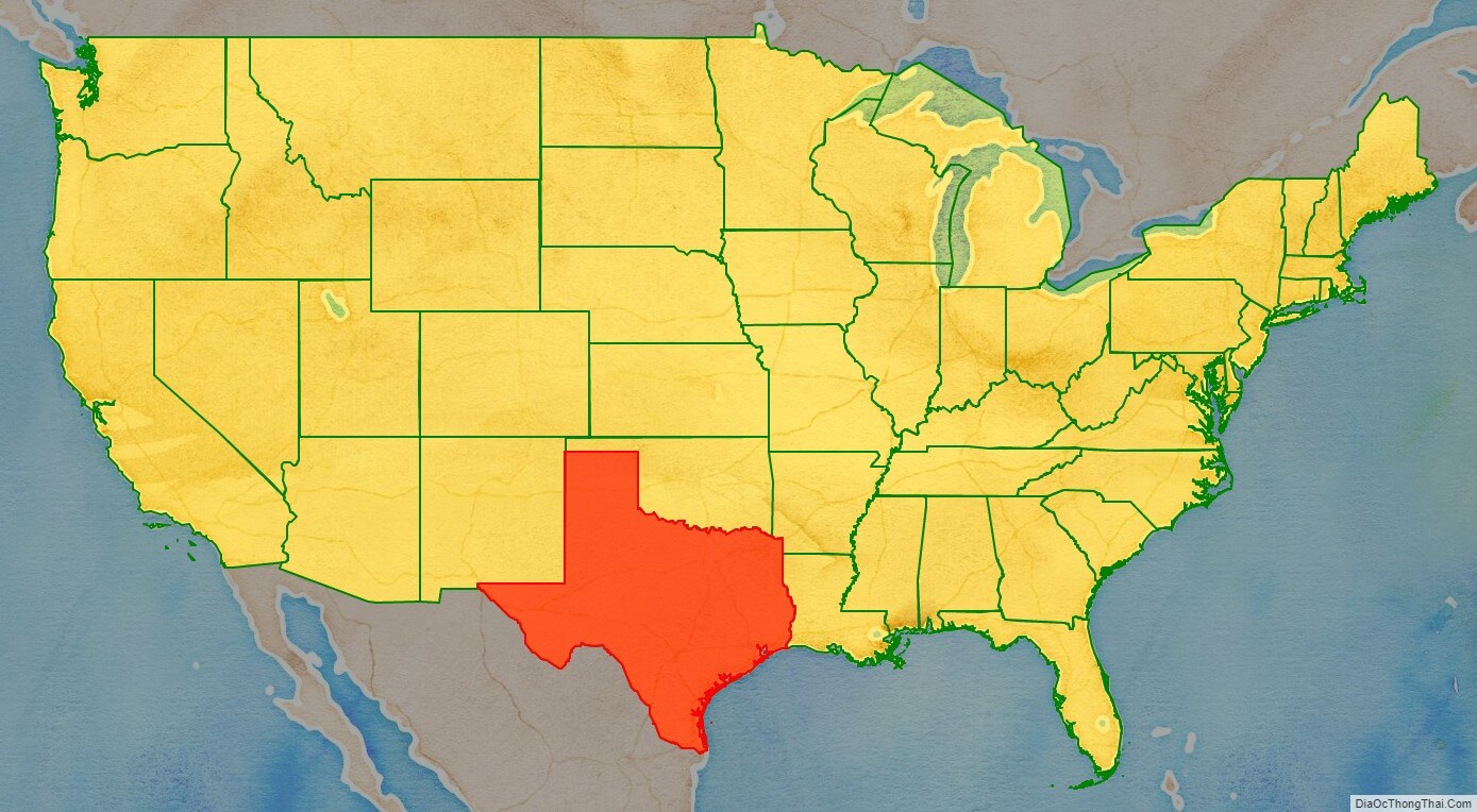
Texas (/ˈtɛksəs/, also locally /ˈtɛksɪz/; Spanish: Texas, Tejas) is a state in the South Central region of the United States. At 268,596 square miles (695,660 km), and with more than 30 million residents in 2022, it is the second-largest U.S. state by both area (after Alaska) and population (after California). Texas shares borders with the states of Louisiana to the east, Arkansas to the northeast, Oklahoma to the north, New Mexico to the west, and the Mexican states of Chihuahua, Coahuila, Nuevo León, and Tamaulipas to the south and southwest; and has a coastline with the Gulf of Mexico to the southeast.
Houston is the most populous city in Texas and the fourth-largest in the U.S., while San Antonio is the second most populous in the state and seventh-largest in the country. Dallas–Fort Worth and Greater Houston are, respectively, the fourth- and fifth-largest metropolitan statistical areas in the country. Other major cities include Austin, the second most populous state capital in the U.S., and El Paso. Texas is nicknamed the Lone Star State for its former status as an independent republic, and as a reminder of the state’s struggle for independence from Mexico. The Lone Star can be found on the Texas state flag and the Texas state seal. The origin of Texas’s name is from the Caddo word táyshaʼ meaning ‘friends’.
Due to its size and geologic features such as the Balcones Fault, Texas contains diverse landscapes common to both the U.S. Southern and the Southwestern regions. Although Texas is popularly associated with the U.S. southwestern deserts, less than ten percent of Texas’s land area is desert. Most population centers are in areas of former prairies, grasslands, forests, and the coastline. Traveling from east to west, terrain ranges from coastal swamps and piney woods, to rolling plains and rugged hills, to the desert and mountains of the Big Bend.
The term “six flags over Texas” is a colloquial term used in reference to the nations that have ruled over the territory. Spain was the first European country to claim and control the area of Texas. Following a short-lived colony controlled by France, Mexico controlled the territory until 1836 when Texas won its independence, becoming the Republic of Texas. In 1845, Texas joined the union as the 28th state. The state’s annexation set off a chain of events that led to the Mexican–American War in 1846. Following victory by the United States, Texas remained a slave state until the American Civil War, when it declared its secession from the Union in early 1861 before officially joining the Confederate States of America on March 2. After the Civil War and the restoration of its representation in the federal government, Texas entered a long period of economic stagnation.
Historically, four major industries shaped the Texas economy prior to World War II: cattle and bison, cotton, timber, and oil. Before and after the Civil War, the cattle industry—which Texas came to dominate—was a major economic driver for the state, and created the traditional image of the Texas cowboy. In the later 19th century, cotton and lumber grew to be major industries as the cattle industry became less lucrative. Ultimately, the discovery of major petroleum deposits (Spindletop in particular) initiated an economic boom that became the driving force behind the economy for much of the 20th century. Texas developed a diversified economy and high tech industry during the mid-20th century. As of 2022, it has the most Fortune 500 company headquarters (53) in the United States. With a growing base of industry, the state leads in many industries, including tourism, agriculture, petrochemicals, energy, computers and electronics, aerospace, and biomedical sciences. Texas has led the U.S. in state export revenue since 2002 and has the second-highest gross state product. If Texas were a sovereign state, it would have the 10th-largest economy in the world.
| Before statehood: | Republic of Texas |
|---|---|
| Admitted to the Union: | December 29, 1845 (28th) |
| Capital: | Austin |
| Largest city: | Houston |
| Largest metro and urban areas: | Dallas–Fort Worth |
| Elevation: | 1,700 ft (520 m) |
| Total Area: | 268,596 sq mi (695,662 km) |
| Area Rank: | 2nd |
| Total Population: | 29,145,505 |
| Population Rank: | 2nd |
| Population Density: | 114/sq mi (42.9/km) |
| Population Density Rank: | 26th |
| Median Household Income: | $64,034 |
| Income Rank: | 22nd |
| Demonym(s): | Texan Texian (archaic) Tejano (usually only used for Hispanics) |
| USPS abbreviation: | TX |
| ISO 3166 code: | US-TX |
| Website: | texas.gov |
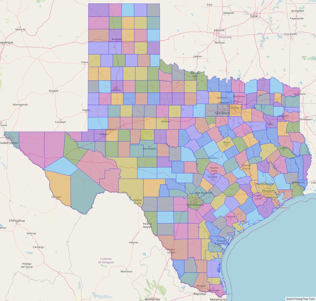
Online Interactive Map
Click on ![]() to view map in "full screen" mode.
to view map in "full screen" mode.
Texas location map. Where is Texas state?
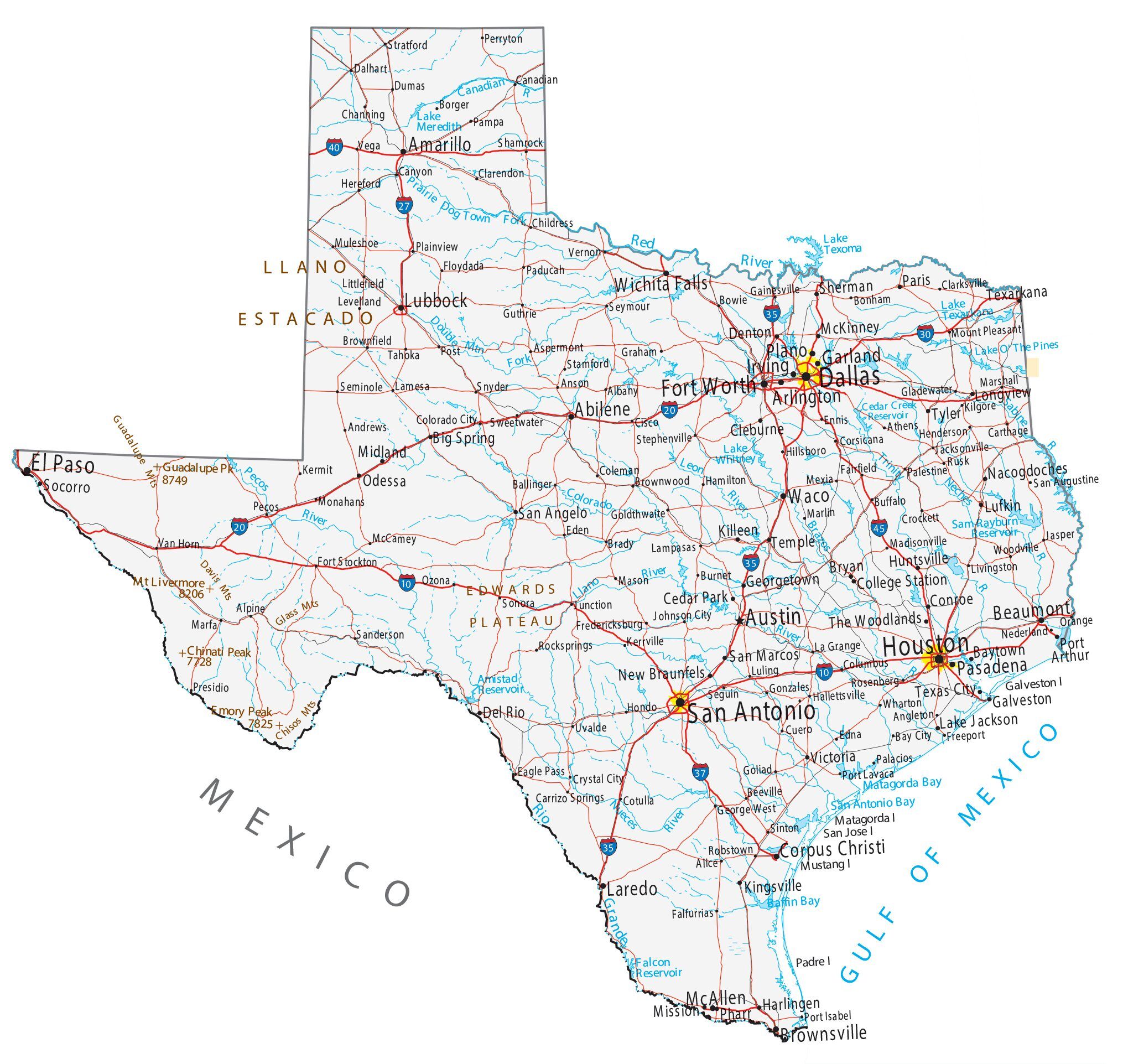
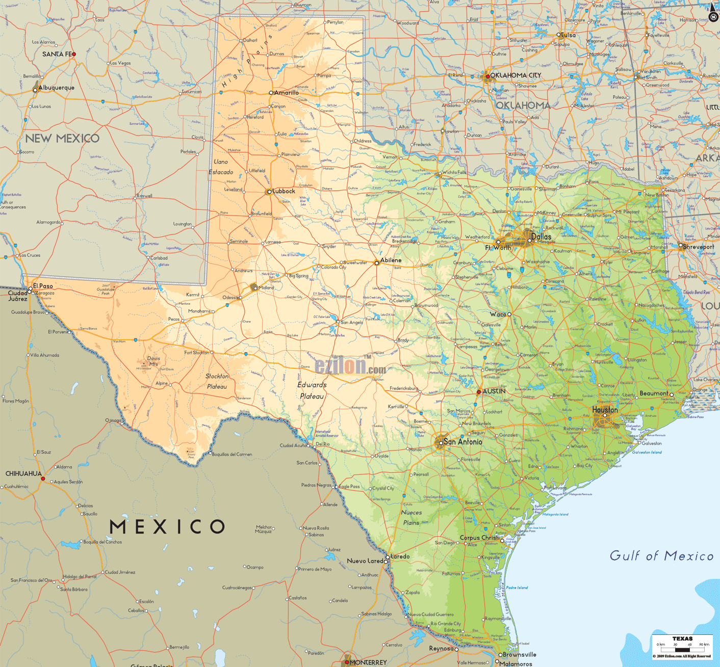
Texas Road Map
Texas Map – Roads & Cities
Texas Street Map
Texas State Map – Places and Landmarks
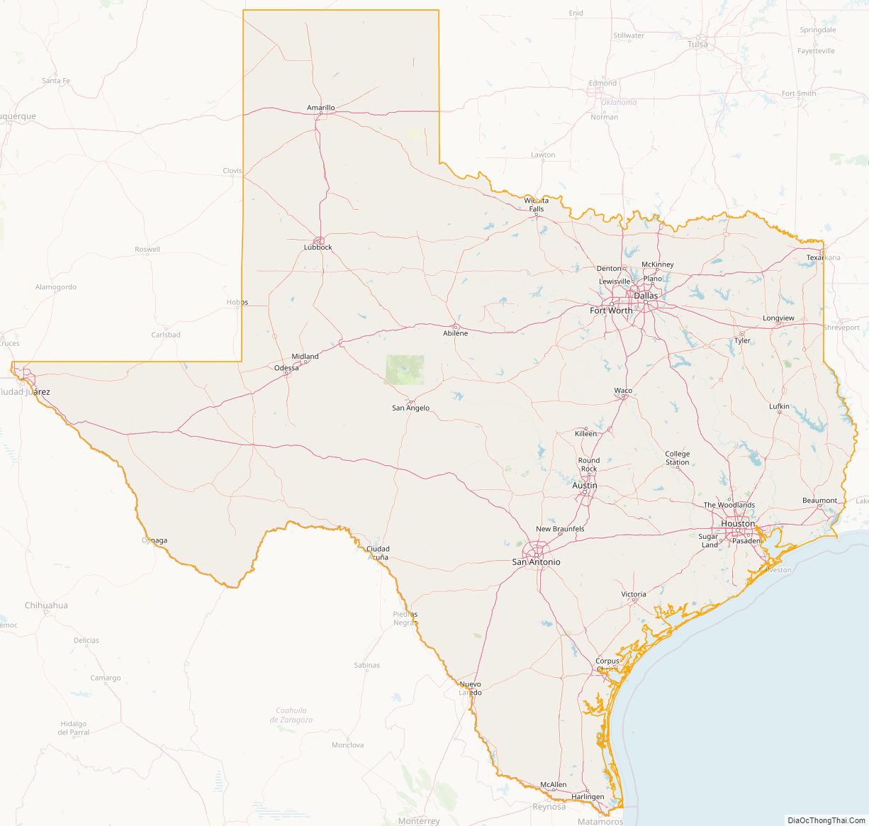
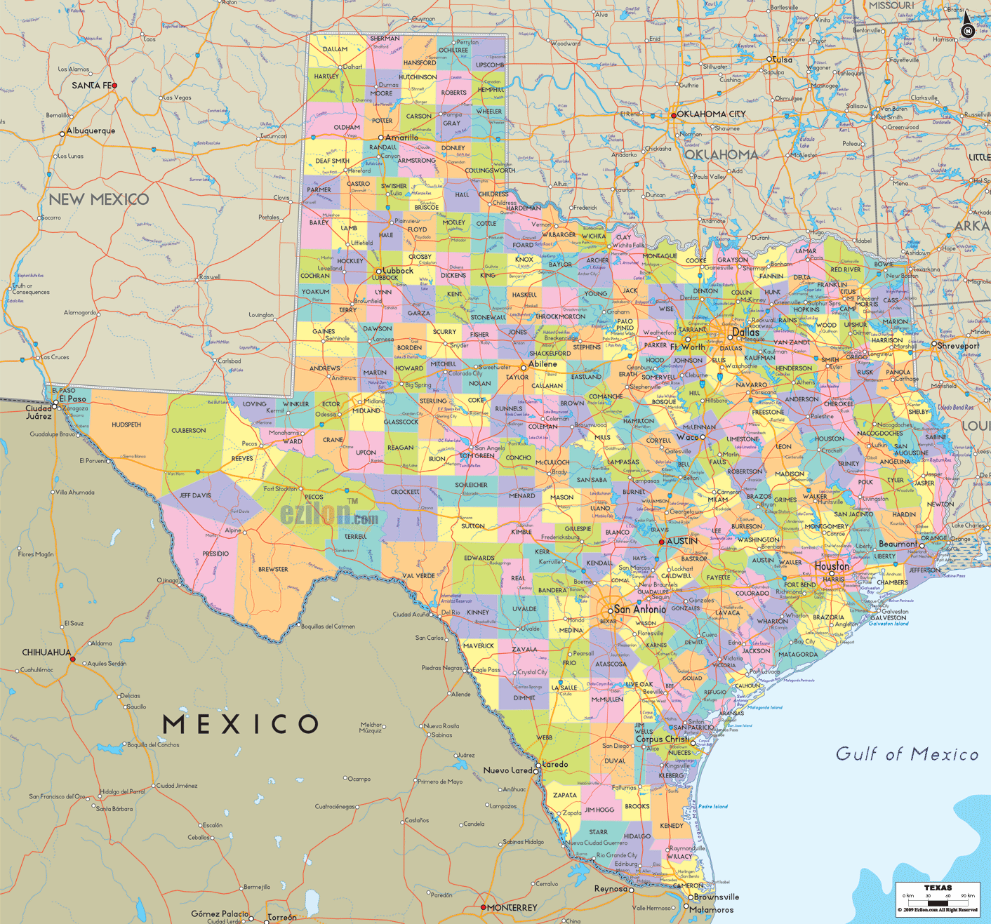
Texas Political Map
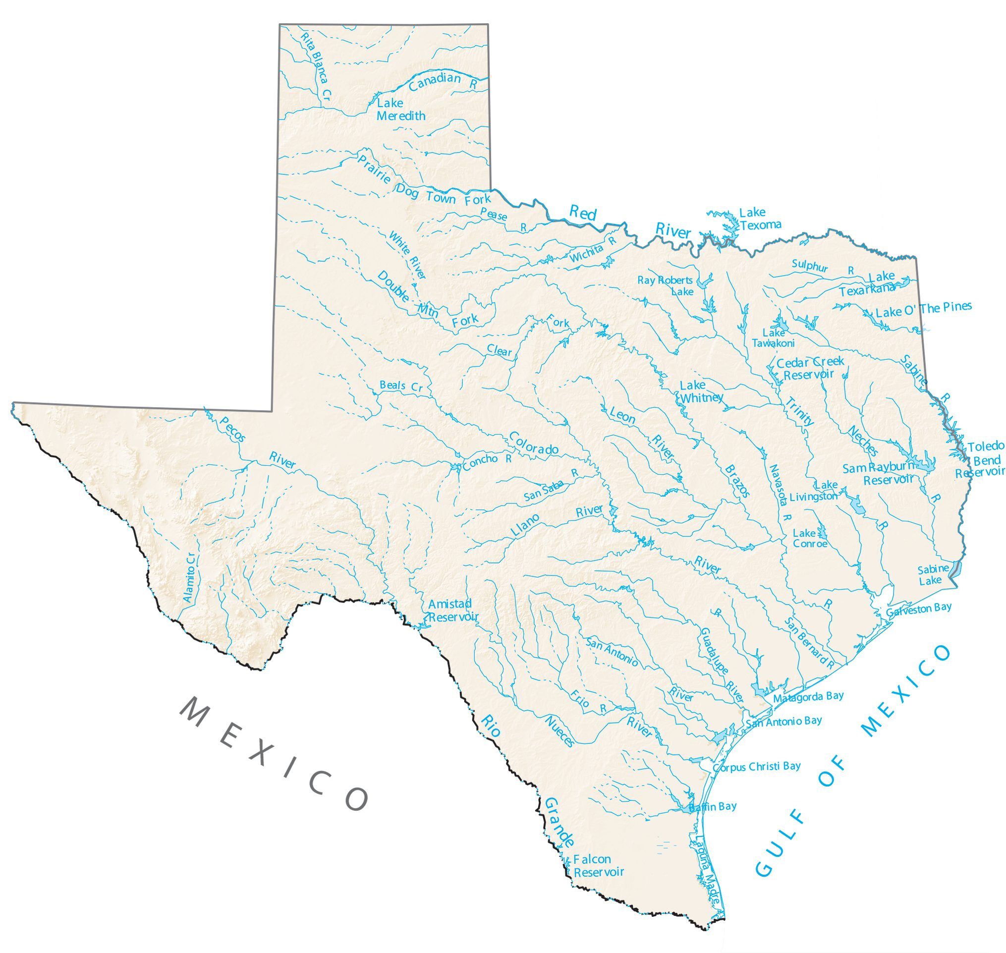
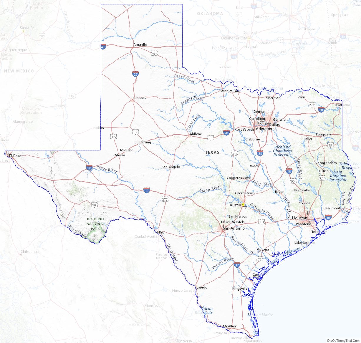
Texas Lakes and Rivers Map
Geography
Texas is the second-largest U.S. state, after Alaska, and the largest state within the contiguous United States, with an area of 268,820 square miles (696,200 km). Though 10% larger than France, almost twice as large as Germany or Japan, and more than twice the size of the United Kingdom, it ranks only 27th worldwide amongst country subdivisions by size. If it were an independent country, Texas would be the 39th-largest.
Texas is in the south central part of the United States of America. Three of its borders are defined by rivers. The Rio Grande forms a natural border with the Mexican states of Chihuahua, Coahuila, Nuevo León, and Tamaulipas to the south. The Red River forms a natural border with Oklahoma and Arkansas to the north. The Sabine River forms a natural border with Louisiana to the east. The Texas Panhandle has an eastern border with Oklahoma at 100° W, a northern border with Oklahoma at 36°30′ N and a western border with New Mexico at 103° W. El Paso lies on the state’s western tip at 32° N and the Rio Grande.
With 10 climatic regions, 14 soil regions and 11 distinct ecological regions, regional classification becomes problematic with differences in soils, topography, geology, rainfall, and plant and animal communities. One classification system divides Texas, in order from southeast to west, into the following: Gulf Coastal Plains, Interior Lowlands, Great Plains, and Basin and Range Province.
The Gulf Coastal Plains region wraps around the Gulf of Mexico on the southeast section of the state. Vegetation in this region consists of thick piney woods. The Interior Lowlands region consists of gently rolling to hilly forested land and is part of a larger pine-hardwood forest. The Cross Timbers region and Caprock Escarpment are part of the Interior Lowlands.
The Great Plains region in Central Texas spans through the state’s panhandle and Llano Estacado to the state’s hill country near Lago Vista and Austin. This region is dominated by prairie and steppe. “Far West Texas” or the “Trans-Pecos” region is the state’s Basin and Range Province. The most varied of the regions, this area includes Sand Hills, the Stockton Plateau, desert valleys, wooded mountain slopes and desert grasslands.
Texas has 3,700 named streams and 15 major rivers, with the Rio Grande as the largest. Other major rivers include the Pecos, the Brazos, Colorado, and Red River. While Texas has few natural lakes, Texans have built more than a hundred artificial reservoirs.
The size and unique history of Texas make its regional affiliation debatable; it can be fairly considered a Southern or a Southwestern state, or both. The vast geographic, economic, and cultural diversity within the state itself prohibits easy categorization of the whole state into a recognized region of the United States. Notable extremes range from East Texas which is often considered an extension of the Deep South, to Far West Texas which is generally acknowledged to be part of the interior Southwest.
Geology
Texas is the southernmost part of the Great Plains, which ends in the south against the folded Sierra Madre Occidental of Mexico. The continental crust forms a stable Mesoproterozoic craton which changes across a broad continental margin and transitional crust into true oceanic crust of the Gulf of Mexico. The oldest rocks in Texas date from the Mesoproterozoic and are about 1,600 million years old.
These Precambrian igneous and metamorphic rocks underlie most of the state, and are exposed in three places: Llano uplift, Van Horn, and the Franklin Mountains, near El Paso. Sedimentary rocks overlay most of these ancient rocks. The oldest sediments were deposited on the flanks of a rifted continental margin, or passive margin that developed during Cambrian time.
This margin existed until Laurasia and Gondwana collided in the Pennsylvanian subperiod to form Pangea. This is the buried crest of the Appalachian Mountains–Ouachita Mountains zone of Pennsylvanian continental collision. This orogenic crest is today buried beneath the Dallas–Waco–Austin–San Antonio trend.
The late Paleozoic mountains collapsed as rifting in the Jurassic period began to open the Gulf of Mexico. Pangea began to break up in the Triassic, but seafloor spreading to form the Gulf of Mexico occurred only in the mid- and late Jurassic. The shoreline shifted again to the eastern margin of the state and the Gulf of Mexico’s passive margin began to form. Today 9 to 12 miles (14 to 19 km) of sediments are buried beneath the Texas continental shelf and a large proportion of remaining US oil reserves are here. At the start of its formation, the incipient Gulf of Mexico basin was restricted and seawater often evaporated completely to form thick evaporite deposits of Jurassic age. These salt deposits formed salt dome diapirs, and are found in East Texas along the Gulf coast.
East Texas outcrops consist of Cretaceous and Paleogene sediments which contain important deposits of Eocene lignite. The Mississippian and Pennsylvanian sediments in the north; Permian sediments in the west; and Cretaceous sediments in the east, along the Gulf coast and out on the Texas continental shelf contain oil. Oligocene volcanic rocks are found in far west Texas in the Big Bend area. A blanket of Miocene sediments known as the Ogallala formation in the western high plains region is an important aquifer. Located far from an active plate tectonic boundary, Texas has no volcanoes and few earthquakes.
Wildlife
A wide range of animals and insects live in Texas. It is the home to 65 species of mammals, 213 species of reptiles and amphibians, including the American green tree frog, and the greatest diversity of bird life in the United States—590 native species in all. At least 12 species have been introduced and now reproduce freely in Texas.
Texas plays host to several species of wasps, including an abundance of Polistes exclamans, and is an important ground for the study of Polistes annularis.
During the spring Texas wildflowers such as the state flower, the bluebonnet, line highways throughout Texas. During the Johnson Administration the first lady, Lady Bird Johnson, worked to draw attention to Texas wildflowers.
Climate
The large size of Texas and its location at the intersection of multiple climate zones gives the state highly variable weather. The Panhandle of the state has colder winters than North Texas, while the Gulf Coast has mild winters. Texas has wide variations in precipitation patterns. El Paso, on the western end of the state, averages 8.7 inches (220 mm) of annual rainfall, while parts of southeast Texas average as much as 64 inches (1,600 mm) per year. Dallas in the North Central region averages a more moderate 37 inches (940 mm) per year.
Snow falls multiple times each winter in the Panhandle and mountainous areas of West Texas, once or twice a year in North Texas, and once every few years in Central and East Texas. Snow falls south of San Antonio or on the coast only in rare circumstances. Of note is the 2004 Christmas Eve snowstorm, when 6 inches (150 mm) of snow fell as far south as Kingsville, where the average high temperature in December is 65 °F.
Maximum temperatures in the summer months average from the 80s °F (26 °C) in the mountains of West Texas and on Galveston Island to around 100 °F (38 °C) in the Rio Grande Valley, but most areas of Texas see consistent summer high temperatures in the 90 °F (32 °C) range.
Night-time summer temperatures range from the upper 50s °F (14 °C) in the West Texas mountains to 80 °F (27 °C) in Galveston.
The table below consists of averages for August (generally the warmest month) and January (generally the coldest) in selected cities in various regions of the state.
Thunderstorms strike Texas often, especially the eastern and northern portions of the state. Tornado Alley covers the northern section of Texas. The state experiences the most tornadoes in the United States, an average of 139 a year. These strike most frequently in North Texas and the Panhandle. Tornadoes in Texas generally occur in the months of April, May, and June.
Some of the most destructive hurricanes in U.S. history have impacted Texas. A hurricane in 1875 killed about 400 people in Indianola, followed by another hurricane in 1886 that destroyed the town. These events allowed Galveston to take over as the chief port city. The 1900 Galveston hurricane subsequently devastated that city, killing about 8,000 people or possibly as many as 12,000. This makes it the deadliest natural disaster in U.S. history. In 2017, Hurricane Harvey made landfall in Rockport as a Category 4 Hurricane, causing significant damage there. The storm stalled over land for a very long time, allowing it to drop unprecedented amounts of rain over the Greater Houston area and surrounding counties. The result was widespread and catastrophic flooding that inundated hundreds of thousands of homes. Harvey ultimately became the costliest hurricane worldwide, causing an estimated $198.6 billion in damage, surpassing the cost of Hurricane Katrina.
Other devastating Texas hurricanes include the 1915 Galveston hurricane, Hurricane Audrey in 1957 which killed more than 600 people, Hurricane Carla in 1961, Hurricane Beulah in 1967, Hurricane Alicia in 1983, Hurricane Rita in 2005, and Hurricane Ike in 2008. Tropical storms have also caused their share of damage: Allison in 1989 and again during 2001, Claudette in 1979, and Tropical Storm Imelda in 2019.
There is no substantial physical barrier between Texas and the polar region. Although it is unusual, it is possible for arctic or polar air masses to penetrate Texas, as occurred during the February 13–17, 2021 North American winter storm. Usually, prevailing winds in North America will push polar air masses to the southeast before they reach Texas. Because such intrusions are rare, and, perhaps, unexpected, they may result in crises such as the 2021 Texas power crisis.
Greenhouse gases
As of 2017, Texas emitted the most greenhouse gases in the U.S., almost twice the amount of California, the second-most polluting state. As of 2017 the state emits about 1,600 billion pounds (707 million metric tons) of carbon dioxide annually. As an independent state, Texas would rank as the world’s seventh-largest producer of greenhouse gases. Causes of the state’s vast greenhouse gas emissions include the state’s large number of coal power plants and the state’s refining and manufacturing industries. In 2010, there were 2,553 “emission events” which poured 44.6 million pounds (20,200 metric tons) of contaminants into the Texas sky.
Administrative divisions
The state has three cities with populations exceeding one million: Houston, San Antonio, and Dallas. These three rank among the 10 most populous cities of the United States. As of 2020, six Texas cities had populations greater than 600,000 people. Austin, Fort Worth, and El Paso are among the 20 largest U.S. cities. Texas has four metropolitan areas with populations greater than a million: Dallas–Fort Worth–Arlington, Houston–Sugar Land–The Woodlands, San Antonio–New Braunfels, and Austin–Round Rock–San Marcos. The Dallas–Fort Worth and Houston metropolitan areas number about 7.5 million and 7 million residents as of 2019, respectively.
Three interstate highways—I-35 to the west (Dallas–Fort Worth to San Antonio, with Austin in between), I-45 to the east (Dallas to Houston), and I-10 to the south (San Antonio to Houston) define the Texas Urban Triangle region. The region of 60,000 square miles (160,000 km) contains most of the state’s largest cities and metropolitan areas as well as 17 million people, nearly 75 percent of Texas’s total population. Houston and Dallas have been recognized as world cities. These cities are spread out amongst the state.
In contrast to the cities, unincorporated rural settlements known as colonias often lack basic infrastructure and are marked by poverty. The office of the Texas Attorney General stated, in 2011, that Texas had about 2,294 colonias, and estimates about 500,000 lived in the colonias. Hidalgo County, as of 2011, has the largest number of colonias. Texas has the largest number of people living in colonias of all states.
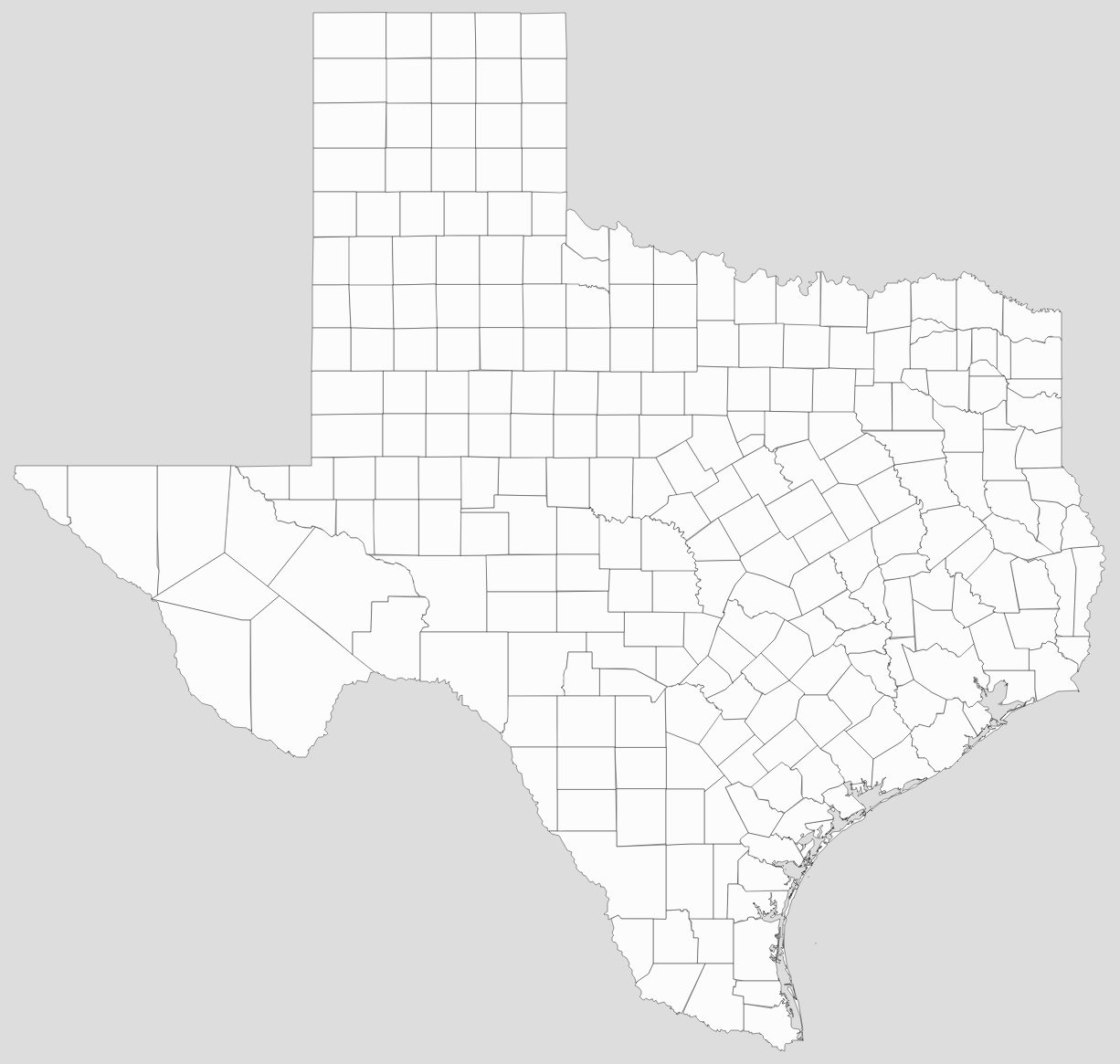
Texas has 254 counties, which is more than any other state by 95 (Georgia). Each county runs on Commissioners’ Court system consisting of four elected commissioners (one from each of four precincts in the county, roughly divided according to population) and a county judge elected at large from the entire county. County government runs similar to a “weak” mayor-council system; the county judge has no veto authority, but votes along with the other commissioners.
Although Texas permits cities and counties to enter “interlocal agreements” to share services, the state does not allow consolidated city-county governments, nor does it have metropolitan governments. Counties are not granted home rule status; their powers are strictly defined by state law. The state does not have townships—areas within a county are either incorporated or unincorporated. Incorporated areas are part of a municipality. The county provides limited services to unincorporated areas and to some smaller incorporated areas. Municipalities are classified either “general law” cities or “home rule”. A municipality may elect home rule status once it exceeds 5,000 population with voter approval.
Texas also permits the creation of “special districts”, which provide limited services. The most common is the school district, but can also include hospital districts, community college districts, and utility districts (one utility district near Austin was the plaintiff in a landmark Supreme Court case involving the Voting Rights Act). Municipal, school district, and special district elections are nonpartisan, though the party affiliation of a candidate may be well-known. County and state elections are partisan.
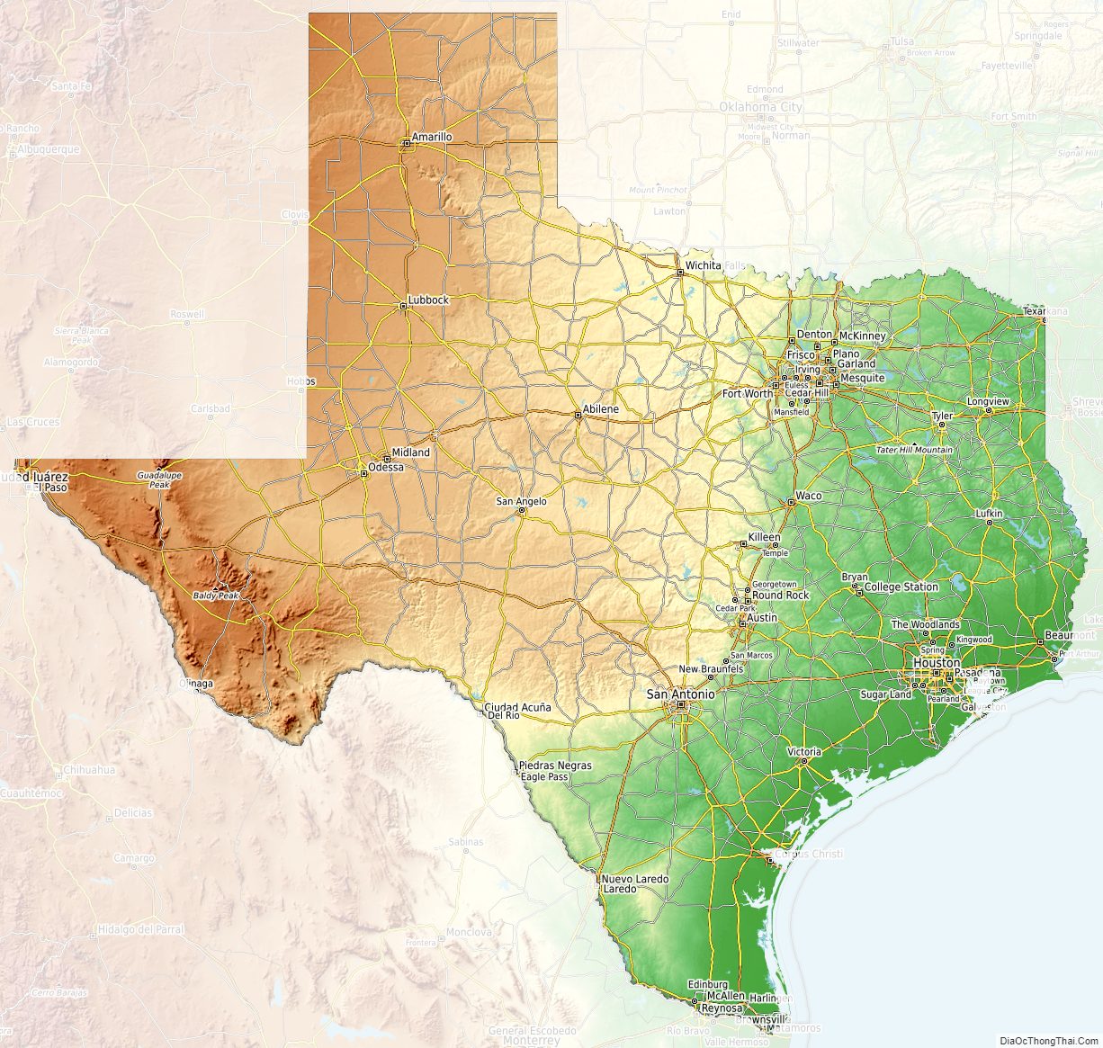
Texas Physical Map
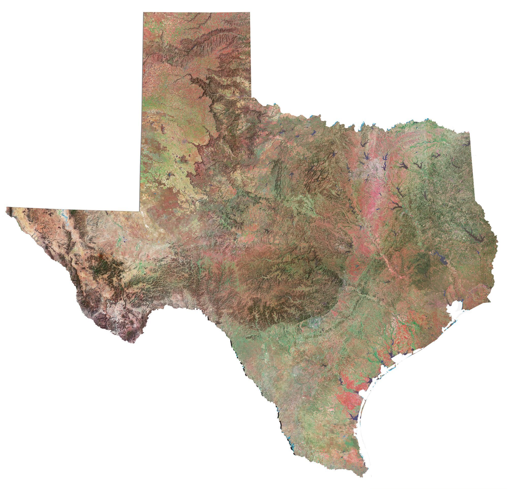
Texas Topographic Map
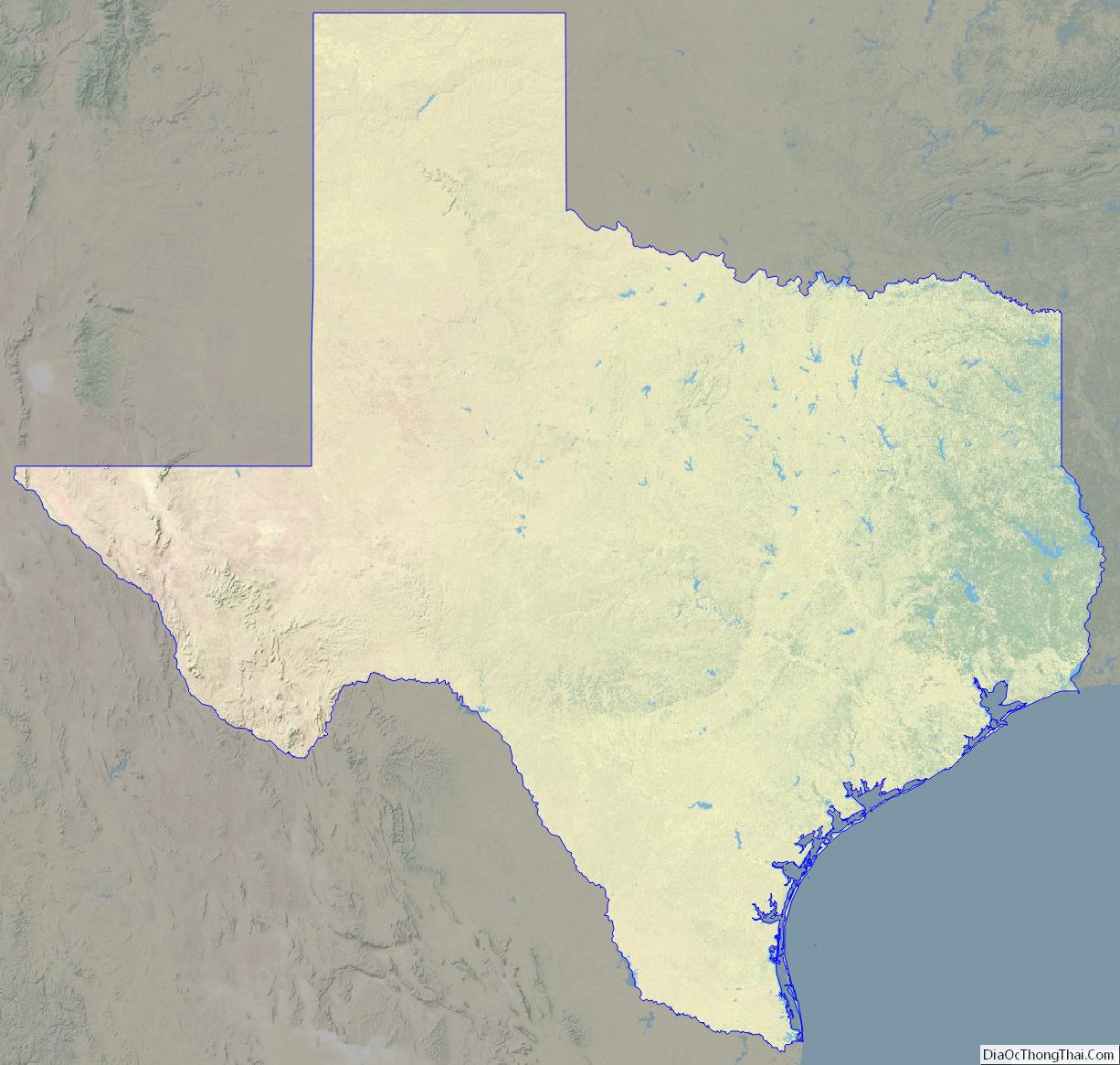
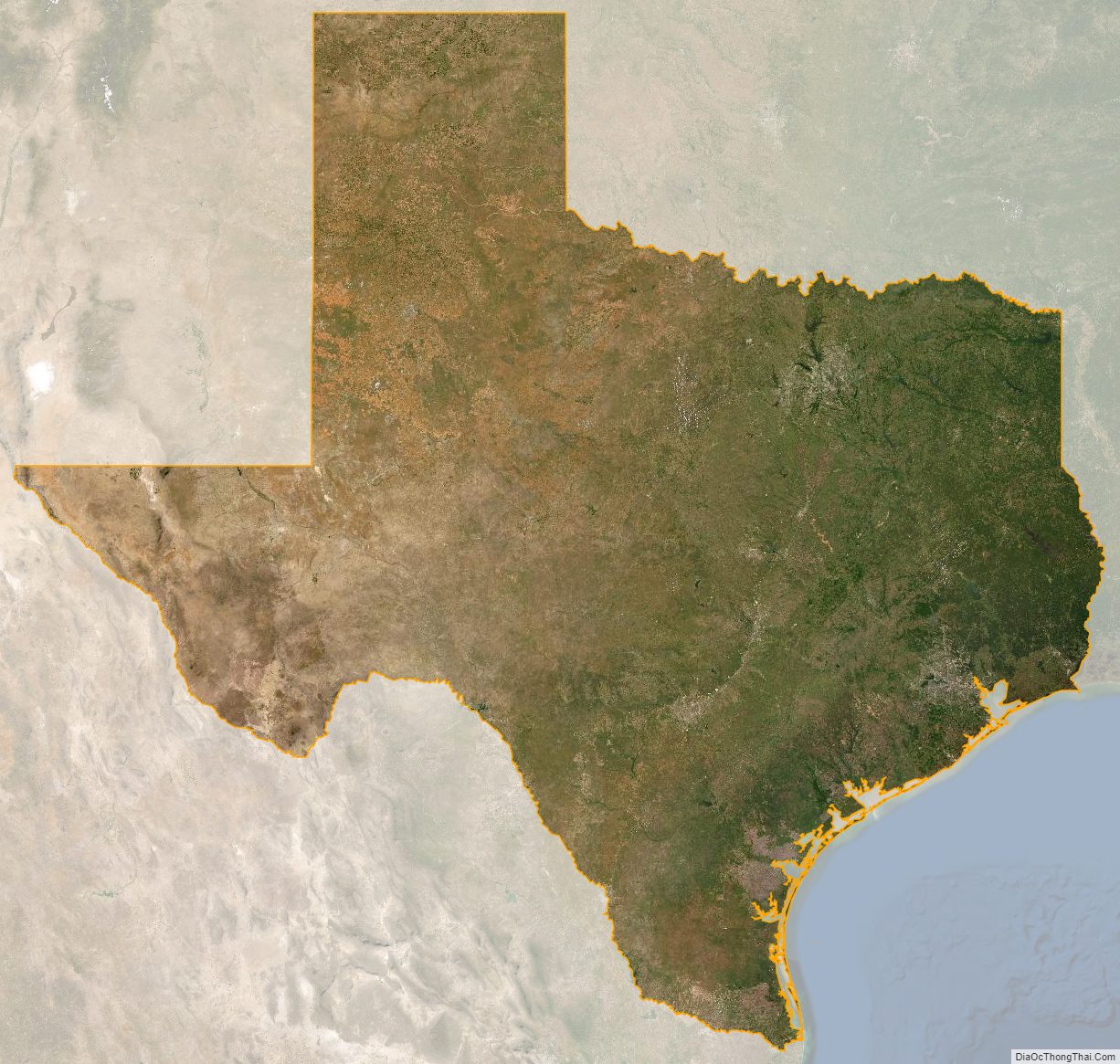
Texas Satellite Map
Others printable maps
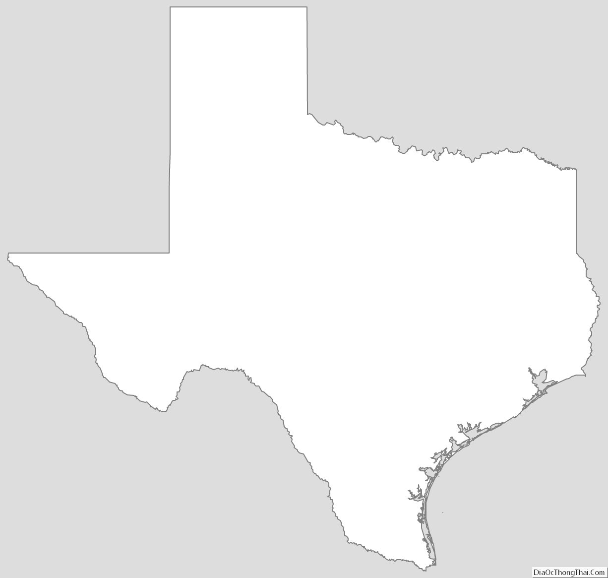
Texas Outline Map
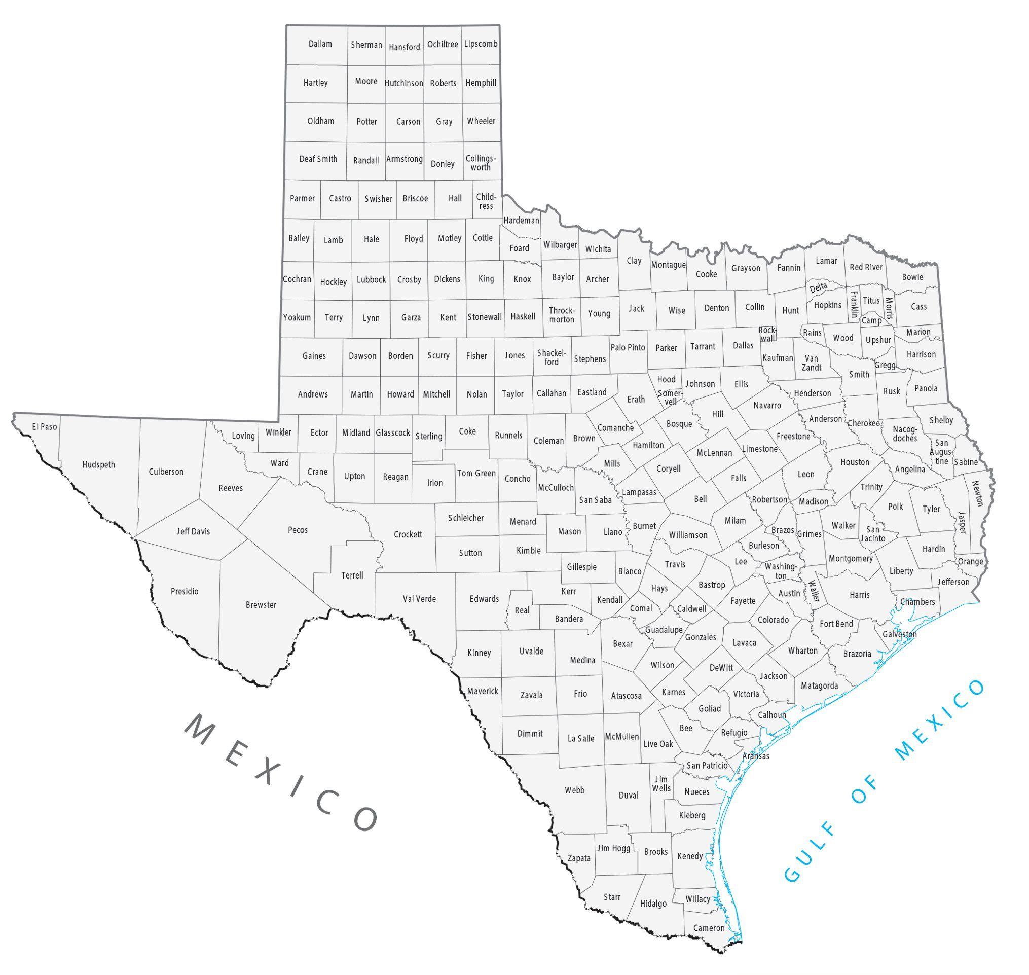
Blank Texas County Map
See also
Map of Texas State and its subdivision:- Anderson
- Andrews
- Angelina
- Aransas
- Archer
- Armstrong
- Atascosa
- Austin
- Bailey
- Bandera
- Bastrop
- Baylor
- Bee
- Bell
- Bexar
- Blanco
- Borden
- Bosque
- Bowie
- Brazoria
- Brazos
- Brewster
- Briscoe
- Brooks
- Brown
- Burleson
- Burnet
- Caldwell
- Calhoun
- Callahan
- Cameron
- Camp
- Carson
- Cass
- Castro
- Chambers
- Cherokee
- Childress
- Clay
- Cochran
- Coke
- Coleman
- Collin
- Collingsworth
- Colorado
- Comal
- Comanche
- Concho
- Cooke
- Coryell
- Cottle
- Crane
- Crockett
- Crosby
- Culberson
- Dallam
- Dallas
- Dawson
- Deaf Smith
- Delta
- Denton
- Dewitt
- Dickens
- Dimmit
- Donley
- Duval
- Eastland
- Ector
- Edwards
- El Paso
- Ellis
- Erath
- Falls
- Fannin
- Fayette
- Fisher
- Floyd
- Foard
- Fort Bend
- Franklin
- Freestone
- Frio
- Gaines
- Galveston
- Garza
- Gillespie
- Glasscock
- Goliad
- Gonzales
- Gray
- Grayson
- Gregg
- Grimes
- Guadalupe
- Hale
- Hall
- Hamilton
- Hansford
- Hardeman
- Hardin
- Harris
- Harrison
- Hartley
- Haskell
- Hays
- Hemphill
- Henderson
- Hidalgo
- Hill
- Hockley
- Hood
- Hopkins
- Houston
- Howard
- Hudspeth
- Hunt
- Hutchinson
- Irion
- Jack
- Jackson
- Jasper
- Jeff Davis
- Jefferson
- Jim Hogg
- Jim Wells
- Johnson
- Jones
- Karnes
- Kaufman
- Kendall
- Kenedy
- Kent
- Kerr
- Kimble
- King
- Kinney
- Kleberg
- Knox
- La Salle
- Lamar
- Lamb
- Lampasas
- Lavaca
- Lee
- Leon
- Liberty
- Limestone
- Lipscomb
- Live Oak
- Llano
- Loving
- Lubbock
- Lynn
- Madison
- Marion
- Martin
- Mason
- Matagorda
- Maverick
- McCulloch
- McLennan
- McMullen
- Medina
- Menard
- Midland
- Milam
- Mills
- Mitchell
- Montague
- Montgomery
- Moore
- Morris
- Motley
- Nacogdoches
- Navarro
- Newton
- Nolan
- Nueces
- Ochiltree
- Oldham
- Orange
- Palo Pinto
- Panola
- Parker
- Parmer
- Pecos
- Polk
- Potter
- Presidio
- Rains
- Randall
- Reagan
- Real
- Red River
- Reeves
- Refugio
- Roberts
- Robertson
- Rockwall
- Runnels
- Rusk
- Sabine
- San Augustine
- San Jacinto
- San Patricio
- San Saba
- Schleicher
- Scurry
- Shackelford
- Shelby
- Sherman
- Smith
- Somervell
- Starr
- Stephens
- Sterling
- Stonewall
- Sutton
- Swisher
- Tarrant
- Taylor
- Terrell
- Terry
- Throckmorton
- Titus
- Tom Green
- Travis
- Trinity
- Tyler
- Upshur
- Upton
- Uvalde
- Val Verde
- Van Zandt
- Victoria
- Walker
- Waller
- Ward
- Washington
- Webb
- Wharton
- Wheeler
- Wichita
- Wilbarger
- Willacy
- Williamson
- Wilson
- Winkler
- Wise
- Wood
- Yoakum
- Young
- Zapata
- Zavala
- Alabama
- Alaska
- Arizona
- Arkansas
- California
- Colorado
- Connecticut
- Delaware
- District of Columbia
- Florida
- Georgia
- Hawaii
- Idaho
- Illinois
- Indiana
- Iowa
- Kansas
- Kentucky
- Louisiana
- Maine
- Maryland
- Massachusetts
- Michigan
- Minnesota
- Mississippi
- Missouri
- Montana
- Nebraska
- Nevada
- New Hampshire
- New Jersey
- New Mexico
- New York
- North Carolina
- North Dakota
- Ohio
- Oklahoma
- Oregon
- Pennsylvania
- Rhode Island
- South Carolina
- South Dakota
- Tennessee
- Texas
- Utah
- Vermont
- Virginia
- Washington
- West Virginia
- Wisconsin
- Wyoming


