Da Nang (Da Nang, ) is one of the five largest cities in Vietnam including Ho Chi Minh City, Hanoi, Haiphong, and Can Tho in terms of urbanization and economy. Located on the coast of the South China Sea at the mouth of the Han River, it is one of Vietnam’s most important port cities. As one of the country’s five direct-controlled municipalities, it is under the direct administration of the central government.
Da Nang is the commercial and educational centre of Central Vietnam, as well as being the largest city in the region. In addition to its well-sheltered, easily accessible port, Da Nang’s location on the path of National Route 1A and the North–South Railway makes it a hub for transportation. It is located within 100 km of several UNESCO World Heritage Sites, including the Imperial City of Hue, the Old Town of Hoi An, and the My Son ruins. The city was previously known as Cua Han during early Dai Viet settlement, and as Tourane (or Turon) during French colonial rule. Before 1997, the city was part of Quang Nam-Da Nang Province.
On 1 January 1997, Da Nang was separated from Quang Nam Province to become one of four independent (centrally controlled) municipalities in Vietnam. Da Nang is listed as a first class city, and has a higher urbanization ratio than any of Vietnam’s other provinces or centrally governed cities.
Most of the names by which Da Nang has been known make reference to its position at the Han River estuary. The city’s present name is generally agreed to be a Vietnamese adaptation of the Cham word da nak, which is translated as “opening of a large river”.
Other Chamic sources, with similar definitions, have been proposed. Inrasara (aka Phu Tram), a researcher specializing in Champa, suggests Da Nang is a variation of the Cham word daknan (lit. “the large water”); Sakaya (aka Van Mon), another Champa researcher, claims a connection with the Raglai word danang, meaning “river source”.
Another name given to Da Nang was Cua Han (lit. “mouth of the Han “). The name used by the French, Tourane, is said to derive from this name, by way of a rough transliteration. Notably, this name (spelled “Cua han”) appears on maps of the area drafted by Alexandre de Rhodes in 1650. The name Kean (cf. Ke Han, roughly “Han market”) was another name purportedly used during the 17th century to refer to the land situated at the foot of the Hai Van Pass.
Other names referring to Da Nang include:
* Vung Thung, a colloquial name which survives in folklore.
* Tra Uc, Tra Ao, Tra Son and Dong Long Loan, literary names used by Confucian scholars.
* In Chu Nom, used until 1945, “Da Nang” is written as.
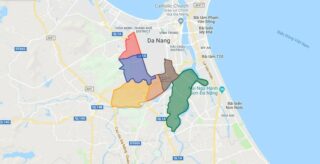
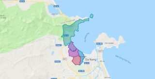
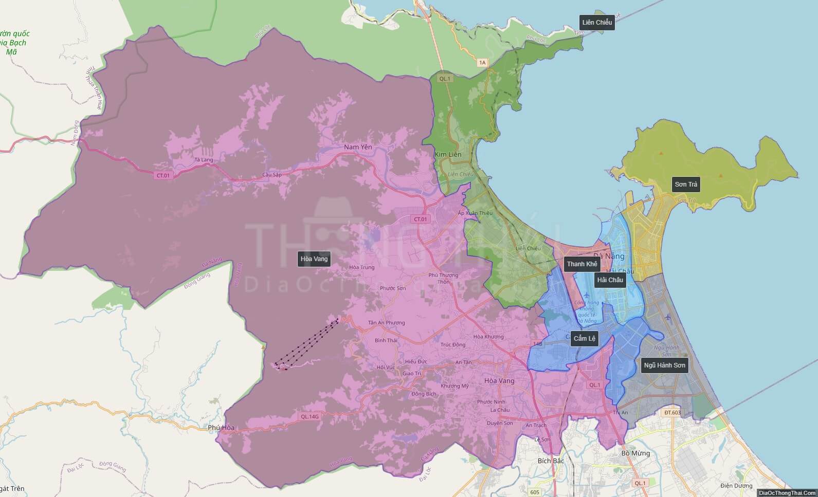
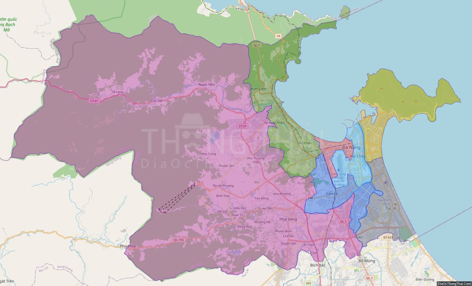
Political Map of Da Nang city
Click on ![]() to view map in "full screen" mode.
to view map in "full screen" mode.
Base Map Layer: Open Street Map (OSM), Arcgisonline, Google Map, Wmflabs.
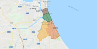
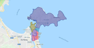
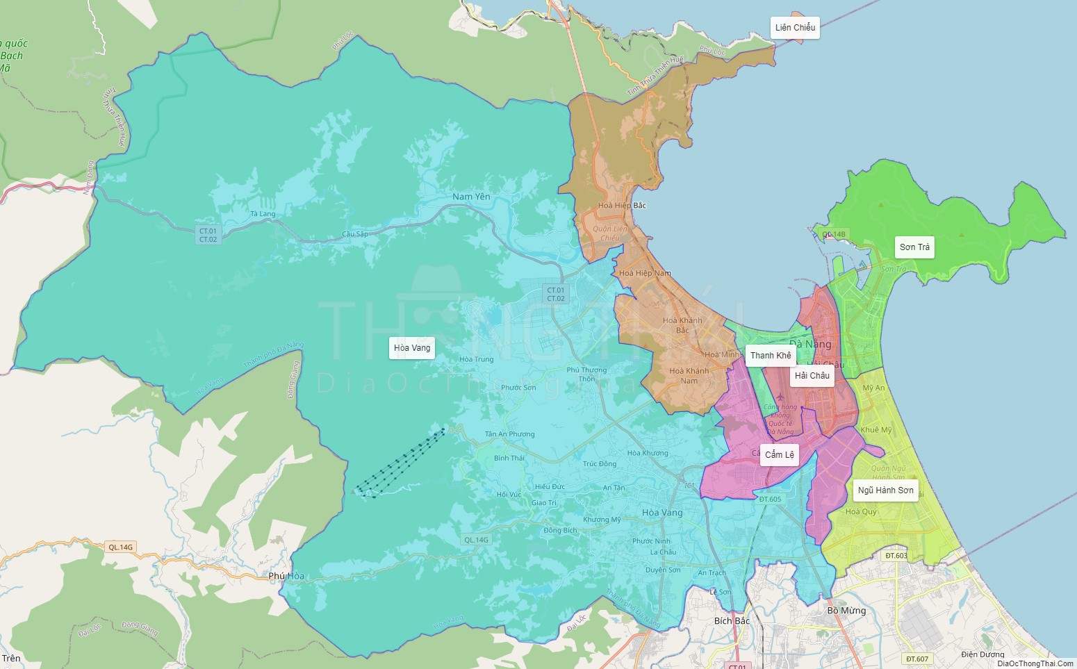
Large scale maps of Da Nang city
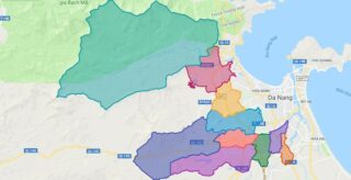
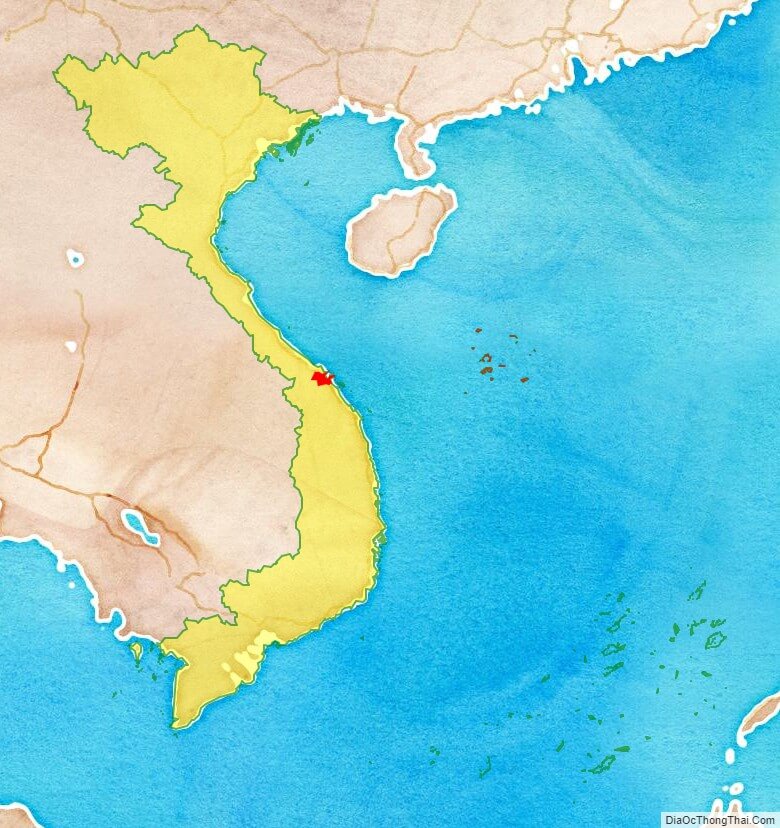
Da Nang city location map
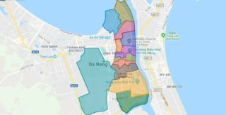
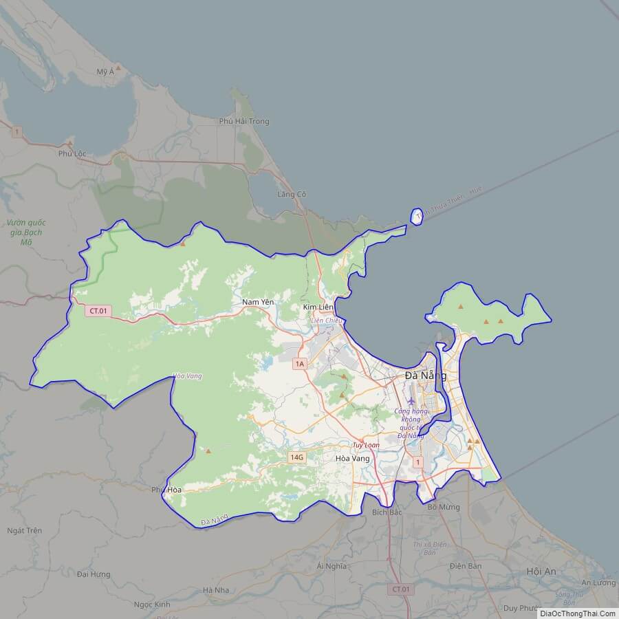
Da Nang city street map
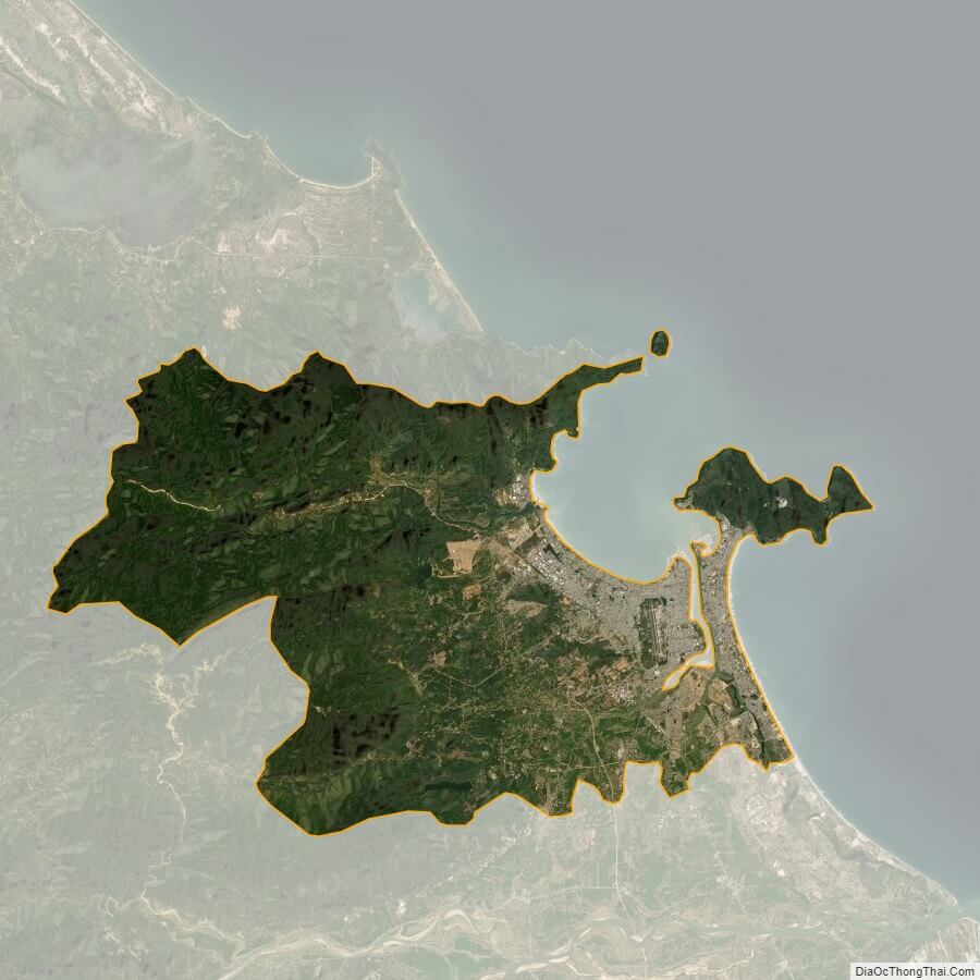
Da Nang city satellite map