North America, a vast and diverse continent, is home to a rich tapestry of cultures, landscapes, and ecosystems. Spanning from the frozen tundra of the Arctic to the tropical beaches of the Caribbean, this continent encompasses 23 countries and numerous territories. Known for its economic powerhouses like the United States and Canada, as well as the vibrant cultures of Mexico and Central America, North America plays a crucial role in global affairs. This article explores the geography, political divisions, and unique characteristics of this fascinating continent, providing a comprehensive overview through a collection of detailed maps and insightful information.
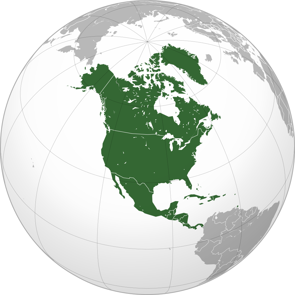
Location Map
North America, like South America, is entirely in the Western Hemisphere, separated from Europe and Africa by the Atlantic Ocean, and from Asia and Oceania by the vast Pacific Ocean.
North America is the third-largest continent in the world with an area of 21,346,000 km² (824,714 mi²), and an estimated population of about 380 million people.
North America, like the Americas in general, is also called the “New World”, as humanity only became aware of this continent after Christopher Columbus discovered it at the end of the 15th century. Although Columbus is considered the first to discover North America, in fact, many indigenous people (Native Americans) had been living here long before.
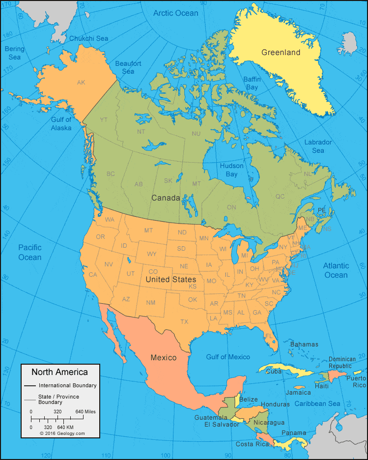
Most people mistakenly think that Mexico belongs to South America. In fact, besides the United States and Canada, North America also includes Mexico and many other countries. However, there is still much debate about how to determine the boundary between North and South America.
- The first view uses the border between Colombia and Panama as the boundary between North and South America. With this calculation, all of Panama belongs to South America.
- However, some geologists believe that the southernmost point of North America is the Isthmus of Tehuantepec, Mexico; from here, Central America stretches southeast towards South America.
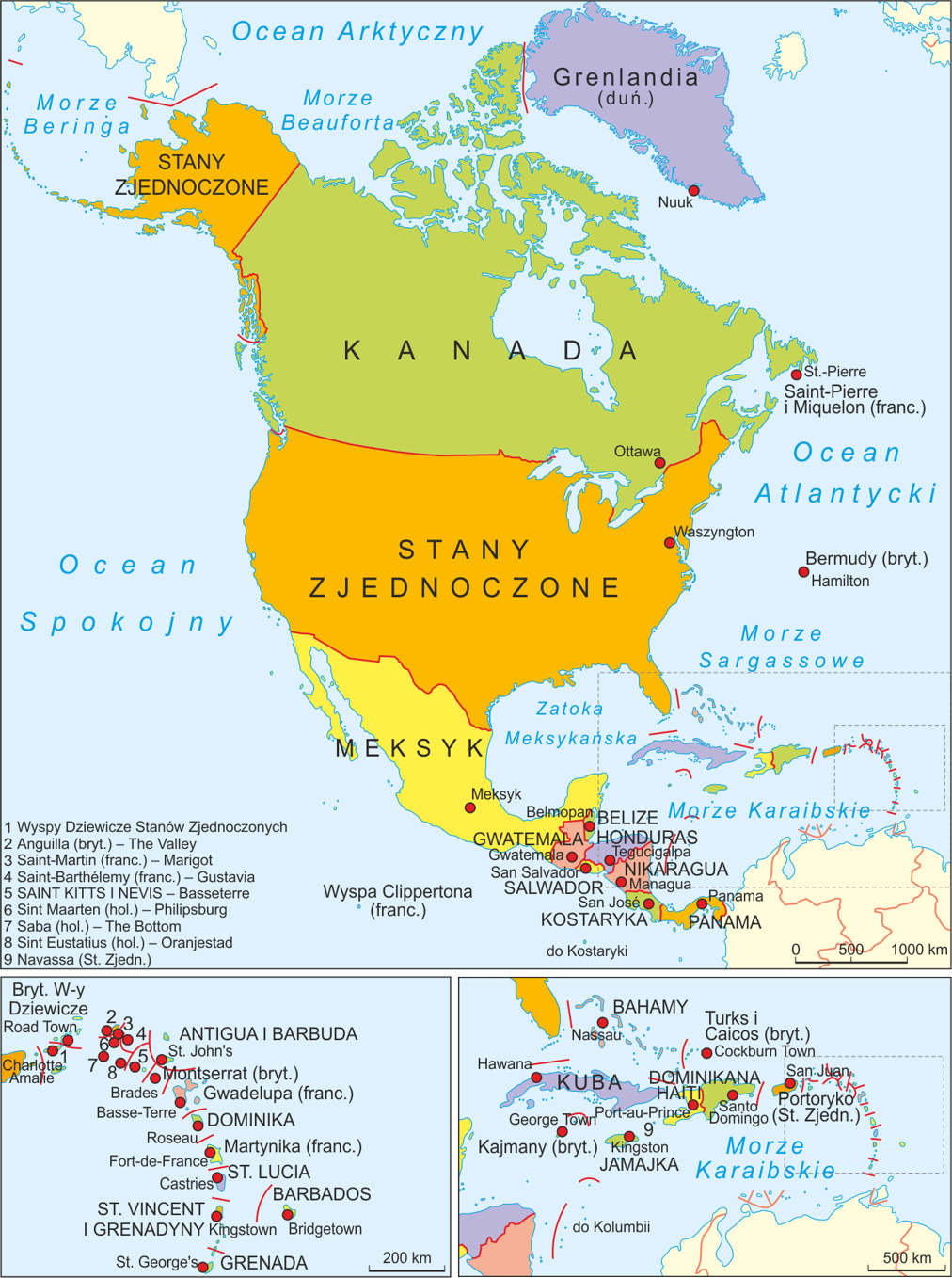
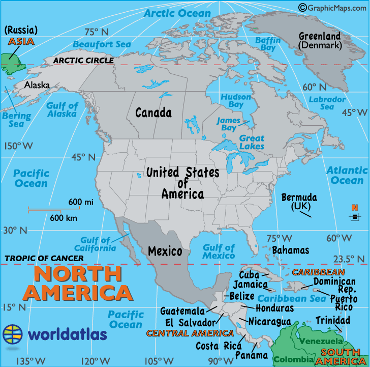
- According to the official United Nations definition, “North America” includes three regions: North America, Central America, and the Caribbean. See the illustration below.
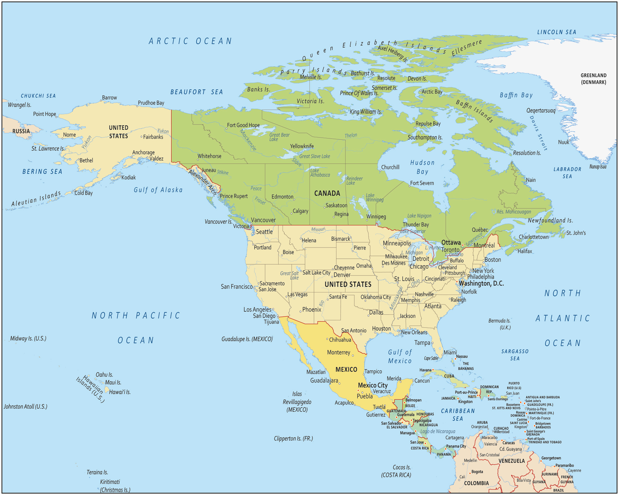
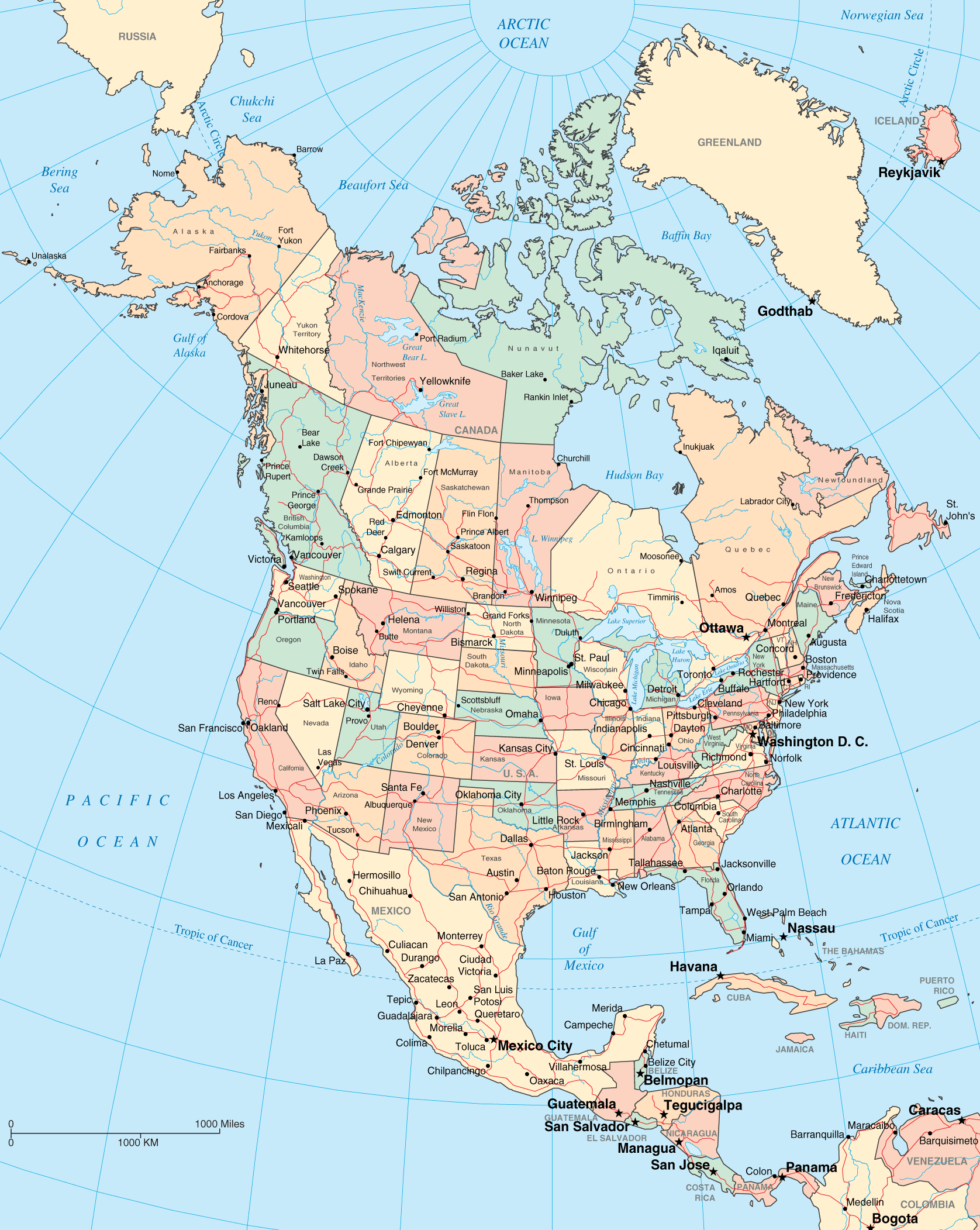
List of North American Countries
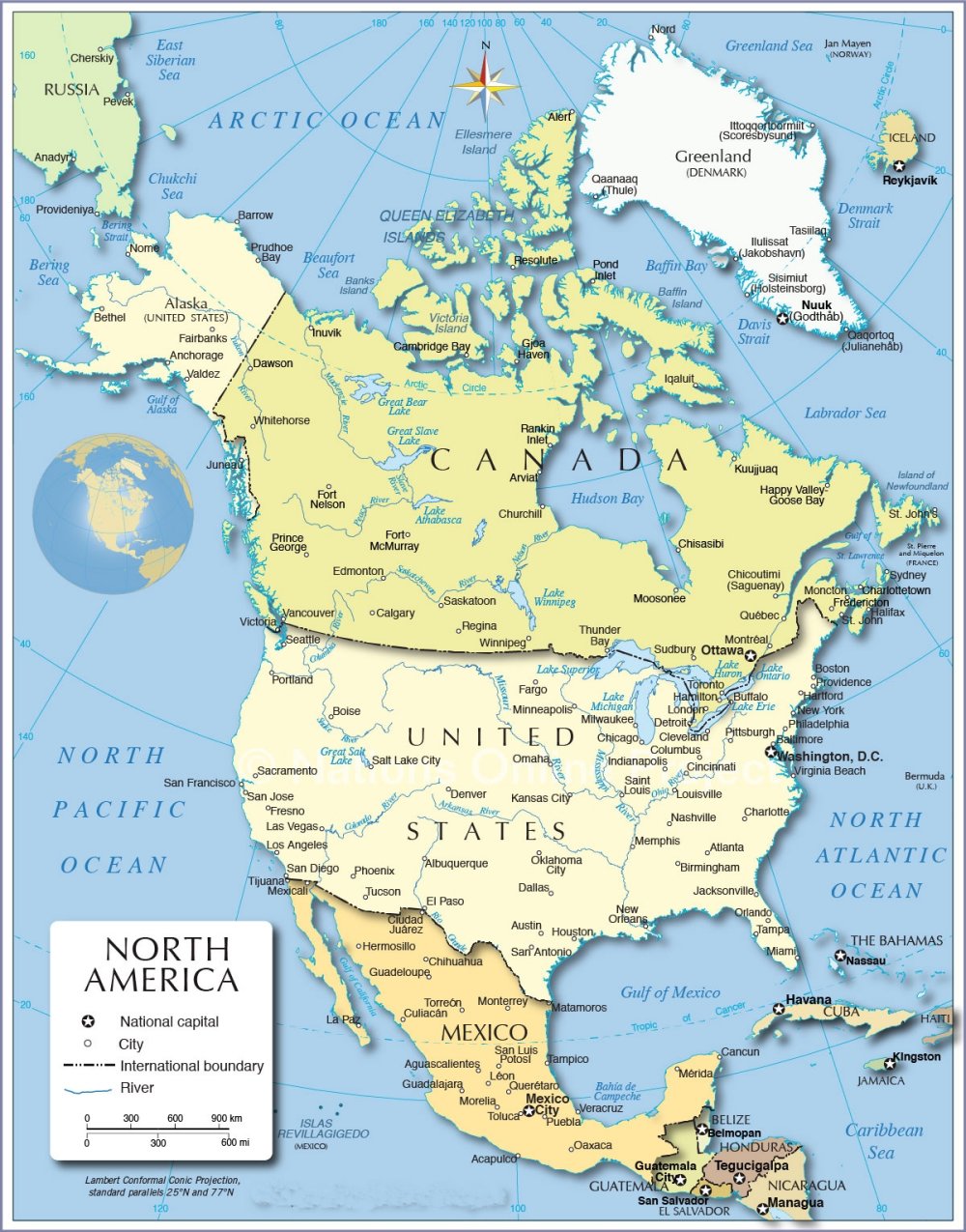
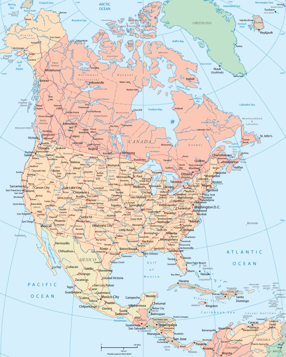
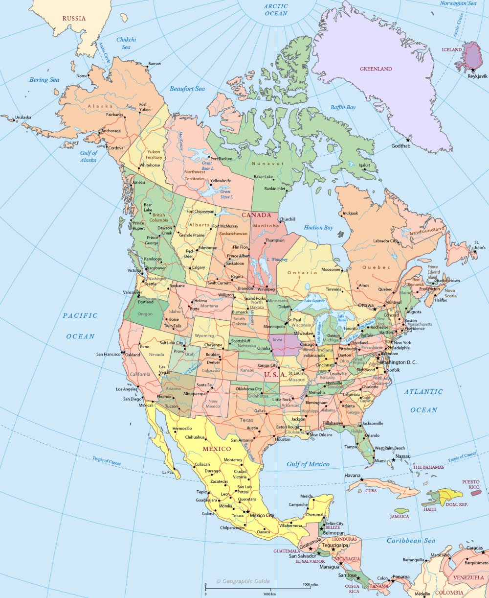
Political Map
Below is a compilation of political maps of North American countries for easy reference. The selected maps are all high-quality, high-resolution maps. The maps you see directly on the web may have been reduced in size to increase page loading speed. To download the original image file, you can click on the Download button below each image.

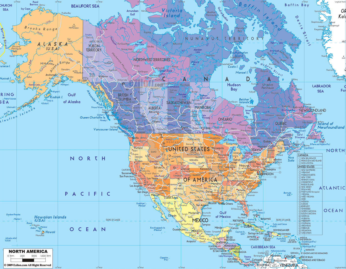

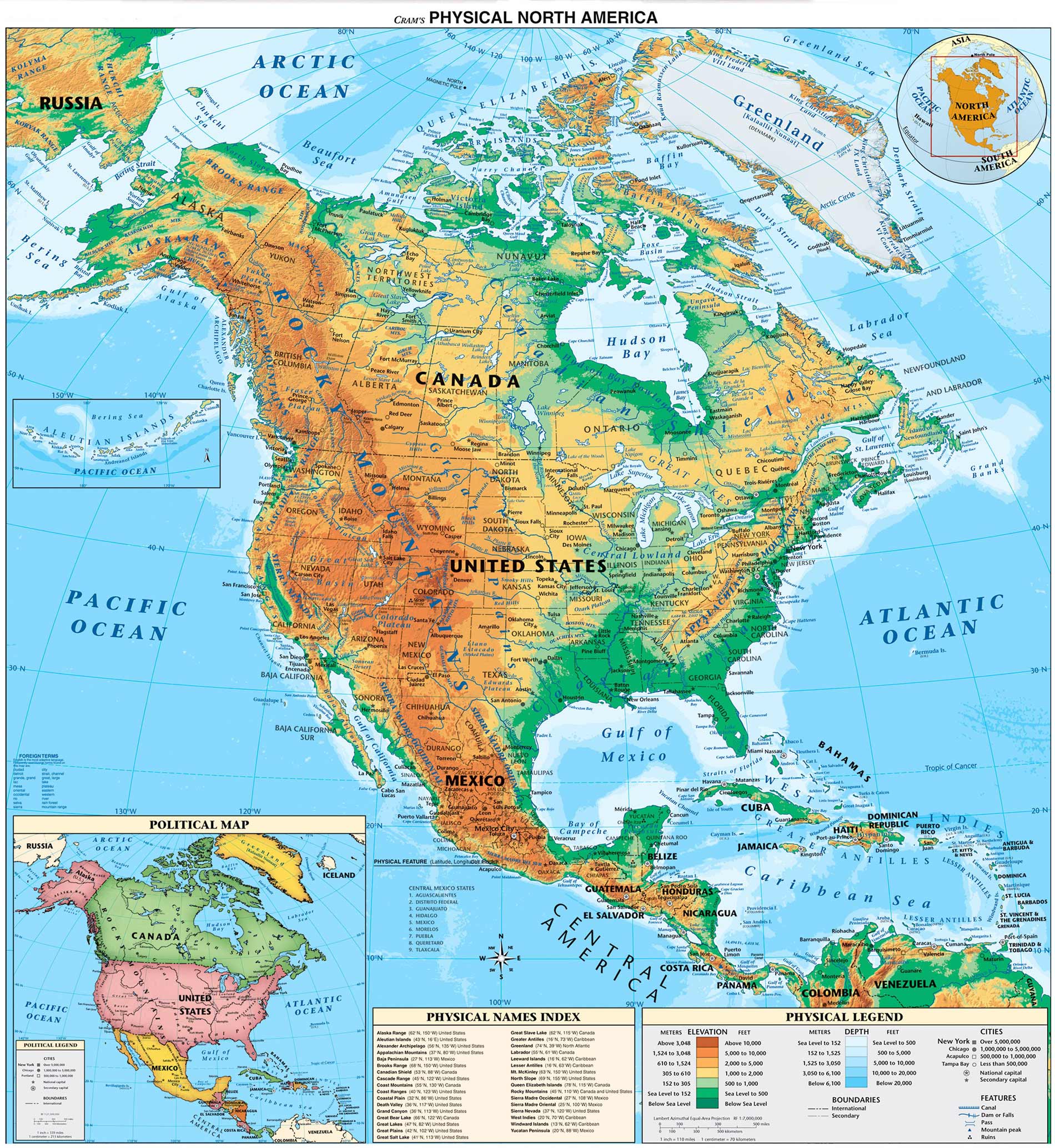
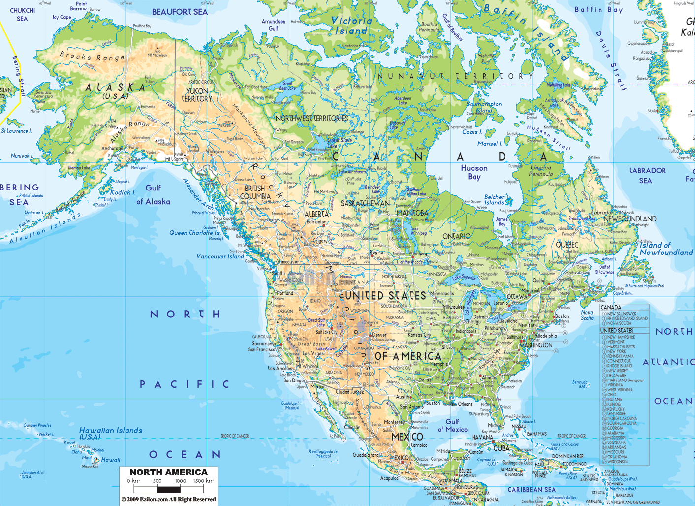
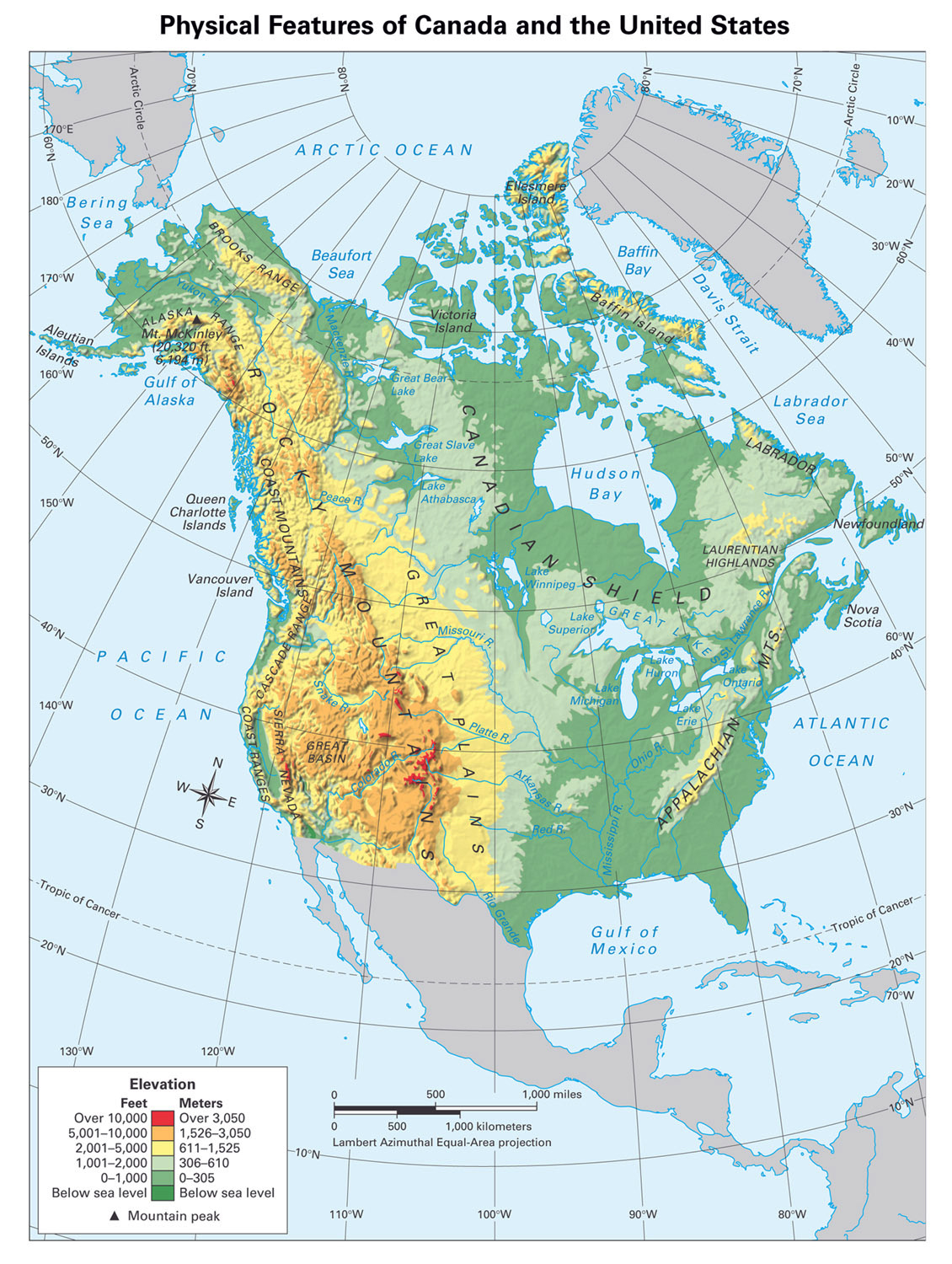
Physical Map
To understand more about the physical geography of North America, you can refer to the physical maps below. You can easily distinguish between plains and mountain ranges with a physical map. You can also see some major rivers on this map.
See more
- Saint Kitts & Nevis
- Saint Lucia
- Samoa
- San Marino
- São Tomé & Príncipe
- Saudi Arabia
- Senegal
- Serbia
- Seychelles
- Sierra Leone
- Singapore
- Slovakia
- Slovenia
- Solomon Islands
- Somalia
- South Africa
- South Korea
- South Sudan
- Spain
- Sri Lanka
- Saint Vincent & the Grenadines
- Sudan
- Suriname
- Sweden
- Switzerland
- Syria
- Saint Helena
- Saint Barthélemy
- Saint Martin
- Saint Pierre and Miquelon
- Somaliland