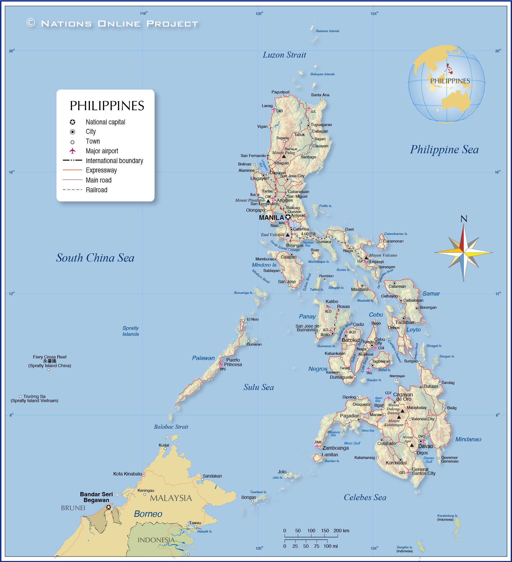
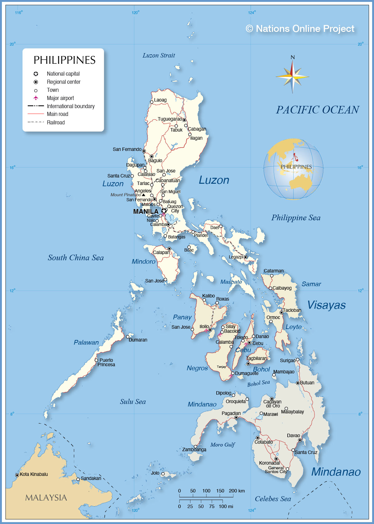
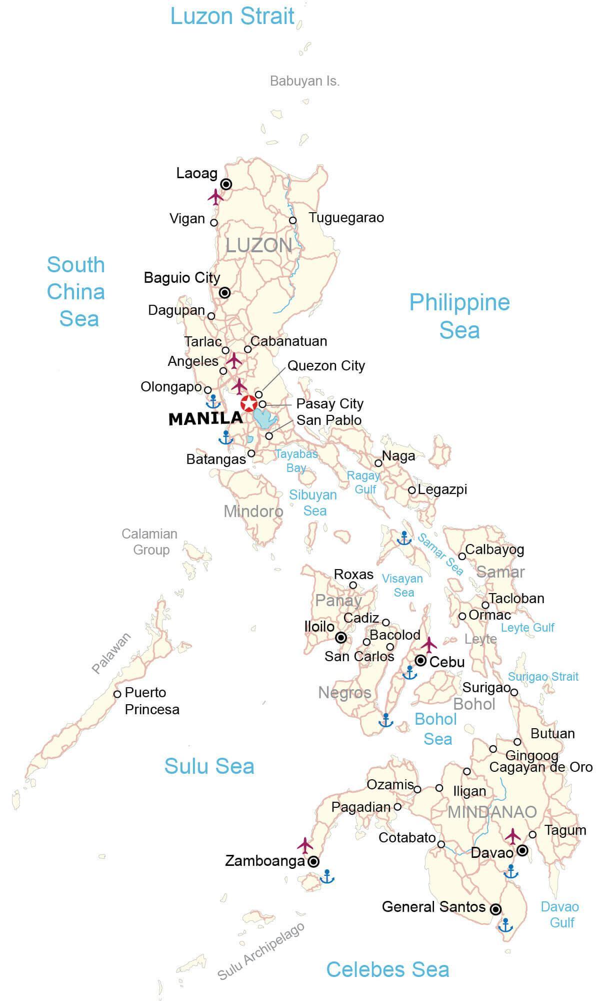
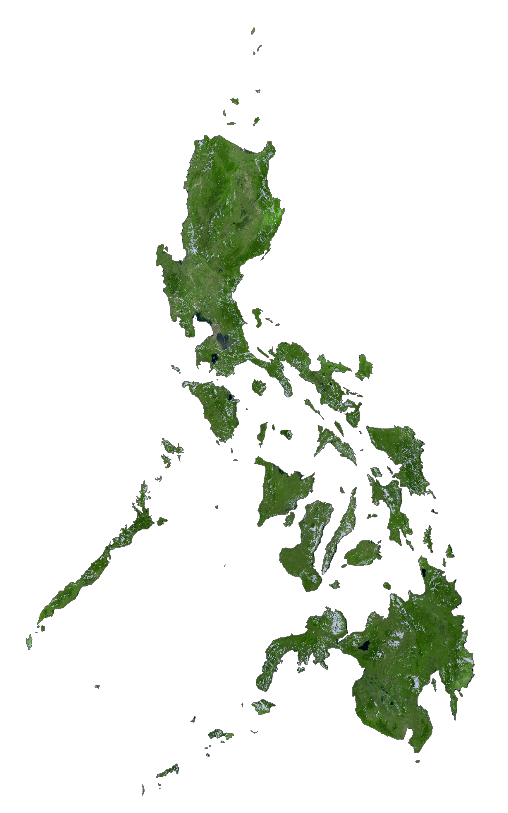
Covering a total land area of 300,000 sq. km, the Philippines is an archipelagic nation located in Southeast Asia.
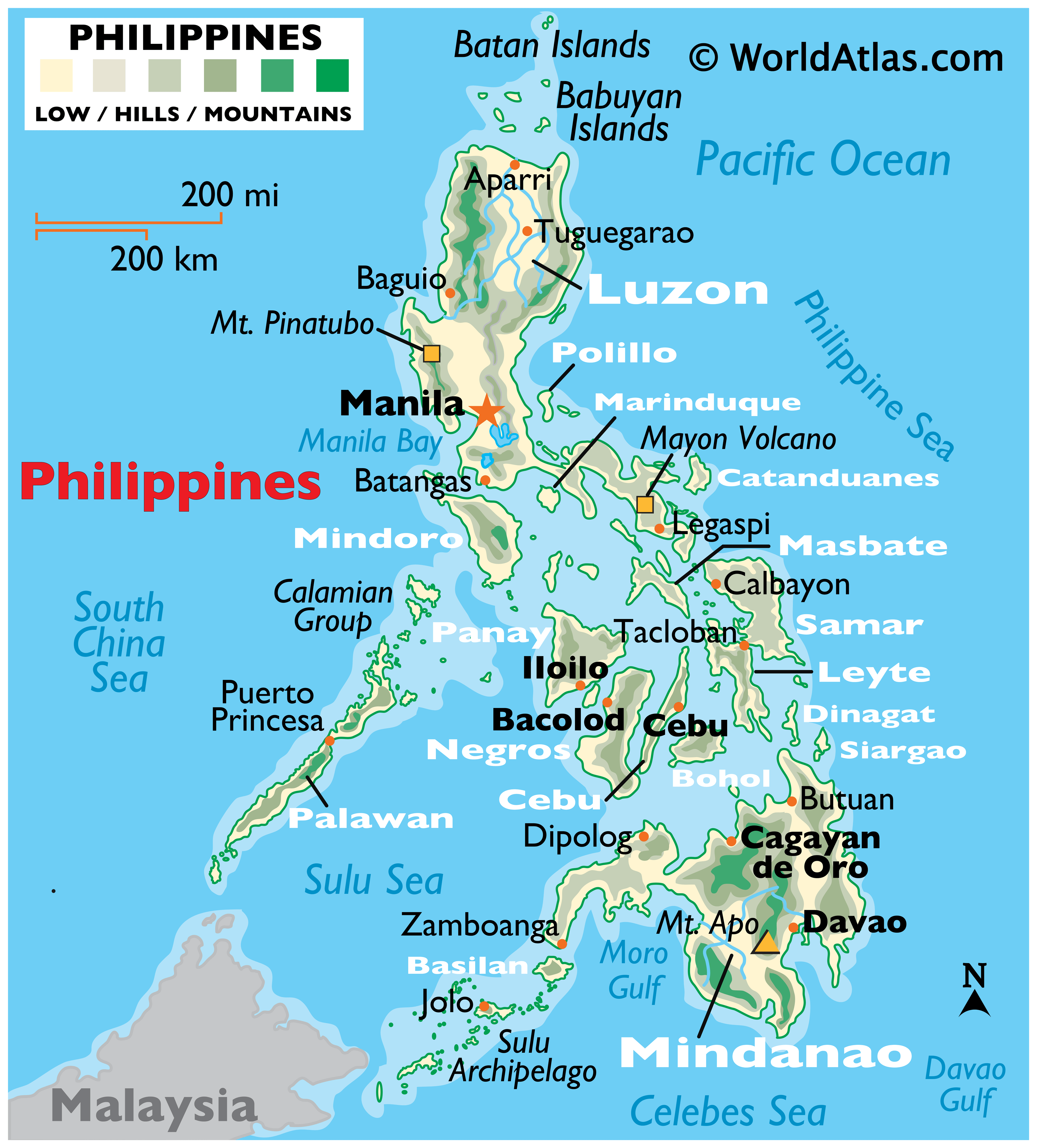
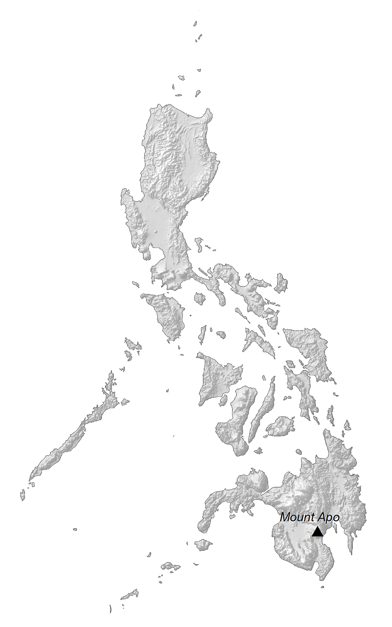
As observed on the map, the three major islands of the country include Luzon, Mindanao, and the Visayas. The country has a coastline of some 36,290km, making it the world’s 5th longest coastline. The most prominent mountain range, the Cordillera Central – is located on the island of Luzon. The Sierra Madre Mountains, also located in Luzon, is the country’s longest mountain range. It merges with the Cordillera Central to form the Caraballo Mountains in the north-central part of Luzon. Located in the southeastern part of Luzon Island is the Mayon Volcano, which rises to an elevation of 8,077ft (2,462m). Situated in the Mindanao island is the country’s highest point – Mount Apo, which rises to an elevation of 9,692ft (2,954m). At a depth of 34,580ft (10,540m), the Galathea Depth of the Philippine Sea is the country’s deepest point as well as the world’s 3rd deepest point. The major rivers of the Philippines include Agno, Cagayan, Pampanga, Pasig, Bicol, Mindanao, and Agusan rivers. The Laguna de Bay with an area of 922 sq. km is the country’s largest lake. The lowest point in the country is the Philippine Sea and the South China Sea at 0ft.
| Flag: |  |
|---|---|
| Legal Name: | Republic of the Philippines |
| Capital Value: | Manila |
| Official languages: |
|
| Demonym(s): | Filipino (masculine and neutral) Filipina (feminine) Pinoy (used for certain common nouns) |
| Government: | Unitary presidential republic |
| Legislature: | Congress |
| Total Area: | 300,000 km² |
| Land Area: | 298,170 km² |
| Water Area: | 1,830 km² |
| Population: | 108,116,615 |
| Density: | 336/km (870.2/sq mi) (37th) |
| GDP: | $376.80 Billion |
| GDP Per Capita: | $3,485.08 |
| Currency Value: | Philippine pesos (PHP) |
| Driving side: | right |
| Calling code: | +63 |
| Internet TLD: | .ph |
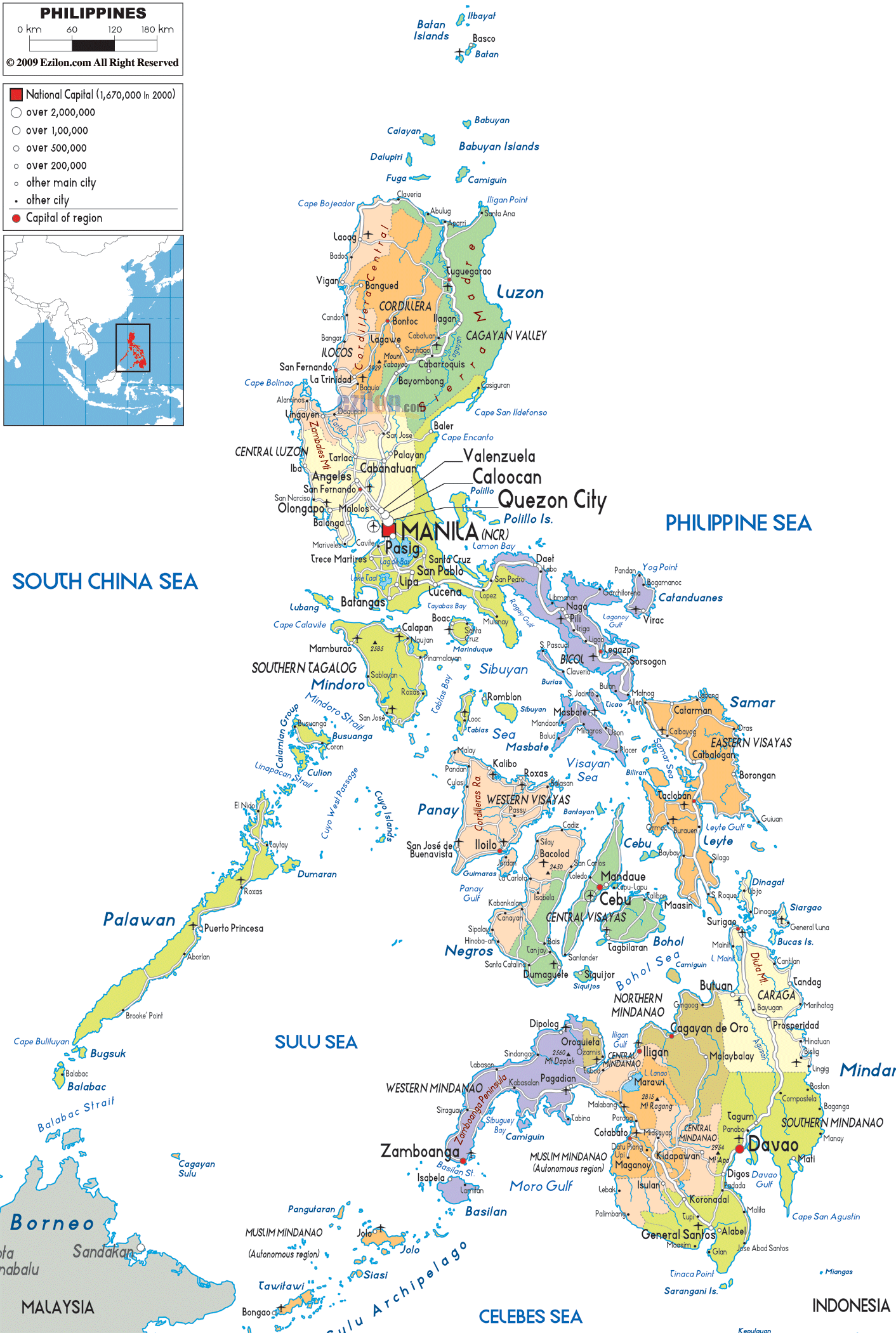
Explore the rugged terrain and topography of the Philippines with this map. It contains cities, towns, roads, gulfs, seas, and islands, all shown with satellite imagery and an elevation map. Get an amazing view of the country with this interactive map!
Online Interactive Political Map
Click on ![]() to view map in "full screen" mode.
to view map in "full screen" mode.
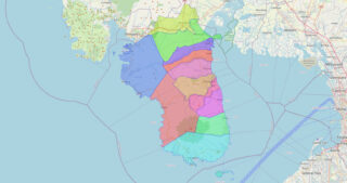
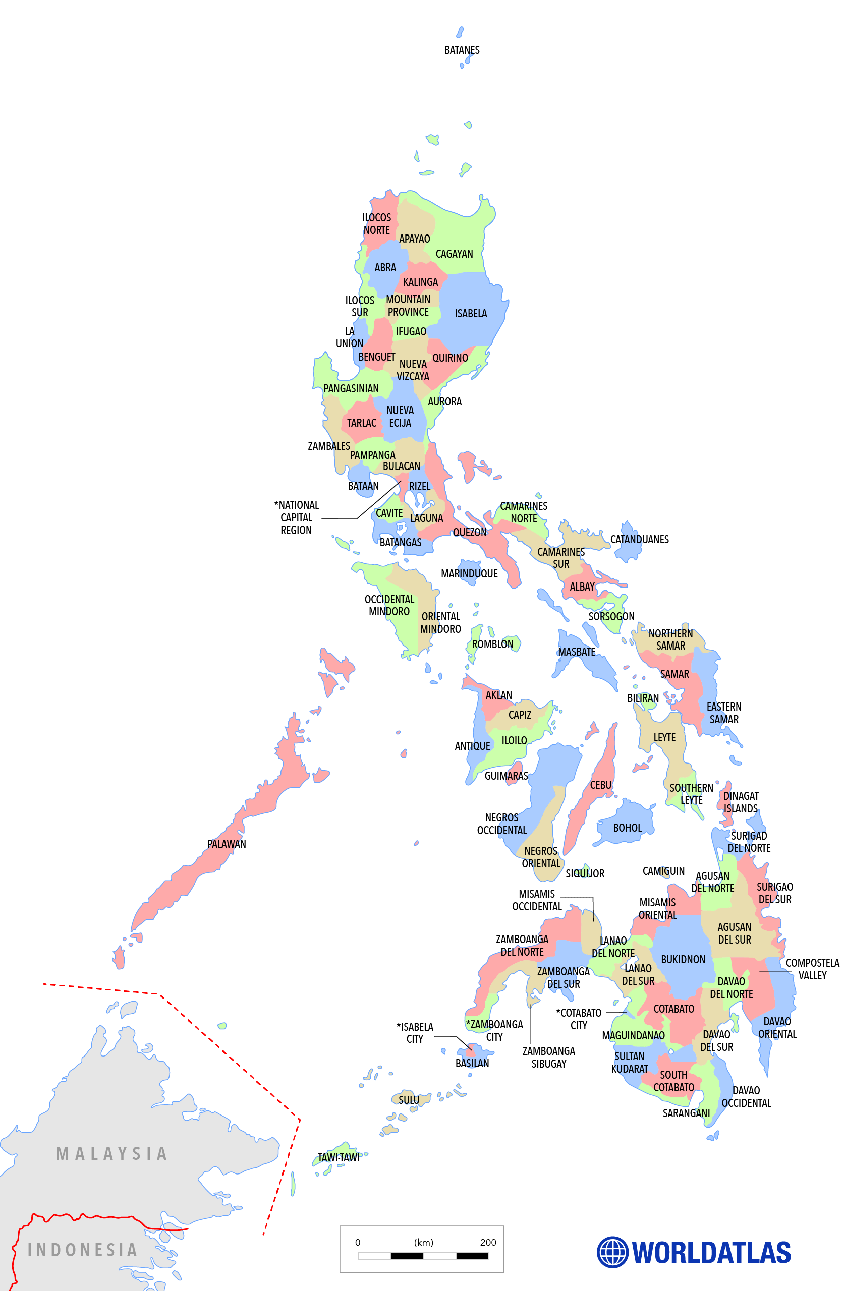
Philippines (officially, The Republic of Philippines) is administratively divided into 17 regions, 81 provinces, 146 cities, 1,488 municipalities, and 42,036 barangays.
The 81 provinces in alphabetical order are: Abra, Agusan del Norte, Agusan del Sur, Aklan, Albay, Antique, Apayao, Aurora, Basilan, Bataan, Batanes, Batangas, Biliran, Benguet, Bohol, Bukidnon, Bulacan, Cagayan, Camarines Norte, Camarines Sur, Camiguin, Capiz, Catanduanes, Cavite, Cebu, Compostela, Cotabato, Davao del Norte, Davao del Sur, Davao Occidental, Davao Oriental, Dinagat Islands, Eastern Samar, Guimaras, Ifugao, Ilocos Norte, Ilocos Sur, Iloilo, Isabela, Kalinga, Laguna, Lanao del Norte, Lanao del Sur, La Union, Leyte, Maguindanao, Marinduque, Masbate, Mindoro Occidental, Mindoro Oriental, Misamis Occidental, Misamis Oriental, Mountain, Negros Occidental, Negros Oriental, Northern Samar, Nueva Ecija, Nueva Vizcaya, Palawan, Pampanga, Pangasinan, Quezon, Quirino, Rizal, Romblon, Samar, Sarangani, Siquijor, Sorsogon, South Cotabato, Southern Leyte, Sultan Kudarat, Sulu, Surigao del Norte, Surigao del Sur, Tarlac, Tawi-Tawi, Zambales, Zamboanga del Norte, Zamboanga del Sur, Zamboanga Sibugay;
Covering a total land area of 300,000 sq. km, the Philippines is an archipelagic nation located in Southeast Asia. Situated in the southwestern part of Luzon Island, along the eastern coast of Manila Bay is Manila – the capital city of the Philippines. It serves as the major administrative, political, social, cultural, and economic center of the country. Located at the heart of Luzon island, to the northeast of Manila is Quezon City – the largest and the most populous city of the Philippines. Both Manila and Quezon City are a part of Metro Manila, which is the National Capital Region of the Philippines. Metro Manila serves as the seat of the government of the Philippines.
Location Maps
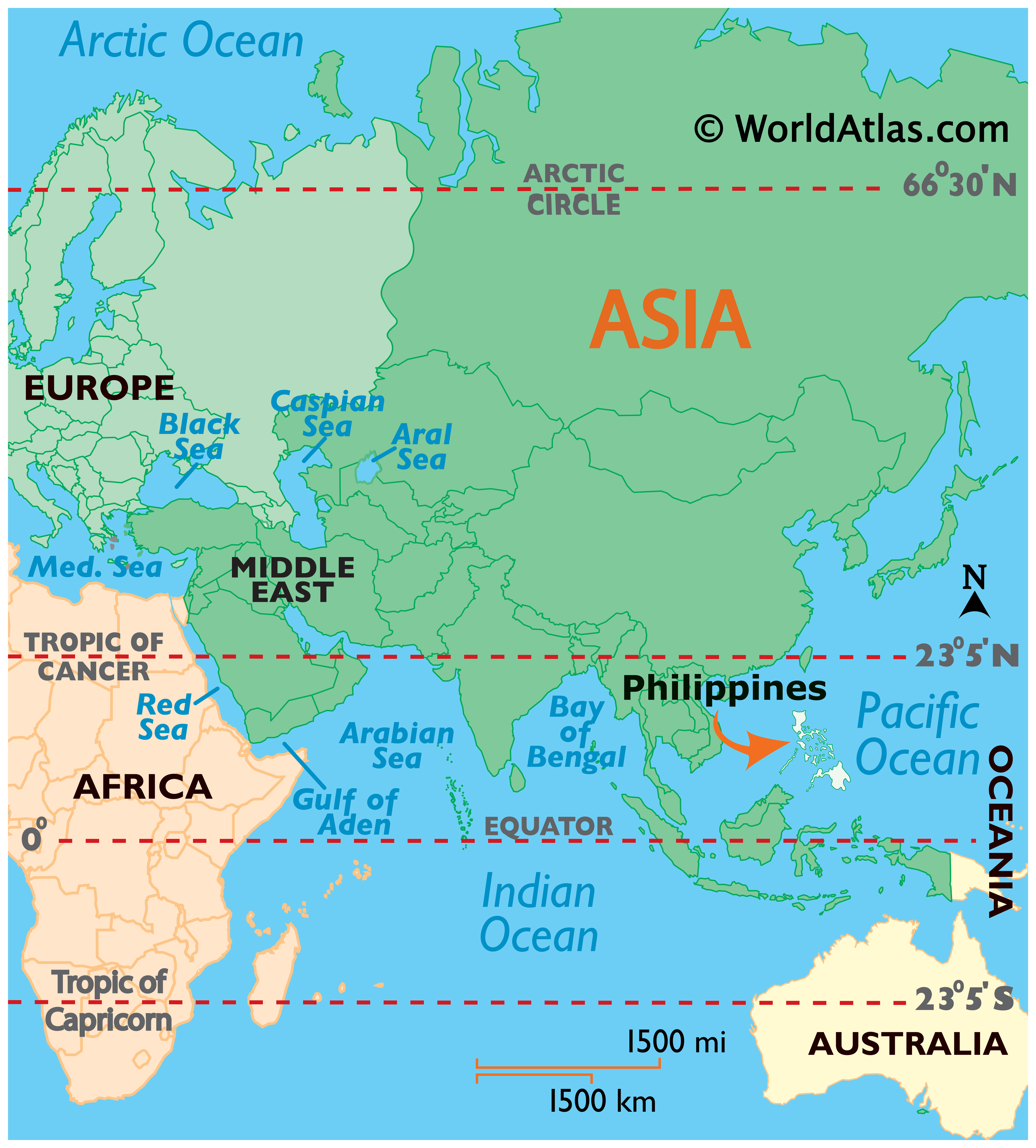
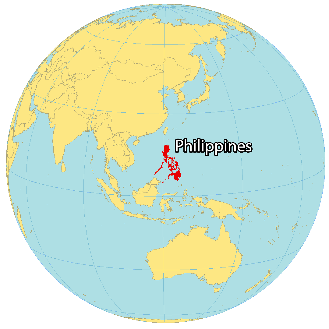
Where is Philippines?
The Philippines is composed of 7,640 islands in the Pacific Ocean, making it the 8th country with the most islands. Its three main regions are Luzon, Visayas, and Mindanao.
The Philippines is situated near Malaysia to the southwest, Vietnam to the west, Hong Kong to the northwest, Taiwan to the north, and Indonesia to the south. It is bordered by the South China Sea to the west, the Philippines Sea to the east, and the Celebes Sea to the south.
Manila is the capital city of the Philippines, while its largest city is Quezon City.

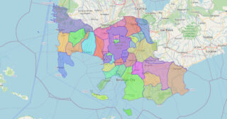
High Definition Political Map of Philippines
History
The Philippines is an archipelagic country in Southeast Asia, with a rich and diverse history that spans thousands of years. The first known inhabitants of the Philippines were the Negrito people, who arrived from Africa around 30,000 years ago. Over time, various ethnic groups, including the Austronesians, Malayans, and Chinese, settled in the region.
In the 16th century, the Philippines was colonized by Spain, which ruled the country for over 300 years. During this period, the Spanish authorities imposed their own culture, language, and religion on the indigenous population, and worked to suppress local customs and traditions.
In 1898, the Philippines declared independence from Spain, but soon came under the control of the United States, which had defeated Spain in the Spanish-American War. The US ruled the Philippines for over 40 years, until the country gained independence in 1946.
After independence, the Philippines became a democracy, but the country was also marked by political instability, corruption, and economic challenges. The country has also faced various natural disasters, including typhoons, earthquakes, and volcanic eruptions.
Despite these challenges, the Philippines has made significant progress in recent years, with a growing economy and a vibrant cultural scene. The country is known for its rich history, diverse cuisine, and beautiful natural landscapes, including its many beaches and tropical islands.
The Philippines is also home to a vibrant and diverse population, with over 100 different ethnic groups and languages spoken throughout the country. There is hope that the Philippines can continue to build a brighter future for its people, while also preserving its rich cultural heritage and natural beauty.
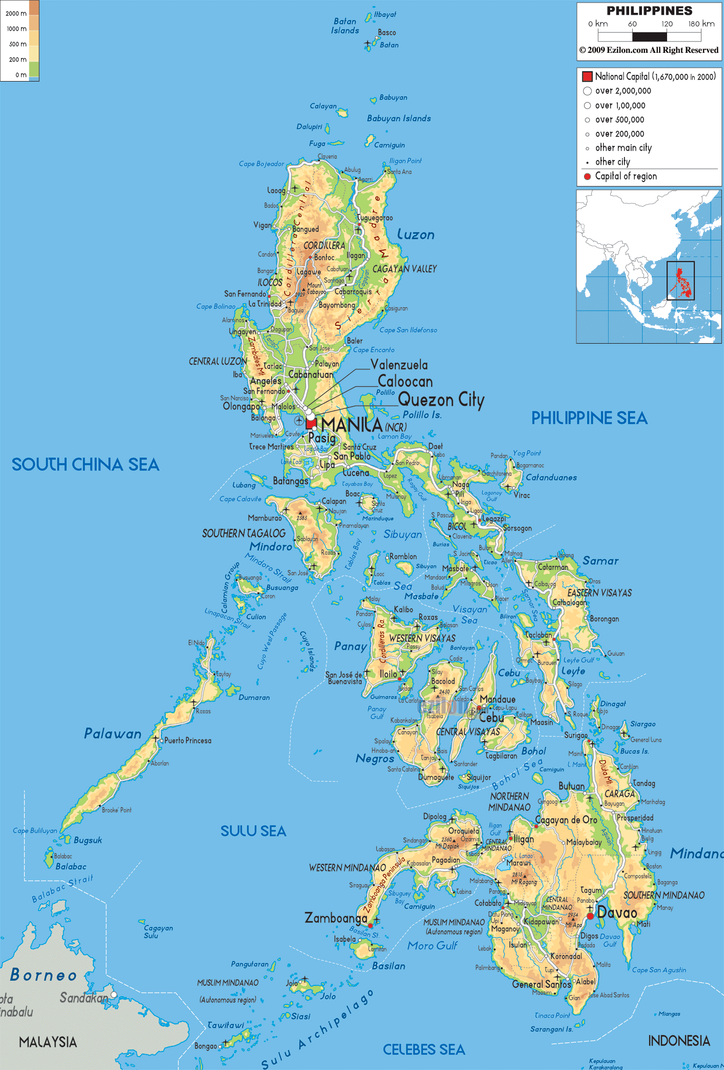
Physical Map of Philippines
Philippines Satellite Map
Elevation Map
Other Maps