San Diego (Spanish for ‘Saint Didacus’; /ˌsæn diˈeɪɡoʊ/ SAN dee-AY-goh, Spanish: [san ˈdjeɣo]) is a city on the Pacific Ocean coast of Southern California located immediately adjacent to the Mexico–United States border. With a 2020 population of 1,386,932, it is the eighth-most populous city in the United States, the second-most populous in California and the seat of San Diego County, the fifth-most populous county in the United States, with 3,286,069 estimated residents as of 2021. The city is known for its mild year-round Mediterranean climate, natural deep-water harbor, extensive beaches and parks, long association with the United States Navy, and recent emergence as a healthcare and biotechnology development center. San Diego is the second largest city in the state of California after Los Angeles.
Historically home to the Kumeyaay Native Americans, San Diego has been referred to as the Birthplace of California, since it was the first site visited and settled by Europeans on what is now the U.S. West Coast. Upon landing in San Diego Bay in 1542, Juan Rodríguez Cabrillo claimed the area for Spain, forming the basis for the settlement of Alta California 200 years later. The Presidio and Mission San Diego de Alcalá, founded in 1769, formed the first European settlement in what is now California. In 1821, San Diego became part of the newly declared Mexican Empire, which reformed as the First Mexican Republic two years later. California was conquered by the U.S. in 1848 following the Mexican–American War and was admitted to the union as a state in 1850.
San Diego’s main economic engines are military and defense-related activities, tourism, international trade, research, and manufacturing. The city is the economic center of the San Diego–Tijuana conurbation, the second-most populous transborder metropolitan area in the Western Hemisphere (after Detroit–Windsor), home to an estimated 4,922,723 people as of 2012. The primary border crossing between San Diego and Tijuana, the San Ysidro Port of Entry, is the busiest international land border crossing in the world outside of Asia (fourth-busiest overall). The city’s airport, San Diego International Airport, is the busiest single-runway airport in the world.
| Name: | San Diego city |
|---|---|
| LSAD Code: | 25 |
| LSAD Description: | city (suffix) |
| State: | California |
| County: | San Diego County |
| Incorporated: | March 27, 1850 |
| Elevation: | 62 ft (19 m) |
| Total Area: | 372.42 sq mi (964.56 km²) |
| Land Area: | 325.88 sq mi (844.02 km²) |
| Water Area: | 46.54 sq mi (120.54 km²) 12.68% |
| Total Population: | 1,386,932 |
| Population Density: | 4,255.96/sq mi (1,643.25/km²) |
| FIPS code: | 0666000 |
| Website: | www.sandiego.gov |
Our collection of San Diego maps will help you explore this city and all its attractions. With these maps, you can find everything from beaches to parks, restaurants, and more.
Discover the beauty of San Diego with our San Diego map collection. From highways to points of interest, these maps will help you explore this amazing city.
San Diego is an incredible city to visit and explore. Our San Diego map collection will help you uncover it all – from highways and roads to things to do and more. Nicknamed “America’s Finest City”, San Diego is full of culture, history, and natural beauty. From its beaches to its museums and shopping districts, San Diego has something to offer everyone. With our maps, you can find everything from beaches to parks, restaurants, and more. So explore this amazing coastal city in California and uncover its beauty with our San Diego map collection.
Online Interactive Map
Click on ![]() to view map in "full screen" mode.
to view map in "full screen" mode.
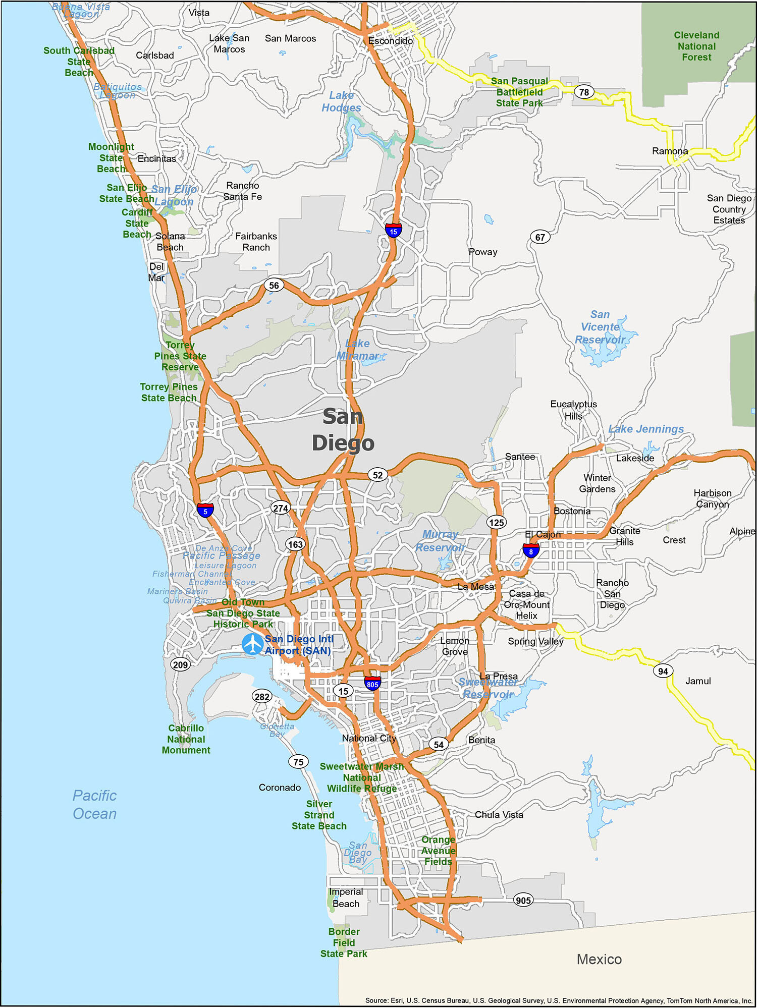
This interactive map is designed to guide you and show you how to get the most out of your time on the road. It lets you explore all of San Diego’s neighborhoods, attractions, and amenities. Whether you want to find the best place to stay, explore, and have fun, this interactive map really helps you get up close and personal with the city. Whether you’re a local or visiting, this map helps you easily navigate the city with multiple points of interest including hotels, restaurants, and parks.
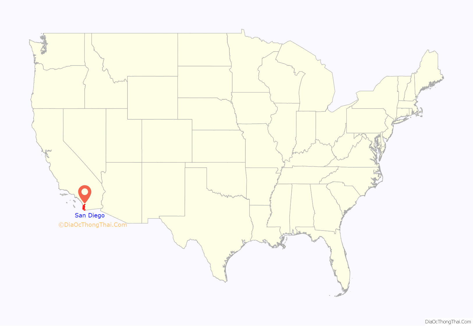
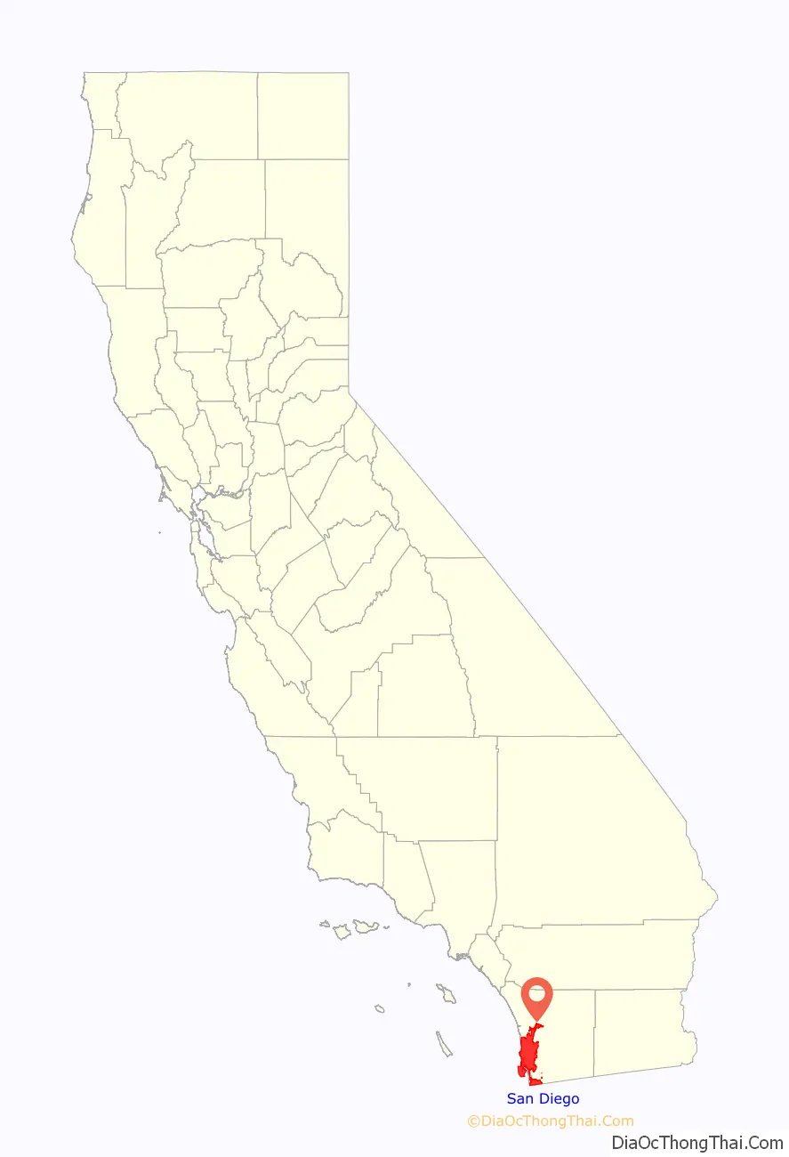
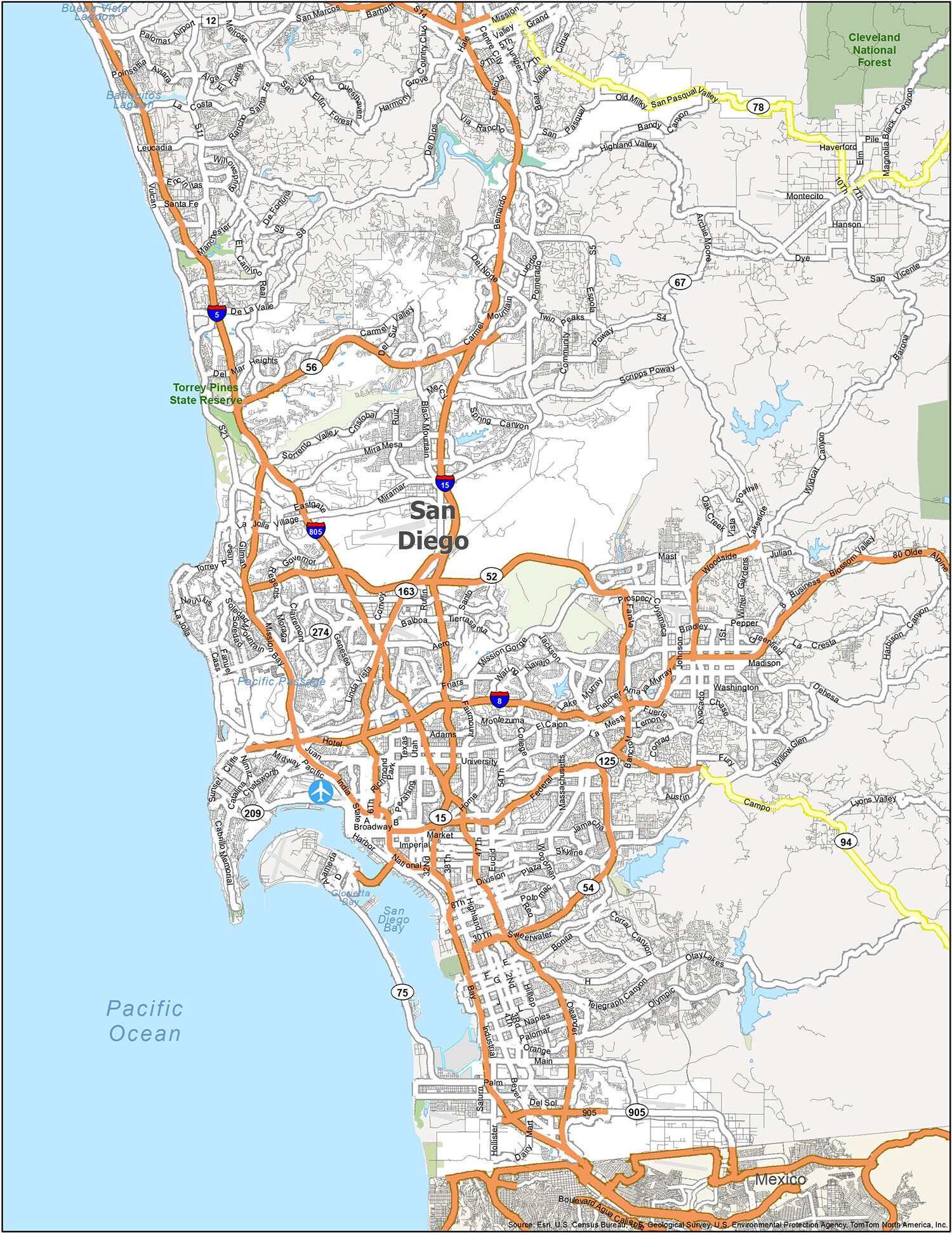
San Diego location map. Where is San Diego city?
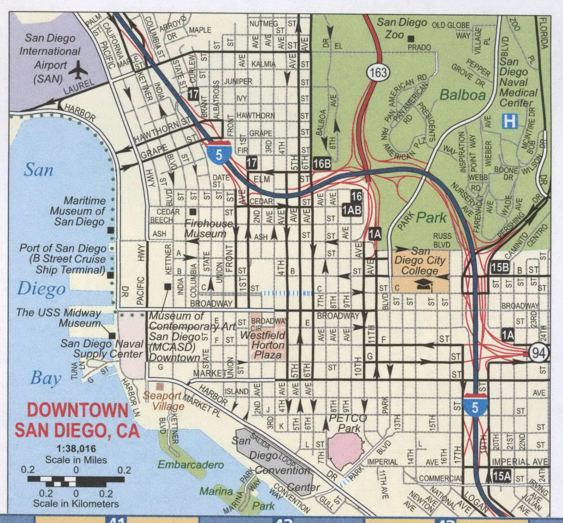
San Diego Road Map
San Diego is a big place, and it’s easy to get lost without a map. This San Diego road map is perfect for finding your way to your favorite landmarks and attractions. Ideal for locals and visitors alike, this San Diego road map is the perfect guide to the city. From main attractions to scenic drives, it’s a time-saving way to get around and discover the best of what this area has to offer. If you plan on getting out of the city, you can find highway information on our California road map.
Interstate Highways in San Diego include I-5, I-8, I-15, and I-805.
US Highways in San Diego include 8, 15, 18, 30, 52, 54, 56, 66, 75, 78, 94, 125, 163, 206, 209, 259, 274, 330, 905, Del Dios Hwy, Hills Pky, Ocean View Hills Pky, and Pacific Hwy.
Expressways/Parkways in San Diego include Bear Valley Pky, Bernardo Heights Pky, Cesar E Chavez Pky, Chollas Pky, La Jolla Pky, Sabre Springs Pky, Scripps Poway Pky, and Valencia Pky.
Major Roads in San Diego include 10th Ave, 11th Ave, 32nd St, Aero Dr, Balboa Ave, Bernardo Dr, Black Mountain Rd, Canon St, Carmel Mountain Rd, Carmel Valley Rd, Catalina Blvd, Cypress Canyon Park Dr, Del Rio, Garnet Ave, Harbor Dr, Kearny Villa Rd, Mira Mesa Blvd, Miramar Rd, Mission Bay Dr, Otay Mesa RdPalm Ave, Point Loma Ave, Pomerado Rd, Rancho Carmel Dr, Rosecrans St, San Pasqual Valley Rd, Santo Rd, Sunset Cliffs Blvd, Talbot St, and Tierrasanta Blvd.
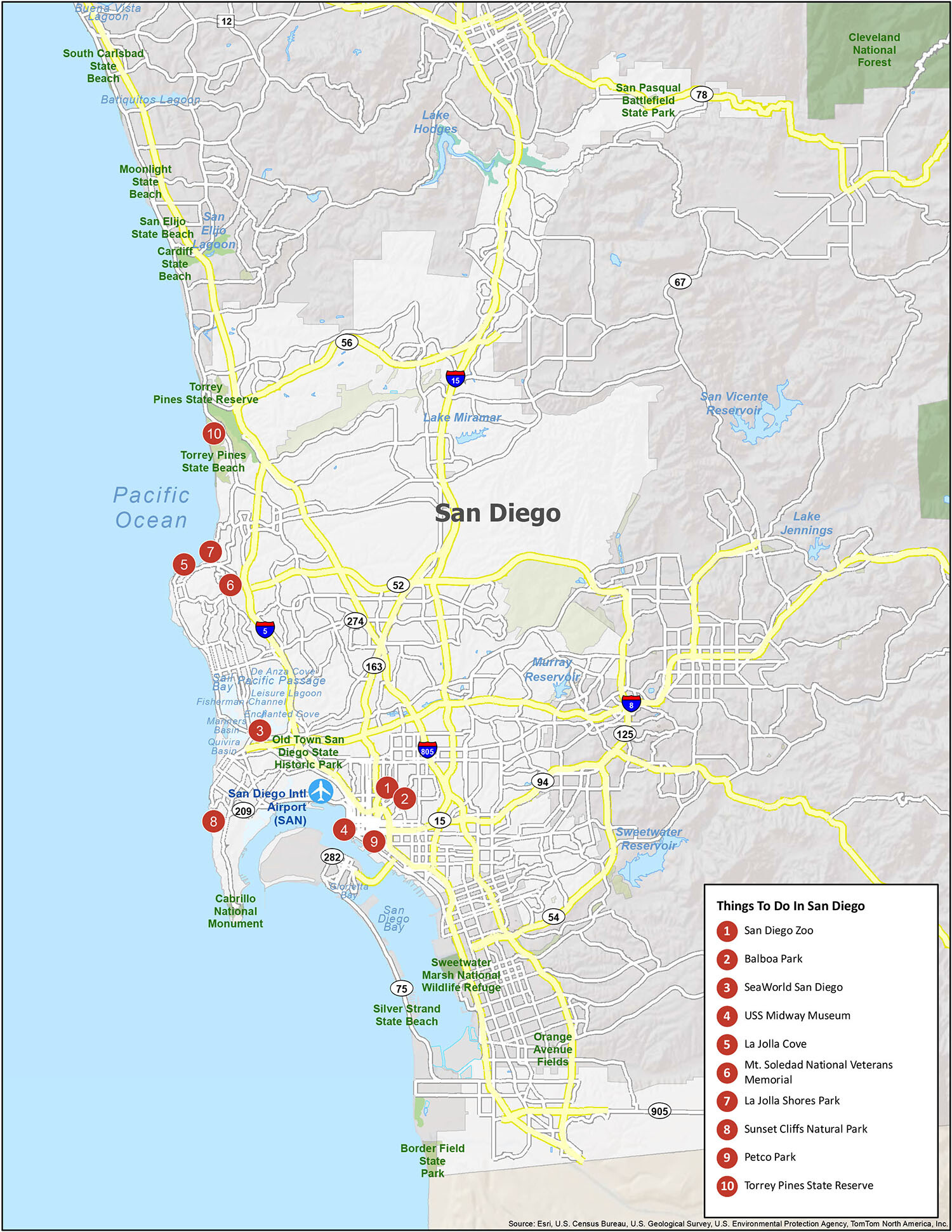
San Diego is a great place to travel. It’s a big city with lots to offer tourists, and there are plenty of things to do in the area if you want to explore it. Explore the San Diego attractions, see which beaches are worth visiting, and discover the best parks in the city. Have all your trips and adventures planned with convenience, including the ability to customize your own map? This reference map has all the things you need to know when exploring the city.
Airports: San Diego International Airport (SAN)
Cities: Carlsbad, Chula Vista, Coronado, Del Mar, El Cajon, Encinitas, Escondido, Imperial Beach, La Mesa, Lemon Grove, National City, Poway, San Diego, San Marcos, Santee, Solana Beach, Vista
Census-designated place (CDP): Alpine, Bonita, Bostonia, Casa de Oro-Mount Helix, Crest, Eucalyptus Hills, Fairbanks Ranch, Granite Hills, Harbison Canyon, Jamul, La Presa, Lake San Marcos, Lakeside, Ramona, Rancho San Diego, Rancho Santa Fe, San Diego Country Estates, Spring Valley, Winter Gardens
10 things to do in San Diego city
This interactive map is designed to guide you and show you how to get the most out of your time on the road. It lets you explore all of San Diego’s neighborhoods, attractions, and amenities. Whether you want to find the best place to stay, explore, and have fun, this interactive map really helps you get up close and personal with the city. Whether you’re a local or visiting, this map helps you easily navigate the city with multiple points of interest including hotels, restaurants, and parks.
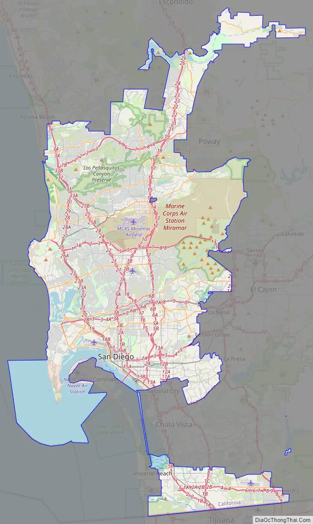
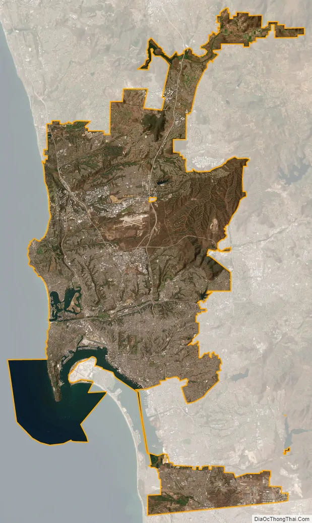
San Diego city Satellite Map
Geography
According to SDSU professor emeritus Monte Marshall, San Diego Bay is “the surface expression of a north-south-trending, nested graben”. The Rose Canyon and Point Loma fault zones are part of the San Andreas Fault system. About 40 miles (64 km) east of the bay are the Laguna Mountains in the Peninsular Ranges, which are part of the backbone of the American continents.
The city lies on approximately 200 deep canyons and hills separating its mesas, creating small pockets of natural open space scattered throughout the city and giving it a hilly geography. Traditionally, San Diegans have built their homes and businesses on the mesas, while leaving the urban canyons relatively wild. Thus, the canyons give parts of the city a segmented feel, creating gaps between otherwise proximate neighborhoods and contributing to a low-density, car-centered environment. The San Diego River runs through the middle of San Diego from east to west, creating a river valley that serves to divide the city into northern and southern segments. During the historic period and presumably earlier as well, the river has shifted its flow back and forth between San Diego Bay and Mission Bay, and its fresh water was the focus of the earliest Spanish explorers. Miguel Costansó, a cartographer, wrote in 1769, “When asked by signs where the watering-place was, the Indians pointed to a grove which could be seen at a considerable distance to the northeast, giving to understand that a river or creek flowed through it, and that they would lead our men to it if they would follow.” That river was the San Diego River. Several reservoirs and Mission Trails Regional Park also lie between and separate developed areas of the city.
Notable peaks within the city limits include Cowles Mountain, the highest point in the city at 1,591 feet (485 m); Black Mountain at 1,558 feet (475 m); and Mount Soledad at 824 feet (251 m). The Cuyamaca Mountains and Laguna Mountains rise to the east of the city, and beyond the mountains are desert areas. The Cleveland National Forest is a half-hour drive from downtown San Diego. Numerous farms are found in the valleys northeast and southeast of the city.
In its 2013 ParkScore ranking, The Trust for Public Land reported that San Diego had the 9th-best park system among the 50 most populous U.S. cities. ParkScore ranks city park systems by a formula that analyzes acreage, access, and service and investment.
Climate
San Diego has one of the top-ten best climates in the United States, according to the Farmers’ Almanac and has one of the two best summer climates in the country as scored by The Weather Channel. Under the Köppen–Geiger climate classification system, the San Diego area has been variously categorized as having either a semi-arid climate (BSh in the original classification and BSkn in modified Köppen classification with the n denoting summer fog) or a hot-summer Mediterranean climate (Csa). San Diego’s climate is characterized by warm, dry summers and mild winters, with most of the annual precipitation falling between December and March. The city has a mild climate year-round, with an average of 201 days above 70 °F (21 °C) and low rainfall (9–13 inches [230–330 mm] annually).
The climate in San Diego, like most of Southern California, often varies significantly over short geographical distances, resulting in microclimates. In San Diego, this is mostly because of the city’s topography (the Bay, and the numerous hills, mountains, and canyons). Frequently, particularly during the “May gray/June gloom” period, a thick “marine layer” cloud cover keeps the air cool and damp within a few miles of the coast, but yields to bright cloudless sunshine approximately 5–10 miles (8–16 km) inland. Sometimes the June gloom lasts into July, causing cloudy skies over most of San Diego for the entire day. Even in the absence of June gloom, inland areas experience much more significant temperature variations than coastal areas, where the ocean serves as a moderating influence. Thus, for example, downtown San Diego averages January lows of 50 °F (10 °C) and August highs of 78 °F (26 °C). The city of El Cajon, just 12 miles (19 km) inland from downtown San Diego, averages January lows of 42 °F (6 °C) and August highs of 88 °F (31 °C).
The average surface temperature of the water at Scripps Pier in the California Current has increased by almost 3 °F (1.7 °C) since 1950, according to scientists at Scripps Institution of Oceanography. Additionally, the mean minimum is now above 40 °F (4 °C), putting San Diego in hardiness zone 11, with the last freeze having occurred many decades ago.
Annual rainfall along the coast averages 10.65 inches (271 mm) and the median is 9.6 inches (240 mm). The months of December through March supply most of the rain, with February the only month averaging 2 inches (51 mm) or more. The months of May through September tend to be almost completely dry. Although there are few wet days per month during the rainy period, rainfall can be heavy when it does fall. Rainfall is usually greater in the higher elevations of San Diego; some of the higher areas can receive 11–15 inches (280–380 mm) per year. Variability from year to year can be dramatic: in the wettest years of 1883/1884 and 1940/1941, more than 24 inches (610 mm) fell, whilst in the driest years there was as little as 3.2 inches (80 mm). The wettest month on record is December 1921 with 9.21 inches (234 mm).
Snow in the city is so rare that it has been observed only six times in the century-and-a-half that records have been kept. In 1949 and 1967, snow stayed on the ground for a few hours in higher locations like Point Loma and La Jolla. The other three occasions, in 1882, 1946, and 1987, involved flurries but no accumulation. On February 21, 2019, snow fell and accumulated in residential areas of the city, but none fell in the downtown area.
Ecology
Like much of Southern California, the majority of San Diego’s current area was originally occupied on the west by coastal sage scrub and on the east by chaparral, plant communities made up mostly of drought-resistant shrubs. The steep and varied topography and proximity to the ocean create a number of different habitats within the city limits, including tidal marsh and canyons. The chaparral and coastal sage scrub habitats in low elevations along the coast are prone to wildfire, and the rates of fire increased in the 20th century, due primarily to fires starting near the borders of urban and wild areas.
San Diego’s broad city limits encompass a number of large nature preserves, including Torrey Pines State Reserve, Los Peñasquitos Canyon Preserve, and Mission Trails Regional Park. Torrey Pines State Reserve and a coastal strip continuing to the north constitute one of only two locations where the rare species of Torrey Pine, Pinus torreyana, is found. Due to the steep topography that prevents or discourages building, along with some efforts for preservation, there are also a large number of canyons within the city limits that serve as nature preserves, including Switzer Canyon, Tecolote Canyon Natural Park, and Marian Bear Memorial Park in San Clemente Canyon, as well as a number of small parks and preserves.
San Diego County has one of the highest counts of animal and plant species that appear on the endangered list of counties in the United States. Because of its diversity of habitat and its position on the Pacific Flyway, San Diego County has recorded 492 different bird species, more than any other region in the country. San Diego always scores high in the number of bird species observed in the annual Christmas Bird Count, sponsored by the Audubon Society, and it is known as one of the “birdiest” areas in the United States.
San Diego and its backcountry suffer from periodic wildfires. In October 2003, San Diego was the site of the Cedar Fire, at that time the largest wildfire in California over the past century. The fire burned 280,000 acres (1,100 km), killed 15 people, and destroyed more than 2,200 homes. In addition to damage caused by the fire, smoke resulted in a significant increase in emergency room visits due to asthma, respiratory problems, eye irritation, and smoke inhalation; the poor air quality caused San Diego County schools to close for a week. Wildfires four years later destroyed some areas, particularly within Rancho Bernardo, as well as the nearby communities of Rancho Santa Fe and Ramona.
Neighborhoods
The City of San Diego recognizes 52 individual areas as Community Planning Areas. Within a given planning area there may be several distinct neighborhoods. Altogether the city contains more than 100 identified neighborhoods.
Downtown San Diego is located on San Diego Bay. Balboa Park encompasses several mesas and canyons to the northeast, surrounded by older, dense urban communities including Hillcrest and North Park. To the east and southeast lie City Heights, the College Area, and Southeast San Diego. To the north lies Mission Valley and Interstate 8. The communities north of the valley and freeway, and south of Marine Corps Air Station Miramar, include Clairemont, Kearny Mesa, Tierrasanta, and Navajo. Stretching north from Miramar are the northern suburbs of Mira Mesa, Scripps Ranch, Rancho Peñasquitos, and Rancho Bernardo. The far northeast portion of the city encompasses Lake Hodges and the San Pasqual Valley, which holds an agricultural preserve. Carmel Valley and Del Mar Heights occupy the northwest corner of the city. To their south are Torrey Pines State Reserve and the business center of the Golden Triangle. Further south are the beach and coastal communities of La Jolla, Pacific Beach, Mission Beach, and Ocean Beach. Point Loma occupies the peninsula across San Diego Bay from downtown. The communities of South San Diego (an Exclave), such as San Ysidro and Otay Mesa, are located next to the Mexico–United States border, and are physically separated from the rest of the city by the cities of National City and Chula Vista. A narrow strip of land at the bottom of San Diego Bay connects these southern neighborhoods with the rest of the city.
- Selection of neighborhoods in San Diego
La Jolla
North Park
Point Loma
East Village
Gaslamp Quarter
Hillcrest
Linda Vista
Columbia
San Ysidro
Normal Heights
Rancho Bernardo
Marina District
For the most part, San Diego neighborhood boundaries tend to be understood by its residents based on geographical boundaries like canyons and street patterns. The city recognized the importance of its neighborhoods when it organized its 2008 General Plan around the concept of a “City of Villages”.
Cityscape
San Diego was originally centered on the Old Town district, but by the late 1860s the focus had shifted to the bayfront, in the belief that this new location would increase trade. As the “New Town” – present-day Downtown – waterfront location quickly developed, it eclipsed Old Town as the center of San Diego.
The development of skyscrapers over 300 feet (91 m) in San Diego is attributed to the construction of the El Cortez Hotel in 1927, the tallest building in the city from 1927 to 1963. As time went on, multiple buildings claimed the title of San Diego’s tallest skyscraper, including the Union Bank of California Building and Symphony Towers. Currently the tallest building in San Diego is One America Plaza, standing 500 feet (150 m) tall, which was completed in 1991. The downtown skyline contains no super-talls, as a regulation put in place by the Federal Aviation Administration in the 1970s set a 500 feet (152 m) limit on the height of buildings within a one-mile (1.6 km) radius of the San Diego International Airport. An iconic description of the skyline includes its skyscrapers being compared to the tools of a toolbox.
There are several new high-rises under construction, including two that exceed 400 feet (122 m) in height.
See also
Map of California State and its subdivision:- Alameda
- Alpine
- Amador
- Butte
- Calaveras
- Colusa
- Contra Costa
- Del Norte
- El Dorado
- Fresno
- Glenn
- Humboldt
- Imperial
- Inyo
- Kern
- Kings
- Lake
- Lassen
- Los Angeles
- Madera
- Marin
- Mariposa
- Mendocino
- Merced
- Modoc
- Mono
- Monterey
- Napa
- Nevada
- Orange
- Placer
- Plumas
- Riverside
- Sacramento
- San Benito
- San Bernardino
- San Diego
- San Francisco
- San Joaquin
- San Luis Obispo
- San Mateo
- Santa Barbara
- Santa Clara
- Santa Cruz
- Shasta
- Sierra
- Siskiyou
- Solano
- Sonoma
- Stanislaus
- Sutter
- Tehama
- Trinity
- Tulare
- Tuolumne
- Ventura
- Yolo
- Yuba
- Alabama
- Alaska
- Arizona
- Arkansas
- California
- Colorado
- Connecticut
- Delaware
- District of Columbia
- Florida
- Georgia
- Hawaii
- Idaho
- Illinois
- Indiana
- Iowa
- Kansas
- Kentucky
- Louisiana
- Maine
- Maryland
- Massachusetts
- Michigan
- Minnesota
- Mississippi
- Missouri
- Montana
- Nebraska
- Nevada
- New Hampshire
- New Jersey
- New Mexico
- New York
- North Carolina
- North Dakota
- Ohio
- Oklahoma
- Oregon
- Pennsylvania
- Rhode Island
- South Carolina
- South Dakota
- Tennessee
- Texas
- Utah
- Vermont
- Virginia
- Washington
- West Virginia
- Wisconsin
- Wyoming


