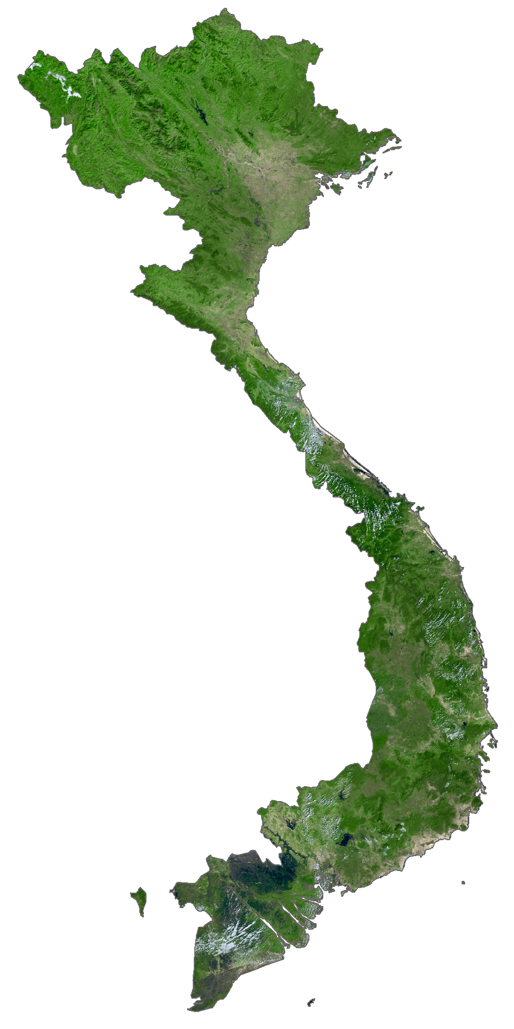
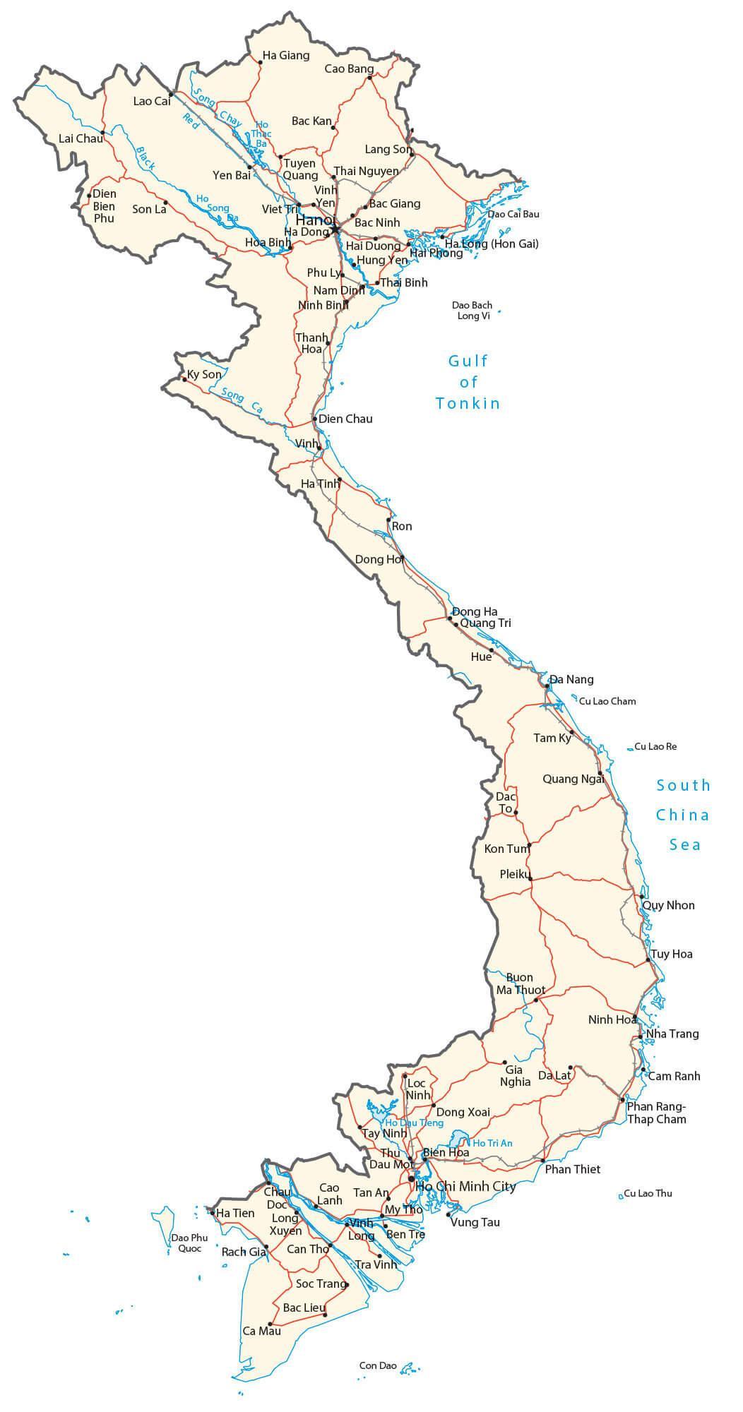
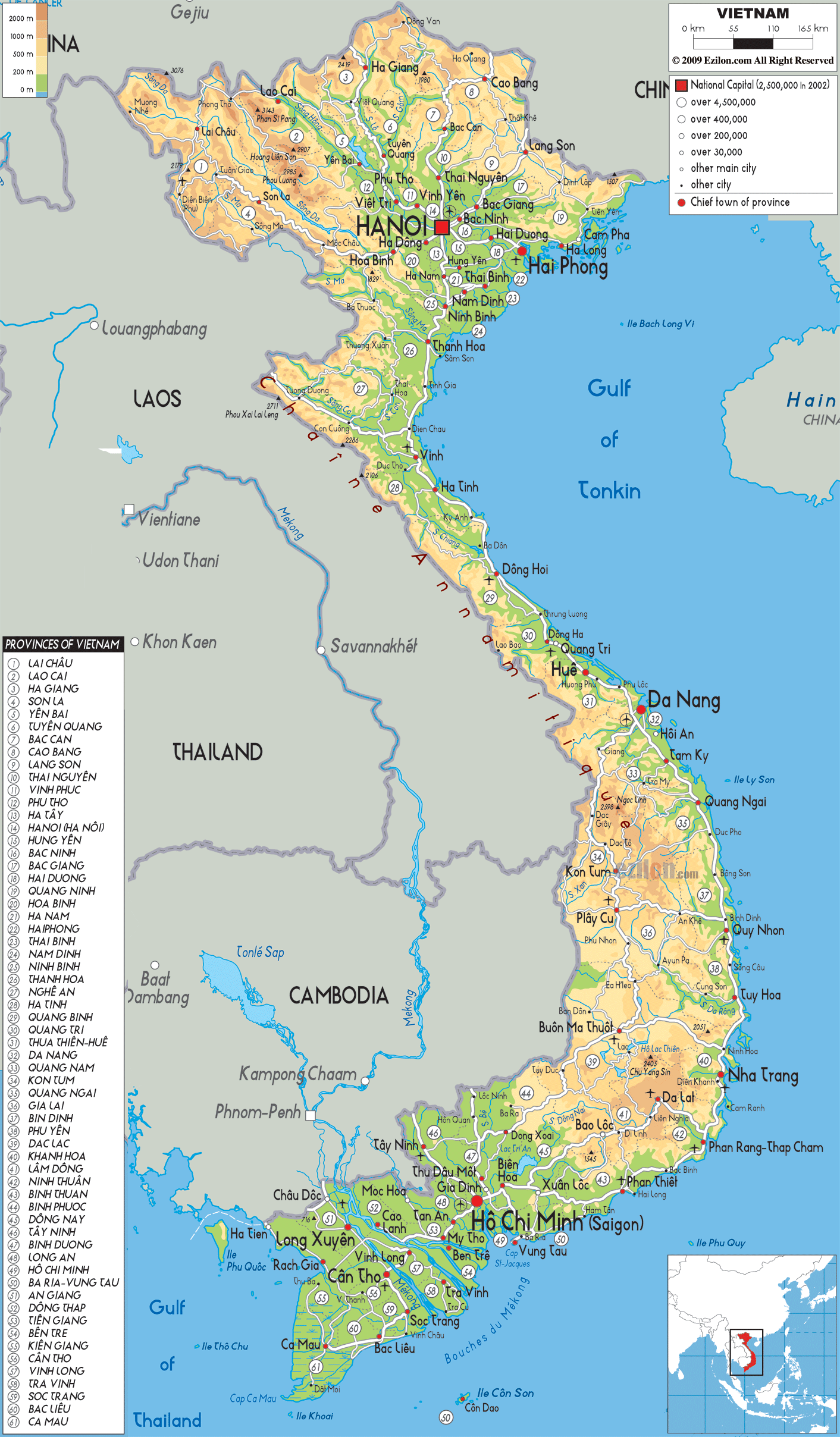
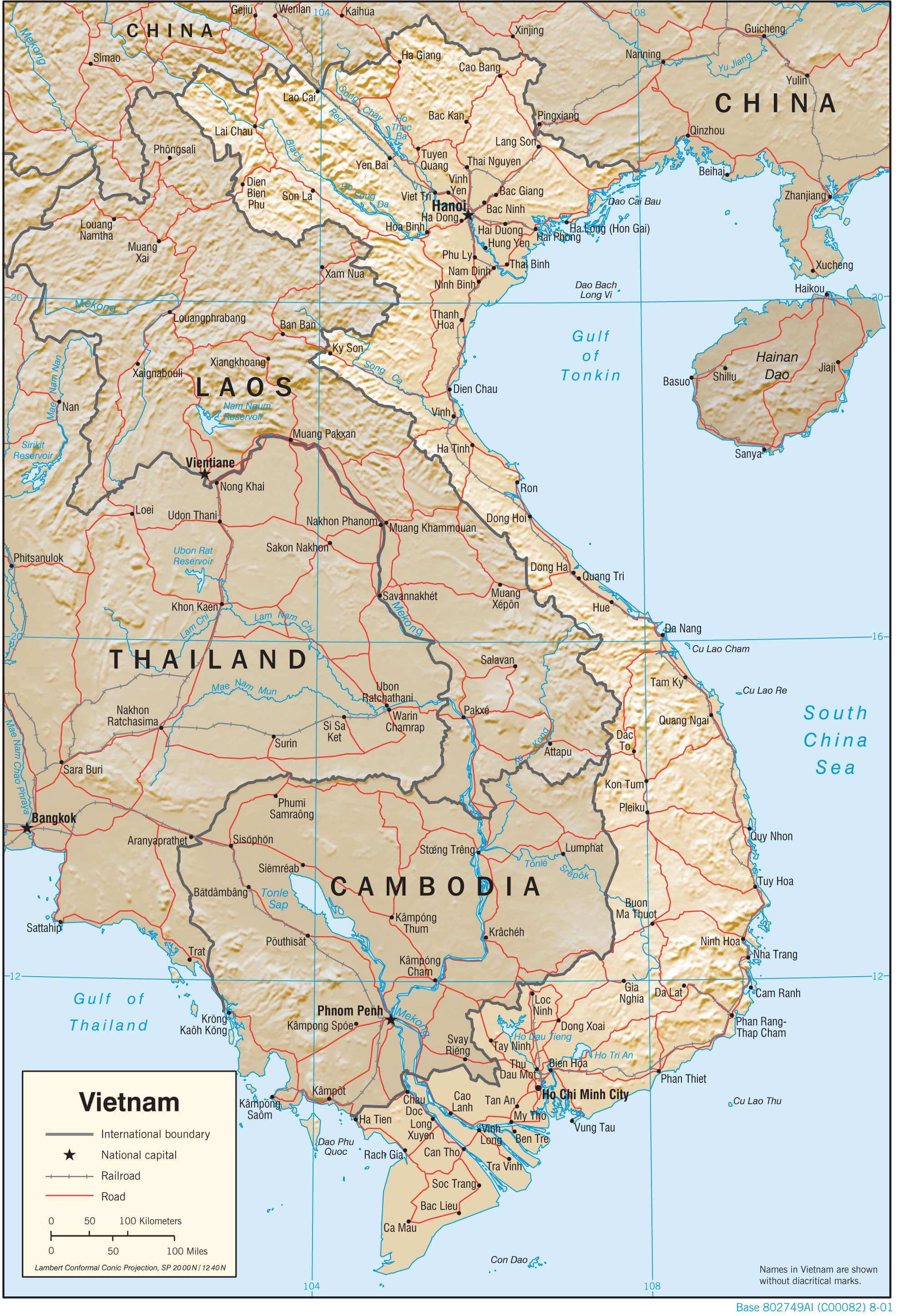
Located in the Indochinese Peninsula’s eastern edge, Vietnam covers an area of around 331,211.6 sq. km. The coastline of mainland Vietnam is about 3,260 km long. The country also includes several islands.
Vietnam is roughly S-shaped running for a distance of about 1,650 km in the north-to-south directions. It is about 50 km wide at its narrowest region.
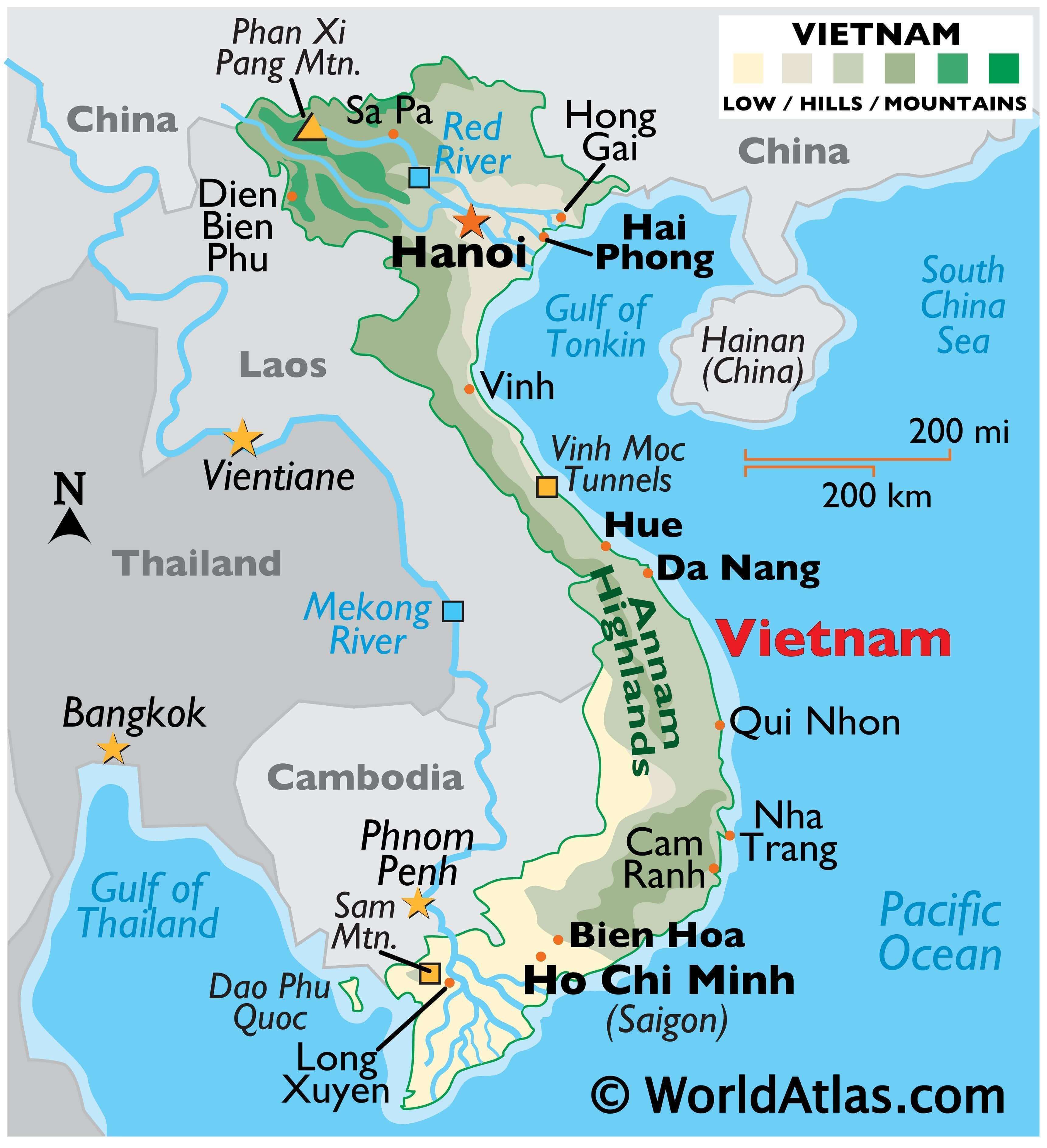
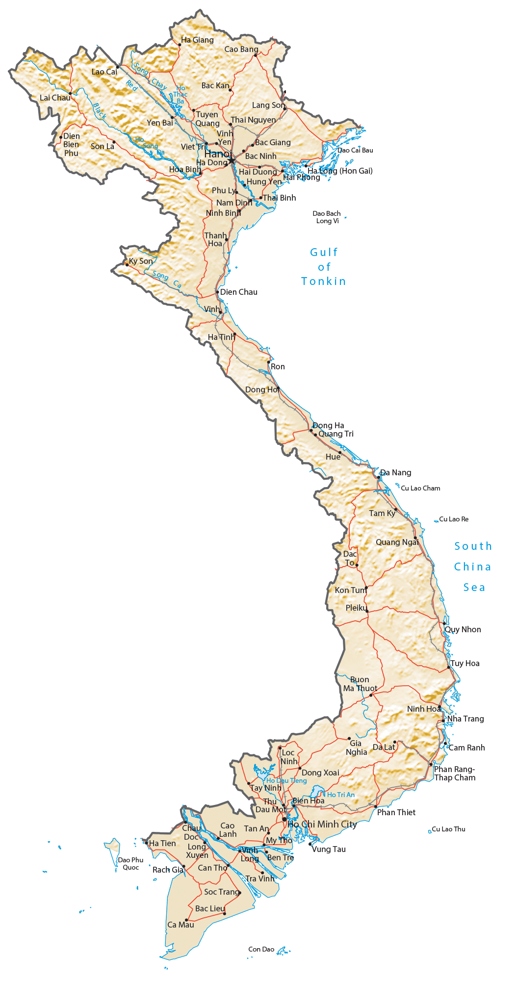
Vietnam is a country of tropical lowlands, rolling green hills, and densely forested mountains. As observed on the physical map above, low-level land covers about 20% of the country.
The Red River delta is fronted by hills that rise gently into the high mountains of the northwest.
The Annam Highlands (marked on the map above) covers much of the central landscape, and in the southern areas, the coastal lowlands and Mekong River Delta merge.
A fertile and narrow coastal lowland extends south from the Red River Delta to the Mekong Delta. The Mekong Delta is a low-level plain, one inundated by hundreds of small rivers and canals. Thick jungles and mangrove swamps cover the far-southern areas of land.
The Red River (Song Hong), and the Mekong are the most significant rivers; both have numerous tributaries, and the latter is certainly among the great rivers of the world.
As marked on the map above by an upright yellow triangle, Vietnam’s highest point is Phan Xi Pang whose summit reaches 3,144 m; the lowest point is the South China Sea at 0m.
| Flag: |  |
|---|---|
| Legal Name: | Socialist Republic of Vietnam |
| Capital Value: | Hanoi (Ha Noi) |
| Demonym(s): | Vietnamese |
| Government: | Unitary Marxist–Leninist one-party socialist republic |
| Legislature: | National Assembly |
| Total Area: | 331,210 km² |
| Land Area: | 310,070 km² |
| Water Area: | 21,140 km² |
| Population: | 96,462,106 |
| Density: | 295.0/km (764.0/sq mi) (29th) |
| GDP: | $261.92 Billion |
| GDP Per Capita: | $2,715.28 |
| Currency Value: | Dong (VND) |
| Driving side: | right |
| Calling code: | +84 |
| Internet TLD: | .vn |
Vietnam is a country of stunning natural beauty, with a unique topography that can be seen in the satellite imagery and elevation display. From the towering heights of Fansipan to its long, narrow coastline, its cities, towns, islands, lakes, rivers, highways, and roads provide an interesting visual reference map.
Online Interactive Political Map
Click on ![]() to view map in "full screen" mode.
to view map in "full screen" mode.
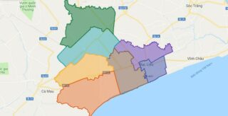
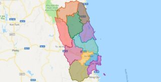
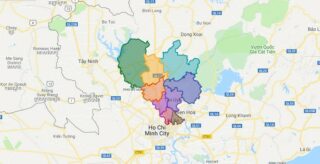
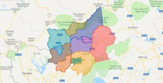
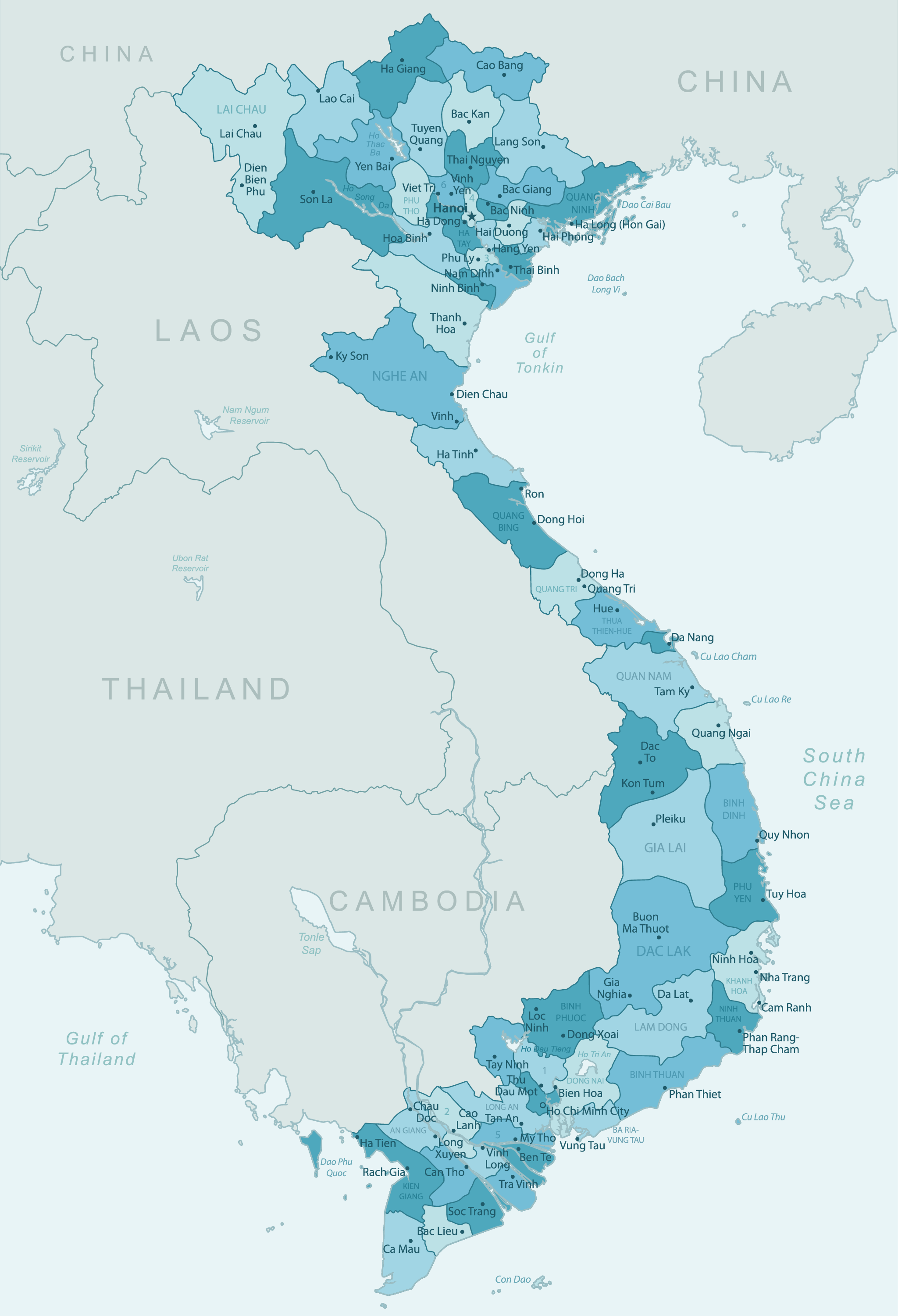
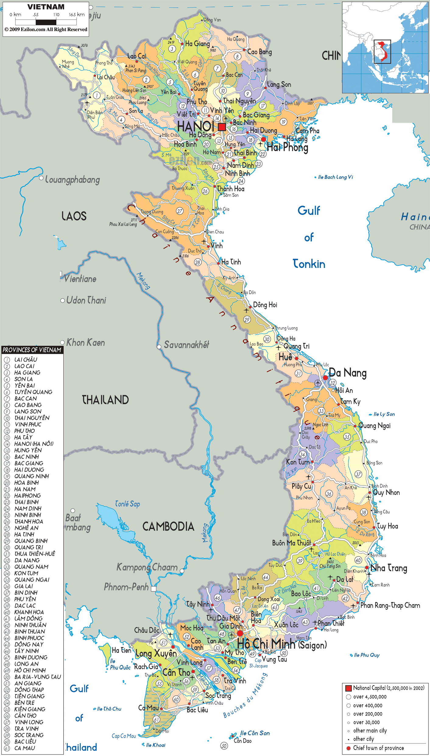
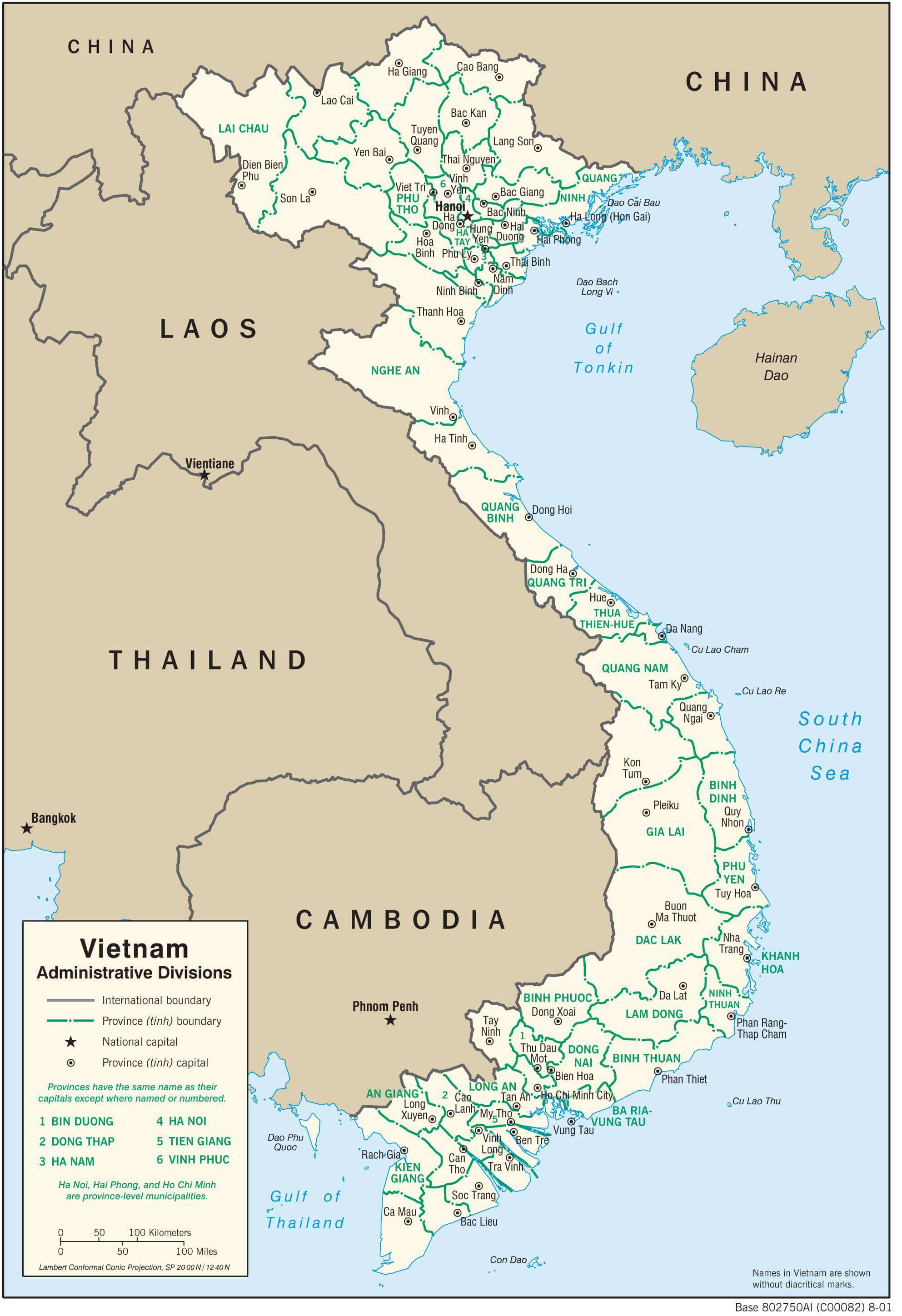
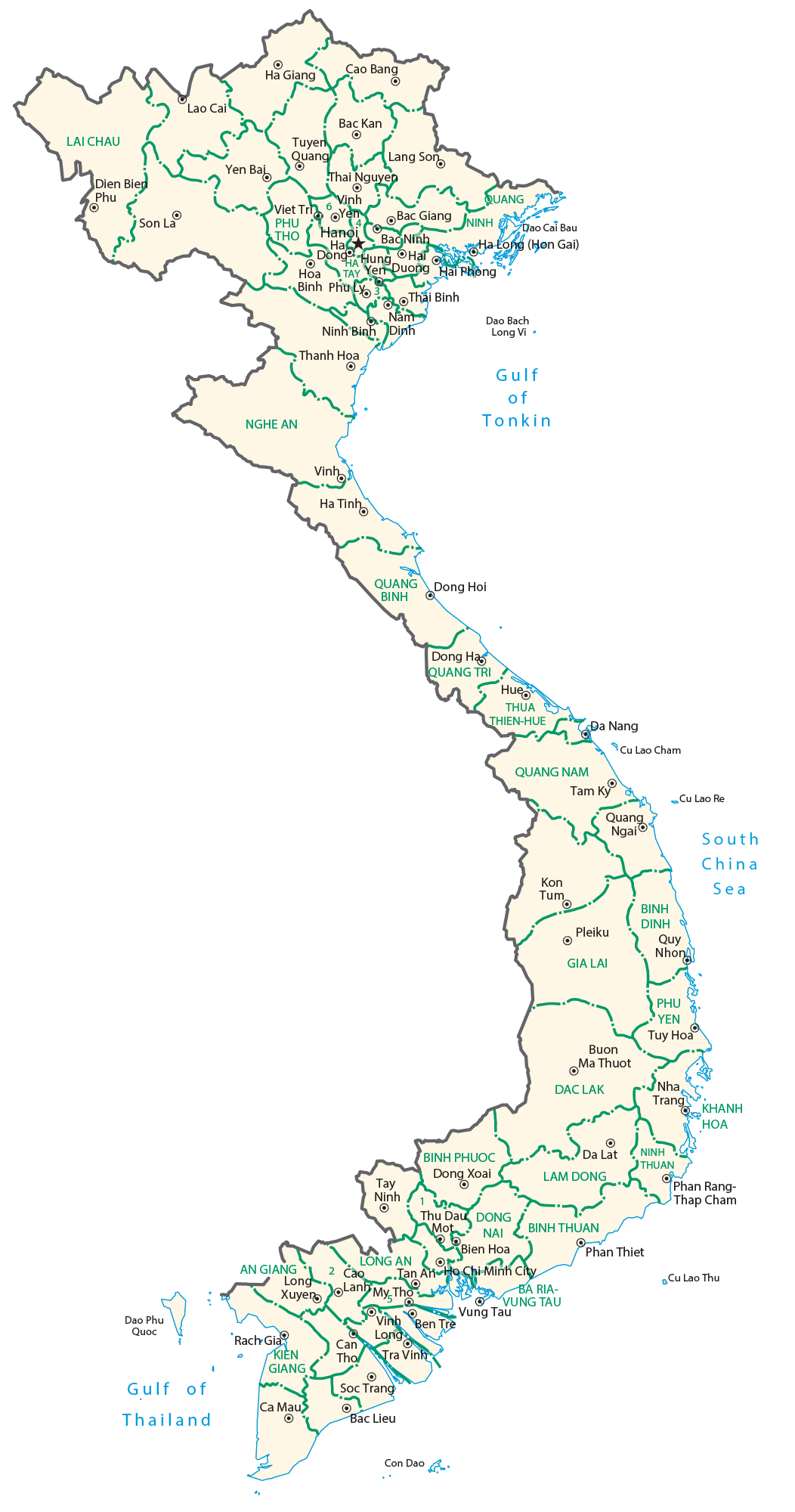
Vietnam comprises of 58 administrative provinces and 5 municipalities. The municipalities are the highest-ranked cities besides having a special status equal to the provinces.
In alphabetical order, the 58 provinces are: An Giang, Bac Giang, Bac Kan, Bac Lieu, Bac Ninh, Ba Ria-Vung Tau, Ben Tre, Binh Dinh, Binh Duong, Binh Phuoc, Binh Thuan, Ca Mau, Cao Bang, Dak Lak, Dak Nong, Dien Bien, Dong Nai, Dong Thap, Gia Lai, Ha Giang, Ha Nam, Ha Tinh, Hai Duong, Hau Giang, Hoa Binh, Hung Yen, Khanh Hoa, Kien Giang, Kon Tum, Lai Chau, Lam Dong, Lang Son, Lao Cai, Long An, Nam Dinh, Nghe An, Ninh Binh, Ninh Thuan, Phu Tho, Phu Yen, Quang Binh, Quang Nam, Quang Ngai, Quang Ninh, Quang Tri, Soc Trang, Son La, Tay Ninh, Thai Binh, Thai Nguyen, Thanh Hoa, Thua Thien-Hue, Tien Giang, Tra Vinh, Tuyen Quang, Vinh Long, Vinh Phuc, and Yen Bai.
The 5 municipalities are: Can Tho, Da Nang, Ha Noi (Hanoi), Hai Phong and Ho Chi Minh City (formerly, Saigon).
The provinces are subdivided into Provincial Cities, Towns, and Rural Districts (huyen). Hanoi, the capital and the second-most populous city of Vietnam is located in the northern region of the country.
Location Maps
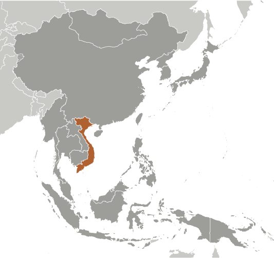
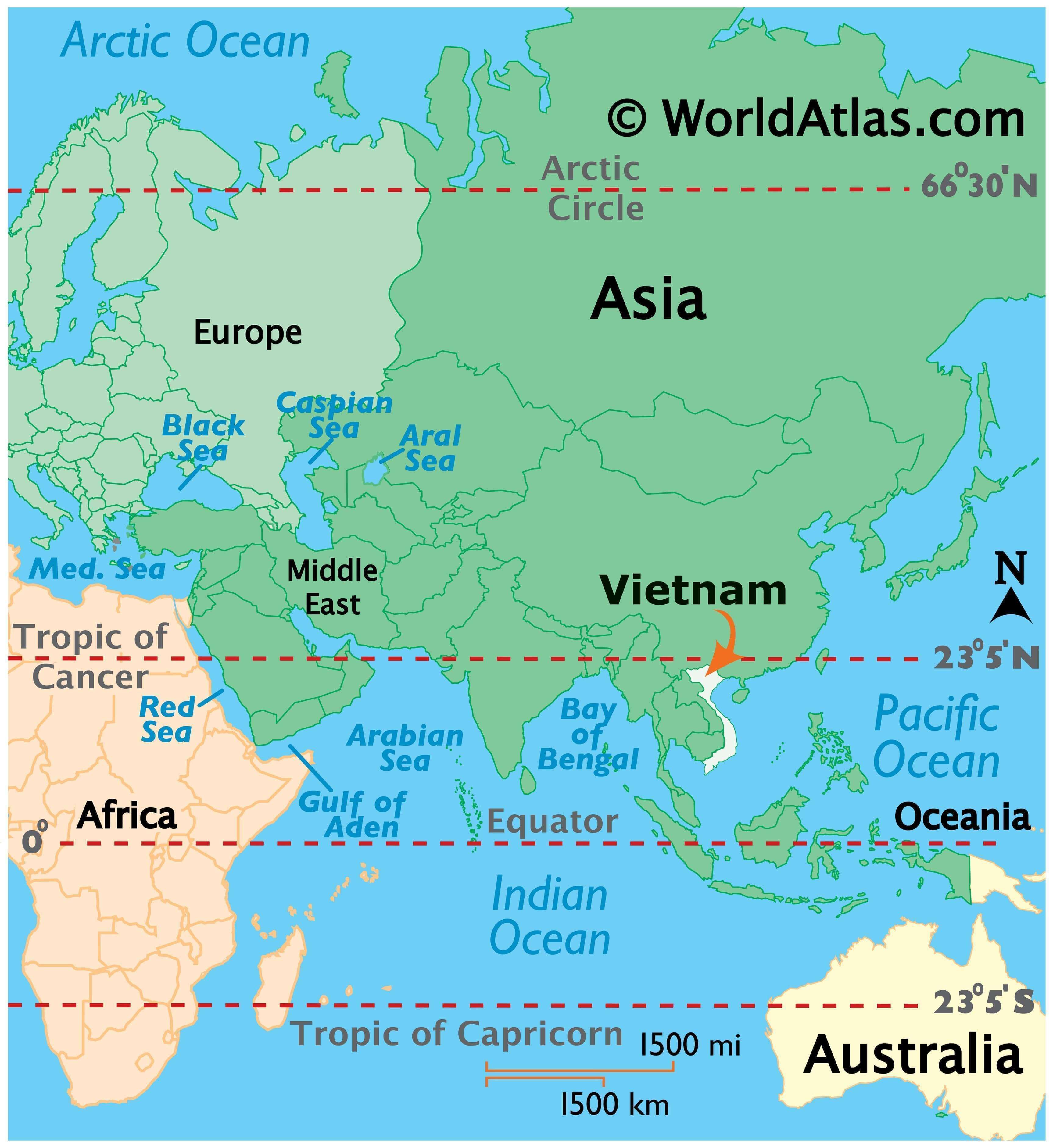
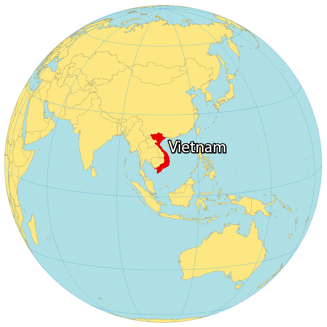
Where is Vietnam?
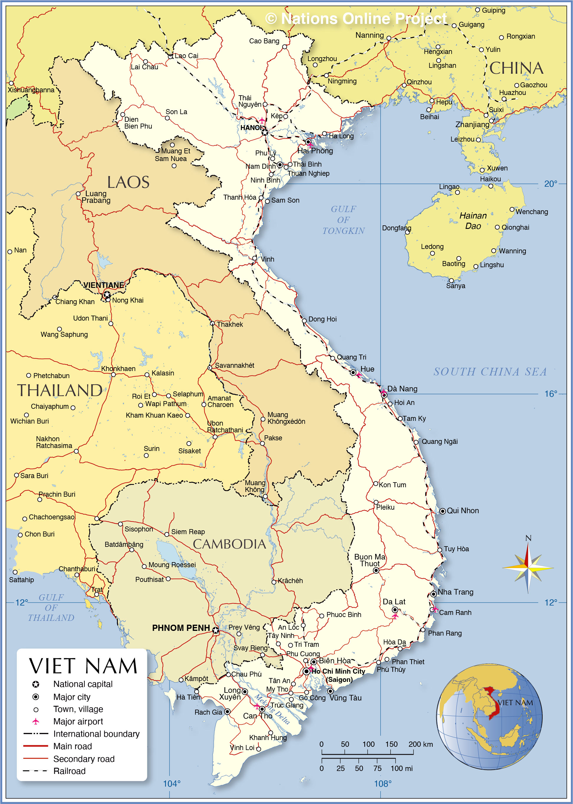
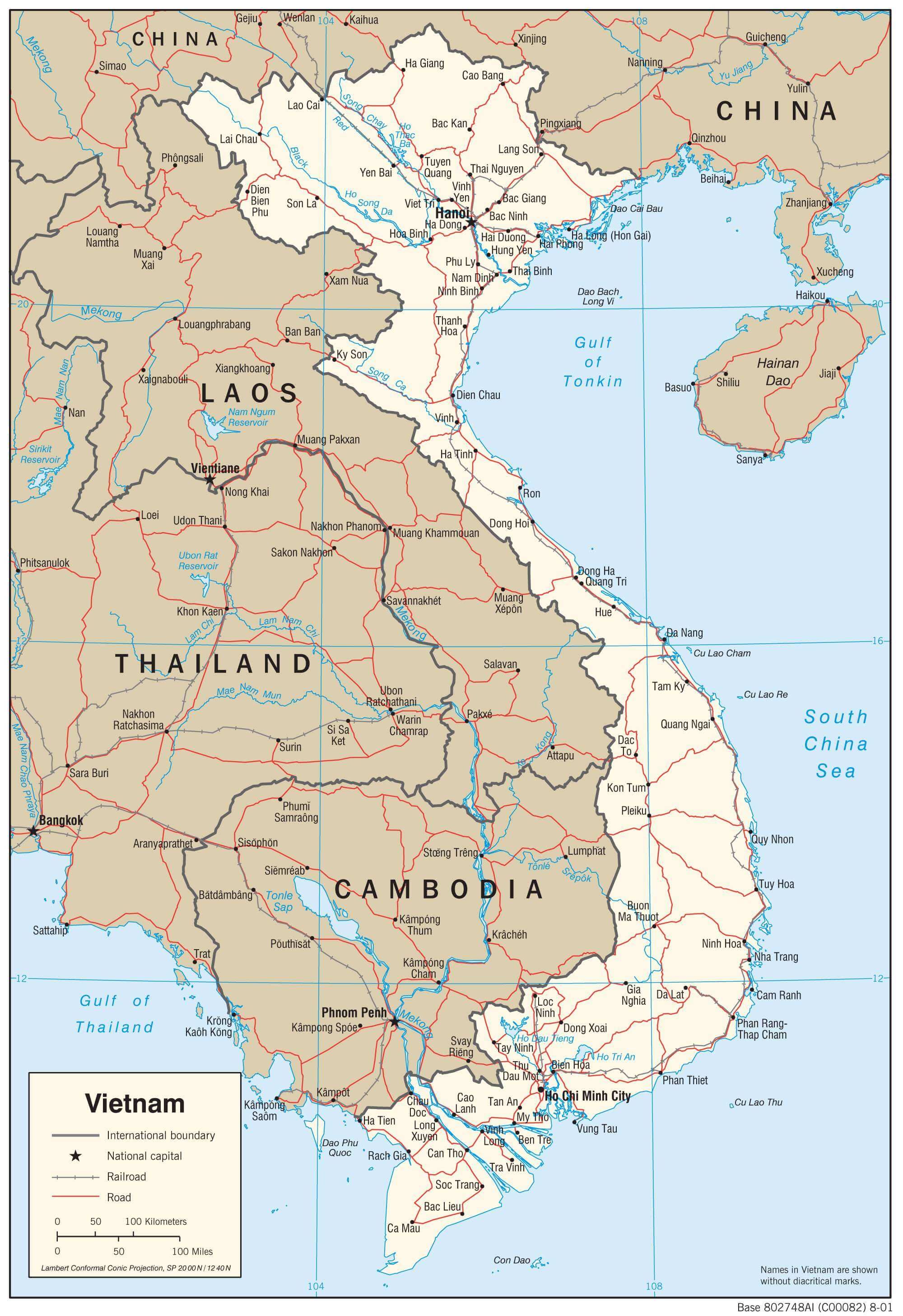
Vietnam is situated in southeastern Asia, bordered by the South China Sea, the Gulf of Tonkin, and the Gulf of Thailand. It is neighbored by only three countries in Asia, including China to the north, and Laos and Cambodia to the west. Despite having an area of approximately the size of New Mexico, it is the 14th most populous country in the world, with one of the highest population densities of over 300 people per square kilometer.
The Vietnam War, lasting for 20 years, was a major event in the country’s history. During the war, over 3,000,000 Vietnamese and 60,000 Americans were killed. The capital city of Vietnam is Hanoi, while its largest city is Ho Chi Minh City. Other major cities include Da Nang, Haiphong, and Bien Hoa.
High Definition Political Map of Vietnam
Vietnam Administrative Map
Physical Map of Vietnam
Transportation Map of Vietnam
Vietnam Satellite Map